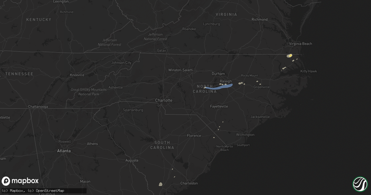
Hail Map in North Carolina on July 23, 2019
Get this storm
July 23 map
$229
one time, instant access
Download today. No call, no setup
Keep the $229
Bought the map and want the full workflow? Apply the entire $229 to a subscription within 7 days. None of it is wasted.
Every map, not just this one
This buys you this map. Subscription and you get every map we run, in the markets you choose from a few cities to whole states to nationwide. Plus real-time alerts the moment a storm fires.
Contact data
Name, contact info, occupancy, even credit band for addresses in the footprint. You go from where it hit to who to call.
Become the source they trust
Unlimited branding weather history reports on demand. You already have the documented answer ready for the property owner, and you are the one who showed up with it.
Property data and RoofTrace estimates
Pull up any address you have got, its value and the exact code rules for that jurisdiction, straight from One Click Code. Then RoofTrace estimates the squares, pitch, and roof value, priced the way you price.
Storm reports in North Carolina
North Carolina
| Date | Description |
|---|---|
| 07/23/20194:50 PM CDT | Trees down at forest dr and richardson rd. |
| 07/23/20194:20 PM CDT | Tree downed near the camden county library along run swamp rd. |
| 07/23/20194:03 PM CDT | Several trees down in the cherry oak subdivision. Time estimated from radar. |
| 07/23/20193:28 PM CDT | Tree down on road near ballard rd and fort branch rd. |
| 07/23/20193:03 PM CDT | Tree down on power line at 7024 church st in saratoga. |
| 07/23/20193:00 PM CDT | Multiple trees downed along s trotman road... Just north of shiloh. Time is radar estimated. |
| 07/23/20192:45 PM CDT | Trees downed and partially blocking road along tulls creek rd. Numerous power outages reported in the area. |
| 07/23/20192:34 PM CDT | Tree down at saint marys church rd and mobley rd. |
| 07/23/20192:26 PM CDT | Trees and power lines down. |
| 07/23/20192:06 PM CDT | Tree down on e indiana ave in southern pines. |
| 07/23/20192:04 PM CDT | Three trees down on poplar st |
| 07/23/20191:53 PM CDT | Tree down at summer hill church rd and murdocksville rd. |
| 07/23/20191:45 PM CDT | Corrects previous tstm wnd dmg report from 3 ene moyock. Trees downed and partially blocking road along tulls creek rd. Numerous power outages reported in the area. |
| 07/23/20191:36 PM CDT | 10 - 12 trees down or... Blown apart. |
| 07/23/20191:35 PM CDT | Storm damage on spruce meadows ln in willow springs. Possible tornado. |
| 07/23/20191:35 PM CDT | 6 - 7 trees down... 3 - 4 poles down causing power outages. |
| 07/23/20191:34 PM CDT | A brief tornado touchdown occurred in the community of willow springs... Nc on july 23... 2019. The damage consisted of a combination of snapped and uprooted trees... M |
| 07/23/20191:29 PM CDT | Tree down at the corner of murdocksville road |
| 07/23/20191:27 PM CDT | Downed tree on power lines at highway 55 near w holly springs rd. A power outage resulted... Affecting traffic signals. |
| 07/23/20191:19 PM CDT | Tree down at nc highway 211 and love grove church rd. |
| 07/23/20191:11 PM CDT | Tree down at wild forest rd near valley rd. |
| 07/23/20191:05 PM CDT | Several trees down on hwy 1. |
| 07/23/20191:05 PM CDT | Correction: tree down on lower moncure rd near the deep river. |
| 07/23/20191:00 PM CDT | Tree down on badders rd. |
| 07/23/201912:56 PM CDT | Tree down at 556 s carbonton rd. |
| 07/23/201912:50 PM CDT | Tree down at south carbonton road |
| 07/23/201912:38 PM CDT | Large limbs and one tree down in high wind. |
| 07/23/201912:04 PM CDT | Tree down at s main st extension and mt vista health park rd. |
| 07/23/201911:54 AM CDT | Debris in road and tree limbs down at lawndale dr and wingate st in greensboro. |
| 07/23/201911:54 AM CDT | Tree down at burnetts chapel rd and drake rd. |
| 07/23/201911:46 AM CDT | Tree down on hogan bowers rd. |
| 07/23/201911:29 AM CDT | Tree down at nc highway 8 and jersey church rd. |
| 07/23/201911:08 AM CDT | Two trees down at boones cave rd and old pasture rd. |
| 07/23/20198:26 AM CDT | Tree blown down at intersection of johnson road and robertson ridge road. Time estimated from radar. |
| 07/23/20197:54 AM CDT | At 1252 PM EDT, severe thunderstorms were located along a line extending from near Thomasville to 7 miles west of Asheboro to near Seagrove, moving northeast at 35 mph. HAZARD...60 mph wind gusts. SOURCE...Radar indicated. IMPACT...Expect damage to roofs, siding, and trees. Locations impacted include... Greensboro, High Point, Asheboro, Randleman, Siler City, North Carolina Zoo, Thomasville, Seagrove, McLeansville and Archdale. |
| 07/23/20197:31 AM CDT | At 1231 PM EDT, a severe thunderstorm was located over Garner, or 9 miles south of Raleigh, moving east at 30 mph. HAZARD...60 mph wind gusts. SOURCE...Radar indicated. IMPACT...Expect damage to roofs, siding, and trees. Locations impacted include... Raleigh, Garner, Clayton, Zebulon, Knightdale, Wendell, Emit, Lake Wheeler, Flowers and Lake Benson. |
| 07/23/20191:07 AM CDT | At 607 PM EDT, a severe thunderstorm was located 10 miles north of Lagoon, or 12 miles northeast of Elizabethtown, moving northeast at 35 mph. HAZARD...60 mph wind gusts. SOURCE...Radar indicated. IMPACT...Expect damage to roofs, siding, and trees. Locations impacted include... Harrells, Garland and Ivanhoe. |
| 07/23/201912:40 AM CDT | At 540 PM EDT, a severe thunderstorm was located near Bladenboro, or 12 miles northwest of Whiteville, moving northeast at 20 mph. HAZARD...60 mph wind gusts. SOURCE...Radar indicated. IMPACT...Expect wind damage to trees and power lines. Locations impacted include... Elizabethtown, Bladenboro, Boardman, Bladen Community College, Abbottsburg, Butters, Clarkton, Dublin and Bladen County Hospital. |
| 07/23/201912:06 AM CDT | At 505 PM EDT, a severe thunderstorm was located near Robersonville, or 8 miles southwest of Williamston, moving northeast at 40 mph. HAZARD...60 mph wind gusts and penny size hail. SOURCE...Radar indicated. IMPACT...Expect damage to trees and powerlines. This severe thunderstorm will be near, Windsor around 535 PM EDT.Other locations impacted by this severe thunderstorm include MerryHill, Mount Gould, Quitsna, Midway, Woodard and Edenhouse. |
| 07/22/201911:52 PM CDT | At 452 PM EDT, severe thunderstorms were located along a line extending from near Bethel to near East Carolina University, moving northeast at 55 mph. HAZARD...60 mph wind gusts and quarter size hail. SOURCE...Radar indicated. IMPACT...Hail damage to vehicles is expected. Expect wind damage to roofs, siding, and trees. Locations impacted include... Greenville, Winterville, Williamston, Ayden, Farmville, Plymouth, Bethel, Stokes, Snow Hill, Bell Arthur, Robersonville, Pactolus, House, Bruce, Jason, Ormondsville, Maury, Roundtree, Lizzie and Old Ford. |
| 07/22/201911:12 PM CDT | At 412 PM EDT, a severe thunderstorm was located over Indiantown, or near Camden, moving northeast at 25 mph. HAZARD...60 mph wind gusts and quarter size hail. SOURCE...Radar indicated. IMPACT...Minor damage to vehicles is possible. Expect wind damage to trees and powerlines. This severe thunderstorm will be near, Indiantown and Old Trap around 415 PM EDT. Currituck around 430 PM EDT. Corolla and Knotts Island around 445 PM EDT.Other locations impacted by this severe thunderstorm include Barco,Coinjock, Riddle, Poplar Branch, Aydlett, Waterlily, Bertha, Gregory,Shawboro and Maple. |
| 07/22/201911:05 PM CDT | At 404 PM EDT, a severe thunderstorm was located 8 miles southeast of Wilson, or 12 miles northwest of Farmville, moving northeast at 25 mph. HAZARD...60 mph wind gusts and nickel size hail. SOURCE...Radar indicated. IMPACT...Expect damage to roofs, siding, and trees. Locations impacted include... Greenville, Williamston, Farmville, Bethel, Robersonville, Bruce, Gold Point, Fountain, Hamilton, Oak City, Bull Head VFD, Parmele, Walstonburg, Everetts, Falkland and Hassell. |
| 07/22/201910:37 PM CDT | At 337 PM EDT, a severe thunderstorm was located near Chapanoke, or near Elizabeth City State University, moving northeast at 30 mph. HAZARD...60 mph wind gusts and quarter size hail. SOURCE...Radar indicated. IMPACT...Minor damage to vehicles is possible. Expect wind damage to trees and powerlines. This severe thunderstorm will be near, Elizabeth City around 340 PM EDT. Elizabeth City State University and Weeksville around 350 PM EDT. Camden and Whitehall Shores around 355 PM EDT. Shiloh around 400 PM EDT. Indiantown and Old Trap around 405 PM EDT.Other locations impacted by this severe thunderstorm include BobWhite Fork, Belcross, Burnt Mills, Snowden, Pierceville, ListersCorner, Glen Cove, Gregory, Frog Island and Powells Point. |
| 07/22/201910:23 PM CDT | At 323 PM EDT, a severe thunderstorm was located 11 miles northeast of Smithfield, moving east at 45 mph. HAZARD...60 mph wind gusts. SOURCE...Radar indicated. IMPACT...Expect damage to roofs, siding, and trees. Locations impacted include... Smithfield, Wilson, Fremont, Micro, Selma, Kenly, Lucama, Stantonsburg, Black Creek and Saratoga. |
| 07/22/201910:16 PM CDT | At 315 PM EDT, a severe thunderstorm was located near Valhalla, or near Hertford, moving northeast at 20 mph. HAZARD...60 mph wind gusts and quarter size hail. SOURCE...Radar indicated. IMPACT...Minor damage to vehicles is possible. Expect wind damage to trees and powerlines. This severe thunderstorm will be near, Snug Harbor around 330 PM EDT. Hertford, Winfall, Burgess and Belvidere around 335 PM EDT. Chapanoke around 355 PM EDT. Nixonton around 400 PM EDT.Other locations impacted by this severe thunderstorm include HolidayIsland, Drummond Point, Arrowhead Beach, Saint Johns, Parkville,Hancock, Nicanor, Yeopim Station, Pasquotank and Jacocks. |
| 07/22/20199:28 PM CDT | At 227 PM EDT, a severe thunderstorm was located near Fuquay-Varina, or 10 miles south of Cary, moving east at 40 mph. HAZARD...60 mph wind gusts. SOURCE...Radar indicated. IMPACT...Expect damage to roofs, siding, and trees. Locations impacted include... Raleigh, Cary, Smithfield, Garner, Fuquay-Varina, Clayton, Zebulon, Angier, Benson and Apex. |
| 07/22/20199:11 PM CDT | At 211 PM EDT, severe thunderstorms were located along a line extending from near Sanford to 9 miles east of Carthage, moving east at 35 mph. HAZARD...60 mph wind gusts and penny size hail. SOURCE...Radar indicated. IMPACT...Expect damage to roofs, siding, and trees. Locations impacted include... Sanford, Lillington, Angier, Erwin, Whispering Pines, Coats, Broadway, Vass, Cameron and Lemon Springs. |
| 07/22/20198:47 PM CDT | At 147 PM EDT, a severe thunderstorm was located over Goldston, or 10 miles northwest of Sanford, moving east at 40 mph. HAZARD...60 mph wind gusts. SOURCE...Radar indicated. IMPACT...Expect damage to roofs, siding, and trees. Locations impacted include... Raleigh, Cary, Sanford, Pittsboro, Fuquay-Varina, Goldston, Apex, Holly Springs, Morrisville and Lake Wheeler. |
All States Impacted by Hail Map on July 23, 2019
Cities Impacted by Hail Map on July 23, 2019
- Havre, MT
- South Mills, NC
- Libby, MT
- Florissant, CO
- Divide, CO
- Hill City, SD
- Saint George, SC
- Custer, SD
- Kaycee, WY
- Buffalo, WY
- Thompson Falls, MT
- Trout Creek, MT
- Lillian, AL
- Roosevelt, WA
- Red Lodge, MT
- Elizabeth City, NC
- Cottageville, SC
- Box Elder, MT
- Kila, MT
- Marion, MT
- Bickleton, WA
- Usk, WA
- Alger, MI
- Shawboro, NC
- Elberta, AL
- Wilson, NC
- Lucama, NC
- Cary, NC
- Holly Springs, NC
- Apex, NC
- Hialeah, FL
- Miami, FL
- Raleigh, NC
- Early Branch, SC
- Varnville, SC
- Yemassee, SC
- Daytona Beach, FL
- Sims, NC
- Kenly, NC
- Middlesex, NC
- Ormond Beach, FL
- Edenton, NC
- Estes Park, CO
- Hertford, NC
- Nichols, SC
- Garner, NC
- Thermal, CA
- Goldston, NC
- Bear Creek, NC
- Show Low, AZ
- Clayton, WA
- Bladenboro, NC
- Evergreen, NC
- Greenville, NC
- Virginia Beach, VA
- Whitefish, MT
- Robertsdale, AL
- Macclesfield, NC
- Tarboro, NC
- Madera, CA
- Globe, AZ
- Cerro Gordo, NC
- Chadbourn, NC
- Camden, NC
- Chilmark, MA
- Vineyard Haven, MA
- Edgartown, MA
- Oak Bluffs, MA
- West Tisbury, MA
- Cuttyhunk, MA
- Eastham, MA
- Chatham, MA
- West Harwich, MA
- Forestdale, MA
- South Chatham, MA
- Hyannis, MA
- South Dennis, MA
- North Falmouth, MA
- Cataumet, MA
- North Chatham, MA
- Barnstable, MA
- Osterville, MA
- Buzzards Bay, MA
- Cummaquid, MA
- Falmouth, MA
- West Yarmouth, MA
- South Yarmouth, MA
- Pocasset, MA
- West Barnstable, MA
- Marstons Mills, MA
- East Sandwich, MA
- Harwich, MA
- Brewster, MA
- West Dennis, MA
- Cotuit, MA
- Yarmouth Port, MA
- Mashpee, MA
- Dennis, MA
- Dennis Port, MA
- Orleans, MA
- Woods Hole, MA
- Centerville, MA
- Sandwich, MA
- Harwich Port, MA
- East Falmouth, MA
- Sanford, NC
- Fuquay Varina, NC
- Willow Spring, NC
- New Hill, NC
- Clayton, NC
- Moncure, NC


