Hail Map on July 23, 2019
Get this storm
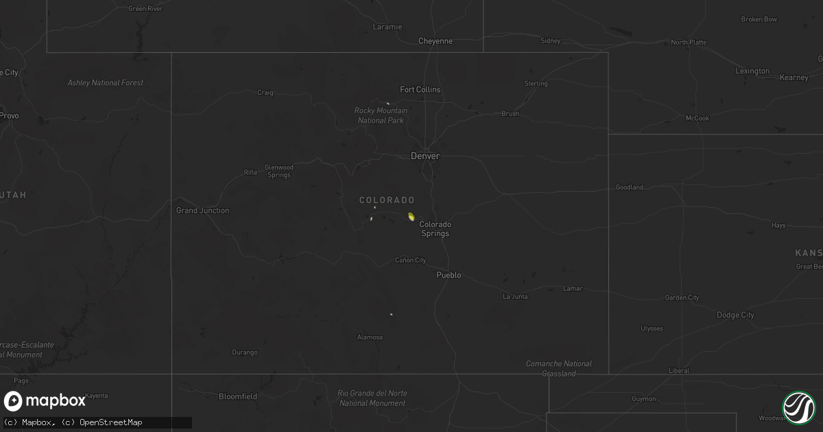
July 23 map
$229
one time, instant access
Download today. No call, no setup
Keep the $229
Bought the map and want the full workflow? Apply the entire $229 to a subscription within 7 days. None of it is wasted.
Every map, not just this one
This buys you this map. Subscription and you get every map we run, in the markets you choose from a few cities to whole states to nationwide. Plus real-time alerts the moment a storm fires.
Contact data
Name, contact info, occupancy, even credit band for addresses in the footprint. You go from where it hit to who to call.
Become the source they trust
Unlimited branding weather history reports on demand. You already have the documented answer ready for the property owner, and you are the one who showed up with it.
Property data and RoofTrace estimates
Pull up any address you have got, its value and the exact code rules for that jurisdiction, straight from One Click Code. Then RoofTrace estimates the squares, pitch, and roof value, priced the way you price.
States Impacted by Hail Map on July 23, 2019
Storm reports
Arizona
| Date | Description |
|---|---|
| 07/23/201912:58 AM CDT | At 557 PM MST/557 PM PDT/, a severe thunderstorm was located near Gordon's Well, or 19 miles northwest of Gadsden, moving southeast at 10 mph. HAZARD...60 mph wind gusts. SOURCE...Radar indicated. IMPACT...Expect damage to roofs, siding, and trees. Locations impacted include... Gordon's Well, Algodones Dunes and Andrade. |
| 07/23/201912:44 AM CDT | At 543 PM MST, a severe thunderstorm was located 7 miles southeast of Top Of The World, or 9 miles southwest of Globe, moving southwest at 15 mph. HAZARD...60 mph wind gusts and penny size hail. SOURCE...Radar indicated. IMPACT...Expect damage to roofs, siding, and trees. Locations impacted include... Superior, Miami, Top Of The World, Top-Of-The-World and Claypool. |
| 07/23/201912:11 AM CDT | At 510 PM MST, a severe thunderstorm was located over Globe, and is nearly stationary. HAZARD...60 mph wind gusts and nickel size hail. SOURCE...Radar indicated. IMPACT...Expect damage to roofs, siding, and trees. Locations impacted include... Globe, Miami, Central Heights-Midland City, Claypool and Inspiration. |
| 07/22/201910:22 PM CDT | At 320 PM MST, a severe thunderstorm was located over Mountainaire, or 10 miles southwest of Flagstaff, moving northwest at 15 mph. HAZARD...Quarter size hail. SOURCE...Radar indicated. IMPACT...Damage to vehicles is expected. Locations impacted include... Kachina Village, Mountainaire, Sterling Fish Hatchery and Pine Flat Campground. |
Alabama
| Date | Description |
|---|---|
| 07/23/20191:31 PM CDT | Public reports 4 large trees and large limbs down near the corner of pioneer rd and fowl river rd. Time estimated by radar. |
| 07/22/20199:09 PM CDT | At 209 PM CDT, a severe thunderstorm was located near Lillian, or 11 miles east of Foley, moving southeast at 20 mph. HAZARD...60 mph wind gusts. SOURCE...Radar indicated. IMPACT...Expect damage to roofs, siding, and trees. Locations impacted include... Ensley, Foley, Orange Beach, Lillian, Myrtle Grove, Summerdale, Perdido Beach and Elberta. |
| 07/22/20198:28 PM CDT | At 128 PM CDT, a severe thunderstorm was located 6 miles north of Alabama Port, or 6 miles southeast of Theodore, moving southeast at 15 mph. HAZARD...60 mph wind gusts. SOURCE...Radar indicated. IMPACT...Expect damage to roofs, siding, and trees. Locations impacted include... Alabama Port. |
California
| Date | Description |
|---|---|
| 07/23/201912:03 AM CDT | At 503 PM PDT, a severe thunderstorm was located over Thermal, or 9 miles south of Coachella, moving east at 15 mph. HAZARD...60 mph wind gusts. SOURCE...Radar indicated. IMPACT...Expect damage to roofs, siding, and trees. Locations impacted include... Coachella, Thermal, Mecca and Santa Rosa Mountain. |
| 07/22/201910:56 PM CDT | At 355 PM PDT, a severe thunderstorm was located over Hwy S22 Between Ranchita And Borrego Springs, or 7 miles west of Borrego Springs, and is nearly stationary. HAZARD...60 mph wind gusts and quarter size hail. SOURCE...Radar indicated. IMPACT...Hail damage to vehicles is expected. Expect wind damage to roofs, siding, and trees. Locations impacted include... Borrego Springs, Borrego Palm Canyon, Hwy S22 Between Ranchita And Borrego Springs, Ranchita, Hwy S2 Between Hwy 79 And Hwy 78 and Los Coyotes Indian Reservation. |
| 07/22/20197:33 PM CDT | Power pole down. |
| 07/22/20197:29 PM CDT | Large tree branch blocking the road at 60th avenue and van buren street. |
| 07/22/20197:27 PM CDT | Power pole down. |
| 07/22/20197:24 PM CDT | Tree fell on top of vehicle. Man was inside the vehicle and is now pinned inside the vehicle. |
| 07/22/20197:21 PM CDT | Tree in roadway. |
| 07/22/20197:13 PM CDT | Power pole down... Blocking roadway. |
| 07/22/20197:09 PM CDT | Power pole leaning across roadway. |
| 07/22/20197:08 PM CDT | Power pole down. |
Colorado
| Date | Description |
|---|---|
| 07/23/20196:55 PM CDT | A local report indicates 1.00 inch wind near DIVIDE |
| 07/23/201912:39 AM CDT | At 539 PM MDT, a severe thunderstorm was located near Divide, or 22 miles northwest of Colorado Springs, moving southeast at 5 mph. HAZARD...60 mph wind gusts and half dollar size hail. SOURCE...Radar indicated. IMPACT...Hail damage to vehicles is expected. Expect wind damage to roofs, siding, and trees. Locations impacted include... Woodland Park and Divide. |
South Dakota
| Date | Description |
|---|---|
| 07/23/20195:59 PM CDT | A local report indicates 1.50 inch wind near 2 SW ROCHFORD |
| 07/23/20195:48 PM CDT | A local report indicates 1.50 inch wind near 2 SW ROCHFORD |
| 07/23/20195:41 PM CDT | A local report indicates 1.50 inch wind near 2 SW ROCHFORD |
| 07/23/20195:00 PM CDT | A local report indicates 1.75 inch wind near 3 SE DEERFIELD |
| 07/23/201912:43 AM CDT | At 542 PM MDT, a severe thunderstorm was located 3 miles southeast of Moon, or 13 miles east of Newcastle, moving south at 15 mph. HAZARD...Golf ball size hail. SOURCE...Radar indicated. IMPACT...People and animals outdoors will be injured. Expect damage to roofs, siding, windows, and vehicles. Locations impacted include... Moon, Jewel Cave National Monument and Elk Mountain Lookout. |
| 07/22/201911:50 PM CDT | At 450 PM MDT, a severe thunderstorm was located near Flag Mountain, or 15 miles northwest of Hill City, and is nearly stationary. HAZARD...Ping pong ball size hail. SOURCE...Trained weather spotters. At 448 PM MDT ping pong ball size hail was reported 2 miles southwest of Rochford. IMPACT...People and animals outdoors will be injured. Expect damage to roofs, siding, windows, and vehicles. Locations impacted include... Rochford, Flag Mountain, Mystic, Deerfield, Deerfield Reservoir, Crooks Tower and Black Fox Campground. |
| 07/22/201911:25 PM CDT | At 425 PM MDT, a severe thunderstorm was located over Flag Mountain, or 17 miles northwest of Hill City, and is nearly stationary. HAZARD...Ping pong ball size hail. SOURCE...Radar indicated. IMPACT...People and animals outdoors will be injured. Expect damage to roofs, siding, windows, and vehicles. Locations impacted include... Rochford, Flag Mountain, Deerfield and Deerfield Reservoir. |
| 07/22/201910:57 PM CDT | At 356 PM MDT, a severe thunderstorm was located over Deerfield, or 14 miles northwest of Hill City, moving south at 15 mph. HAZARD...Quarter size hail. SOURCE...Radar indicated. IMPACT...Damage to vehicles is expected. Locations impacted include... Flag Mountain, Deerfield, Deerfield Reservoir, Medicine Mountain and Bear Mountain Lookout. |
Wyoming
| Date | Description |
|---|---|
| 07/23/20195:48 PM CDT | A local report indicates 1.50 inch wind near 2 SW ROCHELLE |
| 07/23/20195:41 PM CDT | A local report indicates 1.50 inch wind near 2 SW ROCHELLE |
| 07/23/20195:30 PM CDT | A few trees downed south of jackson. One tree fell on colter elementary school and caused minor damage. |
| 07/23/20193:05 AM CDT | At 805 PM MDT, a severe thunderstorm was located near Beartooth Pass, or 12 miles southwest of Red Lodge, moving northeast at 20 mph. HAZARD...60 mph wind gusts and quarter size hail. SOURCE...Radar indicated. IMPACT...Hail damage to vehicles is expected. Expect wind damage to roofs, siding, and trees. Locations impacted include... Red Lodge, Bearcreek and Washoe. |
| 07/22/201911:00 PM CDT | At 359 PM MDT, a severe thunderstorm was located 9 miles east of Mayoworth, which is 11 miles north of Kaycee, moving southeast at 25 mph. HAZARD...70 mph wind gusts and ping pong ball size hail. SOURCE...Radar indicated. IMPACT...People and animals outdoors will be injured. Expect hail damage to roofs, siding, windows, and vehicles. Expect considerable tree damage. Wind damage is also likely to mobile homes, roofs, and outbuildings. This severe thunderstorm will remain over mainly rural areas of southeastern Johnson County.This includes Interstate 25 between mile markers 261 and 271. |
| 07/22/201910:34 PM CDT | At 333 PM MDT, a severe thunderstorm was located 11 miles north of Mayoworth, which is 19 miles north of Kaycee, moving southeast at 25 mph. HAZARD...60 mph wind gusts and quarter size hail. SOURCE...Radar indicated. IMPACT...Hail damage to vehicles is expected. Expect wind damage to roofs, siding, and trees. This severe thunderstorm will remain over mainly rural areas of central Johnson County.This includes Interstate 25 between mile markers 264 and 277. |
Maryland
| Date | Description |
|---|---|
| 07/23/20197:44 AM CDT | At 1244 AM EDT, a severe thunderstorm was located near Lewes, or 14 miles northeast of Georgetown, moving northeast at 50 mph. HAZARD...60 mph wind gusts. SOURCE...Radar indicated. IMPACT...Damage to roofs, siding, trees, and power lines is possible. Locations impacted include... Georgetown, Milford, Millsboro, Harrington, Lewes, Milton, Dagsboro, Ellendale, Henlopen Acres, Sycamore, Big Stone Beach, Long Neck, Frankford, Frederica, Houston, Dewey Beach and Farmington. |
Idaho
| Date | Description |
|---|---|
| 07/23/20194:18 AM CDT | At 917 PM PDT, severe thunderstorms were located along a line extending from 16 miles south of Chewelah to near Deer Park, moving northeast at 25 mph. HAZARD...60 mph wind gusts and penny size hail. SOURCE...Radar indicated. IMPACT...Expect damage to roofs, siding, and trees. Locations impacted include... Deer Park, Newport, Springdale, Cusick, Sacheen Lake, Chewelah Peak, Usk, Dalkena, Loon Lake, Clayton, Diamond Lake, Valley, Bead Lake Campground and 49 Degrees North. |
| 07/23/201912:11 AM CDT | Storm damage across city. Winds around 60mph. |
| 07/23/201912:07 AM CDT | Tree fell on garage and apartment. |
| 07/22/201911:57 PM CDT | 100 ft pine tree uprooted. Top half of colorado blue spruce snapped off. Other tree damage in nearby cemetery with some damage to statues. Trampoline blown into field f |
| 07/22/201911:40 PM CDT | Idaho state route 3: road blocked from canary creek road to black rock road due to fallen trees. |
New Jersey
| Date | Description |
|---|---|
| 07/22/20198:44 PM CDT | At 143 AM EDT, a severe thunderstorm was located over Somers Point, or near Ocean City, moving northeast at 45 mph. HAZARD...60 mph wind gusts. SOURCE...This storm previously produced a 59 mph wind gust at Cape May Harbor IMPACT...Damage to roofs, siding, trees, and power lines is possible. Locations impacted include... Atlantic City, Pleasantville, Somers Point, Ventnor City, Brigantine, Northfield, Absecon, Margate City, Tuckerton, Port Republic, Longport, Pomona, English Creek, Bass River State Forest, New Gretna, Mystic Island and Linwood. |
Massachusetts
| Date | Description |
|---|---|
| 07/23/201911:30 AM CDT | Trees down with one blocking route 28 southbound. Wires down on main street. Large tree down on quanset road by ridgewood motel. Wires down on karen lane. Tree down on |
| 07/23/201911:30 AM CDT | Multiple trees down. |
| 07/23/201911:24 AM CDT | Several dozen trees down on route 28. |
| 07/23/201911:20 AM CDT | 2 utility poles leaning on morris island causeway with 1 snapped in half and wires hanging low to the ground. |
| 07/23/201911:19 AM CDT | A local report indicates 84 MPH wind near CHATHAM |
| 07/23/201911:15 AM CDT | Trees... Utility poles and wires down on south street at sisson road. Wires down on route 137 at route 39. Tree down on route 39. |
| 07/23/201911:15 AM CDT | A local report indicates 85 MPH wind near CHATHAM |
| 07/23/201911:14 AM CDT | Large tree down blocking stony brook road. Tree and power lines down on run hill road. |
| 07/23/201911:10 AM CDT | Tree and wires down on route 28 at pond street... Route 28 at geneva street... Sharon way... Uncle ephriams way... Pine street... Highland avenue... Kelly road and star |
| 07/23/201911:10 AM CDT | Same cell that produced the barnstable-yarmouth tornado caused another tornado in harwich that was on the ground from 1210 pm to 1215 pm. Ef1 ranking with max wind gust |
| 07/23/201911:10 AM CDT | Roof blown off a section of the cape sands inn. Confirmed tornado by radar |
| 07/23/201911:06 AM CDT | Trees and wires down on loring avenue. Wires down on corporation road. Tree... Wires and utility pole down on pleasant street. Wires down on car on depot street at vest |
| 07/23/201911:05 AM CDT | Tree down on wires on scudder road. Several large trees and many large branches down on wianno avenue. 2 small boats flipped over in west bay. |
| 07/23/201911:04 AM CDT | Tree down on a car. Wires down. |
| 07/23/201911:04 AM CDT | A local report indicates 66 MPH wind near CHAPIN |
| 07/23/201911:01 AM CDT | Tree down on gosnold street at old colony road. |
| 07/23/201911:00 AM CDT | A brief... Narrow tornado touched down in west yarmouth at the same time as another tornado was on the ground just to its north. This tornado was only 50 yards wide and |
| 07/23/201911:00 AM CDT | Roof blown off a section of cape sands inn. |
| 07/23/201910:57 AM CDT | Waterspout moved onshore just west of kalmus in southeast barnstable. 91 mph gust was recorded. Ef1 tornado with max winds of 110 mph moved ne across yarmouth and lifte |
| 07/23/201910:48 AM CDT | Tree down on wires on barnstable road. Large branch down in front of the simmons homestead on pitchers way blocking one lane. Wires down on scudder avenue. Tree down bl |
| 07/23/201910:40 AM CDT | Tree down across driveway on alma road. Tree and wires down on car in driveway on cordwood road. Tree across the road on hunt circle. |
| 07/23/201910:38 AM CDT | Popponesset |
| 07/23/201910:30 AM CDT | Tree and wires down on california avenue at hudson avenue. |
| 07/23/201910:25 AM CDT | Two trees down on lamberts cove road. One tree and wires down on state road. |
| 07/23/20195:45 AM CDT | At 1044 AM EDT, a severe thunderstorm was located 10 miles west of Aquinnah, moving northeast at 35 mph. HAZARD...60 mph wind gusts. SOURCE...Radar indicated. IMPACT...Expect damage to trees and power lines. Locations impacted include... Falmouth, Oak Bluffs, Edgartown, Tisbury, Aquinnah, West Tisbury, Chilmark and Gosnold. |
Montana
| Date | Description |
|---|---|
| 07/23/20191:45 AM CDT | Malta south dot on us 191 at mp 122.5 |
| 07/23/20191:03 AM CDT | At 601 PM MDT, a severe thunderstorm was located 12 miles southwest of Kalispell, moving northeast at 25 mph. HAZARD...60 mph wind gusts and penny size hail. SOURCE...Radar indicated. IMPACT...Expect damage to roofs, siding, and trees. Locations impacted include... Kalispell, Evergreen, Columbia Falls, Kila, Creston, Marion and La Salle. |
| 07/22/201911:15 PM CDT | 62 mph wind gust... Near hill colony. |
| 07/22/201910:38 PM CDT | 64 mph thunderstorm wind gust at the havre asos. |
Virginia
| Date | Description |
|---|---|
| 07/23/201912:20 PM CDT | Tree downed along benefit road at st brides rd. |
| 07/23/20197:40 AM CDT | At 1240 PM EDT, a severe thunderstorm was located near Corapeake, or near Sunbury, moving northeast at 25 mph. HAZARD...60 mph wind gusts and quarter size hail. SOURCE...Radar indicated. IMPACT...Minor damage to vehicles is possible. Expect wind damage to trees and powerlines. This severe thunderstorm will be near, South Mills around 100 PM EDT. Northwest around 125 PM EDT.Other locations impacted by this severe thunderstorm includeHorseshoe, Lynchs Corner, Snowden, Pierceville, Savage, Acorn Hill,Tar Corner, Herberts Corner, Sharon and Sandy Cross. |
| 07/22/20199:01 PM CDT | At 201 PM EDT, a severe thunderstorm was located near Back Bay, or 10 miles north of Currituck, moving northeast at 30 mph. HAZARD...60 mph wind gusts and penny size hail. SOURCE...Radar indicated. IMPACT...Expect damage to trees and powerlines. Locations impacted include... Virginia Beach, Princess Anne, Back Bay, Knotts Island, Sigma, Sandbridge Beach, Dam Neck, Munden and Pungo. |
| 07/22/20198:18 PM CDT | At 118 PM EDT, a severe thunderstorm was located near Northwest, or 7 miles northeast of South Mills, moving east at 20 mph. HAZARD...70 mph wind gusts and ping pong ball size hail. SOURCE...Radar indicated. IMPACT...People and animals outdoors will be injured. Expect hail damage to roofs, siding, windows, and vehicles. Expect considerable tree damage. Wind damage is also likely to mobile homes, roofs, and outbuildings. This severe thunderstorm will be near, Northwest around 130 PM EDT. Moyock around 135 PM EDT. Back Bay around 200 PM EDT.Other locations impacted by this severe thunderstorm include Snowden,Mount Pleasant, Sigma, Sandbridge Beach, Dam Neck, Munden, Hickory,Pungo and Sligo. |
South Carolina
| Date | Description |
|---|---|
| 07/23/20195:15 PM CDT | Tree down at intersection of round o rd and dodds farm ln per sc highway patrol. Time estimated based on report time and radar. |
| 07/22/20198:05 PM CDT | Tree knocked down on lagoon road near intersection with avocet road. |
| 07/22/20197:15 PM CDT | Tree limb was blown into a power line that started an electrical fire. |
North Carolina
| Date | Description |
|---|---|
| 07/23/20194:50 PM CDT | Trees down at forest dr and richardson rd. |
| 07/23/20194:20 PM CDT | Tree downed near the camden county library along run swamp rd. |
| 07/23/20194:03 PM CDT | Several trees down in the cherry oak subdivision. Time estimated from radar. |
| 07/23/20193:28 PM CDT | Tree down on road near ballard rd and fort branch rd. |
| 07/23/20193:03 PM CDT | Tree down on power line at 7024 church st in saratoga. |
| 07/23/20193:00 PM CDT | Multiple trees downed along s trotman road... Just north of shiloh. Time is radar estimated. |
| 07/23/20192:45 PM CDT | Trees downed and partially blocking road along tulls creek rd. Numerous power outages reported in the area. |
| 07/23/20192:34 PM CDT | Tree down at saint marys church rd and mobley rd. |
| 07/23/20192:26 PM CDT | Trees and power lines down. |
| 07/23/20192:06 PM CDT | Tree down on e indiana ave in southern pines. |
| 07/23/20192:04 PM CDT | Three trees down on poplar st |
| 07/23/20191:53 PM CDT | Tree down at summer hill church rd and murdocksville rd. |
| 07/23/20191:45 PM CDT | Corrects previous tstm wnd dmg report from 3 ene moyock. Trees downed and partially blocking road along tulls creek rd. Numerous power outages reported in the area. |
| 07/23/20191:36 PM CDT | 10 - 12 trees down or... Blown apart. |
| 07/23/20191:35 PM CDT | Storm damage on spruce meadows ln in willow springs. Possible tornado. |
| 07/23/20191:35 PM CDT | 6 - 7 trees down... 3 - 4 poles down causing power outages. |
| 07/23/20191:34 PM CDT | A brief tornado touchdown occurred in the community of willow springs... Nc on july 23... 2019. The damage consisted of a combination of snapped and uprooted trees... M |
| 07/23/20191:29 PM CDT | Tree down at the corner of murdocksville road |
| 07/23/20191:27 PM CDT | Downed tree on power lines at highway 55 near w holly springs rd. A power outage resulted... Affecting traffic signals. |
| 07/23/20191:19 PM CDT | Tree down at nc highway 211 and love grove church rd. |
| 07/23/20191:11 PM CDT | Tree down at wild forest rd near valley rd. |
| 07/23/20191:05 PM CDT | Correction: tree down on lower moncure rd near the deep river. |
| 07/23/20191:05 PM CDT | Several trees down on hwy 1. |
| 07/23/20191:00 PM CDT | Tree down on badders rd. |
| 07/23/201912:56 PM CDT | Tree down at 556 s carbonton rd. |
| 07/23/201912:50 PM CDT | Tree down at south carbonton road |
| 07/23/201912:38 PM CDT | Large limbs and one tree down in high wind. |
| 07/23/201912:04 PM CDT | Tree down at s main st extension and mt vista health park rd. |
| 07/23/201911:54 AM CDT | Tree down at burnetts chapel rd and drake rd. |
| 07/23/201911:54 AM CDT | Debris in road and tree limbs down at lawndale dr and wingate st in greensboro. |
| 07/23/201911:46 AM CDT | Tree down on hogan bowers rd. |
| 07/23/201911:29 AM CDT | Tree down at nc highway 8 and jersey church rd. |
| 07/23/201911:08 AM CDT | Two trees down at boones cave rd and old pasture rd. |
| 07/23/20198:26 AM CDT | Tree blown down at intersection of johnson road and robertson ridge road. Time estimated from radar. |
| 07/23/20197:54 AM CDT | At 1252 PM EDT, severe thunderstorms were located along a line extending from near Thomasville to 7 miles west of Asheboro to near Seagrove, moving northeast at 35 mph. HAZARD...60 mph wind gusts. SOURCE...Radar indicated. IMPACT...Expect damage to roofs, siding, and trees. Locations impacted include... Greensboro, High Point, Asheboro, Randleman, Siler City, North Carolina Zoo, Thomasville, Seagrove, McLeansville and Archdale. |
| 07/23/20197:31 AM CDT | At 1231 PM EDT, a severe thunderstorm was located over Garner, or 9 miles south of Raleigh, moving east at 30 mph. HAZARD...60 mph wind gusts. SOURCE...Radar indicated. IMPACT...Expect damage to roofs, siding, and trees. Locations impacted include... Raleigh, Garner, Clayton, Zebulon, Knightdale, Wendell, Emit, Lake Wheeler, Flowers and Lake Benson. |
| 07/23/20191:07 AM CDT | At 607 PM EDT, a severe thunderstorm was located 10 miles north of Lagoon, or 12 miles northeast of Elizabethtown, moving northeast at 35 mph. HAZARD...60 mph wind gusts. SOURCE...Radar indicated. IMPACT...Expect damage to roofs, siding, and trees. Locations impacted include... Harrells, Garland and Ivanhoe. |
| 07/23/201912:40 AM CDT | At 540 PM EDT, a severe thunderstorm was located near Bladenboro, or 12 miles northwest of Whiteville, moving northeast at 20 mph. HAZARD...60 mph wind gusts. SOURCE...Radar indicated. IMPACT...Expect wind damage to trees and power lines. Locations impacted include... Elizabethtown, Bladenboro, Boardman, Bladen Community College, Abbottsburg, Butters, Clarkton, Dublin and Bladen County Hospital. |
| 07/23/201912:06 AM CDT | At 505 PM EDT, a severe thunderstorm was located near Robersonville, or 8 miles southwest of Williamston, moving northeast at 40 mph. HAZARD...60 mph wind gusts and penny size hail. SOURCE...Radar indicated. IMPACT...Expect damage to trees and powerlines. This severe thunderstorm will be near, Windsor around 535 PM EDT.Other locations impacted by this severe thunderstorm include MerryHill, Mount Gould, Quitsna, Midway, Woodard and Edenhouse. |
| 07/22/201911:52 PM CDT | At 452 PM EDT, severe thunderstorms were located along a line extending from near Bethel to near East Carolina University, moving northeast at 55 mph. HAZARD...60 mph wind gusts and quarter size hail. SOURCE...Radar indicated. IMPACT...Hail damage to vehicles is expected. Expect wind damage to roofs, siding, and trees. Locations impacted include... Greenville, Winterville, Williamston, Ayden, Farmville, Plymouth, Bethel, Stokes, Snow Hill, Bell Arthur, Robersonville, Pactolus, House, Bruce, Jason, Ormondsville, Maury, Roundtree, Lizzie and Old Ford. |
| 07/22/201911:12 PM CDT | At 412 PM EDT, a severe thunderstorm was located over Indiantown, or near Camden, moving northeast at 25 mph. HAZARD...60 mph wind gusts and quarter size hail. SOURCE...Radar indicated. IMPACT...Minor damage to vehicles is possible. Expect wind damage to trees and powerlines. This severe thunderstorm will be near, Indiantown and Old Trap around 415 PM EDT. Currituck around 430 PM EDT. Corolla and Knotts Island around 445 PM EDT.Other locations impacted by this severe thunderstorm include Barco,Coinjock, Riddle, Poplar Branch, Aydlett, Waterlily, Bertha, Gregory,Shawboro and Maple. |
| 07/22/201911:05 PM CDT | At 404 PM EDT, a severe thunderstorm was located 8 miles southeast of Wilson, or 12 miles northwest of Farmville, moving northeast at 25 mph. HAZARD...60 mph wind gusts and nickel size hail. SOURCE...Radar indicated. IMPACT...Expect damage to roofs, siding, and trees. Locations impacted include... Greenville, Williamston, Farmville, Bethel, Robersonville, Bruce, Gold Point, Fountain, Hamilton, Oak City, Bull Head VFD, Parmele, Walstonburg, Everetts, Falkland and Hassell. |
| 07/22/201910:37 PM CDT | At 337 PM EDT, a severe thunderstorm was located near Chapanoke, or near Elizabeth City State University, moving northeast at 30 mph. HAZARD...60 mph wind gusts and quarter size hail. SOURCE...Radar indicated. IMPACT...Minor damage to vehicles is possible. Expect wind damage to trees and powerlines. This severe thunderstorm will be near, Elizabeth City around 340 PM EDT. Elizabeth City State University and Weeksville around 350 PM EDT. Camden and Whitehall Shores around 355 PM EDT. Shiloh around 400 PM EDT. Indiantown and Old Trap around 405 PM EDT.Other locations impacted by this severe thunderstorm include BobWhite Fork, Belcross, Burnt Mills, Snowden, Pierceville, ListersCorner, Glen Cove, Gregory, Frog Island and Powells Point. |
| 07/22/201910:23 PM CDT | At 323 PM EDT, a severe thunderstorm was located 11 miles northeast of Smithfield, moving east at 45 mph. HAZARD...60 mph wind gusts. SOURCE...Radar indicated. IMPACT...Expect damage to roofs, siding, and trees. Locations impacted include... Smithfield, Wilson, Fremont, Micro, Selma, Kenly, Lucama, Stantonsburg, Black Creek and Saratoga. |
| 07/22/201910:16 PM CDT | At 315 PM EDT, a severe thunderstorm was located near Valhalla, or near Hertford, moving northeast at 20 mph. HAZARD...60 mph wind gusts and quarter size hail. SOURCE...Radar indicated. IMPACT...Minor damage to vehicles is possible. Expect wind damage to trees and powerlines. This severe thunderstorm will be near, Snug Harbor around 330 PM EDT. Hertford, Winfall, Burgess and Belvidere around 335 PM EDT. Chapanoke around 355 PM EDT. Nixonton around 400 PM EDT.Other locations impacted by this severe thunderstorm include HolidayIsland, Drummond Point, Arrowhead Beach, Saint Johns, Parkville,Hancock, Nicanor, Yeopim Station, Pasquotank and Jacocks. |
| 07/22/20199:28 PM CDT | At 227 PM EDT, a severe thunderstorm was located near Fuquay-Varina, or 10 miles south of Cary, moving east at 40 mph. HAZARD...60 mph wind gusts. SOURCE...Radar indicated. IMPACT...Expect damage to roofs, siding, and trees. Locations impacted include... Raleigh, Cary, Smithfield, Garner, Fuquay-Varina, Clayton, Zebulon, Angier, Benson and Apex. |
| 07/22/20199:11 PM CDT | At 211 PM EDT, severe thunderstorms were located along a line extending from near Sanford to 9 miles east of Carthage, moving east at 35 mph. HAZARD...60 mph wind gusts and penny size hail. SOURCE...Radar indicated. IMPACT...Expect damage to roofs, siding, and trees. Locations impacted include... Sanford, Lillington, Angier, Erwin, Whispering Pines, Coats, Broadway, Vass, Cameron and Lemon Springs. |
| 07/22/20198:47 PM CDT | At 147 PM EDT, a severe thunderstorm was located over Goldston, or 10 miles northwest of Sanford, moving east at 40 mph. HAZARD...60 mph wind gusts. SOURCE...Radar indicated. IMPACT...Expect damage to roofs, siding, and trees. Locations impacted include... Raleigh, Cary, Sanford, Pittsboro, Fuquay-Varina, Goldston, Apex, Holly Springs, Morrisville and Lake Wheeler. |
Washington
| Date | Description |
|---|---|
| 07/23/20194:53 AM CDT | At 953 PM PDT, severe thunderstorms were located along a line extending from 20 miles southwest of Nordman to near Priest River, moving northeast at 60 mph. HAZARD...60 mph wind gusts and penny size hail. SOURCE...Radar indicated. IMPACT...Expect damage to roofs, siding, and trees. Locations impacted include... Bonners Ferry, Moyie Springs, Nordman, Copeland, Beaver Creek Campground, Coolin, Porthill, Bead Lake Campground, South Skookum Lake Campground, Copper Creek Campground, Naples, Robinson Lake Campground, Meadow Creek Campground, Browns Lake Campground, Ruby and Meadow Creek. |
| 07/23/20194:35 AM CDT | At 934 PM PDT, severe thunderstorms were located along a line extending from 10 miles southwest of Newport to near Hayden Lake, moving northeast at 75 mph. HAZARD...60 mph wind gusts and penny size hail. SOURCE...Radar indicated. IMPACT...Expect damage to roofs, siding, and trees. Locations impacted include... Sandpoint, Priest River, Spirit Lake, Ponderay, Athol, Kootenai, Dover, Clark Fork, East Hope, Oldtown, Hope, Jordan Creek Campground, Colburn, Cabinet, Magee Ranger Station, Schweitzer Mountain, Cocolalla, Chilco, Laclede and Careywood. |
| 07/23/20193:57 AM CDT | At 857 PM PDT, severe thunderstorms were located along a line extending from 10 miles northwest of Fairchild AFB to 7 miles south of Dishman, moving northeast at 50 mph. HAZARD...60 mph wind gusts and penny size hail. SOURCE...Radar indicated. IMPACT...Expect damage to roofs, siding, and trees. Locations impacted include... Spokane, Post Falls, Hayden, Rathdrum, Liberty Lake, Airway Heights, Nine Mile Falls, Millwood, Hauser, Otis Orchards-East Farms, Fairwood, Suncrest, Otis Orchards, Green Acres, Trentwood, Country Homes, Town And Country, Chattaroy, Dishman and Mead.People attending Nrn Quest Casino Outdoor Events should seek safeshelter immediately! |
| 07/23/201912:43 AM CDT | Thunderstorm wind gusts resulted in a downed tree which fell on a cabin at the rainbow beach resort. The dock was also dismantled at the resort. A nearby raws reported |
| 07/23/201912:10 AM CDT | Tree downed and damaged vehicles. |
| 07/22/201911:55 PM CDT | Tree downed by wind and lightning. |
| 07/22/201911:52 PM CDT | Large ponderosa pine snapped halfway up at old america kampground. Tree approx 12 inches in diameter. |
| 07/22/201911:42 PM CDT | Reported power outage in his area. |
| 07/22/201911:21 PM CDT | Spokane felts field peak wind gust. |
| 07/22/201911:13 PM CDT | Strong wind gusts blew roof flashing off the roof. |
| 07/22/201911:05 PM CDT | Numerous trees downed and power outages in brownes addition. Time estimated based on radar. |
| 07/22/201910:59 PM CDT | Corrects previous tstm wnd gst report from spokane international. |
Cities Impacted by Hail Map on July 23, 2019
- Havre, MT
- South Mills, NC
- Libby, MT
- Florissant, CO
- Divide, CO
- Hill City, SD
- Saint George, SC
- Custer, SD
- Kaycee, WY
- Buffalo, WY
- Thompson Falls, MT
- Trout Creek, MT
- Lillian, AL
- Roosevelt, WA
- Red Lodge, MT
- Elizabeth City, NC
- Cottageville, SC
- Box Elder, MT
- Kila, MT
- Marion, MT
- Bickleton, WA
- Usk, WA
- Alger, MI
- Shawboro, NC
- Elberta, AL
- Wilson, NC
- Lucama, NC
- Cary, NC
- Holly Springs, NC
- Apex, NC
- Hialeah, FL
- Miami, FL
- Raleigh, NC
- Early Branch, SC
- Varnville, SC
- Yemassee, SC
- Daytona Beach, FL
- Sims, NC
- Kenly, NC
- Middlesex, NC
- Ormond Beach, FL
- Edenton, NC
- Estes Park, CO
- Hertford, NC
- Nichols, SC
- Garner, NC
- Thermal, CA
- Goldston, NC
- Bear Creek, NC
- Show Low, AZ
- Clayton, WA
- Bladenboro, NC
- Evergreen, NC
- Greenville, NC
- Virginia Beach, VA
- Whitefish, MT
- Robertsdale, AL
- Macclesfield, NC
- Tarboro, NC
- Madera, CA
- Globe, AZ
- Cerro Gordo, NC
- Chadbourn, NC
- Camden, NC
- Chilmark, MA
- Vineyard Haven, MA
- Edgartown, MA
- Oak Bluffs, MA
- West Tisbury, MA
- Cuttyhunk, MA
- Eastham, MA
- Chatham, MA
- West Harwich, MA
- Forestdale, MA
- South Chatham, MA
- Hyannis, MA
- South Dennis, MA
- North Falmouth, MA
- Cataumet, MA
- North Chatham, MA
- Barnstable, MA
- Osterville, MA
- Buzzards Bay, MA
- Cummaquid, MA
- Falmouth, MA
- West Yarmouth, MA
- South Yarmouth, MA
- Pocasset, MA
- West Barnstable, MA
- Marstons Mills, MA
- East Sandwich, MA
- Harwich, MA
- Brewster, MA
- West Dennis, MA
- Cotuit, MA
- Yarmouth Port, MA
- Mashpee, MA
- Dennis, MA
- Dennis Port, MA
- Orleans, MA
- Woods Hole, MA
- Centerville, MA
- Sandwich, MA
- Harwich Port, MA
- East Falmouth, MA
- Sanford, NC
- Fuquay Varina, NC
- Willow Spring, NC
- New Hill, NC
- Clayton, NC
- Moncure, NC