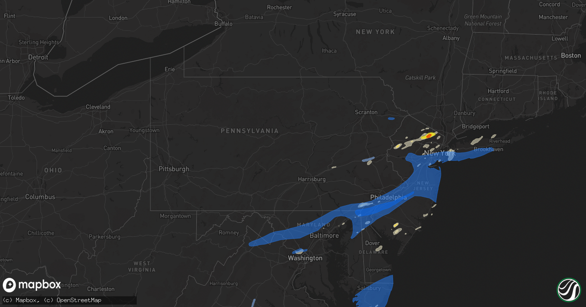
Hail Map in Pennsylvania on July 22, 2019
Get this storm
July 22 map
$229
one time, instant access
Download today. No call, no setup
Keep the $229
Bought the map and want the full workflow? Apply the entire $229 to a subscription within 7 days. None of it is wasted.
Every map, not just this one
This buys you this map. Subscription and you get every map we run, in the markets you choose from a few cities to whole states to nationwide. Plus real-time alerts the moment a storm fires.
Contact data
Name, contact info, occupancy, even credit band for addresses in the footprint. You go from where it hit to who to call.
Become the source they trust
Unlimited branding weather history reports on demand. You already have the documented answer ready for the property owner, and you are the one who showed up with it.
Property data and RoofTrace estimates
Pull up any address you have got, its value and the exact code rules for that jurisdiction, straight from One Click Code. Then RoofTrace estimates the squares, pitch, and roof value, priced the way you price.
Storm reports in Pennsylvania
Pennsylvania
| Date | Description |
|---|---|
| 07/22/20194:55 PM CDT | Trees down. |
| 07/22/20194:50 PM CDT | Tree or limb down blocking us-1. |
| 07/22/20194:48 PM CDT | Newbold... Pa nos site |
| 07/22/20194:40 PM CDT | Downed tree on interstate 276 near the neshaminy falls interchange. Time estimated from radar. |
| 07/22/20194:40 PM CDT | Multiple large trees down between woodbine ave and street rd. Time estimated from radar. |
| 07/22/20194:37 PM CDT | Multiple trees and wires down along with one or more houses possibly on fire. Time estimated from radar. |
| 07/22/20194:34 PM CDT | Two eight-inch diameter branches blocking cloverly lane near sewell lane. Time estimated from radar. |
| 07/22/20194:32 PM CDT | Water rescue from a vehicle reported. |
| 07/22/20194:30 PM CDT | Trees and power lines down. Time estimated from radar. |
| 07/22/20194:28 PM CDT | Kphl asos. |
| 07/22/20194:26 PM CDT | Downed tree at intersection of koch road and ironstone drive. Time estimated from radar. |
| 07/22/20194:23 PM CDT | Numerous trees down. |
| 07/22/20194:22 PM CDT | Widespread damage in springfield with numerous trees and wires down. Time estimated from radar. |
| 07/22/20194:22 PM CDT | Downed tree closed u.s. Highway 22 between routes 512 and 191. Time estimated from radar. |
| 07/22/20194:19 PM CDT | Downed tree on interstate 476 between south of the interstate 78 interchange. Time estimated from radar. |
| 07/22/20194:16 PM CDT | Downed utility on paoli pike. Time estimated from radar. |
| 07/22/20194:15 PM CDT | Delayed report. Trained spotter estimated 80mph wind gusts. |
| 07/22/20194:15 PM CDT | Downed tree on howertown road. Time estimated from radar. |
| 07/22/20194:12 PM CDT | Multiple trees down on and near wylie rd. Time estimated from radar. |
| 07/22/20194:12 PM CDT | Downed tree on hardt hill road. Time estimated from radar. |
| 07/22/20194:11 PM CDT | Multiple trees down on and near kings highway. Time estimated from radar. |
| 07/22/20194:10 PM CDT | Tree down on wires on n warren ave at pennsylvania ave. Time estimated from radar. |
| 07/22/20194:10 PM CDT | Trees and wires down in upper milford. |
| 07/22/20193:55 PM CDT | Corrects previous time of tstm wnd dmg report from weisenberg twp. Trees and wires down in weisenberg twp. Time estimated from radar. |
| 07/22/20193:55 PM CDT | Corrects time of previous tstm wnd dmg report from 1 s weisenberg twp. Trees down on willow run rd. Time estimated from radar. |
| 07/22/20193:53 PM CDT | Trees and wires down in weisenberg twp. Time estimated from radar. |
| 07/22/20193:51 PM CDT | Trees down on willow run rd. Time estimated from radar. |
| 07/22/20193:43 PM CDT | Tree down on baywood rd at tower course dr. Time estimated from radar. |
| 07/22/20193:40 PM CDT | Tree or limb down blocking the roadway on spruce ave at jones ln. Time estimated from radar. |
| 07/22/20193:21 PM CDT | Trees down on wires near peach bottom |
| 07/22/20192:56 PM CDT | Trees down on wires near marstown |
| 07/22/20192:52 PM CDT | Trees down on wires near kirkwood |
| 07/22/20192:25 PM CDT | Multiple trees down in porter township. |
| 07/22/20192:00 PM CDT | Plum creek closed due to flooding |
| 07/22/201912:45 PM CDT | Tree down on wires... Causing a fire near intersection of canterbrook drive and maple ridge drive. |
| 07/22/201912:43 PM CDT | 17 trees down in a homeowner's yard on trail end court... One which fell on a car. |
| 07/22/201912:37 PM CDT | 17 trees down in a homeowner's yard on trail end court... One which fell on a car. |
| 07/22/201912:30 PM CDT | A few trees down in yard. A tent gazebo collapsed. |
| 07/22/20197:51 AM CDT | At 1251 PM EDT, a severe thunderstorm was located near Mount Lena, or 9 miles northwest of Frederick, moving northeast at 20 mph. HAZARD...60 mph wind gusts and quarter size hail. SOURCE...Radar indicated. IMPACT...Damaging winds will cause some trees and large branches to fall. This could injure those outdoors, as well as damage homes and vehicles. Roadways may become blocked by downed trees. Localized power outages are possible. Unsecured light objects may become projectiles. Locations impacted include... Thurmont, Emmitsburg, Taneytown, Walkersville, Wolfsville, Myersville, Woodsboro, Union Bridge, Harney, New Midway, Ladiesburg, Utica, Pleasant Walk, Rocky Ridge, Bolivar, Detour, Keysville, Keymar, Graceham and Lewistown. |
| 07/22/20197:05 AM CDT | At 1205 AM EDT, a severe thunderstorm was located near New Mahoning, or near Tamaqua, moving northeast at 30 mph. HAZARD...60 mph wind gusts and quarter size hail. SOURCE...Radar indicated. IMPACT...Minor damage to vehicles is possible. Wind damage to roofs, siding, trees, and power lines is possible. Locations impacted include... Lehighton, Palmerton, Jim Thorpe, Nesquehoning, Weatherly, Brodheadsville, New Mahoning, Kunkletown, Gilbert, Lake Harmony, Rossland, Albrightsville, Kresgeville, Jonas, Meckesville, Beltzville State Park, Penn Forest Reservoir, Christmans, Lansford and Summit Hill. |
| 07/22/20194:46 AM CDT | At 946 PM EDT, a severe thunderstorm was located over Manchester, or near Parkville, moving east at 25 mph. HAZARD...60 mph wind gusts. SOURCE...Radar indicated. IMPACT...Damaging winds will cause some trees and large branches to fall. This could injure those outdoors, as well as damage homes and vehicles. Roadways may become blocked by downed trees. Localized power outages are possible. Unsecured light objects may become projectiles. Locations impacted include... Hampstead, Manchester, Bentley Springs, Freeland, Lineboro, Millers, Greenmount and Maryland Line. |
| 07/22/20193:20 AM CDT | At 820 PM EDT, a severe thunderstorm was located over Womelsdorf, or near Myerstown, moving east at 35 mph. HAZARD...60 mph wind gusts. SOURCE...Radar indicated. IMPACT...Damage to roofs, siding, trees, and power lines is possible. Locations impacted include... Reading, Wyomissing, Birdsboro, Kutztown, Hamburg, Fleetwood, Sinking Spring, Laureldale, Womelsdorf, Wernersville, Newmanstown, Topton, Leesport, Shoemakersville, Bernville, Lyons, Strausstown, Lenhartsville, Spring Ridge and Fairview Hgts. |
| 07/22/201912:40 AM CDT | At 540 PM EDT, severe thunderstorms were located along a line extending from Andalusia to Lindenwold to Shiloh, moving northeast at 65 mph. These are very dangerous storms. HAZARD...80 mph wind gusts. SOURCE...Radar indicated. IMPACT...Flying debris will be dangerous to those caught without shelter. Mobile homes will be heavily damaged. Expect considerable damage to roofs, windows, and vehicles. Extensive tree damage and power outages are likely. Locations impacted include... Philadelphia, Toms River, Trenton, Vineland, Long Branch, Millville, Bridgeton, Asbury Park, Lakewood, Cherry Hill, Middletown, Old Bridge, Bensalem, Jackson, Howell, Evesham, Mount Laurel, Marlboro, Manalapan and Ewing. |
| 07/22/201912:17 AM CDT | At 517 PM EDT, several severe thunderstorms were located along a line extending from Washington to near Bally, moving east at 30 mph. HAZARD...70 mph wind gusts. SOURCE...Law enforcement. Numerous reports of wind damage have been received from Lehigh and Warren Counties with these storms. IMPACT...Expect considerable tree damage. Damage is likely to mobile homes, roofs, and outbuildings. Locations impacted include... Allentown, Easton, Morristown, Bethlehem, Dover, Forks, Emmaus, Hackettstown, Quakertown, Perkasie, Byram, Wilson, Bedminster, Washington, Hellertown, Morris Plains, Mendham, Flemington, Mountain Lakes and Tinicum. |
| 07/21/201911:24 PM CDT | At 424 PM EDT, severe thunderstorms were located along a line extending from Andover to Oxford, moving northeast at 35 mph. HAZARD...60 mph wind gusts and penny size hail. SOURCE...Radar indicated. IMPACT...Damage to roofs, siding, trees, and power lines is possible. Locations impacted include... Port Jervis, Newton, Montague, Hopatcong, Hackettstown, Washington, Blairstown, Mount Arlington, Franklin, Stanhope, Hamburg, Netcong, Belvidere, Harmony, Oxford, Ogdensburg, Alpha, Sussex, Hope and Milford. |
| 07/21/201911:11 PM CDT | At 410 PM EDT, severe thunderstorms were located along a line extending from near Strausstown to near Fredericksburg to Cleona, moving northeast at 30 mph. HAZARD...60 mph wind gusts. SOURCE...Radar indicated. IMPACT...Expect damage to trees, roofs, and siding. Locations impacted include... Lebanon, Annville, Cornwall, Myerstown, Orwigsburg, Pleasant Hill, Sand Hill, Newmanstown, Lebanon South, Cleona, Avon, Richland, Fredericksburg, Schaefferstown, Quentin, Timber Hills, Mount Gretna Heights, McKeansburg, Lawn and Lickdale.This includes the following Interstates... The Pennsylvania Turnpike from mile markers 260 to 264. Interstate 78 from mile markers 1 to 8. |
| 07/21/201910:17 PM CDT | At 316 PM EDT, a severe thunderstorm was located over Fort Indiantown Gap, moving northeast at 25 mph. HAZARD...70 mph wind gusts. SOURCE...Radar indicated. IMPACT...Expect considerable tree damage. Damage is likely to mobile homes, roofs, and outbuildings. Locations impacted include... Pottsville, Schuylkill Haven, Minersville, Pine Grove, Tremont, Fredericksburg, Friedensburg, Marlin, Forrestville, Branchdale, Seltzer, Donaldson, Heckscherville, Harper Tavern, Lickdale, Fort Indiantown Gap, Lake Wynonah, Jonestown, Cressona and Ravine.This includes the following Interstates... Interstate 78 from mile markers 0 to 8. Interstate 81 from mile markers 82 to 107. |
| 07/21/20199:35 PM CDT | At 234 PM EDT, severe thunderstorms were located along a line extending from near High Point to near Oxford, moving east at 20 mph. HAZARD...60 mph wind gusts and penny size hail. SOURCE...Radar indicated. IMPACT...Damage to roofs, siding, trees, and power lines is possible. Locations impacted include... Port Jervis, Newton, Montague, Dover, Hopatcong, Hackettstown, Wharton, Rockaway, Blairstown, Mount Arlington, Franklin, Mendham, Stanhope, Hamburg, Netcong, Oxford, Ogdensburg, Sussex, Hope and Chester. |
| 07/21/20198:06 PM CDT | At 104 AM EDT, a severe thunderstorm was located near Drums, or 7 miles north of Hazleton, moving northeast at 20 mph. HAZARD...60 mph wind gusts and quarter size hail. SOURCE...Radar indicated. IMPACT...Hail damage to vehicles is expected. Expect wind damage to roofs, siding, and trees. Locations impacted include... Wilkes-Barre, Hazleton, Kingston, Nanticoke, Plains, Pittston, Plymouth, Exeter, Swoyersville and West Pittston. |
| 07/21/20198:00 PM CDT | At least one downed utility. Time estimated from radar. |
| 07/21/20197:50 PM CDT | Downed tree and wires on saucony road. Time estimated from radar. |
| 07/21/20197:40 PM CDT | Downed power cables on state highway 61 between wall street and orchard lane. Time estimated from radar. |
All States Impacted by Hail Map on July 22, 2019
Cities Impacted by Hail Map on July 22, 2019
- Jamaica, NY
- Beach Haven, NJ
- Manahawkin, NJ
- Garrett, WY
- Lake George, CO
- Cleburne, TX
- Burleson, TX
- San Saba, TX
- Globe, AZ
- Waldwick, NJ
- Allendale, NJ
- Wyckoff, NJ
- Wayne, NJ
- Ramsey, NJ
- Haskell, NJ
- Pompton Plains, NJ
- Oakland, NJ
- Bloomingdale, NJ
- Butler, NJ
- Saddle River, NJ
- Riverdale, NJ
- Lincoln Park, NJ
- Boonton, NJ
- Pompton Lakes, NJ
- Mahwah, NJ
- Towaco, NJ
- Franklin Lakes, NJ
- Merry Hill, NC
- Colerain, NC
- Locust Hill, VA
- Topping, VA
- Saluda, VA
- Gloucester, VA
- Kew Gardens, NY
- Oakland Gardens, NY
- Saint Albans, NY
- Woodmere, NY
- Far Rockaway, NY
- Hewlett, NY
- Rosedale, NY
- Malverne, NY
- Great Neck, NY
- New Hyde Park, NY
- Fresh Meadows, NY
- Glen Oaks, NY
- Cedarhurst, NY
- Lynbrook, NY
- Forest Hills, NY
- Flushing, NY
- Floral Park, NY
- Garden City, NY
- Little Neck, NY
- Lawrence, NY
- Elmont, NY
- South Richmond Hill, NY
- Springfield Gardens, NY
- Queens Village, NY
- South Ozone Park, NY
- Bellerose, NY
- Inwood, NY
- Cambria Heights, NY
- Richmond Hill, NY
- Bayside, NY
- Hollis, NY
- Valley Stream, NY
- Arverne, NY
- Wetmore, CO
- Westcliffe, CO
- Thermopolis, WY
- Disputanta, VA
- Vail, AZ
- Vineland, NJ
- Joshua, TX
- Alvarado, TX
- Keene, TX
- Purdys, NY
- Suffolk, VA
- Franklin, VA
- Franklin, TX
- Crowheart, WY
- White Stone, VA
- Toano, VA
- Williamsburg, VA
- Shacklefords, VA
- Barhamsville, VA
- Weems, VA
- Aberdeen, MD
- Aberdeen Proving Ground, MD
- Pavillion, WY
- Shoshoni, WY
- Miami, AZ
- Wingo, KY
- Water Valley, KY
- Woodcliff Lake, NJ
- Hibernia, NJ
- Randolph, NJ
- Ledgewood, NJ
- Budd Lake, NJ
- Denville, NJ
- Hopatcong, NJ
- Mount Arlington, NJ
- Stanhope, NJ
- Chester, NJ
- West Milford, NJ
- Lake Hopatcong, NJ
- Long Valley, NJ
- Flanders, NJ
- Monsey, NY
- Montvale, NJ
- Montville, NJ
- Dover, NJ
- Rockaway, NJ
- Wanaque, NJ
- Spring Valley, NY
- Mine Hill, NJ
- Midland Park, NJ
- Kenvil, NJ
- Netcong, NJ
- Landing, NJ
- Hackettstown, NJ
- Port Murray, NJ
- Succasunna, NJ
- Wharton, NJ
- Prince George, VA
- Spring Grove, VA
- Emory, TX
- Oxford, NJ
- Great Meadows, NJ
- Belvidere, NJ
- Charles City, VA
- Riner, VA
- Christiansburg, VA
- Westfield, NJ
- Clark, NJ
- Scotch Plains, NJ
- Divide, CO
- Broaddus, TX
- Tucson, AZ
- Conway, NC
- Twentynine Palms, CA
- Joshua Tree, CA
- Darby, MT
- Corsicana, TX
- Barry, TX
- Peridot, AZ
- Sonoita, AZ
- Trexlertown, PA
- Allentown, PA
- Alburtis, PA
- Mertztown, PA
- Breinigsville, PA
- Macungie, PA
- Keenesburg, CO
- Hudson, CO
- Normangee, TX
- McLeod, MT
- Saint David, AZ
- Lolo, MT
- Florence, MT
- Casper, WY
- Myerstown, PA
- Fredericksburg, PA
- Bethel, PA
- Hamilton, TX
- Jonesboro, TX
- Egg Harbor Township, NJ
- Absecon, NJ
- Pleasantville, NJ
- Sierra Vista, AZ
- Hereford, AZ
- Kilmarnock, VA
- Lutherville Timonium, MD
- Towson, MD
- Payson, AZ
- Lander, WY
- Kearny, NJ
- Newark, NJ
- North Arlington, NJ
- Belleville, NJ
- Newark, DE
- Elkton, MD
- Riverton, WY
- Watkins, CO
- Commerce City, CO
- Aurora, CO
- Young, AZ
- New Church, VA
- Pocomoke City, MD
- Old Westbury, NY
- Howard, CO
- Salida, CO
- Mountainside, NJ
- New Providence, NJ
- Summit, NJ
- Springfield, NJ
- Townsend, DE
- Parker, CO
- Middletown, DE
- Port Penn, DE
- Loving, NM
- Gladstone, VA
- Carlsbad, NM
- Landenberg, PA
- Avondale, PA
- Millville, NJ
- Petersburg, VA
- Rayville, LA
- Mangham, LA
- Williamston, NC
- Staten Island, NY
- Chadds Ford, PA
- Kennett Square, PA
- Toughkenamon, PA
- Washington, NJ
- Somerset, NJ
- New Brunswick, NJ
- Piscataway, NJ
- Galena, MD
- Edenton, NC
- Sells, AZ
- South Bay, FL
- Belle Glade, FL
- Rockville, MD
- Kensington, MD
- Garrett Park, MD
- Chevy Chase, MD
- Silver Spring, MD
- Potomac, MD
- Glen Echo, MD
- Bethesda, MD
- Cabin John, MD
- Moonachie, NJ
- Palisades Park, NJ
- Carlstadt, NJ
- East Rutherford, NJ
- Secaucus, NJ
- Little Ferry, NJ
- Ridgefield, NJ
- Ridgefield Park, NJ
- Brooklyn, NY
- Ringwood, NJ
- McNeal, AZ
- Murfreesboro, NC
- Pendleton, NC
- Woodbine, NJ
- Stockton, MD
- Girdletree, MD
- Bisbee, AZ
- Cody, WY
- Bloomfield, NJ
- East Orange, NJ
- Windsor, NC
- Township Of Washington, NJ
- Oradell, NJ
- Harrington Park, NJ
- Paramus, NJ
- Emerson, NJ
- Westwood, NJ
- Lone Tree, CO
- Denver, CO
- Buffalo, TX
- Verona, NJ
- Caldwell, NJ
- Roseland, NJ
- Fairfield, NJ
- Essex Fells, NJ
- Livingston, NJ
- West Orange, NJ
- East Hanover, NJ
- Cedar Grove, NJ
- Delhi, LA
- Winnsboro, LA
- Milmay, NJ
- Port Elizabeth, NJ
- Milford, DE
- Frederica, DE
- Marion Station, MD
- Oak Hall, VA
- Fulton, KY
- Marlin, TX
- East Northport, NY
- Northport, NY
- Saint James, NY
- Kings Park, NY
- East Setauket, NY
- Port Jefferson, NY
- Smithtown, NY
- Commack, NY
- Stony Brook, NY
- Hockessin, DE
- Garnet Valley, PA
- Wilmington, DE
- West Grove, PA
- Glen Mills, PA
- Bennett, CO
- Goldonna, LA
- Greycliff, MT
- Hardyville, VA
- Hartfield, VA
- Wake, VA
- Wading River, NY
- Check, VA
- Pilot, VA
- Floyd, VA
- Gates, NC
- Warner Springs, CA
- Little Falls, NJ
- Paterson, NJ
- Woodlyn, PA
- Swarthmore, PA
- Brookhaven, PA
- Chester, PA
- Wallingford, PA
- Santa Anna, TX
- Tangier, VA
- Andover, NJ
- Lanexa, VA
- Como, NC
- Newsoms, VA
- Jasper, TX
- Zavalla, TX
- Columbia, LA
- Grayson, LA
- Tuckerton, NJ
- West Creek, NJ
- Meadows Of Dan, VA
- Big Sky, MT
- Abingdon, MD
- Mount Vernon, TX
- Pima, AZ
- Amado, AZ
- Green Valley, AZ
- Mascot, VA
- Urbanna, VA
- Church View, VA
- Moneta, VA
- Clinton, KY
- Southside, TN
- Charlotte, TN
- Cumberland Furnace, TN
- Long Branch, NJ
- Folcroft, PA
- Kennedyville, MD
- Somerville, NJ
- Columbus, NJ
- Middle Village, NY
- Mastic Beach, NY
- Brightwaters, NY
- Deal, NJ
- Cranbury, NJ
- Merrick, NY
- Pennsauken, NJ
- Robbinsville, NJ
- Dayton, NJ
- Woodbridge, NJ
- Freehold, NJ
- Sayville, NY
- Drexel Hill, PA
- Basking Ridge, NJ
- Bradley Beach, NJ
- Perryville, MD
- West Berlin, NJ
- Monroeville, NJ
- Buckeystown, MD
- Saint Georges, DE
- Jefferson, MD
- Carteret, NJ
- Millington, MD
- Plainfield, NJ
- Mickleton, NJ
- Middlesex, NJ
- Ranson, WV
- Fanwood, NJ
- Allenwood, NJ
- Millstone Township, NJ
- Spotswood, NJ
- Springfield, PA
- Folsom, PA
- Mount Airy, MD
- Hainesport, NJ
- Pedricktown, NJ
- Marlton, NJ
- Sicklerville, NJ
- Warwick, MD
- Round Hill, VA
- Colonia, NJ
- Lincroft, NJ
- Rockville Centre, NY
- Bayport, NY
- Mantua, NJ
- Marriottsville, MD
- Bellmawr, NJ
- East Meadow, NY
- Red Bank, NJ
- Wrightstown, NJ
- Mullica Hill, NJ
- Oaklyn, NJ
- Holbrook, NY
- Massapequa, NY
- Trenton, NJ
- Marlboro, NJ
- Plainsboro, NJ
- Ozone Park, NY
- Brentwood, NY
- Elk Mills, MD
- Roselle Park, NJ
- Keyport, NJ
- Berryville, VA
- Rahway, NJ
- Lindenhurst, NY
- Manchester Township, NJ
- Aston, PA
- Mount Royal, NJ
- Oakdale, NY
- Oceanport, NJ
- Hillsborough, NJ
- Union, NJ
- Odessa, DE
- Sparks Glencoe, MD
- Beachwood, NJ
- Gaithersburg, MD
- Palmyra, NJ
- Essington, PA
- Matawan, NJ
- Great River, NY
- Roselle, NJ
- Cochranville, PA
- Lakehurst, NJ
- Farmingdale, NY
- Farmingdale, NJ
- Oxford, PA
- Fair Haven, NJ
- Fallston, MD
- Bala Cynwyd, PA
- Avon By The Sea, NJ
- Blackwood, NJ
- Germantown, MD
- Haddonfield, NJ
- Long Island City, NY
- Franklin Park, NJ
- Cecilton, MD
- Islip, NY
- Chesapeake City, MD
- Far Hills, NJ
- Riverside, NJ
- Haddon Heights, NJ
- Phoenix, MD
- Gibbsboro, NJ
- Brunswick, MD
- Breezy Point, NY
- Audubon, NJ
- Burlington, NJ
- Magnolia, NJ
- Old Bridge, NJ
- New Castle, DE
- Fords, NJ
- Atlantic Highlands, NJ
- Levittown, PA
- Iselin, NJ
- Bethpage, NY
- Ijamsville, MD
- Stratford, NJ
- Windsor, NJ
- Summit Point, WV
- Mastic, NY
- Pikesville, MD
- Lansdowne, PA
- Sayreville, NJ
- Parkton, MD
- Thorofare, NJ
- Salem, NJ
- Lovettsville, VA
- Belford, NJ
- Oceanside, NY
- Rego Park, NY
- Jarrettsville, MD
- Woodbury Heights, NJ
- Glendora, NJ
- Ocean Beach, NY
- Darby, PA
- North Brunswick, NJ
- West Islip, NY
- Neptune, NJ
- White Hall, MD
- Ronkonkoma, NY
- Manville, NJ
- Shrewsbury, NJ
- Seaside Heights, NJ
- Point Lookout, NY
- Freeport, NY
- Bristol, PA
- Upper Darby, PA
- Knoxville, MD
- Morrisville, PA
- Chesterfield, NJ
- Prospect Park, PA
- Keasbey, NJ
- Marcus Hook, PA
- Quarryville, PA
- Berkeley Heights, NJ
- Owings Mills, MD
- Clear Brook, VA
- Beverly, NJ
- Ridley Park, PA
- Bordentown, NJ
- Purcellville, VA
- Harpers Ferry, WV
- Cream Ridge, NJ
- Pennsville, NJ
- Little Silver, NJ
- South Bound Brook, NJ
- Babylon, NY
- Highland Park, NJ
- Lincoln University, PA
- National Park, NJ
- Fairless Hills, PA
- Cherry Hill, NJ
- New York, NY
- Bel Air, MD
- Highlands, NJ
- Baldwin, MD
- Pitman, NJ
- Clementon, NJ
- Sewell, NJ
- Waterford, VA
- Cranford, NJ
- Chestertown, MD
- Perth Amboy, NJ
- Califon, NJ
- Brielle, NJ
- Whiteford, MD
- Helmetta, NJ
- Monrovia, MD
- Joint Base Mdl, NJ
- Conowingo, MD
- North East, MD
- Riverton, NJ
- Roebling, NJ
- Center Moriches, NY
- Millington, NJ
- Gladstone, NJ
- New Egypt, NJ
- Camden, NJ
- Cheltenham, PA
- Jersey City, NJ
- South Plainfield, NJ
- Somerdale, NJ
- Island Park, NY
- Asbury Park, NJ
- Martinsville, NJ
- Bensalem, PA
- Glenolden, PA
- Reisterstown, MD
- Sewaren, NJ
- Brick, NJ
- Bridgewater, NJ
- Thornton, PA
- Mantoloking, NJ
- Berlin, NJ
- Levittown, NY
- Voorhees, NJ
- Williamstown, NJ
- Pine Beach, NJ
- Middletown, NJ
- Hempstead, NY
- Hazlet, NJ
- Upperco, MD
- Howard Beach, NY
- Wenonah, NJ
- Parlin, NJ
- Brookhaven, NY
- Deer Park, NY
- Mount Ephraim, NJ
- Paulsboro, NJ
- Pylesville, MD
- Bound Brook, NJ
- Woodstock, MD
- Barnesville, MD
- Penns Grove, NJ
- Street, MD
- Pemberton, NJ
- Cliffwood, NJ
- New Market, MD
- Clarksboro, NJ
- Sea Girt, NJ
- Amityville, NY
- Blue Point, NY
- Gibbstown, NJ
- Glyndon, MD
- West Long Branch, NJ
- Port Reading, NJ
- Browns Mills, NJ
- East Rockaway, NY
- Point Of Rocks, MD
- Crum Lynne, PA
- Bellmore, NY
- South River, NJ
- Clifton Heights, PA
- Elizabeth, NJ
- Allentown, NJ
- Bay Shore, NY
- Massey, MD
- Leonardo, NJ
- Broomall, PA
- New Windsor, MD
- Peapack, NJ
- Adamstown, MD
- Medford, NJ
- Glassboro, NJ
- Claymont, DE
- Media, PA
- Woodstown, NJ
- Bellport, NY
- Watchung, NJ
- Ocean Grove, NJ
- Hillside, NJ
- Grenloch, NJ
- Seaford, NY
- Kendall Park, NJ
- Runnemede, NJ
- Metuchen, NJ
- Finksburg, MD
- Bayonne, NJ
- Woodbury, NJ
- Woodside, NY
- Clarksburg, MD
- Charlestown, MD
- Linden, NJ
- West Babylon, NY
- Central Islip, NY
- Woodhaven, NY
- Cockeysville, MD
- Edison, NJ
- Merchantville, NJ
- Brookeville, MD
- Swedesboro, NJ
- Maspeth, NY
- Charles Town, WV
- Bear, DE
- Holtsville, NY
- Elmhurst, NY
- Leesburg, VA
- Massapequa Park, NY
- Peach Bottom, PA
- Mount Laurel, NJ
- Englishtown, NJ
- Bohemia, NY
- Seaside Park, NJ
- Dunellen, NJ
- Roosevelt, NJ
- Georgetown, MD
- Westville, NJ
- Morganville, NJ
- Whitehouse Station, NJ
- Ocean Gate, NJ
- Kenilworth, NJ
- Princeton, NJ
- Millville, WV
- Earleville, MD
- Atlantic Beach, NY
- Belmar, NJ
- Boyds, MD
- Lawrence Township, NJ
- East Islip, NY
- Franklin Square, NY
- Dickerson, MD
- Monkton, MD
- Warren, NJ
- Lakewood, NJ
- Glenwood, MD
- West Sayville, NY
- Baldwin, NY
- Randallstown, MD
- Howell, NJ
- Mount Holly, NJ
- Philadelphia, PA
- Hunt Valley, MD
- Jackson, NJ
- Copiague, NY
- Norwood, PA
- Point Pleasant Beach, NJ
- Monmouth Beach, NJ
- Cooksville, MD
- Island Heights, NJ
- Colts Neck, NJ
- Florence, NJ
- Bedminster, NJ
- Morton, PA
- Vincentown, NJ
- Lawnside, NJ
- Croydon, PA
- Moriches, NY
- Princeton Junction, NJ
- Drumore, PA
- Manasquan, NJ
- Merion Station, PA
- Holmes, PA
- Rising Sun, MD
- Damascus, MD
- Woodbine, MD
- Monroe Township, NJ
- Stephenson, VA
- Bayville, NJ
- Kirkwood, PA
- Collingswood, NJ
- Stirling, NJ
- Port Deposit, MD
- Eatontown, NJ
- Patchogue, NY
- Bernardsville, NJ
- South Amboy, NJ
- Stevenson, MD
- Rumson, NJ
- Ridgewood, NY
- Montchanin, DE
- Rockaway Park, NY
- Port Monmouth, NJ
- Colora, MD
- Raritan, NJ
- Islip Terrace, NY
- Rockland, DE
- Lumberton, NJ
- East Brunswick, NJ
- Maple Shade, NJ
- West Chester, PA
- Keansburg, NJ
- Monmouth Junction, NJ
- Delaware City, DE
- Oakhurst, NJ
- Langhorne, PA
- Forest Hill, MD
- Willingboro, NJ
- Barrington, NJ
- Garwood, NJ
- Rancocas, NJ
- Wantagh, NY
- Gloucester City, NJ
- Bridgeport, NJ
- North Babylon, NY
- Havertown, PA
- West Friendship, MD
- Westminster, MD
- Frederick, MD
- Boyce, VA
- Avenel, NJ
- Elizabethport, NJ
- Toms River, NJ
- Uniondale, NY
- Sykesville, MD
- Sharon Hill, PA
- Jobstown, NJ
- Winchester, VA
- Cookstown, NJ
- Yorklyn, DE
- Delta, PA
- Tuscarora, MD
- Roosevelt, NY
- Allenhurst, NJ
- Hightstown, NJ
- Milltown, NJ
- Shirley, NY
- Wynnewood, PA
- Moorestown, NJ
- West Hempstead, NY
- Long Beach, NY
- Fort Monmouth, NJ
- Nottingham, PA
- Lavallette, NJ
- Darlington, MD
- Holmdel, NJ
- Chester Heights, PA
- Spring Lake, NJ
- Stephens City, VA
- Vienna, VA
- McLean, VA
- Great Falls, VA
- Greentown, PA
- Hawley, PA
- Dingmans Ferry, PA
- Milford, PA
- Kutztown, PA
- Whitehall, PA
- Orefield, PA
- New Tripoli, PA
- Fogelsville, PA
- Blue Ridge, VA
- Goodview, VA
- Shawsville, VA
- Elliston, VA
- Callaway, VA
- Roanoke, VA
- Bent Mountain, VA
- Copper Hill, VA
- Hardy, VA
- Salem, VA
- Vinton, VA
- Boones Mill, VA
- Gordonsville, VA
- Troy, VA
- Palmyra, VA
- Skipwith, VA
- Chase City, VA
- Portsmouth, VA
- Chesapeake, VA
- Carrsville, VA
- Windsor, VA
- Blackstone, VA
- Kenbridge, VA
- Crewe, VA
- Courtland, VA
- Waverly, VA
- Hallwood, VA
- Chincoteague Island, VA
- Temperanceville, VA
- Princess Anne, MD
- Dagsboro, DE
- Millville, DE
- Eden, MD
- Millsboro, DE
- Quantico, MD
- Willards, MD
- Crisfield, MD
- Bethany Beach, DE
- Delmar, DE
- Whaleyville, MD
- Sanford, VA
- Fenwick Island, DE
- Tyaskin, MD
- Greenbackville, VA
- Ocean City, MD
- Berlin, MD
- Westover, MD
- Newark, MD
- Ocean View, DE
- Deal Island, MD
- Salisbury, MD
- Selbyville, DE
- Parsonsburg, MD
- Delmar, MD
- Frankford, DE
- Bishopville, MD
- Fruitland, MD
- Snow Hill, MD
- Pittsville, MD
- Showell, MD
- Haledon, NJ
- Deer Trail, CO
- Strasburg, CO
- Agate, CO
- Kiowa, CO
- Elizabeth, CO
- Ramah, CO
- Littleton, CO


