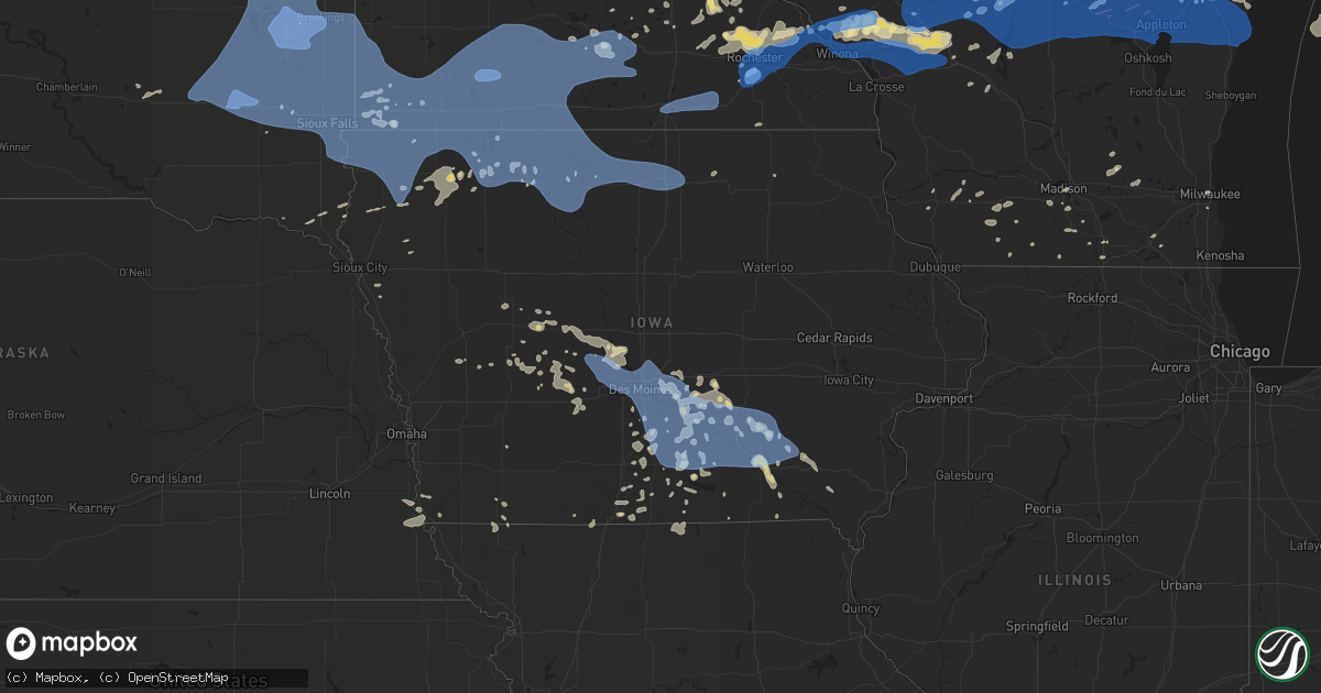
Hail Map in Iowa on July 20, 2019
Get this storm
July 20 map
$229
one time, instant access
Download today. No call, no setup
Keep the $229
Bought the map and want the full workflow? Apply the entire $229 to a subscription within 7 days. None of it is wasted.
Every map, not just this one
This buys you this map. Subscription and you get every map we run, in the markets you choose from a few cities to whole states to nationwide. Plus real-time alerts the moment a storm fires.
Contact data
Name, contact info, occupancy, even credit band for addresses in the footprint. You go from where it hit to who to call.
Become the source they trust
Unlimited branding weather history reports on demand. You already have the documented answer ready for the property owner, and you are the one who showed up with it.
Property data and RoofTrace estimates
Pull up any address you have got, its value and the exact code rules for that jurisdiction, straight from One Click Code. Then RoofTrace estimates the squares, pitch, and roof value, priced the way you price.
Storm reports in Iowa
Iowa
| Date | Description |
|---|---|
| 07/20/20196:55 PM CDT | Tree limbs down taking out power lines. Time estimated from radar. |
| 07/20/20196:55 PM CDT | Power lines down on ia 23 near the intersection of tiller avenue blocking both lanes. They also advised there are possibly sparking power lines near the roadway just ea |
| 07/20/20196:54 PM CDT | A local report indicates 60 MPH wind near ALBIA |
| 07/20/20196:40 PM CDT | Mahaska county emergency manager reports many instances of tree damage and power outages countywide. Time estimated per center of county. |
| 07/20/20196:21 PM CDT | Guthrie co emergency manager reported large trees down in yale. Several streets blocked. |
| 07/20/20196:15 PM CDT | Awos station kcnc chariton airport. |
| 07/20/20196:15 PM CDT | Awos station koxv knoxville airport. |
| 07/20/20196:10 PM CDT | Two 4 inch maple branches down. Multiple reports of tree damage across town. Time estimated. |
| 07/20/20196:10 PM CDT | Time estimated by radar. Numerous trees down at property. Largest 14 inches in diameter. Tree branch left a hole in roof of residence. |
| 07/20/20196:10 PM CDT | Knia/krls reported power outages across the county... As well as a tree down at a campground near red rock... Possibly trapping someone in a vehicle. Via radio news soc |
| 07/20/20195:50 PM CDT | Estimated 50 to 60 mph wind with a lot of minor tree damage... Small branches and leaves down. Time estimated. |
| 07/20/20195:43 PM CDT | Idot reports tree and power line damage along highway 92. Time estimated. |
| 07/20/20195:24 PM CDT | Trees down at the ia dot facility in ankeny. Small 4 to 6 inch diameter trees snapped and blown down. Time estimated from radar... Delayed report. |
| 07/20/20195:23 PM CDT | Corrects previous tstm wnd dmg report |
| 07/20/20195:20 PM CDT | Utility wires down. |
| 07/20/20195:18 PM CDT | Portable message boards blown over. Time estimated. |
| 07/20/20195:15 PM CDT | Residential shed tipped over. Via social media. Time estimated. |
| 07/20/20195:15 PM CDT | Polk county emergency management staff reported 4 inch tree branch down. |
| 07/20/20195:02 PM CDT | Power poles down. Relayed via fire department. Time estimated. |
| 07/20/20195:02 PM CDT | Large tree down along vine st. Time estimated. |
| 07/20/20195:00 PM CDT | Report via dallas center fd. Pole barn lost roof at feed lot. Time estimated. |
| 07/20/20195:00 PM CDT | 4 inch tree limbs down at f31 & r22. Time estimated. |
| 07/20/20194:35 PM CDT | Large tree down just outside of town. Passed on from perry pd. Time estimated. |
| 07/20/20191:50 PM CDT | Several 1-2 inch tree branches down near residence... One 4 foot long 2 inch healthy tree branch down. Also noted some shingles blown down on shed. Time estimated from |
| 07/20/201912:58 PM CDT | A few trees down on power lines. |
| 07/20/201912:13 PM CDT | Kwwl-tv viewer shares pictures of tree damage... Branches 2 to 3 inches in diameter downed in waverly. Time estimated by radar. |
| 07/20/201912:13 PM CDT | A large tree limb nearly 1 foot in diameter was broken with the gust front. There was no thunderstorm... But the gust front from thunderstorms to the north produced win |
| 07/20/201911:49 AM CDT | Photo of tree down on house. Relayed via broadcast media. Time estimated from radar. |
| 07/20/201911:38 AM CDT | Social media picture of downed tree limbs about 2 to 3 inches in diameter... Tents ripped apart. Wind gusts estimated 50 to 60 mph. |
| 07/20/201911:38 AM CDT | Large tree limb down on franklin county fairgrounds. Via social media picture. Time estimated by radar. |
| 07/20/201911:34 AM CDT | Tree blown down. |
| 07/20/201911:26 AM CDT | Kimt-tv viewer shares photo of large tree limb snapped in mason city. Diameter appears to be at least 8 inches. |
| 07/20/201911:20 AM CDT | A local report indicates 61 MPH wind near 3 NE CLEAR LAKE |
| 07/20/201911:15 AM CDT | A local report indicates 58 MPH wind near 2 WNW CLARION |
| 07/20/201911:06 AM CDT | Social media picture of 5 inch tree limbs downed. Time estimated from radar. |
| 07/20/201911:06 AM CDT | Social media picture of large tree limb... Around 10 inches in diameter... Broken in garner... Ia. |
| 07/20/201910:58 AM CDT | Multiple spotters have reported tree limbs... About 3 to 4 inches in diameter have been downed. |
| 07/20/201910:55 AM CDT | A local report indicates 60 MPH wind near 2 SSE FOREST CITY |
| 07/20/201910:38 AM CDT | Several larger tree limbs down in algona. |
| 07/20/201910:37 AM CDT | Estimated 60 mph gust. A few larger tree limbs are down with several smaller branches and twigs. |
| 07/20/201910:03 AM CDT | A local report indicates 64 MPH wind near 2 WNW GRUVER |
| 07/20/201910:01 AM CDT | Asos station kest estherville airport. |
| 07/20/20199:50 AM CDT | A local report indicates 60 MPH wind near DICKENS |
| 07/20/20199:43 AM CDT | Asos station kspw spencer municipal airport. |
| 07/20/20199:35 AM CDT | Large tents destroyed by arnolds park amusement park. Time estimated from radar. |
| 07/20/20199:34 AM CDT | Five inch tree limbs broken. |
| 07/20/20199:32 AM CDT | Estimated 60 mph wind at scharnberg park. Tree limbs breaking. |
| 07/20/20199:30 AM CDT | Six inch diameter tree branches down. |
| 07/20/20199:15 AM CDT | Large trees down throughout the town. |
| 07/20/20199:10 AM CDT | Mesonet station rsyi4 2 ne sibley. |
| 07/20/20199:06 AM CDT | Four inch diameter tree branch down. |
| 07/20/20197:10 AM CDT | At 1210 PM CDT, severe thunderstorms were located along a line extending from near Independence to near Canton, moving east at 50 mph. HAZARD...60 mph wind gusts. SOURCE...Radar indicated. IMPACT...Expect damage to roofs, siding, and trees. Locations impacted include... La Crosse, Winona, Arcadia, Onalaska, Buffalo, Holmen, West Salem, Trempealeau, Galesville, Bangor, Blair, Buffalo City, Fountain City, Stoddard, Coon Valley, North Bend, La Crosse Airport, Brice Prairie, French Island and Dodge.People attending the La Crosse Interstate Fair should seek safeshelter immediately! |
| 07/20/20196:40 AM CDT | At 1139 AM CDT, severe thunderstorms were located along a line extending from 6 miles southwest of Le Roy to 6 miles southwest of Floyd, moving east at 65 mph. HAZARD...70 mph wind gusts. SOURCE...Radar indicated. IMPACT...Expect considerable tree damage. Damage is likely to mobile homes, roofs, and outbuildings. Severe thunderstorms will be near... Nashua, Lime Springs and Ionia around 1155 AM CDT. Cresco, New Hampton and Jerico around 1205 PM CDT. Fredericksburg and Lawler around 1210 PM CDT.Other locations impacted by these severe thunderstorms include VernonSprings County Park, Vernon Springs, Bradford, Chickasaw, CountyRoads V 58 And A 46, New Hampton Airport and County Roads B 28 And V18. |
| 07/20/20196:36 AM CDT | At 1134 AM CDT, severe thunderstorms were located along a line extending from near Wabasha to near Adams, moving east at 65 mph. HAZARD...70 mph wind gusts. SOURCE...Radar indicated. This storm has a history of producing 60 to 65 mph wind gusts. IMPACT...Expect considerable tree damage. Damage is likely to mobile homes, roofs, and outbuildings. Severe thunderstorms will be near... Harmony around 1205 PM CDT. Canton around 1210 PM CDT. Mabel around 1215 PM CDT.Other locations impacted by these severe thunderstorms includeForestville State Park, Potsdam, Isinours, I 90 Exit 257, Riceford,Fillmore and County Roads 28 And 31.People attending the Fillmore County Fair, and Rushford Days shouldseek safe shelter immediately! |
| 07/20/20196:35 AM CDT | At 1131 AM CDT, the leading edge of severe winds associated with northern Iowa thunderstorms was along a line extending from Sheffield to 10 miles south of Webster City, moving east at 60 mph. HAZARD...60 mph wind gusts. SOURCE...Radar indicated. At 1115am 60 mph winds were reported at the Clarion Airport. IMPACT...Expect damage to roofs, siding, and trees. Severe thunderstorms will be near... Sheffield around 1135 AM CDT. Jewell Junction around 1145 AM CDT. Greene around 1150 AM CDT. Clarksville around 1200 PM CDT. Eldora around 1210 PM CDT.Other locations impacted by these severe thunderstorms includeSteamboat Rock, Blairsburg, Radcliffe, Bradford, Iowa Falls MunicipalAirport, Kamrar, Wellsburg, Geneva, Hansell and Union.This includes Interstate 35 between mile markers 127 and 150, andbetween mile markers 155 and 172. |
| 07/20/20195:41 AM CDT | At 1041 AM CDT, a line of severe thunderstorm was located 7 miles northeast of Frost, or 23 miles west of Albert Lea, moving east at 50 mph. These thunderstorms have a history of producing wind gusts in excess of 60 mph. HAZARD...60 mph wind gusts. SOURCE...Radar indicated. IMPACT...Expect damage to roofs, siding, and trees. Locations impacted include... Albert Lea, Wells, Clarks Grove, Minnesota Lake, Elmore, Alden, Glenville, Geneva, Emmons, Bricelyn, Hartland and London.This includes the following highways... Interstate 35 between mile markers 1 and 24. Interstate 90 between mile markers 124 and 173. U.S. Highway 169 between mile markers 1 and 5. |
| 07/20/20195:01 AM CDT | At 1000 AM CDT, a severe thunderstorm was located near Lewisville, or 21 miles north of Fairmont, moving east at 65 mph. HAZARD...60 mph wind gusts and penny size hail. SOURCE...Radar indicated. IMPACT...Expect damage to roofs, siding, and trees. Locations impacted include... Mankato, Fairmont, North Mankato, Blue Earth, Lake Crystal, Eagle Lake, Wells, Janesville, Mapleton, Winnebago, Madison Lake and St. Clair.This includes the following highways... Interstate 90 between mile markers 101 and 142. U.S. Highway 14 between mile markers 122 and 152. U.S. Highway 169 between mile markers 1 and 57. |
| 07/20/20194:42 AM CDT | At 942 AM CDT, severe thunderstorms were located along a line extending from 6 miles north of Superior to near Royal, moving east at 60 mph. HAZARD...60 mph wind gusts. SOURCE...Radar indicated. IMPACT...Expect damage to roofs, siding, and trees. Locations impacted include... Estherville, Emmetsburg, Swan Lake, Five Island Lake, Ingham Lake, High Lake, Lost Island Lake, Okamanpedan Lake, Iowa Lake, Silver Lake, Rush Lake, Armstrong, Graettinger, Ruthven, Ringsted, Mallard, Wallingford, Ayrshire, Gruver and Cylinder. |
| 07/20/20194:40 AM CDT | At 940 AM CDT, severe thunderstorms were located along a line extending from near Bergen to near Sutherland, moving east at 60 mph. HAZARD...60 mph wind gusts. SOURCE...Radar indicated. IMPACT...Expect damage to roofs, siding, and trees. Severe thunderstorms will be near... Sioux Rapids and Greenville around 955 AM CDT. Webb around 1000 AM CDT.Other locations impacted by these severe thunderstorms include Alpha,Gillett Grove, Moneta, Dickens, Calumet and Rossie. |
| 07/20/20194:37 AM CDT | At 937 AM CDT, a severe thunderstorm was located over Cleghorn, or 10 miles northwest of Cherokee, moving east at 45 mph. HAZARD...60 mph wind gusts. SOURCE...Radar indicated. IMPACT...Expect damage to roofs, siding, and trees. This severe thunderstorm will be near... Cherokee and Larrabee around 950 AM CDT. Aurelia around 1000 AM CDT. Alta around 1010 AM CDT. Storm Lake, Lakeside and Truesdale around 1015 AM CDT.Other locations impacted by this severe thunderstorm include Calumet,Meriden and Rembrandt. |
| 07/20/20194:19 AM CDT | At 919 AM CDT, severe thunderstorms was located near Heron Lake, or 8 miles west of Windom, moving east at 45 mph. these storms have a history of producing wing gusts of 60 to 70 mph. HAZARD...60 mph wind gusts and penny size hail. SOURCE...Radar indicated. IMPACT...Expect damage to roofs, siding, and trees. Locations impacted include... St. James, Madelia, Springfield, Sherburn, Truman, Trimont, Welcome, Butterfield, Hanska, Comfrey, Ceylon and Lewisville.This includes the following highways... Interstate 90 between mile markers 82 and 100. U.S. Highway 14 between mile markers 69 and 80. |
| 07/20/20192:41 AM CDT | At 740 AM CDT, severe thunderstorms were located along a line extending from 7 miles southeast of Estelline to near Wentworth to near Bridgewater, moving east at 65 mph. HAZARD...70 mph wind gusts and penny size hail. SOURCE...Radar indicated. IMPACT...Expect considerable tree damage. Damage is likely to mobile homes, roofs, and outbuildings. Severe thunderstorms will be near... White around 745 AM CDT. Lake Vermillion State Recreation Area and Colman around 750 AM CDT. Flandreau, Hendricks, Humboldt, Egan and Trent around 755 AM CDT. Wall Lake around 800 AM CDT. Hartford, Ivanhoe and Arco around 805 AM CDT. Sioux Falls, Pipestone and Pipestone National Monument around 810 AM CDT. Minneota, Holland and Trosky around 815 AM CDT. Brandon, Edgerton, Ghent, Woodstock, Rowena and Camden State Park around 820 AM CDT.Other locations impacted by these severe thunderstorms include Ihlen,Hatfield, Bushnell and Lynd. |
| 07/20/20192:37 AM CDT | At 737 PM CDT, a severe thunderstorm was located near Fairfield, moving east at 40 mph. HAZARD...60 mph wind gusts. SOURCE...Radar indicated. IMPACT...Expect damage to roofs, siding, and trees. Locations impacted include... Fairfield, Mount Pleasant, New London, Winfield, Wayland, Brighton, Richland, Birmingham, Salem, Libertyville, Stockport, Lockridge, Maharishi Vedic City, Olds, Packwood, Hillsboro, Rome, Westwood, Mount Union and Pleasant Plain. |
| 07/20/20192:24 AM CDT | At 723 PM CDT, a severe thunderstorm was located near Indianola, moving southeast at 35 mph. HAZARD...60 mph wind gusts and quarter size hail. SOURCE...Radar indicated. IMPACT...Hail damage to vehicles is expected. Expect wind damage to roofs, siding, and trees. Locations impacted include... Indianola, Chariton, Melcher-Dallas, Avenue Of The Saints Event Center, Milo, Russell, New Virginia, Martensdale, Lacona, Lucas, Woodburn, Williamson, St. Marys, Derby, Ackworth, Spring Hill, Bevington, Sandyville, Lake Ahquabi State Park and Red Haw Lake State Park.This includes Interstate 35 between mile markers 43 and 62. |
| 07/20/20192:00 AM CDT | At 659 PM CDT, a severe thunderstorm was located over Saylorville Lake, or over Johnston, moving east at 35 mph. HAZARD...60 mph wind gusts and penny size hail. SOURCE...Radar indicated. IMPACT...Expect damage to roofs, siding, and trees. Locations impacted include... Des Moines, West Des Moines, Ankeny, Urbandale, Johnston, Clive, Altoona, Waukee, Norwalk, Pleasant Hill, Grimes, Windsor Heights, Carlisle, Bondurant, Polk City, Saylorville, Mitchellville, Granger, Southridge Mall and Jordan Creek Town Center.This includes the following highways... Interstate 35 between mile markers 63 and 72, and between milemarkers 87 and 99. Interstate 80 between mile markers 119 and 149. Interstate 235 between mile markers 1 and 14. |
| 07/20/20191:49 AM CDT | At 649 PM CDT, severe thunderstorms were located along a line extending from near Ottumwa to near Centerville to 13 miles northwest of Unionville to 10 miles southwest of Corydon, moving southeast at 45 mph. HAZARD...60 mph wind gusts and quarter size hail. SOURCE...Radar indicated. IMPACT...Hail damage to vehicles is expected. Expect wind damage to roofs, siding, and trees. Locations impacted include... Kirksville, Unionville, Lancaster, Green City, Queen City, Novinger, Greentop, Downing, Greencastle, Glenwood, Newtown, Pollock, Lucerne, Worthington, Livonia, Harris, Powersville, Lemons and Green Castle. |
| 07/20/20191:48 AM CDT | At 648 PM CDT, severe thunderstorms were located along a line extending from 6 miles east of Grinnell to 9 miles west of Eddyville, moving east at 65 mph. HAZARD...60 mph wind gusts and quarter size hail. SOURCE...Radar indicated. IMPACT...Hail damage to vehicles is expected. Expect wind damage to roofs, siding, and trees. Locations impacted include... Oskaloosa, Montezuma, New Sharon, Eddyville, Fremont, Beacon, University Park, Deep River, Barnes City, Rose Hill, Leighton, Keomah Village, Lake Keomah State Park and Oskaloosa Municipal Airport. |
| 07/20/20191:41 AM CDT | At 641 PM CDT, a severe thunderstorm was located near Adel, moving southeast at 35 mph. HAZARD...60 mph wind gusts and quarter size hail. SOURCE...Radar indicated. IMPACT...Hail damage to vehicles is expected. Expect wind damage to roofs, siding, and trees. Locations impacted include... West Des Moines, Urbandale, Clive, Waukee, Grimes, Winterset, Adel, Stuart, Dallas Center, Earlham, Panora, De Soto, Van Meter, Jordan Creek Town Center, Lake Panorama, Redfield, St. Charles, Dexter, Diamondhead Lake and Minburn.This includes Interstate 80 between mile markers 88 and 121. |
| 07/20/201912:58 AM CDT | At 558 PM CDT, severe thunderstorms were located along a line extending from 11 miles southeast of Iowa Speedway to near Melcher-Dallas to 11 miles south of Indianola, moving southeast at 35 mph. HAZARD...60 mph wind gusts and quarter size hail. SOURCE...Radar indicated. IMPACT...Hail damage to vehicles is expected. Expect wind damage to roofs, siding, and trees. Locations impacted include... Oskaloosa, Pella, Knoxville, Chariton, New Sharon, Eddyville, Lake Red Rock, Knoxville Raceway, Sully, Fremont, Russell, Lovilia, Beacon, University Park, Bussey, Lynnville, Lacona, Harvey, Lucas and Rose Hill. |
| 07/20/201912:29 AM CDT | At 529 PM CDT, severe thunderstorms were located along a line extending from Baxter to near Indianola, moving east at 55 mph. HAZARD...60 mph wind gusts and quarter size hail. SOURCE...Radar indicated. IMPACT...Hail damage to vehicles is expected. Expect wind damage to roofs, siding, and trees. Locations impacted include... Des Moines, Newton, Indianola, Pleasant Hill, Knoxville, Carlisle, Mitchellville, Colfax, Monroe, Pleasantville, Prairie City, Melcher-Dallas, Baxter, Iowa Speedway, Knoxville Raceway, Lake Red Rock, Rock Creek Lake, Milo, Hartford and Kellogg.This includes Interstate 80 between mile markers 149 and 177. |
| 07/19/201911:59 PM CDT | At 459 PM CDT, a severe thunderstorm was located over Granger, or near Grimes, moving southeast at 45 mph. HAZARD...60 mph wind gusts and penny size hail. SOURCE...Radar indicated. IMPACT...Expect damage to roofs, siding, and trees. Locations impacted include... Des Moines, West Des Moines, Ankeny, Urbandale, Johnston, Clive, Altoona, Norwalk, Pleasant Hill, Grimes, Windsor Heights, Carlisle, Bondurant, Polk City, Huxley, Saylorville, Mitchellville, Slater, Baxter and Southridge Mall.This includes the following highways... Interstate 35 near mile marker 72, and between mile markers 87 and105. Interstate 80 between mile markers 123 and 151. Interstate 235 between mile markers 1 and 14. |
| 07/19/201911:28 PM CDT | At 428 PM CDT, a severe thunderstorm was located near Perry, moving southeast at 40 mph. HAZARD...60 mph wind gusts and penny size hail. SOURCE...Radar indicated. IMPACT...Expect damage to roofs, siding, and trees. Locations impacted include... Urbandale, Johnston, Grimes, Perry, Polk City, Madrid, Granger, Woodward, Big Creek Lake, Saylorville Lake, Minburn, Sheldahl, Bouton, Big Creek State Park and Perry Municipal Airport. |
| 07/19/201911:14 PM CDT | At 413 PM CDT, a severe thunderstorm was located near Jefferson, moving southeast at 45 mph. HAZARD...60 mph wind gusts and penny size hail. SOURCE...Radar indicated. IMPACT...Expect damage to roofs, siding, and trees. Locations impacted include... Jefferson, Ogden, Grand Junction, Rippey, Beaver, Berkley and Jefferson Municipal Airport. |
| 07/19/20198:20 PM CDT | At 120 PM CDT, severe thunderstorms were located along a line extending from 9 miles north of Richland Center to Balltown, moving east at 70 mph. HAZARD...60 mph wind gusts. SOURCE...Radar indicated. IMPACT...Expect damage to roofs, siding, and trees. Severe thunderstorms will be near... Dickeyville around 135 PM CDT. Platteville around 140 PM CDT.Other locations impacted by these severe thunderstorms includeHighway 61 And County T, Montfort, Highway 80 And County C C,Gillingham, Neptune, County Roads A And Z and Blue River. |
| 07/19/20197:55 PM CDT | Tree limbs on power lines. Tree limb on fire. Time estimated from radar. |
| 07/19/20197:25 PM CDT | Tree uprooted on south side of ottumwa. Via social media. Time estimated from radar. |
| 07/19/20197:15 PM CDT | Large 6 to 8 inch tree branch snapped. Report via social media. Delayed report. Time estimated via radar. |
| 07/19/20197:10 PM CDT | Wayne county emergency manager reported power lines down in town. Time estimated. |
| 07/19/20197:05 PM CDT | Power poles leaning over halfway to the ground. This is a delayed report. |
| 07/19/20197:05 PM CDT | 4-5 inch tree branch down on the side of alices rd. This is a delayed report. |
| 07/19/20197:04 PM CDT | 8 inch tree branch down near warrior ln and hickman. |
| 07/19/20197:00 PM CDT | 60 mph winds with gutter blown off neighbors house. |
| 07/19/20197:00 PM CDT | Large tree down... 20 to 30 foot tall and 6 inch diameter trunk. Reported at 142nd and lakeview... Clive. |
| 07/19/20197:00 PM CDT | Asos station kotm ottumwa regional airport. |
| 07/19/20197:00 PM CDT | Tree limbs down taking out power lines. Time estimated from radar. |
All States Impacted by Hail Map on July 20, 2019
Cities Impacted by Hail Map on July 20, 2019
- Moulton, IA
- Jamestown, CO
- Longmont, CO
- Boulder, CO
- Ward, CO
- Rose Hill, IA
- Hedrick, IA
- Sigourney, IA
- Delta, IA
- Colorado Springs, CO
- Idalia, CO
- McCool Junction, NE
- Fairmont, NE
- York, NE
- Henderson, NE
- Centerville, IA
- Udell, IA
- Princeton, MO
- Spickard, MO
- Jackman, ME
- Graettinger, IA
- Emmetsburg, IA
- Pulaski, IA
- Stinnett, KY
- Hyden, KY
- Arcadia, WI
- Holcomb, KS
- Garden City, KS
- Sully, IA
- Lynnville, IA
- Granite Falls, NC
- Hudson, NC
- Leoti, KS
- Bonduel, WI
- Amherst, WI
- Churdan, IA
- Jefferson, IA
- Ralston, IA
- Glidden, IA
- Scranton, IA
- Berryville, VA
- Boyce, VA
- Bluemont, VA
- Front Royal, VA
- Sublette, KS
- Satanta, KS
- Venus, PA
- Brookfield, MO
- Chariton, IA
- Russell, IA
- Sedalia, CO
- Divide, CO
- Pueblo, CO
- New London, WI
- Bear Creek, WI
- Rockville, NE
- Boelus, NE
- Denver, CO
- Morrison, CO
- Golden, CO
- Sanderson, FL
- Alzada, MT
- Cheyenne, WY
- Montrose, SD
- Canistota, SD
- Archer, IA
- Sheldon, IA
- Hartley, IA
- Sutherland, IA
- Primghar, IA
- Sanborn, IA
- Paullina, IA
- Gayville, SD
- Burlington, CO
- Kirk, CO
- Letcher, KY
- Blackey, KY
- Cornettsville, KY
- Carsonville, MI
- Davis City, IA
- Leon, IA
- Decatur, IA
- Cannon Falls, MN
- Kenyon, MN
- Dennison, MN
- Woodward, IA
- Dannebrog, NE
- Grand Island, NE
- Cairo, NE
- Saint Libory, NE
- Oconto, NE
- Ansley, NE
- Clifford, MI
- Mayville, MI
- Silverwood, MI
- La Junta, CO
- Saint Joseph, MO
- Cosby, MO
- Savannah, MO
- Prairie City, IA
- Runnells, IA
- Custer, MI
- Chase, MI
- Branch, MI
- Baldwin, MI
- Scottville, MI
- Big Rapids, MI
- Free Soil, MI
- Irons, MI
- Hersey, MI
- Rodney, MI
- Paris, MI
- Idlewild, MI
- Bitely, MI
- Luther, MI
- Reed City, MI
- Ludington, MI
- Fountain, MI
- Indianola, IA
- Guilford, MO
- Larkspur, CO
- Monument, CO
- Las Animas, CO
- New Hampton, MO
- McFall, MO
- Bethany, MO
- Lamar, CO
- Granada, CO
- Holly, CO
- Northville, MI
- Howe, IN
- Stratton, CO
- Yoder, CO
- Chili, WI
- Marshfield, WI
- Millville, MN
- Mazeppa, MN
- Oronoco, MN
- West Concord, MN
- Rochester, MN
- Pine Island, MN
- Zumbro Falls, MN
- Zumbrota, MN
- Elgin, MN
- Lexington, NE
- Cleveland, OH
- Lucas, IA
- Lacona, IA
- Lovilia, IA
- Melrose, IA
- Albia, IA
- Greenville, ME
- Vona, CO
- Weston, WY
- Brady, NE
- Hayes Center, NE
- Lafayette, CO
- Olney Springs, CO
- Sugar City, CO
- Ordway, CO
- Rock River, WY
- Whitley City, KY
- Palm Harbor, FL
- Mineral Point, WI
- Darlington, WI
- Barrington, IL
- Casco, WI
- Luxemburg, WI
- Milford, IA
- Weldon, IA
- Apex, NC
- Cary, NC
- Bear Creek, NC
- Sanford, NC
- Magnolia, MN
- Luverne, MN
- Cozad, NE
- Rea, MO
- Rosendale, MO
- Bolckow, MO
- New Port Richey, FL
- Monroe, IA
- Beaver Crossing, NE
- Mankato, MN
- Benkelman, NE
- Seibert, CO
- Wyaconda, MO
- Auburndale, WI
- Hewitt, WI
- Edgerton, MN
- Barnard, MO
- Conception Junction, MO
- Kit Carson, CO
- Grenville, NM
- Dunnellon, FL
- Taylorsville, NC
- Black River Falls, WI
- Sparta, WI
- Tomah, WI
- Warrens, WI
- Eads, CO
- Dunbar, NE
- Maitland, MO
- Skidmore, MO
- Floris, IA
- Bloomfield, IA
- Hamburg, IA
- Branson, CO
- Model, CO
- New Sharon, IA
- Adrian, MN
- Manlius, NY
- Cazenovia, NY
- Oregon, MO
- Fillmore, MO
- Winston, MO
- Weatherby, MO
- Leroy, MI
- Juda, WI
- Brodhead, WI
- Liberal, KS
- Wray, CO
- Saint Francis, KS
- Clearmont, WY
- Arvada, WY
- Green Bay, WI
- Moorefield, NE
- Cainsville, MO
- Winston Salem, NC
- Faribault, MN
- Reeseville, WI
- Columbus, WI
- Perry, IA
- Pleasantville, IA
- Knoxville, IA
- Pattonsburg, MO
- Salix, IA
- Pulaski, WI
- Amsterdam, NY
- Pattersonville, NY
- North Bloomfield, OH
- Orwell, OH
- Empire, MI
- Dodgeville, WI
- Barneveld, WI
- Ridgeway, WI
- Elkhorn, WI
- Fremont, IA
- Oskaloosa, IA
- Valparaiso, NE
- Baring, MO
- Grainfield, KS
- Sarasota, FL
- Spirit Lake, IA
- Mosinee, WI
- Pleasant Dale, NE
- Hillsboro, IA
- Saint Petersburg, FL
- Steen, MN
- Kanaranzi, MN
- Ellsworth, MN
- Plainview, MN
- Marienthal, KS
- Granton, WI
- Pittsville, WI
- Norwalk, IA
- Callaway, NE
- Unionville, MO
- Green Castle, MO
- Newell, SD
- Eleva, WI
- Mondovi, WI
- Mitchellville, IA
- Swan, IA
- Searsboro, IA
- Reasnor, IA
- Otley, IA
- Altoona, IA
- Pella, IA
- Melcher Dallas, IA
- Traverse City, MI
- Lake Ann, MI
- Irwin, IA
- Kirkman, IA
- Elsie, NE
- Tribune, KS
- Broken Bow, NE
- Novinger, MO
- Worthington, MO
- Nebraska City, NE
- Hasty, CO
- Eagle Lake, MN
- Madison Lake, MN
- Guthrie Center, IA
- Imperial, NE
- Advance, NC
- Oregon, WI
- Stoughton, WI
- Boone, CO
- Altamont, MO
- Avondale, CO
- Plover, WI
- Junction City, WI
- Stevens Point, WI
- North Platte, NE
- Watertown, WI
- Blair, WI
- Ettrick, WI
- Lake Zurich, IL
- Mundelein, IL
- Union Star, MO
- Clarksdale, MO
- Amity, MO
- King City, MO
- Fox River Grove, IL
- Algonquin, IL
- Dundee, IL
- Cary, IL
- Carpentersville, IL
- Greenville Junction, ME
- Rockwood, ME
- Maysville, MO
- Watson, MO
- Peru, NE
- Brownville, NE
- Rock Port, MO
- Coon Rapids, IA
- Audubon, IA
- Edgerton, WI
- Evansville, WI
- Windsor, OH
- Middlefield, OH
- Vicco, KY
- Sassafras, KY
- Viper, KY
- Isom, KY
- Scuddy, KY
- Redfox, KY
- Roxana, KY
- Jeremiah, KY
- Whitesburg, KY
- North Port, FL
- Fort Myers, FL
- Thomasville, NC
- Lake Geneva, WI
- Springfield, WI
- Burlington, WI
- Trinidad, CO
- Rosholt, WI
- Hatley, WI
- Hesperia, MI
- Lexington, NC
- Milwaukee, WI
- Oak Creek, WI
- Franklin, WI
- Waterloo, WI
- Jamaica, IA
- Gates Mills, OH
- Chesterland, OH
- Branchville, NJ
- Mason City, NE
- Lineville, IA
- Byron, MN
- White Post, VA
- Spencer, IA
- Skaneateles, NY
- Auburn, NY
- Claremont, MN
- Oxford, MI
- New Era, MI
- Cochrane, WI
- Newton, IA
- Helena, MO
- Milo, IA
- Granger, IA
- Madrid, IA
- Janesville, MN
- Farmington, MI
- Williamson, IA
- London, KY
- Kellogg, IA
- Downing, MO
- Memphis, MO
- Volga, SD
- Bremen, IN
- Algoma, WI
- Niobrara, NE
- Fairfield, IA
- New Boston, MO
- Darlington, MO
- Albany, MO
- Lake Crystal, MN
- Janesville, WI
- Rocky Ford, CO
- Tampa, FL
- Kilkenny, MN
- Montgomery, MN
- South Wayne, WI
- Monticello, NY
- Vowinckel, PA
- Lucinda, PA
- Marble, PA
- Lickingville, PA
- Fryburg, PA
- Leeper, PA
- Shippenville, PA
- Cooksburg, PA
- Murfreesboro, TN
- Smyrna, TN
- Gainesville, FL
- Oneida, NY
- Oneill, NE
- Sumner, NE
- Luray, MO
- Arbela, MO
- Knox City, MO
- Gorin, MO
- La Belle, MO
- Rutledge, MO
- Oneida, WI
- Seymour, WI
- Ogdensburg, WI
- New Franken, WI
- Hardwick, MN
- Camden, NY
- Taberg, NY
- Blossvale, NY
- Everly, IA
- Maywood, NE
- Westboro, MO
- Tarkio, MO
- Fairfax, MO
- Lake City, IA
- Lohrville, IA
- Stratton, NE
- Browning, MO
- Humphreys, MO
- Gillette, WY
- De Pere, WI
- Monroe, WI
- Milan, MO
- Deckerville, MI
- Sandusky, MI
- Port Sanilac, MI
- Brooksville, FL
- Hanna, WY
- Medicine Bow, WY
- Fountain City, WI
- Scott City, KS
- Marion, SD
- Corydon, IA
- Rudd, IA
- Hospers, IA
- Orange City, IA
- Carroll, IA
- Monticello, KY
- Bronston, KY
- Lake George, CO
- Estes Park, CO
- Cape Coral, FL
- Randolph, MN
- Royal, IA
- Dedham, IA
- Culbertson, NE
- Prole, IA
- Wood River, NE
- Burlington Junction, MO
- Promise City, IA
- Seymour, IA
- Athens, PA
- Powersville, MO
- Hart, MI
- Rome, NY
- Sheridan Lake, CO
- Gilman City, MO
- Rothbury, MI
- Stanberry, MO
- Conception, MO
- Deerfield, IL
- Lake Forest, IL
- Libertyville, IL
- Vernon Hills, IL
- Lincolnshire, IL
- Woodland Park, CO
- Green Mountain Falls, CO
- Oneida, TN
- Taylor, WI
- Whitehall, WI
- Melrose, WI
- Independence, WI
- Dodge, WI
- Galesville, WI
- Union, NE
- Percival, IA
- Elk Point, SD
- Eldon, IA
- Agency, IA
- Ottumwa, IA
- Maxwell, NE
- Miller, NE
- Stewartville, MN
- Lake Butler, FL
- Brooker, FL
- Boyd, WI
- Custer, WI
- Redfield, IA
- Earlham, IA
- Fremont, OH
- Pittsboro, NC
- Fostoria, OH
- Kansas, OH
- Columbia, IA
- Hamilton, IA
- Green City, MO
- Maiden Rock, WI
- Humboldt, SD
- Gruver, TX
- Ocala, FL
- Eddyville, NE
- Wallace, NE
- Bosler, WY
- Red Wing, MN
- Waco, NE
- Van Wert, IA
- Garden Grove, IA
- Newtown, MO
- Lucerne, MO
- New Virginia, IA
- Mocksville, NC
- Lyons, CO
- Leighton, IA
- Champion, NE
- Saint Peter, MN
- Cleveland, MN
- Morristown, MN
- Waterville, MN
- Gothenburg, NE
- La Plata, MO
- Kirksville, MO
- Gibbs, MO
- Casey, IA
- Bagley, IA
- Yale, IA
- Stuart, IA
- Panora, IA
- Bayard, IA
- Menlo, IA
- Dexter, IA
- Overton, NE
- Arlington, CO
- Somerset, KY
- Swink, CO
- Shelby, MI
- White Cloud, MI
- Walkerville, MI
- Montague, MI
- Glenrock, WY
- Gallatin, TN
- Milladore, WI
- Altura, MN
- Mantorville, MN
- Eyota, MN
- Kasson, MN
- Kellogg, MN
- Dodge Center, MN
- Arkdale, WI
- Saint Charles, MI
- Haswell, CO
- Cookeville, TN
- Thurman, IA
- Sidney, IA
- Boyceville, WI
- Menomonie, WI
- Lena, IL
- Marion, WI
- Oriskany Falls, NY
- Goldston, NC
- Trinity, NC
- Parrish, FL
- Union Center, SD
- Clearmont, MO
- Scandinavia, WI
- Clintonville, WI
- Waupaca, WI
- Tigerton, WI
- Iola, WI
- Manawa, WI
- Weyauwega, WI
- Greentop, MO
- Brashear, MO
- Sibley, IA
- Little Rock, IA
- Humeston, IA
- Woodburn, IA
- Derby, IA
- Marquette, NE
- Lonsdale, MN
- Troy, NY
- Murray, NE
- Weskan, KS
- White Lake, SD
- Madison, WI
- Ridgeway, MO
- Bay City, WI
- Winona, KS
- Rickman, TN
- Livingston, TN
- Jasper, MN
- Colfax, IA
- Amazonia, MO
- Allardt, TN
- Sunbright, TN
- Trempealeau, WI
- Saginaw, MI
- Shawano, WI
- Slemp, KY
- Black Creek, WI
- Bird Island, MN
- Olivia, MN
- Franklin, MN
- Goodhue, MN
- Le Center, MN
- Maryville, MO
- Boscobel, WI
- Fennimore, WI
- High Point, NC
- Statesville, NC
- Oconomowoc, WI
- Ixonia, WI
- Newbury, OH
- Pentwater, MI
- Breckenridge, MO
- Spring Hill, FL
- Osmond, NE
- Hazard, NE
- Litchfield, NE
- Seward, NE
- McCook, NE
- Littleton, CO
- Chestnut Mound, TN
- Baxter, TN
- Buffalo Valley, TN
- Silver Point, TN
- Kewaunee, WI
- Sloan, IA
- Hiddenite, NC
- Stony Point, NC
- Mount Ayr, IA
- Morriston, FL
- Fall Creek, WI
- Defiance, IA
- Earling, IA
- Burton, OH
- Clarinda, IA
- Arcadia, FL
- Remsen, IA
- Randleman, NC
- Livonia, MO
- Maurice, IA
- Gallatin, MO
- Wisconsin Rapids, WI
- Vesper, WI
- Wellfleet, NE
- Bloomer, WI
- Chippewa Falls, WI
- Camp Douglas, WI
- Manzanola, CO
- Madison, NY
- Bradenton, FL
- Ogden, IA
- Verona, WI
- Elkhorn City, KY
- Reddick, FL
- Galt, MO
- Elroy, WI
- Mauston, WI
- Osceola, IA
- Venice, FL
- Lancaster, WI
- Albany, WI
- Tracy, IA
- Bussey, IA
- Parks, NE
- Mount Juliet, TN
- Gower, MO
- Stewartsville, MO
- Plattsburg, MO
- Trimble, MO
- Manning, IA
- Conneaut Lake, PA
- Cameron, MO
- Hamilton, MO
- Adair, IA
- Grafton, NE
- Myakka City, FL
- Breda, IA
- Shelton, NE
- Sophia, NC
- North Branch, MI
- Fostoria, MI
- Terril, IA
- Dickens, IA
- Le Mars, IA
- Ireton, IA
- Vermillion, SD
- Amherst Junction, WI
- Bentonville, VA
- Nerstrand, MN
- Plankinton, SD
- Asheboro, NC
- Cheyenne Wells, CO
- Wildwood, FL
- Oxford, FL
- Hickman, TN
- Hilliard, FL
- Callahan, FL
- Good Thunder, MN
- Constantia, NY
- West Monroe, NY
- Glen Arbor, MI
- Ruthven, IA
- Estherville, IA
- Olin, NC
- Union Grove, NC
- West Farmington, OH
- Snover, MI
- Palms, MI
- Homosassa, FL
- Lecanto, FL
- Kendall, WI
- Syracuse, NY
- Nedrow, NY
- Marietta, NY
- Harmony, NC
- Queen City, MO
- Highland, WI
- Montfort, WI
- Muscoda, WI
- Clairfield, TN
- Deerfield, KS
- Alachua, FL
- Wesley, IA
- Kingsley, IA
- Amherst, NE
- Pleasanton, NE
- Franklinton, NC
- Plano, IA
- Trenton, MO
- Jameson, MO
- Kidder, MO
- Texhoma, OK
- Fonda, NY
- Fultonville, NY
- Fort Hunter, NY
- Beaver Creek, MN
- Algona, IA
- Jones, MI
- Laredo, MO
- Kenton, OK
- Linneus, MO
- Purdin, MO
- Beresford, SD
- Burbank, SD
- Solon, OH
- Bedford, OH
- Chagrin Falls, OH
- Micanopy, FL
- Deer Lodge, TN
- Blythedale, MO
- Eagleville, MO
- Aurora, NE
- Pine Knot, KY
- Strunk, KY
- Revelo, KY
- Marlette, MI
- Summerfield, FL
- Marathon, WI
- Manitou Springs, CO
- McClave, CO
- Beloit, WI
- Perryton, TX
- Arlington Heights, IL
- Wheeling, IL
- Palatine, IL
- Pollock, MO
- Guymon, OK
- Ledger, MT
- Conrad, MT
- Buchanan, MI
- Galien, MI
- Rudolph, WI
- Middletown, VA
- Manistee, MI
- Ackworth, IA
- Liberty Center, IA
- Morganton, NC
- Egg Harbor, WI
- Ollie, IA
- Packwood, IA
- Barre, VT
- Montpelier, VT
- Bee, NE
- Mercer, MO
- Burt, IA
- Denmark, WI
- Unity, WI
- Spencer, WI
- Stratford, WI
- Colby, WI
- Pickering, MO
- Alcester, SD
- Chardon, OH
- New Hampton, IA
- Green Isle, MN
- Bradshaw, NE
- Naples, FL
- Stockville, NE
- Lebanon, TN
- Arpin, WI
- Welch, MN
- Mapleton, MN
- Necedah, WI
- Rushmore, MN
- Blanchardville, WI
- Hollandale, WI
- Hickory, NC
- Cobb, WI
- Braddyville, IA
- Elmo, MO
- Jamesport, MO
- Alton, IA
- Granville, IA
- Dallas Center, IA
- Polk City, IA
- Rippey, IA
- Bouton, IA
- Grand Junction, IA
- Le Roy, MN
- Reese, MI
- Old Town, FL
- Dawson, IA
- Ridott, IL
- Pecatonica, IL
- Batavia, IA
- Wiley, CO
- Hudson, FL
- Parkers Lake, KY
- Elizabeth, IL
- Savanna, IL
- Kellerton, IA
- Hatfield, MO
- Forestville, WI
- Villisca, IA
- Cumberland, IA
- Murdock, NE
- Weeping Water, NE
- Cascade, CO
- Peyton, CO
- Calhan, CO
- Albany, NY
- Berlin, NY
- Stephentown, NY
- Palatine Bridge, NY
- Marcy, NY
- Petersburg, NY
- Schenectady, NY
- Nelliston, NY
- Latham, NY
- Ilion, NY
- Tribes Hill, NY
- Fort Johnson, NY
- New Hartford, NY
- Johnstown, NY
- Yorkville, NY
- Frankfort, NY
- Clifton Park, NY
- Utica, NY
- Wynantskill, NY
- Rotterdam Junction, NY
- Alplaus, NY
- Oriskany, NY
- Cohoes, NY
- Whitesboro, NY
- Mohawk, NY
- Sand Lake, NY
- Little Falls, NY
- Westmoreland, NY
- Lanesborough, MA
- Watervliet, NY
- Fort Plain, NY
- Herkimer, NY
- New York Mills, NY
- Williamstown, MA
- Hagaman, NY
- Averill Park, NY
- Rexford, NY
- Poestenkill, NY
- Saint Johnsville, NY
- Barnes City, IA
- Pleasant Hill, IA
- Johnston, IA
- Blakesburg, IA
- Hartford, IA
- Richland, IA
- Bondurant, IA
- Ankeny, IA
- Clive, IA
- What Cheer, IA
- Beacon, IA
- Urbandale, IA
- Minburn, IA
- Berwick, IA
- Hayesville, IA
- University Park, IA
- Windsor Heights, IA
- Kirkville, IA
- Martinsburg, IA
- Harvey, IA
- Carlisle, IA
- Waukee, IA
- Eddyville, IA
- West Des Moines, IA
- Des Moines, IA
- Cedar, IA
- Adel, IA
- Grimes, IA
- Elkhart, IA
- Chillicothe, IA
- Lenoir, NC
- Estelline, SD
- Lake Benton, MN
- Swea City, IA
- Aurora, SD
- Oldham, SD
- Colman, SD
- Mountain Lake, MN
- Fairmont, MN
- Iona, MN
- Worthing, SD
- Woodstock, MN
- Harrisburg, SD
- Lake Preston, SD
- Canton, SD
- Ledyard, IA
- Britt, IA
- Arnolds Park, IA
- Welcome, MN
- Brandon, SD
- Madelia, MN
- Trimont, MN
- Avoca, MN
- Doon, IA
- Wentworth, SD
- Crystal Lake, IA
- Pemberton, MN
- Nunda, SD
- Egan, SD
- Castlewood, SD
- Colton, SD
- Howard, SD
- Garretson, SD
- Renner, SD
- Odin, MN
- Minnesota Lake, MN
- Saint Clair, MN
- Jeffers, MN
- Artesian, SD
- Ventura, IA
- Lester, IA
- Granada, MN
- Lakota, IA
- Brookings, SD
- Livermore, IA
- Sinai, SD
- Ashton, IA
- George, IA
- Parker, SD
- Butterfield, MN
- Sanborn, MN
- Dell Rapids, SD
- Salem, SD
- Hayti, SD
- Winnebago, MN
- Fulton, SD
- Fertile, IA
- Rock Rapids, IA
- New Richland, MN
- Elmore, MN
- Springfield, MN
- Garner, IA
- Whittemore, IA
- Waldorf, MN
- Elkton, SD
- Windom, MN
- Monroe, SD
- Madison, SD
- Okoboji, IA
- Saint James, MN
- Amboy, MN
- Fostoria, IA
- Bryant, SD
- Reading, MN
- Mason City, IA
- Rockwell, IA
- Tea, SD
- Jackson, MN
- Letcher, SD
- Okabena, MN
- Cylinder, IA
- Bridgewater, SD
- Canova, SD
- De Smet, SD
- Lewisville, MN
- Winfred, SD
- Melvin, IA
- Lamberton, MN
- Alvord, IA
- Truman, MN
- Hartford, SD
- Hull, IA
- Crooks, SD
- Rutland, SD
- Sleepy Eye, MN
- Larchwood, IA
- New Ulm, MN
- Trent, SD
- Hanska, MN
- Alpha, MN
- Round Lake, MN
- Pipestone, MN
- Ocheyedan, IA
- Darfur, MN
- Valley Springs, SD
- Bingham Lake, MN
- Comfrey, MN
- Heron Lake, MN
- Flandreau, SD
- Alexandria, SD
- Carthage, SD
- Holland, MN
- Bode, IA
- Kenneth, MN
- Wilmont, MN
- Baltic, SD
- West Bend, IA
- Clear Lake, IA
- Lu Verne, IA
- Waseca, MN
- Ruthton, MN
- Boyden, IA
- Blue Earth, MN
- Dunnell, MN
- Vernon Center, MN
- Brewster, MN
- Titonka, IA
- Ramona, SD
- Chancellor, SD
- Chandler, MN
- Storden, MN
- White, SD
- Ormsby, MN
- Matlock, IA
- Fedora, SD
- Dolliver, IA
- Fenton, IA
- Ottosen, IA
- Bruce, SD
- Lone Rock, IA
- Worthington, MN
- Woden, IA
- Lake Norden, SD
- Lake Park, IA
- Buffalo Center, IA
- Forest City, IA
- Hills, MN
- Leota, MN
- Lakefield, MN
- Ringsted, IA
- Lismore, MN
- Harris, IA
- Emery, SD
- Fulda, MN
- Lyons, SD
- Sioux Falls, SD
- Spencer, SD
- Rock Valley, IA
- Chester, SD
- Inwood, IA
- Badger, SD
- Bigelow, MN
- Mitchell, SD
- Sherburn, MN
- Armstrong, IA
- Arlington, SD
- Garden City, MN
- Bancroft, IA
- Westbrook, MN
- Superior, IA
- Ceylon, MN
- Sioux Center, IA
- Wallingford, IA
- Erwin, SD
- Albert Lea, MN
- Lansing, MN
- Brownsdale, MN
- Austin, MN
- Hayward, MN
- Waltham, MN
- Hollandale, MN
- Rose Creek, MN
- Winona, MN
- Saint Charles, MN
- Chatfield, MN
- Bangor, WI
- West Salem, WI
- Rockland, WI
- Racine, MN
- Alma, WI
- Dover, MN
- Minnesota City, MN
- Holmen, WI
- Mindoro, WI
- Osseo, MN
- Minneapolis, MN
- Forest Junction, WI
- Maribel, WI
- Pine River, WI
- Hixton, WI
- Cecil, WI
- Nichols, WI
- Sherwood, WI
- Babcock, WI
- Edgar, WI
- Kaukauna, WI
- Menasha, WI
- Greenleaf, WI
- Little Chute, WI
- Friendship, WI
- Hortonville, WI
- Humbird, WI
- Wautoma, WI
- Suamico, WI
- Two Rivers, WI
- Appleton, WI
- Larsen, WI
- Manitowoc, WI
- Greenville, WI
- Embarrass, WI
- Neenah, WI
- Wrightstown, WI
- Francis Creek, WI
- Shiocton, WI
- Greenwood, WI
- Neillsville, WI
- Bancroft, WI
- Loyal, WI
- Hilbert, WI
- Whitelaw, WI
- Combined Locks, WI
- Plainfield, WI
- Brillion, WI
- Almond, WI
- Wittenberg, WI
- Reedsville, WI
- Nekoosa, WI
- Port Edwards, WI
- Alma Center, WI
- Fremont, WI
- Winneconne, WI
- Mishicot, WI
- Hancock, WI
- Eland, WI
- Kimberly, WI
- Oshkosh, WI
- Nelsonville, WI
- Merrillan, WI
- Wild Rose, WI
- Saint Paul, MN
- Benzonia, MI
- Buckley, MI
- Honor, MI
- Thompsonville, MI
- Grawn, MI
- Kingsley, MI
- Beulah, MI
- Interlochen, MI
- Frankfort, MI
- Brohman, MI
- Frankenmuth, MI
- Munger, MI
- Carrollton, MI
- Fenton, MI
- Davisburg, MI
- Linden, MI
- Holly, MI
- Royal Oak, MI
- Pleasant Ridge, MI
- Oak Park, MI
- Redford, MI
- Highland Park, MI
- Novi, MI
- Southfield, MI
- Ferndale, MI
- Detroit, MI
- Livonia, MI
- Huntington Woods, MI
- Hazel Park, MI
- Fowler, CO
- Crowley, CO
- Cheraw, CO


