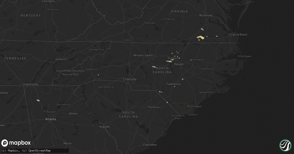
Hail Map in North Carolina on July 18, 2024
Get this storm
July 18 map
$229
one time, instant access
Download today. No call, no setup
Keep the $229
Bought the map and want the full workflow? Apply the entire $229 to a subscription within 7 days. None of it is wasted.
Every map, not just this one
This buys you this map. Subscription and you get every map we run, in the markets you choose from a few cities to whole states to nationwide. Plus real-time alerts the moment a storm fires.
Contact data
Name, contact info, occupancy, even credit band for addresses in the footprint. You go from where it hit to who to call.
Become the source they trust
Unlimited branding weather history reports on demand. You already have the documented answer ready for the property owner, and you are the one who showed up with it.
Property data and RoofTrace estimates
Pull up any address you have got, its value and the exact code rules for that jurisdiction, straight from One Click Code. Then RoofTrace estimates the squares, pitch, and roof value, priced the way you price.
Storm reports in North Carolina
North Carolina
| Date | Description |
|---|---|
| 07/18/20246:45 PM CDT | Trees down in tramway. |
| 07/18/20246:13 PM CDT | Several trees down reported in sanford. |
| 07/18/20245:54 PM CDT | Trees down on powerlines which caused power outages. |
| 07/18/20245:18 PM CDT | Trees down across southern camden county south of shiloh. |
| 07/18/20245:18 PM CDT | Tree down near iron mountain road. |
| 07/18/20245:17 PM CDT | Tree down near 3400 block of old nc hwy 13 in asheboro. |
| 07/18/20245:05 PM CDT | Powerlines down in yard. |
| 07/18/20244:55 PM CDT | Tree down on roadway. |
| 07/18/20244:50 PM CDT | Tree down in mar mac. |
| 07/18/20244:25 PM CDT | Tree down on powerline near route 13. |
| 07/18/20244:20 PM CDT | Tree down blocking roadway near bringle ferry rd and wyatts grove church rd. |
| 07/18/20244:15 PM CDT | Tree down on power line on morgan rd. |
| 07/18/20244:00 PM CDT | Tree split and fell into roadway near the intersection of n ellis st and w council st. |
| 07/18/20243:50 PM CDT | Tree down on powerlines near grovemont road. |
| 07/18/20243:50 PM CDT | Multiple trees down across the salisbury area. |
| 07/18/20243:45 PM CDT | Tree down in east garner. |
| 07/18/20243:45 PM CDT | Tree down near creedmoor road resulting in power outage. |
| 07/18/20243:30 PM CDT | Large tree fell into the roadway near highway 152 w and jackson rd. |
| 07/18/20243:30 PM CDT | Tree down on highway 152 w. |
| 07/18/20243:25 PM CDT | Power lines down near shearers rd and timber rd. |
| 07/18/20243:18 PM CDT | Trees and power lines down on overhead bridge rd. |
| 07/18/20243:18 PM CDT | Trees down on i-77 near mile marker 39. |
| 07/18/20243:15 PM CDT | Multiple trees down near farrington mill road... Barbee chapel road and governors drive. |
| 07/18/20243:08 PM CDT | Power lines down on fern hill rd. |
| 07/18/20243:05 PM CDT | Multiple trees down in southeastern durham county near bethesda. |
| 07/18/20242:51 PM CDT | A tree was reported down on an electrical box. This was near the intersection of bowden rd and quailview dr.... Southwest of carrboro. |
| 07/18/20242:50 PM CDT | Tree down on robertson road. |
| 07/18/20242:50 PM CDT | Tree down in red oak. |
| 07/18/20242:50 PM CDT | Tree down on powerlines. |
| 07/18/20242:00 PM CDT | Tree down on sugarloaf mountain rd. |
| 07/18/20241:50 PM CDT | Power line down near st pauls rd and old clear creek rd. |
| 07/18/20241:45 PM CDT | Tree down near may road and phellps road. |
| 07/18/20241:45 PM CDT | Tree down on powerlines near guess road. |
| 07/18/20241:40 PM CDT | Tree down on laurel crest road. |
| 07/18/20241:40 PM CDT | Tree down on the 500 block of hart road. |
| 07/18/20241:18 PM CDT | Tree down on hester road. |
| 07/18/20241:05 PM CDT | Tree and debris down on range road. |
| 07/18/20241:00 PM CDT | Tree down on old oxford road. |
| 07/18/202412:58 PM CDT | Tree down on ellis chapel road and pat tilly road. |
All States Impacted by Hail Map on July 18, 2024
Cities Impacted by Hail Map on July 18, 2024
- Manor, TX
- Coupland, TX
- Elgin, TX
- Union, MS
- De Kalb, MS
- Collinsville, MS
- Napoleonville, LA
- Belle Rose, LA
- Pierre Part, LA
- White Castle, LA
- Rougemont, NC
- Stem, NC
- Kennesaw, GA
- Donaldsonville, LA
- Baton Rouge, LA
- Bahama, NC
- Walker, LA
- Lauderdale, MS
- Porterville, MS
- Denham Springs, LA
- Freeman, VA
- Lawrenceville, VA
- Wake Forest, NC
- Durham, NC
- Hendersonville, NC
- Emporia, VA
- Raleigh, NC
- Madison, FL
- Mill Spring, NC
- York, AL
- Cuba, AL
- Valdosta, GA
- Fargo, GA
- Gainesville, AL
- Carthage, MS
- Spring Hope, NC
- Homerville, GA
- Jarratt, VA
- Calhoun, GA
- Epes, AL
- Madisonville, LA
- Ponchatoula, LA
- Covington, LA
- Folsom, LA
- Bush, LA
- Plainville, GA
- Sedley, VA
- Franklin, VA
- Nahunta, GA
- Folkston, GA
- Dinwiddie, VA
- Dewitt, VA
- Chapel Hill, NC
- Adairsville, GA
- Guadalupita, NM
- Eagle Nest, NM
- Walnut Grove, MS
- Perkinston, MS
- Zuni, VA
- Mora, NM
- Punta Gorda, FL
- Apex, NC
- Yulee, FL
- Muleshoe, TX
- Jacksonville, FL
- Henderson, NV
- Fernandina Beach, FL
- Rainsville, NM
- Columbia, MS
- Brunswick, GA
- Saint Marys, GA
- Anderson, SC
- Iva, SC
- Dunn, NC
- Buena Vista, NM
- Estes Park, CO
- Abbeville, SC
- Pachuta, MS
- Rose Hill, MS
- Buffalo, MT
- Tuscaloosa, AL
- Hobson, MT
- Tignall, GA
- McLain, MS
- Myakka City, FL
- Laurinburg, NC
- Laurel Hill, NC
- Gibson, NC
- Cottondale, AL
- Cheyenne, WY
- Elkton, FL
- Sapello, NM
- Rociada, NM
- Hastings, FL
- Quitman, MS
- Ramah, CO
- Calhan, CO
- Dubois, ID
- Clio, SC
- McColl, SC
- Bennettsville, SC
- Montezuma, NM
- Saint Augustine, FL
- Shubuta, MS
- Lithia, FL
- Asheboro, NC
- Portales, NM
- Las Vegas, NM
- Newton Grove, NC
- Brooksville, FL
- Whitlash, MT
- Beulah, ND
- Aguilar, CO
- Fayetteville, NC
- Hope Mills, NC
- Little Rock, SC
- Dover, FL
- Plant City, FL
- Valrico, FL
- San Jose, NM
- Dillon, SC
- Hamer, SC
- Sylacauga, AL
- Hazen, ND
- Farwell, TX
- Chugwater, WY
- Ribera, NM
- Colorado Springs, CO
- La Veta, CO
- Elida, NM
- Gilbertown, AL
- Lake View, SC
- Seffner, FL
- Glorieta, NM
- Nichols, SC
- Mullins, SC
- Walsenburg, CO
- Peyton, CO
- Zephyrhills, FL
- Weogufka, AL
- Lagrange, WY
- Moriarty, NM
- Wagarville, AL
- Agate, CO
- Kathleen, FL
- Dade City, FL
- Briggsdale, CO
- Meriden, WY
- Simla, CO
- Wallace, KS
- New Raymer, CO
- Byers, CO
- Deer Trail, CO
- Albin, WY
- Fort McCoy, FL
- Leesburg, FL
- Miami, AZ
- Globe, AZ
- Musselshell, MT
- Trinchera, CO
- Matheson, CO
- Vail, AZ
- Crescent City, FL
- Custer, MT
- Branson, CO
- Claypool, AZ
- Sharon Springs, KS
- Lady Lake, FL
- Pine Bluffs, WY
- Harrisburg, NE
- Georgetown, FL
- Hysham, MT
- Tucson, AZ
- Limon, CO
- Umatilla, FL
- Genoa, CO
- Woodrow, CO
- Avondale, CO
- Fairmont, NC
- Winkelman, AZ
- Weskan, KS
- Sahuarita, AZ
- Bushnell, NE
- Estancia, NM
- Folsom, NM
- Arriba, CO
- Grenville, NM
- Bighorn, MT
- Wilton, ND
- Pittsboro, NC
- Creedmoor, NC
- Baldwin, ND
- Batesland, SD
- Martin, SD
- Allen, SD
- Wishek, ND
- Lehr, ND
- Agar, SD
- Gettysburg, SD
- Wausa, NE
- Bloomfield, NE
- Onida, SD
- Randolph, NE
- Hartington, NE
- Holabird, SD
- Highmore, SD
- Coleridge, NE
- Wanblee, SD
- Merriman, NE
- Lebanon, SD


