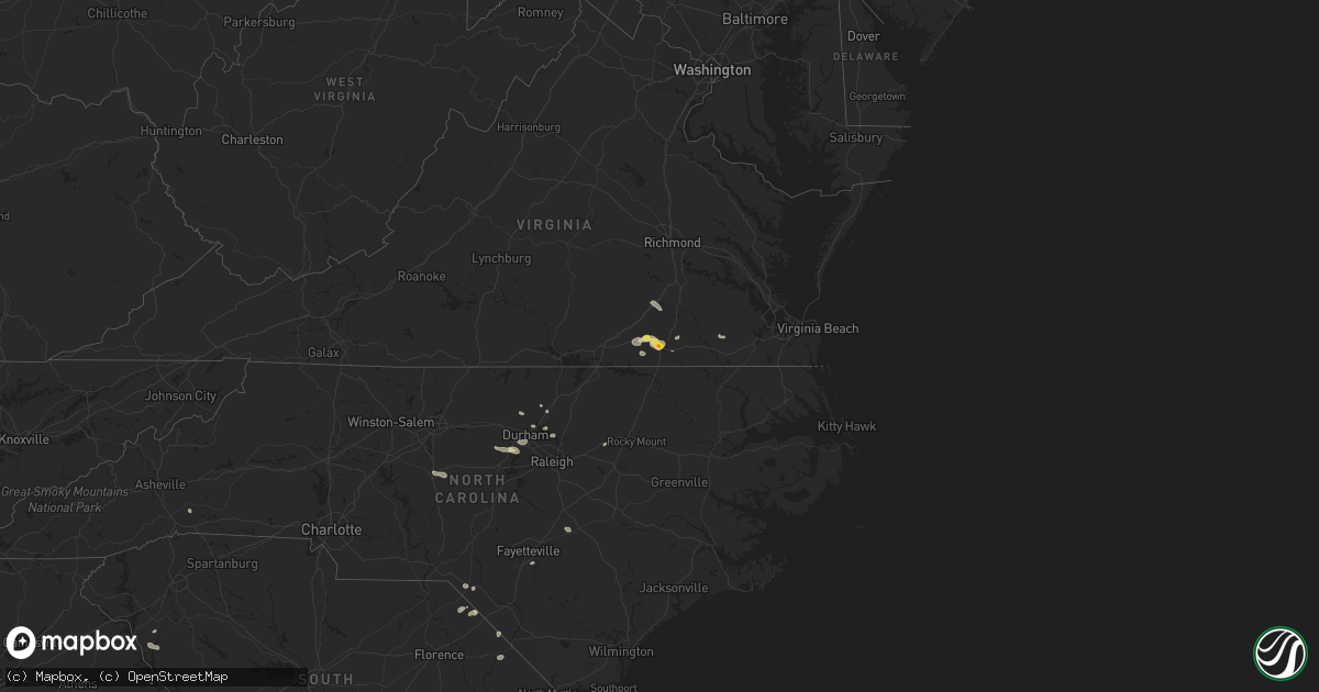
Hail Map on July 18, 2024
Get this storm
July 18 map
$229
one time, instant access
Download today. No call, no setup
Keep the $229
Bought the map and want the full workflow? Apply the entire $229 to a subscription within 7 days. None of it is wasted.
Every map, not just this one
This buys you this map. Subscription and you get every map we run, in the markets you choose from a few cities to whole states to nationwide. Plus real-time alerts the moment a storm fires.
Contact data
Name, contact info, occupancy, even credit band for addresses in the footprint. You go from where it hit to who to call.
Become the source they trust
Unlimited branding weather history reports on demand. You already have the documented answer ready for the property owner, and you are the one who showed up with it.
Property data and RoofTrace estimates
Pull up any address you have got, its value and the exact code rules for that jurisdiction, straight from One Click Code. Then RoofTrace estimates the squares, pitch, and roof value, priced the way you price.
States Impacted by Hail Map on July 18, 2024
Storm reports
North Carolina
| Date | Description |
|---|---|
| 07/18/20246:45 PM CDT | Trees down in tramway. |
| 07/18/20246:13 PM CDT | Several trees down reported in sanford. |
| 07/18/20245:54 PM CDT | Trees down on powerlines which caused power outages. |
| 07/18/20245:18 PM CDT | Tree down near iron mountain road. |
| 07/18/20245:18 PM CDT | Trees down across southern camden county south of shiloh. |
| 07/18/20245:17 PM CDT | Tree down near 3400 block of old nc hwy 13 in asheboro. |
| 07/18/20245:05 PM CDT | Powerlines down in yard. |
| 07/18/20244:55 PM CDT | Tree down on roadway. |
| 07/18/20244:50 PM CDT | Tree down in mar mac. |
| 07/18/20244:25 PM CDT | Tree down on powerline near route 13. |
| 07/18/20244:20 PM CDT | Tree down blocking roadway near bringle ferry rd and wyatts grove church rd. |
| 07/18/20244:15 PM CDT | Tree down on power line on morgan rd. |
| 07/18/20244:00 PM CDT | Tree split and fell into roadway near the intersection of n ellis st and w council st. |
| 07/18/20243:50 PM CDT | Tree down on powerlines near grovemont road. |
| 07/18/20243:50 PM CDT | Multiple trees down across the salisbury area. |
| 07/18/20243:45 PM CDT | Tree down in east garner. |
| 07/18/20243:45 PM CDT | Tree down near creedmoor road resulting in power outage. |
| 07/18/20243:30 PM CDT | Tree down on highway 152 w. |
| 07/18/20243:30 PM CDT | Large tree fell into the roadway near highway 152 w and jackson rd. |
| 07/18/20243:25 PM CDT | Power lines down near shearers rd and timber rd. |
| 07/18/20243:18 PM CDT | Trees and power lines down on overhead bridge rd. |
| 07/18/20243:18 PM CDT | Trees down on i-77 near mile marker 39. |
| 07/18/20243:15 PM CDT | Multiple trees down near farrington mill road... Barbee chapel road and governors drive. |
| 07/18/20243:08 PM CDT | Power lines down on fern hill rd. |
| 07/18/20243:05 PM CDT | Multiple trees down in southeastern durham county near bethesda. |
| 07/18/20242:51 PM CDT | A tree was reported down on an electrical box. This was near the intersection of bowden rd and quailview dr.... Southwest of carrboro. |
| 07/18/20242:50 PM CDT | Tree down on powerlines. |
| 07/18/20242:50 PM CDT | Tree down in red oak. |
| 07/18/20242:50 PM CDT | Tree down on robertson road. |
| 07/18/20242:00 PM CDT | Tree down on sugarloaf mountain rd. |
| 07/18/20241:50 PM CDT | Power line down near st pauls rd and old clear creek rd. |
| 07/18/20241:45 PM CDT | Tree down on powerlines near guess road. |
| 07/18/20241:45 PM CDT | Tree down near may road and phellps road. |
| 07/18/20241:40 PM CDT | Tree down on the 500 block of hart road. |
| 07/18/20241:40 PM CDT | Tree down on laurel crest road. |
| 07/18/20241:18 PM CDT | Tree down on hester road. |
| 07/18/20241:05 PM CDT | Tree and debris down on range road. |
| 07/18/20241:00 PM CDT | Tree down on old oxford road. |
| 07/18/202412:58 PM CDT | Tree down on ellis chapel road and pat tilly road. |
Idaho
| Date | Description |
|---|---|
| 07/17/20248:15 PM CDT | Itd95 rwis inl puzzle at the junction of us 20 and us 26. |
Nevada
| Date | Description |
|---|---|
| 07/18/20243:10 PM CDT | North henderson sensor gusted to 60 mph due to a nearby thunderstorm at 1310. |
Mississippi
| Date | Description |
|---|---|
| 07/18/20244:45 PM CDT | Several small tree branches in road. |
| 07/18/20244:25 PM CDT | Strong outflow winds from nearby thunderstorms blew down a few trees in hattiesburg and petal. A tree fell onto a house and car on montague street in hattiesburg and tr |
| 07/18/20244:18 PM CDT | Several trees down. |
| 07/18/20244:10 PM CDT | A tree blew down in brooklyn. |
| 07/18/20243:44 PM CDT | Pearl river county sheriffs office received a report of a tree down. |
| 07/18/20243:17 PM CDT | Pearl river county sheriffs office received a report of a powerline down. |
Florida
| Date | Description |
|---|---|
| 07/18/20241:14 PM CDT | Tree down at the intersection of south quitman highway and bright proctor road. |
South Carolina
| Date | Description |
|---|---|
| 07/18/20246:45 PM CDT | Sumter fire dept responding to a tree that fell on a vehicle on azalea ct. Time estimated from radar. |
| 07/18/20245:58 PM CDT | Sc dept of public safety reports trees down on emanuel church rd near the intersection of two notch rd. Time estimated from radar. |
| 07/18/20245:55 PM CDT | Richland county dispatch reports powerlines down on torwood dr. Scdps also reported a tree down in ne columbia on trenholm rd. |
| 07/18/20245:55 PM CDT | Corrects previous tstm wnd dmg report from 1 ene lexington. Adds additional damage in the same area. Retired nws employee reports a tree down near coventry lake dr and |
| 07/18/20244:39 PM CDT | Sc dept of public safety reports trees down on highway 34 near the intersection of broad river rd. |
| 07/18/20244:16 PM CDT | Tree down on roadway. |
| 07/18/20244:15 PM CDT | Multiple trees down on roadway. |
| 07/18/20244:00 PM CDT | Several trees and power lines down along highway 284. |
| 07/18/20243:55 PM CDT | Several trees and power lines down along lakeside drive. |
| 07/18/20243:23 PM CDT | Tree down in the clinton area. |
| 07/18/20243:03 PM CDT | Two large trees down along georgia rd. |
| 07/18/20243:03 PM CDT | 9 trees down and several power lines down across the gray court area. |
| 07/18/20242:30 PM CDT | Tree down on holiday dam rd. |
| 07/18/20242:20 PM CDT | Several trees and power lines down across the city of belton. |
South Dakota
| Date | Description |
|---|---|
| 07/17/20247:16 PM CDT | A local report indicates 84 MPH wind near 12 E Oelrichs |
Virginia
| Date | Description |
|---|---|
| 07/18/20244:18 PM CDT | Corrects previous tstm wnd dmg report from 2 sse hickory. Trees down at south battlefield blvd power poles down. Battlefield blvd was closed from hickory rd to centervi |
| 07/18/20244:15 PM CDT | Trees down along hallmark way. |
| 07/18/20244:10 PM CDT | Planes shifted westward due to wind at the chesapeake regional airport. |
| 07/18/20244:02 PM CDT | A sizable broken tree branch that has fallen onto the road. |
| 07/18/20243:24 PM CDT | Corrects previous tstm wnd dmg report from 4 nnw booker. A sizable broken tree branch that has fallen onto the road. Tree down. |
| 07/18/20243:11 PM CDT | Report from mping: 1-inch tree limbs broken; shingles blown off. |
| 07/18/20242:52 PM CDT | Tree down on highway on i-85 at mile marker 49. |
| 07/18/20242:35 PM CDT | Trees down. |
| 07/18/20242:31 PM CDT | Downed tree blocking the south right lane on i-95. |
| 07/18/20242:23 PM CDT | Tree down. |
| 07/18/20242:21 PM CDT | Tree down blocking one lane of us-58 westbound. |
| 07/18/20242:19 PM CDT | Numerous trees down across the city of emporia. Several roads blocked and power lines down. |
| 07/18/20242:16 PM CDT | Vehicles damaged. |
| 07/18/20242:06 PM CDT | Trees down on highway 58 blocking east bound lanes. |
| 07/18/20241:52 PM CDT | A local report indicates 1.00 inch wind near 3 WNW Pleasant Shade |
| 07/18/202411:08 AM CDT | Tree down along double bridges road near salem road. Time estimated from radar. |
| 07/18/202410:36 AM CDT | Tree downed by thunderstorm winds near the intersection of wards road and dearing for road... Blocking the right lane. |
Louisiana
| Date | Description |
|---|---|
| 07/18/20242:32 PM CDT | St. Tammany parish sheriffs office received a report of a tree down along highway 1077 near highway 21. |
| 07/18/20242:30 PM CDT | St. Tammany parish sheriffs office received a report of a tree down along highway 437 near river road. |
| 07/18/20242:29 PM CDT | A trained spotter reported a wind gust of 65mph recorded in goodbee... Louisiana. |
| 07/18/20242:06 PM CDT | Tangipahoa parish sheriffs office received a report of a tree down along traino landing road. |
| 07/18/20242:04 PM CDT | Tangipahoa parish sheriffs office received a report of a tree down on durbin road near old hwy 51. |
| 07/18/20242:00 PM CDT | Tangipahoa parish sheriffs office received a report of a tree down along stafford road near old genessee road. |
| 07/18/20241:40 PM CDT | Livingston parish sheriffs office received a report of a power line down along good road. |
| 07/18/20241:32 PM CDT | The public reported a power line down. |
| 07/18/20241:30 PM CDT | Livingston parish sheriffs office received a report of 3 trees down along frost road. |
| 07/18/20241:11 PM CDT | Corrects previous tstm wnd dmg report from 5 s walker. Large tree limb down onto a home at the intersection of joe may road and brown road near denham springs. Time est |
| 07/18/20248:44 AM CDT | Trees blown down on hwy 27. |
Wyoming
| Date | Description |
|---|---|
| 07/17/20247:37 PM CDT | Asos station kwrl worland airport. |
Georgia
| Date | Description |
|---|---|
| 07/18/20244:33 PM CDT | Powerlines down at intersection of dallas acworth hwy and hiram acworth hwy. |
| 07/18/20244:28 PM CDT | Powerlines down along graham rd near colton creek rd. |
| 07/18/20244:10 PM CDT | Tree down near intersection of crossroads church rd and winterville dr. |
| 07/18/20244:00 PM CDT | Tree fell through home along riverwood pass near e paulding dr. |
| 07/18/20243:56 PM CDT | 2 trees down along dallas acworth hwy north of dallas - one at oak leaf rd and one at bone circle. |
| 07/18/20243:36 PM CDT | Report from mping: 1-inch tree limbs broken; shingles blown off. Portion of metal roof blown off just west of hwy 17... Hwy 82... Hwy 303 intersection. |
| 07/17/20247:31 PM CDT | Tree down near the intersection of ga 54 and melson rd per em. |
| 07/17/20247:31 PM CDT | Tree down near intersection of mobley bridge rd and hightower rd per em. |
Alabama
| Date | Description |
|---|---|
| 07/18/20245:42 PM CDT | A tree was blown down near cr 47 and cr 99 near shelby. |
| 07/18/20245:36 PM CDT | A tree was blown down and blocking the road at hix road and pearson chapel road. |
| 07/18/20245:06 PM CDT | A tree was blown down on sr 22 just east of daviston. |
| 07/18/20244:37 PM CDT | A few trees were blown down and there was damage to some billboards along i-20/59 near buttermilk road. |
| 07/18/20244:35 PM CDT | Numerous trees were blown down in what appeared to be a microburst. This occurred in fort toulouse state historical park. |
Arizona
| Date | Description |
|---|---|
| 07/17/20248:33 PM CDT | Poles/ wire down. |
| 07/17/20248:15 PM CDT | Personal weather station reported wind gust of 62 mph. |
| 07/17/20248:14 PM CDT | Personal weather station reported gust to 66. |
Utah
| Date | Description |
|---|---|
| 07/18/20245:11 PM CDT | Outflow wind gust from nearby cluster of thunderstorms. Mesonet station ur298 15.9 w knolls - arnosa. |
| 07/17/20248:40 PM CDT | Mesonet station utdcd us-189 at deer creek dam. |
New Mexico
| Date | Description |
|---|---|
| 07/17/202410:55 PM CDT | Mesonet station wsm40 mine |
Cities Impacted by Hail Map on July 18, 2024
- Manor, TX
- Coupland, TX
- Elgin, TX
- Union, MS
- De Kalb, MS
- Collinsville, MS
- Napoleonville, LA
- Belle Rose, LA
- Pierre Part, LA
- White Castle, LA
- Rougemont, NC
- Stem, NC
- Kennesaw, GA
- Donaldsonville, LA
- Baton Rouge, LA
- Bahama, NC
- Walker, LA
- Lauderdale, MS
- Porterville, MS
- Denham Springs, LA
- Freeman, VA
- Lawrenceville, VA
- Wake Forest, NC
- Durham, NC
- Hendersonville, NC
- Emporia, VA
- Raleigh, NC
- Madison, FL
- Mill Spring, NC
- York, AL
- Cuba, AL
- Valdosta, GA
- Fargo, GA
- Gainesville, AL
- Carthage, MS
- Spring Hope, NC
- Homerville, GA
- Jarratt, VA
- Calhoun, GA
- Epes, AL
- Madisonville, LA
- Ponchatoula, LA
- Covington, LA
- Folsom, LA
- Bush, LA
- Plainville, GA
- Sedley, VA
- Franklin, VA
- Nahunta, GA
- Folkston, GA
- Dinwiddie, VA
- Dewitt, VA
- Chapel Hill, NC
- Adairsville, GA
- Guadalupita, NM
- Eagle Nest, NM
- Walnut Grove, MS
- Perkinston, MS
- Zuni, VA
- Mora, NM
- Punta Gorda, FL
- Apex, NC
- Yulee, FL
- Muleshoe, TX
- Jacksonville, FL
- Henderson, NV
- Fernandina Beach, FL
- Rainsville, NM
- Columbia, MS
- Brunswick, GA
- Saint Marys, GA
- Anderson, SC
- Iva, SC
- Dunn, NC
- Buena Vista, NM
- Estes Park, CO
- Abbeville, SC
- Pachuta, MS
- Rose Hill, MS
- Buffalo, MT
- Tuscaloosa, AL
- Hobson, MT
- Tignall, GA
- McLain, MS
- Myakka City, FL
- Laurinburg, NC
- Laurel Hill, NC
- Gibson, NC
- Cottondale, AL
- Cheyenne, WY
- Elkton, FL
- Sapello, NM
- Rociada, NM
- Hastings, FL
- Quitman, MS
- Ramah, CO
- Calhan, CO
- Dubois, ID
- Clio, SC
- McColl, SC
- Bennettsville, SC
- Montezuma, NM
- Saint Augustine, FL
- Shubuta, MS
- Lithia, FL
- Asheboro, NC
- Portales, NM
- Las Vegas, NM
- Newton Grove, NC
- Brooksville, FL
- Whitlash, MT
- Beulah, ND
- Aguilar, CO
- Fayetteville, NC
- Hope Mills, NC
- Little Rock, SC
- Dover, FL
- Plant City, FL
- Valrico, FL
- San Jose, NM
- Dillon, SC
- Hamer, SC
- Sylacauga, AL
- Hazen, ND
- Farwell, TX
- Chugwater, WY
- Ribera, NM
- Colorado Springs, CO
- La Veta, CO
- Elida, NM
- Gilbertown, AL
- Lake View, SC
- Seffner, FL
- Glorieta, NM
- Nichols, SC
- Mullins, SC
- Walsenburg, CO
- Peyton, CO
- Zephyrhills, FL
- Weogufka, AL
- Lagrange, WY
- Moriarty, NM
- Wagarville, AL
- Agate, CO
- Kathleen, FL
- Dade City, FL
- Briggsdale, CO
- Meriden, WY
- Simla, CO
- Wallace, KS
- New Raymer, CO
- Byers, CO
- Deer Trail, CO
- Albin, WY
- Fort McCoy, FL
- Leesburg, FL
- Miami, AZ
- Globe, AZ
- Musselshell, MT
- Trinchera, CO
- Matheson, CO
- Vail, AZ
- Crescent City, FL
- Custer, MT
- Branson, CO
- Claypool, AZ
- Sharon Springs, KS
- Lady Lake, FL
- Pine Bluffs, WY
- Harrisburg, NE
- Georgetown, FL
- Hysham, MT
- Tucson, AZ
- Limon, CO
- Umatilla, FL
- Genoa, CO
- Woodrow, CO
- Avondale, CO
- Fairmont, NC
- Winkelman, AZ
- Weskan, KS
- Sahuarita, AZ
- Bushnell, NE
- Estancia, NM
- Folsom, NM
- Arriba, CO
- Grenville, NM
- Bighorn, MT
- Wilton, ND
- Pittsboro, NC
- Creedmoor, NC
- Baldwin, ND
- Batesland, SD
- Martin, SD
- Allen, SD
- Wishek, ND
- Lehr, ND
- Agar, SD
- Gettysburg, SD
- Wausa, NE
- Bloomfield, NE
- Onida, SD
- Randolph, NE
- Hartington, NE
- Holabird, SD
- Highmore, SD
- Coleridge, NE
- Wanblee, SD
- Merriman, NE
- Lebanon, SD