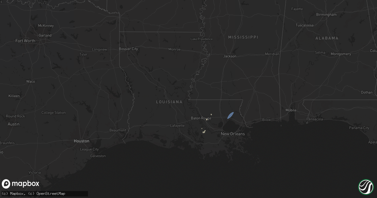
Hail Map in Louisiana on July 18, 2024
Get this storm
July 18 map
$229
one time, instant access
Download today. No call, no setup
Keep the $229
Bought the map and want the full workflow? Apply the entire $229 to a subscription within 7 days. None of it is wasted.
Every map, not just this one
This buys you this map. Subscription and you get every map we run, in the markets you choose from a few cities to whole states to nationwide. Plus real-time alerts the moment a storm fires.
Contact data
Name, contact info, occupancy, even credit band for addresses in the footprint. You go from where it hit to who to call.
Become the source they trust
Unlimited branding weather history reports on demand. You already have the documented answer ready for the property owner, and you are the one who showed up with it.
Property data and RoofTrace estimates
Pull up any address you have got, its value and the exact code rules for that jurisdiction, straight from One Click Code. Then RoofTrace estimates the squares, pitch, and roof value, priced the way you price.
Storm reports in Louisiana
Louisiana
| Date | Description |
|---|---|
| 07/18/20242:32 PM CDT | St. Tammany parish sheriffs office received a report of a tree down along highway 1077 near highway 21. |
| 07/18/20242:30 PM CDT | St. Tammany parish sheriffs office received a report of a tree down along highway 437 near river road. |
| 07/18/20242:29 PM CDT | A trained spotter reported a wind gust of 65mph recorded in goodbee... Louisiana. |
| 07/18/20242:06 PM CDT | Tangipahoa parish sheriffs office received a report of a tree down along traino landing road. |
| 07/18/20242:04 PM CDT | Tangipahoa parish sheriffs office received a report of a tree down on durbin road near old hwy 51. |
| 07/18/20242:00 PM CDT | Tangipahoa parish sheriffs office received a report of a tree down along stafford road near old genessee road. |
| 07/18/20241:40 PM CDT | Livingston parish sheriffs office received a report of a power line down along good road. |
| 07/18/20241:32 PM CDT | The public reported a power line down. |
| 07/18/20241:30 PM CDT | Livingston parish sheriffs office received a report of 3 trees down along frost road. |
| 07/18/20241:11 PM CDT | Corrects previous tstm wnd dmg report from 5 s walker. Large tree limb down onto a home at the intersection of joe may road and brown road near denham springs. Time est |
| 07/18/20248:44 AM CDT | Trees blown down on hwy 27. |
All States Impacted by Hail Map on July 18, 2024
Cities Impacted by Hail Map on July 18, 2024
- Manor, TX
- Coupland, TX
- Elgin, TX
- Union, MS
- De Kalb, MS
- Collinsville, MS
- Napoleonville, LA
- Belle Rose, LA
- Pierre Part, LA
- White Castle, LA
- Rougemont, NC
- Stem, NC
- Kennesaw, GA
- Donaldsonville, LA
- Baton Rouge, LA
- Bahama, NC
- Walker, LA
- Lauderdale, MS
- Porterville, MS
- Denham Springs, LA
- Freeman, VA
- Lawrenceville, VA
- Wake Forest, NC
- Durham, NC
- Hendersonville, NC
- Emporia, VA
- Raleigh, NC
- Madison, FL
- Mill Spring, NC
- York, AL
- Cuba, AL
- Valdosta, GA
- Fargo, GA
- Gainesville, AL
- Carthage, MS
- Spring Hope, NC
- Homerville, GA
- Jarratt, VA
- Calhoun, GA
- Epes, AL
- Madisonville, LA
- Ponchatoula, LA
- Covington, LA
- Folsom, LA
- Bush, LA
- Plainville, GA
- Sedley, VA
- Franklin, VA
- Nahunta, GA
- Folkston, GA
- Dinwiddie, VA
- Dewitt, VA
- Chapel Hill, NC
- Adairsville, GA
- Guadalupita, NM
- Eagle Nest, NM
- Walnut Grove, MS
- Perkinston, MS
- Zuni, VA
- Mora, NM
- Punta Gorda, FL
- Apex, NC
- Yulee, FL
- Muleshoe, TX
- Jacksonville, FL
- Henderson, NV
- Fernandina Beach, FL
- Rainsville, NM
- Columbia, MS
- Brunswick, GA
- Saint Marys, GA
- Anderson, SC
- Iva, SC
- Dunn, NC
- Buena Vista, NM
- Estes Park, CO
- Abbeville, SC
- Pachuta, MS
- Rose Hill, MS
- Buffalo, MT
- Tuscaloosa, AL
- Hobson, MT
- Tignall, GA
- McLain, MS
- Myakka City, FL
- Laurinburg, NC
- Laurel Hill, NC
- Gibson, NC
- Cottondale, AL
- Cheyenne, WY
- Elkton, FL
- Sapello, NM
- Rociada, NM
- Hastings, FL
- Quitman, MS
- Ramah, CO
- Calhan, CO
- Dubois, ID
- Clio, SC
- McColl, SC
- Bennettsville, SC
- Montezuma, NM
- Saint Augustine, FL
- Shubuta, MS
- Lithia, FL
- Asheboro, NC
- Portales, NM
- Las Vegas, NM
- Newton Grove, NC
- Brooksville, FL
- Whitlash, MT
- Beulah, ND
- Aguilar, CO
- Fayetteville, NC
- Hope Mills, NC
- Little Rock, SC
- Dover, FL
- Plant City, FL
- Valrico, FL
- San Jose, NM
- Dillon, SC
- Hamer, SC
- Sylacauga, AL
- Hazen, ND
- Farwell, TX
- Chugwater, WY
- Ribera, NM
- Colorado Springs, CO
- La Veta, CO
- Elida, NM
- Gilbertown, AL
- Lake View, SC
- Seffner, FL
- Glorieta, NM
- Nichols, SC
- Mullins, SC
- Walsenburg, CO
- Peyton, CO
- Zephyrhills, FL
- Weogufka, AL
- Lagrange, WY
- Moriarty, NM
- Wagarville, AL
- Agate, CO
- Kathleen, FL
- Dade City, FL
- Briggsdale, CO
- Meriden, WY
- Simla, CO
- Wallace, KS
- New Raymer, CO
- Byers, CO
- Deer Trail, CO
- Albin, WY
- Fort McCoy, FL
- Leesburg, FL
- Miami, AZ
- Globe, AZ
- Musselshell, MT
- Trinchera, CO
- Matheson, CO
- Vail, AZ
- Crescent City, FL
- Custer, MT
- Branson, CO
- Claypool, AZ
- Sharon Springs, KS
- Lady Lake, FL
- Pine Bluffs, WY
- Harrisburg, NE
- Georgetown, FL
- Hysham, MT
- Tucson, AZ
- Limon, CO
- Umatilla, FL
- Genoa, CO
- Woodrow, CO
- Avondale, CO
- Fairmont, NC
- Winkelman, AZ
- Weskan, KS
- Sahuarita, AZ
- Bushnell, NE
- Estancia, NM
- Folsom, NM
- Arriba, CO
- Grenville, NM
- Bighorn, MT
- Wilton, ND
- Pittsboro, NC
- Creedmoor, NC
- Baldwin, ND
- Batesland, SD
- Martin, SD
- Allen, SD
- Wishek, ND
- Lehr, ND
- Agar, SD
- Gettysburg, SD
- Wausa, NE
- Bloomfield, NE
- Onida, SD
- Randolph, NE
- Hartington, NE
- Holabird, SD
- Highmore, SD
- Coleridge, NE
- Wanblee, SD
- Merriman, NE
- Lebanon, SD


