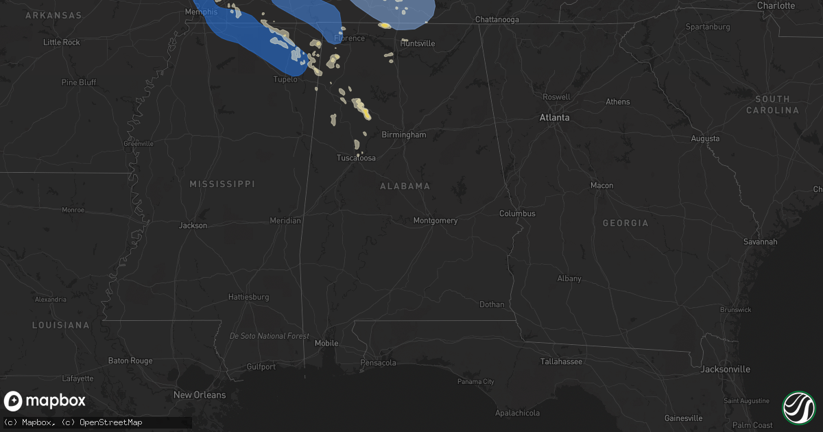
Hail Map in Alabama on July 18, 2023
Get this storm
July 18 map
$229
one time, instant access
Download today. No call, no setup
Keep the $229
Bought the map and want the full workflow? Apply the entire $229 to a subscription within 7 days. None of it is wasted.
Every map, not just this one
This buys you this map. Subscription and you get every map we run, in the markets you choose from a few cities to whole states to nationwide. Plus real-time alerts the moment a storm fires.
Contact data
Name, contact info, occupancy, even credit band for addresses in the footprint. You go from where it hit to who to call.
Become the source they trust
Unlimited branding weather history reports on demand. You already have the documented answer ready for the property owner, and you are the one who showed up with it.
Property data and RoofTrace estimates
Pull up any address you have got, its value and the exact code rules for that jurisdiction, straight from One Click Code. Then RoofTrace estimates the squares, pitch, and roof value, priced the way you price.
Storm reports in Alabama
Alabama
| Date | Description |
|---|---|
| 07/18/20236:52 PM CDT | A power line was reported down at this location. |
| 07/18/20236:49 PM CDT | A tree was reported dowm om cr 494. |
| 07/18/20236:45 PM CDT | Tree fallen on county road 82 north of weiss lake. Winds estimated between 40-50 mph. |
| 07/18/20236:45 PM CDT | Several reports of trees down. One over a power line and several over roads in steele... Al. A person also hit a tree... No injuries. Winds estimated between 40-50 mph. |
| 07/18/20236:35 PM CDT | Report from mping: trees uprooted or snapped; roof blown off. |
| 07/18/20236:30 PM CDT | Large tree blocking roadway in oneonta. Winds around 40-50 mph. |
| 07/18/20236:30 PM CDT | Large tree blocking roadway on 5th st. Another large tree down near/on a residence near adams ave. Estimated winds around 40-50 mph in oneonta. |
| 07/18/20236:30 PM CDT | Trees and power lines down on lehigh rd.... Trafford... And timmerman circle in blountsville. Winds estimated between 40-50 mph. |
| 07/18/20236:26 PM CDT | Report from mping: trees uprooted or snapped; roof blown off. |
| 07/18/20236:23 PM CDT | Tree reported down on cr 122 off of highway 75. |
| 07/18/20236:21 PM CDT | Numerous trees were blown down in the boaz area. One tree fell on a house. |
| 07/18/20236:20 PM CDT | A large tree was blown down the intersection of cr 52 and highway 227. |
| 07/18/20236:16 PM CDT | A tree was reported on mockingbird lane. |
| 07/18/20236:00 PM CDT | Trees and power lines down in the walter area. |
| 07/18/20236:00 PM CDT | Corrects previous tstm wnd dmg report from 1 wnw guntersville. Roof peeled on city harbor suites in guntersville. |
| 07/18/20235:55 PM CDT | Trees downed around arab. |
| 07/18/20235:55 PM CDT | Trees reported down in the arab area. |
| 07/18/20235:55 PM CDT | Trees downed around union grove. |
| 07/18/20235:54 PM CDT | Several trees down in the baileyton area. |
| 07/18/20235:53 PM CDT | Trees were reported down in the union grove area. |
| 07/18/20235:52 PM CDT | Report from mping: 1-inch tree limbs broken; shingles blown off. |
| 07/18/20235:51 PM CDT | Trees downed in ruth. |
| 07/18/20235:49 PM CDT | Trees down in the ruth area. |
| 07/18/20235:42 PM CDT | Estimated wind gusts of 60-70 mph. |
| 07/18/20235:42 PM CDT | Report from mping: 1-inch tree limbs broken; shingles blown off. |
| 07/18/20235:37 PM CDT | Report from mping: 3-inch tree limbs broken; power poles broken. |
| 07/18/20235:34 PM CDT | Tree downed near intersection of patton rd sw and drake ave sw - reported by off duty nws meteorologist. |
| 07/18/20235:34 PM CDT | Wind gusts of 60-70 mph near interchange of i-565 and mooresville rd. |
| 07/18/20235:25 PM CDT | Report from mping: 1-inch tree limbs broken; shingles blown off. |
| 07/18/20235:25 PM CDT | Tree downed near intersection of sheldon and malor cir |
| 07/18/20235:24 PM CDT | Report from mping: 1-inch tree limbs broken; shingles blown off. |
| 07/18/20235:24 PM CDT | Report from mping: 1-inch tree limbs broken; shingles blown off. |
| 07/18/20235:22 PM CDT | Tree downed near hwys 101 and 194 north of town creek. |
| 07/18/20235:20 PM CDT | Report from mping: homes/buildings completely destroyed. |
| 07/18/20235:20 PM CDT | Report from mping: 3-inch tree limbs broken; power poles broken. |
| 07/18/20235:18 PM CDT | Power lines down blocking wall triana between hwy 72 and capshaw rd. |
| 07/18/20235:17 PM CDT | Trees and large branches were knocked down and some minor gutter roof damage report near the intersection of kelly springs road and jeff road. |
| 07/18/20235:16 PM CDT | Report from mping: 1-inch tree limbs broken; shingles blown off. |
| 07/18/20235:16 PM CDT | Nw of nick davis and jeff rd intersection. |
| 07/18/20235:16 PM CDT | Corrects previous tstm wnd dmg report from 4 sse harvest. Four to five trees were snapped near this location. Two of them large hardwood trees. |
| 07/18/20235:11 PM CDT | A tree was reported down at this location. |
| 07/18/20235:10 PM CDT | Large trees down in the cranebrake area near lindsey lane near the golf course. |
| 07/18/20235:05 PM CDT | A local report indicates 70 MPH wind near 2 ESE Athens |
| 07/18/20235:05 PM CDT | Trees reported downed along cannon rd by ema. |
| 07/18/20235:02 PM CDT | Tree was uprooted and loose construction equipment blown around at this location. |
| 07/18/20235:02 PM CDT | Trees were reported down at this location. |
| 07/18/20235:01 PM CDT | Numerous large trees down or snapped. 1/4 of damage to one barn and side blown out near roof damage. |
| 07/18/20234:58 PM CDT | Trees were reported down at this location. |
| 07/18/20234:57 PM CDT | Corrects previous tstm wnd dmg report from 9 wnw underwood-petersville. Trees were reported down at this location. |
| 07/18/20234:48 PM CDT | A tree was blown down at this location. |
| 07/18/20234:48 PM CDT | Tree report down at this location. |
| 07/17/202310:17 PM CDT | Trees down near centreville. |
| 07/17/20239:52 PM CDT | A few trees down... Some on power lines... In the tuscaloosa area. |
| 07/17/20239:46 PM CDT | Tree reported down on power line on highway 216 in the lake view area. |
| 07/17/20239:32 PM CDT | Trees down in several locations across pickens county including near gordo. |
| 07/17/20238:57 PM CDT | Trees and power lines were blown down near carbon hill. |
| 07/17/20238:55 PM CDT | Tree on home on 3rd ave nw in fayette. Trees and power lines reported down across fayette county. |
| 07/17/20238:48 PM CDT | Trees were blown down in vernon. |
| 07/17/20238:42 PM CDT | Trees were blown down in and around guin. Winds were estimated at 50-55 mph. |
| 07/17/20238:40 PM CDT | Trees were blown down in sulligent. |
| 07/17/20238:25 PM CDT | Tree down along osborn rd and colburn mountain rd. |
| 07/17/20238:25 PM CDT | Trees were blown down in and around hamilton. Winds were estimated at 50-55 mph. |
| 07/17/20237:48 PM CDT | Tree down along osborn hill rd and colburn mountain rd. |
| 07/17/20237:10 PM CDT | Tree down near the intersection of morgan bridge rd. And al hwy 144. Winds estimated between 40-50 mph. |
| 07/17/20237:04 PM CDT | Report from mping: 3-inch tree limbs broken; power poles broken. |
| 07/17/20237:00 PM CDT | A snapped tree was reported at the intersection of slaughter road and farrow road. |
All States Impacted by Hail Map on July 18, 2023
Cities Impacted by Hail Map on July 18, 2023
- Sulphur, IN
- Battletown, KY
- English, IN
- Leavenworth, IN
- Cape Girardeau, MO
- Jackson, MO
- Scott City, MO
- McClure, IL
- Chaffee, MO
- Thebes, IL
- Olive Branch, IL
- Ullin, IL
- Miller City, IL
- Tamms, IL
- Pulaski, IL
- Villa Ridge, IL
- Olmsted, IL
- Grand Chain, IL
- Mound City, IL
- Cairo, IL
- Mounds, IL
- Karnak, IL
- Kevil, KY
- La Center, KY
- Barlow, KY
- Metropolis, IL
- Paducah, KY
- West Paducah, KY
- Wickliffe, KY
- Cunningham, KY
- Bardwell, KY
- Jonesboro, IL
- Cypress, IL
- Dongola, IL
- Golconda, IL
- Belknap, IL
- Vienna, IL
- Melber, KY
- Grantsburg, IL
- Brookport, IL
- Salem, KY
- Smithland, KY
- Hampton, KY
- Burna, KY
- Symsonia, KY
- Tiline, KY
- Hickory, KY
- Boaz, KY
- Benton, KY
- Grand Rivers, KY
- Calvert City, KY
- Ledbetter, KY
- Marion, KY
- Princeton, KY
- Gilbertsville, KY
- Fredonia, KY
- Eddyville, KY
- Kuttawa, KY
- Cadiz, KY
- Ord, NE
- North Loup, NE
- Sweet Springs, MO
- Iberia, MO
- Sevierville, TN
- Odessa, MO
- Holden, MO
- Hilton, NY
- Tuscumbia, MO
- Eldon, MO
- Kaiser, MO
- Vienna, MO
- Warsaw, MO
- Waverly, MO
- Elyria, NE
- Burwell, NE
- Rapid City, SD
- Box Elder, SD
- Horse Cave, KY
- Cave City, KY
- Salem, MO
- Lenox, MO
- Hardyville, KY
- Centertown, MO
- Clinton, MO
- Calhoun, MO
- Onaga, KS
- Scotia, NE
- Elba, NE
- Saint Paul, NE
- Wolbach, NE
- Center, KY
- Versailles, MO
- Belle, MO
- Bland, MO
- Blairstown, MO
- Urich, MO
- Creighton, MO
- Dannebrog, NE
- Saint Libory, NE
- Excelsior Springs, MO
- Otterville, MO
- Bunceton, MO
- Leopold, IN
- Saint Croix, IN
- Vichy, MO
- Dixon, MO
- Rolla, MO
- Saint Elizabeth, MO
- Eugene, MO
- Cosby, TN
- Lincoln, MO
- Stover, MO
- Ionia, MO
- Sedalia, MO
- Mora, MO
- Green Ridge, MO
- Cole Camp, MO
- Spearfish, SD
- Belle Fourche, SD
- Archer, NE
- Palmer, NE
- Crocker, MO
- Richland, MO
- Brumley, MO
- Clarksburg, MO
- Tipton, MO
- Pilot Grove, MO
- Brinktown, MO
- Meta, MO
- Garden City, MO
- Archie, MO
- Hamlin, NY
- Waterport, NY
- Albion, NY
- Kendall, NY
- Kent, NY
- Edmonton, KY
- Knob Lick, KY
- Newburg, MO
- Ulman, MO
- Richmond, MO
- Warrensburg, MO
- Smithton, MO
- Gravois Mills, MO
- Windsor, MO
- Knob Noster, MO
- Saint Onge, SD
- Whitewood, SD
- Saint Robert, MO
- Centerview, MO
- Norborne, MO
- Edgar Springs, MO
- Charleston, MO
- Fancy Farm, KY
- Arlington, KY
- Mayfield, KY
- Murray, KY
- Farmington, KY
- Kirksey, KY
- Dexter, KY
- Almo, KY
- Hardin, KY
- New Concord, KY
- Hazel, KY
- Fort Campbell, KY
- Dover, TN
- Herndon, KY
- Woodlawn, TN
- Indian Mound, TN
- Big Rock, TN
- La Fayette, KY
- Bumpus Mills, TN
- Cumberland City, TN
- Clinton, KY
- Sedalia, KY
- Wingo, KY
- Buchanan, TN
- Puryear, TN
- Springville, TN
- Paris, TN
- Stewart, TN
- Tennessee Ridge, TN
- Big Sandy, TN
- Erin, TN
- Hopkinsville, KY
- Crofton, KY
- White Plains, KY
- Oak Grove, KY
- Cerulean, KY
- Dawson Springs, KY
- Gracey, KY
- Nortonville, KY
- Saint Charles, KY
- Cumberland Furnace, TN
- Cunningham, TN
- Pembroke, KY
- Palmyra, TN
- Vanleer, TN
- Clarksville, TN
- Ridgely, TN
- Lenox, TN
- Obion, TN
- Dyersburg, TN
- Finley, TN
- Halls, TN
- Newbern, TN
- Trenton, TN
- Dyer, TN
- Atwood, TN
- Bradford, TN
- Greenfield, TN
- Buena Vista, TN
- Bruceton, TN
- Huntingdon, TN
- Friendship, TN
- McKenzie, TN
- Trezevant, TN
- Milan, TN
- Trimble, TN
- Kenton, TN
- Rutherford, TN
- Rives, TN
- Sharon, TN
- Martin, TN
- Gleason, TN
- Hollow Rock, TN
- Mansfield, TN
- Hornbeak, TN
- Henry, TN
- Dresden, TN
- Union City, TN
- Troy, TN
- Medina, TN
- Lavinia, TN
- Cedar Grove, TN
- Yuma, TN
- Humboldt, TN
- Westport, TN
- Wildersville, TN
- Cottage Grove, TN
- Jackson, TN
- Gadsden, TN
- Camden, TN
- Sugar Tree, TN
- Holladay, TN
- Palmersville, TN
- Waverly, TN
- New Johnsonville, TN
- Eva, TN
- Trenton, KY
- Beech Creek, KY
- Greenville, KY
- Elkton, KY
- Lewisburg, KY
- Russellville, KY
- Adams, TN
- Olmstead, KY
- Adairville, KY
- Pleasant View, TN
- Springfield, TN
- Nashville, TN
- Joelton, TN
- Southside, TN
- Guthrie, KY
- Allensville, KY
- Sharon Grove, KY
- Ashland City, TN
- Belton, KY
- Charlotte, TN
- Cedar Hill, TN
- Chapmansboro, TN
- Kingston Springs, TN
- Burns, TN
- Pegram, TN
- Dickson, TN
- Hurricane Mills, TN
- McEwen, TN
- White Bluff, TN
- Alamo, TN
- Only, TN
- Oakfield, TN
- Bon Aqua, TN
- Fairview, TN
- Parsons, TN
- Lexington, TN
- Nunnelly, TN
- Lobelville, TN
- Dunmor, KY
- Greenbrier, TN
- Rochester, KY
- Morgantown, KY
- Beechmont, KY
- Auburn, KY
- Lyles, TN
- Centerville, TN
- Linden, TN
- Darden, TN
- Pine Ridge, SD
- Oregonia, OH
- Clarksville, OH
- New Vienna, OH
- Leesburg, OH
- Hillsboro, OH
- Blanchester, OH
- Midland, OH
- Greenfield, OH
- Duck River, TN
- Hohenwald, TN
- Scotts Hill, TN
- Huron, TN
- Beech Bluff, TN
- Decaturville, TN
- Mount Pleasant, TN
- Columbia, TN
- Hampshire, TN
- Williamsport, TN
- Primm Springs, TN
- Franklin, TN
- Santa Fe, TN
- Culleoka, TN
- Thompsons Station, TN
- Hermitage, TN
- Nolensville, TN
- Antioch, TN
- Brentwood, TN
- Spring Hill, TN
- Madison, TN
- Cottontown, TN
- Orlinda, TN
- Old Hickory, TN
- Hendersonville, TN
- Cross Plains, TN
- Goodlettsville, TN
- Portland, TN
- Franklin, KY
- Mount Juliet, TN
- White House, TN
- Whites Creek, TN
- Woodburn, KY
- Gallatin, TN
- Roundhill, KY
- Bowling Green, KY
- Rockfield, KY
- Scottsville, KY
- Alvaton, KY
- Brooksville, KY
- Lebanon, TN
- Westmoreland, TN
- Bethpage, TN
- Adolphus, KY
- Oakland, KY
- Castalian Springs, TN
- Hartsville, TN
- Watertown, TN
- Carthage, TN
- Elmwood, TN
- Pleasant Shade, TN
- Gordonsville, TN
- Riddleton, TN
- Lafayette, TN
- Dixon Springs, TN
- Murfreesboro, TN
- Arrington, TN
- Rockvale, TN
- Lascassas, TN
- Eagleville, TN
- Smyrna, TN
- College Grove, TN
- La Vergne, TN
- Christiana, TN
- Wartrace, TN
- Unionville, TN
- Belfast, TN
- Chapel Hill, TN
- Milton, TN
- Readyville, TN
- Shelbyville, TN
- Bell Buckle, TN
- Lewisburg, TN
- Beechgrove, TN
- Manchester, TN
- Normandy, TN
- Bradyville, TN
- Auburntown, TN
- Liberty, TN
- Brush Creek, TN
- Hickman, TN
- Alexandria, TN
- Woodbury, TN
- Morrison, TN
- Benton, MO
- Fulton, KY
- Dukedom, TN
- Summertown, TN
- Dowelltown, TN
- Gainesboro, TN
- Browder, KY
- Drakesboro, KY
- Rushville, NE
- Hollis, NH
- Nashua, NH
- Gordon, NE
- West Chester, OH
- Mason, OH
- Maineville, OH
- Crown City, OH
- Gallipolis, OH
- Apple Grove, WV
- Ashton, WV
- Fraziers Bottom, WV
- Buffalo, WV
- Pomeroy, OH
- West Columbia, WV
- Mason, WV
- Middleport, OH
- Racine, OH
- Hartford, WV
- New Haven, WV
- Syracuse, OH
- Letart, WV
- Big Springs, WV
- Brohard, WV
- Macfarlan, WV
- Smithville, WV
- Clifton, TN
- Waynesboro, TN
- Ethridge, TN
- Lawrenceburg, TN
- Westpoint, TN
- Leoma, TN
- Lynnville, TN
- Loretto, TN
- Petersburg, TN
- Taft, TN
- Ardmore, TN
- Minor Hill, TN
- Pulaski, TN
- Madison, AL
- Dellrose, TN
- Fayetteville, TN
- Frankewing, TN
- Cornersville, TN
- Toney, AL
- Tanner, AL
- Lester, AL
- Elkmont, AL
- Athens, AL
- Anderson, AL
- Goodspring, TN
- Ardmore, AL
- Huntsville, AL
- Five Points, TN
- Harvest, AL
- Prospect, TN
- Elora, TN
- Kelso, TN
- Hazel Green, AL
- Flintville, TN
- Lynchburg, TN
- Winchester, TN
- Belvidere, TN
- Mulberry, TN
- Tullahoma, TN
- Portland, OH
- Etowah, AR
- Manila, AR
- Osceola, AR
- Dyess, AR
- Lepanto, AR
- Caraway, AR
- Marked Tree, AR
- Tyronza, AR
- Joiner, AR
- Turrell, AR
- Gilmore, AR
- Keiser, AR
- Frenchmans Bayou, AR
- Henning, TN
- Bassett, AR
- Wilson, AR
- Bay, AR
- Black Oak, AR
- Trumann, AR
- Lake City, AR
- Jonesboro, AR
- Paragould, AR
- Brookland, AR
- Monette, AR
- Harrisburg, AR
- Weiner, AR
- Walnut Ridge, AR
- State University, AR
- Bono, AR
- Merriman, NE
- Milltown, IN
- Corydon, IN
- Depauw, IN
- Liberty, KY
- Dunlow, WV
- Tollesboro, KY
- Vanceburg, KY
- Leon, WV
- Lexington, KY
- Central, IN
- Mauckport, IN
- Webster, KY
- Rhodelia, KY
- Payneville, KY
- Union Star, KY
- Campbellsville, KY
- Greensburg, KY
- Summersville, KY
- Lynchburg, OH
- Etoile, KY
- Austin, KY
- Fountain Run, KY
- Glasgow, KY
- Hodgenville, KY
- Shelbyville, KY
- Simpsonville, KY
- Lebanon, KY
- Springfield, KY
- Loretto, KY
- Bardstown, KY
- New Haven, KY
- Summer Shade, KY
- Eighty Eight, KY
- Prospect, KY
- South Fulton, TN
- Raywick, KY
- Mount Sherman, KY
- Buffalo, KY
- Morrow, OH
- Ona, WV
- Lesage, WV
- Milton, WV
- Red House, WV
- Glenwood, WV
- Etowah, NC
- Horse Shoe, NC
- Mills River, NC
- Hendersonville, NC
- Webster, NY
- Martinsville, OH
- Lebanon, OH
- Dover, KY
- Augusta, KY
- Falmouth, KY
- Germantown, KY
- Foster, KY
- Langsville, OH
- Rutland, OH
- Piketon, OH
- Peebles, OH
- Goshen, OH
- Pleasant Plain, OH
- Wilmore, KY
- Lancaster, KY
- Harrodsburg, KY
- Argillite, KY
- Owingsville, KY
- Mount Sterling, KY
- Maysville, KY
- Lawrenceburg, KY
- Versailles, KY
- Salvisa, KY
- Glenville, WV
- Normantown, WV
- Poughkeepsie, AR
- Ravenden, AR
- Williford, AR
- Smithville, AR
- Latham, OH
- Wilmington, OH
- Middleburg, KY
- Hustonville, KY
- Birdseye, IN
- Branchville, IN
- Bristow, IN
- Ironton, OH
- Russell, KY
- Flatwoods, KY
- Ripley, OH
- Kiahsville, WV
- Bragg City, MO
- Hayti, MO
- Steele, MO
- Caruthersville, MO
- Fort Pierce, FL
- Ashland, KY
- South Point, OH
- Marion, NC
- Paris, KY
- Luxora, AR
- Ripley, TN
- Georgetown, IN
- Ramsey, IN
- New Salisbury, IN
- Crandall, IN
- Tiptonville, TN
- Rochester, NY
- Rockport, IN
- Waynesville, OH
- Louisville, KY
- Boston, KY
- Lebanon Junction, KY
- Arden, NC
- Waynesburg, KY
- Kings Mountain, KY
- Asheville, NC
- Leicester, NC
- Candler, NC
- South Lebanon, OH
- Greenup, KY
- Powhatan, AR
- Black Rock, AR
- Lewisport, KY
- Willisburg, KY
- Chaplin, KY
- Burlison, TN
- Drummonds, TN
- Brighton, TN
- Munford, TN
- Munday, WV
- Brockport, NY
- Winchester, KY
- Ontario, NY
- Rome, IN
- Cannelton, IN
- Hardinsburg, KY
- Manchester, OH
- West Union, OH
- Port Saint Lucie, FL
- Portageville, MO
- Bath Springs, TN
- Middletown, OH
- Hamilton, OH
- Aberdeen, OH
- Laconia, IN
- Wilsondale, WV
- Fayetteville, OH
- Loveland, OH
- Fairfield, OH
- Cincinnati, OH
- Lenoir, NC
- Elizabethtown, KY
- New Hope, KY
- Reagan, TN
- Big Bend, WV
- Bainbridge, OH
- Nicholasville, KY
- Brownsville, TN
- Falls Of Rough, KY
- Churchs Ferry, ND
- Elk Horn, KY
- Brodhead, KY
- Yosemite, KY
- Crab Orchard, KY
- Columbia, KY
- Salt Lick, KY
- Brandenburg, KY
- Lyndonville, NY
- Hickman, KY
- Saint Albans, WV
- Hurricane, WV
- Collettsville, NC
- Sellersburg, IN
- Charlestown, IN
- Knifley, KY
- Lodgepole, NE
- Chappell, NE
- Dallas, SD
- Winner, SD
- Colome, SD
- Gregory, SD
- Herrick, SD
- Burke, SD
- Naper, NE
- Mills, NE
- Stuart, NE
- Newport, NE
- Kennebec, SD
- Reliance, SD
- Hamill, SD
- Chamberlain, SD
- Ashley, ND
- Bingham, NE
- Ashby, NE
- Ellsworth, NE
- Pierre, SD
- Fort Pierre, SD
- Atkinson, NE
- Bassett, NE
- Presho, SD
- Lower Brule, SD
- Harrold, SD
- Fort Thompson, SD
- Long Lake, SD
- Spiritwood, ND
- Sanborn, ND
- Jamestown, ND
- Valley City, ND
- Litchville, ND
- Douglas, WY
- Shawnee, WY
- Edgemont, SD
- Fessenden, ND
- Blunt, SD
- Pepperell, MA
- Jamestown, OH
- Jeffersonville, OH
- Saulsbury, TN
- Ashton, NE
- Arcadia, NE
- Comstock, NE
- Sargent, NE
- Holabird, SD
- Mount Orab, OH
- Sardinia, OH
- Harvey, ND
- Highmore, SD
- Custer, SD
- Branson, CO
- Wilkesville, OH
- Albany, OH
- Pickens, SC
- Russellville, AL
- Harrisville, WV
- Creston, WV
- Elizabeth, WV
- Gurley, NE
- Sidney, NE
- Covington, TN
- Ovid, CO
- McArthur, OH
- Southside, WV
- Gallipolis Ferry, WV
- Fancy Gap, VA
- Harrison, NE
- Crawford, NE
- Hamilton, AL
- Brilliant, AL
- Miller, SD
- Saint Lawrence, SD
- Ree Heights, SD
- Sedgwick, CO
- Julesburg, CO
- Zirconia, NC
- Marietta, SC
- Kit Carson, CO
- New Site, MS
- Marietta, MS
- Georgetown, OH
- Atoka, TN
- Millington, TN
- Decatur, AL
- Trinity, AL
- Tishomingo, MS
- Iuka, MS
- Hartselle, AL
- Oacoma, SD
- Corinth, MS
- Nauvoo, AL
- New Albany, IN
- Jeffersonville, IN
- Clarksville, IN
- Tuscumbia, AL
- Spruce Pine, AL
- Hodges, AL
- Red Bay, AL
- Vina, AL
- Hamden, OH
- Baldwyn, MS
- Booneville, MS
- Gravel Switch, KY
- Carbon Hill, AL
- Liberty, WV
- Bagdad, KY
- Frankfort, KY
- Pleasureville, KY
- Carrington, ND
- Newcastle, WY
- Eads, TN
- Arlington, TN
- Dennis, MS
- Ripley, MS
- Rossville, TN
- Collierville, TN
- Oakland, TN
- Crestwood, KY
- Goshen, KY
- Washington Court House, OH
- Central City, NE
- Russellville, OH
- Hamersville, OH
- Oran, MO
- Bertrand, MO
- Sikeston, MO
- Tremont, MS
- Belmont, MS
- Fulton, MS
- Golden, MS
- Bells, TN
- Denmark, TN
- Townley, AL
- Eldridge, AL
- Ray, OH
- Tiplersville, MS
- Walnut, MS
- Sugar City, CO
- Florence, AL
- Batavia, OH
- Williamsburg, OH
- Bethel, OH
- Ranger, WV
- Appleton, MN
- Pinson, TN
- Medon, TN
- Middleton, TN
- Mason, TN
- Dalton, NE
- Grand Junction, TN
- Falkner, MS
- Rienzi, MS
- Columbus, KY
- Rarden, OH
- Greenwood Springs, MS
- Vinton, OH
- Winchester, OH
- Williston, TN
- Somerville, TN
- Moscow, TN
- Memphis, TN
- Marion, AR
- Germantown, TN
- Cordova, TN
- Olive Branch, MS
- Southaven, MS
- Byhalia, MS
- Red Banks, MS
- Holly Springs, MS
- La Grange, TN
- Lamar, MS
- Michigan City, MS
- Blue Mountain, MS
- Potts Camp, MS
- Hickory Flat, MS
- Ashland, MS
- Myrtle, MS
- Oelrichs, SD
- Chadron, NE
- Henderson, TN
- Finger, TN
- Bethel Springs, TN
- Hornsby, TN
- Enville, TN
- Toone, TN
- Selmer, TN
- Adamsville, TN
- Bolivar, TN
- Crump, TN
- Olivehill, TN
- Lutts, TN
- Ramer, TN
- Sardis, TN
- Savannah, TN
- Michie, TN
- Stantonville, TN
- Milledgeville, TN
- Shiloh, TN
- Guys, TN
- Counce, TN
- Waterloo, AL
- Collinwood, TN
- Morris Chapel, TN
- Vivian, SD
- Pukwana, SD
- Kimball, SD
- Cherokee, AL
- Burnsville, MS
- Cypress Inn, TN
- Guntown, MS
- New Albany, MS
- Tupelo, MS
- Saltillo, MS
- Dumas, MS
- Blue Springs, MS
- Mooreville, MS
- Mantachie, MS
- Platte, SD
- Geddes, SD
- Water Valley, KY
- Lake Andes, SD
- Fayette, MO
- Rocheport, MO
- Columbia, MO
- Coxs Mills, WV
- Wanblee, SD
- Martin, SD
- Long Valley, SD
- Bowdon, ND
- Cathay, ND
- Norris, SD
- White River, SD
- Troy, NH
- Marlborough, NH
- Belcourt, ND
- Mylo, ND
- Oshkosh, NE
- Souris, ND
- Venango, NE
- Wood, SD
- White, SD
- Rolla, ND
- Leola, SD
- Frohna, MO
- Uniontown, MO
- California, MO
- Prairie Home, MO
- Volga, SD
- Brookings, SD
- Arlington, SD
- Carbondale, IL
- Makanda, IL
- Canby, MN
- Sykeston, ND
- Enderlin, ND
- Wishek, ND
- Lynd, MN
- Russell, MN
- Fairburn, SD
- Hay Springs, NE
- Stickney, SD
- Fenton, MO
- Peetz, CO
- Padroni, CO
- Buchanan, ND
- Clara City, MN
- Wolf Lake, IL
- Murphysboro, IL
- De Soto, IL
- Dunseith, ND
- Bottineau, ND
- Union, MO
- Robertsville, MO
- Saint Clair, MO
- Oakman, AL
- Liberty, NC
- Carterville, IL
- Jasper, AL
- Kathryn, ND
- Ypsilanti, ND
- Salem, SC
- Saint John, ND
- Hot Springs, SD
- Oneill, NE
- Scott Depot, WV
- Hardin, MO
- Northport, AL
- Tuscaloosa, AL
- Marion, IL
- Ogallala, NE
- Anna, IL
- Cobden, IL
- Chamois, MO
- Mount Vernon, SD
- Alto Pass, IL
- Energy, IL
- Sedgewickville, MO
- Perryville, MO
- Stonefort, IL
- Ozark, IL
- Simpson, IL
- New Burnside, IL
- Creal Springs, IL
- Goreville, IL
- Kyle, SD
- Williamsburg, MO
- Montgomery City, MO
- New Florence, MO
- Hillsboro, MO
- Vergennes, IL
- Syracuse, MO
- Wimbledon, ND
- Parmelee, SD
- Winfield, AL
- Guin, AL
- Buncombe, IL
- Ellis Grove, IL
- Chester, IL
- Altenburg, MO
- Oak Ridge, MO
- Grand Tower, IL
- Parrish, AL
- Vernon, AL
- Kennedy, AL
- Fayette, AL
- Murdock, MN
- Dittmer, MO
- Starkweather, ND
- Bloomsdale, MO
- Sainte Genevieve, MO
- Villa Ridge, MO
- Nome, ND
- Egeland, ND
- Allen, SD
- Hyannis, NE
- Raymond, MN
- Aberdeen, SD
- Ipswich, SD
- Rosebud, MO
- Sullivan, MO
- Leslie, MO
- Gerald, MO
- Ghent, MN
- Minneota, MN
- Lynch, NE
- Spencer, NE
- Bristow, NE
- Perth, ND
- Modoc, IL
- Prairie Du Rocher, IL
- Springview, NE
- Marthasville, MO
- Hermann, MO
- Morrison, MO
- Boyd, MN
- Dawson, MN
- Haleyville, AL
- Festus, MO
- Grantsville, WV
- Fults, IL
- Aurora, NE
- Taunton, MN
- Madison, MN
- Clarkfield, MN
- Edmore, ND
- Lawton, ND
- Whitman, NE
- Owensville, MO
- Bonnots Mill, MO
- Tebbetts, MO
- New Bloomfield, MO
- Mount Sterling, MO
- Linn, MO
- Steedman, MO
- Mokane, MO
- Fulton, MO
- Whitney, NE
- Smithton, IL
- Waterloo, IL
- New Athens, IL
- Crook, CO
- Old Appleton, MO
- High Ridge, MO
- Ballwin, MO
- Eureka, MO
- Pinckneyville, IL
- Elkville, IL
- Eddyville, IL
- Ava, IL
- Mapleton, MN
- Berry, AL
- Echo, MN
- Wood Lake, MN
- Porter, MN
- Ashland, MO
- Verdigre, NE
- Winnetoon, NE
- Washington, MO
- Jamestown, MO
- Sumerco, WV
- Midkiff, WV
- Alkol, WV
- Griffithsville, WV
- Spurlockville, WV
- Branchland, WV
- Crum, WV
- Fort Gay, WV
- Yawkey, WV
- Harts, WV
- Milan, NH
- Andover, ME
- Errol, NH
- Morehead, KY
- Valley Park, MO
- Wildwood, MO
- Bisbee, ND
- Rocklake, ND
- Pacific, MO
- Augusta, MO
- Warrenton, MO


