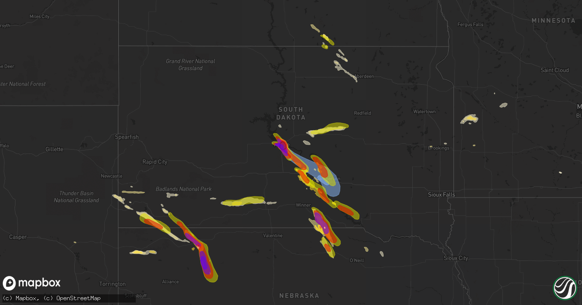
Hail Map on July 18, 2023
Get this storm
July 18 map
$229
one time, instant access
Download today. No call, no setup
Keep the $229
Bought the map and want the full workflow? Apply the entire $229 to a subscription within 7 days. None of it is wasted.
Every map, not just this one
This buys you this map. Subscription and you get every map we run, in the markets you choose from a few cities to whole states to nationwide. Plus real-time alerts the moment a storm fires.
Contact data
Name, contact info, occupancy, even credit band for addresses in the footprint. You go from where it hit to who to call.
Become the source they trust
Unlimited branding weather history reports on demand. You already have the documented answer ready for the property owner, and you are the one who showed up with it.
Property data and RoofTrace estimates
Pull up any address you have got, its value and the exact code rules for that jurisdiction, straight from One Click Code. Then RoofTrace estimates the squares, pitch, and roof value, priced the way you price.
States Impacted by Hail Map on July 18, 2023
Storm reports
New Hampshire
| Date | Description |
|---|---|
| 07/18/20234:05 PM CDT | Social media photos of quarter-sized hail in chester. Hail shredded leaves. |
| 07/18/20233:45 PM CDT | Tree and wires down on elwood rd. |
| 07/18/20233:35 PM CDT | Wires down blocking granite st. |
| 07/18/20233:35 PM CDT | Large tree down on robinson rd. |
| 07/18/20233:35 PM CDT | Multiple trees down blocking walden pond dr. |
| 07/18/20233:35 PM CDT | Tree down partially blocking amherst st. |
| 07/18/20233:35 PM CDT | Measured hail up to half dollar size on broad st in w. Nashua. |
| 07/18/20233:35 PM CDT | Tree down blocking the intersection of orange and lock streets. |
| 07/18/20233:34 PM CDT | Hail measured at 1-inch. Dented car hood. |
| 07/18/202312:30 PM CDT | Multiple reports of quarter-sized hail in troy. Photo posted on social media. Hail fell for 4-5 mins. Time estimated by radar. |
| 07/17/20237:25 PM CDT | Social media photos of hail measured between 1.4-inch and 1.6-inch in the errol area. Hail lasted for 8 minutes. |
Indiana
| Date | Description |
|---|---|
| 07/18/20234:46 PM CDT | One tree down along highway 135 south of new salisbury. Time estimated by radar. Report via twitter. |
| 07/18/20239:18 AM CDT | Spotter relayed photo of quarter sized hail in beechwood. Time estimated from radar. |
Missouri
| Date | Description |
|---|---|
| 07/18/202312:13 PM CDT | Asos station kcgi cape girardeau mo. |
| 07/18/20238:06 AM CDT | A local report indicates 60 MPH wind near 5 SE Green Ridge |
| 07/18/20234:31 AM CDT | Tree limbs down and two trees snapped. Time estimated from radar. |
| 07/18/20232:47 AM CDT | Spotter reported quarter sized hail in western columbia. |
| 07/18/20232:40 AM CDT | Via twitter: report of at least quarter sized hail falling for about 7 minutes. |
South Dakota
| Date | Description |
|---|---|
| 07/18/20236:56 PM CDT | A local report indicates 2.50 inch wind near 1 ESE Pierre |
| 07/18/20236:47 PM CDT | Corrects previous hail report from pierre. Based on further analysis and communication. Photo submitted via social media without standard reference object... And no mea |
| 07/18/20236:47 PM CDT | Photo submitted via facebook. |
| 07/18/20236:45 PM CDT | Photo submitted via facebook. |
| 07/18/20236:45 PM CDT | A local report indicates a tornado near 11 S Fort Pierre |
| 07/18/20236:45 PM CDT | Reported via facebook. |
| 07/18/20236:43 PM CDT | Multiple public reports via facebook. |
| 07/18/20236:43 PM CDT | Photo submitted via twitter. |
| 07/18/20236:40 PM CDT | Reported via facebook. |
| 07/18/20236:40 PM CDT | Very few hailstones... But the largest was the size of quarters. |
| 07/18/20236:40 PM CDT | A local report indicates 2.00 inch wind near Pierre Regional Airport |
| 07/18/20236:37 PM CDT | A local report indicates 1.00 inch wind near Pierre |
| 07/18/20234:06 PM CDT | A local report indicates 1.75 inch wind near 5 N Pine Ridge |
| 07/18/20234:05 PM CDT | A local report indicates 1.00 inch wind near 1 W Pine Ridge |
| 07/18/20234:05 PM CDT | A local report indicates 1.00 inch wind near 2 W Pine Ridge |
| 07/18/202311:45 AM CDT | A local report indicates 1.00 inch wind near Pringle |
| 07/18/20233:19 AM CDT | Mostly pea and marble... Few quarters |
| 07/18/20232:58 AM CDT | Est 50 to 60 mph winds. Tree branches down... Furniture blown around. Small hail |
| 07/17/202311:45 PM CDT | A local report indicates 1.00 inch wind near Pringle |
| 07/17/202310:15 PM CDT | Sdsu mesonet site ggms2 7 ssw gregory. |
| 07/17/20238:49 PM CDT | A local report indicates 1.50 inch wind near 5 SW Kennebec |
| 07/17/20238:28 PM CDT | Mesonet station 54 reliance |
| 07/17/20238:22 PM CDT | Corrects previous tstm wnd gst report from 3 s chamberlain. |
| 07/17/20238:16 PM CDT | Tree damage... Downed powerlines... Tipped campers and roof damage reported in and near oacoma. |
| 07/17/20238:15 PM CDT | Mesonet station ocms2 oacoma 2w |
| 07/17/20238:05 PM CDT | Semi tipped over along i-90. |
| 07/17/20238:05 PM CDT | Semi tipped over along i-90. |
| 07/17/20237:48 PM CDT | A local report indicates 64 MPH wind near Lower Brule |
| 07/17/20237:45 PM CDT | Winds estimated at 70 mph... Trees damaged... Powerlines down... Solar panels damaged. Hail the size of nickels. |
| 07/17/20237:40 PM CDT | Hail was mostly pea size but a few were as large as quarters. Winds estimated at 40 mph. 1.20 inches of rain. The storm did not last long. |
| 07/17/20237:29 PM CDT | Personal weather station. |
| 07/17/20237:18 PM CDT | Photo submitted via facebook. |
| 07/17/20237:00 PM CDT | Photo submitted via twitter. |
Ohio
| Date | Description |
|---|---|
| 07/18/20235:54 PM CDT | Trees and power lines down throughout west union. Time estimated from radar. |
| 07/18/20235:36 PM CDT | Tree down near intersection of 324 and state route 160. |
| 07/18/20235:36 PM CDT | Tree down along lake road. Time estimated from radar. |
| 07/18/20235:35 PM CDT | Tree down along martindill road. |
| 07/18/20235:34 PM CDT | Trees and power lines down at old us 52 between grays lane and birney lane. Time estimated from radar. |
| 07/18/20235:21 PM CDT | Some tree limbs reported down in the buford area. Time estimated from radar. |
| 07/18/20235:16 PM CDT | Trees reported down near jasper on state route 104. Time estimated from radar. |
| 07/18/20235:13 PM CDT | Numerous trees down on us68 between mount orab and fayetteville. Most damage in chasetown. Time estimated from radar. |
| 07/18/20235:11 PM CDT | Trees down on power lines on spring grove road. Time estimated from radar. |
| 07/18/20235:10 PM CDT | Tree reported down on state route 243. Time estimated from radar. |
| 07/18/20235:07 PM CDT | Several trees and large limbs reported down in town. Time estimated fr |
| 07/18/20235:07 PM CDT | Several trees and large limbs reported down in town. Time estimated from radar. |
| 07/18/20235:07 PM CDT | A local report indicates 1.00 inch wind near Racine |
| 07/18/20235:05 PM CDT | Tree down near the intersection of oak street and south 4th street. Time estimated by radar. |
| 07/18/20235:02 PM CDT | Tree down on state route 93. Time estimated from radar. |
| 07/18/20235:00 PM CDT | Multiple pictures of trees down or snapped in and around town of syracuse sent on social media. Time radar estimated. |
| 07/18/20234:46 PM CDT | Lawrence county 911 reporting a tree has fallen and is blocking the road in the 700 block of county rd 6. In ironton. Power lines were also compromised. Time estimated |
| 07/18/20234:45 PM CDT | Corrects report source from previous tstm wnd dmg report from 3 s kincaid springs. Trees reported down on grassy fork road near houghland hill road. Time estimated from |
| 07/18/20234:45 PM CDT | Trees down on back road. Time estimated from radar. |
| 07/18/20234:45 PM CDT | Tree fell on top of a vehicle and into the road at the intersection of north second street and railroad street. Time estimated from radar. |
| 07/18/20234:45 PM CDT | Lawrence county 911 reporting a tree has fallen in the 2000 block of murdock road at ora richey road. Time estimated by radar. |
| 07/18/20234:45 PM CDT | Trees reported down on grassy fork road near houghland hill road. Time estimated from radar. |
| 07/18/20234:29 PM CDT | Several trees and power lines down in deerfield and hamilton townships. Time estimated from radar. |
| 07/18/20234:26 PM CDT | Trees reported down in nile township. Time estimated from radar. |
| 07/18/20234:25 PM CDT | A local report indicates 1.00 inch wind near 1 WSW Mason |
| 07/18/20234:20 PM CDT | Numerous trees down on us 52 in ripley area. Time estimated from radar. |
| 07/18/20234:18 PM CDT | Corrects time from previous tstm wnd dmg report from 10 ssw west portsmouth. Trees reported down on tipton lane. Time estimated from radar. |
| 07/18/20233:32 PM CDT | Photo posted on social media. Time estimated from radar. |
| 07/18/20233:32 PM CDT | Photo posted on social media. Time estimated from radar. |
| 07/18/20233:32 PM CDT | Several branches down on large tree. Photo submitted on social media. Time estimated from radar. |
| 07/18/20233:29 PM CDT | A local report indicates 1.50 inch wind near 2 WNW Clarksville |
| 07/18/20233:21 PM CDT | A local report indicates 1.00 inch wind near 2 WNW Clarksville |
| 07/17/20238:13 PM CDT | Trees reported down on tipton lane. Time estimated from radar. |
North Carolina
| Date | Description |
|---|---|
| 07/18/20234:35 PM CDT | County officials report multiple trees blown down west of hendersonville from mills river south toward laurel park. |
| 07/18/20234:26 PM CDT | Several trees down on power lines/utility equipment in the horse shoe area. |
| 07/18/20234:00 PM CDT | County 911 center reports multiple trees blown down from enka south toward avery creek. |
| 07/17/202310:40 PM CDT | Reports of a few trees down across the county from near franklin to highlands. |
| 07/17/202310:30 PM CDT | Several trees and power lines down in andrews... Nc. |
Vermont
| Date | Description |
|---|---|
| 07/18/20235:10 PM CDT | 2 trees downed in tunbridge by thunderstorm wind gusts; 1 knocking out electricity to a residence and 1 blocking a road. |
Utah
| Date | Description |
|---|---|
| 07/18/20236:50 PM CDT | Mesonet station pc367 e bearlake. |
| 07/18/20236:20 PM CDT | Mesonet station utdcd us-189 at deer creek dam. |
| 07/18/20235:00 PM CDT | Mesonet station pc349 nephi west. |
| 07/18/20234:50 PM CDT | Mesonet station utckh chaulk hill. |
| 07/18/20234:40 PM CDT | Mesonet station pc358 hansel valley. |
| 07/18/20233:50 PM CDT | Mesonet station utrch i-70 at richfield. |
| 07/18/20233:42 PM CDT | Asos station kcny 16 nw moab. |
| 07/18/20233:29 PM CDT | Awos station kenv wendover airport. |
| 07/17/20237:22 PM CDT | Mesonet station ur305 27.0 e lucin. |
Illinois
| Date | Description |
|---|---|
| 07/18/20231:25 PM CDT | Large tree down on house. |
| 07/18/202312:35 PM CDT | Trees down on shumaker rd just west of i-57. Other trees down throughout the county. |
| 07/18/20234:39 AM CDT | Report from mping: quarter |
Colorado
| Date | Description |
|---|---|
| 07/17/20237:10 PM CDT | A local report indicates 1.00 inch wind near 1 SSW Ovid |
New York
| Date | Description |
|---|---|
| 07/18/20235:15 PM CDT | Trees and powerlines down on county highway 18. |
| 07/18/20231:50 PM CDT | Trees and wires down at spencer road and route 14. Time estimated from radar. |
| 07/18/20231:38 PM CDT | Trees and wires down at route 226 and altay road. Time estimated from radar. |
| 07/18/20231:17 PM CDT | Tree down on guy park avenue along with wires down. |
| 07/18/202311:45 AM CDT | Siding blown off a house and garage door damaged by thunderstorm wind. Several trees were also down. Delayed report. |
| 07/18/202311:33 AM CDT | Wires down into a house along wautoma beach rd. |
Nevada
| Date | Description |
|---|---|
| 07/18/202310:47 AM CDT | Mesonet station ccrn2 currant creek raws station elevation: 5750 ft. |
Tennessee
| Date | Description |
|---|---|
| 07/18/20236:30 PM CDT | Several trees down county-wide. |
| 07/18/20236:15 PM CDT | A tree is blocking west shelby dr near reynolds road in collierville. Time is radar estimated. |
| 07/18/20236:10 PM CDT | Multiple trees have large limbs fallen/broken off. |
| 07/18/20236:08 PM CDT | Eleven power poles and associated power lines were downed along winchester blvd. |
| 07/18/20236:00 PM CDT | Tree uprooted into street in sea isle park. Time is radar estimated. |
| 07/18/20236:00 PM CDT | Trees and power lines down on white station rd near meadow crest cv in memphis. Time is radar estimated. |
| 07/18/20236:00 PM CDT | Large tree limbs down at poplar and yates. Time is radar estimated. |
| 07/18/20236:00 PM CDT | Tree down in east memphis. Time is radar estimated. |
| 07/18/20235:54 PM CDT | Tree limbs down at sycamore view rd and raleigh lagrange. |
| 07/18/20235:40 PM CDT | Quarter-sized hail and a tree down in gilt edge. |
| 07/18/20234:45 PM CDT | Tspotter report of tree down on henslee rd in wheel. |
| 07/18/20234:37 PM CDT | Facebook reports indicate numerous trees down across giles county with a shed overturned in pulaski. |
| 07/18/20234:30 PM CDT | Facebook photo of a tree down blocking villa way in chapel hill. |
| 07/18/20234:25 PM CDT | Tree down on vehicle at 225 caperton ave. Driver was able to exit vehicle. |
| 07/18/20234:23 PM CDT | Numerous trees down across lawrenceburg including one on a house at 831 north mahr ave. |
| 07/18/20234:20 PM CDT | Tree down at buffalo road and brink street and another tree down at first avenue at pulaski st in lawrenceburg. 500 customers without power. |
| 07/18/20234:20 PM CDT | Facebook report of large tree snapped in collinwood. |
| 07/18/20234:11 PM CDT | Twitter photo received of tree down blocking a portion of holly tree gap road. |
| 07/18/20234:10 PM CDT | Large tree down at university dr and auburn ln. |
| 07/18/20234:10 PM CDT | Numerous trees down across the county with scattered power outages. |
| 07/18/20234:05 PM CDT | Tspotter video showed a tree blown down in thompsons station. |
| 07/18/20234:05 PM CDT | Facebook photo of small tree down in waynesboro. |
| 07/18/20233:55 PM CDT | Tree down on saundersville rd at north greenhill rd. |
| 07/18/20233:55 PM CDT | Facebook reports indicated a few trees down across lewis county. |
| 07/18/20233:55 PM CDT | Corrects previous tstm wnd dmg report from 2 n mount juliet. Trees and power pole down across sunset circle at sunset dr. |
| 07/18/20233:55 PM CDT | Power lines down across sunset circle at sunset dr. |
| 07/18/20233:55 PM CDT | Tree down and power outages in maryland farms. |
| 07/18/20233:50 PM CDT | Facebook report of two trees snapped at a home in centerville. |
| 07/18/20233:47 PM CDT | Tspotter report of large trees down on new shackle road. |
| 07/18/20233:45 PM CDT | Large tree down in backyard of home in east nashville. |
| 07/18/20233:44 PM CDT | Trees down on power lines on davidson road in belle meade. |
| 07/18/20233:43 PM CDT | Tspotter report of trees and power lines down in madison. |
| 07/18/20233:40 PM CDT | Tspotter report of tree down on house in bellevue near james lawson high school. |
| 07/18/20233:30 PM CDT | Tspotter photo showed small tree snapped in joelton. |
| 07/18/20233:27 PM CDT | Large tree snapped near residence south of davis chapel. |
| 07/18/20233:23 PM CDT | Multiple trees down north of camden to benton county line. A transformer was also struck by lightning. |
| 07/18/20233:15 PM CDT | Trees down in the holladay community. |
| 07/18/20232:55 PM CDT | Trees down across clarksville including at 229 trey ct. 5...700 without power. |
| 07/18/20232:51 PM CDT | Power lines down. |
| 07/18/20232:50 PM CDT | Power lines down from winds causing a fire. |
| 07/18/20232:42 PM CDT | Trained spotter measured wind gust of 63 mph. |
| 07/18/20232:40 PM CDT | Handful of trees down across the county. |
| 07/18/20232:28 PM CDT | One tree down on old trenton road. Time is radar estimated. |
| 07/18/20232:27 PM CDT | Several trees down on keely mill road. Time is radar estimated. |
| 07/18/20232:27 PM CDT | Estimated a 3 in and a 3.5 in tree limb down in dyer... Tn on high street. |
| 07/18/20232:25 PM CDT | Trees down on bumpus mills road. |
| 07/18/20232:25 PM CDT | 20 percent of stewart county without power. |
| 07/18/20232:24 PM CDT | Trees down on wyatt hollow road. |
| 07/18/20232:23 PM CDT | Estimated 60 mph winds in dover. |
| 07/18/20232:21 PM CDT | Public reports a tree fell on two vehicles in the lowes parking lot. Time is radar estimated. |
| 07/18/20232:20 PM CDT | Tree on vehicle on donelson parkway. |
| 07/18/20232:11 PM CDT | Multiple trees down on snake hill rd. Time is radar estimated. |
| 07/18/20232:10 PM CDT | Trees down across highway 54. Time is radar estimated. Power outages in dresden. |
| 07/18/20232:09 PM CDT | Multiple trees down across weakley county. Time is radar estimated. |
| 07/18/20231:40 PM CDT | A carport was lifted and tossed on tn 78 across from lake county health dept in tiptonville. Time is radar estimated. |
| 07/18/20231:36 PM CDT | Trees down over the road. |
| 07/18/20234:28 AM CDT | Report of a power pole down... Lines across the road. |
| 07/18/20234:08 AM CDT | Powerlines down on roadway. |
| 07/18/20233:00 AM CDT | A local report indicates 1.00 inch wind near Puryear |
West Virginia
| Date | Description |
|---|---|
| 07/18/20236:31 PM CDT | Trees down near the intersection of route 5. Time estimated from radar. |
| 07/18/20236:19 PM CDT | Trees and power lines down. 2 broken power poles. Time estimated from radar. |
| 07/18/20236:19 PM CDT | Multiple trees down. Route 5 is shut down just past sand fork. Time estimated from radar. |
| 07/18/20236:19 PM CDT | Multiple trees down along sand fork road. Time estimated from radar. |
| 07/18/20236:14 PM CDT | Power pole and transformer down. |
| 07/18/20236:13 PM CDT | Multiple reports reports of trees and lines down in the sand fork area. Time estimated from radar. |
| 07/18/20236:11 PM CDT | Multiple trees reported down and carports flipped. |
| 07/18/20236:10 PM CDT | Tree reported down blocking both lanes of u.s. Highway 33 west. |
| 07/18/20236:06 PM CDT | Power out in the area of glennville. |
| 07/18/20236:05 PM CDT | Tree and power lines down. Time estimated from radar. |
| 07/18/20236:04 PM CDT | Tree down along slate road. |
| 07/18/20236:00 PM CDT | Power lines and tree down along poca road. |
| 07/18/20235:44 PM CDT | Tree and power lines down along harmony road. Time estimated from radar. |
| 07/18/20235:42 PM CDT | Tree down along ambler road. |
| 07/18/20235:12 PM CDT | Multiple trees and power lines down in the area of ranger. |
| 07/18/20235:03 PM CDT | 15 to 20 trees down between hartford and the jackson county line. Power poles also down in this area in 2 separate places. Time estimated from radar. |
| 07/18/20235:02 PM CDT | Putnam county 911 is reporting a tree down in the 4000 block of winfield rd near an industrial park. Time estimated by radar. |
| 07/18/20235:00 PM CDT | Received some pictures out of nitro via social media of some medium and large size trees down in a backyard. A shed was damaged due to one of the trees falling. Time es |
| 07/18/20235:00 PM CDT | A local report indicates 1.00 inch wind near New Haven |
| 07/18/20234:59 PM CDT | Putnam county 911-tree down... Blocking both lanes in the 10000 block of charleston rd in hometown. Lines involved... Unsure if power lines. Road is not passable. Time |
| 07/18/20234:59 PM CDT | Tree down in the 13000 block of winfield rd.... Near a fast food restaurant. Time estimated by radar. Report received via putnam county 911 center. |
| 07/18/20234:57 PM CDT | Tree down blocking the southbound lane of winfield rd at plantation rd in fraziers bottom. Time estimated by radar. Reported via putnam county 911. |
| 07/18/20234:57 PM CDT | Putnam county 911 reported a tree down on hurricane creek road at coleman creek road near hurricane. Time estimated by radar. |
| 07/18/20234:57 PM CDT | Tree down in winfield along state route 34... In the 5000 block... Near a business. Time estimated by radar. Report received from putnam county 911 center. |
| 07/18/20234:55 PM CDT | Tree reported down. Time estimated by radar. |
| 07/18/20234:55 PM CDT | Tree reported down. Time estimated by radar. |
| 07/18/20234:54 PM CDT | Tree down on a house on guyan river road in ranger. Time estimated from radar. |
| 07/18/20234:53 PM CDT | Also heard that a funnel cloud had been spotted. |
| 07/18/20234:50 PM CDT | Large tree down. Power is also out. |
| 07/18/20234:45 PM CDT | Two trees down blocking state route 34 south. |
| 07/18/20234:36 PM CDT | Hail between 1 inch to half dollar size. Time estimated from radar. Verified 1 inch hail from picture on social media. |
| 07/18/20234:32 PM CDT | Also spotted a funnel cloud forming and spinning... Falling apart and forming again several times before it went over the hill while on the phone at 540 pm. |
| 07/17/202310:55 PM CDT | A tree is down on coal heritage rd... Blocking both lanes. |
Mississippi
| Date | Description |
|---|---|
| 07/18/20236:15 PM CDT | Kolv reports 54kts at 2315z. |
| 07/17/20237:55 PM CDT | Numerous trees and power lines down in the fairview community. A barn sustained roof damage. Some of the more significant damage was on saddle club rd. |
| 07/17/20237:41 PM CDT | Trees dpwm netweem natchez trace and marietta along ms 371 blocking the road. Time is radar estimated. |
| 07/17/20237:39 PM CDT | Trees and power lines down on cr 5491 near marietta... Ms. |
| 07/17/20237:31 PM CDT | A carport was blown over on cr 6071 in sw prentiss county. |
| 07/17/20237:06 PM CDT | Large tree uprooted in blue mountain. Time is radar estimated. |
| 07/17/20237:00 PM CDT | Power lines down blocking road on hwy 311. Time is radar estimated. |
North Dakota
| Date | Description |
|---|---|
| 07/17/202310:40 PM CDT | Hail just began. |
| 07/17/20238:10 PM CDT | A local report indicates 1.00 inch wind near 3 NW Fessenden |
South Carolina
| Date | Description |
|---|---|
| 07/18/20236:32 PM CDT | A couple of trees were blown down in an area just northeast of table rock state park. |
| 07/18/20231:00 AM CDT | Large limbs split off bradford pears on little mountain rd... Including one tree split in half. Small pine tree downed... Along with a couple trees down across from the |
| 07/18/202312:58 AM CDT | Trees down on power lines/utility equipment in the inman area. |
| 07/18/202312:39 AM CDT | Trees down on power lines/utility equipment in the highland area. |
| 07/18/202312:36 AM CDT | Trees down on power lines/utility equipment in the lake robinson area. |
| 07/18/202312:27 AM CDT | Trees down on power lines/utility equipment in the belvue school rd area. |
| 07/18/202312:27 AM CDT | At least 2 trees were blown down behind a fire department. |
Arkansas
| Date | Description |
|---|---|
| 07/18/20235:12 PM CDT | Tree down... Power outages... And a flag pole down. Time is radar estimated. |
| 07/18/20235:10 PM CDT | One tree down on freer rd. Time is radar estimated. |
| 07/18/20234:50 PM CDT | Large tree down off gee street in jonesboro. |
| 07/18/20234:50 PM CDT | Tree down near oak ave and main st. Other reports of trees down in jonesboro. |
| 07/18/20234:42 PM CDT | Relayed by oem from sheriff office: powerline down on hwy 61 south of blytheville near hwy 312. Time is radar estimated. |
| 07/18/20234:40 PM CDT | Trees blown down onto power lines east of alicia. |
Kentucky
| Date | Description |
|---|---|
| 07/18/20235:52 PM CDT | Marion county emergency manager sent pictures of a barn that was destroyed. Time estimated from radar. |
| 07/18/20235:43 PM CDT | Tree down in the pleasure ridge park area. |
| 07/18/20235:39 PM CDT | Multiple reports of trees down in campbellsville and across the county on roads and powerlines. A few structures were also damaged by falling trees. |
| 07/18/20235:24 PM CDT | Tree across the roadway. |
| 07/18/20235:21 PM CDT | Trees down near summerville. |
| 07/18/20235:05 PM CDT | Trees down near russell soccer complex. |
| 07/18/20235:00 PM CDT | Multiple trees with power lines down. Time estimated from radar. |
| 07/18/20235:00 PM CDT | Trees down near intersection of smith branch road and us highway 23 south. |
| 07/18/20234:54 PM CDT | Multiple trees down on roads in lebanon. Some are impassible. |
| 07/18/20234:52 PM CDT | Trees down. Time estimated from radar. |
| 07/18/20234:50 PM CDT | Tree contact caused power outages. |
| 07/18/20234:50 PM CDT | Trees down. Time estimated from radar. |
| 07/18/20234:41 PM CDT | Tree down along beechy creek. Time estimated on radar. |
| 07/18/20234:13 PM CDT | Tree down along se licking river rd and higgins branch rd. |
| 07/18/20234:08 PM CDT | Mesonet station jcak2 jackson raws. |
| 07/18/20234:03 PM CDT | Nws employees estimated wind gusts to between 60-70 mph at times... Which lasted about 5 minutes from 5:03 pm until about 5:08 pm. |
| 07/18/20234:00 PM CDT | Trees down on highway 1812 on frozen hill. Time estimated from radar. |
| 07/18/20233:52 PM CDT | Corrects previous tstm wnd dmg report from 1 sw murphyfork. Off-duty nws employee relayed a report of a down tree about a mile up murphy fork road. Time estimated from |
| 07/18/20233:50 PM CDT | Trees down near the intersection of bowling green road and little muddy church road. Time estimated by radar. |
| 07/18/20233:38 PM CDT | Social media report of two picnics flipped over and moved about 30 feet at intersection of terrill fork rd and holly road. Time estimated by velocity signature on radar |
| 07/18/20233:36 PM CDT | Large tree branch down on rose bend rd. Time estimated by radar velocity signature. Report and video from social media. |
| 07/18/20233:36 PM CDT | Report of huge tree blocking tom rose branch rd. Report via social media. |
| 07/18/20233:25 PM CDT | Reports of multiple trees down on roads and houses within russellville. Time estimated by radar. |
| 07/18/20233:25 PM CDT | Dispatch reported multiple trees down along both highways 587 and 11 south of beattyville. |
| 07/18/20233:23 PM CDT | Two vehicles trapped by trees on either side and power line down on lower licking road in rowan county. No injuries. Time estimated by radar. |
| 07/18/20233:10 PM CDT | Tree down around the 4000 block of hwy 1209. Time estimate by radar. |
| 07/18/20233:05 PM CDT | Trees down across bath county. Time estimated from radar. |
| 07/18/20233:05 PM CDT | Social media report and photo of snapped tree limb on telephone line. Time estimated based on velocity radar signature. |
| 07/18/20233:02 PM CDT | Tree down at entrance of mountain crest apartments entrance. |
| 07/18/20233:01 PM CDT | Tree down in backyard of residence. Report via social media. |
| 07/18/20232:57 PM CDT | Social media report of power lines down along richmond road or highway 52 near the madison and estill county line. |
| 07/18/20232:55 PM CDT | Numerous trees down along highway u.s. 60 from 4670 us 60 to the bath county line. That portion of the highway will be close a few hours for tree removal. Also... House |
| 07/18/20232:52 PM CDT | Multiple trees down along hwy 2004 around the 400 and 600 blocks. Time estimated by radar. |
| 07/18/20232:45 PM CDT | Trees down along white turley pike and wades mill roads. Time estimated by radar. |
| 07/18/20232:26 PM CDT | A local report indicates 70 MPH wind near 3 NNW Hopkinsville |
| 07/18/20232:07 PM CDT | Storm damage to trailer and barn. |
| 07/18/20232:07 PM CDT | Trees down. |
| 07/18/20232:05 PM CDT | Mobile home and barn destroyed along cadiz road just east of i-24. Late report. |
| 07/18/20232:00 PM CDT | Delayed report. Tree down in bryantsville. |
| 07/18/20231:52 PM CDT | Off-duty nws employee relayed a report of a down tree about a mile up murphy fork road. Time estimated from radar. |
| 07/18/20231:50 PM CDT | Tree fell on vehicle. |
| 07/18/20231:43 PM CDT | Measured wind gust on the top of kentucky dam. |
| 07/18/20231:37 PM CDT | Hail ranged from peas to the size of a quarter. |
| 07/18/20231:35 PM CDT | Awos station km25 mayfield ky. |
| 07/18/20231:30 PM CDT | Trees and power lines down in town. |
| 07/18/20231:25 PM CDT | Multiple trees and powerlines down. |
| 07/18/20231:19 PM CDT | Intersection of old mayfield and bryan rd. 60+ mph winds reported. |
| 07/18/20231:00 PM CDT | Trees down over the road. |
| 07/18/202312:49 PM CDT | Multiple trees down windows blown out in house. |
| 07/18/202312:48 PM CDT | Trees down in bandana. Trees also down throughout the county. |
| 07/18/202311:56 AM CDT | Multiple trees down or uprooted... Some laying against homes. |
| 07/18/20236:23 AM CDT | Tree down on highway 68... Blocking one lane of traffic. |
| 07/18/20235:52 AM CDT | A local report indicates 1.25 inch wind near 6 NNE Faridealing |
| 07/18/20235:30 AM CDT | A local report indicates 1.25 inch wind near 5 N Faridealing |
| 07/18/20234:55 AM CDT | Tree down on lawrence road in southwest calloway county. Road is also flooded. |
| 07/18/20233:30 AM CDT | Tree down blocking highway 45. Time estimated via radar. |
| 07/18/20233:26 AM CDT | Spotter reports widespread wind damage in sedalia... Estimates 70-80 mph gusts. |
| 07/18/20231:44 AM CDT | 8 inch in diameter tree blocking highway 94 about 1.5 miles southwest of cuba... Ky. |
| 07/17/20238:13 PM CDT | Laurel county dispatch relayed a report of a down tree on the powerlines near the 160 block of southland dr. |
| 07/17/20237:50 PM CDT | Tyner fire dept reported to 911 dispatch a tree was down blocking the road in the daniel boone national forest. Tree was removed by the fire department. Time estimated |
| 07/17/20237:45 PM CDT | Laurel county dispatch relayed a report of a down tree with powerlines near the 850 block of ky-3434. |
| 07/17/20237:30 PM CDT | Tree and powerlines down at ky highway 3434 near noelle road. Time estimated from radar velocity signature. |
| 07/17/20237:00 PM CDT | Tree down on fence on gum sulphur rd in the brodhead area. Time estimated by radar velocity signature. |
Alabama
| Date | Description |
|---|---|
| 07/18/20236:52 PM CDT | A power line was reported down at this location. |
| 07/18/20236:49 PM CDT | A tree was reported dowm om cr 494. |
| 07/18/20236:45 PM CDT | Several reports of trees down. One over a power line and several over roads in steele... Al. A person also hit a tree... No injuries. Winds estimated between 40-50 mph. |
| 07/18/20236:45 PM CDT | Tree fallen on county road 82 north of weiss lake. Winds estimated between 40-50 mph. |
| 07/18/20236:35 PM CDT | Report from mping: trees uprooted or snapped; roof blown off. |
| 07/18/20236:30 PM CDT | Large tree blocking roadway in oneonta. Winds around 40-50 mph. |
| 07/18/20236:30 PM CDT | Large tree blocking roadway on 5th st. Another large tree down near/on a residence near adams ave. Estimated winds around 40-50 mph in oneonta. |
| 07/18/20236:30 PM CDT | Trees and power lines down on lehigh rd.... Trafford... And timmerman circle in blountsville. Winds estimated between 40-50 mph. |
| 07/18/20236:26 PM CDT | Report from mping: trees uprooted or snapped; roof blown off. |
| 07/18/20236:23 PM CDT | Tree reported down on cr 122 off of highway 75. |
| 07/18/20236:21 PM CDT | Numerous trees were blown down in the boaz area. One tree fell on a house. |
| 07/18/20236:20 PM CDT | A large tree was blown down the intersection of cr 52 and highway 227. |
| 07/18/20236:16 PM CDT | A tree was reported on mockingbird lane. |
| 07/18/20236:00 PM CDT | Corrects previous tstm wnd dmg report from 1 wnw guntersville. Roof peeled on city harbor suites in guntersville. |
| 07/18/20236:00 PM CDT | Trees and power lines down in the walter area. |
| 07/18/20235:55 PM CDT | Trees downed around arab. |
| 07/18/20235:55 PM CDT | Trees downed around union grove. |
| 07/18/20235:55 PM CDT | Trees reported down in the arab area. |
| 07/18/20235:54 PM CDT | Several trees down in the baileyton area. |
| 07/18/20235:53 PM CDT | Trees were reported down in the union grove area. |
| 07/18/20235:52 PM CDT | Report from mping: 1-inch tree limbs broken; shingles blown off. |
| 07/18/20235:51 PM CDT | Trees downed in ruth. |
| 07/18/20235:49 PM CDT | Trees down in the ruth area. |
| 07/18/20235:42 PM CDT | Estimated wind gusts of 60-70 mph. |
| 07/18/20235:42 PM CDT | Report from mping: 1-inch tree limbs broken; shingles blown off. |
| 07/18/20235:37 PM CDT | Report from mping: 3-inch tree limbs broken; power poles broken. |
| 07/18/20235:34 PM CDT | Tree downed near intersection of patton rd sw and drake ave sw - reported by off duty nws meteorologist. |
| 07/18/20235:34 PM CDT | Wind gusts of 60-70 mph near interchange of i-565 and mooresville rd. |
| 07/18/20235:25 PM CDT | Report from mping: 1-inch tree limbs broken; shingles blown off. |
| 07/18/20235:25 PM CDT | Tree downed near intersection of sheldon and malor cir |
| 07/18/20235:24 PM CDT | Report from mping: 1-inch tree limbs broken; shingles blown off. |
| 07/18/20235:24 PM CDT | Report from mping: 1-inch tree limbs broken; shingles blown off. |
| 07/18/20235:22 PM CDT | Tree downed near hwys 101 and 194 north of town creek. |
| 07/18/20235:20 PM CDT | Report from mping: homes/buildings completely destroyed. |
| 07/18/20235:20 PM CDT | Report from mping: 3-inch tree limbs broken; power poles broken. |
| 07/18/20235:18 PM CDT | Power lines down blocking wall triana between hwy 72 and capshaw rd. |
| 07/18/20235:17 PM CDT | Trees and large branches were knocked down and some minor gutter roof damage report near the intersection of kelly springs road and jeff road. |
| 07/18/20235:16 PM CDT | Report from mping: 1-inch tree limbs broken; shingles blown off. |
| 07/18/20235:16 PM CDT | Nw of nick davis and jeff rd intersection. |
| 07/18/20235:16 PM CDT | Corrects previous tstm wnd dmg report from 4 sse harvest. Four to five trees were snapped near this location. Two of them large hardwood trees. |
| 07/18/20235:11 PM CDT | A tree was reported down at this location. |
| 07/18/20235:10 PM CDT | Large trees down in the cranebrake area near lindsey lane near the golf course. |
| 07/18/20235:05 PM CDT | Trees reported downed along cannon rd by ema. |
| 07/18/20235:05 PM CDT | A local report indicates 70 MPH wind near 2 ESE Athens |
| 07/18/20235:02 PM CDT | Tree was uprooted and loose construction equipment blown around at this location. |
| 07/18/20235:02 PM CDT | Trees were reported down at this location. |
| 07/18/20235:01 PM CDT | Numerous large trees down or snapped. 1/4 of damage to one barn and side blown out near roof damage. |
| 07/18/20234:58 PM CDT | Trees were reported down at this location. |
| 07/18/20234:57 PM CDT | Corrects previous tstm wnd dmg report from 9 wnw underwood-petersville. Trees were reported down at this location. |
| 07/18/20234:48 PM CDT | Tree report down at this location. |
| 07/18/20234:48 PM CDT | A tree was blown down at this location. |
| 07/17/202310:17 PM CDT | Trees down near centreville. |
| 07/17/20239:52 PM CDT | A few trees down... Some on power lines... In the tuscaloosa area. |
| 07/17/20239:46 PM CDT | Tree reported down on power line on highway 216 in the lake view area. |
| 07/17/20239:32 PM CDT | Trees down in several locations across pickens county including near gordo. |
| 07/17/20238:57 PM CDT | Trees and power lines were blown down near carbon hill. |
| 07/17/20238:55 PM CDT | Tree on home on 3rd ave nw in fayette. Trees and power lines reported down across fayette county. |
| 07/17/20238:48 PM CDT | Trees were blown down in vernon. |
| 07/17/20238:42 PM CDT | Trees were blown down in and around guin. Winds were estimated at 50-55 mph. |
| 07/17/20238:40 PM CDT | Trees were blown down in sulligent. |
| 07/17/20238:25 PM CDT | Trees were blown down in and around hamilton. Winds were estimated at 50-55 mph. |
| 07/17/20238:25 PM CDT | Tree down along osborn rd and colburn mountain rd. |
| 07/17/20237:48 PM CDT | Tree down along osborn hill rd and colburn mountain rd. |
| 07/17/20237:10 PM CDT | Tree down near the intersection of morgan bridge rd. And al hwy 144. Winds estimated between 40-50 mph. |
| 07/17/20237:04 PM CDT | Report from mping: 3-inch tree limbs broken; power poles broken. |
| 07/17/20237:00 PM CDT | A snapped tree was reported at the intersection of slaughter road and farrow road. |
Nebraska
| Date | Description |
|---|---|
| 07/18/20236:34 PM CDT | A local report indicates 64 MPH wind near 4 W Chappell |
| 07/18/20236:05 PM CDT | A local report indicates 1.00 inch wind near 18 N Ashby |
| 07/18/20236:05 PM CDT | A local report indicates 63 MPH wind near 18 N Ashby |
| 07/18/20236:04 PM CDT | Spotter reported that corn was stripped. |
| 07/18/20235:30 PM CDT | Tornado lasted 3 to 5 minutes then dissipated. |
| 07/18/20235:10 PM CDT | A local report indicates 3.00 inch wind near 9 S Gordon |
| 07/18/20235:00 PM CDT | A local report indicates 1.00 inch wind near 4 S Gordon |
| 07/18/20234:52 PM CDT | A local report indicates 2.00 inch wind near NE Clinton |
| 07/18/20234:50 PM CDT | A local report indicates 1.00 inch wind near 1 NW Clinton |
| 07/18/20234:40 PM CDT | A local report indicates 2.50 inch wind near 3 N Clinton |
| 07/18/20234:24 PM CDT | A local report indicates 1.25 inch wind near 5 SSE Whiteclay |
| 07/17/202311:55 PM CDT | Delayed report public reports pea to quarter sized hail of and on for 6 to 8 minutes via social media. |
| 07/17/202310:30 PM CDT | Delayed report... Public reports baseball sized hail with damage to windows on household. |
| 07/17/202310:05 PM CDT | A local report indicates 1.00 inch wind near 4 NE Chappell |
Maine
| Date | Description |
|---|---|
| 07/18/20234:13 PM CDT | 1 foot of water flowing over old county rd. |
| 07/18/20234:00 PM CDT | Tree and wires down on spring st. |
| 07/18/20232:40 PM CDT | Several trees down on the northeast corner of cross lake... Including one on a house and another on a power line. |
Cities Impacted by Hail Map on July 18, 2023
- Sulphur, IN
- Battletown, KY
- English, IN
- Leavenworth, IN
- Cape Girardeau, MO
- Jackson, MO
- Scott City, MO
- McClure, IL
- Chaffee, MO
- Thebes, IL
- Olive Branch, IL
- Ullin, IL
- Miller City, IL
- Tamms, IL
- Pulaski, IL
- Villa Ridge, IL
- Olmsted, IL
- Grand Chain, IL
- Mound City, IL
- Cairo, IL
- Mounds, IL
- Karnak, IL
- Kevil, KY
- La Center, KY
- Barlow, KY
- Metropolis, IL
- Paducah, KY
- West Paducah, KY
- Wickliffe, KY
- Cunningham, KY
- Bardwell, KY
- Jonesboro, IL
- Cypress, IL
- Dongola, IL
- Golconda, IL
- Belknap, IL
- Vienna, IL
- Melber, KY
- Grantsburg, IL
- Brookport, IL
- Salem, KY
- Smithland, KY
- Hampton, KY
- Burna, KY
- Symsonia, KY
- Tiline, KY
- Hickory, KY
- Boaz, KY
- Benton, KY
- Grand Rivers, KY
- Calvert City, KY
- Ledbetter, KY
- Marion, KY
- Princeton, KY
- Gilbertsville, KY
- Fredonia, KY
- Eddyville, KY
- Kuttawa, KY
- Cadiz, KY
- Ord, NE
- North Loup, NE
- Sweet Springs, MO
- Iberia, MO
- Sevierville, TN
- Odessa, MO
- Holden, MO
- Hilton, NY
- Tuscumbia, MO
- Eldon, MO
- Kaiser, MO
- Vienna, MO
- Warsaw, MO
- Waverly, MO
- Elyria, NE
- Burwell, NE
- Rapid City, SD
- Box Elder, SD
- Horse Cave, KY
- Cave City, KY
- Salem, MO
- Lenox, MO
- Hardyville, KY
- Centertown, MO
- Clinton, MO
- Calhoun, MO
- Onaga, KS
- Scotia, NE
- Elba, NE
- Saint Paul, NE
- Wolbach, NE
- Center, KY
- Versailles, MO
- Belle, MO
- Bland, MO
- Blairstown, MO
- Urich, MO
- Creighton, MO
- Dannebrog, NE
- Saint Libory, NE
- Excelsior Springs, MO
- Otterville, MO
- Bunceton, MO
- Leopold, IN
- Saint Croix, IN
- Vichy, MO
- Dixon, MO
- Rolla, MO
- Saint Elizabeth, MO
- Eugene, MO
- Cosby, TN
- Lincoln, MO
- Stover, MO
- Ionia, MO
- Sedalia, MO
- Mora, MO
- Green Ridge, MO
- Cole Camp, MO
- Spearfish, SD
- Belle Fourche, SD
- Archer, NE
- Palmer, NE
- Crocker, MO
- Richland, MO
- Brumley, MO
- Clarksburg, MO
- Tipton, MO
- Pilot Grove, MO
- Brinktown, MO
- Meta, MO
- Garden City, MO
- Archie, MO
- Hamlin, NY
- Waterport, NY
- Albion, NY
- Kendall, NY
- Kent, NY
- Edmonton, KY
- Knob Lick, KY
- Newburg, MO
- Ulman, MO
- Richmond, MO
- Warrensburg, MO
- Smithton, MO
- Gravois Mills, MO
- Windsor, MO
- Knob Noster, MO
- Saint Onge, SD
- Whitewood, SD
- Saint Robert, MO
- Centerview, MO
- Norborne, MO
- Edgar Springs, MO
- Charleston, MO
- Fancy Farm, KY
- Arlington, KY
- Mayfield, KY
- Murray, KY
- Farmington, KY
- Kirksey, KY
- Dexter, KY
- Almo, KY
- Hardin, KY
- New Concord, KY
- Hazel, KY
- Fort Campbell, KY
- Dover, TN
- Herndon, KY
- Woodlawn, TN
- Indian Mound, TN
- Big Rock, TN
- La Fayette, KY
- Bumpus Mills, TN
- Cumberland City, TN
- Clinton, KY
- Sedalia, KY
- Wingo, KY
- Buchanan, TN
- Puryear, TN
- Springville, TN
- Paris, TN
- Stewart, TN
- Tennessee Ridge, TN
- Big Sandy, TN
- Erin, TN
- Hopkinsville, KY
- Crofton, KY
- White Plains, KY
- Oak Grove, KY
- Cerulean, KY
- Dawson Springs, KY
- Gracey, KY
- Nortonville, KY
- Saint Charles, KY
- Cumberland Furnace, TN
- Cunningham, TN
- Pembroke, KY
- Palmyra, TN
- Vanleer, TN
- Clarksville, TN
- Ridgely, TN
- Lenox, TN
- Obion, TN
- Dyersburg, TN
- Finley, TN
- Halls, TN
- Newbern, TN
- Trenton, TN
- Dyer, TN
- Atwood, TN
- Bradford, TN
- Greenfield, TN
- Buena Vista, TN
- Bruceton, TN
- Huntingdon, TN
- Friendship, TN
- McKenzie, TN
- Trezevant, TN
- Milan, TN
- Trimble, TN
- Kenton, TN
- Rutherford, TN
- Rives, TN
- Sharon, TN
- Martin, TN
- Gleason, TN
- Hollow Rock, TN
- Mansfield, TN
- Hornbeak, TN
- Henry, TN
- Dresden, TN
- Union City, TN
- Troy, TN
- Medina, TN
- Lavinia, TN
- Cedar Grove, TN
- Yuma, TN
- Humboldt, TN
- Westport, TN
- Wildersville, TN
- Cottage Grove, TN
- Jackson, TN
- Gadsden, TN
- Camden, TN
- Sugar Tree, TN
- Holladay, TN
- Palmersville, TN
- Waverly, TN
- New Johnsonville, TN
- Eva, TN
- Trenton, KY
- Beech Creek, KY
- Greenville, KY
- Elkton, KY
- Lewisburg, KY
- Russellville, KY
- Adams, TN
- Olmstead, KY
- Adairville, KY
- Pleasant View, TN
- Springfield, TN
- Nashville, TN
- Joelton, TN
- Southside, TN
- Guthrie, KY
- Allensville, KY
- Sharon Grove, KY
- Ashland City, TN
- Belton, KY
- Charlotte, TN
- Cedar Hill, TN
- Chapmansboro, TN
- Kingston Springs, TN
- Burns, TN
- Pegram, TN
- Dickson, TN
- Hurricane Mills, TN
- McEwen, TN
- White Bluff, TN
- Alamo, TN
- Only, TN
- Oakfield, TN
- Bon Aqua, TN
- Fairview, TN
- Parsons, TN
- Lexington, TN
- Nunnelly, TN
- Lobelville, TN
- Dunmor, KY
- Greenbrier, TN
- Rochester, KY
- Morgantown, KY
- Beechmont, KY
- Auburn, KY
- Lyles, TN
- Centerville, TN
- Linden, TN
- Darden, TN
- Pine Ridge, SD
- Oregonia, OH
- Clarksville, OH
- New Vienna, OH
- Leesburg, OH
- Hillsboro, OH
- Blanchester, OH
- Midland, OH
- Greenfield, OH
- Duck River, TN
- Hohenwald, TN
- Scotts Hill, TN
- Huron, TN
- Beech Bluff, TN
- Decaturville, TN
- Mount Pleasant, TN
- Columbia, TN
- Hampshire, TN
- Williamsport, TN
- Primm Springs, TN
- Franklin, TN
- Santa Fe, TN
- Culleoka, TN
- Thompsons Station, TN
- Hermitage, TN
- Nolensville, TN
- Antioch, TN
- Brentwood, TN
- Spring Hill, TN
- Madison, TN
- Cottontown, TN
- Orlinda, TN
- Old Hickory, TN
- Hendersonville, TN
- Cross Plains, TN
- Goodlettsville, TN
- Portland, TN
- Franklin, KY
- Mount Juliet, TN
- White House, TN
- Whites Creek, TN
- Woodburn, KY
- Gallatin, TN
- Roundhill, KY
- Bowling Green, KY
- Rockfield, KY
- Scottsville, KY
- Alvaton, KY
- Brooksville, KY
- Lebanon, TN
- Westmoreland, TN
- Bethpage, TN
- Adolphus, KY
- Oakland, KY
- Castalian Springs, TN
- Hartsville, TN
- Watertown, TN
- Carthage, TN
- Elmwood, TN
- Pleasant Shade, TN
- Gordonsville, TN
- Riddleton, TN
- Lafayette, TN
- Dixon Springs, TN
- Murfreesboro, TN
- Arrington, TN
- Rockvale, TN
- Lascassas, TN
- Eagleville, TN
- Smyrna, TN
- College Grove, TN
- La Vergne, TN
- Christiana, TN
- Wartrace, TN
- Unionville, TN
- Belfast, TN
- Chapel Hill, TN
- Milton, TN
- Readyville, TN
- Shelbyville, TN
- Bell Buckle, TN
- Lewisburg, TN
- Beechgrove, TN
- Manchester, TN
- Normandy, TN
- Bradyville, TN
- Auburntown, TN
- Liberty, TN
- Brush Creek, TN
- Hickman, TN
- Alexandria, TN
- Woodbury, TN
- Morrison, TN
- Benton, MO
- Fulton, KY
- Dukedom, TN
- Summertown, TN
- Dowelltown, TN
- Gainesboro, TN
- Browder, KY
- Drakesboro, KY
- Rushville, NE
- Hollis, NH
- Nashua, NH
- Gordon, NE
- West Chester, OH
- Mason, OH
- Maineville, OH
- Crown City, OH
- Gallipolis, OH
- Apple Grove, WV
- Ashton, WV
- Fraziers Bottom, WV
- Buffalo, WV
- Pomeroy, OH
- West Columbia, WV
- Mason, WV
- Middleport, OH
- Racine, OH
- Hartford, WV
- New Haven, WV
- Syracuse, OH
- Letart, WV
- Big Springs, WV
- Brohard, WV
- Macfarlan, WV
- Smithville, WV
- Clifton, TN
- Waynesboro, TN
- Ethridge, TN
- Lawrenceburg, TN
- Westpoint, TN
- Leoma, TN
- Lynnville, TN
- Loretto, TN
- Petersburg, TN
- Taft, TN
- Ardmore, TN
- Minor Hill, TN
- Pulaski, TN
- Madison, AL
- Dellrose, TN
- Fayetteville, TN
- Frankewing, TN
- Cornersville, TN
- Toney, AL
- Tanner, AL
- Lester, AL
- Elkmont, AL
- Athens, AL
- Anderson, AL
- Goodspring, TN
- Ardmore, AL
- Huntsville, AL
- Five Points, TN
- Harvest, AL
- Prospect, TN
- Elora, TN
- Kelso, TN
- Hazel Green, AL
- Flintville, TN
- Lynchburg, TN
- Winchester, TN
- Belvidere, TN
- Mulberry, TN
- Tullahoma, TN
- Portland, OH
- Etowah, AR
- Manila, AR
- Osceola, AR
- Dyess, AR
- Lepanto, AR
- Caraway, AR
- Marked Tree, AR
- Tyronza, AR
- Joiner, AR
- Turrell, AR
- Gilmore, AR
- Keiser, AR
- Frenchmans Bayou, AR
- Henning, TN
- Bassett, AR
- Wilson, AR
- Bay, AR
- Black Oak, AR
- Trumann, AR
- Lake City, AR
- Jonesboro, AR
- Paragould, AR
- Brookland, AR
- Monette, AR
- Harrisburg, AR
- Weiner, AR
- Walnut Ridge, AR
- State University, AR
- Bono, AR
- Merriman, NE
- Milltown, IN
- Corydon, IN
- Depauw, IN
- Liberty, KY
- Dunlow, WV
- Tollesboro, KY
- Vanceburg, KY
- Leon, WV
- Lexington, KY
- Central, IN
- Mauckport, IN
- Webster, KY
- Rhodelia, KY
- Payneville, KY
- Union Star, KY
- Campbellsville, KY
- Greensburg, KY
- Summersville, KY
- Lynchburg, OH
- Etoile, KY
- Austin, KY
- Fountain Run, KY
- Glasgow, KY
- Hodgenville, KY
- Shelbyville, KY
- Simpsonville, KY
- Lebanon, KY
- Springfield, KY
- Loretto, KY
- Bardstown, KY
- New Haven, KY
- Summer Shade, KY
- Eighty Eight, KY
- Prospect, KY
- South Fulton, TN
- Raywick, KY
- Mount Sherman, KY
- Buffalo, KY
- Morrow, OH
- Ona, WV
- Lesage, WV
- Milton, WV
- Red House, WV
- Glenwood, WV
- Etowah, NC
- Horse Shoe, NC
- Mills River, NC
- Hendersonville, NC
- Webster, NY
- Martinsville, OH
- Lebanon, OH
- Dover, KY
- Augusta, KY
- Falmouth, KY
- Germantown, KY
- Foster, KY
- Langsville, OH
- Rutland, OH
- Piketon, OH
- Peebles, OH
- Goshen, OH
- Pleasant Plain, OH
- Wilmore, KY
- Lancaster, KY
- Harrodsburg, KY
- Argillite, KY
- Owingsville, KY
- Mount Sterling, KY
- Maysville, KY
- Lawrenceburg, KY
- Versailles, KY
- Salvisa, KY
- Glenville, WV
- Normantown, WV
- Poughkeepsie, AR
- Ravenden, AR
- Williford, AR
- Smithville, AR
- Latham, OH
- Wilmington, OH
- Middleburg, KY
- Hustonville, KY
- Birdseye, IN
- Branchville, IN
- Bristow, IN
- Ironton, OH
- Russell, KY
- Flatwoods, KY
- Ripley, OH
- Kiahsville, WV
- Bragg City, MO
- Hayti, MO
- Steele, MO
- Caruthersville, MO
- Fort Pierce, FL
- Ashland, KY
- South Point, OH
- Marion, NC
- Paris, KY
- Luxora, AR
- Ripley, TN
- Georgetown, IN
- Ramsey, IN
- New Salisbury, IN
- Crandall, IN
- Tiptonville, TN
- Rochester, NY
- Rockport, IN
- Waynesville, OH
- Louisville, KY
- Boston, KY
- Lebanon Junction, KY
- Arden, NC
- Waynesburg, KY
- Kings Mountain, KY
- Asheville, NC
- Leicester, NC
- Candler, NC
- South Lebanon, OH
- Greenup, KY
- Powhatan, AR
- Black Rock, AR
- Lewisport, KY
- Willisburg, KY
- Chaplin, KY
- Burlison, TN
- Drummonds, TN
- Brighton, TN
- Munford, TN
- Munday, WV
- Brockport, NY
- Winchester, KY
- Ontario, NY
- Rome, IN
- Cannelton, IN
- Hardinsburg, KY
- Manchester, OH
- West Union, OH
- Port Saint Lucie, FL
- Portageville, MO
- Bath Springs, TN
- Middletown, OH
- Hamilton, OH
- Aberdeen, OH
- Laconia, IN
- Wilsondale, WV
- Fayetteville, OH
- Loveland, OH
- Fairfield, OH
- Cincinnati, OH
- Lenoir, NC
- Elizabethtown, KY
- New Hope, KY
- Reagan, TN
- Big Bend, WV
- Bainbridge, OH
- Nicholasville, KY
- Brownsville, TN
- Falls Of Rough, KY
- Churchs Ferry, ND
- Elk Horn, KY
- Brodhead, KY
- Yosemite, KY
- Crab Orchard, KY
- Columbia, KY
- Salt Lick, KY
- Brandenburg, KY
- Lyndonville, NY
- Hickman, KY
- Saint Albans, WV
- Hurricane, WV
- Collettsville, NC
- Sellersburg, IN
- Charlestown, IN
- Knifley, KY
- Lodgepole, NE
- Chappell, NE
- Dallas, SD
- Winner, SD
- Colome, SD
- Gregory, SD
- Herrick, SD
- Burke, SD
- Naper, NE
- Mills, NE
- Stuart, NE
- Newport, NE
- Kennebec, SD
- Reliance, SD
- Hamill, SD
- Chamberlain, SD
- Ashley, ND
- Bingham, NE
- Ashby, NE
- Ellsworth, NE
- Pierre, SD
- Fort Pierre, SD
- Atkinson, NE
- Bassett, NE
- Presho, SD
- Lower Brule, SD
- Harrold, SD
- Fort Thompson, SD
- Long Lake, SD
- Spiritwood, ND
- Sanborn, ND
- Jamestown, ND
- Valley City, ND
- Litchville, ND
- Douglas, WY
- Shawnee, WY
- Edgemont, SD
- Fessenden, ND
- Blunt, SD
- Pepperell, MA
- Jamestown, OH
- Jeffersonville, OH
- Saulsbury, TN
- Ashton, NE
- Arcadia, NE
- Comstock, NE
- Sargent, NE
- Holabird, SD
- Mount Orab, OH
- Sardinia, OH
- Harvey, ND
- Highmore, SD
- Custer, SD
- Branson, CO
- Wilkesville, OH
- Albany, OH
- Pickens, SC
- Russellville, AL
- Harrisville, WV
- Creston, WV
- Elizabeth, WV
- Gurley, NE
- Sidney, NE
- Covington, TN
- Ovid, CO
- McArthur, OH
- Southside, WV
- Gallipolis Ferry, WV
- Fancy Gap, VA
- Harrison, NE
- Crawford, NE
- Hamilton, AL
- Brilliant, AL
- Miller, SD
- Saint Lawrence, SD
- Ree Heights, SD
- Sedgwick, CO
- Julesburg, CO
- Zirconia, NC
- Marietta, SC
- Kit Carson, CO
- New Site, MS
- Marietta, MS
- Georgetown, OH
- Atoka, TN
- Millington, TN
- Decatur, AL
- Trinity, AL
- Tishomingo, MS
- Iuka, MS
- Hartselle, AL
- Oacoma, SD
- Corinth, MS
- Nauvoo, AL
- New Albany, IN
- Jeffersonville, IN
- Clarksville, IN
- Tuscumbia, AL
- Spruce Pine, AL
- Hodges, AL
- Red Bay, AL
- Vina, AL
- Hamden, OH
- Baldwyn, MS
- Booneville, MS
- Gravel Switch, KY
- Carbon Hill, AL
- Liberty, WV
- Bagdad, KY
- Frankfort, KY
- Pleasureville, KY
- Carrington, ND
- Newcastle, WY
- Eads, TN
- Arlington, TN
- Dennis, MS
- Ripley, MS
- Rossville, TN
- Collierville, TN
- Oakland, TN
- Crestwood, KY
- Goshen, KY
- Washington Court House, OH
- Central City, NE
- Russellville, OH
- Hamersville, OH
- Oran, MO
- Bertrand, MO
- Sikeston, MO
- Tremont, MS
- Belmont, MS
- Fulton, MS
- Golden, MS
- Bells, TN
- Denmark, TN
- Townley, AL
- Eldridge, AL
- Ray, OH
- Tiplersville, MS
- Walnut, MS
- Sugar City, CO
- Florence, AL
- Batavia, OH
- Williamsburg, OH
- Bethel, OH
- Ranger, WV
- Appleton, MN
- Pinson, TN
- Medon, TN
- Middleton, TN
- Mason, TN
- Dalton, NE
- Grand Junction, TN
- Falkner, MS
- Rienzi, MS
- Columbus, KY
- Rarden, OH
- Greenwood Springs, MS
- Vinton, OH
- Winchester, OH
- Williston, TN
- Somerville, TN
- Moscow, TN
- Memphis, TN
- Marion, AR
- Germantown, TN
- Cordova, TN
- Olive Branch, MS
- Southaven, MS
- Byhalia, MS
- Red Banks, MS
- Holly Springs, MS
- La Grange, TN
- Lamar, MS
- Michigan City, MS
- Blue Mountain, MS
- Potts Camp, MS
- Hickory Flat, MS
- Ashland, MS
- Myrtle, MS
- Oelrichs, SD
- Chadron, NE
- Henderson, TN
- Finger, TN
- Bethel Springs, TN
- Hornsby, TN
- Enville, TN
- Toone, TN
- Selmer, TN
- Adamsville, TN
- Bolivar, TN
- Crump, TN
- Olivehill, TN
- Lutts, TN
- Ramer, TN
- Sardis, TN
- Savannah, TN
- Michie, TN
- Stantonville, TN
- Milledgeville, TN
- Shiloh, TN
- Guys, TN
- Counce, TN
- Waterloo, AL
- Collinwood, TN
- Morris Chapel, TN
- Vivian, SD
- Pukwana, SD
- Kimball, SD
- Cherokee, AL
- Burnsville, MS
- Cypress Inn, TN
- Guntown, MS
- New Albany, MS
- Tupelo, MS
- Saltillo, MS
- Dumas, MS
- Blue Springs, MS
- Mooreville, MS
- Mantachie, MS
- Platte, SD
- Geddes, SD
- Water Valley, KY
- Lake Andes, SD
- Fayette, MO
- Rocheport, MO
- Columbia, MO
- Coxs Mills, WV
- Wanblee, SD
- Martin, SD
- Long Valley, SD
- Bowdon, ND
- Cathay, ND
- Norris, SD
- White River, SD
- Troy, NH
- Marlborough, NH
- Belcourt, ND
- Mylo, ND
- Oshkosh, NE
- Souris, ND
- Venango, NE
- Wood, SD
- White, SD
- Rolla, ND
- Leola, SD
- Frohna, MO
- Uniontown, MO
- California, MO
- Prairie Home, MO
- Volga, SD
- Brookings, SD
- Arlington, SD
- Carbondale, IL
- Makanda, IL
- Canby, MN
- Sykeston, ND
- Enderlin, ND
- Wishek, ND
- Lynd, MN
- Russell, MN
- Fairburn, SD
- Hay Springs, NE
- Stickney, SD
- Fenton, MO
- Peetz, CO
- Padroni, CO
- Buchanan, ND
- Clara City, MN
- Wolf Lake, IL
- Murphysboro, IL
- De Soto, IL
- Dunseith, ND
- Bottineau, ND
- Union, MO
- Robertsville, MO
- Saint Clair, MO
- Oakman, AL
- Liberty, NC
- Carterville, IL
- Jasper, AL
- Kathryn, ND
- Ypsilanti, ND
- Salem, SC
- Saint John, ND
- Hot Springs, SD
- Oneill, NE
- Scott Depot, WV
- Hardin, MO
- Northport, AL
- Tuscaloosa, AL
- Marion, IL
- Ogallala, NE
- Anna, IL
- Cobden, IL
- Chamois, MO
- Mount Vernon, SD
- Alto Pass, IL
- Energy, IL
- Sedgewickville, MO
- Perryville, MO
- Stonefort, IL
- Ozark, IL
- Simpson, IL
- New Burnside, IL
- Creal Springs, IL
- Goreville, IL
- Kyle, SD
- Williamsburg, MO
- Montgomery City, MO
- New Florence, MO
- Hillsboro, MO
- Vergennes, IL
- Syracuse, MO
- Wimbledon, ND
- Parmelee, SD
- Winfield, AL
- Guin, AL
- Buncombe, IL
- Ellis Grove, IL
- Chester, IL
- Altenburg, MO
- Oak Ridge, MO
- Grand Tower, IL
- Parrish, AL
- Vernon, AL
- Kennedy, AL
- Fayette, AL
- Murdock, MN
- Dittmer, MO
- Starkweather, ND
- Bloomsdale, MO
- Sainte Genevieve, MO
- Villa Ridge, MO
- Nome, ND
- Egeland, ND
- Allen, SD
- Hyannis, NE
- Raymond, MN
- Aberdeen, SD
- Ipswich, SD
- Rosebud, MO
- Sullivan, MO
- Leslie, MO
- Gerald, MO
- Ghent, MN
- Minneota, MN
- Lynch, NE
- Spencer, NE
- Bristow, NE
- Perth, ND
- Modoc, IL
- Prairie Du Rocher, IL
- Springview, NE
- Marthasville, MO
- Hermann, MO
- Morrison, MO
- Boyd, MN
- Dawson, MN
- Haleyville, AL
- Festus, MO
- Grantsville, WV
- Fults, IL
- Aurora, NE
- Taunton, MN
- Madison, MN
- Clarkfield, MN
- Edmore, ND
- Lawton, ND
- Whitman, NE
- Owensville, MO
- Bonnots Mill, MO
- Tebbetts, MO
- New Bloomfield, MO
- Mount Sterling, MO
- Linn, MO
- Steedman, MO
- Mokane, MO
- Fulton, MO
- Whitney, NE
- Smithton, IL
- Waterloo, IL
- New Athens, IL
- Crook, CO
- Old Appleton, MO
- High Ridge, MO
- Ballwin, MO
- Eureka, MO
- Pinckneyville, IL
- Elkville, IL
- Eddyville, IL
- Ava, IL
- Mapleton, MN
- Berry, AL
- Echo, MN
- Wood Lake, MN
- Porter, MN
- Ashland, MO
- Verdigre, NE
- Winnetoon, NE
- Washington, MO
- Jamestown, MO
- Sumerco, WV
- Midkiff, WV
- Alkol, WV
- Griffithsville, WV
- Spurlockville, WV
- Branchland, WV
- Crum, WV
- Fort Gay, WV
- Yawkey, WV
- Harts, WV
- Milan, NH
- Andover, ME
- Errol, NH
- Morehead, KY
- Valley Park, MO
- Wildwood, MO
- Bisbee, ND
- Rocklake, ND
- Pacific, MO
- Augusta, MO
- Warrenton, MO