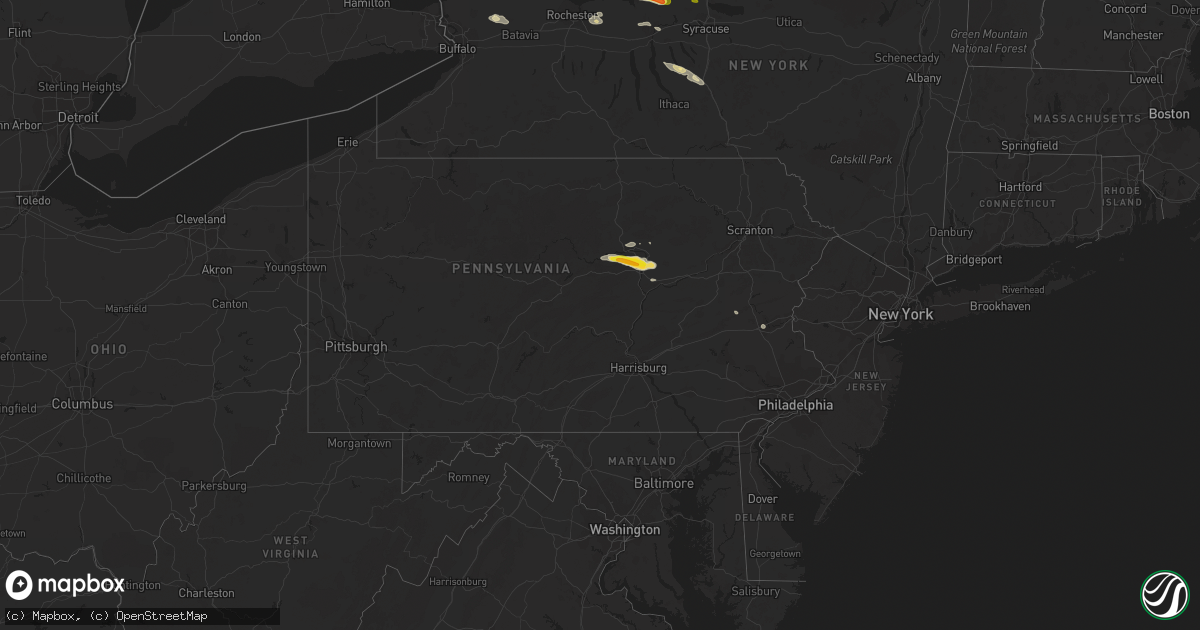
Hail Map in Pennsylvania on July 18, 2016
Get this storm
July 18 map
$229
one time, instant access
Download today. No call, no setup
Keep the $229
Bought the map and want the full workflow? Apply the entire $229 to a subscription within 7 days. None of it is wasted.
Every map, not just this one
This buys you this map. Subscription and you get every map we run, in the markets you choose from a few cities to whole states to nationwide. Plus real-time alerts the moment a storm fires.
Contact data
Name, contact info, occupancy, even credit band for addresses in the footprint. You go from where it hit to who to call.
Become the source they trust
Unlimited branding weather history reports on demand. You already have the documented answer ready for the property owner, and you are the one who showed up with it.
Property data and RoofTrace estimates
Pull up any address you have got, its value and the exact code rules for that jurisdiction, straight from One Click Code. Then RoofTrace estimates the squares, pitch, and roof value, priced the way you price.
Storm reports in Pennsylvania
Pennsylvania
| Date | Description |
|---|---|
| 07/18/20162:45 PM CDT | Multiple trees and tree limbs down... Including one large tree down along a main highway. Time estimated from radar. |
| 07/18/20162:43 PM CDT | Several large trees down or snapped at the base... Some falling onto cars and other property. Some large limbs torn off which pulled down wires especially near the high |
| 07/18/20162:41 PM CDT | Tree damage. Time estimated from radar. |
| 07/18/20162:28 PM CDT | Downed tree that hit a transformer and power lines. Time estimated from radar. |
| 07/18/20162:15 PM CDT | Tree and wires down on route 30 east of gap. |
| 07/18/20162:14 PM CDT | Trees down |
| 07/18/20162:09 PM CDT | Multiple trees down and a roof blown off a chicken house. |
| 07/18/20162:08 PM CDT | Trees down |
| 07/18/20162:08 PM CDT | Measured at 308 and at 309 pm. |
| 07/18/20162:07 PM CDT | Large tree limb down onto a car on 22nd street breaking the back window. |
| 07/18/20162:05 PM CDT | Trees down. |
| 07/18/20162:05 PM CDT | 400 pound a/c units were knocking off their mounting and onto their side. This occurred on the top of the emergency management building... 10 stories up. |
| 07/18/20162:05 PM CDT | Trees down. |
| 07/18/20162:02 PM CDT | Trees down onto wires. Time estimated from radar. |
| 07/18/20162:00 PM CDT | Wheat crop damaged. Time estimated from radar. |
| 07/18/20161:58 PM CDT | Large tree down onto wires on old topton road. Time estimated from radar. |
| 07/18/20161:58 PM CDT | Trees and wires down. Time estimated from radar. |
| 07/18/20161:15 PM CDT | Tree down half mile north of ephrata borough |
| 07/18/201612:41 PM CDT | Trees down on route 501 |
| 07/18/201612:36 PM CDT | Tree down |
| 07/18/201612:25 PM CDT | Large tree... 22 inches in diameter... Blown down. |
| 07/18/201612:15 PM CDT | Trees down all over the county according to 911 center. |
| 07/18/201612:15 PM CDT | Trees down |
| 07/18/201611:27 AM CDT | A local report indicates 1.75 inch wind near ALLENWOOD |
| 07/18/201611:20 AM CDT | Trees down in clinton township. |
| 07/18/201611:20 AM CDT | Trees down just south of i-80 on white deer pike between mile marker 206 and 207 |
All States Impacted by Hail Map on July 18, 2016
Cities Impacted by Hail Map on July 18, 2016
- Macedon, NY
- Fairport, NY
- Walworth, NY
- Weld, ME
- Temple, ME
- Dade City, FL
- Enders, NE
- Wauneta, NE
- Lewellen, NE
- Big Springs, NE
- Brule, NE
- Hammond, NY
- Heuvelton, NY
- Ogdensburg, NY
- Paxton, NE
- Sutherland, NE
- Dudley, GA
- Dublin, GA
- Dexter, GA
- Corinna, ME
- Exeter, ME
- Zephyrhills, FL
- Storm Lake, IA
- Alta, IA
- Beresford, SD
- Cut Bank, MT
- Saint Regis Falls, NY
- Alvo, NE
- Murdock, NE
- Elmwood, NE
- Houston, TX
- Orange, VA
- Petersburg, IL
- Greenview, IL
- Raymond, NE
- Geyser, MT
- Denton, MT
- Coffee Creek, MT
- Stanford, MT
- Manville, WY
- Greeley, CO
- Madison, ME
- Norridgewock, ME
- New Vineyard, ME
- Farmington, ME
- Phillips, ME
- Strong, ME
- Anson, ME
- Saint Johnsbury, VT
- Littleton, NH
- Clyde, NY
- Savannah, NY
- Steinhatchee, FL
- Fort Peck, MT
- Rapid City, SD
- Aurelia, IA
- Holyoke, CO
- Wray, CO
- Custer, SD
- Sedalia, CO
- Castle Rock, CO
- Ivesdale, IL
- Caratunk, ME
- Imperial, NE
- Framingham, MA
- Ashland, MA
- Sherborn, MA
- Natick, MA
- Webster, FL
- Grover, CO
- Vermontville, NY
- Gillette, WY
- Upton, WY
- Oshkosh, NE
- Monarch, MT
- Neihart, MT
- Hilger, MT
- Cascade, MT
- White Sulphur Springs, MT
- Winifred, MT
- Lewistown, MT
- Raynesford, MT
- Stockett, MT
- Great Falls, MT
- Belt, MT
- Hopkinton, MA
- Au Sable Forks, NY
- Bloomingdale, NY
- Saranac Lake, NY
- Paul Smiths, NY
- Ashwood, OR
- Aguilar, CO
- Whitefish, MT
- Wasta, SD
- Julesburg, CO
- Amherst, CO
- Lodgepole, NE
- Otis, CO
- Cook, NE
- Keystone, SD
- Hermosa, SD
- Zortman, MT
- Chappell, NE
- Corinth, VT
- East Corinth, VT
- Bradford, VT
- Piermont, NH
- Browning, MT
- Colebrook, NH
- Errol, NH
- Lincoln, NE
- Danville, PA
- Muncy, PA
- Watsontown, PA
- Turbotville, PA
- Jersey Shore, PA
- Montgomery, PA
- Williamsport, PA
- Allenwood, PA
- New Columbia, PA
- Oldtown, MD
- Cumberland, MD
- Sundance, WY
- Hinsdale, MT
- Montgomery Center, VT
- Martville, NY
- Sterling, NY
- Hannibal, NY
- Wolcott, NY
- Red Creek, NY
- Champion, NE
- Paoli, CO
- Haxtun, CO
- Bartow, GA
- Lisbon, NH
- Bath, NH
- Saint Albans, ME
- Prineville, OR
- Powell Butte, OR
- Newport, ME
- Stetson, ME
- Carmel, ME
- Bangor, ME
- Palmyra, ME
- Plymouth, ME
- Etna, ME
- Callaway, NE
- Keenesburg, CO
- Hudson, CO
- Horseshoe Beach, FL
- Weeping Water, NE
- Avoca, NE
- Nehawka, NE
- Evans, CO
- La Salle, CO
- Bingham, ME
- Pittsburg, NH
- North Anson, ME
- Levant, ME
- Skowhegan, ME
- Athens, ME
- Harmony, ME
- Milford, ME
- New Portland, ME
- Hudson, ME
- Solon, ME
- Hartland, ME
- Kenduskeag, ME
- Dexter, ME
- Greenbush, ME
- Beecher Falls, VT
- Norton, VT
- Orono, ME
- Bradley, ME
- Canaan, VT
- Andover, ME
- Rangeley, ME
- Corinth, ME
- Old Town, ME
- Kingfield, ME
- Edgemont, SD
- Lusk, WY
- Lance Creek, WY
- Edgefield, SC
- Johnston, SC
- Rye, CO
- Beulah, CO
- Trego, MT
- Brighton, CO
- Smithfield, ME
- Waterville, ME
- Oakland, ME
- Fairfield, ME
- Crofton, NE
- Yankton, SD
- Saint Helena, NE
- Island Pond, VT
- New Sharon, ME
- Guildhall, VT
- Lake Lure, NC
- Sac City, IA
- Lake View, IA
- Malta, MT
- Ault, CO
- Sidney, NE
- Gurley, NE
- Canaan, ME
- Pittsfield, ME
- Pine Ridge, SD
- Heathsville, VA
- Reedville, VA
- Newberry, SC
- Mount Pulaski, IL
- Lincoln, IL
- Minatare, NE
- Scottsbluff, NE
- Worton, MD
- Wrightsville, GA
- Nemo, SD
- Barnet, VT
- Astoria, IL
- Havana, IL
- Summerville, OR
- Elgin, OR
- Vienna, GA
- Byromville, GA
- Cantonment, FL
- Enosburg Falls, VT
- Richford, VT
- East Berkshire, VT
- Ashton, IA
- Spartanburg, SC
- Alton, IA
- Remsen, IA
- Tabor, SD
- Yoder, WY
- Camden Wyoming, DE
- Viola, DE
- Fairmount, IL
- Indianola, IL
- Sioux Center, IA
- Hawarden, IA
- Columbia, SC
- Middleport, NY
- Basom, NY
- Medina, NY
- Parishville, NY
- Mill Spring, NC
- Bayard, NE
- Piedmont, SD
- Sturgis, SD
- Black Hawk, SD
- Rembert, SC
- Carlton, GA
- Wadley, GA
- Ruckersville, VA
- Heart Butte, MT
- Bridgeport, IL
- Lawrenceville, IL
- Saint Francisville, IL
- Golconda, IL
- Garfield, GA
- Montoursville, PA
- West Topsham, VT
- Fairlee, VT
- Washington, VT
- Orford, NH
- Loganville, GA
- Dacula, GA
- Grayson, GA
- Lawrenceville, GA
- Quimby, IA
- Anderson, SC
- Iva, SC
- Bennett, CO
- Commerce, GA
- Ellsworth, NE
- Statesboro, GA
- Sumner, IL
- Deadwood, SD
- Mission Hill, SD
- Utica, SD
- Moorcroft, WY
- Argenta, IL
- Cisco, IL
- Sedgwick, CO
- Crook, CO
- Altavista, VA
- Lynch Station, VA
- Ontario, NY
- Hershey, NE
- Williamstown, VT
- Graniteville, VT
- Wentworth, NH
- Topsham, VT
- Barre, VT
- Perryville, MO
- Fort Benton, MT
- Primghar, IA
- Hartley, IA
- North Troy, VT
- Malone, NY
- Cleghorn, IA
- Bethlehem, NH
- Monroe, NH
- Saluda, SC
- Lead, SD
- Warwick, MD
- Earleville, MD
- Marcus, IA
- Caputa, SD
- Hughesville, PA
- Kenney, IL
- Jordan, MT
- Brewer, ME
- Lisco, NE
- Plattsburgh, NY
- Peru, NY
- Lewistown, IL
- Topeka, IL
- Easton, IL
- Phoenix, AZ
- Newark, DE
- Brussels, IL
- Batchtown, IL
- Nebraska City, NE
- Eddington, ME
- North Henderson, IL
- Ellisville, IL
- Avon, IL
- London Mills, IL
- Canton, IL
- Bartow, FL
- Atlanta, IL
- Lakeland, FL
- Clinton, IL
- Waynesville, IL
- Red Bud, IL
- Evansville, IL
- Broadus, MT
- Dalton, NE
- Le Mars, IA
- Arcola, IL
- Humboldt, IL
- Gayville, SD
- Bridgeport, NE
- Wheatland, WY
- Allentown, PA
- Whitehall, PA
- Newcastle, WY
- Kershaw, SC
- Bethune, SC
- Waverly, NE
- Homer, NY
- Cortland, NY
- Locke, NY
- Buchanan, GA
- Galva, IA
- Early, IA
- Schaller, IA
- Beattyville, KY
- Stanardsville, VA
- Trenton, SC
- Glendo, WY
- Old Fort, NC
- Fleming, CO
- Newport, VT
- Newport Center, VT
- Mullen, NE
- Hurt, VA
- Morrill, NE
- Aiken, SC
- Groveland, FL
- Tallapoosa, GA
- Akron, CO
- Monticello, IL
- Roxbury, ME
- Dover, DE
- Felton, DE
- Magnolia, DE
- Gothenburg, NE
- Auburndale, FL
- Winter Haven, FL
- Logan, OH
- Ogallala, NE
- Troy, MT
- Bridgeport, CT
- Stratford, CT
- Lake Placid, NY
- Chesapeake City, MD
- Middletown, DE
- Windsor, SC
- Wilmington, NY
- Rainbow Lake, NY
- Rock Valley, IA
- Doon, IA
- Pesotum, IL
- Sadorus, IL
- Dyke, VA
- Harrisburg, NE
- Terryville, CT
- Danville, VT
- Ovid, CO
- Nags Head, NC
- La Grande, OR
- Penfield, NY
- Cozad, NE
- Somerset, VA
- Mason City, IL
- Bloomsdale, MO
- Hopkins, SC
- Springfield, IL
- Tryon, NE
- Chestertown, MD
- Volin, SD
- West Columbia, SC
- Lemoyne, NE
- Dieterich, IL
- Wheeler, IL
- Moravia, NY
- Oakfield, NY
- Akron, NY
- Fairview, IL
- Brazil, IN
- Teutopolis, IL
- Montrose, IL
- Roggen, CO
- Chambers, AZ
- East Dublin, GA
- Mitchell, NE
- Antelope, OR
- Sullivan, IL
- Lovington, IL
- Linden, PA
- Hindsboro, IL
- Oakland, IL
- Punta Gorda, FL
- Sugar Hill, NH
- Franconia, NH
- Martinsville, IN
- Derby Line, VT
- Rock Port, MO
- Westboro, MO
- Tarkio, MO
- Colton, NY
- Hull, IA
- Stratton, ME
- Greenwood, NE
- Otoe, NE
- Davey, NE
- Murray, NE
- Manley, NE
- Union, NE
- Louisville, NE
- Zolfo Springs, FL
- Graniteville, SC
- Valier, MT
- Camargo, IL
- Villa Grove, IL
- Tuscola, IL
- Atwood, IL
- Hudson, SD
- Sorrento, FL
- Sidney, IL
- Tolono, IL
- Philo, IL
- Guilford, ME
- Groton, NY
- Scipio Center, NY
- Genoa, NY
- Brady, NE
- Arnold, NE
- Limestone, ME
- Coin, IA
- Shenandoah, IA
- Green Spring, WV
- San Jose, IL
- Saint David, IL
- Cuba, IL
- Burgess, VA
- North Port, FL
- Nashua, MT
- Bude, MS
- Gerlaw, IL
- Quincy, IN
- Monrovia, IN
- Paragon, IN
- Coatesville, IN
- Clayton, IN
- Mooresville, IN
- Fillmore, IN
- Greencastle, IN
- Brooklyn, IN
- Morgantown, IN
- Stilesville, IN
- Carbon, IN
- Mapleton, ME
- Thurman, IA
- Sidney, IA
- Smithfield, IL
- Newton, IL
- Arthur, NE
- Merino, CO
- Hiawassee, GA
- Box Elder, SD
- Wall, SD
- Millen, GA
- Torrington, WY
- New Port Richey, FL
- Franklin, NC
- Saybrook, IL
- Hartsville, SC
- Millville, NJ
- Kingsley, IA
- Port Byron, NY
- Sangerville, ME
- Abbot, ME
- Andreas, PA
- Newport, NE
- Cheshire, MA
- Foley, MO
- Winfield, MO
- Watson, IL
- Effingham, IL
- Bronson, IA
- Satsuma, FL
- Sutherland, IA
- Wolf Point, MT
- Milton, FL
- Hamburg, IA
- Clermont, FL
- Winter Garden, FL
- Fairfield, CT
- Sherman, IL
- Williamsville, IL
- Lakeside, NE
- Biddle, MT
- Boyes, MT
- Cato, NY
- Pennellville, NY
- Moran, MI
- Saint Ignace, MI
- Mackinac Island, MI
- Pointe Aux Pins, MI
- Morgan, VT
- Whitefield, NH
- Clinton, MT
- Florence, MT
- Missoula, MT


