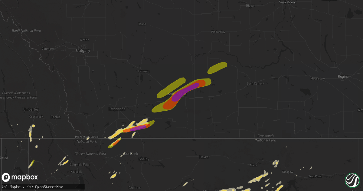
Hail Map on July 18, 2016
Get this storm
July 18 map
$229
one time, instant access
Download today. No call, no setup
Keep the $229
Bought the map and want the full workflow? Apply the entire $229 to a subscription within 7 days. None of it is wasted.
Every map, not just this one
This buys you this map. Subscription and you get every map we run, in the markets you choose from a few cities to whole states to nationwide. Plus real-time alerts the moment a storm fires.
Contact data
Name, contact info, occupancy, even credit band for addresses in the footprint. You go from where it hit to who to call.
Become the source they trust
Unlimited branding weather history reports on demand. You already have the documented answer ready for the property owner, and you are the one who showed up with it.
Property data and RoofTrace estimates
Pull up any address you have got, its value and the exact code rules for that jurisdiction, straight from One Click Code. Then RoofTrace estimates the squares, pitch, and roof value, priced the way you price.
States Impacted by Hail Map on July 18, 2016
Storm reports
Vermont
| Date | Description |
|---|---|
| 07/18/20166:15 PM CDT | A local report indicates 1.00 inch wind near 1 NNE EAST BERKSHIRE |
| 07/18/20166:15 PM CDT | 2 inch diameter limbs down |
| 07/18/20165:30 PM CDT | Reported by public. |
| 07/18/20165:30 PM CDT | Trees and power lines down |
| 07/18/20165:18 PM CDT | Public reports trees down. |
| 07/18/20162:12 PM CDT | Golf ball size hail |
| 07/18/20162:01 PM CDT | Tree down on interstate 91 northbound |
| 07/18/20161:54 PM CDT | Tree down |
| 07/18/20161:24 PM CDT | Trees down on northeast side of town |
| 07/18/20161:18 PM CDT | Large tree branches downed on police cruisers at the police station. Minor vehicle damage and no injuries. Time estimated. |
| 07/18/201612:38 PM CDT | Large tree branches downed on police cruisers at the police station. Minor vehicle damage and no injuries. Time estimated. |
| 07/18/201612:36 PM CDT | Trees on a house in hidden pines development... Power lines across jericho rd in richmond |
| 07/18/201612:21 PM CDT | Large tree branches downed on police cruisers at the police station. Minor vehicle damage and no injuries. Time estimated. |
| 07/18/201611:30 AM CDT | Tree down |
| 07/18/201611:30 AM CDT | Tree downed |
| 07/18/201611:25 AM CDT | Large hemlock downed |
| 07/18/201611:15 AM CDT | A local report indicates 1.00 inch wind near 3 W JAY |
| 07/18/201611:11 AM CDT | Trees down |
| 07/18/201610:42 AM CDT | Large maple tree uprooted near abbey restaurant rt 105 |
| 07/18/201610:42 AM CDT | Large maple tree uprooted near abbey restaurant rt 105 |
Arizona
| Date | Description |
|---|---|
| 07/17/20168:14 PM CDT | Medium sized tree uprooted onto road... Another tree branches broken from wind gusts. |
| 07/17/20168:09 PM CDT | Asos station phoenix sky harbor intl arpt /phx/. |
| 07/17/20168:08 PM CDT | 2 medium sized trees blown over into the road. |
Oregon
| Date | Description |
|---|---|
| 07/17/20167:45 PM CDT | A local report indicates 1.25 inch wind near SUMMERVILLE |
Colorado
| Date | Description |
|---|---|
| 07/18/20166:05 PM CDT | A local report indicates 1.75 inch wind near 2 NNE GREELEY |
| 07/18/20166:05 PM CDT | Large tree branches down along 10th street. Tree down on numerous cars at 10th and 33rd intersection. |
| 07/18/20166:00 PM CDT | A local report indicates 1.25 inch wind near 1 N GREELEY |
| 07/17/201610:33 PM CDT | A local report indicates 67 MPH wind near HOLYOKE |
| 07/17/201610:32 PM CDT | A local report indicates 64 MPH wind near 8 S HOLYOKE |
| 07/17/20169:10 PM CDT | A local report indicates 59 MPH wind near AKRON |
South Carolina
| Date | Description |
|---|---|
| 07/18/20166:30 PM CDT | Public reported quarter sized hail at columbia international university. . |
| 07/18/20165:45 PM CDT | Newberry electric cooperative reported large tree limbs downed power lines on airport rd. Near newberry country club. |
| 07/18/20165:43 PM CDT | Trees down bouknight rd . |
| 07/18/20165:35 PM CDT | Trees and limbs on roadway hwy 178. |
| 07/18/20165:25 PM CDT | Trees down in cedar creek development. |
| 07/18/20165:21 PM CDT | Trees reported down vaucluse and old vaucluse rd. |
| 07/18/20165:21 PM CDT | Tree down dry branch rd and whiskey rd. |
| 07/18/20165:13 PM CDT | Trees down martin hollow and toolbeck roads. . |
| 07/18/20165:10 PM CDT | Trees down shaws fork rd and new holland rd. |
Delaware
| Date | Description |
|---|---|
| 07/18/20165:45 PM CDT | 56 knot gust. |
| 07/18/20164:30 PM CDT | A few trees down. Times estimated from radar. |
| 07/18/20163:30 PM CDT | Several large tree limbs snapped off. |
| 07/18/20163:28 PM CDT | Large tree completely toppled over and onto a driveway and road. This occurred in the richardson park area. Time estimated based on radar. |
| 07/18/20163:25 PM CDT | Large tree down. Time estimated from radar. |
| 07/18/20163:20 PM CDT | Some trees and power lines down. Time estimated from radar. |
| 07/18/20163:10 PM CDT | Tree limbs down |
Illinois
| Date | Description |
|---|---|
| 07/18/201611:00 AM CDT | Trees and power lines down |
| 07/18/201610:40 AM CDT | Large tree limbs blown down and portions of cornfields bent or flattened. |
| 07/18/201610:39 AM CDT | Tree and power lines down |
Florida
| Date | Description |
|---|---|
| 07/18/20163:52 PM CDT | Media sent photo of roof damage to a private school. Time estimated by radar. |
| 07/18/20163:25 PM CDT | Asos measured 55 kts from ese |
| 07/18/20163:25 PM CDT | Asos at orlando international |
| 07/18/20161:27 PM CDT | 16-18 inch oak tree snapped and fell on home. Time estimated from radar. |
| 07/18/20161:22 PM CDT | Mobile home roof damage likely from straight line winds. Time estimated from radar. |
| 07/18/201612:05 PM CDT | 3 trees down on miller landing road |
New Hampshire
| Date | Description |
|---|---|
| 07/18/20165:37 PM CDT | Multiple reports of downed trees. |
| 07/18/20162:42 PM CDT | Trees and wires down on 107a and jewell street |
| 07/18/20162:30 PM CDT | Tree branches down on silver street. |
| 07/18/20162:30 PM CDT | Trees and wires down at on-ramp of exit 5... I-93 |
| 07/18/20162:23 PM CDT | Trees and wires down on route 153 and brooks drive |
| 07/18/20162:20 PM CDT | 3 trees down on independence drive in merrimack. |
| 07/18/20162:20 PM CDT | Large trees down on route 101 |
| 07/18/20162:18 PM CDT | Survey team confirms microburst. 80-90mph max winds. 2 miles wide. 1.6 miles long. Numerous structures damaged and hundreds of trees snapped or uprooted. |
| 07/18/20162:14 PM CDT | Trees down on somerville... Clay... Jewett... And amherst streets. |
| 07/18/20162:10 PM CDT | Numerous trees down around silver lake in madison. |
| 07/18/20162:10 PM CDT | Large tree snapped on indian trail in tamworth. |
| 07/18/20161:49 PM CDT | Trees down throughout town. |
| 07/18/201612:19 PM CDT | Tree down on power lines |
| 07/18/201612:15 PM CDT | A local report indicates 1.75 inch wind near 3 SW COLEBROOK |
| 07/18/201611:42 AM CDT | Nws storm survey confirms ef0 tornado in pittsburg nh. Hundreds of trees uprooted with dozens snapped. Downed trees took wires down in multiple locations. This damage w |
| 07/18/201611:39 AM CDT | Trees down on route 3 in pittsburg. |
| 07/18/201611:38 AM CDT | A local report indicates 1.00 inch wind near CLARKSVILLE |
| 07/17/20167:03 PM CDT | Trees and power lines down across the town. |
Alabama
| Date | Description |
|---|---|
| 07/17/20167:40 PM CDT | Several trees uprooted near 55 ceremony road. Winds estimated 40-50 mph. |
| 07/17/20167:40 PM CDT | Tree down on house on 34 overlook drive. Winds estimated 40-50 mph. |
North Carolina
| Date | Description |
|---|---|
| 07/18/20162:25 PM CDT | Several trees blown down between lake lure and the rutherford/polk county line. Time estimated from radar data. |
Maine
| Date | Description |
|---|---|
| 07/18/20166:15 PM CDT | 35 pennell st. Tree down |
| 07/18/20165:42 PM CDT | A local report indicates 1.00 inch wind near TEMPLE |
| 07/18/20165:23 PM CDT | A local report indicates 1.00 inch wind near 4 N LIMESTONE |
| 07/18/20165:23 PM CDT | A local report indicates 1.00 inch wind near TEMPLE |
| 07/18/20165:20 PM CDT | Report from social media. Time estimated from radar. |
| 07/18/20164:50 PM CDT | From social media. Time estimated via radar. |
| 07/18/20164:45 PM CDT | Nws employee reports intermittent funnel touchdowns. |
| 07/18/20164:40 PM CDT | Ef-0 tornado damage confirmed. 100-yard damage path confirmed through woods with many trees down. Other brief touchdowns may have been possible to east... But dense for |
| 07/18/20164:35 PM CDT | Report of a large branch down at us 1 and route 189. |
| 07/18/20164:08 PM CDT | Tree down on truck on olive street. From social media via wabi. Time estimated from radar. |
| 07/18/20164:07 PM CDT | Fire department reports 3 trees down in veazie. |
| 07/18/20164:05 PM CDT | Power lines down at wilson and main. Pictures posted to social media. Time estimated from radar. |
| 07/18/20163:55 PM CDT | Many branches down in crawford. Time estimated from radar. |
| 07/18/20163:45 PM CDT | Carmel post office reports multiple trees down between carmel and hermon. |
| 07/18/20163:44 PM CDT | Police report multiple trees down across etna. |
| 07/18/20163:15 PM CDT | Many trees down around town. Time estimated from radar. |
| 07/18/20163:12 PM CDT | Fire department reports tree down on state street. |
| 07/18/20163:12 PM CDT | Two small tress on roads. Time estimated by radar. |
| 07/18/20163:05 PM CDT | Tree down in veazie. Reported from penobscot dispatch. Time estimated from radar. |
| 07/18/20163:04 PM CDT | Quarter-size hail on ten road. Report relayed via social media. Time estimated from radar. |
| 07/18/20162:58 PM CDT | Time estimated from radar. |
| 07/18/20162:58 PM CDT | Time estimated from radar. |
| 07/18/20162:57 PM CDT | Approx. 30 trees down on a camp on the east side of etna lake. Time estimated by radar. |
| 07/18/20162:55 PM CDT | Report from social media. Time estimated from radar. |
| 07/18/20162:50 PM CDT | Two trees down on talmadge road. |
| 07/18/20162:50 PM CDT | At least 15-20 trees down between topsfield and brookton. Time estimated from radar. |
| 07/18/20162:47 PM CDT | Emera reports trees and lines down near pushaw lake. |
| 07/18/20162:47 PM CDT | Trees down at pushaw lake campground. Two campers totalled and a sign with 2-inch metal supports was bent backward. |
| 07/18/20162:45 PM CDT | Milford fire department reports power lines down on greenfield road. Time estimated from radar. |
| 07/18/20162:40 PM CDT | Mdot reports 2 trees down on route 6 between topsfield and kossuth twp. Time estimated from radar. |
| 07/18/20162:40 PM CDT | Multiple trees down on route 7 going into corinna. Time estimated from radar. |
| 07/18/20162:40 PM CDT | Town office reports trees down on kenduskeag-levant road. |
| 07/18/20162:38 PM CDT | Town office reports tree down on avenue road. |
| 07/18/20162:25 PM CDT | Trees down on road from exeter to stetson. Report from wabi social media. Time estimated from radar. |
| 07/18/20162:25 PM CDT | Resident reports a gazebo was destroyed and several heavy adirondack chairs were tossed off the deck. |
| 07/18/20162:25 PM CDT | Emera reports lines down in exeter. |
| 07/18/20162:23 PM CDT | 26 winter st tree on house |
| 07/18/20162:20 PM CDT | Trees down on road from exeter to stetson. Report from wabi social media. Time estimated from radar. |
| 07/18/20162:20 PM CDT | Two trees down... Incl a 60-foot maple. |
| 07/18/20162:18 PM CDT | Trees down on wires. Report from social media. Time estimated from radar. |
| 07/18/20162:15 PM CDT | Poles reported down on water street. Time estimated from radar. |
| 07/18/20162:15 PM CDT | Tree down near west front market |
| 07/18/20162:11 PM CDT | Mdot reports 2 trees down on route 155 south of lincoln. |
| 07/18/20162:11 PM CDT | Mdot reports tree down on us 2 in lincoln. Time estimated from radar. |
| 07/18/20162:05 PM CDT | A local report indicates 1.00 inch wind near ANSON |
| 07/18/20161:51 PM CDT | Central maine power reports numerous trees down along route 150. |
| 07/18/20161:45 PM CDT | Trees down |
| 07/18/20161:45 PM CDT | A local report indicates 1.50 inch wind near 1 WNW HARMONY |
| 07/18/20161:45 PM CDT | Many trees snapped and uprooted |
| 07/18/20161:45 PM CDT | Tops of many trees snapped off. |
| 07/18/20161:35 PM CDT | A dozen trees reported down in dover-foxcroft. |
| 07/18/20161:35 PM CDT | Trees down on route 7 just south of dover-foxcroft. |
| 07/18/20161:35 PM CDT | County ema reports dozens of trees down in dover-foxcroft and east sangerville. |
| 07/18/20161:28 PM CDT | A few trees down in sangerville. |
| 07/18/20161:25 PM CDT | Multiple trees down in guilford. |
| 07/18/20161:20 PM CDT | Trees down . |
| 07/18/20161:20 PM CDT | Tree down on a house in abbot. |
| 07/18/20161:05 PM CDT | A local report indicates 1.75 inch wind near KINGFIELD |
| 07/18/20161:00 PM CDT | Numerous trees and lines down on route 16. Road blocked for two hours. Hail damage to vehicle. |
| 07/18/201612:27 PM CDT | Many trees down... Roads blocked... Many power outages. |
| 07/17/20168:05 PM CDT | Trees down. |
| 07/17/20168:05 PM CDT | Mdot reports one tree down on bridge street. |
| 07/17/20168:00 PM CDT | Trees down. |
| 07/17/20167:46 PM CDT | Trees down. |
| 07/17/20167:30 PM CDT | Trees down. |
| 07/17/20167:15 PM CDT | Oak tree and several limbs downed by strong winds. Time estimated from radar |
Georgia
| Date | Description |
|---|---|
| 07/18/20166:55 PM CDT | Numerous trees and powerlines downed as a result of a downburst in columbus. Heaviest damages occurred in the east highlands and dinglewood portions of the city. Numero |
| 07/18/20166:54 PM CDT | Several trees downed outside wrbl tv studio on 13th ave. One sign blown down and several glass bus stops blown out. |
| 07/18/20165:45 PM CDT | 2 trees down in the northwood trail subdivision just north of dudley |
| 07/18/20165:42 PM CDT | One tree reported downed in dudley... Time estimated from radar |
| 07/18/20164:42 PM CDT | Several trees reported downed on lovett scott road. Time estimated from radar |
| 07/18/20163:46 PM CDT | Some trees down on hwy 81 north near bold springs. Time estimated from radar |
Montana
| Date | Description |
|---|---|
| 07/18/20166:30 PM CDT | Three vehicles with hail damage dents. Broken windshield on one of the vehicles. Garden plants defoliated. |
| 07/18/20165:46 PM CDT | . |
| 07/18/20168:37 AM CDT | A local report indicates 62 MPH wind near 6 E GEYSER |
| 07/18/20163:28 AM CDT | Mesonet station navajo 1n /mtred/. |
| 07/18/20161:53 AM CDT | Mesonet station oswego 4n /e0034/. |
| 07/18/20161:00 AM CDT | Took brand new barbeque off of cement patio |
| 07/18/201612:51 AM CDT | Asos station glasgow airport |
| 07/18/201612:44 AM CDT | Mesonet station king coulee /kigm8/. |
| 07/18/201612:40 AM CDT | Pea sized hail reported as well. |
| 07/17/201611:32 PM CDT | Mesonet station zortman 1w /aldm8/. |
| 07/17/201610:07 PM CDT | Delayed report. Spotter reported several trees down around town. |
| 07/17/201610:02 PM CDT | 58 mph wind gust when the storm went through. |
| 07/17/201610:00 PM CDT | Mostly pea size hail but they did find a few quarter size hail stones. |
| 07/17/20169:58 PM CDT | 60 mph wind gust with the storm as it moved through. |
| 07/17/20169:30 PM CDT | 66 mph wind gust at the dot sensor just east of denton. |
| 07/17/20169:28 PM CDT | Delayed report. |
| 07/17/20169:24 PM CDT | Hail of at least quarter size estimated...possibly larger. Time estimated based on radar. |
| 07/17/20169:15 PM CDT | Correction to previous report for time. Spotter reported several trees down around town. |
| 07/17/20169:06 PM CDT | A local report indicates 1.50 inch wind near 1 S COFFEE CREEK |
| 07/17/20169:00 PM CDT | A local report indicates 1.25 inch wind near 5 N STANFORD |
| 07/17/20168:50 PM CDT | A local report indicates 1.50 inch wind near 4 N STANFORD |
| 07/17/20168:37 PM CDT | A local report indicates 62 MPH wind near 6 E GEYSER |
| 07/17/20168:30 PM CDT | Delayed report. Mainly pea-size with a few quarter-size hailstones. |
| 07/17/20167:30 PM CDT | Delayed report of golf ball-size hail. |
| 07/17/20167:25 PM CDT | A local report indicates 1.00 inch wind near 19 ESE BROADUS |
| 07/17/20167:20 PM CDT | A local report indicates 1.00 inch wind near 2 NNE BOYES |
Nebraska
| Date | Description |
|---|---|
| 07/18/20161:32 AM CDT | Small branches down. Personal wind sensor on top of a grain elevator suggested 60+ mph but cannot confirm winds this strong closer to surface. |
| 07/18/201612:14 AM CDT | Home weather station reported wind gust to 72 mph. Wind blew several tree branches down. |
| 07/17/20169:00 PM CDT | Eight power poles downed. Tin peeled off of an out building. Windmill damaged. Dime to nickel size hail reported. |
Tennessee
| Date | Description |
|---|---|
| 07/18/20162:55 PM CDT | Trees down / 4 utility poles down industrial blvd and bennet dr. Tree on car 5th and flower st. Tree down on east madison st. |
South Dakota
| Date | Description |
|---|---|
| 07/18/20166:43 PM CDT | A local report indicates 60 MPH wind near 2 W HAYWARD |
| 07/18/20166:39 PM CDT | A local report indicates 3.00 inch wind near 1 SW BLACK HAWK |
| 07/18/20166:34 PM CDT | A local report indicates 62 MPH wind near 6 NE PRINGLE |
| 07/18/20166:23 PM CDT | A local report indicates 2.50 inch wind near BLACK HAWK |
| 07/18/20166:15 PM CDT | A local report indicates 2.00 inch wind near 2 NE BLACK HAWK |
| 07/18/20166:14 PM CDT | Lasted 5 to 10 minutes |
| 07/18/20165:45 PM CDT | A local report indicates 2.00 inch wind near 1 NNW PIEDMONT |
| 07/18/20165:42 PM CDT | A local report indicates 60 MPH wind near 15 NW EDGEMONT |
| 07/18/20165:23 PM CDT | A local report indicates 1.50 inch wind near 1 NNW PIEDMONT |
| 07/18/20165:00 PM CDT | A local report indicates 2.25 inch wind near 1 NNW PIEDMONT |
| 07/18/20164:53 PM CDT | A local report indicates 1.75 inch wind near 1 NNW PIEDMONT |
| 07/18/20164:46 PM CDT | A local report indicates 1.00 inch wind near 1 NNW PIEDMONT |
| 07/18/20163:24 PM CDT | Penny to quarter size hail |
| 07/17/20168:50 PM CDT | Time estimated from radar |
| 07/17/20168:46 PM CDT | A local report indicates 75 MPH wind near 8 S PLAINVIEW |
| 07/17/20168:09 PM CDT | A local report indicates 75 MPH wind near 3 E WICKSVILLE |
| 07/17/20168:05 PM CDT | A local report indicates 65 MPH wind near 8 S PLAINVIEW |
| 07/17/20167:41 PM CDT | A local report indicates 60 MPH wind near 9 N BOX ELDER |
| 07/17/20167:17 PM CDT | A local report indicates 1.50 inch wind near 1 N DOWNTOWN RAPID CITY |
| 07/17/20167:16 PM CDT | A local report indicates 1.00 inch wind near 1 NE DOWNTOWN RAPID CIT |
| 07/17/20167:13 PM CDT | A local report indicates 1.50 inch wind near 1 E DOWNTOWN RAPID CITY |
| 07/17/20167:13 PM CDT | Multiple large trees snapped in half. Picture submitted via facebook. |
| 07/17/20167:11 PM CDT | A local report indicates 60 MPH wind near 4 N DOWNTOWN RAPID CITY |
| 07/17/20167:06 PM CDT | A local report indicates 60 MPH wind near 4 SW HERMOSA |
| 07/17/20167:00 PM CDT | Estimated 60 to 70 mph wind gust. 1 - 2 tree limbs down. |
Wyoming
| Date | Description |
|---|---|
| 07/18/20165:03 PM CDT | A local report indicates 60 MPH wind near 11 SSW REDBIRD |
| 07/17/20167:15 PM CDT | Mostly 1/2 hail |
| 07/17/20167:08 PM CDT | 15 minutes of heavy rain. Hail ranged from pea size to quarter size. |
| 07/17/20167:08 PM CDT | 15 minutes of heavy rain. Hail ranged from pea size to quarter size. |
Virginia
| Date | Description |
|---|---|
| 07/18/20164:40 PM CDT | Tree down on power lines and power pole snapped in the 18000 block of monrovia road. |
| 07/18/20164:15 PM CDT | Halifax county 911 center reports one tree down in the 10000 block of chatham road. |
| 07/18/20163:50 PM CDT | 5-foot in diameter tree uprooted and roof of barn partially blown off on old durrette road. |
| 07/18/20163:48 PM CDT | A local report indicates 1.00 inch wind near 1 SE STANARDSVILLE |
| 07/18/20163:48 PM CDT | Multiple trees down near ice house rd and holmes run |
| 07/18/20163:48 PM CDT | Half dollar size hail |
| 07/18/20163:48 PM CDT | Numerous trees down in stanardsville |
| 07/18/20163:30 PM CDT | Tree down near the intersection of buckman road and richmond highway. |
| 07/18/20163:21 PM CDT | Tree limb down blocking roadway at intersection of north fort myer drive and arlington boulevard. |
| 07/18/20163:19 PM CDT | Unfinished wall of house under construction intersection of n george mason dr and washington blvd blown down |
| 07/18/20163:17 PM CDT | Wires down in the 2300 block of north wakefield street. |
| 07/18/20163:13 PM CDT | Multiple trees down near the intersection of garrisonville road and onville road. |
| 07/18/20163:12 PM CDT | Tree down near chatham rd at meadville rd. Time radar estimated. |
| 07/18/20163:11 PM CDT | Branches and wires down near the intersection of georgetown pike and georgtown court. |
| 07/18/20163:06 PM CDT | *** 1 inj *** tree down on car in the 12000 block of old yates ford road. |
| 07/18/20162:38 PM CDT | Tree down near the intersection of beach road and old mill estates lane. |
| 07/18/20162:34 PM CDT | Large branches down and siding blown off house near galloway drive southeast. |
| 07/18/20162:31 PM CDT | Numerous trees and wires down in the vicinity of highview court. |
| 07/18/20162:26 PM CDT | 6-inch in diameter tree limb down near the intersection of white shop road and james monroe highway. |
| 07/18/20162:21 PM CDT | Numerous trees and wires down near the intersection of eggbornsville road and riverside farm lane. |
| 07/18/20162:18 PM CDT | Tree down in roadway on castle mountain road. |
| 07/18/20162:17 PM CDT | Tree down in roadway in 490 block of ben venue road. |
| 07/18/20161:51 PM CDT | Tree down on powerlines 7100 block browntown rd |
| 07/18/20161:50 PM CDT | Trees down on us rt 340 between skyline vista and snake dr |
| 07/18/20161:50 PM CDT | Tree down on 287 near the maryland state line. |
| 07/18/20161:48 PM CDT | Trees down on powerlines 300 blk s rocky ln |
| 07/18/20161:47 PM CDT | Trees down on roadway in 2900 blk bentonville rd |
| 07/18/20161:46 PM CDT | Tree down near the intersection of arnold lane and sawmill lane. |
| 07/18/20161:32 PM CDT | 2 trees down. Power pole down. |
Massachusetts
| Date | Description |
|---|---|
| 07/18/20164:07 PM CDT | Large limbs down on wompatuck road. |
| 07/18/20164:00 PM CDT | Small boat flipped over just offshore near river street in weymouth. |
| 07/18/20163:55 PM CDT | Numerous trees and wires down in north part of hingham including...downers ave.... Bulow rd.... Planders field lane... Jarvis ave.... Lincoln st.... Miles rd. Whiton dr |
| 07/18/20163:52 PM CDT | Tree down blocking la grange street. |
| 07/18/20163:50 PM CDT | Multiple trees and wires down on lovell st. Tree and wires down on wessagusset rd. Tree down on squanto rd. Limbs down on river st. Past the beach. A boat broke free of |
| 07/18/20163:47 PM CDT | Extensive number of trees downed. |
| 07/18/20163:45 PM CDT | Tree into house on warner street. |
| 07/18/20163:42 PM CDT | Utility pole down on washington street at new washington. |
| 07/18/20163:40 PM CDT | Tree down on bicknell and harbot streets. |
| 07/18/20163:40 PM CDT | 2 large trees down. |
| 07/18/20163:39 PM CDT | Tree down on lrona road. |
| 07/18/20163:39 PM CDT | Tree down across road on tower avenue. |
| 07/18/20163:39 PM CDT | Power lines down on weld street at garnet road. Power lines down on beech street. |
| 07/18/20163:30 PM CDT | Tree and wires down on hoover street |
| 07/18/20163:27 PM CDT | Tree down on route 16 by wellesley college. Tree down and numerous branches of varying size down on brooke street. Large branch down and blocking laten road. |
| 07/18/20163:10 PM CDT | Tree down on route 213 |
| 07/18/20163:03 PM CDT | Trees down on union street north of rt. 9. Also a two-foot diameter tree down on a home. |
| 07/18/20163:00 PM CDT | Tree on building on north avenue. |
| 07/18/20162:42 PM CDT | Tree down in road blocking woodman avenue. Tree on house on woodman avenue. Wires in road on carol avenue. |
| 07/18/20162:25 PM CDT | Very large tree on traffic light at groveland and water streets. |
| 07/18/20162:00 PM CDT | Tree down on east ringe road. 2 large branches down on penacook drive at sunset lake. |
| 07/18/20161:48 PM CDT | Tree down on wires on south athol road. |
| 07/18/20161:48 PM CDT | Tree and wires down on leonard street and also tree into house. |
| 07/18/20161:40 PM CDT | Tree and wires down on royalston road |
| 07/18/20161:32 PM CDT | Tree and wires down on prospect avenue. |
| 07/18/20161:32 PM CDT | Tree and wires down on north holden at orange road. Multiple trees down on flower hill road. |
| 07/18/20161:25 PM CDT | Wires down on northfield road. Tree on house on south street. |
| 07/18/20161:25 PM CDT | Numerous power lines down throughout town |
| 07/18/20161:25 PM CDT | Tree on a house on mill street. |
| 07/18/20161:22 PM CDT | Large tree branch down on wires on congress and orchard streets. |
| 07/18/20161:20 PM CDT | Utility pole and wires down on shelburne falls road. |
| 07/18/20161:20 PM CDT | Wires down on river road. |
| 07/18/20161:16 PM CDT | Large tree branch down on wires on congress street. |
| 07/18/20161:11 PM CDT | Tree down on wires on bardswell ferry road |
| 07/18/20161:10 PM CDT | Tree down just east of goulds sugar house on route 2. |
| 07/18/20161:09 PM CDT | Tree and wires down on apple valley road |
| 07/18/20161:05 PM CDT | Trees and wires down on east hawley road. |
| 07/18/201612:50 PM CDT | Tree down blocking rd at 1301 main rd. |
| 07/18/201612:45 PM CDT | Trees and wires down at 15 east st. |
| 07/18/201612:43 PM CDT | Numerous trees and wires down across the area. |
District of Columbia
| Date | Description |
|---|---|
| 07/18/20163:24 PM CDT | Tree down in the 700 block of barry place northwest. |
| 07/18/20163:19 PM CDT | Large tree uprooted in the 3600 block of everett street northwest. |
| 07/18/20163:12 PM CDT | Tree down in the 7700 block of 13th street northwest. |
Connecticut
| Date | Description |
|---|---|
| 07/18/20164:02 PM CDT | Trees down off ella grasso blvd |
| 07/18/20163:52 PM CDT | Numerous large tree limbs down resulting in power outages |
| 07/18/20163:37 PM CDT | Large tree struck by lightning and brought down with branch on power lines blocking road on main street |
| 07/18/20162:55 PM CDT | Trees and wires down on broad street in old wethersfield section. |
| 07/18/20162:30 PM CDT | Tree down on new britain avenue. |
| 07/18/20162:30 PM CDT | Tree down on woodland street. |
| 07/18/20162:23 PM CDT | Trees down on on allen street and riverside ave. |
New York
| Date | Description |
|---|---|
| 07/18/20165:04 PM CDT | Marine thunderstorm wind gust of 50 knots |
| 07/18/20164:40 PM CDT | Marine thunderstorm wind gust of 50 knots |
| 07/18/20164:22 PM CDT | Tree down at north jerusalem road and putnam avenue |
| 07/18/20164:20 PM CDT | Damage to barn and house roofs... Telephone pole snapped and landed on truck |
| 07/18/20164:10 PM CDT | Tree down on van. Nobody hurt. Relayed by cnycentral |
| 07/18/20164:04 PM CDT | Tree down on 47th street |
| 07/18/20163:48 PM CDT | Marine thunderstorm wind of 59 knots |
| 07/18/20163:45 PM CDT | Trees down at 2 locations in moravia |
| 07/18/20162:50 PM CDT | Trees down on wires at intersection of wood street and goldfinch lane |
| 07/18/20161:30 PM CDT | A local report indicates 1.25 inch wind near VERMONTVILLE |
| 07/18/201612:50 PM CDT | Five tree limbs of six inches in diameter snapped off. One large limb blocking rte 14 south. |
| 07/18/201612:46 PM CDT | Pole down across road |
| 07/18/201612:25 PM CDT | Tree brought down wires. Roadway blocked |
| 07/18/201612:25 PM CDT | Trees and wires down at 517 county rte 49. |
| 07/18/201612:25 PM CDT | Several trees downed... Trees also down in cleveland |
| 07/18/201612:22 PM CDT | Downed power lines on route 43. |
| 07/18/201612:20 PM CDT | Powerlines down 1/2 mile west of route 4 on route 32. |
| 07/18/201612:17 PM CDT | Trees and wires down at 50 mountain rd... Harrison ave... And 30 reservoir rd. |
| 07/18/201612:15 PM CDT | Powerlines and large tree limbs down on richards st near cedar dam. |
| 07/18/201611:53 AM CDT | Nickel and quarter sized hail |
| 07/18/201611:51 AM CDT | Tree down on rt 22 |
| 07/18/201611:36 AM CDT | Tree down at intersection of route 402 and route 405. |
| 07/18/201611:35 AM CDT | A local report indicates 1.00 inch wind near HANNIBAL |
| 07/18/201611:24 AM CDT | Wires down. |
| 07/18/201611:21 AM CDT | Trees down across road |
| 07/18/201611:15 AM CDT | Tree blown down. |
| 07/18/201610:39 AM CDT | Tree down on us rt 11 |
| 07/18/201610:32 AM CDT | Tree down on morgan rd |
| 07/18/201610:23 AM CDT | Trees down on wires |
Maryland
| Date | Description |
|---|---|
| 07/18/20165:45 PM CDT | Tree across road. |
| 07/18/20164:52 PM CDT | Several trees down near buzzs marina |
| 07/18/20164:26 PM CDT | Wires down on sotterley road near forest landing road. |
| 07/18/20164:18 PM CDT | Numerous trees and wires down in towson. |
| 07/18/20164:15 PM CDT | Tree down near the intersection of loveville road and kavanagh road. |
| 07/18/20164:10 PM CDT | Tree down across roadway on gray inn court. |
| 07/18/20164:00 PM CDT | Trees down. Time estimated from radar. |
| 07/18/20164:00 PM CDT | *** 1 inj *** large tree limb on house in 15000 block of woodville road. |
| 07/18/20163:55 PM CDT | Large tree limbs snapped near the intersection of candy hill road and croom road. |
| 07/18/20163:37 PM CDT | Multiple trees down near the intersection of indian head highway and laurel drive. |
| 07/18/20163:18 PM CDT | Tree down on wires in the 5200 block of duvall drive. |
| 07/18/20163:16 PM CDT | Tree down near the intersection of wisconsin avenue and woodmont avenue. |
| 07/18/20163:15 PM CDT | Tree down near the intersection river road and westbard avenue. |
| 07/18/20163:15 PM CDT | Tree down near river rd and goldsboro rd partially blocking road |
| 07/18/20163:14 PM CDT | Tree down near the intersection of goldsboro road and river road. |
| 07/18/20163:10 PM CDT | Tree down near the intersection of river road and bradley boulevard. |
| 07/18/20163:06 PM CDT | *** 2 inj *** multiple trees and wires down. Two individuals struck by falling tree. |
| 07/18/20163:06 PM CDT | Numerous trees and wires down in towson. |
| 07/18/20163:05 PM CDT | One 3-foot diameter tree down on power lines...additional 2-foot diameter tree down. |
| 07/18/20162:57 PM CDT | Telephone pole snapped in half by high thunderstorm winds near the intersection of west joppa road and abell ridge circle. |
| 07/18/201612:34 PM CDT | Tree down in roadway in 14000 block of ruby road southeast. |
| 07/18/201612:27 PM CDT | Tree down in roadway in the 15000 block of cresap mill road southeast. |
| 07/18/201612:23 PM CDT | Tree on house in the 300 block of avirett avenue. |
| 07/18/201612:23 PM CDT | Tree down near the intersection of east industrial boulevard and seymour street. |
| 07/18/201612:23 PM CDT | Tree down in roadway in 600 block of william street. |
| 07/18/201612:23 PM CDT | Tree in roadway in the 900 block of grand avenue. |
New Jersey
| Date | Description |
|---|---|
| 07/18/20163:55 PM CDT | A local report indicates 68 MPH wind near LINDEN AIRPORT |
| 07/18/20163:40 PM CDT | Marine thunderstorm wind gust of 57 knots |
| 07/18/20163:34 PM CDT | Tree split in half and blocking driveway on crescent place |
| 07/18/20163:34 PM CDT | Large tree downed with branch on wires closing road at iroquois road and algonquin drive |
| 07/18/20163:32 PM CDT | Trees down on south avenue and east avenue |
| 07/18/20163:32 PM CDT | Road closed at pine street with tree and wires down |
| 07/18/20163:30 PM CDT | A live wire fell on a vehicle at midway avenue and hunter avenue resulting in a fatality. |
| 07/18/20163:30 PM CDT | Trees and tree limbs down. |
| 07/18/20163:30 PM CDT | Large steel fence collapsed at construction site on grove street |
| 07/18/20163:28 PM CDT | Trees and powerlines down at midway avenue and hunter avenue |
| 07/18/20163:25 PM CDT | Trees and tree limbs down. |
| 07/18/20163:20 PM CDT | Trees and tree limbs down. |
| 07/18/20163:15 PM CDT | Several large tree limbs down... Some into roadways. Time estimated from radar. |
| 07/18/20163:10 PM CDT | Large branch down and blocking road on south street |
| 07/18/20162:53 PM CDT | Large tree limbs down in portions of readington township. Time estimated from radar. |
| 07/18/20162:30 PM CDT | Tree down along with several limbs down. Time estimated from radar. |
| 07/18/20162:30 PM CDT | A large barn collapsed on smith lane. There was also some tree and power line damage in the immediate vicinity. Determination after reviewing data and information is a |
Pennsylvania
| Date | Description |
|---|---|
| 07/18/20162:45 PM CDT | Multiple trees and tree limbs down... Including one large tree down along a main highway. Time estimated from radar. |
| 07/18/20162:43 PM CDT | Several large trees down or snapped at the base... Some falling onto cars and other property. Some large limbs torn off which pulled down wires especially near the high |
| 07/18/20162:41 PM CDT | Tree damage. Time estimated from radar. |
| 07/18/20162:28 PM CDT | Downed tree that hit a transformer and power lines. Time estimated from radar. |
| 07/18/20162:15 PM CDT | Tree and wires down on route 30 east of gap. |
| 07/18/20162:14 PM CDT | Trees down |
| 07/18/20162:09 PM CDT | Multiple trees down and a roof blown off a chicken house. |
| 07/18/20162:08 PM CDT | Trees down |
| 07/18/20162:08 PM CDT | Measured at 308 and at 309 pm. |
| 07/18/20162:07 PM CDT | Large tree limb down onto a car on 22nd street breaking the back window. |
| 07/18/20162:05 PM CDT | 400 pound a/c units were knocking off their mounting and onto their side. This occurred on the top of the emergency management building... 10 stories up. |
| 07/18/20162:05 PM CDT | Trees down. |
| 07/18/20162:05 PM CDT | Trees down. |
| 07/18/20162:02 PM CDT | Trees down onto wires. Time estimated from radar. |
| 07/18/20162:00 PM CDT | Wheat crop damaged. Time estimated from radar. |
| 07/18/20161:58 PM CDT | Trees and wires down. Time estimated from radar. |
| 07/18/20161:58 PM CDT | Large tree down onto wires on old topton road. Time estimated from radar. |
| 07/18/20161:15 PM CDT | Tree down half mile north of ephrata borough |
| 07/18/201612:41 PM CDT | Trees down on route 501 |
| 07/18/201612:36 PM CDT | Tree down |
| 07/18/201612:25 PM CDT | Large tree... 22 inches in diameter... Blown down. |
| 07/18/201612:15 PM CDT | Trees down |
| 07/18/201612:15 PM CDT | Trees down all over the county according to 911 center. |
| 07/18/201611:27 AM CDT | A local report indicates 1.75 inch wind near ALLENWOOD |
| 07/18/201611:20 AM CDT | Trees down just south of i-80 on white deer pike between mile marker 206 and 207 |
| 07/18/201611:20 AM CDT | Trees down in clinton township. |
West Virginia
| Date | Description |
|---|---|
| 07/18/20161:41 PM CDT | Two trees down on harpers ferry road near loudoun heights lane. |
| 07/18/20161:21 PM CDT | Trees down at 4000 block of tabler station road |
| 07/18/201612:41 PM CDT | Tree down on wires. |
Cities Impacted by Hail Map on July 18, 2016
- Macedon, NY
- Fairport, NY
- Walworth, NY
- Weld, ME
- Temple, ME
- Dade City, FL
- Enders, NE
- Wauneta, NE
- Lewellen, NE
- Big Springs, NE
- Brule, NE
- Hammond, NY
- Heuvelton, NY
- Ogdensburg, NY
- Paxton, NE
- Sutherland, NE
- Dudley, GA
- Dublin, GA
- Dexter, GA
- Corinna, ME
- Exeter, ME
- Zephyrhills, FL
- Storm Lake, IA
- Alta, IA
- Beresford, SD
- Cut Bank, MT
- Saint Regis Falls, NY
- Alvo, NE
- Murdock, NE
- Elmwood, NE
- Houston, TX
- Orange, VA
- Petersburg, IL
- Greenview, IL
- Raymond, NE
- Geyser, MT
- Denton, MT
- Coffee Creek, MT
- Stanford, MT
- Manville, WY
- Greeley, CO
- Madison, ME
- Norridgewock, ME
- New Vineyard, ME
- Farmington, ME
- Phillips, ME
- Strong, ME
- Anson, ME
- Saint Johnsbury, VT
- Littleton, NH
- Clyde, NY
- Savannah, NY
- Steinhatchee, FL
- Fort Peck, MT
- Rapid City, SD
- Aurelia, IA
- Holyoke, CO
- Wray, CO
- Custer, SD
- Sedalia, CO
- Castle Rock, CO
- Ivesdale, IL
- Caratunk, ME
- Imperial, NE
- Framingham, MA
- Ashland, MA
- Sherborn, MA
- Natick, MA
- Webster, FL
- Grover, CO
- Vermontville, NY
- Gillette, WY
- Upton, WY
- Oshkosh, NE
- Monarch, MT
- Neihart, MT
- Hilger, MT
- Cascade, MT
- White Sulphur Springs, MT
- Winifred, MT
- Lewistown, MT
- Raynesford, MT
- Stockett, MT
- Great Falls, MT
- Belt, MT
- Hopkinton, MA
- Au Sable Forks, NY
- Bloomingdale, NY
- Saranac Lake, NY
- Paul Smiths, NY
- Ashwood, OR
- Aguilar, CO
- Whitefish, MT
- Wasta, SD
- Julesburg, CO
- Amherst, CO
- Lodgepole, NE
- Otis, CO
- Cook, NE
- Keystone, SD
- Hermosa, SD
- Zortman, MT
- Chappell, NE
- Corinth, VT
- East Corinth, VT
- Bradford, VT
- Piermont, NH
- Browning, MT
- Colebrook, NH
- Errol, NH
- Lincoln, NE
- Danville, PA
- Muncy, PA
- Watsontown, PA
- Turbotville, PA
- Jersey Shore, PA
- Montgomery, PA
- Williamsport, PA
- Allenwood, PA
- New Columbia, PA
- Oldtown, MD
- Cumberland, MD
- Sundance, WY
- Hinsdale, MT
- Montgomery Center, VT
- Martville, NY
- Sterling, NY
- Hannibal, NY
- Wolcott, NY
- Red Creek, NY
- Champion, NE
- Paoli, CO
- Haxtun, CO
- Bartow, GA
- Lisbon, NH
- Bath, NH
- Saint Albans, ME
- Prineville, OR
- Powell Butte, OR
- Newport, ME
- Stetson, ME
- Carmel, ME
- Bangor, ME
- Palmyra, ME
- Plymouth, ME
- Etna, ME
- Callaway, NE
- Keenesburg, CO
- Hudson, CO
- Horseshoe Beach, FL
- Weeping Water, NE
- Avoca, NE
- Nehawka, NE
- Evans, CO
- La Salle, CO
- Bingham, ME
- Pittsburg, NH
- North Anson, ME
- Levant, ME
- Skowhegan, ME
- Athens, ME
- Harmony, ME
- Milford, ME
- New Portland, ME
- Hudson, ME
- Solon, ME
- Hartland, ME
- Kenduskeag, ME
- Dexter, ME
- Greenbush, ME
- Beecher Falls, VT
- Norton, VT
- Orono, ME
- Bradley, ME
- Canaan, VT
- Andover, ME
- Rangeley, ME
- Corinth, ME
- Old Town, ME
- Kingfield, ME
- Edgemont, SD
- Lusk, WY
- Lance Creek, WY
- Edgefield, SC
- Johnston, SC
- Rye, CO
- Beulah, CO
- Trego, MT
- Brighton, CO
- Smithfield, ME
- Waterville, ME
- Oakland, ME
- Fairfield, ME
- Crofton, NE
- Yankton, SD
- Saint Helena, NE
- Island Pond, VT
- New Sharon, ME
- Guildhall, VT
- Lake Lure, NC
- Sac City, IA
- Lake View, IA
- Malta, MT
- Ault, CO
- Sidney, NE
- Gurley, NE
- Canaan, ME
- Pittsfield, ME
- Pine Ridge, SD
- Heathsville, VA
- Reedville, VA
- Newberry, SC
- Mount Pulaski, IL
- Lincoln, IL
- Minatare, NE
- Scottsbluff, NE
- Worton, MD
- Wrightsville, GA
- Nemo, SD
- Barnet, VT
- Astoria, IL
- Havana, IL
- Summerville, OR
- Elgin, OR
- Vienna, GA
- Byromville, GA
- Cantonment, FL
- Enosburg Falls, VT
- Richford, VT
- East Berkshire, VT
- Ashton, IA
- Spartanburg, SC
- Alton, IA
- Remsen, IA
- Tabor, SD
- Yoder, WY
- Camden Wyoming, DE
- Viola, DE
- Fairmount, IL
- Indianola, IL
- Sioux Center, IA
- Hawarden, IA
- Columbia, SC
- Middleport, NY
- Basom, NY
- Medina, NY
- Parishville, NY
- Mill Spring, NC
- Bayard, NE
- Piedmont, SD
- Sturgis, SD
- Black Hawk, SD
- Rembert, SC
- Carlton, GA
- Wadley, GA
- Ruckersville, VA
- Heart Butte, MT
- Bridgeport, IL
- Lawrenceville, IL
- Saint Francisville, IL
- Golconda, IL
- Garfield, GA
- Montoursville, PA
- West Topsham, VT
- Fairlee, VT
- Washington, VT
- Orford, NH
- Loganville, GA
- Dacula, GA
- Grayson, GA
- Lawrenceville, GA
- Quimby, IA
- Anderson, SC
- Iva, SC
- Bennett, CO
- Commerce, GA
- Ellsworth, NE
- Statesboro, GA
- Sumner, IL
- Deadwood, SD
- Mission Hill, SD
- Utica, SD
- Moorcroft, WY
- Argenta, IL
- Cisco, IL
- Sedgwick, CO
- Crook, CO
- Altavista, VA
- Lynch Station, VA
- Ontario, NY
- Hershey, NE
- Williamstown, VT
- Graniteville, VT
- Wentworth, NH
- Topsham, VT
- Barre, VT
- Perryville, MO
- Fort Benton, MT
- Primghar, IA
- Hartley, IA
- North Troy, VT
- Malone, NY
- Cleghorn, IA
- Bethlehem, NH
- Monroe, NH
- Saluda, SC
- Lead, SD
- Warwick, MD
- Earleville, MD
- Marcus, IA
- Caputa, SD
- Hughesville, PA
- Kenney, IL
- Jordan, MT
- Brewer, ME
- Lisco, NE
- Plattsburgh, NY
- Peru, NY
- Lewistown, IL
- Topeka, IL
- Easton, IL
- Phoenix, AZ
- Newark, DE
- Brussels, IL
- Batchtown, IL
- Nebraska City, NE
- Eddington, ME
- North Henderson, IL
- Ellisville, IL
- Avon, IL
- London Mills, IL
- Canton, IL
- Bartow, FL
- Atlanta, IL
- Lakeland, FL
- Clinton, IL
- Waynesville, IL
- Red Bud, IL
- Evansville, IL
- Broadus, MT
- Dalton, NE
- Le Mars, IA
- Arcola, IL
- Humboldt, IL
- Gayville, SD
- Bridgeport, NE
- Wheatland, WY
- Allentown, PA
- Whitehall, PA
- Newcastle, WY
- Kershaw, SC
- Bethune, SC
- Waverly, NE
- Homer, NY
- Cortland, NY
- Locke, NY
- Buchanan, GA
- Galva, IA
- Early, IA
- Schaller, IA
- Beattyville, KY
- Stanardsville, VA
- Trenton, SC
- Glendo, WY
- Old Fort, NC
- Fleming, CO
- Newport, VT
- Newport Center, VT
- Mullen, NE
- Hurt, VA
- Morrill, NE
- Aiken, SC
- Groveland, FL
- Tallapoosa, GA
- Akron, CO
- Monticello, IL
- Roxbury, ME
- Dover, DE
- Felton, DE
- Magnolia, DE
- Gothenburg, NE
- Auburndale, FL
- Winter Haven, FL
- Logan, OH
- Ogallala, NE
- Troy, MT
- Bridgeport, CT
- Stratford, CT
- Lake Placid, NY
- Chesapeake City, MD
- Middletown, DE
- Windsor, SC
- Wilmington, NY
- Rainbow Lake, NY
- Rock Valley, IA
- Doon, IA
- Pesotum, IL
- Sadorus, IL
- Dyke, VA
- Harrisburg, NE
- Terryville, CT
- Danville, VT
- Ovid, CO
- Nags Head, NC
- La Grande, OR
- Penfield, NY
- Cozad, NE
- Somerset, VA
- Mason City, IL
- Bloomsdale, MO
- Hopkins, SC
- Springfield, IL
- Tryon, NE
- Chestertown, MD
- Volin, SD
- West Columbia, SC
- Lemoyne, NE
- Dieterich, IL
- Wheeler, IL
- Moravia, NY
- Oakfield, NY
- Akron, NY
- Fairview, IL
- Brazil, IN
- Teutopolis, IL
- Montrose, IL
- Roggen, CO
- Chambers, AZ
- East Dublin, GA
- Mitchell, NE
- Antelope, OR
- Sullivan, IL
- Lovington, IL
- Linden, PA
- Hindsboro, IL
- Oakland, IL
- Punta Gorda, FL
- Sugar Hill, NH
- Franconia, NH
- Martinsville, IN
- Derby Line, VT
- Rock Port, MO
- Westboro, MO
- Tarkio, MO
- Colton, NY
- Hull, IA
- Stratton, ME
- Greenwood, NE
- Otoe, NE
- Davey, NE
- Murray, NE
- Manley, NE
- Union, NE
- Louisville, NE
- Zolfo Springs, FL
- Graniteville, SC
- Valier, MT
- Camargo, IL
- Villa Grove, IL
- Tuscola, IL
- Atwood, IL
- Hudson, SD
- Sorrento, FL
- Sidney, IL
- Tolono, IL
- Philo, IL
- Guilford, ME
- Groton, NY
- Scipio Center, NY
- Genoa, NY
- Brady, NE
- Arnold, NE
- Limestone, ME
- Coin, IA
- Shenandoah, IA
- Green Spring, WV
- San Jose, IL
- Saint David, IL
- Cuba, IL
- Burgess, VA
- North Port, FL
- Nashua, MT
- Bude, MS
- Gerlaw, IL
- Quincy, IN
- Monrovia, IN
- Paragon, IN
- Coatesville, IN
- Clayton, IN
- Mooresville, IN
- Fillmore, IN
- Greencastle, IN
- Brooklyn, IN
- Morgantown, IN
- Stilesville, IN
- Carbon, IN
- Mapleton, ME
- Thurman, IA
- Sidney, IA
- Smithfield, IL
- Newton, IL
- Arthur, NE
- Merino, CO
- Hiawassee, GA
- Box Elder, SD
- Wall, SD
- Millen, GA
- Torrington, WY
- New Port Richey, FL
- Franklin, NC
- Saybrook, IL
- Hartsville, SC
- Millville, NJ
- Kingsley, IA
- Port Byron, NY
- Sangerville, ME
- Abbot, ME
- Andreas, PA
- Newport, NE
- Cheshire, MA
- Foley, MO
- Winfield, MO
- Watson, IL
- Effingham, IL
- Bronson, IA
- Satsuma, FL
- Sutherland, IA
- Wolf Point, MT
- Milton, FL
- Hamburg, IA
- Clermont, FL
- Winter Garden, FL
- Fairfield, CT
- Sherman, IL
- Williamsville, IL
- Lakeside, NE
- Biddle, MT
- Boyes, MT
- Cato, NY
- Pennellville, NY
- Moran, MI
- Saint Ignace, MI
- Mackinac Island, MI
- Pointe Aux Pins, MI
- Morgan, VT
- Whitefield, NH
- Clinton, MT
- Florence, MT
- Missoula, MT