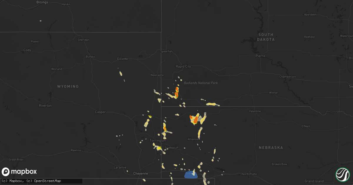
Hail Map on July 17, 2024
Get this storm
July 17 map
$229
one time, instant access
Download today. No call, no setup
Keep the $229
Bought the map and want the full workflow? Apply the entire $229 to a subscription within 7 days. None of it is wasted.
Every map, not just this one
This buys you this map. Subscription and you get every map we run, in the markets you choose from a few cities to whole states to nationwide. Plus real-time alerts the moment a storm fires.
Contact data
Name, contact info, occupancy, even credit band for addresses in the footprint. You go from where it hit to who to call.
Become the source they trust
Unlimited branding weather history reports on demand. You already have the documented answer ready for the property owner, and you are the one who showed up with it.
Property data and RoofTrace estimates
Pull up any address you have got, its value and the exact code rules for that jurisdiction, straight from One Click Code. Then RoofTrace estimates the squares, pitch, and roof value, priced the way you price.
States Impacted by Hail Map on July 17, 2024
Storm reports
Texas
| Date | Description |
|---|---|
| 07/17/20246:45 PM CDT | Severe thunderstorm wind gusts downed a power line east of ivanhoe. |
| 07/17/20246:27 PM CDT | A local report indicates 60 MPH wind near 2 WNW Clyde |
| 07/17/20244:20 PM CDT | Utility company reports 37 power poles down along fm 1836 in kaufman county. |
| 07/17/20243:20 PM CDT | Corrects time of previous tstm wnd dmg report from 7 nne kemp. Utility company reports 37 power poles down along fm 1836 in kaufman county. |
| 07/16/20247:15 PM CDT | A 58 mph wind gust was measured at cleburne municipal airport. |
Massachusetts
| Date | Description |
|---|---|
| 07/17/20246:14 PM CDT | In north chelmsford trees reported down on wires. Time estimated via radar. |
| 07/17/20246:02 PM CDT | In acton a tree was reported blocking a lane of travel. Relayed via amateur radio. Time estimated by radar. |
| 07/17/20246:02 PM CDT | In littleton trees and wires reported down. Relayed via amateur radio. Time estimated via radar. |
| 07/17/20245:50 PM CDT | In groton wires were reported down. Relayed via amateur radio. Time estimated via radar. |
| 07/17/20245:40 PM CDT | In worcester tree reported down on a house... Though the house was not damaged. Relayed via amateur radio. |
| 07/17/20245:28 PM CDT | Reported by trained spotter. |
| 07/17/20245:16 PM CDT | Multiple trees reported down in monson. Relayed via amateur radio. Time estimated via radar. |
| 07/17/20245:10 PM CDT | In palmer a tree was reported down on a house. House is damaged. Relayed via amateur radio. |
| 07/17/20245:05 PM CDT | In barre trees and wires reported down. Relayed via amateur radio. |
| 07/17/20244:50 PM CDT | In hardwick a tree was reported down. Time estimated via radar. |
| 07/17/20244:50 PM CDT | In belchertown trees reported down on route 9. Relayed via amateur radio. Time estimated via radar. |
| 07/17/20244:45 PM CDT | In belchertown wires reported down. Relayed via amateur radio. |
| 07/17/20244:38 PM CDT | Nickel to quarter sized hail reported in granby. Time estimated by radar. |
| 07/17/20244:35 PM CDT | In hatfield tree reported down. Relayed via amateur radio. |
| 07/17/20244:30 PM CDT | In south hadley a tree was reported to have damaged the back of a house. Relayed via amateur radio. |
| 07/17/20244:30 PM CDT | In south hadley tree reported down. Relayed via amateur radio. Time estimated via radar. |
| 07/17/20244:15 PM CDT | In westhampton multiple trees reported down across roads. Relayed via amateur radio. |
| 07/17/20244:15 PM CDT | In westhampton tree reported down. Relayed via amateur radio. |
| 07/17/20244:15 PM CDT | In montague tree reported down in road. Relayed via amateur radio. |
| 07/17/20244:15 PM CDT | In easthampton multiple trees and power lines reported down via dpw. |
| 07/17/20244:15 PM CDT | In easthampton power lines reported down. Relayed via amateur radio. |
| 07/17/20244:11 PM CDT | In deerfield tree reported down blocking i-91 southbound... Traffic stopped according to state police. Relayed via amateur radio. |
| 07/17/20244:06 PM CDT | In south deerfield a tree was reported down on a garage. Relayed via amateur radio. Time estimated via radar. |
| 07/17/20244:05 PM CDT | Multple trees reported down on roads in deerfield. Relayed via amateur radio. Time estimated via radar. |
| 07/17/20244:05 PM CDT | In westhampton multiple trees reported down blocking part of the road. Time estimated via radar. Relayed via amateur radio. |
| 07/17/20244:00 PM CDT | In cummington wires reported down on route 9. Relayed via amateur radio. |
| 07/17/20243:57 PM CDT | In huntington multiple trees reported down in roads and on wires around town. Time estimated via radar. |
| 07/17/20243:55 PM CDT | In greenfield trees reported down. Call received from spotter. Time estimated from radar. |
| 07/17/20243:53 PM CDT | In huntington multiple trees reported down on wires. Relayed via amateur radio. Time estimated via radar. |
| 07/17/20243:37 PM CDT | In cummington wires reported down. Relayed via amateur radio. Time estimated via radar. |
| 07/17/20243:35 PM CDT | In plainfield tree reported down blocking the road. Relayed via amateur radio. |
| 07/17/20243:33 PM CDT | In plainfield tree reported down on car. Relayed via amateur radio. |
Mississippi
| Date | Description |
|---|---|
| 07/17/20242:40 PM CDT | A 6 to 8 inch pine tree was blown over near indian springs road and longview drive. |
| 07/16/20249:15 PM CDT | A large tree limb was blown down onto ms highway 9 near the intersection with hebron road and hester road. |
Virginia
| Date | Description |
|---|---|
| 07/17/20246:50 PM CDT | Communications center got a report about a downed tree. |
| 07/17/20246:41 PM CDT | Tree down near n terrys bridge rd. |
| 07/17/20246:35 PM CDT | Tree down. |
| 07/17/20246:28 PM CDT | Tree down. Via social media. |
| 07/17/20246:20 PM CDT | Large live branch snapped. |
| 07/17/20246:15 PM CDT | Tree down. |
| 07/17/20246:13 PM CDT | Tree down near friendship church rd. |
| 07/17/20246:02 PM CDT | Tree down on lunenburg county road. |
| 07/17/20245:55 PM CDT | Tree down at the intersection of lewiston plank rd and lone pine rd. Cwm. |
| 07/17/20245:55 PM CDT | On rt 640 north of court house rd... Tree is leaning over roadway onto powerlines. |
| 07/17/20245:50 PM CDT | Tree down. |
| 07/17/20245:42 PM CDT | Large tree limbs from five trees broken by thunderstorm winds on legrande avenue. |
| 07/17/20245:38 PM CDT | Tree down on patrick henry highway in the vicinity of watson woods road. |
| 07/17/20245:35 PM CDT | Tree down blocking highway at the intersection of s genito rd and selma rd. |
| 07/17/20245:28 PM CDT | Tree down across road way. |
| 07/17/20245:25 PM CDT | Tree down along clinton road. |
| 07/17/20245:23 PM CDT | Tree down on gully tavern road. |
| 07/17/20245:18 PM CDT | Tree down by plank road and s airport road. Cwm. |
| 07/17/20245:16 PM CDT | Tree knocked down along highway shop rd. |
| 07/17/20245:15 PM CDT | Tree down on northview drive. |
| 07/17/20245:13 PM CDT | Tree down along plank road. |
| 07/17/20245:10 PM CDT | Tree knocked down along prince edward hwy at pamplin road. |
| 07/17/20245:08 PM CDT | Tree knocked down on a power pole. Time estimated from radar. |
| 07/17/20245:08 PM CDT | Tree down on five forks road. |
| 07/17/20245:00 PM CDT | Trees and lines down. |
| 07/17/20244:59 PM CDT | Tree down in 2500 block of north powhatan street. |
| 07/17/20244:54 PM CDT | A few reports of trees down in great falls. |
| 07/17/20244:54 PM CDT | Tree down on mount pleasant drive near intersection with meadow view lane. |
| 07/17/20244:53 PM CDT | Tree down at millbank road and heights school road. |
| 07/17/20244:50 PM CDT | Corrects previous tstm wnd dmg report from 3 sse gold hill. A large tree and a carport were knocked down. |
| 07/17/20244:35 PM CDT | Numerous trees down in the town of dillwyn and northeast to trents mill road. |
| 07/17/20244:35 PM CDT | A large tree and a carport were knocked down. |
| 07/17/20244:32 PM CDT | Tree down along highway 24. |
| 07/17/20244:24 PM CDT | Power line and tree down along stevens road. |
| 07/17/20244:19 PM CDT | Tree downed by thunderstorm winds and blocking the road near the intersection of brookneal highway and saint home place. |
| 07/17/20244:18 PM CDT | Tree downed by thunderstorm winds and blocking roadway on old rustburg road. |
| 07/17/20244:16 PM CDT | Tree down on wards ferry road. |
| 07/17/20244:16 PM CDT | Tree down on bastable mill road. |
| 07/17/20244:07 PM CDT | Two trees and large branches down. |
| 07/17/20244:02 PM CDT | Tree down on highway. |
| 07/17/20244:02 PM CDT | Tree down on 13341 louisa road. |
| 07/17/20243:49 PM CDT | Tree and power lines down south of waterford. |
| 07/17/20243:49 PM CDT | Tree down on chestnut fork road near intersection with ridgelea avenue. |
| 07/17/20243:45 PM CDT | Trees down in philomont on hunt valley lane and route 622. |
| 07/17/20243:45 PM CDT | Tree down in 6200 block of james madison highway. |
| 07/17/20243:38 PM CDT | Trees and wires down near shadwell. |
| 07/17/20243:33 PM CDT | Reports of trees... Branches... And wires down on the south side of charlottesville. |
| 07/17/20243:22 PM CDT | Tree down on river road. |
| 07/17/20243:21 PM CDT | Three reports of trees down in rappahannock county. |
| 07/17/20243:16 PM CDT | Numerous trees reported down in western part of the county. |
| 07/17/20243:16 PM CDT | Numerous trees reported down in the western part of the county. |
| 07/17/20243:03 PM CDT | Multiple trees down in the afton mountain area. |
| 07/17/20242:59 PM CDT | Large tree down in waynesboro. |
| 07/17/20242:51 PM CDT | Power lines down in the elkton area. |
| 07/17/20242:51 PM CDT | Tree down on china clay road. |
| 07/17/20242:43 PM CDT | Tree down in 600 block of christians creek road. |
| 07/17/20242:39 PM CDT | Tree down in the 1500 block of lee jackson highway. |
| 07/17/20242:34 PM CDT | Tree down on mish barn road. |
| 07/17/20242:32 PM CDT | Personal weather station |
| 07/17/20242:22 PM CDT | Power lines down just west of the city of harrisonburg. |
| 07/17/20242:05 PM CDT | Tree down. |
| 07/17/20242:02 PM CDT | Tree and wires down outside of forestville. |
| 07/17/20241:35 PM CDT | Tree down at carloover lane and sam sneed highway. |
| 07/17/20244:18 AM CDT | Trees down at south battlefield blvd power poles down. Battlefield blvd was closed from hickory rd to centerville. |
| 07/16/20247:14 PM CDT | Tree down on us 15. |
| 07/16/20247:14 PM CDT | A couple of trees blown down in virgilina. |
Tennessee
| Date | Description |
|---|---|
| 07/17/20244:35 PM CDT | Multiple trees down. Tree struck an ambulance but no injuries. |
| 07/17/20244:30 PM CDT | Several large trees were blown over near frazier park. |
| 07/17/20244:15 PM CDT | A large tree fell and snapped two power poles in graysville. |
| 07/17/20242:05 PM CDT | Corrects previous tstm wnd dmg report from 7 e loretto. Trees down in leoma near rabbit trail road at old florence pulaski road. Time appx and based on radar. |
| 07/17/20242:00 PM CDT | Several trees down north of five points including a large tree blocking richardson road. |
| 07/17/20241:49 PM CDT | Several trees down north of five points. |
Wyoming
| Date | Description |
|---|---|
| 07/17/20243:59 PM CDT | Trained spotter reports 60 to 65 mph wind gusts with multiple tree branches down. |
| 07/17/20241:14 PM CDT | A local report indicates 1.25 inch wind near 2 WSW Lusk |
South Dakota
| Date | Description |
|---|---|
| 07/17/20242:30 PM CDT | Mostly smaller |
| 07/17/20241:58 PM CDT | A local report indicates 1.25 inch wind near 8 S Hot Springs |
| 07/17/20241:26 PM CDT | A local report indicates 1.75 inch wind near 4 S Wind Cave Visitors |
| 07/17/20241:19 PM CDT | A local report indicates 1.75 inch wind near 5 SE Wind Cave Visitors |
West Virginia
| Date | Description |
|---|---|
| 07/17/20241:13 PM CDT | A local report indicates 1.00 inch wind near 3 ENE Neola |
| 07/17/20241:13 PM CDT | 14 hardwood and softwood trees blow down. Roof blown off garage traveled 500 feet away. |
| 07/17/20241:11 PM CDT | A 45 foot maple tree was uprooted by thunderstorm winds at a residence on route 92... About 16 miles north of white sulphur springs. |
| 07/17/202412:40 PM CDT | Several trees snapped off. |
| 07/17/202412:40 PM CDT | Several trees down on red horse road. |
Arkansas
| Date | Description |
|---|---|
| 07/16/20247:55 PM CDT | A few power lines were blown down in dermott. |
Arizona
| Date | Description |
|---|---|
| 07/17/20246:20 PM CDT | Goodwin mesa mesonet sensor measured a gust of 64 mph from the direction of a nearby thunderstorm. Humidity increased 20% and temperature dropped nearly 20 degrees. |
Nevada
| Date | Description |
|---|---|
| 07/17/20246:35 PM CDT | Upr ola |
Alabama
| Date | Description |
|---|---|
| 07/17/20244:06 PM CDT | Tree reported down along county road 368 near dutton. |
| 07/17/20243:32 PM CDT | Multiple trees and power lines down 1300 blk cr-8 woodville. |
| 07/17/20243:30 PM CDT | Tree blown down and blocking both lanes of pearson chapel road 5000 block area. Time estimated from radar. |
| 07/17/20243:24 PM CDT | Tree down blocking both lanes on robinson road. |
| 07/17/20243:06 PM CDT | Tree reported down along highway 36 and perkins wood road. |
| 07/17/20243:06 PM CDT | Tree reported down along collier drive in hartselle. |
| 07/17/20243:03 PM CDT | A few trees down in sylacauga involving powerlines and roadway blockage. Time estimated from radar. |
| 07/17/20242:47 PM CDT | A few trees down in childersburg involving powerlines and roadway blockage. Time estimated from radar. |
| 07/17/20242:36 PM CDT | Multiple trees reported down along hwy 127 and hays mill road. |
New York
| Date | Description |
|---|---|
| 07/17/20244:40 PM CDT | Albany county 911 center reported multiple reports of trees and wires down in the town of watervliet that impacted the roadways of 5th avenue and 16th street. |
| 07/17/20243:38 PM CDT | Tree down off ny 22 and upland ln. |
| 07/17/20243:26 PM CDT | Tree down on ny 312 at garity blvd |
| 07/17/20243:26 PM CDT | Tree down on ny 312 at rocco drive |
| 07/17/20243:11 PM CDT | Tree down with wires at ny 117 intersection with annandale rd. |
| 07/17/20243:11 PM CDT | Trees down with wires on belden rd. |
| 07/17/20243:06 PM CDT | Tree down on ny 120 at commodore road |
| 07/17/20243:06 PM CDT | Multiple trees down on highway 100 north of chappaqua rd. |
| 07/17/20243:04 PM CDT | Tree down on shear hill rd. |
| 07/17/20243:00 PM CDT | Multiple tree limbs down throughout croton-on-hudson blocking roadways. |
| 07/17/20243:00 PM CDT | Multiple trees down on state hwy 9 in croton-on-hudson. |
| 07/17/20243:00 PM CDT | Large tree limbs downed power poles. |
| 07/17/20242:55 PM CDT | Trees and powerlines down in haverstraw reported on social media and on scanners. |
| 07/17/20242:53 PM CDT | Trees anmd wires down on us 9w southbound between gurnee ave |
| 07/17/20242:53 PM CDT | Tree on home on broadway in haverstraw. |
| 07/17/20242:42 PM CDT | Tree down in fahnestock state park blocking road to campsite. |
| 07/17/20242:36 PM CDT | Tree down on us 202 & wilder rd. |
| 07/17/20242:36 PM CDT | Wires down |
| 07/17/20242:32 PM CDT | Two trees down. Time estimated from radar. |
| 07/17/20242:18 PM CDT | Tree on wires on chittenden road. |
| 07/17/202411:37 AM CDT | Tree down on northgate court |
| 07/17/202411:37 AM CDT | Tree down on northgate court. |
Maryland
| Date | Description |
|---|---|
| 07/17/20246:11 PM CDT | A couple trees and wires down in dentsville per 911 center. |
| 07/17/20245:54 PM CDT | A couple trees and branches down closing part of taylors neck road near walters landing road. |
| 07/17/20245:17 PM CDT | Tree down in 10100 block of bird river road. |
| 07/17/20244:12 PM CDT | Tree down on the 1300 block of ellwood ave |
| 07/16/20248:05 PM CDT | Tree was downed onto centennial road near rhodesdale. |
| 07/16/20247:16 PM CDT | Trees on wires around chestertown. Time estimated from radar. |
| 07/16/20247:10 PM CDT | Trees and wires blew down near the intersection of sandy bottom road and new cut road. |
Pennsylvania
| Date | Description |
|---|---|
| 07/17/20246:30 PM CDT | Photo of a large tree down blocking spring hill rd. Time estimated. |
| 07/17/20246:10 PM CDT | Report from mping: quarter |
| 07/17/20246:06 PM CDT | Trees down on wires resulting in a fire near colbert street in stroudsbourg... Pa. Time estimated from radar. |
| 07/17/20246:06 PM CDT | Tree down blocking the roadway on cherry lane road. Time estimated from radar. |
| 07/17/20246:02 PM CDT | Trees down on wires resulting in a fire. Time estimated from radar. |
| 07/17/20245:42 PM CDT | Wires down at blantz rd and long ln. |
| 07/17/20245:39 PM CDT | Report of trees down around lower towamensing township. Time estimated from radar. |
| 07/17/20245:21 PM CDT | Trees on wires. Time estimated by radar. |
| 07/17/20245:20 PM CDT | Wires down at cly rd and york haven rd. |
| 07/17/20245:20 PM CDT | Wires down at birchland ave and fairview rd. |
| 07/17/20245:04 PM CDT | Tree down on a house on plaza dr. |
| 07/17/20245:02 PM CDT | Trees down... Damaged outbuildings at jds farm. |
| 07/17/20244:51 PM CDT | Several areas with trees and wires down in buck township. |
| 07/17/20244:32 PM CDT | Trees down in the mountain top area. |
| 07/17/20244:21 PM CDT | Several large trees down... And several trees snapped at approximately 30 feet above. Time estimated by radar. |
| 07/17/20243:50 PM CDT | Trees and wires down near benton including along maple grove rd near ribble ln. |
| 07/17/20242:15 PM CDT | Large tree split off about half way up and blocking the roadway. This occurred at south midland and oakdale avenues in lower providence township. Time estimated from ra |
| 07/17/20242:11 PM CDT | Received photos of a large tree that fell down on backyard deck with multiple other trees down on roads. Time estimated. |
| 07/17/20242:02 PM CDT | Trees and wires down in porter township. Time estimated by radar. |
| 07/17/20242:01 PM CDT | Last physical read via physical anemometer was 71 mph... However... Shut off before the peak wind. Severe winds lasted for 4 minutes and 30 seconds. Significant uprooti |
| 07/17/20242:00 PM CDT | Trees and wires down. Time estimated from radar. |
| 07/17/20241:59 PM CDT | Multiple reports of large trees down all around chester springs area. Time estimated from radar. |
| 07/17/20241:52 PM CDT | Trained spotter measures wind gust of 66.8 mph on a mounted atmos 41 research weather station. Also reports of powerlines and poles down along creekside dr. |
| 07/17/20241:49 PM CDT | Several photos of many large tree limbs and a few trees snapped in exton. Time estimated. |
| 07/17/20241:42 PM CDT | Photos of large limbs and a few trees down near corner ketch rd and rolling glenn lane. Time estimated. |
| 07/17/20241:30 PM CDT | Trees on wires. |
New Mexico
| Date | Description |
|---|---|
| 07/17/20245:45 PM CDT | 3in diameter tree limbs snapped from tree. Time estimated from radar. |
| 07/16/20247:50 PM CDT | Mesonet station caln5 canyon blanco. |
Connecticut
| Date | Description |
|---|---|
| 07/17/20244:35 PM CDT | Multiple trees down on glenfield ave near wooster park. |
| 07/17/20244:32 PM CDT | Trees down on nichols ave in stratford. |
| 07/17/20244:18 PM CDT | Large tree limbs down on several roads including stony brook rd... Arrowhead way... And littlebrook rd. |
| 07/17/20243:45 PM CDT | Multiple trees down with wires at several locations including golden hill rd. And edgewood st. |
| 07/16/202410:03 PM CDT | Tree limbs down on utility lines causing a power outage. |
| 07/16/20248:33 PM CDT | 911 call center reports three trees down in monroe. |
New Jersey
| Date | Description |
|---|---|
| 07/17/20242:31 PM CDT | Delayed report. A tree fell down on wires causing them to burn on george hill rd. Time estimated. |
| 07/17/20242:15 PM CDT | Received a photo of trees down laying across old mine rd between peters valley and cr560. Time estimated. |
| 07/16/20248:33 PM CDT | Report of trees down on rita ave by local pd. Time estimated from radar. |
| 07/16/20247:55 PM CDT | Wires down on white st. |
South Carolina
| Date | Description |
|---|---|
| 07/17/20246:56 PM CDT | Sc dept of public safety reports trees down at the intersection of salem rd and old manning rd. Time estimated from radar. |
| 07/17/20246:30 PM CDT | Sc dept of public safety reports trees down on pinewood rd near the intersection of starks ferry rd. Time estimated from radar. |
| 07/17/20246:30 PM CDT | Sc dept of public safety reports trees down on pinewood rd near the intersection of south saint pauls church rd. Time estimated from radar. |
| 07/17/20245:26 PM CDT | Tree down on garners ferry rd near the intersection of old eastover rd. |
| 07/17/20245:24 PM CDT | Kershaw county dispatch reports trees down on lockhart rd near belton rd. They also reported trees down throughout the county leading to power outages. |
| 07/17/20245:24 PM CDT | Sc dept of public safety reports trees down on congaree rd near the intersection of old ferry rd. Time estimated from radar. |
| 07/17/20245:19 PM CDT | Sc department of public safety reports trees down on providence rd near holland rd. Time estimated from radar. |
| 07/17/20244:55 PM CDT | Sc dept of public safety reports a tree down near the intersection of montgomery ln and old hopkins rd. Time estimated from radar. |
| 07/17/20244:06 PM CDT | Fairfield county dispatch reports trees down on newberry rd near salem crossroads. Time estimated from radar. |
| 07/17/20242:20 PM CDT | Tree fell over onto a brick wall on old buncombe rd. |
| 07/17/20242:14 PM CDT | Tree down on power line on cedar lane rd. |
Kansas
| Date | Description |
|---|---|
| 07/16/20247:12 PM CDT | Weatherlink site rietcheck farms. |
Ohio
| Date | Description |
|---|---|
| 07/17/20243:50 PM CDT | Tree down on comly street. |
| 07/17/20243:30 PM CDT | 1 tree reported down. |
| 07/17/20243:29 PM CDT | Tree down on griggs road. |
| 07/17/20242:58 PM CDT | Report from mping: 3-inch tree limbs broken. |
| 07/17/20242:53 PM CDT | 8 inch tree down in worthington near arapaho avenue and arapaho court. Time estimated from radar. |
| 07/17/20241:43 PM CDT | Report from two media sources of public reports of trees down. Time estimated from radar. |
| 07/17/202412:43 PM CDT | Tree blocking road. Time estimated from radar. |
| 07/17/202412:42 PM CDT | Tree blocking road. Time estimated from radar. |
| 07/17/202412:38 PM CDT | Tree blocking road. Time estimated from radar. |
Utah
| Date | Description |
|---|---|
| 07/17/20245:40 PM CDT | Outflow wind gust from nearby cluster of thunderstorms. Mesonet station ut29 plymouth. |
Georgia
| Date | Description |
|---|---|
| 07/17/20246:45 PM CDT | Tree down across hickory rd. Near tucker rd. Time estimated by radar. |
| 07/17/20245:35 PM CDT | Trees were reported down in a.h. Stephens state park as well as in crawfordville with some trees across roads in the area. |
| 07/17/20244:52 PM CDT | 5 trees reported down on ebenezer road. |
| 07/17/20244:48 PM CDT | Tree reported down blocking road on east 4th street. Several trees reported down across town. |
| 07/17/20244:40 PM CDT | Quarter size hail reported at guyton rd and courthouse rd. |
| 07/17/20244:37 PM CDT | Tree reported down at 2915 little mccall road... And wires down at little mccall road and courthouse road. |
| 07/17/20244:37 PM CDT | Television station reports about 2100 effingham county residents without power from passing thunderstorms. The article mentions power lines down near courthouse road. |
| 07/17/20244:36 PM CDT | Line down at intersection of hodgeville road and triumph drive. |
| 07/17/20244:33 PM CDT | Several trees down near james road and cheely drive and newby lane. |
| 07/17/20244:30 PM CDT | Tree and powerlines were reported down along s miller st. Time was estimated by radar. |
| 07/17/20244:25 PM CDT | Several trees down around the james road and cheely drive/newby lane area per emergency management. |
| 07/17/20244:15 PM CDT | Peak wind gust reported at the kags asos. |
| 07/17/20244:15 PM CDT | A tree was reported down on log cabin drive. |
| 07/17/20244:10 PM CDT | A utility line was reported down in the vicinity of lucille driskell circle. |
| 07/17/20242:02 PM CDT | Lincoln county dispatch reports trees down on amity woodlawn rd near the intersection of thomson hwy. Time estimated from radar. |
Nebraska
| Date | Description |
|---|---|
| 07/17/20246:14 PM CDT | Mesonet station fw8225 sidney. |
| 07/17/20246:11 PM CDT | A local report indicates 60 MPH wind near Sidney |
| 07/17/20245:22 PM CDT | Mesonet station hrsn1 7 s chadron - kings canyon raws - hrs. |
| 07/17/20242:19 PM CDT | A local report indicates 1.50 inch wind near 7 W Agate |
Maine
| Date | Description |
|---|---|
| 07/17/20244:35 PM CDT | Trees and wires down. |
Louisiana
| Date | Description |
|---|---|
| 07/17/20244:21 PM CDT | Delayed report. Powerline blown down on 12th street. |
| 07/17/20242:31 PM CDT | St. Helena sheriffs office received a report of a powerline down off of bates road. |
| 07/17/20242:31 PM CDT | St. Helena sheriffs department received a report of a tree down on highway 441 north of highway 38. |
| 07/17/20241:43 PM CDT | Corrects previous tstm wnd dmg report from 9 e pride. St helena sheriffs department received a report of a tree down on highway 63... North of highway 16. |
| 07/17/20241:43 PM CDT | St helena sheriffs department received a report of a tree down on highway 63... North of highway 16. |
North Carolina
| Date | Description |
|---|---|
| 07/17/20244:20 PM CDT | Trees down across the belmont area. |
| 07/17/20243:12 PM CDT | Tree down on valley rd. |
| 07/17/20243:07 PM CDT | Power lines down in taylorsville. |
| 07/17/20243:06 PM CDT | Tree down on peach orchard rd. |
| 07/17/20242:50 PM CDT | Tree down on power line on temple hill church rd. |
| 07/17/20242:40 PM CDT | Tree down on vashti rd. |
| 07/17/20242:40 PM CDT | Tree down on dobbins road. |
| 07/17/20242:35 PM CDT | Tree down on silas deal rd. |
| 07/17/20242:25 PM CDT | Tree down and blocking roadway. |
| 07/17/20242:19 PM CDT | Tree down on poplar springs rd. |
| 07/17/20242:08 PM CDT | Tree down on pleasant hill church rd. |
| 07/16/20247:24 PM CDT | Trees down on powerlines. Resulted in widespread power outages. |
| 07/16/20247:05 PM CDT | Tree down on powerlines. |
| 07/16/20247:00 PM CDT | Tree down on powerline. |
New Hampshire
| Date | Description |
|---|---|
| 07/17/20246:54 PM CDT | Tree down on wires. Time estimated by radar. |
| 07/17/20244:30 PM CDT | Reported by amateur radio. |
| 07/17/20243:22 PM CDT | Trees and wires down on east side rd. Time estimated by radar. |
| 07/17/20243:22 PM CDT | Tree down on shoulder of eaton rd about 1/4 mile north of nhdot facility. Time estimated by radar. |
| 07/17/20241:28 PM CDT | Multiple trees blocking grissom lane... Trees were around 16 inches in diameter. |
| 07/17/20241:28 PM CDT | A few trees were blown down onto the parking lot at the bowling alley off of maple ave. Time estimated by radar. |
| 07/16/20247:10 PM CDT | Tree down blacksnake road. |
| 07/16/20247:05 PM CDT | Delayed report...trees down on south main st by old town rd. Time estimated via radar. |
| 07/16/20247:05 PM CDT | Delayed report...flag pole uprooted and a tree down on exeter rd about a mile off of i-95. |
Cities Impacted by Hail Map on July 17, 2024
- Royal, AR
- Hot Springs National Park, AR
- Fordland, MO
- Rogersville, MO
- Comins, MI
- Curran, MI
- Shuqualak, MS
- Gladwin, MI
- Tutwiler, MS
- Drew, MS
- Parchman, MS
- Aliceville, AL
- Anna, OH
- Minster, OH
- Lusk, WY
- Sidney, OH
- Jackson, LA
- Zachary, LA
- Pride, LA
- Columbia, MS
- Harrison, NE
- Denham Springs, LA
- Buffalo Gap, SD
- Hot Springs, SD
- Blairstown, NJ
- Slaughter, LA
- Greenwell Springs, LA
- Unadilla, GA
- Pinehurst, GA
- Marion, AL
- Franklin, KY
- Ladonia, TX
- Wolfe City, TX
- Jay Em, WY
- Newton, NJ
- Washington, GA
- Coatesville, PA
- Honey Brook, PA
- Glenmoore, PA
- Greenville, TX
- Scottsville, KY
- Clinton, LA
- Lafayette, TN
- Campbell, TX
- Centreville, MS
- Cumby, TX
- Quinlan, TX
- Andover, NJ
- Sulphur Springs, TX
- Wilson, LA
- Springfield, LA
- Liberty, MS
- Gloster, MS
- Crestview, FL
- Defuniak Springs, FL
- Downingtown, PA
- Chester Springs, PA
- Dix, NE
- Loretto, TN
- Lone Oak, TX
- Terrell, TX
- Royse City, TX
- Clermont, FL
- Groveland, FL
- Kit Carson, CO
- Wills Point, TX
- Snover, MI
- Kimball, NE
- Malvern, PA
- Phoenixville, PA
- Exton, PA
- Wheatland, WY
- Deer Park, TX
- La Porte, TX
- Point, TX
- Sandusky, MI
- Garrett, WY
- Maurepas, LA
- Webster, TX
- Houston, TX
- Columbiana, AL
- Brunswick, GA
- Lewiston Woodville, NC
- Ahoskie, NC
- Hamilton, NC
- Williamston, NC
- Windsor, NC
- Robersonville, NC
- Pasadena, TX
- Wilsonville, AL
- South Houston, TX
- Friendswood, TX
- Scurry, TX
- Pine, CO
- Bailey, CO
- Kaufman, TX
- Clinton, NC
- Glendo, WY
- New City, NY
- Pomona, NY
- Torrington, WY
- Kemp, TX
- Corbin, KY
- Haverstraw, NY
- Congers, NY
- Galena Park, TX
- Rockford, AL
- Goodwater, AL
- Sylacauga, AL
- Hawk Springs, WY
- Greenville, AL
- Glennville, GA
- Croton On Hudson, NY
- Valley Cottage, NY
- Bellaire, TX
- Baxley, GA
- Oglethorpe, GA
- New Raymer, CO
- Mahopac, NY
- Carmel, NY
- Yoder, WY
- Lyman, NE
- Ludowici, GA
- Hermosa, SD
- Manville, WY
- Charlemont, MA
- Plainfield, MA
- Windsor, MA
- Cummington, MA
- Savoy, MA
- Pittsburg, TX
- Demarest, NJ
- Oradell, NJ
- Bergenfield, NJ
- New Milford, NJ
- Cresskill, NJ
- Dumont, NJ
- Tenafly, NJ
- Haworth, NJ
- Meridian, MS
- Andersonville, GA
- Trenton, AL
- Hollytree, AL
- Custer, SD
- Laurel, MS
- Rushville, NE
- Blair, SC
- Fairburn, SD
- Hay Springs, NE
- Ashfield, MA
- Woodville, AL
- Alpine, NJ
- Closter, NJ
- Veteran, WY
- Rising Star, TX
- Cisco, TX
- Mount Pleasant, TX
- Winfield, TX
- Stanford, MT
- Cartersville, GA
- Paint Rock, AL
- Loxley, AL
- Saint Stephens, AL
- Robertsdale, AL
- Culpeper, VA
- Mitchells, VA
- Ranger, TX
- Hinesville, GA
- Shubuta, MS
- Tribune, KS
- Conway, MA
- Williamsburg, MA
- Shelburne Falls, MA
- Macon, GA
- Vona, CO
- Eufaula, AL
- Blythe, GA
- Hephzibah, GA
- Gray, GA
- Eastland, TX
- Loraine, TX
- Mauk, GA
- Buena Vista, GA
- Hobson, MT
- Guyton, GA
- Vonore, TN
- Briceville, TN
- Easthampton, MA
- Deerfield, MA
- Mitchell, NE
- Bedford, VA
- Thaxton, VA
- Bloomingdale, GA
- Ellabell, GA
- Southampton, MA
- Florence, MA
- Huntington, MA
- Stratton, CO
- Conchas Dam, NM
- Ogallala, NE
- Loudon, TN
- Sharon Springs, KS
- Harrisburg, NE
- Sterling, CO
- Merino, CO
- Crawford, NE
- Blountsville, AL
- Hanceville, AL
- Cheyenne Wells, CO
- Omaha, GA
- Lumpkin, GA
- Holyoke, MA
- South Hadley, MA
- Northampton, MA
- Granby, MA
- Maryneal, TX
- Baird, TX
- Cusseta, GA
- Bethune, CO
- Augusta, GA
- Jackson, SC
- Waynesboro, GA
- Girard, GA
- Sylvania, GA
- Burlington, CO
- Bushnell, NE
- Whitney, NE
- Stoneham, CO
- Montalba, TX
- Richland, GA
- Georgetown, GA
- Ludlow, MA
- Chicopee, MA
- Mingus, TX
- Lisman, AL
- Rincon, GA
- Ten Mile, TN
- Decatur, TN
- Wingina, VA
- Solano, NM
- Chadron, NE
- Weskan, KS
- Bayard, NE
- Kempton, PA
- Quitman, MS
- Gordon, TX
- Leoti, KS
- Fort Myers, FL
- Stephenville, TX
- Naples, TX
- Skull Valley, AZ
- Moneta, VA
- Wallace, KS
- Wiley, CO
- Lamar, CO
- Laramie, WY
- Snyder, CO
- Kirkland, AZ
- Texarkana, AR
- Norwood, LA
- Lower Peach Tree, AL
- Avery, TX
- Camden, SC
- Butler, AL
- Potter, NE
- New Ringgold, PA
- El Dorado, AR
- Charlotte Court House, VA
- Gilbert, PA
- Effort, PA
- Kresgeville, PA
- Kunkletown, PA
- Bradley, AR
- Dillwyn, VA
- Farmville, VA
- Tolar, TX
- Bluff Dale, TX
- Merriman, NE
- Fouke, AR
- Robert Lee, TX
- Emerson, AR
- Magnolia, AR
- Bunnell, FL
- Saylorsburg, PA
- Brodheadsville, PA
- Dalton, NE
- Nunn, CO
- Akron, CO
- Stamps, AR
- Taylor, AR
- Junction City, AR
- Wilton, CT
- Ridgefield, CT
- Darien, CT
- Payson, AZ
- Kanorado, KS
- Lance Creek, WY
- Sidney, NE
- Gurley, NE
- Lodgepole, NE
- Idalia, CO
- Lipan, TX
- Granbury, TX
- Syracuse, KS
- Abilene, TX
- Clyde, TX
- Union Point, GA
- Montague, MA
- Monson, MA
- Palmer, MA
- Warren, TX
- Batesland, SD
- Springfield, GA
- Belchertown, MA
- Crook, CO
- Jasper, TX
- Ellsworth, NE
- Chappell, NE
- Haynesville, LA
- Two Dot, MT
- Wounded Knee, SD
- Athens, TX
- Yuma, CO
- Eckley, CO
- Hemphill, TX
- Lisco, NE
- Carbon, TX
- Hillister, TX
- Woodville, TX
- Glen Rose, TX
- Snow Hill, NC
- Stantonsburg, NC
- Gladstone, VA
- Saint Francis, KS
- Wray, CO
- Young, AZ
- Julesburg, CO
- Prescott, AR
- Goodland, KS
- Pine Ridge, SD
- Cleburne, TX
- Ovid, CO
- Kirbyville, TX
- Manning, SC
- Martin, SD
- Kendall, KS
- Colorado Springs, CO
- Penrose, CO
- Haxtun, CO
- Lugoff, SC
- Emmet, AR
- Oshkosh, NE
- Edgemont, SD
- Camp Verde, AZ
- Amherst, CO
- Holyoke, CO
- Larue, TX
- Stamford, CT
- Monticello, AR
- Summerton, SC
- Santee, SC
- Norwalk, CT
- Oelrichs, SD
- Rosston, AR
- New Zion, SC
- Bridgeport, NE
- Tennessee Colony, TX
- Ashby, NE
- Dermott, AR
- Hamburg, AR
- Levelland, TX
- Atwood, CO
- Kingstree, SC
- Cades, SC
- McGehee, AR
- Taiban, NM
- Hazlehurst, GA
- Gillette, WY
- Big Timber, MT
- Dewey, AZ
- Post, TX
- Arkansas City, AR
- Rohwer, AR
- Montrose, AR
- Johnson, KS
- Hillrose, CO
- Haigler, NE
- Parks, NE
- Bird City, KS
- Champion, NE
- Logan, OH
- Junction City, OH
- Fort Sumner, NM
- Strong, AR
- Summerfield, LA
- Homer, LA
- Fountain Hill, AR
- Mcminnville, TN
- Bremen, OH
- New Straitsville, OH
- Ulysses, KS
- Mantee, MS
- Manter, KS
- Sedgwick, CO
- Longview, TX
- Lake City, SC
- Ackerman, MS
- Mathiston, MS
- Dundalk, MD
- Baltimore, MD
- Benoit, MS
- Woodland, MS
- Eupora, MS
- Wray, GA
- Sedona, AZ
- Sturgis, MS
- Marion, SC
- Monroe, LA
- Preston, GA
- South Deerfield, MA
- Doddsville, MS
- West Monroe, LA
- Douglas, GA
- Broxton, GA
- Schlater, MS
- Maben, MS
- Wilbraham, MA
- Three Rivers, MA
- Chesterfield, MA
- Buckingham, VA
- Causey, NM
- Sudan, TX
- Smithville, TX
- Wilson, TX
- Pheba, MS
- Maple, TX
- Bastrop, TX
- Boyle, MS
- Shaw, MS
- Shawnee, OH
- Nicholls, GA
- Sunflower, MS
- Karval, CO
- West Green, GA
- Norfolk, VA
- Rogers, NM
- Sikes, LA
- Lisbon, LA
- Leesville, LA
- Grayson, LA
- Corning, OH
- New Lexington, OH
- Rosedale, MD
- Geyser, MT
- Congress, AZ
- Winona, MS
- Benson, AZ
- Appomattox, VA
- Java, VA
- Cambridge, MD
- Denton, GA
- Prospect, VA
- Church Creek, MD
- Nathalie, VA
- Cullen, VA
- Rainbow, TX
- Ambrose, GA
- Tucumcari, NM
- Alma, GA
- Ocilla, GA
- Randolph, VA
- Brookneal, VA
- Palestine, TX
- Drakes Branch, VA
- Keysville, VA
- Vernon Hill, VA
- Roosevelt, AZ
- Pearson, GA
- Tifton, GA
- Greenwood, MS
- Enigma, GA
- Florence, SC
- Alton, VA
- South Boston, VA
- San Jon, NM
- Franklin, TX
- Hearne, TX
- Normangee, TX
- Bryan, TX
- Broaddus, TX
- Cameron, TX
- Buckholts, TX
- Davilla, TX
- Rockdale, TX
- Thorndale, TX
- Thrall, TX
- Taylor, TX
- Coupland, TX