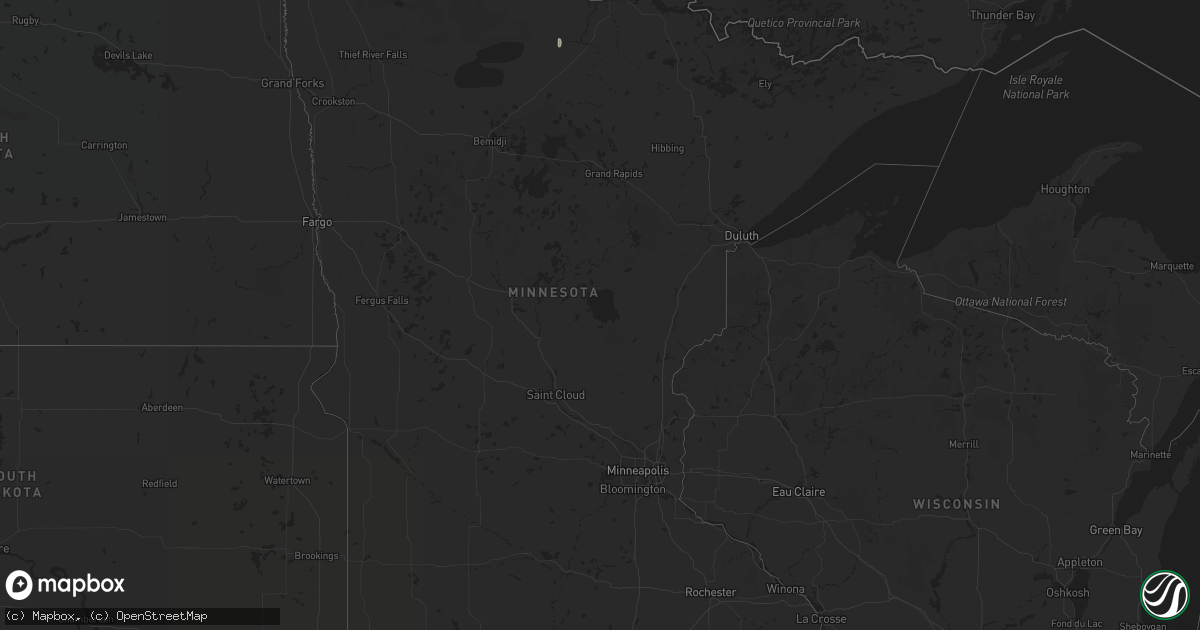
Hail Map in Minnesota on July 17, 2022
Get this storm
July 17 map
$229
one time, instant access
Download today. No call, no setup
Keep the $229
Bought the map and want the full workflow? Apply the entire $229 to a subscription within 7 days. None of it is wasted.
Every map, not just this one
This buys you this map. Subscription and you get every map we run, in the markets you choose from a few cities to whole states to nationwide. Plus real-time alerts the moment a storm fires.
Contact data
Name, contact info, occupancy, even credit band for addresses in the footprint. You go from where it hit to who to call.
Become the source they trust
Unlimited branding weather history reports on demand. You already have the documented answer ready for the property owner, and you are the one who showed up with it.
Property data and RoofTrace estimates
Pull up any address you have got, its value and the exact code rules for that jurisdiction, straight from One Click Code. Then RoofTrace estimates the squares, pitch, and roof value, priced the way you price.
Storm reports in Minnesota
Minnesota
| Date | Description |
|---|---|
| 07/17/20226:20 AM CDT | A local report indicates 1.00 inch wind near 6 WNW WILLIAMS |
| 07/17/20226:15 AM CDT | A local report indicates 1.00 inch wind near 3 NW ROOSEVELT |
| 07/17/20225:48 AM CDT | A local report indicates 1.50 inch wind near 2 E ROSEAU |
| 07/17/20225:48 AM CDT | A local report indicates 1.50 inch wind near E ROSEAU |
| 07/17/20225:42 AM CDT | A local report indicates 1.50 inch wind near 2 N ROSEAU |
| 07/17/20225:42 AM CDT | A local report indicates 1.00 inch wind near 2 N ROSEAU |
| 07/17/20224:02 AM CDT | Tree down. Time estimated from radar. |
| 07/17/20223:36 AM CDT | Trees down in the crystal springs area of grand rapids. Delayed report. Time estimated from radar and gpz awos. |
| 07/17/20222:12 AM CDT | Multiple trees down near mile marker 33 on highway 135 n. One was a 14 inch spruce... A few 6 inch balsams... And two 6 inch popple or aspen trees. Location approximate |
| 07/17/20222:00 AM CDT | A couple 40 to 50 foot tall popple trees down. Another large fir tree down that knocked down a power line. Some other smaller branches and old branches down due to stro |
| 07/17/20221:54 AM CDT | About 25 trees snapped or uprooted. Most of them were snapped about 6 feet above the ground. The trees varied in size... But approximately 8 to 10 inches in diameter. G |
| 07/17/20221:54 AM CDT | Pontoon and boat lift were lifted and turned upside down on lake vermilion near mckinley park. Location approximate. Time estimated by radar. Report received via facebo |
| 07/17/20221:49 AM CDT | Trees and power lines down on highway 1 near the y store. Delayed report. Time estimated from radar. |
| 07/17/202212:48 AM CDT | Three birch trees snapped. Delayed report. Time estimated from radar. |
| 07/17/202212:42 AM CDT | Numerous trees and powerlines down around international falls. Time estimated from asos and radar. |
| 07/17/202212:35 AM CDT | Peak wind measured at an ndawn station at 3 meters. |
All States Impacted by Hail Map on July 17, 2022
Cities Impacted by Hail Map on July 17, 2022
- Wappapello, MO
- McGee, MO
- Elizabethtown, IL
- Equality, IL
- Harrisburg, IL
- Chester, AR
- Rudy, AR
- Marble Hill, MO
- Hoboken, NJ
- Weehawken, NJ
- Astoria, NY
- Union City, NJ
- New York, NY
- Jersey City, NJ
- Secaucus, NJ
- Bronx, NY
- North Bergen, NJ
- West New York, NJ
- Niangua, MO
- Grovespring, MO
- Bee Branch, AR
- Damascus, AR
- Quitman, AR
- Shirley, AR
- Puxico, MO
- Waynesville, MO
- Scottsdale, AZ
- Mill Spring, MO
- Mountain View, MO
- Casa Grande, AZ
- Florence, AZ
- Arizona City, AZ
- Eloy, AZ
- Lost Creek, KY
- Jackson, KY
- Browning, MT
- Camp Verde, AZ
- Laquey, MO
- Falcon, MO
- Birch Tree, MO
- Eminence, MO
- Edgemont, AR
- Greenbrier, AR
- Fairfield Bay, AR
- Heber Springs, AR
- Higden, AR
- Drasco, AR
- Mount Vernon, AR
- Ida, AR
- Mountain View, AR
- Lebanon, MO
- Salem, MO
- Crosby, ND
- Wharncliffe, WV
- Gilbert, WV
- Greenville, MO
- Mountain Grove, MO
- Globe, AZ
- Roosevelt, MN
- Ambrose, ND
- Fortuna, ND
- Rolla, MO
- Newburg, MO
- Cut Bank, MT
- Hartville, MO
- Benson, AZ
- Carrier Mills, IL
- Magazine, AR
- Paris, AR
- Big Falls, MN
- Fairfield, MT
- Summersville, MO
- Young, AZ
- Richland, MO
- Belle Rose, LA
- Oak Ridge, MO
- Friedheim, MO
- Perryville, MO
- Payson, AZ
- Omaha, IL
- Ridgway, IL
- East Glacier Park, MT
- Lynchburg, MO
- Plato, MO
- Asbury, NJ
- Warroad, MN
- Crocker, MO
- Dixon, MO
- Forest Lakes, AZ
- Salem, VA
- Long Valley, NJ
- Ava, MO
- Chadwick, MO
- Oldfield, MO
- Horseshoe Bend, AR
- Ash Flat, AR
- Franklin, AR
- Flagstaff, AZ
- Colonial Beach, VA
- Loretto, VA
- Champlain, VA
- Hustle, VA
- Willow Springs, MO
- Myrtle, MO
- Couch, MO
- Alton, MO
- Pleasant Grove, AR
- Bunker, MO
- Picacho, AZ
- Conway, MO
- Pine, AZ
- Badger, MN
- Roseau, MN
- Woodford, VA
- Fredericksburg, VA
- Manchester, NH
- Mammoth Spring, AR
- Maricopa, AZ
- Roby, MO
- Green Forest, AR
- Berryville, AR
- Rio Rico, AZ
- Cook Sta, MO
- Cherryville, MO
- Amado, AZ
- Tucson, AZ
- Genoa, WV
- Dunlow, WV
- Wesco, MO
- Steelville, MO
- Mesa, AZ
- Forbes, ND
- Bucyrus, MO
- Graff, MO
- Huggins, MO
- Lakeside, AZ
- Show Low, AZ
- Moody, MO
- Caulfield, MO
- Sorrento, FL
- Mount Dora, FL
- Eustis, FL
- Silva, MO
- Galena, MO
- Raleigh, IL
- Galatia, IL
- Eldorado, IL
- Batesville, AR
- Grand Canyon, AZ
- Phillipsburg, MO
- Sedona, AZ
- Sells, AZ
- Camp, AR
- Thayer, MO
- Cave City, AR
- Viola, AR
- Junction, IL
- Mount Pleasant, AR
- Guion, AR
- Orange, VA
- Gordonsville, VA
- Tubac, AZ
- Clinton, AR
- Leslie, AR
- Salol, MN
- Leon, VA
- Brightwood, VA
- Reva, VA
- Mount Lemmon, AZ
- Wellington, FL
- Loxahatchee, FL
- Alsen, ND
- Canton, MS
- Camden, MS
- Jerome, MO
- Oran, MO
- Chaffee, MO
- Fulks Run, VA
- Hackberry, AZ
- Wayne, WV
- East Lynn, WV
- Salem, AR
- Crane, MO
- Jarratt, VA
- Marshfield, MO
- Tumbling Shoals, AR
- Wiseman, AR
- Oxford, AR
- Apopka, FL
- Hardy, AR
- Phoenix, AZ
- Laveen, AZ
- Gilbert, AZ
- Paradise Valley, AZ
- Tempe, AZ
- Charlotte, AR
- Newark, AR
- Cord, AR
- Amagon, AR
- Newport, AR
- Weiner, AR
- Fisher, AR
- Sulphur Rock, AR
- Altus, AR
- Scranton, AR
- Danville, AR
- Belleville, AR
- Havana, AR
- Ola, AR
- Perryville, AR
- Coal Hill, AR
- Dardanelle, AR
- Subiaco, AR
- Casa, AR
- Hartman, AR
- Ozark, AR
- Auburn, NH
- Hooksett, NH
- Circleville, OH
- Stoutsville, OH
- Marana, AZ
- Advance, MO
- Cape Girardeau, MO
- McClure, IL
- Patton, MO
- Leopold, MO
- Glenallen, MO
- Millersville, MO
- Marquand, MO
- Jackson, MO
- Scott City, MO
- Burfordville, MO
- Whitewater, MO
- Tamms, IL
- Bell City, MO
- Sturdivant, MO
- Metropolis, IL
- Thebes, IL
- Gipsy, MO
- Olmsted, IL
- Olive Branch, IL
- Wickliffe, KY
- Mounds, IL
- Cairo, IL
- Barlow, KY
- Zalma, MO
- Miller City, IL
- Brownwood, MO
- Sikeston, MO
- Mound City, IL
- Paducah, KY
- Brookport, IL
- Bloomfield, MO
- Villa Ridge, IL
- Ledbetter, KY
- Charleston, MO
- Kevil, KY
- Benton, MO
- Pulaski, IL
- West Paducah, KY
- Lowndes, MO
- La Center, KY
- Ullin, IL
- Clubb, MO
- Smithland, KY
- Buncombe, IL
- Jonesboro, IL
- Goreville, IL
- Vienna, IL
- Ozark, IL
- Anna, IL
- Cobden, IL
- Dongola, IL
- Alto Pass, IL


