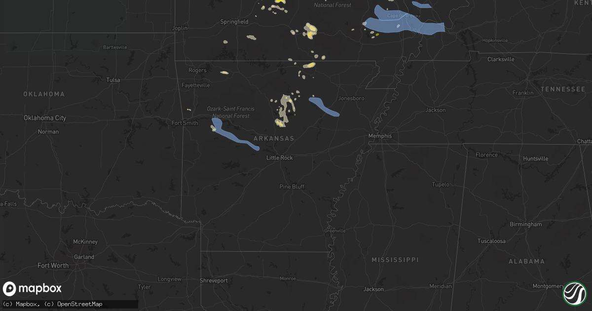
Hail Map in Arkansas on July 17, 2022
Get this storm
July 17 map
$229
one time, instant access
Download today. No call, no setup
Keep the $229
Bought the map and want the full workflow? Apply the entire $229 to a subscription within 7 days. None of it is wasted.
Every map, not just this one
This buys you this map. Subscription and you get every map we run, in the markets you choose from a few cities to whole states to nationwide. Plus real-time alerts the moment a storm fires.
Contact data
Name, contact info, occupancy, even credit band for addresses in the footprint. You go from where it hit to who to call.
Become the source they trust
Unlimited branding weather history reports on demand. You already have the documented answer ready for the property owner, and you are the one who showed up with it.
Property data and RoofTrace estimates
Pull up any address you have got, its value and the exact code rules for that jurisdiction, straight from One Click Code. Then RoofTrace estimates the squares, pitch, and roof value, priced the way you price.
Storm reports in Arkansas
Arkansas
| Date | Description |
|---|---|
| 07/17/20222:45 PM CDT | Several limbs and small trees down across county roads parallel to highway 63... South of the highway 63/highway 9 intersection. |
| 07/17/20222:11 PM CDT | A tree was blown down along highway 9. |
| 07/17/20226:33 AM CDT | At 1133 PM CDT, a severe thunderstorm was located near Denning, or 8 miles northwest of Paris, moving southeast at 40 mph. HAZARD...60 mph wind gusts and penny size hail. SOURCE...Radar indicated. IMPACT...Expect damage to roofs, siding, and trees. Locations impacted include... Russellville... Clarksville... Paris... Danville... Dardanelle... London... Knoxville... Subiaco... Hartman... Scranton... Ratcliff... Lake Dardanelle State Park... Hinkle... Mt Nebo State Park... Hoyt... Mount Magazine... Lake Dardanelle... Midway in Logan County... Spadra... Mosley...This includes Interstate 40 between mile markers 45 and 52, andbetween mile markers 65 and 77. |
| 07/17/20226:27 AM CDT | At 1127 PM CDT, a severe thunderstorm was located near Woolly Hollow State Park, or 17 miles southwest of Heber Springs, moving southeast at 30 mph. HAZARD...60 mph wind gusts and quarter size hail. SOURCE...Radar indicated. IMPACT...Hail damage to vehicles is expected. Expect wind damage to roofs, siding, and trees. Locations impacted include... Vilonia... Quitman... Guy... Rose Bud... Damascus... Enola... Twin Groves... Mount Vernon... Gravel Hill... Woolly Hollow State Park... Holland... Barney... El Paso... Otto... Romance... Enders... Floyd... |
| 07/17/20226:04 AM CDT | At 1102 PM CDT, a severe thunderstorm was located over Jacksonport, or near Newport, moving southeast at 50 mph. HAZARD...60 mph wind gusts. SOURCE...Radar indicated. IMPACT...Expect damage to roofs, siding, and trees. Locations impacted include... Wynne, Harrisburg, Weiner, Cherry Valley, Hickory Ridge, Waldenburg, Fair Oaks, Vanndale, Fisher, Hydrick, Wiley Crossing, Birdeye, Supply, Weona Junction, Weona, Stewart, Brushy Lake, Mersman, Uno and Bay Village. |
| 07/17/20225:50 AM CDT | At 1050 PM CDT, severe thunderstorms were located along a line extending from near Swifton to Diaz to 7 miles south of Oil Trough, moving southeast at 45 mph. HAZARD...60 mph wind gusts and penny size hail. SOURCE...Radar indicated. IMPACT...Expect damage to roofs, siding, and trees. Locations impacted include... Newport... Augusta... Bald Knob... Tuckerman... Diaz... Newark... Swifton... Patterson... Grubbs... Pleasant Plains... Oil Trough... Russell... Jacksonport... Tupelo... Algoa... McCrory... McFadden... Steprock... Bradford... Campbell Station...This includes US Highway 67 between mile markers 54 and 100. |
| 07/17/20225:12 AM CDT | At 1012 PM CDT, severe thunderstorms were located along a line extending from Ash Flat to near Sidney to near Croker, moving east at 35 mph. HAZARD...60 mph wind gusts and penny size hail. SOURCE...Radar indicated. IMPACT...Expect damage to roofs, siding, and trees. Locations impacted include... Batesville... Ash Flat... Black Rock... Lake Charles State Park... Cave City... Newark... Cushman... Mount Pleasant... Strawberry... Lynn... Magness... Sidney... Moorefield... Salado... Annieville... Croker... Gid... Stella... Southside in Independence Count... Sulphur Rock... |
| 07/17/20223:23 AM CDT | Entergy outage map shows multiple customers within this community without power due to wind damage related to thunderstorms. |
| 07/17/20222:59 AM CDT | At 758 PM CDT, a severe thunderstorm was located near Fayetteville, moving southeast at 40 mph. HAZARD...60 mph wind gusts. SOURCE...Trained weather spotters. Drake Field reported a 60 mph wind gust. IMPACT...Expect damage to roofs, siding, and trees. Locations in or near the path include... Fayetteville... Springdale... Farmington... Elkins... Greenland... St. Paul... Wesley... Saint Paul... Boston... Pettigrew... Japton... Witter... Drake Field Airport... Johnson... Goshen... Georgetown... Crosses... Combs... Dutton... Tuttle...This includes Interstate 49 between mile markers 58 and 68. |
| 07/17/20222:57 AM CDT | At 757 PM CDT, severe thunderstorms were located along a line extending from Fairdealing to 7 miles northwest of Maynard to 9 miles east of Mammoth Spring, moving southeast at 35 mph. HAZARD...60 mph wind gusts and penny size hail. SOURCE...Radar indicated. IMPACT...Expect damage to roofs, siding, and trees. Locations impacted include... Pocahontas... Reyno... Maynard... Biggers... Ravenden Springs... Attica... Dalton... Elkins Park... Brakebill... Middlebrook... Warm Springs... Ingram... Birdell... Hamil... Stokes... Engelerg... Sharum... Elm Store... Brockett... Pitman... |
| 07/17/20221:44 AM CDT | At 644 PM CDT, severe thunderstorms were located along a line extending from near Fremont to near West Plains, moving southeast at 30 mph. HAZARD...60 mph wind gusts and penny size hail. SOURCE...Radar indicated. IMPACT...Expect damage to roofs, siding, and trees. Locations impacted include... West Plains... Grand Gulf State Park... Thayer... Mammoth Spring... Alton... South Fork... Koshkonong... Brandsville... Thomasville... Mammoth Spring State Park... Lanton... Myrtle... Wilderness... Couch... Pottersville... Rover... Greer... |
| 07/17/20221:30 AM CDT | Entergy outage map shows multiple customers without power in this area due to wind damage related to thunderstorms. |
| 07/17/202212:14 AM CDT | Tree blown down over power lines. |
| 07/16/202211:54 PM CDT | Trees and powerlines reported down across the western portion of paris. |
| 07/16/202211:25 PM CDT | Damage to poultry houses and large tree limb down near compressor road and ar highway 23. |
| 07/16/202210:45 PM CDT | A measured wind gust of 63 mph northwest of oil trough... Ar. This is a correction to the previous storm report that was sent and did not have the correct magnitude. |
| 07/16/202210:32 PM CDT | A tree was snapped a couple feet above ground level. |
| 07/16/202210:04 PM CDT | Asos site at walnut ridge... Ar measured a 62 mph wind gust. This is a corrected storm report to the previous report that had the incorrect magnitude. |
| 07/16/202210:00 PM CDT | A storm spotter reported a 63 mph wind gust about 3 miles northeast of minturn. |
| 07/16/20229:38 PM CDT | At 237 PM CDT, a severe thunderstorm was located near Mammoth Spring, moving east at 25 mph. HAZARD...60 mph wind gusts and quarter size hail. SOURCE...Radar indicated. IMPACT...Hail damage to vehicles is expected. Expect wind damage to roofs, siding, and trees. Locations impacted include... Mammoth Spring... Hardy... Armstrong... Ozark Acres... Saddler Falls... Wirth... |
| 07/16/20227:52 PM CDT | Observed by kfyv asos. |
| 07/16/20227:50 PM CDT | Large tree limb downed into home causing extensive damage. Report via twitter and time estimated by radar. |
All States Impacted by Hail Map on July 17, 2022
Cities Impacted by Hail Map on July 17, 2022
- Wappapello, MO
- McGee, MO
- Elizabethtown, IL
- Equality, IL
- Harrisburg, IL
- Chester, AR
- Rudy, AR
- Marble Hill, MO
- Hoboken, NJ
- Weehawken, NJ
- Astoria, NY
- Union City, NJ
- New York, NY
- Jersey City, NJ
- Secaucus, NJ
- Bronx, NY
- North Bergen, NJ
- West New York, NJ
- Niangua, MO
- Grovespring, MO
- Bee Branch, AR
- Damascus, AR
- Quitman, AR
- Shirley, AR
- Puxico, MO
- Waynesville, MO
- Scottsdale, AZ
- Mill Spring, MO
- Mountain View, MO
- Casa Grande, AZ
- Florence, AZ
- Arizona City, AZ
- Eloy, AZ
- Lost Creek, KY
- Jackson, KY
- Browning, MT
- Camp Verde, AZ
- Laquey, MO
- Falcon, MO
- Birch Tree, MO
- Eminence, MO
- Edgemont, AR
- Greenbrier, AR
- Fairfield Bay, AR
- Heber Springs, AR
- Higden, AR
- Drasco, AR
- Mount Vernon, AR
- Ida, AR
- Mountain View, AR
- Lebanon, MO
- Salem, MO
- Crosby, ND
- Wharncliffe, WV
- Gilbert, WV
- Greenville, MO
- Mountain Grove, MO
- Globe, AZ
- Roosevelt, MN
- Ambrose, ND
- Fortuna, ND
- Rolla, MO
- Newburg, MO
- Cut Bank, MT
- Hartville, MO
- Benson, AZ
- Carrier Mills, IL
- Magazine, AR
- Paris, AR
- Big Falls, MN
- Fairfield, MT
- Summersville, MO
- Young, AZ
- Richland, MO
- Belle Rose, LA
- Oak Ridge, MO
- Friedheim, MO
- Perryville, MO
- Payson, AZ
- Omaha, IL
- Ridgway, IL
- East Glacier Park, MT
- Lynchburg, MO
- Plato, MO
- Asbury, NJ
- Warroad, MN
- Crocker, MO
- Dixon, MO
- Forest Lakes, AZ
- Salem, VA
- Long Valley, NJ
- Ava, MO
- Chadwick, MO
- Oldfield, MO
- Horseshoe Bend, AR
- Ash Flat, AR
- Franklin, AR
- Flagstaff, AZ
- Colonial Beach, VA
- Loretto, VA
- Champlain, VA
- Hustle, VA
- Willow Springs, MO
- Myrtle, MO
- Couch, MO
- Alton, MO
- Pleasant Grove, AR
- Bunker, MO
- Picacho, AZ
- Conway, MO
- Pine, AZ
- Badger, MN
- Roseau, MN
- Woodford, VA
- Fredericksburg, VA
- Manchester, NH
- Mammoth Spring, AR
- Maricopa, AZ
- Roby, MO
- Green Forest, AR
- Berryville, AR
- Rio Rico, AZ
- Cook Sta, MO
- Cherryville, MO
- Amado, AZ
- Tucson, AZ
- Genoa, WV
- Dunlow, WV
- Wesco, MO
- Steelville, MO
- Mesa, AZ
- Forbes, ND
- Bucyrus, MO
- Graff, MO
- Huggins, MO
- Lakeside, AZ
- Show Low, AZ
- Moody, MO
- Caulfield, MO
- Sorrento, FL
- Mount Dora, FL
- Eustis, FL
- Silva, MO
- Galena, MO
- Raleigh, IL
- Galatia, IL
- Eldorado, IL
- Batesville, AR
- Grand Canyon, AZ
- Phillipsburg, MO
- Sedona, AZ
- Sells, AZ
- Camp, AR
- Thayer, MO
- Cave City, AR
- Viola, AR
- Junction, IL
- Mount Pleasant, AR
- Guion, AR
- Orange, VA
- Gordonsville, VA
- Tubac, AZ
- Clinton, AR
- Leslie, AR
- Salol, MN
- Leon, VA
- Brightwood, VA
- Reva, VA
- Mount Lemmon, AZ
- Wellington, FL
- Loxahatchee, FL
- Alsen, ND
- Canton, MS
- Camden, MS
- Jerome, MO
- Oran, MO
- Chaffee, MO
- Fulks Run, VA
- Hackberry, AZ
- Wayne, WV
- East Lynn, WV
- Salem, AR
- Crane, MO
- Jarratt, VA
- Marshfield, MO
- Tumbling Shoals, AR
- Wiseman, AR
- Oxford, AR
- Apopka, FL
- Hardy, AR
- Phoenix, AZ
- Laveen, AZ
- Gilbert, AZ
- Paradise Valley, AZ
- Tempe, AZ
- Charlotte, AR
- Newark, AR
- Cord, AR
- Amagon, AR
- Newport, AR
- Weiner, AR
- Fisher, AR
- Sulphur Rock, AR
- Altus, AR
- Scranton, AR
- Danville, AR
- Belleville, AR
- Havana, AR
- Ola, AR
- Perryville, AR
- Coal Hill, AR
- Dardanelle, AR
- Subiaco, AR
- Casa, AR
- Hartman, AR
- Ozark, AR
- Auburn, NH
- Hooksett, NH
- Circleville, OH
- Stoutsville, OH
- Marana, AZ
- Advance, MO
- Cape Girardeau, MO
- McClure, IL
- Patton, MO
- Leopold, MO
- Glenallen, MO
- Millersville, MO
- Marquand, MO
- Jackson, MO
- Scott City, MO
- Burfordville, MO
- Whitewater, MO
- Tamms, IL
- Bell City, MO
- Sturdivant, MO
- Metropolis, IL
- Thebes, IL
- Gipsy, MO
- Olmsted, IL
- Olive Branch, IL
- Wickliffe, KY
- Mounds, IL
- Cairo, IL
- Barlow, KY
- Zalma, MO
- Miller City, IL
- Brownwood, MO
- Sikeston, MO
- Mound City, IL
- Paducah, KY
- Brookport, IL
- Bloomfield, MO
- Villa Ridge, IL
- Ledbetter, KY
- Charleston, MO
- Kevil, KY
- Benton, MO
- Pulaski, IL
- West Paducah, KY
- Lowndes, MO
- La Center, KY
- Ullin, IL
- Clubb, MO
- Smithland, KY
- Buncombe, IL
- Jonesboro, IL
- Goreville, IL
- Vienna, IL
- Ozark, IL
- Anna, IL
- Cobden, IL
- Dongola, IL
- Alto Pass, IL


