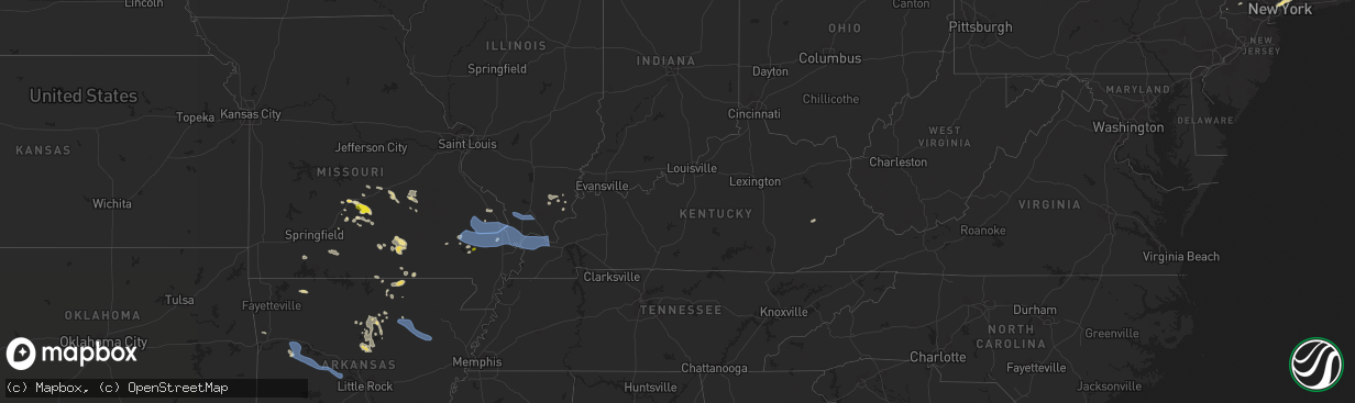
Hail Map in Kentucky on July 17, 2022
The weather event in Kentucky on July 17, 2022 includes Hail, Wind, and Tornado maps. 17 states and 274 cities were impacted and suffered possible damage. The total estimated number of properties impacted is 0.
Want more than just the map?
Turn this storm into a full workflow.
- Owner + property data so you know who to knock
- OnDemand branded weather history reports to win the "did we even have hail?" argument
- RoofTrace estimate so reps stop guessing numbers at the door
Bought this map? Upgrade within 7 days and we'll credit the $230. (10-15 min setup call)
Hail
Wind
Tornado
0
Estimated number of impacted properties by a 1.00" hail or larger0
Estimated number of impacted properties by a 1.75" hail or larger0
Estimated number of impacted properties by a 2.50" hail or largerStorm reports in Kentucky
Kentucky
| Date | Description |
|---|---|
| 07/17/20225:09 PM CDT | Inez 2e co-op observer reported several trees blown down by thunderstorm winds onto roadways in the inez area. Martin county dispatch received 7 downed tree reports. |
| 07/17/20224:06 PM CDT | Tree reported down on barnes mountain road. Time estimated via radar. |
| 07/17/20224:23 AM CDT | At 923 PM CDT, severe thunderstorms were located along a line extending from near Ware to Tamms to near Horseshoe Lake Conservation Area to near Miner to near New Madrid, moving southeast at 30 mph. HAZARD...60 mph wind gusts and penny size hail. SOURCE...Radar indicated. IMPACT...Expect damage to roofs, siding, and trees. Severe thunderstorms will be near... Mounds and Mound City around 935 PM CDT. Charleston and Cairo around 940 PM CDT.Other locations in the path of these severe thunderstorms includeEast Prairie, Big Oak Tree State Park, Wickliffe, Anniston, Barlow,Wyatt, Dorena, La Center and Bardwell.This includes the following highways... Interstate 57 in Illinois between Mile Markers 1 and 22. Interstate 57 in Missouri between Mile Markers 2 and 21. Interstate 55 between Mile Markers 46 and 62. |
| 07/17/202212:17 AM CDT | Trees down near the intersection of w 7th street and ridgecrest drive. |
| 07/17/202212:17 AM CDT | Barn blown over and trees were down. |
| 07/16/202211:50 PM CDT | At 450 PM EDT, a severe thunderstorm was located over Blackburn, moving east at 20 mph. HAZARD...60 mph wind gusts and penny size hail. SOURCE...Radar indicated. IMPACT...Expect damage to roofs, siding, and trees. This severe thunderstorm will remain over mainly rural areas of southeastern Clark and eastern Madison Counties, including the following locations... Bybee, Duluth, College Hill, Moberly, Combs, Panola, Dreyfus, Brassfield, Reeds Crossing and Speedwell. |
| 07/16/202211:46 PM CDT | At 446 PM EDT, a severe thunderstorm was located near Winston, or 8 miles east of Richmond, moving east at 35 mph. HAZARD...60 mph wind gusts. SOURCE...Radar indicated. IMPACT...Expect damage to roofs, siding, and trees. This severe thunderstorm will be near... Blackburn around 450 PM EDT. Winston around 455 PM EDT. Irvine around 500 PM EDT. Willow Tree around 505 PM EDT.Other locations in the path of this severe thunderstorm includeCottage Furnace and Knowlton. |
All States Impacted by Hail Map on July 17, 2022
Cities Impacted by Hail Map on July 17, 2022
- Wappapello, MO
- McGee, MO
- Elizabethtown, IL
- Equality, IL
- Harrisburg, IL
- Chester, AR
- Rudy, AR
- Marble Hill, MO
- Hoboken, NJ
- Weehawken, NJ
- Astoria, NY
- Union City, NJ
- New York, NY
- Jersey City, NJ
- Secaucus, NJ
- Bronx, NY
- North Bergen, NJ
- West New York, NJ
- Niangua, MO
- Grovespring, MO
- Bee Branch, AR
- Damascus, AR
- Quitman, AR
- Shirley, AR
- Puxico, MO
- Waynesville, MO
- Scottsdale, AZ
- Mill Spring, MO
- Mountain View, MO
- Casa Grande, AZ
- Florence, AZ
- Arizona City, AZ
- Eloy, AZ
- Lost Creek, KY
- Jackson, KY
- Browning, MT
- Camp Verde, AZ
- Laquey, MO
- Falcon, MO
- Birch Tree, MO
- Eminence, MO
- Edgemont, AR
- Greenbrier, AR
- Fairfield Bay, AR
- Heber Springs, AR
- Higden, AR
- Drasco, AR
- Mount Vernon, AR
- Ida, AR
- Mountain View, AR
- Lebanon, MO
- Salem, MO
- Crosby, ND
- Wharncliffe, WV
- Gilbert, WV
- Greenville, MO
- Mountain Grove, MO
- Globe, AZ
- Roosevelt, MN
- Ambrose, ND
- Fortuna, ND
- Rolla, MO
- Newburg, MO
- Cut Bank, MT
- Hartville, MO
- Benson, AZ
- Carrier Mills, IL
- Magazine, AR
- Paris, AR
- Big Falls, MN
- Fairfield, MT
- Summersville, MO
- Young, AZ
- Richland, MO
- Belle Rose, LA
- Oak Ridge, MO
- Friedheim, MO
- Perryville, MO
- Payson, AZ
- Omaha, IL
- Ridgway, IL
- East Glacier Park, MT
- Lynchburg, MO
- Plato, MO
- Asbury, NJ
- Warroad, MN
- Crocker, MO
- Dixon, MO
- Forest Lakes, AZ
- Salem, VA
- Long Valley, NJ
- Ava, MO
- Chadwick, MO
- Oldfield, MO
- Horseshoe Bend, AR
- Ash Flat, AR
- Franklin, AR
- Flagstaff, AZ
- Colonial Beach, VA
- Loretto, VA
- Champlain, VA
- Hustle, VA
- Willow Springs, MO
- Myrtle, MO
- Couch, MO
- Alton, MO
- Pleasant Grove, AR
- Bunker, MO
- Picacho, AZ
- Conway, MO
- Pine, AZ
- Badger, MN
- Roseau, MN
- Woodford, VA
- Fredericksburg, VA
- Manchester, NH
- Mammoth Spring, AR
- Maricopa, AZ
- Roby, MO
- Green Forest, AR
- Berryville, AR
- Rio Rico, AZ
- Cook Sta, MO
- Cherryville, MO
- Amado, AZ
- Tucson, AZ
- Genoa, WV
- Dunlow, WV
- Wesco, MO
- Steelville, MO
- Mesa, AZ
- Forbes, ND
- Bucyrus, MO
- Graff, MO
- Huggins, MO
- Lakeside, AZ
- Show Low, AZ
- Moody, MO
- Caulfield, MO
- Sorrento, FL
- Mount Dora, FL
- Eustis, FL
- Silva, MO
- Galena, MO
- Raleigh, IL
- Galatia, IL
- Eldorado, IL
- Batesville, AR
- Grand Canyon, AZ
- Phillipsburg, MO
- Sedona, AZ
- Sells, AZ
- Camp, AR
- Thayer, MO
- Cave City, AR
- Viola, AR
- Junction, IL
- Mount Pleasant, AR
- Guion, AR
- Orange, VA
- Gordonsville, VA
- Tubac, AZ
- Clinton, AR
- Leslie, AR
- Salol, MN
- Leon, VA
- Brightwood, VA
- Reva, VA
- Mount Lemmon, AZ
- Wellington, FL
- Loxahatchee, FL
- Alsen, ND
- Canton, MS
- Camden, MS
- Jerome, MO
- Oran, MO
- Chaffee, MO
- Fulks Run, VA
- Hackberry, AZ
- Wayne, WV
- East Lynn, WV
- Salem, AR
- Crane, MO
- Jarratt, VA
- Marshfield, MO
- Tumbling Shoals, AR
- Wiseman, AR
- Oxford, AR
- Apopka, FL
- Hardy, AR
- Phoenix, AZ
- Laveen, AZ
- Gilbert, AZ
- Paradise Valley, AZ
- Tempe, AZ
- Charlotte, AR
- Newark, AR
- Cord, AR
- Amagon, AR
- Newport, AR
- Weiner, AR
- Fisher, AR
- Sulphur Rock, AR
- Altus, AR
- Scranton, AR
- Danville, AR
- Belleville, AR
- Havana, AR
- Ola, AR
- Perryville, AR
- Coal Hill, AR
- Dardanelle, AR
- Subiaco, AR
- Casa, AR
- Hartman, AR
- Ozark, AR
- Auburn, NH
- Hooksett, NH
- Circleville, OH
- Stoutsville, OH
- Marana, AZ
- Advance, MO
- Cape Girardeau, MO
- McClure, IL
- Patton, MO
- Leopold, MO
- Glenallen, MO
- Millersville, MO
- Marquand, MO
- Jackson, MO
- Scott City, MO
- Burfordville, MO
- Whitewater, MO
- Tamms, IL
- Bell City, MO
- Sturdivant, MO
- Metropolis, IL
- Thebes, IL
- Gipsy, MO
- Olmsted, IL
- Olive Branch, IL
- Wickliffe, KY
- Mounds, IL
- Cairo, IL
- Barlow, KY
- Zalma, MO
- Miller City, IL
- Brownwood, MO
- Sikeston, MO
- Mound City, IL
- Paducah, KY
- Brookport, IL
- Bloomfield, MO
- Villa Ridge, IL
- Ledbetter, KY
- Charleston, MO
- Kevil, KY
- Benton, MO
- Pulaski, IL
- West Paducah, KY
- Lowndes, MO
- La Center, KY
- Ullin, IL
- Clubb, MO
- Smithland, KY
- Buncombe, IL
- Jonesboro, IL
- Goreville, IL
- Vienna, IL
- Ozark, IL
- Anna, IL
- Cobden, IL
- Dongola, IL
- Alto Pass, IL


