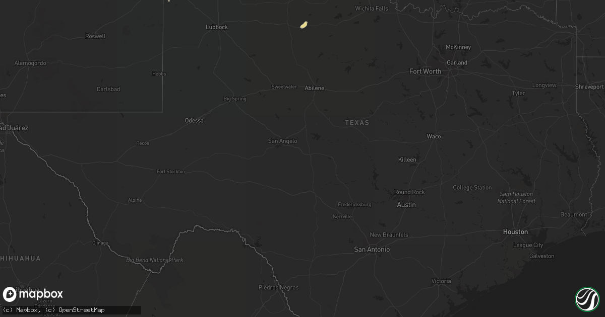
Hail Map in Texas on July 17, 2021
Get this storm
July 17 map
$229
one time, instant access
Download today. No call, no setup
Keep the $229
Bought the map and want the full workflow? Apply the entire $229 to a subscription within 7 days. None of it is wasted.
Every map, not just this one
This buys you this map. Subscription and you get every map we run, in the markets you choose from a few cities to whole states to nationwide. Plus real-time alerts the moment a storm fires.
Contact data
Name, contact info, occupancy, even credit band for addresses in the footprint. You go from where it hit to who to call.
Become the source they trust
Unlimited branding weather history reports on demand. You already have the documented answer ready for the property owner, and you are the one who showed up with it.
Property data and RoofTrace estimates
Pull up any address you have got, its value and the exact code rules for that jurisdiction, straight from One Click Code. Then RoofTrace estimates the squares, pitch, and roof value, priced the way you price.
Storm reports in Texas
Texas
| Date | Description |
|---|---|
| 07/17/20216:55 PM CDT | A local report indicates 62 MPH wind near 11 ESE VALLEY DE ORO |
| 07/17/20216:55 PM CDT | Corrected for time from previous tstm wnd gst report from amarillo. |
| 07/17/20216:02 PM CDT | Hail making a lot of noises banging on everything. Person estimates the largest hail stones to be at least the size of quarters. Hail stopped around 1704 lst. |
| 07/17/20215:51 PM CDT | A few trees were blown down near the howardwick entrance off of highway 70 and 1 mile north of the entrance on highway 70. A carport roof was also blown off in howardwi |
| 07/17/20215:14 PM CDT | Reported mostly quarter size hail with a few stones as large as golf balls. Said a cotton field two miles to the west was completely destroyed. |
| 07/17/20214:13 AM CDT | At 913 PM CDT, severe thunderstorms were located along a line extending from 4 miles east of Easter to 4 miles northwest of Lazbuddie to 5 miles north of Clovis, moving south at 20 mph. HAZARD...60 mph wind gusts and nickel size hail. SOURCE...Radar indicated. IMPACT...Expect damage to roofs, siding, and trees. Locations impacted include... Muleshoe, Dimmitt, Friona, Hart, Earth, Bovina, Farwell, Sudan, Summerfield, Needmore, Easter, Lazbuddie, Oklahoma Lane, Progress, Lariat, West Camp, Black, Rhea and Springlake. |
| 07/17/20213:18 AM CDT | At 817 PM CDT, severe thunderstorms were located along a line extending from near Bellview to 6 miles northwest of Happy, moving southeast at 25 mph. HAZARD...70 mph wind gusts and nickel size hail. SOURCE...66 mph wind measured at the Hereford West Texas Mesonet IMPACT...Expect considerable tree damage. Damage is likely to mobile homes, roofs, and outbuildings. Locations impacted include... Tulia, Dimmitt, Friona, Hart, Bovina, Farwell, Kress, Happy, Summerfield, Easter, Lazbuddie, Oklahoma Lane, Lariat, Claytonville, Black, Rhea and Nazareth. |
| 07/17/20212:51 AM CDT | At 751 PM CDT, severe thunderstorms were located along a line extending from 8 miles south of Canyon to 12 miles northwest of Dawn to 10 miles north of Bellview, moving southwest at 15 mph. HAZARD...70 mph wind gusts and penny size hail. SOURCE...Radar indicated. IMPACT...Expect some tree damage. Damage is likely to mobile homes, roofs, and outbuildings. Locations impacted include... Amarillo, Hereford, Canyon, Mescalero Park, Buffalo Lake, Dawn, Umbarger, Bootleg and Simms. |
| 07/17/20212:13 AM CDT | At 712 PM CDT, a severe thunderstorm was located over Umbarger, or 9 miles west of Canyon, moving west at 15 mph. HAZARD...70 mph wind gusts and half dollar size hail. SOURCE...Radar indicated. IMPACT...Expect some tree damage. Damage is likely to mobile homes, roofs, and outbuildings. Hail damage to vehicles is expected. Locations impacted include... Dawn, Umbarger and Buffalo Lake. |
| 07/17/20212:12 AM CDT | At 712 PM MDT, a severe thunderstorm was located 7 miles north of Bellview, or 28 miles northwest of Friona, and is nearly stationary. HAZARD...60 mph wind gusts and quarter size hail. SOURCE...Radar indicated. IMPACT...Hail damage to vehicles is expected. Expect wind damage to roofs, siding, and trees. Locations impacted include... Bellview. |
| 07/17/20212:04 AM CDT | At 703 PM CDT, a severe thunderstorm was located 11 miles northwest of Amarillo, moving south at 15 mph. HAZARD...60 mph wind gusts and penny size hail. SOURCE...Automated weather equipment. IMPACT...Minor damage to roofs, siding, and trees is possible. Locations impacted include... Amarillo, Mescalero Park and Bushland. |
| 07/17/20211:27 AM CDT | At 627 PM CDT, a severe thunderstorm was located near Palo Duro Canyon, or 16 miles southwest of Claude, moving southwest at 10 mph. HAZARD...60 mph wind gusts and quarter size hail. SOURCE...Radar indicated. IMPACT...Minor damage to roofs, siding, and trees is possible. Hail damage to vehicles is expected. Locations impacted include... Wayside and Palo Duro Canyon. |
| 07/17/20211:01 AM CDT | At 601 PM CDT, a severe thunderstorm was located over Greenbelt Lake, or near Clarendon, moving southwest at 10 mph. HAZARD...60 mph wind gusts and quarter size hail. SOURCE...Radar indicated. IMPACT...Minor damage to roofs, siding, and trees is possible. Hail damage to vehicles is expected. Locations impacted include... Clarendon, Howardwick, Lelia Lake and Greenbelt Lake. |
| 07/17/202112:45 AM CDT | At 544 AM CDT, a severe thunderstorm was located 12 miles south of Guymon, moving east at 10 mph. HAZARD...60 mph wind gusts and quarter size hail. SOURCE...Radar indicated. IMPACT...Minor damage to roofs, siding, and trees is possible. Hail damage to vehicles is expected. Locations impacted include... Hardesty. |
| 07/17/202112:41 AM CDT | At 541 PM CDT, a severe thunderstorm was located near Grandfield, moving southwest at 10 mph. HAZARD...60 mph wind gusts and penny size hail. SOURCE...Radar indicated. IMPACT...Expect damage to roofs, siding, and trees. Locations impacted include... Grandfield and Loveland. |
| 07/17/202112:00 AM CDT | At 500 PM CDT, a severe thunderstorm was located near Claude, and is nearly stationary. HAZARD...60 mph wind gusts and quarter size hail. SOURCE...Radar indicated. IMPACT...Minor damage to roofs, siding, and trees is possible. Hail damage to vehicles is expected. Hail may accumulate on roadways causing hazardous travel. Locations impacted include... Claude. |
| 07/16/202111:02 PM CDT | At 402 PM CDT, a severe thunderstorm was located over Goodwell, or 11 miles southwest of Guymon, moving southeast at 10 mph. HAZARD...60 mph wind gusts and quarter size hail. SOURCE...Radar indicated. IMPACT...Minor damage to roofs, siding, and trees is possible. Hail damage to vehicles is expected. Locations impacted include... Goodwell and Texhoma. |
| 07/16/202110:54 PM CDT | At 353 PM CDT, a severe thunderstorm was located 9 miles south of Northfield, or 13 miles northeast of Matador, and is nearly stationary. HAZARD...60 mph wind gusts and quarter size hail. SOURCE...Radar indicated. IMPACT...Hail damage to vehicles is expected. Expect wind damage to roofs, siding, and trees. This severe thunderstorm will remain over mainly rural areas of northeastern Motley County. |
| 07/16/202110:48 PM CDT | At 348 PM CDT, a severe thunderstorm was located over Lefors, or 13 miles southeast of Pampa, moving east at 15 mph. HAZARD...60 mph wind gusts and quarter size hail. SOURCE...Radar indicated. IMPACT...Minor damage to roofs, siding, and trees is possible. Hail damage to vehicles is expected. Locations impacted include... Lefors. |
| 07/16/202110:00 PM CDT | At 300 PM CDT, a severe thunderstorm was located 17 miles southeast of Felt, or 21 miles south of Boise City, moving south at 10 mph. HAZARD...60 mph wind gusts and quarter size hail. SOURCE...Radar indicated. IMPACT...Minor damage to roofs, siding, and trees is possible. Hail damage to vehicles is expected. This severe thunderstorm will remain over mainly rural areas of northeastern Dallam County. |
| 07/16/20218:41 PM CDT | Large tree was blown down. |
| 07/16/20218:24 PM CDT | A local report indicates 61 MPH wind near 2 NE FRIONA |
| 07/16/20218:10 PM CDT | 66 mph gust w/ 50 mph wind speed. |
| 07/16/20217:25 PM CDT | 58 mph gust / 51 mph sustained wind. |
| 07/16/20217:04 PM CDT | Ama 15 nne. |
All States Impacted by Hail Map on July 17, 2021
Cities Impacted by Hail Map on July 17, 2021
- Lincoln, RI
- Harrisburg, PA
- Dalhart, TX
- Westhope, ND
- Souris, ND
- Atwood, CO
- Merino, CO
- Sterling, CO
- Boone, CO
- Fowler, CO
- Goodwell, OK
- Edgemont, SD
- Stone Ridge, NY
- Hurley, NY
- West Hurley, NY
- Kingston, NY
- Johnstown, NE
- Newtown, PA
- Langhorne, PA
- Lambertville, NJ
- Philadelphia, PA
- Muncy, PA
- Turbotville, PA
- Newark, NJ
- Elizabeth, NJ
- Potomac, MD
- Reston, VA
- Great Falls, VA
- Herndon, VA
- Leesville, SC
- Clarendon, TX
- Claude, TX
- Airville, PA
- Brogue, PA
- Rhinebeck, NY
- Red Hook, NY
- Cheney, KS
- Bloomsburg, PA
- Millville, PA
- Danville, PA
- South Haven, KS
- Geuda Springs, KS
- Rural Hall, NC
- Oxford, NY
- New Paltz, NY
- Clovis, NM
- Las Animas, CO
- Isabella, OK
- Fairview, OK
- Arnett, OK
- Whitney Point, NY
- Saint Petersburg, FL
- Seminole, FL
- Pinellas Park, FL
- Stratford, TX
- Panhandle, TX
- Deer Trail, CO
- Stilwell, OK
- Berlin, MA
- West Boylston, MA
- Boylston, MA
- Worcester, MA
- Shrewsbury, MA
- Clinton, MA
- Kingman, KS
- Vega, TX
- Brush, CO
- Canon City, CO
- Melrose, NM
- Hereford, TX
- Wildorado, TX
- Sykesville, MD
- Marriottsville, MD
- Lead, SD
- Amarillo, TX
- Rembert, SC
- Purdum, NE
- Canyon, TX
- Wiggins, CO
- Mount Airy, MD
- Carlisle, PA
- Shermans Dale, PA
- Landisburg, PA
- Newville, PA
- Humansville, MO
- Bolivar, MO
- Dunnegan, MO
- Salt Point, NY
- Hyde Park, NY
- Mebane, NC
- Burlington, NC
- Cedar Grove, NC
- Marysville, PA
- Duncannon, PA
- Jasper, NY
- Woodhull, NY
- Addison, NY
- Greenwood, NY
- Cameron Mills, NY
- Canadian, TX
- Fort Morgan, CO
- Turon, KS
- Miami, TX
- Mobeetie, TX
- Custer, SD
- Orange, VA
- Crook, CO
- Peetz, CO
- Denham Springs, LA
- Portales, NM
- Mayesville, SC
- Gable, SC
- Sumter, SC
- Evening Shade, AR
- Lincoln, AR
- Canehill, AR
- Evansville, AR
- Cunningham, KS
- Brule, NE
- Burlington, NJ
- Louisa, VA
- Gordonsville, VA
- Saint Pauls, NC
- Blackstone, VA
- McKenney, VA
- Reidsville, NC
- Muncy Valley, PA
- Benton, PA
- Unityville, PA
- Auburn, MA
- Newark Valley, NY
- Cincinnatus, NY
- Dryden, NY
- Greene, NY
- Slaterville Springs, NY
- Binghamton, NY
- Berkshire, NY
- Lisle, NY
- Richford, NY
- Ithaca, NY
- Newfield, NY
- Marathon, NY
- Willet, NY
- Maine, NY
- Willseyville, NY
- Glen Aubrey, NY
- Smithville Flats, NY
- Harford, NY
- Spencer, NY
- McDonough, NY
- Brooktondale, NY
- Hendersonville, NC
- Black Mountain, NC
- Washington Boro, PA
- Lancaster, PA
- Conestoga, PA
- Millersville, PA
- Elon, NC
- Browns Summit, NC
- McLeansville, NC
- Greensboro, NC
- Gibsonville, NC
- Ridgeland, SC
- Dundalk, MD
- Rosedale, MD
- Essex, MD
- Baltimore, MD
- Bottineau, ND
- Halifax, PA
- Willington, CT
- Ashford, CT
- Storrs Mansfield, CT
- San Jon, NM
- Calhan, CO
- Parkville, MD
- Lake Lure, NC
- Columbia, VA
- Kents Store, VA
- Baker, MT
- Camp Crook, SD
- Buffalo, SD
- Florissant, CO
- Ford, VA
- Amelia Court House, VA
- Lecompte, LA
- Snyder, CO
- Lisco, NE
- Rockland, ID
- American Falls, ID
- Pampa, TX
- Warrenton, VA
- Broad Run, VA
- Otis, MA
- Rantoul, KS
- Torrington, WY
- Cherry Valley, MA
- Pritchett, CO
- Hugo, CO
- Limon, CO
- New Port Richey, FL
- Sudan, TX
- Fairfield, NJ
- Caldwell, NJ
- Little Falls, NJ
- Cedar Grove, NJ
- Wayne, NJ
- Lexington, NC
- Seymour, TX
- Tulsa, OK
- Antler, ND
- Fairfax, OK
- Charles City, VA
- Henrico, VA
- Providence Forge, VA
- Quinton, VA
- Sandston, VA
- Coward, SC
- North Grafton, MA
- High Falls, NY
- Cottekill, NY
- Summerfield, NC
- Springfield, CO
- Hudson, KS
- Havana, KS
- Niotaze, KS
- Clayton, NM
- Cameron, NY
- Williamsburg, VA
- Lynchburg, VA
- Rustburg, VA
- Columbia, SC
- Lake Katrine, NY
- Saugerties, NY
- Titusville, NJ
- Trenton, NJ
- South Hill, VA
- Kenbridge, VA
- Murdock, KS
- Groom, TX
- Colorado Springs, CO
- Sylvia, KS
- St John, KS
- Stockville, NE
- New Hope, PA
- Stockton, NJ
- Ringoes, NJ
- Winston Salem, NC
- Pfafftown, NC
- Alma, GA
- Danville, VA
- Oldsmar, FL
- Dunning, NE
- Florence, NJ
- Levittown, PA
- Morrisville, PA
- Fairless Hills, PA
- Bristol, PA
- Peyton, CO
- Chenango Forks, NY
- Yanceyville, NC
- Troupsburg, NY
- Quanah, TX
- Happy, TX
- Bois D Arc, MO
- Willard, MO
- Ash Grove, MO
- Springfield, MO
- Rowesville, SC
- Wheeler, TX
- Vernon, TX
- Hillrose, CO
- Okeene, OK
- Benson, NC
- Angier, NC
- Lovington, NM
- Roswell, NM
- Madrid, NE
- Carmel, NY
- Wibaux, MT
- Sherwood, ND
- Plevna, KS
- Abbyville, KS
- Carthage, NC
- Vass, NC
- Mansfield Center, CT
- Newkirk, OK
- Huntingdon, PA
- Hot Springs, SD
- Lumberton, NC
- Baton Rouge, LA
- Prairieville, LA
- Broken Arrow, OK
- Grandfield, OK
- Dayville, CT
- Pomfret Center, CT
- Broadview, NM
- Staten Island, NY
- Baxley, GA
- Furlong, PA
- Frenchtown, NJ
- Flemington, NJ
- Lumberville, PA
- Doylestown, PA
- Carversville, PA
- Conover, NC
- Olar, SC
- Ehrhardt, SC
- Mohall, ND
- Eldorado, OK
- Elizabethport, NJ
- Pierce City, MO
- Granby, MO
- Lewisville, NC
- Harrison, NE
- Stafford Springs, CT
- Roxbury, CT
- Southbury, CT
- Palmyra, NJ
- Merchantville, NJ
- Camden, NJ
- Riverton, NJ
- Bensalem, PA
- Pennsauken, NJ
- Riverside, NJ
- Beverly, NJ
- Kirk, CO
- New Britain, CT
- Newington, CT
- Bristol, CT
- Southington, CT
- Plainville, CT
- West Hartford, CT
- Farmington, CT
- Grant, NE
- Glen Burnie, MD
- Curtis Bay, MD
- Sparrows Point, MD
- Fleming, CO
- Jeffersonton, VA
- Remington, VA
- Ruffin, NC
- Pelham, NC
- Gallion, AL
- Faunsdale, AL
- Piscataway, NJ
- Pollock, LA
- Woodstock, NY
- Byers, CO
- Dunseith, ND
- Swansea, SC
- Chestertown, MD
- Towson, MD
- Nottingham, MD
- North Scituate, RI
- Chepachet, RI
- Foster, RI
- East Killingly, CT
- Ellicott City, MD
- Windsor Mill, MD
- Alexandria, LA
- Fort Howard, MD
- Castle Creek, NY
- Middle River, MD
- Glen Arm, MD
- Brooklyn, MD
- Cockeysville, MD
- Millersville, MD
- Perry Hall, MD
- Pasadena, MD
- Phoenix, MD
- Lutherville Timonium, MD
- Tivoli, NY
- Washington Depot, CT
- New Milford, CT
- Port Ewen, NY
- Stevensville, PA
- Wyalusing, PA
- Laceyville, PA
- Maxwell, NE
- Bennett, CO
- Scranton, SC
- Timmonsville, SC
- Dry Prong, LA
- Colfax, LA
- Bentley, LA
- Candor, NY
- Cape Fair, MO
- Bamberg, SC
- Garden Plain, KS
- Milton, KS
- Viola, KS
- Metuchen, NJ
- Fords, NJ
- Iselin, NJ
- South Plainfield, NJ
- Edison, NJ
- Alden, KS
- Wedgefield, SC
- Paducah, TX
- Front Royal, VA
- White Post, VA
- Boyce, VA
- Manning, SC
- Hartley, TX
- Hardeeville, SC
- Okarche, OK
- Whitehall, PA
- Allentown, PA
- Clearwater, FL
- Dunedin, FL
- Orangeburg, SC
- Wagon Mound, NM
- Sutton, MA
- Oxford, MA
- Millbury, MA
- Church Creek, MD
- Cambridge, MD
- Dover, DE
- Neosho, MO
- Jeffersonville, NY
- Fort Cobb, OK
- Arlington, KS
- Lyons, GA
- Hartsville, SC
- Lance Creek, WY
- Rochdale, MA
- Northborough, MA
- Leicester, MA
- Kingston, PA
- Luzerne, PA
- Wilkes Barre, PA
- Plymouth, PA
- Booker, TX
- Red Lion, PA
- Wrightsville, PA
- Windsor, PA
- Gadsden, SC
- Staatsburg, NY
- Bristol, FL
- Voorhees, NJ
- Marlton, NJ
- Cherry Hill, NJ
- Mcalister, NM
- Palmyra, VA
- Pretty Prairie, KS
- Ruckersville, VA
- Earlysville, VA
- Charlottesville, VA
- Dyke, VA
- Owings Mills, MD
- Stevenson, MD
- Pikesville, MD
- Germantown, MD
- Gaithersburg, MD
- Bolton, MA
- Harvard, MA
- Devens, MA
- Lancaster, MA
- Friona, TX
- Bowman, SC
- Catskill, NY
- Lane, KS
- Osawatomie, KS
- Brunson, SC
- Melbourne, AR
- Endicott, NY
- Haven, KS
- Keasbey, NJ
- Sayreville, NJ
- South Amboy, NJ
- Danbury, NC
- Lawsonville, NC
- Bennettsville, SC
- Wallace, SC
- Highland, NY
- Ulster Park, NY
- Cameron, NC
- Gaston, SC
- West Columbia, SC
- Shell Knob, MO
- Lampe, MO
- Hale Center, TX
- Plainview, TX
- Olanta, PA
- Clearfield, PA
- Curwensville, PA
- Clymer, PA
- Dixonville, PA
- New Millport, PA
- Osceola Mills, PA
- Houtzdale, PA
- Glen Campbell, PA
- Philipsburg, PA
- Hillsdale, PA
- Arcadia, PA
- Mahaffey, PA
- Marion Center, PA
- Commodore, PA
- Cherry Tree, PA
- Gipsy, PA
- Indiana, PA
- West Decatur, PA
- Glen Richey, PA
- Irvona, PA
- La Jose, PA
- Ernest, PA
- Rochester Mills, PA
- Little Meadows, PA
- Friendsville, PA
- Summerfield, TX
- Willingboro, NJ
- Columbus, NJ
- Bordentown, NJ
- Jobstown, NJ
- Mount Holly, NJ
- Fallon, MT
- Freeville, NY


