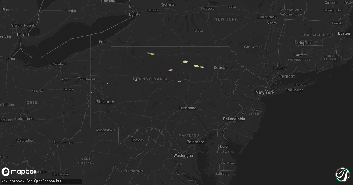
Hail Map in Pennsylvania on July 16, 2021
Get this storm
July 16 map
$229
one time, instant access
Download today. No call, no setup
Keep the $229
Bought the map and want the full workflow? Apply the entire $229 to a subscription within 7 days. None of it is wasted.
Every map, not just this one
This buys you this map. Subscription and you get every map we run, in the markets you choose from a few cities to whole states to nationwide. Plus real-time alerts the moment a storm fires.
Contact data
Name, contact info, occupancy, even credit band for addresses in the footprint. You go from where it hit to who to call.
Become the source they trust
Unlimited branding weather history reports on demand. You already have the documented answer ready for the property owner, and you are the one who showed up with it.
Property data and RoofTrace estimates
Pull up any address you have got, its value and the exact code rules for that jurisdiction, straight from One Click Code. Then RoofTrace estimates the squares, pitch, and roof value, priced the way you price.
Storm reports in Pennsylvania
Pennsylvania
| Date | Description |
|---|---|
| 07/16/20214:15 PM CDT | Multiple large trees down and a tree on a house near coyote ridge rd and chickadee ln. |
| 07/16/20213:48 PM CDT | Large limbs down on road near intersection of nichols street and williams street. |
| 07/16/20213:40 PM CDT | Tree down on electrical pole adjacent to house |
| 07/16/20213:35 PM CDT | Trees down. |
| 07/16/20213:32 PM CDT | Wires down on cush creek road |
| 07/16/20213:25 PM CDT | Tree on wires in brady township. |
| 07/16/20213:14 PM CDT | Tree down on 7th st ext |
| 07/16/20213:07 PM CDT | Trees down. Time estimated from radar. |
| 07/16/20212:45 PM CDT | Trees down. Time estimated from radar. |
| 07/16/20212:40 PM CDT | Tree on house mosgrove road |
| 07/16/20212:14 PM CDT | Trees and power lines on north jackson |
| 07/16/20212:00 PM CDT | Numerous trees and wires down north of city. |
| 07/16/20211:56 PM CDT | Trees and wires down |
| 07/16/20211:40 PM CDT | Numerous reports of downed trees and power lines. |
| 07/16/20211:40 PM CDT | Tree down blocking road intersection of main and school st. Roulette twp. |
| 07/16/20211:28 PM CDT | 1 utility pole down intersection of us-6 and seneca dr. |
| 07/16/20211:27 PM CDT | Tree limb down on wires |
| 07/16/20211:31 AM CDT | At 630 PM EDT, a severe thunderstorm was located near Ricketts Glen State Park, or 16 miles south of Wyalusing, moving east at 30 mph. HAZARD...60 mph wind gusts and quarter size hail. SOURCE...Radar indicated. IMPACT...Hail damage to vehicles is expected. Expect wind damage to roofs, siding, and trees. Locations impacted include... Wilkes-Barre, Falls, Kingston, Plains, Exeter, Vernon, Swoyersville, Edwardsville, Larksville and Forty Fort. |
| 07/16/20211:02 AM CDT | At 601 PM EDT, a severe thunderstorm was located near Lincoln Falls, moving east at 20 mph. HAZARD...60 mph wind gusts and quarter size hail. SOURCE...Radar indicated. IMPACT...Hail damage to vehicles is expected. Expect wind damage to roofs, siding, and trees. Locations impacted include... Ricketts Glen State Park, Dushore, Laporte, Forksville and Eagles Mere. |
| 07/16/202112:29 AM CDT | At 529 PM EDT, a severe thunderstorm was located over Sussex, or 10 miles southeast of Montague, moving southeast at 15 mph. HAZARD...60 mph wind gusts and quarter size hail. SOURCE...Radar indicated. IMPACT...Minor damage to vehicles is possible. Wind damage to roofs, siding, trees, and power lines is possible. Locations impacted include... Franklin, Hamburg, Ogdensburg, Sussex, Branchville, Pellettown, Highland Lake, Vernon Valley and Hainesville. |
| 07/16/202112:21 AM CDT | At 520 PM EDT, a severe thunderstorm was located over Lehighton, moving east at 35 mph. HAZARD...60 mph wind gusts and quarter size hail. SOURCE...Radar indicated. IMPACT...Minor damage to vehicles is possible. Wind damage to roofs, siding, trees, and power lines is possible. Locations impacted include... Lehighton, Palmerton, Bangor, Jim Thorpe, Slatington, Pen Argyl, Wind Gap, Walnutport, East Bangor, Stormville, Brodheadsville, New Mahoning, Kunkletown, Gilbert, Tannersville, Rossland, Berlinsville, Emerald, Kresgeville and Sun Valley.This includes the following highways... Northeast Extension between mile markers 67 and 84. Interstate 80 in Pennsylvania between mile markers 298 and 309. |
| 07/16/202112:13 AM CDT | At 511 PM EDT, a severe thunderstorm was located near Cammal, moving east at 25 mph. HAZARD...60 mph wind gusts and penny size hail. SOURCE...Radar indicated. IMPACT...Expect damage to roofs, siding, and trees. Locations impacted include... Waterville, English Center, Cammal, Little Pine State Park and Salladasburg. |
| 07/15/202111:47 PM CDT | At 447 PM EDT, a severe thunderstorm was located over Ralston, moving southeast at 25 mph. HAZARD...60 mph wind gusts and quarter size hail. SOURCE...Radar indicated. IMPACT...Hail damage to vehicles is expected. Expect wind damage to roofs, siding, and trees. Locations impacted include... Ralston and Buttonwood. |
| 07/15/202111:30 PM CDT | At 430 PM EDT, a severe thunderstorm was located near Arnot, moving east at 25 mph. HAZARD...60 mph wind gusts and quarter size hail. SOURCE...Radar indicated. IMPACT...Hail damage to vehicles is expected. Expect wind damage to roofs, siding, and trees. Locations impacted include... Blossburg, Arnot and Ogdensburg. |
| 07/15/202111:29 PM CDT | At 429 PM EDT, a severe thunderstorm was located near Punxsutawney, moving east at 20 mph. HAZARD...60 mph wind gusts and quarter size hail. SOURCE...Radar indicated. IMPACT...Hail damage to vehicles is expected. Expect wind damage to roofs, siding, and trees. Locations impacted include... Clearfield, Philipsburg, Woodland, Curwensville, Hyde, Osceola Mills, Plymptonville, Rockton, Chester Hill, Karthaus, Houtzdale, Jeffries, Lecontes Mills, Morrisdale, Irvona, West Decatur, Coalport, Grassflat, Ramey and Brisbin.For those driving on Interstate 80, this includes areas between thePenfield and Snow Shoe exits, specifically from mile markers 112 to138. |
| 07/15/202111:12 PM CDT | At 412 PM EDT, a severe thunderstorm was located near Wolfdale, or near Avella, moving east at 25 mph. HAZARD...Wind gusts to 60 mph. SOURCE...Radar. IMPACT...Expect damage to trees and power lines, resulting in some power outages. Locations impacted include... Washington... Canonsburg... Avella... Wolfdale... McGovern... East Washington... Houston... Claysville... Eighty Four... Hickory... West Alexander... Taylorstown...This includes the following highways... Interstate 70 in Pennsylvania between mile markers 1 and 25. Interstate 79 in Pennsylvania between mile markers 27 and 49. |
| 07/15/202111:11 PM CDT | At 411 PM EDT, a severe thunderstorm was located over Sandy, moving east at 25 mph. HAZARD...60 mph wind gusts and quarter size hail. SOURCE...Radar indicated. IMPACT...Hail damage to vehicles is expected. Expect wind damage to roofs, siding, and trees. Locations impacted include... DuBois, Clearfield, Sandy, Curwensville, Hyde, Plymptonville, Rockton, S.B. Elliot State Park, Troutville, Clearfield-Lawrence Airport and Penn State Dubois.For those driving on Interstate 80, this includes areas between theDubois Route 255 and Woodland exits, specifically from mile markers102 to 122. |
| 07/15/202110:56 PM CDT | At 356 PM EDT, severe thunderstorms were located along a line extending from near Brookville to near Indiana, moving east at 15 mph. HAZARD...Wind gusts to 60 mph. SOURCE...Radar. IMPACT...Expect damage to trees and power lines, resulting in some power outages. Locations impacted include... Punxsutawney... Brookville... Reynoldsville... Clymer... Sykesville... Falls Creek... Big Run... Rossiter... Ernest... Marion Center... Cherry Tree... Creekside...This includes Interstate 80 in Pennsylvania between mile markers 84and 96. |
| 07/15/202110:42 PM CDT | At 342 PM EDT, a severe thunderstorm was located over Pittsburgh, moving east at 40 mph. HAZARD...Wind gusts to 60 mph. SOURCE...Radar. IMPACT...Expect damage to trees and power lines, resulting in some power outages. Locations impacted include... Pittsburgh... Penn Hills... Mount Lebanon... Bethel Park... Ross Township... Monroeville... McKeesport... Jeannette... Shaler Township... Plum... West Mifflin... North Side Pittsburgh...This includes the following highways... Pennsylvania Turnpike between mile markers 46 and 72. Interstate 376 in Pennsylvania between mile markers 68 and 84. |
| 07/15/202110:30 PM CDT | At 329 PM EDT, severe thunderstorms were located along a line extending from 6 miles north of Rimersburg to near Kittanning, moving east at 30 mph. HAZARD...Wind gusts to 60 mph. SOURCE...Radar. IMPACT...Expect damage to trees and power lines, resulting in some power outages. Locations impacted include... Kittanning... Brookville... Rimersburg... Ford City... New Bethlehem... West Kittanning... East Brady... Rural Valley... Parker... Sligo... Worthington... Dayton... |
| 07/15/202110:23 PM CDT | At 322 PM EDT, a severe thunderstorm was located near Moon Township, moving east at 40 mph. HAZARD...Wind gusts to 60 mph. SOURCE...Radar. IMPACT...Expect damage to trees and power lines, resulting in some power outages. Locations impacted include... Pittsburgh... Ross Township... McCandless Township... Moon Township... Franklin Park... Aliquippa... Shaler Township... North Side Pittsburgh... Robinson Township... Economy... O'hara Township... Bellevue...This includes the following highways... Interstate 79 in Pennsylvania between mile markers 62 and 73. Interstate 376 in Pennsylvania between mile markers 47 and 54, and between mile markers 56 and 57. |
| 07/15/202110:11 PM CDT | At 311 PM EDT, a severe thunderstorm was located near McDonald, or 8 miles southwest of Moon Township, moving east at 40 mph. HAZARD...Wind gusts to 60 mph. SOURCE...Radar. IMPACT...Expect damage to trees and power lines, resulting in some power outages. Locations impacted include... Pittsburgh... Mount Lebanon... Bethel Park... Ross Township... Moon Township... McMurray... Canonsburg... Gastonville... Shaler Township... West Mifflin... North Side Pittsburgh... Baldwin...This includes the following highways... Interstate 79 in Pennsylvania between mile markers 45 and 65. Interstate 376 in Pennsylvania between mile markers 52 and 74. |
| 07/15/20219:54 PM CDT | At 253 PM EDT, severe thunderstorms were located along a line extending from near Zelienople to 7 miles east of Weirton, moving east at 35 mph. HAZARD...Wind gusts to 60 mph. SOURCE...Radar. IMPACT...Expect damage to trees and power lines, resulting in some power outages. Locations impacted include... Pittsburgh... Penn Hills... Ross Township... McCandless Township... Cranberry... Moon Township... Franklin Park... Shaler Township... Plum... West Mifflin... North Side Pittsburgh... Baldwin...This includes the following highways... Pennsylvania Turnpike between mile markers 25 and 50. Interstate 79 in Pennsylvania between mile markers 60 and 85. Interstate 376 in Pennsylvania between mile markers 54 and 60, and between mile markers 68 and 80. |
| 07/15/20219:49 PM CDT | At 249 PM EDT, severe thunderstorms were located along a line extending from near Slippery Rock to near Zelienople, moving east at 55 mph. HAZARD...Wind gusts to 60 mph. SOURCE...Radar. IMPACT...Expect damage to trees and power lines, resulting in some power outages. Locations impacted include... Butler... Kittanning... Rimersburg... Homeacre-Lyndora... Shanor-Northvue... Meridian... Slippery Rock... Ford City... Meadowood... Oak Hills... West Kittanning... Nixon...This includes Interstate 79 in Pennsylvania between mile markers 90and 105. |
| 07/15/20219:18 PM CDT | At 218 PM EDT, a severe thunderstorm was located over Port Allegany, moving east at 20 mph. HAZARD...60 mph wind gusts and quarter size hail. SOURCE...Radar indicated. IMPACT...Hail damage to vehicles is expected. Expect wind damage to roofs, siding, and trees. Locations impacted include... Coudersport, Port Allegany, Roulette and Oswayo. |
| 07/15/20217:24 PM CDT | Trees down and blocking roadway. Time estimated from radar. |
All States Impacted by Hail Map on July 16, 2021
Cities Impacted by Hail Map on July 16, 2021
- Forksville, PA
- Sesser, IL
- Benton, IL
- Lexington, SC
- Burlington, CO
- Kyle, SD
- Pine Ridge, SD
- Sedona, AZ
- Show Low, AZ
- Cheney, KS
- Norwich, KS
- Fowler, OH
- Burghill, OH
- Wakeeney, KS
- McCracken, KS
- Ellis, KS
- Hays, KS
- Scenic, SD
- Underwood, ND
- Sterling, ND
- Carmen, OK
- Hermosa, SD
- Caputa, SD
- Ninety Six, SC
- Saluda, SC
- Lead, SD
- Rapid City, SD
- Keystone, SD
- Hill City, SD
- Farnam, NE
- Clifton, AZ
- Elizabethtown, IN
- Scipio, IN
- North Vernon, IN
- Westport, IN
- Arriba, CO
- Pine, AZ
- Payson, AZ
- Ponca City, OK
- Newkirk, OK
- Holly, CO
- Muncy Valley, PA
- Channing, TX
- Karval, CO
- Beulah, ND
- Port Allegany, PA
- Roulette, PA
- Moorefield, NE
- Eustis, NE
- Manderson, SD
- Colorado City, AZ
- Roaring Branch, PA
- Liberty, PA
- Ralston, PA
- Rushville, NE
- Wall, SD
- Malta, ID
- Chadron, NE
- Cornville, AZ
- Conway Springs, KS
- Milton, KS
- Viola, KS
- Goddard, KS
- Garden Plain, KS
- Gordon, NE
- Gatewood, MO
- Doniphan, MO
- Hebron, ND
- Lock Haven, PA
- Wounded Knee, SD
- Medford, OK
- Genoa, CO
- Utica, OH
- Mount Vernon, OH
- Prosperity, SC
- Guymon, OK
- Gruver, TX
- Bethune, CO
- Stratton, CO
- Gilbert, SC
- Leesville, SC
- Cherokee, OK
- Richardton, ND
- Waynesville, OH
- Blythewood, SC
- Columbia, SC
- Clanton, AL
- Jemison, AL
- Akron, CO
- Zap, ND
- Slaughter, LA
- Zachary, LA
- Riverdale, ND
- Merriman, NE
- Waynesboro, GA
- Hay Springs, NE
- Batesland, SD
- Salina, OK
- Fordyce, AR
- Thornton, AR
- Pond Creek, OK
- Jet, OK
- Nash, OK
- Alton, UT
- Mineral Springs, AR
- Nashville, AR
- Madison, GA
- Porcupine, SD
- Ideal, SD
- Winner, SD
- La Crosse, KS
- Bison, KS
- Liebenthal, KS
- Norris, SD
- Lakeside, NE
- Oxford, NE
- Camp Verde, AZ
- Peridot, AZ
- San Carlos, AZ
- Weskan, KS
- Lopez, PA
- Deer Creek, OK
- Lamont, OK
- Wanblee, SD
- Interior, SD
- Troy, NC
- Denton, NC
- Burden, KS
- Blair, SC
- Alma, NE
- Orleans, NE
- Whitmire, SC
- Driscoll, ND
- Burlington, ND
- Minot, ND
- Midland, PA
- Industry, PA
- Beaver Falls, PA
- Albert, KS
- Otis, KS
- Dahlonega, GA
- Murrayville, GA
- Pelion, SC
- Madison, IN
- Cross Plains, IN
- Canaan, IN
- Alliance, NE
- Fairburn, SD
- Quinn, SD
- Adair, OK
- Tuba City, AZ
- Artesia, NM
- Dighton, KS
- Rhame, ND
- Drake, ND
- Youngstown, FL
- Petrolia, PA
- Karns City, PA
- Dushore, PA
- Washburn, ND
- Butlerville, IN
- Holton, IN
- McBee, SC
- Burneyville, OK
- Hazen, ND
- Stanton, ND
- Ellsworth, NE
- Dewey, AZ
- Marietta, OK
- Oshkosh, NE
- Du Bois, PA
- Reynoldsville, PA
- Luthersburg, PA
- Sykesville, PA
- Punxsutawney, PA
- Valentine, NE
- McCormick, SC
- Edgefield, SC
- Clearwater, KS
- Oglala, SD
- Salley, SC
- Wagener, SC
- Brady, NE
- Maxwell, NE
- Baker, LA
- Pawnee Rock, KS
- Great Bend, KS
- Rush Center, KS
- Turon, KS
- Loretto, KY
- Saint Francis, KY
- Freeport, KS
- Bluff City, KS
- Cuervo, NM
- Kinards, SC
- Joanna, SC
- Butler, PA
- Milan, KS
- Caldwell, KS
- Louisburg, NC
- Olar, SC
- Ehrhardt, SC
- Pryor, OK
- Coleharbor, ND
- Lincolnton, GA
- Dacoma, OK
- Cambridge, KS
- Atlanta, KS
- Bingham, NE
- El Dorado, AR
- Oelrichs, SD
- Ash Fork, AZ
- Collinsville, OK
- Vera, OK
- Whitney, NE
- West Sunbury, PA
- Columbia, CT
- Amston, CT
- Andover, CT
- Hebron, CT
- Lebanon, CT
- Virginia Beach, VA
- Warrenton, NC
- Flagstaff, AZ
- Holdrege, NE
- Littlefield, AZ
- Stamford, NE
- Kit Carson, CO
- Cortland, OH
- Arapahoe, CO
- Lebanon, KY
- Mount Vernon, KY
- Orlando, KY
- Sardis, OH
- Hoisington, KS
- Olmitz, KS
- Little Mountain, SC
- Parmelee, SD
- Elberton, GA
- Butner, NC
- Troy, SC
- Spavinaw, OK
- Rebersburg, PA
- Mifflinburg, PA
- Greenwood, FL
- Martin, SD
- Berthold, ND
- Belle Plaine, KS
- Hartsville, SC
- St John, KS
- Spearman, TX
- Otis, CO
- Hillsgrove, PA
- Goodwell, OK
- Dragoon, AZ
- Strang, OK
- Marianna, FL
- Whitman, NE
- Cody, NE
- Ashby, NE
- Long Valley, SD
- Kadoka, SD
- Custer, SD
- Smethport, PA


