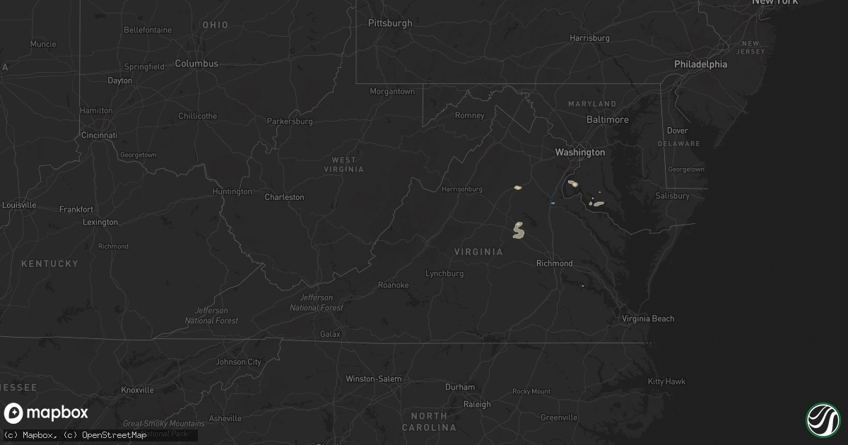
Hail Map in Virginia on July 14, 2021
Get this storm
July 14 map
$229
one time, instant access
Download today. No call, no setup
Keep the $229
Bought the map and want the full workflow? Apply the entire $229 to a subscription within 7 days. None of it is wasted.
Every map, not just this one
This buys you this map. Subscription and you get every map we run, in the markets you choose from a few cities to whole states to nationwide. Plus real-time alerts the moment a storm fires.
Contact data
Name, contact info, occupancy, even credit band for addresses in the footprint. You go from where it hit to who to call.
Become the source they trust
Unlimited branding weather history reports on demand. You already have the documented answer ready for the property owner, and you are the one who showed up with it.
Property data and RoofTrace estimates
Pull up any address you have got, its value and the exact code rules for that jurisdiction, straight from One Click Code. Then RoofTrace estimates the squares, pitch, and roof value, priced the way you price.
Storm reports in Virginia
Virginia
| Date | Description |
|---|---|
| 07/14/20216:00 PM CDT | Trees downed along us-360. Time radar-estimated. |
| 07/14/20215:19 PM CDT | Trees down along jefferson highway. |
| 07/14/20215:00 PM CDT | Multiple trees down south and southeast of mineral. |
| 07/14/20215:00 PM CDT | Widespread tree damage south and southeast of mineral. Route 33 blocked in multiple locations by large |
| 07/14/20214:58 PM CDT | Numerous trees down between yanceyville and apple grove. |
| 07/14/20214:31 PM CDT | Several trees reported down se of the town of louisa. |
| 07/14/20214:23 PM CDT | Large tree down across james madison pkwy and davis dr |
| 07/14/20214:12 PM CDT | Wires down near tazewell st and pendleton rd |
| 07/14/20214:10 PM CDT | A local report indicates 63 MPH wind near FREDERICKSBURG |
| 07/14/20214:09 PM CDT | Tree into the front of a home on bentley court. |
| 07/14/20214:09 PM CDT | Tree in the roadway near shannon drive and lansdowne road. |
| 07/14/20214:09 PM CDT | Tree blocking the roadway near lee drive and lansdowne road. |
| 07/14/20214:06 PM CDT | Trees and wires down in 2000 block of lafayette blvd |
| 07/14/20214:04 PM CDT | Large tree down in the 5400 block of leavells crossing drive. |
| 07/14/20214:04 PM CDT | Tree and wires down on rollingwood drive near sarah lane. |
| 07/14/20214:00 PM CDT | Tree down near salem village drive and elwyn court. |
| 07/14/20213:55 PM CDT | Tree blocking the roadway in the 5900 block of harrison road. |
| 07/14/20213:49 PM CDT | Trees down near piedmont drive and chancellor park drive. |
| 07/14/20213:45 PM CDT | Tree down in 14000 block of thomas nelson hwy blocking sb lanes |
| 07/14/20213:35 PM CDT | Trees down near intersection of kellogg mill rd and bethany way |
| 07/14/20213:26 PM CDT | Tree in the roadway near garrisonville road and algrace boulevard. |
| 07/14/20213:25 PM CDT | Tree down near st adams dr and joshua rd |
| 07/14/20213:08 PM CDT | Tree down on free state road at mountjoy road. |
| 07/14/20213:08 PM CDT | Tree down at leeds manor road and crest hill road. |
| 07/14/20212:45 PM CDT | Tree down in the 3000 block of shelby road. |
| 07/14/20212:41 PM CDT | Tree down on wires on hunting shire lane... Off of henderson road. |
| 07/14/20212:36 PM CDT | Downed tree onto wires off of webster lane. |
| 07/14/20212:36 PM CDT | Wires down along on west asher street. |
| 07/14/20212:36 PM CDT | Tree down along route 29 southbound at route 15. |
| 07/14/20212:32 PM CDT | Wires down in the 400 block of james madison highway. |
| 07/14/20212:32 PM CDT | Wires down in the 2100 block of country club road. |
| 07/14/20212:13 PM CDT | Tree down along route 231 at route 670. |
| 07/14/20211:15 AM CDT | At 614 PM EDT, a severe thunderstorm was located near Gum Spring, or near Hadensville, moving northeast at 25 mph. HAZARD...60 mph wind gusts and quarter size hail. SOURCE...Radar indicated. IMPACT...Minor damage to vehicles is possible. Expect wind damage to trees and powerlines. This severe thunderstorm will be near, Montpelier around 640 PM EDT. Bumpass around 645 PM EDT.Other locations impacted by this severe thunderstorm includeChilesburg, Orchid, Beaverdam, Coatesville, Hewlett, Goodall, RutherGlen, Locust Creek, Mabelton and Apple Grove. |
| 07/14/202112:37 AM CDT | At 537 PM EDT, a severe thunderstorm was located near Mineral, moving east at 15 mph. HAZARD...60 mph wind gusts and quarter size hail. SOURCE...Radar indicated. IMPACT...Minor damage to vehicles is possible. Expect wind damage to trees and powerlines. This severe thunderstorm will be near, Mineral around 555 PM EDT. Bumpass around 615 PM EDT.Other locations impacted by this severe thunderstorm include Orchid,Pendleton, Louisa Airport, Stage Junction, Cuckoo, Caledonia,Dabneys, Yanceyville, Fredericks Hall and Tabscott. |
| 07/14/202112:12 AM CDT | At 511 PM EDT, a severe thunderstorm was located near Mineral, moving northeast at 25 mph. HAZARD...60 mph wind gusts and quarter size hail. SOURCE...Radar indicated. IMPACT...Damaging winds will cause some trees and large branches to fall. This could injure those outdoors, as well as damage homes and vehicles. Roadways may become blocked by downed trees. Localized power outages are possible. Unsecured light objects may become projectiles. Locations impacted include... Glenora, Gatewood, Logan, Partlow and Brokenburg. |
| 07/14/202112:06 AM CDT | At 506 PM EDT, a severe thunderstorm was located over Louisa, moving east at 15 mph. HAZARD...60 mph wind gusts and quarter size hail. SOURCE...Radar indicated. IMPACT...Minor damage to vehicles is possible. Expect wind damage to trees and powerlines. This severe thunderstorm will be near, Mineral around 520 PM EDT. Bumpass around 545 PM EDT.Other locations impacted by this severe thunderstorm includePendleton, Wares Crossroads, Louisa Airport and Fredericks Hall. |
| 07/13/202111:29 PM CDT | At 428 PM EDT, a severe thunderstorm was located 7 miles northwest of Schuyler, or 15 miles south of Waynesboro, moving east at 15 mph. HAZARD...60 mph wind gusts and quarter size hail. SOURCE...Radar indicated. IMPACT...Damaging winds will cause some trees and large branches to fall. This could injure those outdoors, as well as damage homes and vehicles. Roadways may become blocked by downed trees. Localized power outages are possible. Unsecured light objects may become projectiles. Locations impacted include... Schuyler, Nellysford, Scottsville, Esmont, Lovingston, Damon, North Garden, Covesville, Boyd Tavern, Woodridge, Rockfish, Greenfield, Glendower, Keene, Overton, Alberene and Faber. |
| 07/13/202111:20 PM CDT | At 420 PM EDT, severe thunderstorms were located along a line extending from 10 miles southeast of Culpeper to 6 miles northwest of Boswells Tavern, moving east at 25 mph. HAZARD...60 mph wind gusts. SOURCE...Radar indicated. IMPACT...Damaging winds will cause some trees and large branches to fall. This could injure those outdoors, as well as damage homes and vehicles. Roadways may become blocked by downed trees. Localized power outages are possible. Unsecured light objects may become projectiles. Locations impacted include... Fredericksburg, Spotsylvania, Gordonsville, Passapatanzy, Mine Run, Rhoadesville, Brokenburg, Parker, Everona, Verdiersville, Madison Run, Locust Grove, Alsop, Gold Dale, Thornhill, Nasons, Chancellorsville, Logan, Lahore and Glenora. |
| 07/13/202111:06 PM CDT | At 406 PM EDT, a severe thunderstorm was located 10 miles south of Bealeton, or 12 miles east of Culpeper, moving east at 25 mph. HAZARD...60 mph wind gusts and quarter size hail. SOURCE...Radar indicated. IMPACT...Damaging winds will cause some trees and large branches to fall. This could injure those outdoors, as well as damage homes and vehicles. Roadways may become blocked by downed trees. Localized power outages are possible. Unsecured light objects may become projectiles. Locations impacted include... Stafford, Fredericksburg, Falmouth, Leeland, Roseville, Garrisonville, Flat Run, Spring Valley, Chancellorsville, Ramoth, Heflin, Aquia, Storck, Holly Corner, Dunavant, Lake Of The Woods, Richardsville, Glendie, Morrisville and Hartwood. |
| 07/13/202111:01 PM CDT | At 401 PM EDT, severe thunderstorms were located along a line extending from near Delaplane to near Hume, moving east at 25 mph. HAZARD...60 mph wind gusts and quarter size hail. SOURCE...Radar indicated. IMPACT...Damaging winds will cause some trees and large branches to fall. This could injure those outdoors, as well as damage homes and vehicles. Roadways may become blocked by downed trees. Localized power outages are possible. Unsecured light objects may become projectiles. Locations impacted include... South Riding, Brambleton, Warrenton, Linton Hall, Haymarket, Middleburg, Arcola, The Plains, Gainesville, New Baltimore, Marshall, Nokesville, Catlett, Catharpin, Woolsey, Broken Hill, Cresthill, Meadowville, Halfway and Auburn. |
| 07/13/202110:37 PM CDT | At 337 PM EDT, a severe thunderstorm was located over Culpeper, moving east at 25 mph. HAZARD...60 mph wind gusts and quarter size hail. SOURCE...Radar indicated. IMPACT...Damaging winds will cause some trees and large branches to fall. This could injure those outdoors, as well as damage homes and vehicles. Roadways may become blocked by downed trees. Localized power outages are possible. Unsecured light objects may become projectiles. Locations impacted include... Remington, Raccoon Ford, Elkwood, Stevensburg, Brandy Station, Lois, Burr Hill, Flat Run, Winston, Lignum, Lake Of The Woods, Richardsville, Morrisville, Goldvein, Sumerduck and Mitchells. |
| 07/13/202110:26 PM CDT | At 325 PM EDT, a severe thunderstorm was located near Bull Run, or 8 miles west of Dale City, moving east at 10 mph. HAZARD...60 mph wind gusts and quarter size hail. SOURCE...Radar indicated. IMPACT...Damaging winds will cause some trees and large branches to fall. This could injure those outdoors, as well as damage homes and vehicles. Roadways may become blocked by downed trees. Localized power outages are possible. Unsecured light objects may become projectiles. Locations impacted include... Dale City, Lake Ridge, Linton Hall, Bull Run, Manassas, Sudley, Manassas Park, Fairfax Station, Gainesville, Independent Hill, Nokesville, Clifton and Aden. |
| 07/13/202110:04 PM CDT | At 304 PM EDT, a severe thunderstorm was located 8 miles west of Culpeper, moving east at 15 mph. HAZARD...60 mph wind gusts and quarter size hail. SOURCE...Radar indicated. IMPACT...Damaging winds will cause some trees and large branches to fall. This could injure those outdoors, as well as damage homes and vehicles. Roadways may become blocked by downed trees. Localized power outages are possible. Unsecured light objects may become projectiles. Locations impacted include... Culpeper, Brightwood, Raccoon Ford, Winston, Catalpa, Slate Mills, Cardova, Reva, Leon, Alanthus and Boston. |
All States Impacted by Hail Map on July 14, 2021
Cities Impacted by Hail Map on July 14, 2021
- Wyoming, IA
- Beryl, UT
- Enterprise, UT
- Newberry, MI
- McMillan, MI
- Tooele, UT
- Souris, ND
- Allison, IA
- Dysart, IA
- Garrison, IA
- Keystone, IA
- Van Horne, IA
- Vinton, IA
- Mount Auburn, IA
- Bosler, WY
- Mechanicsville, MD
- Wetmore, MI
- Milan, IL
- Sherrard, IL
- Orion, IL
- Lynn Center, IL
- Coal Valley, IL
- Monmouth, IA
- Oxford Junction, IA
- Clarence, IA
- Cedar City, UT
- Johnson, KS
- Shellsburg, IA
- Cedar Rapids, IA
- Fairfax, IA
- Kingman, AZ
- Center Junction, IA
- Spencer, IA
- Graettinger, IA
- Dickens, IA
- Terril, IA
- Ruthven, IA
- Woden, IA
- Loganville, WI
- Chaptico, MD
- Cheyenne, WY
- Laramie, WY
- Granite Canon, WY
- Livermore, CO
- Eckerman, MI
- West Union, IA
- Elgin, IA
- Monticello, IA
- Cascade, IA
- Onslow, IA
- Radcliffe, IA
- Hubbard, IA
- Rapid City, SD
- Iola, TX
- Tonopah, NV
- Independence, IA
- Aurora, IA
- Stanley, IA
- Hazleton, IA
- Lamont, IA
- Winthrop, IA
- Welcome, MD
- La Plata, MD
- Briggsdale, CO
- Mitchellville, IA
- Carr, CO
- Rhinelander, WI
- Dallas Center, IA
- Keswick, IA
- What Cheer, IA
- Beaman, IA
- Dunkerton, IA
- Oelwein, IA
- Readlyn, IA
- Arlington, IA
- Fairbank, IA
- Oran, IA
- Fayette, IA
- Story City, IA
- Garden City, IA
- Hazelhurst, WI
- Harshaw, WI
- Springville, IA
- Central City, IA
- Anamosa, IA
- Kersey, CO
- Orchard, CO
- Green River, UT
- Huntington, UT
- Newton, IA
- Shell Rock, IA
- Clarksville, IA
- Plainfield, IA
- Waverly, IA
- Center Point, IA
- Toddville, IA
- Bettendorf, IA
- Princeton, IA
- Hillsdale, IL
- Walcott, IA
- De Witt, IA
- McCausland, IA
- Camanche, IA
- Eldridge, IA
- Long Grove, IA
- Donahue, IA
- Davenport, IA
- Le Claire, IA
- Port Byron, IL
- Cordova, IL
- Hill City, SD
- Manistique, MI
- Trinity, NC
- Geneseo, IL
- Show Low, AZ
- Maxwell, IA
- Cambridge, IA
- Ayrshire, IA
- Webb, IA
- Annawan, IL
- Sheffield, IL
- Osco, IL
- Kewanee, IL
- Atkinson, IL
- Cambridge, IL
- Neponset, IL
- Heber, AZ
- Culpeper, VA
- Jesup, IA
- Ault, CO
- Poynette, WI
- Rock Springs, WI
- North Freedom, WI
- Merrimac, WI
- Reedsburg, WI
- Hillpoint, WI
- Portage, WI
- Baraboo, WI
- Grinnell, IA
- Seligman, AZ
- Ash Fork, AZ
- East Carbon, UT
- Goldfield, IA
- Renwick, IA
- Baxter, IA
- Gladbrook, IA
- Rawlins, WY
- Newton, MS
- Millers Falls, MA
- Lake Pleasant, MA
- Belchertown, MA
- Sunderland, MA
- Amherst, MA
- Turners Falls, MA
- Wendell, MA
- Shutesbury, MA
- Northfield, MA
- Gill, MA
- Leverett, MA
- Greenfield, MA
- Montague, MA
- Erving, MA
- Nunn, CO
- Toledo, IA
- Clutier, IA
- Montour, IA
- Garwin, IA
- Alton, UT
- Grundy Center, IA
- Hampton, IA
- Alden, IA
- Iowa Falls, IA
- Fairburn, SD
- Hermosa, SD
- Saint George, UT
- Princeton, IL
- Tiskilwa, IL
- East Greenbush, NY
- Averill Park, NY
- Rensselaer, NY
- Troy, NY
- West Sand Lake, NY
- Wynantskill, NY
- Poestenkill, NY
- Ware, MA
- Deerfield, MA
- Bernardston, MA
- Granby, MA
- South Deerfield, MA
- Three Lakes, WI
- Tama, IA
- Panguitch, UT
- Marion, IA
- Tripoli, IA
- Janesville, IA
- Denver, IA
- Cedar Falls, IA
- Nevada, IA
- Ackley, IA
- Steamboat Rock, IA
- Eldora, IA
- Wellsburg, IA
- New Providence, IA
- Roland, IA
- McCallsburg, IA
- Westgate, IA
- Brandon, IA
- Sumner, IA
- Maynard, IA
- Waterloo, IA
- Aplington, IA
- Walker, IA
- Dumont, IA
- Charles City, IA
- Parkersburg, IA
- New Hartford, IA
- Strawberry Point, IA
- Bristow, IA
- Greene, IA
- Kesley, IA
- Randalia, IA
- Rowley, IA
- Dundee, IA
- Caldwell, TX
- Olin, IA
- Williams, AZ
- Conrad, IA
- Lincoln, IA
- Reinbeck, IA
- Traer, IA
- Marshalltown, IA
- Eagle Grove, IA
- Union, IA
- Louisa, VA
- Mineral, VA
- Thor, IA
- Vincent, IA
- Holland, IA
- Robins, IA
- Hiawatha, IA
- Emmetsburg, IA
- Masonville, IA
- Melrose, NY
- Schaghticoke, NY
- Mechanicville, NY
- Phillips, WI
- Colo, IA
- Albany, NY
- Watervliet, NY
- East Schodack, NY
- Cohoes, NY
- Nassau, NY
- Castleton On Hudson, NY
- Waterford, NY
- Latham, NY
- Granger, IA
- Polk City, IA
- Dyersville, IA
- Hopkinton, IA
- Ryan, IA
- Earlville, IA
- Coggon, IA
- Manchester, IA
- Delhi, IA
- Elberon, IA
- Chelsea, IA
- Keyport, NJ
- Keansburg, NJ
- Bingham Canyon, UT
- Alburnett, IA
- Overgaard, AZ
- Lakota, IA
- Collins, IA
- State Center, IA
- Rockwell, IA
- Edgewood, IA
- Stanwood, IA
- Bernard, IA
- Mechanicsville, IA
- Chatham, MI
- Hawkeye, IA
- Gowrie, IA
- Rhodes, IA
- Melbourne, IA
- Algona, IA
- Central, UT
- Glendale, UT
- Putnam, IL
- Bradford, IL
- Hennepin, IL
- Elkhart, IA
- Sheldahl, IA
- Ames, IA
- Madrid, IA
- Alleman, IA
- Slater, IA
- Huxley, IA
- Kelley, IA
- Stockton, UT
- Livermore, IA
- Hardy, IA
- Rock Island, IL
- Waukon, IA
- Decorah, IA
- Cylinder, IA
- Ludlow, MA
- Indian Head, MD
- Kinross, MI
- North Rim, AZ
- Aledo, IL
- Woodward, IA
- Lewiston, MN
- Utica, MN
- Mason City, IA
- Granville, IL
- Mark, IL
- Cobb Island, MD
- Newburg, MD
- Abell, MD
- Coltons Point, MD
- Leonardtown, MD
- Bushwood, MD
- Avenue, MD
- Mingo, IA
- Floyd, IA
- Belle Plaine, IA
- Aredale, IA
- Clarion, IA
- Galt, IA
- Albion, IA
- Taylor Ridge, IL
- Reynolds, IL
- Malcom, IA
- Britt, IA
- Gilman, IA
- Spring Grove, VA
- Columbia, VA
- Kents Store, VA
- Moline, IL
- Lake Tomahawk, WI
- Skull Valley, AZ
- Duchesne, UT
- Myton, UT
- Dows, IA
- Sophia, NC
- Waterville, IA
- Rockford, IA
- Nora Springs, IA
- Rudd, IA
- Hurricane, UT
- Marengo, IA
- Williamsburg, IA
- Laurens, IA
- Marathon, IA
- Boone, IA
- Montezuma, IA
- Leesville, SC
- Marble Rock, IA
- Maquoketa, IA
- Zwingle, IA
- La Motte, IA
- Baldwin, IA
- Bellevue, IA
- Summit, UT
- Farnhamville, IA
- Lake City, IA
- Lohrville, IA
- Ellsworth, IA
- Stratford, IA
- Jewell, IA
- Stanhope, IA
- Ionia, IA
- Lawler, IA
- New Hampton, IA
- Evansdale, IA
- Dewar, IA
- Laurel, IA
- Hartwick, IA
- Victor, IA
- Brooklyn, IA
- Ladora, IA
- Swea City, IA
- Frost, MN
- Blue Earth, MN
- Elmore, MN
- Bricelyn, MN
- Ledyard, IA
- Buffalo Center, IA
- Bradford, IA
- Bennett, IA
- New Liberty, IA
- Tipton, IA
- West Branch, IA
- Spragueville, IA
- Miles, IA
- Sabula, IA
- Andrew, IA
- Forreston, IL
- Pearl City, IL
- Mount Carroll, IL
- Shannon, IL
- Savanna, IL
- Lanark, IL
- Baileyville, IL
- Dakota, IL
- Freeport, IL
- Sharon, WI
- South Beloit, IL
- Durand, IL
- Darien, WI
- Beloit, WI
- Lena, IL
- Rock City, IL
- Davis, IL
- Clinton, WI
- Rockton, IL
- Shirland, IL
- Fredericksburg, VA


