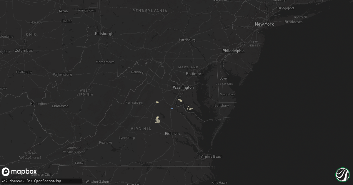
Hail Map in Maryland on July 14, 2021
Get this storm
July 14 map
$229
one time, instant access
Download today. No call, no setup
Keep the $229
Bought the map and want the full workflow? Apply the entire $229 to a subscription within 7 days. None of it is wasted.
Every map, not just this one
This buys you this map. Subscription and you get every map we run, in the markets you choose from a few cities to whole states to nationwide. Plus real-time alerts the moment a storm fires.
Contact data
Name, contact info, occupancy, even credit band for addresses in the footprint. You go from where it hit to who to call.
Become the source they trust
Unlimited branding weather history reports on demand. You already have the documented answer ready for the property owner, and you are the one who showed up with it.
Property data and RoofTrace estimates
Pull up any address you have got, its value and the exact code rules for that jurisdiction, straight from One Click Code. Then RoofTrace estimates the squares, pitch, and roof value, priced the way you price.
Storm reports in Maryland
Maryland
| Date | Description |
|---|---|
| 07/14/20215:55 PM CDT | Tree down on wynn road near davis lane. |
| 07/14/20215:42 PM CDT | A local report indicates 62 MPH wind near 2 WSW PINEY POINT |
| 07/14/20215:42 PM CDT | Tree reported down on a residence on robert leon drive. |
| 07/14/20215:42 PM CDT | Wires down along charles street in solomons. |
| 07/14/20215:38 PM CDT | Tree down on michelle drive in great mills. |
| 07/14/20215:37 PM CDT | Tree and wires on the roadway near point lookout road and winters lane. |
| 07/14/20215:33 PM CDT | Numerous trees down on three notch road between first colony blvd and chancellors run road. |
| 07/14/20215:30 PM CDT | A local report indicates 58 MPH wind near 2 WSW PINEY POINT |
| 07/14/20215:28 PM CDT | Multiple trees down on fairgrounds road in the leonardtown area. |
| 07/14/20215:24 PM CDT | Tree down on woodlawn drive. |
| 07/14/20215:24 PM CDT | Tree down near the intersection of vista road and sotterly road |
| 07/14/20215:24 PM CDT | Numerous trees down in the wildewood area |
| 07/14/20215:23 PM CDT | Tree reported down on potomac view drive. |
| 07/14/20215:23 PM CDT | Tree reported down on pembrook drive near clifford drive. |
| 07/14/20215:21 PM CDT | Three trees down near the intersection of hatchet thickett road and olen mattingly road |
| 07/14/20215:19 PM CDT | Tree down on hickory nut drive near poplar drive. |
| 07/14/20215:19 PM CDT | Tree reported down bayside rod near bluegrass lane. |
| 07/14/20215:15 PM CDT | Tree down on a house on hosta way. |
| 07/14/20215:09 PM CDT | Tree reported down on colton point road near holy angels church. |
| 07/14/20215:05 PM CDT | Tree reported down on louis bailey road. |
| 07/14/20215:00 PM CDT | Tree down on bayside road. |
| 07/14/20215:00 PM CDT | Tree down near colton point road and paul ellis road. |
| 07/14/20214:55 PM CDT | Tree down along dixie lyon road near oema court. |
| 07/14/20214:51 PM CDT | Tree down along budds creek road. |
| 07/14/20214:38 PM CDT | A local report indicates 60 MPH wind near 3 ENE DAHLGREN |
| 07/14/20214:09 PM CDT | Several trees down in the la plata area. |
| 07/14/20214:04 PM CDT | Tree down onto wires near port tobacco road and mill swamp road. |
| 07/14/20213:44 PM CDT | Numerous trees down in the marbury area. |
| 07/14/20212:22 AM CDT | At 722 PM EDT, a severe thunderstorm was located 8 miles northwest of Deal Island, or 17 miles east of Saint Inigoes Creek, moving east at 25 mph. HAZARD...60 mph wind gusts and penny size hail. SOURCE...Radar indicated. IMPACT...Expect damage to trees and powerlines. This severe thunderstorm will be near, Deal Island around 740 PM EDT. Princess Anne around 810 PM EDT.Other locations impacted by this severe thunderstorm include GreenHill, Catchpenny, Wetipquin, Oriole, Trinity, Fairmount, Upper Hill,Royal Oak, Crocheron and Dames Quarter. |
| 07/14/20211:47 AM CDT | At 646 PM EDT, a severe thunderstorm was located over Kinsale, or near Callao, moving east at 30 mph. HAZARD...60 mph wind gusts and penny size hail. SOURCE...Radar indicated. IMPACT...Expect damage to trees and powerlines. This severe thunderstorm will be near, Callao around 650 PM EDT. Lewisetta around 700 PM EDT.Other locations impacted by this severe thunderstorm include Ethel,Currioman Landing, Lottsburg, Threeway, Village, Mount Holly,Oldhams, Hull Neck, Edwardsville and Lyells. |
| 07/14/20211:03 AM CDT | At 603 PM EDT, severe thunderstorms were located along a line extending from near Golden Beach to Saint Clements Bay, moving east at 25 mph. HAZARD...60 mph wind gusts. SOURCE...Radar indicated. IMPACT...Damaging winds will cause some trees and large branches to fall. This could injure those outdoors, as well as damage homes and vehicles. Roadways may become blocked by downed trees. Localized power outages are possible. Unsecured light objects may become projectiles. Locations impacted include... Lexington Park, Chesapeake Ranch Estates, Leonardtown, Piney Point, Tall Timbers, Saint Inigoes Creek, Cuckold Creek, Saint Marys City, Saint George Island, Sheridan Point, Calvert Cliffs, Greenwell State Park, Saint Leonard Creek, Saint Clements Bay, Town Creek, Saint Marys River, White Point Beach, California, Lusby and Patuxent River Naval Air Station. |
| 07/14/202112:46 AM CDT | At 546 PM EDT, a severe thunderstorm was located near Colonial Beach, moving northeast at 20 mph. HAZARD...60 mph wind gusts and quarter size hail. SOURCE...Radar indicated. IMPACT...Damaging winds will cause some trees and large branches to fall. This could injure those outdoors, as well as damage homes and vehicles. Roadways may become blocked by downed trees. Localized power outages are possible. Unsecured light objects may become projectiles. Locations impacted include... Leonardtown, Sheridan Point, Saint Clements Bay, Wicomico River, Mechanicsville, Cobb Island, Rock Point, Bushwood, Clements, Issue, Tompkinsville, Abell, Chaptico, Sandgates, Swan Point, Avenue, Loveville, Oakley, Morganza and Compton. |
| 07/14/202112:24 AM CDT | At 523 PM EDT, severe thunderstorms were located along a line extending from near Waldorf to near Port Tobacco River to Dahlgren, moving east at 25 mph. HAZARD...60 mph wind gusts and quarter size hail. SOURCE...Radar indicated. IMPACT...Damaging winds will cause some trees and large branches to fall. This could injure those outdoors, as well as damage homes and vehicles. Roadways may become blocked by downed trees. Localized power outages are possible. Unsecured light objects may become projectiles. Locations impacted include... Waldorf, La Plata, Leonardtown, Sheridan Point, Popes Creek, Hallowing Point, Golden Beach, Saint Charles, Wicomico, Huntingtown, Hughesville, Baden, Mechanicsville, Charlotte Hall, Aquasco, Bryantown, Benedict, Eagle Harbor, Bushwood and Clements. |
| 07/14/202112:14 AM CDT | At 514 PM EDT, a severe thunderstorm was located over King George, moving east at 15 mph. HAZARD...60 mph wind gusts and quarter size hail. SOURCE...Radar indicated. IMPACT...Damaging winds will cause some trees and large branches to fall. This could injure those outdoors, as well as damage homes and vehicles. Roadways may become blocked by downed trees. Localized power outages are possible. Unsecured light objects may become projectiles. Locations impacted include... King George, Dahlgren, Fairview Beach, Nanjemoy Creek, Weedonville, Ninde and Berthaville. |
| 07/14/202112:01 AM CDT | At 501 PM EDT, severe thunderstorms were located along a line extending from 6 miles southwest of Stafford to Fredericksburg to near Spotsylvania, moving east at 10 mph. HAZARD...60 mph wind gusts and quarter size hail. SOURCE...Radar indicated. IMPACT...Damaging winds will cause some trees and large branches to fall. This could injure those outdoors, as well as damage homes and vehicles. Roadways may become blocked by downed trees. Localized power outages are possible. Unsecured light objects may become projectiles. Locations impacted include... Fredericksburg, King George, Fairview Beach, Potomac Creek, Aquia Creek, Massaponax, Spotsylvania, Falmouth, Passapatanzy, Stones Corner, Leeland, Spring Valley, Brooke, Lambs Creek, White Oak, Sealston, Brookfield and Dogue. |
| 07/13/202111:41 PM CDT | At 441 PM EDT, a severe thunderstorm was located near Quantico, moving east at 20 mph. HAZARD...60 mph wind gusts and quarter size hail. SOURCE...Radar indicated. IMPACT...Damaging winds will cause some trees and large branches to fall. This could injure those outdoors, as well as damage homes and vehicles. Roadways may become blocked by downed trees. Localized power outages are possible. Unsecured light objects may become projectiles. Locations impacted include... Waldorf, La Plata, Port Tobacco River, Saint Charles, Wicomico, Bryans Road, Potomac Heights, Bryantown, Pomfret, Port Tobacco Village, Marbury, Dentsville, Port Tobacco, White Plains, Ironsides, Ripley, Rison, Bel Alton, Nanjemoy and Pisgah. |
All States Impacted by Hail Map on July 14, 2021
Cities Impacted by Hail Map on July 14, 2021
- Wyoming, IA
- Beryl, UT
- Enterprise, UT
- Newberry, MI
- McMillan, MI
- Tooele, UT
- Souris, ND
- Allison, IA
- Dysart, IA
- Garrison, IA
- Keystone, IA
- Van Horne, IA
- Vinton, IA
- Mount Auburn, IA
- Bosler, WY
- Mechanicsville, MD
- Wetmore, MI
- Milan, IL
- Sherrard, IL
- Orion, IL
- Lynn Center, IL
- Coal Valley, IL
- Monmouth, IA
- Oxford Junction, IA
- Clarence, IA
- Cedar City, UT
- Johnson, KS
- Shellsburg, IA
- Cedar Rapids, IA
- Fairfax, IA
- Kingman, AZ
- Center Junction, IA
- Spencer, IA
- Graettinger, IA
- Dickens, IA
- Terril, IA
- Ruthven, IA
- Woden, IA
- Loganville, WI
- Chaptico, MD
- Cheyenne, WY
- Laramie, WY
- Granite Canon, WY
- Livermore, CO
- Eckerman, MI
- West Union, IA
- Elgin, IA
- Monticello, IA
- Cascade, IA
- Onslow, IA
- Radcliffe, IA
- Hubbard, IA
- Rapid City, SD
- Iola, TX
- Tonopah, NV
- Independence, IA
- Aurora, IA
- Stanley, IA
- Hazleton, IA
- Lamont, IA
- Winthrop, IA
- Welcome, MD
- La Plata, MD
- Briggsdale, CO
- Mitchellville, IA
- Carr, CO
- Rhinelander, WI
- Dallas Center, IA
- Keswick, IA
- What Cheer, IA
- Beaman, IA
- Dunkerton, IA
- Oelwein, IA
- Readlyn, IA
- Arlington, IA
- Fairbank, IA
- Oran, IA
- Fayette, IA
- Story City, IA
- Garden City, IA
- Hazelhurst, WI
- Harshaw, WI
- Springville, IA
- Central City, IA
- Anamosa, IA
- Kersey, CO
- Orchard, CO
- Green River, UT
- Huntington, UT
- Newton, IA
- Shell Rock, IA
- Clarksville, IA
- Plainfield, IA
- Waverly, IA
- Center Point, IA
- Toddville, IA
- Bettendorf, IA
- Princeton, IA
- Hillsdale, IL
- Walcott, IA
- De Witt, IA
- McCausland, IA
- Camanche, IA
- Eldridge, IA
- Long Grove, IA
- Donahue, IA
- Davenport, IA
- Le Claire, IA
- Port Byron, IL
- Cordova, IL
- Hill City, SD
- Manistique, MI
- Trinity, NC
- Geneseo, IL
- Show Low, AZ
- Maxwell, IA
- Cambridge, IA
- Ayrshire, IA
- Webb, IA
- Annawan, IL
- Sheffield, IL
- Osco, IL
- Kewanee, IL
- Atkinson, IL
- Cambridge, IL
- Neponset, IL
- Heber, AZ
- Culpeper, VA
- Jesup, IA
- Ault, CO
- Poynette, WI
- Rock Springs, WI
- North Freedom, WI
- Merrimac, WI
- Reedsburg, WI
- Hillpoint, WI
- Portage, WI
- Baraboo, WI
- Grinnell, IA
- Seligman, AZ
- Ash Fork, AZ
- East Carbon, UT
- Goldfield, IA
- Renwick, IA
- Baxter, IA
- Gladbrook, IA
- Rawlins, WY
- Newton, MS
- Millers Falls, MA
- Lake Pleasant, MA
- Belchertown, MA
- Sunderland, MA
- Amherst, MA
- Turners Falls, MA
- Wendell, MA
- Shutesbury, MA
- Northfield, MA
- Gill, MA
- Leverett, MA
- Greenfield, MA
- Montague, MA
- Erving, MA
- Nunn, CO
- Toledo, IA
- Clutier, IA
- Montour, IA
- Garwin, IA
- Alton, UT
- Grundy Center, IA
- Hampton, IA
- Alden, IA
- Iowa Falls, IA
- Fairburn, SD
- Hermosa, SD
- Saint George, UT
- Princeton, IL
- Tiskilwa, IL
- East Greenbush, NY
- Averill Park, NY
- Rensselaer, NY
- Troy, NY
- West Sand Lake, NY
- Wynantskill, NY
- Poestenkill, NY
- Ware, MA
- Deerfield, MA
- Bernardston, MA
- Granby, MA
- South Deerfield, MA
- Three Lakes, WI
- Tama, IA
- Panguitch, UT
- Marion, IA
- Tripoli, IA
- Janesville, IA
- Denver, IA
- Cedar Falls, IA
- Nevada, IA
- Ackley, IA
- Steamboat Rock, IA
- Eldora, IA
- Wellsburg, IA
- New Providence, IA
- Roland, IA
- McCallsburg, IA
- Westgate, IA
- Brandon, IA
- Sumner, IA
- Maynard, IA
- Waterloo, IA
- Aplington, IA
- Walker, IA
- Dumont, IA
- Charles City, IA
- Parkersburg, IA
- New Hartford, IA
- Strawberry Point, IA
- Bristow, IA
- Greene, IA
- Kesley, IA
- Randalia, IA
- Rowley, IA
- Dundee, IA
- Caldwell, TX
- Olin, IA
- Williams, AZ
- Conrad, IA
- Lincoln, IA
- Reinbeck, IA
- Traer, IA
- Marshalltown, IA
- Eagle Grove, IA
- Union, IA
- Louisa, VA
- Mineral, VA
- Thor, IA
- Vincent, IA
- Holland, IA
- Robins, IA
- Hiawatha, IA
- Emmetsburg, IA
- Masonville, IA
- Melrose, NY
- Schaghticoke, NY
- Mechanicville, NY
- Phillips, WI
- Colo, IA
- Albany, NY
- Watervliet, NY
- East Schodack, NY
- Cohoes, NY
- Nassau, NY
- Castleton On Hudson, NY
- Waterford, NY
- Latham, NY
- Granger, IA
- Polk City, IA
- Dyersville, IA
- Hopkinton, IA
- Ryan, IA
- Earlville, IA
- Coggon, IA
- Manchester, IA
- Delhi, IA
- Elberon, IA
- Chelsea, IA
- Keyport, NJ
- Keansburg, NJ
- Bingham Canyon, UT
- Alburnett, IA
- Overgaard, AZ
- Lakota, IA
- Collins, IA
- State Center, IA
- Rockwell, IA
- Edgewood, IA
- Stanwood, IA
- Bernard, IA
- Mechanicsville, IA
- Chatham, MI
- Hawkeye, IA
- Gowrie, IA
- Rhodes, IA
- Melbourne, IA
- Algona, IA
- Central, UT
- Glendale, UT
- Putnam, IL
- Bradford, IL
- Hennepin, IL
- Elkhart, IA
- Sheldahl, IA
- Ames, IA
- Madrid, IA
- Alleman, IA
- Slater, IA
- Huxley, IA
- Kelley, IA
- Stockton, UT
- Livermore, IA
- Hardy, IA
- Rock Island, IL
- Waukon, IA
- Decorah, IA
- Cylinder, IA
- Ludlow, MA
- Indian Head, MD
- Kinross, MI
- North Rim, AZ
- Aledo, IL
- Woodward, IA
- Lewiston, MN
- Utica, MN
- Mason City, IA
- Granville, IL
- Mark, IL
- Cobb Island, MD
- Newburg, MD
- Abell, MD
- Coltons Point, MD
- Leonardtown, MD
- Bushwood, MD
- Avenue, MD
- Mingo, IA
- Floyd, IA
- Belle Plaine, IA
- Aredale, IA
- Clarion, IA
- Galt, IA
- Albion, IA
- Taylor Ridge, IL
- Reynolds, IL
- Malcom, IA
- Britt, IA
- Gilman, IA
- Spring Grove, VA
- Columbia, VA
- Kents Store, VA
- Moline, IL
- Lake Tomahawk, WI
- Skull Valley, AZ
- Duchesne, UT
- Myton, UT
- Dows, IA
- Sophia, NC
- Waterville, IA
- Rockford, IA
- Nora Springs, IA
- Rudd, IA
- Hurricane, UT
- Marengo, IA
- Williamsburg, IA
- Laurens, IA
- Marathon, IA
- Boone, IA
- Montezuma, IA
- Leesville, SC
- Marble Rock, IA
- Maquoketa, IA
- Zwingle, IA
- La Motte, IA
- Baldwin, IA
- Bellevue, IA
- Summit, UT
- Farnhamville, IA
- Lake City, IA
- Lohrville, IA
- Ellsworth, IA
- Stratford, IA
- Jewell, IA
- Stanhope, IA
- Ionia, IA
- Lawler, IA
- New Hampton, IA
- Evansdale, IA
- Dewar, IA
- Laurel, IA
- Hartwick, IA
- Victor, IA
- Brooklyn, IA
- Ladora, IA
- Swea City, IA
- Frost, MN
- Blue Earth, MN
- Elmore, MN
- Bricelyn, MN
- Ledyard, IA
- Buffalo Center, IA
- Bradford, IA
- Bennett, IA
- New Liberty, IA
- Tipton, IA
- West Branch, IA
- Spragueville, IA
- Miles, IA
- Sabula, IA
- Andrew, IA
- Forreston, IL
- Pearl City, IL
- Mount Carroll, IL
- Shannon, IL
- Savanna, IL
- Lanark, IL
- Baileyville, IL
- Dakota, IL
- Freeport, IL
- Sharon, WI
- South Beloit, IL
- Durand, IL
- Darien, WI
- Beloit, WI
- Lena, IL
- Rock City, IL
- Davis, IL
- Clinton, WI
- Rockton, IL
- Shirland, IL
- Fredericksburg, VA


