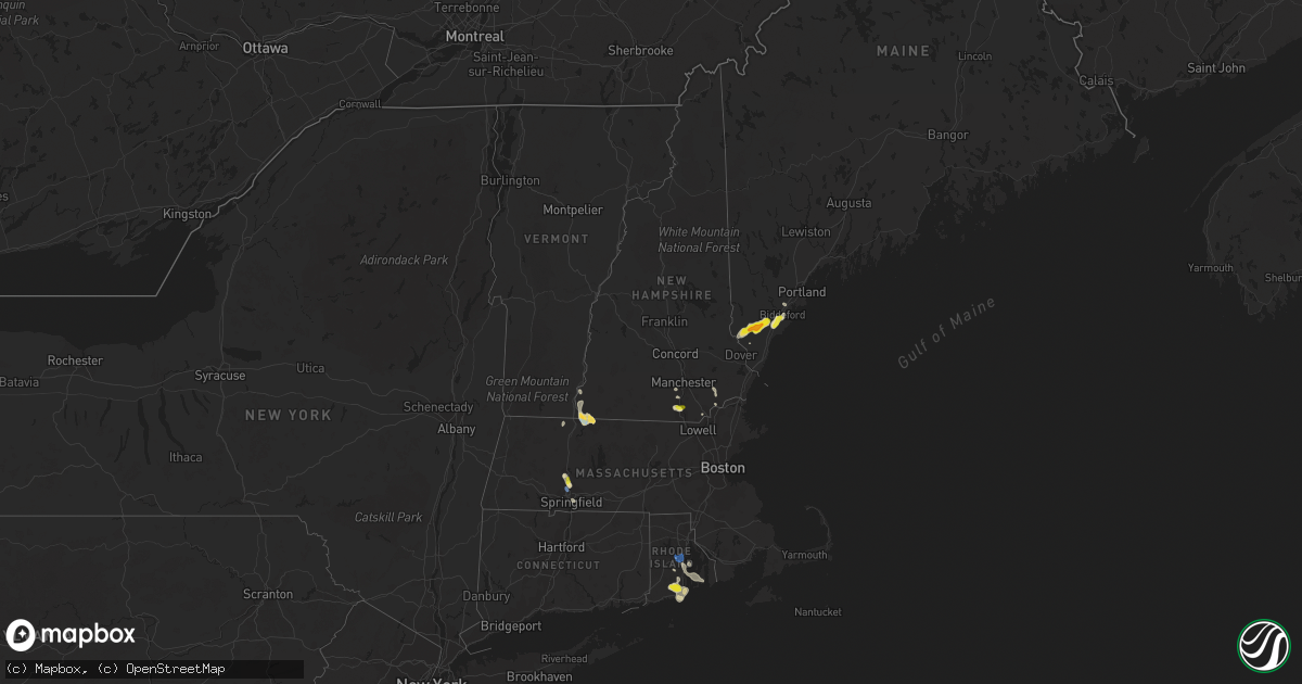
Hail Map in New Hampshire on July 14, 2020
Get this storm
July 14 map
$229
one time, instant access
Download today. No call, no setup
Keep the $229
Bought the map and want the full workflow? Apply the entire $229 to a subscription within 7 days. None of it is wasted.
Every map, not just this one
This buys you this map. Subscription and you get every map we run, in the markets you choose from a few cities to whole states to nationwide. Plus real-time alerts the moment a storm fires.
Contact data
Name, contact info, occupancy, even credit band for addresses in the footprint. You go from where it hit to who to call.
Become the source they trust
Unlimited branding weather history reports on demand. You already have the documented answer ready for the property owner, and you are the one who showed up with it.
Property data and RoofTrace estimates
Pull up any address you have got, its value and the exact code rules for that jurisdiction, straight from One Click Code. Then RoofTrace estimates the squares, pitch, and roof value, priced the way you price.
Storm reports in New Hampshire
New Hampshire
| Date | Description |
|---|---|
| 07/14/20203:27 PM CDT | A local report indicates 1.00 inch wind near 2 SW DANVILLE |
| 07/14/20202:29 PM CDT | A local report indicates 1.00 inch wind near 3 W LITCHFIELD |
| 07/14/20202:22 PM CDT | Down branches also reported. |
| 07/14/20202:20 PM CDT | Time estimated from radar. |
| 07/14/202011:15 AM CDT | Person reports hail between 1.25-1.5in... Beginning at 12:15. |
| 07/14/20206:49 AM CDT | At 1149 AM EDT, severe thunderstorms were located along a line extending from near Chesterfield to near Swanzey, moving southeast at 20 mph. HAZARD...60 mph wind gusts and quarter size hail. SOURCE...Radar indicated. IMPACT...Hail damage to vehicles is expected. Expect wind damage to roofs, siding, and trees. Locations impacted include... Keene, Swanzey, Winchester, Richmond, Hinsdale, Westmoreland and Chesterfield. |
| 07/13/202011:40 PM CDT | At 439 AM EDT, a severe thunderstorm was located over Post Mills, moving northeast at 10 mph. HAZARD...60 mph wind gusts and quarter size hail. SOURCE...Radar indicated. IMPACT...Minor hail damage to vehicles is possible. Expect wind damage to trees and powerlines. Locations impacted include... West Fairlee, Bradford, Thetford, Thetford Hill State Park, Thetford Center, Fairlee, Vershire, Newbury Village, Strafford, Newbury, Thetford Hill, South Vershire, Bradford Center, West Fairlee Center, Ely, Post Mills and South Newbury. |
| 07/13/202011:19 PM CDT | At 418 AM EDT, a severe thunderstorm was located over Lebanon, moving northeast at 20 mph. HAZARD...60 mph wind gusts and quarter size hail. SOURCE...Radar indicated. IMPACT...Hail damage to vehicles is expected. Expect wind damage to roofs, siding, and trees. Locations impacted include... Lebanon, Grafton, Hanover, Enfield, Canaan, Grantham, Lyme, Cornish, Dorchester, Orange and Plainfield.This includes Interstate 89 between mile markers 47 and 60. |
All States Impacted by Hail Map on July 14, 2020
Cities Impacted by Hail Map on July 14, 2020
- Monticello, MS
- Heber Springs, AR
- Sanford, ME
- Alfred, ME
- Kennebunk, ME
- Mcpherson, KS
- Gruver, TX
- Mount Hope, KS
- Titonka, IA
- Buffalo Center, IA
- Albia, IA
- Boyceville, WI
- Wheeler, WI
- Colfax, WI
- Ames, IA
- Boone, IA
- Hooker, OK
- Griffithville, AR
- Searcy, AR
- Ferryville, WI
- Centerville, IA
- Wakefield, RI
- Narragansett, RI
- West Kingston, RI
- Kingston, RI
- Kennebunkport, ME
- Biddeford, ME
- Freeport, IL
- Merrill, WI
- Wausau, WI
- Athens, WI
- Memphis, MO
- St John, KS
- Cimarron, KS
- Jetmore, KS
- Melrose, WI
- Black River Falls, WI
- Reserve, LA
- Edgard, LA
- Garyville, LA
- Olney Springs, CO
- Ordway, CO
- Sugar City, CO
- Coatsville, MO
- Glenwood, MO
- Lancaster, MO
- Radcliffe, IA
- Hubbard, IA
- Buhler, KS
- Grimes, IA
- Granger, IA
- Johnston, IA
- Queen City, MO
- Ramah, CO
- Rush, CO
- Calhan, CO
- Yoder, CO
- Peyton, CO
- Perryton, TX
- Neillsville, WI
- Winterset, IA
- Osceola, IA
- Indianola, IA
- New Virginia, IA
- Saint Charles, IA
- Peru, IA
- Truro, IA
- Hugoton, KS
- Bloomer, WI
- Bunker Hill, KS
- Dorrance, KS
- Madison, MO
- Holliday, MO
- Las Animas, CO
- South Hadley, MA
- Holyoke, MA
- Livingston, AL
- Baker, FL
- Sublette, KS
- Windom, KS
- Marquette, KS
- Englewood, KS
- Story City, IA
- Alden, KS
- Raymond, KS
- Stanberry, MO
- Morse, TX
- Ettrick, WI
- Blair, WI
- Taylor, WI
- Ulysses, KS
- Atmore, AL
- Clearfield, IA
- Novelty, MO
- Leonard, MO
- Clarence, MO
- Macon, MO
- Atlanta, MO
- La Plata, MO
- Anabel, MO
- Cairo, MO
- Dothan, AL
- Benton, IA
- Shannon City, IA
- Diagonal, IA
- Mount Ayr, IA
- Lenox, IA
- Copeland, KS
- Ridgeway, MO
- Grant City, MO
- Hatfield, MO
- Eagleville, MO
- Martinsville, MO
- Edgemont, SD
- Clifton Park, NY
- Madisonville, LA
- Agenda, KS
- Spearman, TX
- Lance Creek, WY
- Gulfport, MS
- Somers, CT
- Ellington, CT
- McCracken, KS
- Black Earth, WI
- Garden City, KS
- Texhoma, OK
- Ingalls, KS
- Dallas Center, IA
- Polk City, IA
- Ankeny, IA
- Des Moines, IA
- West Des Moines, IA
- Madrid, IA
- Urbandale, IA
- Windsor Heights, IA
- Woodward, IA
- Clive, IA
- Waukee, IA
- Jewell, IA
- Gilbert, IA
- Hinsdale, NH
- Warwick, MA
- Winchester, NH
- Northfield, MA
- Vernon, VT
- Kim, CO
- Pritchett, CO
- East Hampstead, NH
- Danville, NH
- Sandown, NH
- Edgerton, WI
- Stoughton, WI
- Burrton, KS
- Inman, KS
- Nickerson, KS
- Hutchinson, KS
- Syracuse, KS
- Dalhart, TX
- Felt, OK
- Boone, CO
- Walsh, CO
- Spring Green, WI
- Plain, WI
- Colorado Springs, CO
- Sylvia, KS
- Stafford, KS
- La Junta, CO
- Aurora, KS
- Thomasville, AL
- Dickinson, AL
- Stinnett, TX
- Sunray, TX
- Uriah, AL
- Manhattan, KS
- Sheldon, WI
- Fort Lauderdale, FL
- Portland, AR
- Montrose, AR
- Chicopee, MA
- Lone Rock, WI
- Sterling, KS
- Lyons, KS
- Lakin, KS
- Satanta, KS
- Pierceville, KS
- Rocky Ford, CO
- Arlington, CO
- Cheraw, CO
- Blakely, GA
- Saucier, MS
- Biloxi, MS
- Belle Fourche, SD
- Rolling Fork, MS
- Novinger, MO
- Green Castle, MO
- Moundridge, KS
- Canton, KS
- Milo, IA
- Pleasantville, IA
- Lacona, IA
- Ashford, CT
- Storrs Mansfield, CT
- Tingley, IA
- Hudson, KS
- Ballston Spa, NY
- Weldon, IA
- Hardesty, OK
- Samson, AL
- Tolland, CT
- Excello, MO
- Jacksonville, MO
- Moberly, MO
- Gate, OK
- Grinnell, IA
- Topeka, KS
- Goodwell, OK
- Guymon, OK
- Melcher Dallas, IA
- Downing, MO
- Milton, WI
- Meade, KS
- Forgan, OK
- Bazine, KS
- Hastings, MN
- West Chesterfield, NH
- Bay Saint Louis, MS
- Allison, IA
- Skidmore, MO
- Lexington, MO
- Galva, KS
- Hasty, CO
- Carlisle, IA
- Ackworth, IA
- North Berwick, ME
- Sully, IA
- Reasnor, IA
- Albany, MO
- New Cambria, MO
- Granada, CO
- Knoxville, IA
- Corning, IA
- Gravity, IA
- King City, MO
- Guilford, MO
- Darlington, MO
- Lindsborg, KS
- Ellsworth, IA
- Bevier, MO
- Junction City, WI
- Milladore, WI
- Arpin, WI
- Assaria, KS
- Muscoda, WI
- Falun, KS
- Delray Beach, FL
- Merrillan, WI
- Hampton, MN
- Farmington, MN
- Thayer, IA
- Greentop, MO
- Wells, ME
- Kansas City, MO
- Saint David, AZ
- Florence, MA
- Easthampton, MA
- Northampton, MA
- Wilmot, AR
- Pass Christian, MS
- Mobile, AL
- Lebanon, ME
- Berwick, ME
- Haverhill, IA
- Laurel, IA
- Robertsdale, AL
- Peabody, KS
- Heidelberg, MS
- Shubuta, MS
- Saunderstown, RI
- Exeter, RI
- Hanover, KS
- Bernardston, MA
- Colrain, MA
- Springfield, MA
- Two Buttes, CO
- Argyle, WI
- Knapp, WI
- Unionville, MO
- Diamondhead, MS
- Ogden, IA
- Milton, FL
- Palm City, FL
- Indiantown, FL
- Stuart, FL
- Long Beach, MS
- Gays Mills, WI
- Solomon, KS
- Osseo, WI
- Augusta, WI
- Jupiter, FL
- Nashua, NH
- Downing, WI
- Glenwood City, WI
- Walton, KS
- Newton, KS
- Merrimack, NH
- Bouton, IA
- Lucas, IA
- Liberty Center, IA
- Mathis, TX
- Hixton, WI
- Humbird, WI
- Alma Center, WI
- Craig, MO
- Pittsville, WI
- Vesper, WI
- Livonia, MO
- Holly, CO
- Bedford, NH
- Onaga, KS
- McRae, AR
- Columbia, IA
- Hamilton, IA
- Brashear, MO
- Hurdland, MO
- Baring, MO
- Courtland, KS
- Creston, IA
- Scandia, KS
- Belleville, KS
- Concordia, KS
- Cowarts, AL
- Blue River, WI
- Boscobel, WI
- Lake View, IA
- North Kingstown, RI
- Lake Worth, FL
- Boynton Beach, FL
- Dodge City, KS
- Wright, KS
- Harvey, IA
- Lamar, CO
- Rockford, IA
- Marble Rock, IA
- Mayview, MO
- Haven, KS
- Saco, ME
- Fountain, CO
- Westmoreland, KS
- Marion, KS
- Kirksville, MO
- Gibbs, MO
- McClave, CO
- Monroe, WI
- Maitland, MO
- Hartford, AL
- Slocomb, AL
- Forest City, IA
- McFall, MO
- Abilene, KS
- Talmage, KS
- Kellogg, IA
- Callao, MO
- Pecatonica, IL
- Ridott, IL
- Barnard, MO
- Bolckow, MO
- Haddam, KS
- Clifton, KS
- Texhoma, TX
- Stratford, TX
- Pompano Beach, FL
- Dermott, AR
- Enfield, CT
- Otley, IA
- Monroe, IA
- Odessa, MO
- Atkinson, NH
- Bethany, MO
- Denver, MO
- Shaw, MS
- Lovilia, IA
- Bussey, IA
- Blue Springs, MO
- Lees Summit, MO
- Eufaula, AL
- Randall, IA
- Newton, IA
- Formoso, KS
- Mitchellville, IA
- Altoona, IA
- Pleasant Hill, IA
- Runnells, IA
- Prairie City, IA
- Rock Port, MO
- Jackson, AL
- Arcadia, WI
- Murray, IA
- Fowler, CO
- Afton, IA
- Olsburg, KS
- Crescent City, FL
- Greensburg, LA
- Kinston, AL
- Hartford, IA
- Pella, IA
- Cornell, WI
- Grand River, IA
- Gentry, MO
- Holt, FL
- Moore Haven, FL
- Abbyville, KS
- Manter, KS
- Eudora, AR
- Mound City, MO
- Chapman, KS
- Hamburg, AR
- Colfax, IA
- Wiley, CO
- Pelham, NH
- Salem, NH
- Lewis, KS
- Silver Creek, MS
- Rosendale, MO
- Cleveland, MS
- Avoca, WI
- Hollenberg, KS
- Fowler, KS
- Fredericksburg, IA
- Sumner, IA
- Jamestown, RI
- Newport, RI
- Middletown, RI
- East Greenwich, RI
- Macksville, KS
- Springfield, CO
- Amherst, NH
- Fillmore, MO
- Pine Hill, AL
- Lower Peach Tree, AL
- Maple Hill, KS
- Paxico, KS
- Chase, KS
- Jacksonville, FL
- West Palm Beach, FL
- Pittsview, AL
- Clayton, AL
- Viroqua, WI
- Prole, IA
- Saint Marys, IA
- Collins, IA
- Green City, MO
- Maryville, MO
- Hughesville, MO
- Sedalia, MO
- West Warwick, RI
- Coventry, RI
- Mingo, IA
- Brattleboro, VT
- West Halifax, VT
- Booker, TX
- Balko, OK
- Chariton, IA
- Plevna, KS
- Arlington, KS
- Partridge, KS
- Turon, KS
- Hudson, NH
- Litchfield, NH
- Stafford Springs, CT
- Stanhope, IA
- Prescott, WI
- Warwick, RI
- Vernon Rockville, CT
- Cohoes, NY
- Waterford, NY
- Rexford, NY
- Fall Creek, WI
- Boyd, WI
- Fairchild, WI
- Stanley, WI
- Manzanola, CO
- Crowley, CO
- Model, CO
- Vilas, CO


