Hail Map in Michigan on July 11, 2022
Get this storm
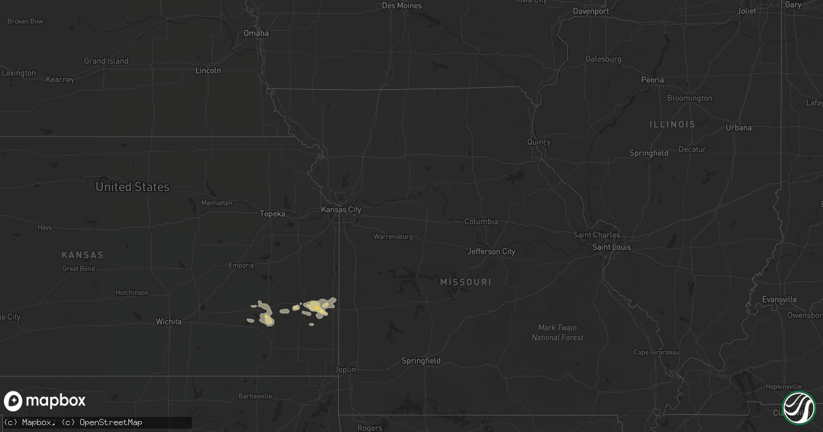
July 11 map
$229
one time, instant access
Download today. No call, no setup
Keep the $229
Bought the map and want the full workflow? Apply the entire $229 to a subscription within 7 days. None of it is wasted.
Every map, not just this one
This buys you this map. Subscription and you get every map we run, in the markets you choose from a few cities to whole states to nationwide. Plus real-time alerts the moment a storm fires.
Contact data
Name, contact info, occupancy, even credit band for addresses in the footprint. You go from where it hit to who to call.
Become the source they trust
Unlimited branding weather history reports on demand. You already have the documented answer ready for the property owner, and you are the one who showed up with it.
Property data and RoofTrace estimates
Pull up any address you have got, its value and the exact code rules for that jurisdiction, straight from One Click Code. Then RoofTrace estimates the squares, pitch, and roof value, priced the way you price.
Storm reports in Michigan
Michigan
| Date | Description |
|---|---|
| 07/11/20226:47 AM CDT | At 1147 PM EDT, a severe thunderstorm was located over Ortonville, or 8 miles northeast of Holly, moving east at 40 mph. HAZARD...60 mph wind gusts and penny size hail. SOURCE...Radar indicated. IMPACT...Expect damage to roofs, siding, and trees. This severe thunderstorm will be near... Metamora around 1200 AM EDT. Oxford around 1205 AM EDT. Almont around 1220 AM EDT.Other locations impacted by this severe thunderstorm includeLakeville, Attica, Holly State Recreation Area, Leonard, Lake Orion,Thornville, Davisburg, Rochester Hills and Auburn Hills. |
| 07/11/20226:14 AM CDT | At 1113 PM EDT, a severe thunderstorm was located over Gaines, or near Durand, moving east at 45 mph. HAZARD...60 mph wind gusts and quarter size hail. SOURCE...Radar indicated. IMPACT...Hail damage to vehicles is expected. Expect wind damage to roofs, siding, and trees. This severe thunderstorm will be near... Swartz Creek around 1120 PM EDT. Linden around 1125 PM EDT. Fenton and Lake Fenton around 1130 PM EDT. Grand Blanc around 1135 PM EDT. Goodrich around 1140 PM EDT.Other locations impacted by this severe thunderstorm include Atlas,Argentine and Rankin. |
| 07/11/20225:41 AM CDT | At 1041 PM EDT, a severe thunderstorm was located near Laingsburg, moving east at 40 mph. HAZARD...60 mph wind gusts and penny size hail. SOURCE...Radar indicated. IMPACT...Expect damage to roofs, siding, and trees. This severe thunderstorm will be near... Laingsburg around 1050 PM EDT. Owosso and Perry around 1100 PM EDT. Morrice around 1105 PM EDT. Corunna around 1110 PM EDT. Bancroft around 1115 PM EDT. Durand around 1120 PM EDT. Byron and Lennon around 1125 PM EDT.Other locations impacted by this severe thunderstorm includeBennington and Vernon. |
| 07/11/20223:20 AM CDT | At 820 PM EDT, a severe thunderstorm was located 12 miles northwest of Silver Lake SP, or 17 miles southwest of Ludington, moving east at 45 mph. HAZARD...60 mph wind gusts and quarter size hail. SOURCE...Radar indicated. IMPACT...Hail damage to vehicles is expected. Expect wind damage to roofs, siding, and trees. This severe thunderstorm will be near... Silver Lake SP around 835 PM EDT. Pentwater, Mears SP and Mears around 840 PM EDT.Other locations in the path of this severe thunderstorm include Hart. |
| 07/11/20221:58 AM CDT | At 658 PM EDT, a severe thunderstorm was located 7 miles east of Garden Corners, or 10 miles southwest of Manistique, moving east at 25 mph. HAZARD...Quarter size hail. SOURCE...Radar indicated. IMPACT...Damage to vehicles is expected. Locations impacted include... Manistique. |
| 07/11/20221:38 AM CDT | At 637 PM EDT, a severe thunderstorm was located over Garden, or 18 miles southwest of Manistique, moving northeast at 15 mph. HAZARD...Quarter size hail. SOURCE...Radar indicated. IMPACT...Damage to vehicles is expected. This severe thunderstorm will remain over mainly rural areas of east central Delta and southwestern Schoolcraft Counties, including the following locations... Point Aux Barques. |
| 07/10/202211:10 PM CDT | Trees down. Time estimated by radar. |
| 07/10/202211:08 PM CDT | Trees and wires down. Time estimated by radar. |
| 07/10/202210:50 PM CDT | Wires down. Time estimated by radar. |
| 07/10/202210:33 PM CDT | Report of large tree down through 2nd floor of house. Wires also reported down in area. |
| 07/10/20229:30 PM CDT | Corrects previous tstm wnd dmg report from 4 ssw saint johns. Two trees down... Power outages. Time estimated from radar. |
| 07/10/20229:30 PM CDT | Two trees down... Power outages. Time estimated from radar. |
| 07/10/20228:42 PM CDT | Tree snapped and limbs down. |
All States Impacted by Hail Map on July 11, 2022
Cities Impacted by Hail Map on July 11, 2022
- Fenton, MI
- Holly, MI
- Linden, MI
- Gaines, MI
- Swartz Creek, MI
- Medford, WI
- Withee, WI
- Saint Johns, MI
- Moran, KS
- Saint Augustine, FL
- Folsom, NM
- Hartley, TX
- Dalhart, TX
- Sheboygan, WI
- Elsmore, KS
- Savonburg, KS
- Uniontown, KS
- Divide, CO
- Florissant, CO
- La Veta, CO
- Humboldt, KS
- Iola, KS
- La Harpe, KS
- Muskegon, MI
- Redfield, KS
- Mosquero, NM
- Conchas Dam, NM
- Manistique, MI
- Garden, MI
- Fort Scott, KS
- Bronson, KS
- Turpin, OK
- Springer, NM
- Yates Center, KS
- Buffalo, KS
- Toronto, KS
- Fredonia, KS
- Benedict, KS
- Branson, CO
- Beaver Dam, WI
- Fulton, KS
- Mapleton, KS
- Sperry, IA
- Grenville, NM
- Valders, WI
- Manitowoc, WI
- Newton, WI
- Clayton, NM
- Yarmouth, IA
- Mediapolis, IA
- Durand, MI
- Bancroft, MI
- Grand Blanc, MI
- Owosso, MI
- Morrice, MI
- Virgil, KS
- Model, CO
- Booker, TX
- Hartford, WI
- Hubertus, WI
- Paige, TX
- Bastrop, TX
- McDade, TX
- Repton, AL
- Bay Minette, AL
- Axis, AL
- Satsuma, AL
- Daphne, AL
- Creola, AL
- Saraland, AL
- Abbeville, LA
- Erath, LA
- Lake George, CO
- Newaygo, MI
- Grant, MI
- Gilman, WI
- Walnut, KS
- Hepler, KS
- Texhoma, OK
- Thrall, TX
- Caldwell, TX
- Kiel, WI
- Saint Nazianz, WI
- Conroe, TX
- New Auburn, WI
- Chetek, WI
- Weyerhaeuser, WI
- Holcombe, WI
- Fremont, MI
- Fall River, KS
- Rapid River, MI
- Atmore, AL
- Brewton, AL
- Duson, LA
- Maurice, LA
- Austin, TX
- Saint Johns, FL
- Jacksonville, FL
- Tucumcari, NM
- Mobile, AL
- Thief River Falls, MN


