Hail Map on July 10, 2024
Get this storm
July 10 map
$229
one time, instant access
Download today. No call, no setup
Keep the $229
Bought the map and want the full workflow? Apply the entire $229 to a subscription within 7 days. None of it is wasted.
Every map, not just this one
This buys you this map. Subscription and you get every map we run, in the markets you choose from a few cities to whole states to nationwide. Plus real-time alerts the moment a storm fires.
Contact data
Name, contact info, occupancy, even credit band for addresses in the footprint. You go from where it hit to who to call.
Become the source they trust
Unlimited branding weather history reports on demand. You already have the documented answer ready for the property owner, and you are the one who showed up with it.
Property data and RoofTrace estimates
Pull up any address you have got, its value and the exact code rules for that jurisdiction, straight from One Click Code. Then RoofTrace estimates the squares, pitch, and roof value, priced the way you price.
States Impacted by Hail Map on July 10, 2024
Storm reports
Florida
| Date | Description |
|---|---|
| 07/10/20242:20 PM CDT | Florida power & light met. Passed along photos taken by field crew of a few wooden powerlines bent and felled over as a strong storm moved through the area. Estimation |
Maryland
| Date | Description |
|---|---|
| 07/10/20246:50 PM CDT | Tree reported down on the 6600 block of remsburg road. |
| 07/09/20247:03 PM CDT | One tree down due to thunderstorm winds along ironsides drive. |
Vermont
| Date | Description |
|---|---|
| 07/10/20246:21 PM CDT | Tree down into powerlines on tucker road in orange. |
| 07/10/20246:10 PM CDT | Trees and wires down on meehan road |
| 07/10/20246:00 PM CDT | Trees and wires down in weybridge and new haven areas. |
| 07/10/20244:49 PM CDT | Numerous trees down near 2504 route 22a in bridport. |
| 07/10/20244:10 PM CDT | Tree down on i-89 southbound near mile marker 73. |
| 07/10/20244:08 PM CDT | Picture of tree down onto us 2 |
| 07/10/20243:55 PM CDT | Tree down on states prison hollow rd |
Iowa
| Date | Description |
|---|---|
| 07/10/20245:24 PM CDT | Emergency management reported lots of hail the size of dimes and nickels with a few quarter sized hail stones mixed in. |
| 07/10/20243:42 PM CDT | Emergency management reported quarter sized hail in coburg. |
| 07/10/20243:01 PM CDT | A local report indicates 2.00 inch wind near 2 ENE Sheldon |
| 07/10/20242:59 PM CDT | Golf ball size hail along hwy 18 roughly 2 miles east of sheldon city center. Time estimated from radar. |
| 07/10/20242:50 PM CDT | No damage has been reported with this gust. |
| 07/10/20242:30 PM CDT | Mostly penny to nickel size but a few as large as quarter size. |
| 07/10/20242:22 PM CDT | Emergency management reported quarter sized hail. |
| 07/10/20241:35 PM CDT | Tower blown down at dispatch office in clarke county. Numerous trees in osceola of 14 to 16 diameter also damaged. Estimated winds of 60 to 70 mph. |
| 07/10/20241:30 PM CDT | Received a call estimating 40-50 mph winds... With 6-8 inch branches down around town. |
| 07/10/20241:19 PM CDT | Measured wind gust. Nearly an inch of rain in 30 minutes. 1 to 2 inch limbs broken off trees. |
New Mexico
| Date | Description |
|---|---|
| 07/10/20246:30 PM CDT | Mesonet station wsm43 little burro |
| 07/10/20245:36 PM CDT | Mesonet station dunn5 dunken 2 ne |
New York
| Date | Description |
|---|---|
| 07/10/20246:41 PM CDT | Trees and wires down on sheldon street. Time estimated from radar. |
| 07/10/20245:54 PM CDT | Three trees were reported down in the town of russia. |
| 07/10/20245:54 PM CDT | Three trees were reported down in the town |
| 07/10/20245:45 PM CDT | Corrects previous tstm wnd dmg report from russia. Three trees were reported down in the town of russia. |
| 07/10/20245:26 PM CDT | Wires down. |
| 07/10/20245:26 PM CDT | Trees down in whitestown. Time estimated from radar. |
| 07/10/20245:24 PM CDT | Trees down in eaton. Time estimated from radar. |
| 07/10/20245:01 PM CDT | Corrects previous tstm wnd dmg report from 3 ene forestport. At least three trees down along with wires. Radar confirmed tornado. Storm survey team will survey the dama |
| 07/10/20245:01 PM CDT | At least three trees down along with wires. |
| 07/10/20244:59 PM CDT | Numerous trees down on horton road near forestport. Time estimated from radar. |
| 07/10/20244:59 PM CDT | Corrects previous tstm wnd dmg report from 3 ene forestport. Numerous trees down on horton road near forestport. Radar confirmed tornado. Storm survey team will survey |
| 07/10/20244:59 PM CDT | Drone images of significant tree damage from forestport fire department facebook page. Radar confirmed tornado. Storm survey team will survey the damage tomorrow. Time |
| 07/10/20244:42 PM CDT | Trees down in morrisville. Time estimated from radar. |
| 07/10/20244:40 PM CDT | Multiple reports of trees and wires down on potato hill road. Time estimated from radar. |
| 07/10/20244:33 PM CDT | Trees down on buck hill road. Time estimated from radar. |
| 07/10/20244:30 PM CDT | Numerous large branches down. |
| 07/10/20244:30 PM CDT | Powerlines blocking route 13. Time estimated from radar. |
| 07/10/20244:25 PM CDT | Trees down in cazenovia. Time estimated from radar. |
| 07/10/20244:24 PM CDT | Multiple trees uprooted and large branches down throughout the town of cortlandville... Relayed by the cortlandville fire department. Time estimated from radar. |
| 07/10/20244:24 PM CDT | Multiple trees snapped and down on social media. |
| 07/10/20244:21 PM CDT | Tree down on us 9. |
| 07/10/20244:18 PM CDT | Trees and wires down on kinney gulf road. |
| 07/10/20244:18 PM CDT | Social media post of estimated quarter sized hail. |
| 07/10/20244:18 PM CDT | Multiple trees down and a damaged fence. Time estimated from radar. |
| 07/10/20244:17 PM CDT | Multiple trees down in the area... Especially madison street. Time estimated from radar. |
| 07/10/20244:11 PM CDT | Tree down on trout brook rd. |
| 07/10/20244:10 PM CDT | Cable line down on sharp street. |
| 07/10/20244:10 PM CDT | Ca |
| 07/10/20244:08 PM CDT | Two trees down on state route 74. |
| 07/10/20244:04 PM CDT | Multiple reports of trees and wires down throughout the town of groton. Time estimated from radar. |
| 07/10/20243:45 PM CDT | Tree down... Partially blocking route 41. Time estimated from radar. |
| 07/10/20243:35 PM CDT | Tree down on corlear dr. |
| 07/10/20243:34 PM CDT | Multiple reports of trees and wires down. Time estimated from radar. |
| 07/10/20243:31 PM CDT | Tree and wires down. |
| 07/10/20243:30 PM CDT | Multiple trees snapped and uprooted on buckley hill road in moravia. Time estimated from radar. |
| 07/10/20243:28 PM CDT | Multiple reports of trees and wires down. Time estimated from radar. |
| 07/10/20243:26 PM CDT | Numerous trees down. Tree on house. Tree on car. Poles down. |
| 07/10/20243:26 PM CDT | Trees down between locke and moravia. Time estimated from radar. |
| 07/10/20243:26 PM CDT | Multiple reports of trees down between locke and moravia. Time estimated from radar. |
| 07/10/20243:20 PM CDT | Multiple reports of trees and wires down. Time estimated from radar. |
| 07/10/20243:20 PM CDT | Trees down. |
| 07/10/20243:18 PM CDT | Tree down on us route 9 just north of sharp bridge campground. |
| 07/10/20243:16 PM CDT | Tree down over highway blocking one lane... Reported on social media. |
| 07/10/20243:15 PM CDT | Report from mping: 3-inch tree limbs broken; power poles broken. |
| 07/10/20243:15 PM CDT | Trees down along side of road near intersection of back rd and wood hill highway. |
| 07/10/20243:14 PM CDT | Multiple reports of trees and wires down. Time estimated from radar. |
| 07/10/20243:14 PM CDT | Tree down across both north bound lanes of i-481. Traffic backed up. |
| 07/10/20243:14 PM CDT | Trees down including a very large uprooted tree. Time estimated from radar. |
| 07/10/20243:13 PM CDT | Tree down across interstate 481. Time estimated from radar. |
| 07/10/20243:12 PM CDT | Tree fell onto a transformer at the corner of fairway drive and morgan road... Knocking out power. Time estimated from radar. |
| 07/10/20243:12 PM CDT | Trees down. Time estimated from radar. |
| 07/10/20243:10 PM CDT | Video of multiple trees down on gaskin road. Time estimated from radar. |
| 07/10/20243:10 PM CDT | Multiple snapped and downed trees in yard. |
| 07/10/20243:05 PM CDT | Multiple reports of trees and wires down in the town of geddes. Time estimated from radar. |
| 07/10/20243:02 PM CDT | Trees and wires down. |
| 07/10/20243:02 PM CDT | Picture of hail in hand when hiking between dial and nippletop mouuntain |
| 07/10/20243:01 PM CDT | Trees down in hector. Time estimated from radar. |
| 07/10/20242:56 PM CDT | Complete structure damage of small barn; lifted and moved across field. |
| 07/10/20242:50 PM CDT | Multiple reports of trees and wires down in cato. |
| 07/10/20242:16 PM CDT | Trees and wires down. |
| 07/10/20242:15 PM CDT | Trees down in waterloo. One large tree has fallen onto a home. Unknown injuries. |
| 07/10/20242:09 PM CDT | Eyewitness report of a tornado affecting vehicular traffic and lifting a vehicle from the road. |
| 07/10/20242:03 PM CDT | Tree down blocking both lanes on pre emption rd. |
| 07/10/20241:59 PM CDT | Tree down blocking road. Time estimated from radar. |
| 07/10/20241:59 PM CDT | Tree down blocking road. Time estimated from radar. |
| 07/10/20241:57 PM CDT | Tree down on mcintyre blvd. |
| 07/10/20241:39 PM CDT | Powerlines down. Time estimated from radar. |
| 07/10/20241:33 PM CDT | Powerlines down. Time estimated from radar. |
| 07/10/20241:26 PM CDT | Tree down on wires. |
| 07/10/20241:24 PM CDT | Powerlines down in canandaigua. Time estimated from radar. |
| 07/10/20241:23 PM CDT | A survey of damage corroborated a nws doppler radar debris ball with tree damage crossing county road 17 and extending to the northeast. |
| 07/10/20241:21 PM CDT | Multiple reports of wires down. |
| 07/10/20241:21 PM CDT | Broken tree limbs at the webster golf club. Time estimated from radar. |
| 07/10/20241:21 PM CDT | Several small trees down. |
| 07/10/20241:10 PM CDT | Trees down in webster. |
| 07/10/20241:02 PM CDT | Trees down. |
| 07/10/20241:00 PM CDT | Pictures of trees down on rt 15a between wheaton hill rd and johnson hill rd on social media. Time estimated from radar. |
| 07/10/202412:59 PM CDT | Tree down on communication lines and tree uprooted next to gas line on cr 22 south of andover. Time estimated from radar. |
| 07/10/202412:59 PM CDT | Trees down in springwater. |
| 07/10/202412:56 PM CDT | Wires down. |
| 07/10/202412:56 PM CDT | Corrects time on previous tstm wnd dmg report from elba. Social media picture of a large branch of a willow tree broken off of tree. Time estimated from radar. |
| 07/10/202412:54 PM CDT | Trees down in springwater. |
| 07/10/202412:51 PM CDT | Tree and wires down. |
| 07/10/202412:42 PM CDT | Ef-0 tornado confirmed by nws storm survey in the town of darien and town of alexander. Maximum winds were 75 mph. Path length was 1 mile. Maximum width was 50 yards. |
| 07/10/202412:42 PM CDT | Tree and wires down. |
| 07/10/202412:37 PM CDT | Tree down on youngs road near lyndhurst road. Time estimated by radar. |
| 07/10/202412:22 PM CDT | 1 inch hail. Time estimated by radar. |
| 07/10/202412:18 PM CDT | Downed tree |
| 07/10/202412:08 PM CDT | Tree down near harlem and rt 33. Time estimated by radar. |
| 07/10/202411:59 AM CDT | Social media picture of trees uprooted on old glenwood road in west falls. Time estimated from radar. |
| 07/10/202411:59 AM CDT | Several social media pictures of several trees down near the tanner road crossing of the west branch cazenozia creek. Time estimated from radar. |
| 07/10/202411:59 AM CDT | Ef-1 tornado confirmed by nws storm survey. Maximum winds estimated of 110 mph. Maximum path width of 400 yards. Path length estimated of 1.5 miles. |
| 07/10/202411:55 AM CDT | A local report indicates 1.00 inch wind near Orchard Park |
| 07/10/202411:47 AM CDT | Tree down on a generator. |
| 07/10/202411:46 AM CDT | Roof blown off house. |
| 07/10/202411:45 AM CDT | Tree on house. |
| 07/10/202411:44 AM CDT | Roof damage to a house. |
| 07/10/202411:44 AM CDT | Trees and wires down. |
| 07/10/202411:41 AM CDT | Roof off of at least one house in east eden... Damage to at least 2 others. Several trees and powerlines down in east eden. Time estimated from radar. |
| 07/10/202411:40 AM CDT | Ef-0 tornado damage confirmed in the town of eden. Estimated maximum winds were 85 mph. Path length estimated at 0.9 miles. Maximum width estimated at 75 yards. |
| 07/10/202411:25 AM CDT | Tree down on median of i90. Time estimated by radar. |
| 07/10/202411:19 AM CDT | Trained spotter reported tree damage on center street in forestville. |
| 07/10/202411:17 AM CDT | Pole and power lines down on ground. |
| 07/10/202411:06 AM CDT | Ef-1 tornado damage confirmed from the town of arkwright to the town of hanover. Estimated peak winds were 110 mph. Estimated path length was 3.0 miles. Estimated maxim |
| 07/10/202411:05 AM CDT | Spotters report trees down and barn roof blown off near straight road and zahm road. Time estimated from radar. |
| 07/10/202410:42 AM CDT | Tree down on klondike road near ripley. Report from county sheriff. Time estimated from radar. |
| 07/10/20249:47 AM CDT | Trees and powerlines down in adams center. Time estimated from radar. |
| 07/10/20249:40 AM CDT | 12 inch diameter tree limbs down near routes 180 and 3. |
| 07/10/20249:37 AM CDT | Trees and powerlines down in sackets. Time estimated from radar. |
| 07/10/20249:34 AM CDT | Trees and powerlines down. Time estimated from radar. |
| 07/09/20247:19 PM CDT | Trees and wires down route 51. Time estimated from radar. Time estimated from radar. |
| 07/09/20247:09 PM CDT | Trees and wires down on willow lane. Time estimated from radar. |
Missouri
| Date | Description |
|---|---|
| 07/10/20245:15 PM CDT | A local report indicates 60 MPH wind near Gentry |
| 07/10/20244:54 PM CDT | Downed wires near railroad street. Time estimated from radar. |
| 07/10/20244:47 PM CDT | Downed wires near roseberry street. Time estimated from radar. |
| 07/10/20243:30 PM CDT | A local report indicates 60 MPH wind near 4 W Livonia |
| 07/09/20247:31 PM CDT | Downed trees and wires near county road 260. Time estimated from radar. |
| 07/09/20247:30 PM CDT | Downed trees and wires near november road. Time estimated from radar. |
Pennsylvania
| Date | Description |
|---|---|
| 07/10/20246:27 PM CDT | Large trees down in chambersburg. |
| 07/10/20245:50 PM CDT | Tree down on a house in the borough and multiple trees down on power lines and blocking the street. |
| 07/10/20245:04 PM CDT | Portion of a tree split and part of a roof peeled off. |
| 07/10/20244:34 PM CDT | Multiple limbs/trees down along hwy 287 & 184. |
| 07/10/20244:34 PM CDT | Multiple limbs/trees down along hwy 287 & 184. |
| 07/10/20243:09 PM CDT | Very large tree down on canoe camp creek rd. |
| 07/10/20243:00 PM CDT | Trees down near renovo rd. |
| 07/10/20242:50 PM CDT | Powerlines/trees down near stony fork campground. |
| 07/10/20242:20 PM CDT | Trees down. |
| 07/09/20247:07 PM CDT | Trees down. |
Virginia
| Date | Description |
|---|---|
| 07/10/20245:18 PM CDT | A tree was down due to thunderstorm winds near bealeton |
| 07/10/20245:00 PM CDT | Several trees were down around warrenton. |
New Hampshire
| Date | Description |
|---|---|
| 07/10/20245:45 PM CDT | Delayed report. Large tree down on clark pond rd. |
| 07/09/20247:48 PM CDT | Delayed report. Social media photos show numerous trees down in whitefield. Time estimated from radar. |
| 07/09/20247:30 PM CDT | Numerous trees down on west main street north of dells |
| 07/09/20247:30 PM CDT | Numerous trees down on west main street north of dells road. |
| 07/09/20247:28 PM CDT | Wires across the road. |
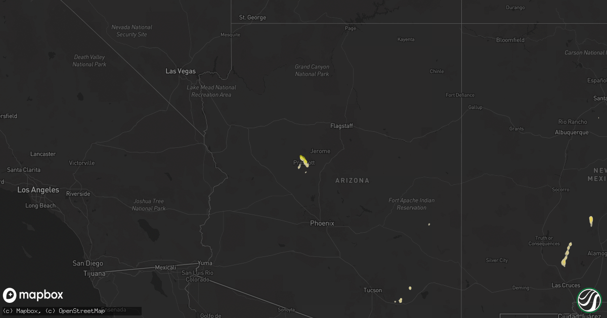
Arizona
| Date | Description |
|---|---|
| 07/10/20245:24 PM CDT | A local report indicates 1.00 inch wind near 4 SW Prescott Airport |
| 07/10/20245:20 PM CDT | Mesonet station qgda3 goodwin mesa |
Nebraska
| Date | Description |
|---|---|
| 07/10/20246:56 PM CDT | Estimated 50 to 60 mph winds along with dime size hail. |
| 07/10/20246:33 PM CDT | Report from mping: half dollar |
| 07/10/20245:37 PM CDT | Report of copious amounts of hail... Some up to quarter size. Also strong winds but no estimate on speeds. Time estimated from radar. |
| 07/09/20247:57 PM CDT | Quarter-size hail. |
| 07/09/20247:18 PM CDT | Hail up to quarter size...most smaller. |
| 07/09/20247:15 PM CDT | Quarter-size hail ended around 7:15. |
Indiana
| Date | Description |
|---|---|
| 07/10/20247:57 AM CDT | Report from mping: 1-inch tree limbs broken. |
Kansas
| Date | Description |
|---|---|
| 07/09/20249:32 PM CDT | Large tree limb fell on the roof of a home and 3 automobiles parked near the home. The roof of the home and the automobiles were damaged. Time estimated from radar data |
| 07/09/20249:29 PM CDT | Private weather station reported a 58 mph wind gust at 929 pm. |
| 07/09/20249:13 PM CDT | Power pole snapped from severe thunderstorm wind gusts. Time estimated from radar. |
| 07/09/20249:13 PM CDT | Sustained 45-55 mph with 68 mph gust measured. |
| 07/09/20249:02 PM CDT | Several trees down one 3 west of leavenworth city on k92 highway blocked roadway 10 inch in diameter a branch tree still standing. |
| 07/09/20248:29 PM CDT | Downed tree limbs and wires near lakewood street. Time estimated from radar. |
Minnesota
| Date | Description |
|---|---|
| 07/10/20243:32 PM CDT | Large tree branch down. Report received via social media. Time estimated from radar. |
| 07/10/20243:32 PM CDT | Large tree limbs snapped. Report received via social media. Time estimated from radar. |
| 07/10/20242:03 PM CDT | Trees down. Delayed report. Time estimated from radar. |
Cities Impacted by Hail Map on July 10, 2024
- Forestville, NY
- Irving, NY
- Perrysburg, NY
- Lawtons, NY
- North Collins, NY
- Eden, NY
- Hamburg, NY
- Orchard Park, NY
- Lake View, NY
- West Falls, NY
- Constableville, NY
- Lowville, NY
- Buffalo, NY
- Elma, NY
- Glenfield, NY
- Turin, NY
- Stewart, MN
- Castorland, NY
- Oswego, NY
- Orient, IA
- Greig, NY
- Brantingham, NY
- Lyons Falls, NY
- Macksburg, IA
- Lorimor, IA
- Pulaski, NY
- Peru, IA
- Murray, IA
- Afton, IA
- Springwater, NY
- Avon, NY
- Truro, IA
- Osceola, IA
- Penfield, NY
- Webster, NY
- Ontario, NY
- Fairport, NY
- Walworth, NY
- Macedon, NY
- Lima, NY
- Honeoye Falls, NY
- Williamson, NY
- Honeoye, NY
- Naples, NY
- Canandaigua, NY
- Redfield, NY
- Woodburn, IA
- New Virginia, IA
- Thayer, IA
- Franklin, MN
- Sodus, NY
- Griswold, IA
- Lewis, IA
- Morgan, MN
- Sacramento, NM
- Massena, IA
- Weldon, IA
- Humeston, IA
- Derby, IA
- Chariton, IA
- Corydon, IA
- Mescalero, NM
- Morton, MN
- Redwood Falls, MN
- Manchester, IA
- Lucas, IA
- Ellston, IA
- Ocheyedan, IA
- Sibley, IA
- Saint Michael, MN
- Bridgewater, IA
- Corning, IA
- Prescott, IA
- Savannah, NY
- Seneca Falls, NY
- Monticello, IA
- Hopkinton, IA
- Elliott, IA
- Creston, IA
- Cromwell, IA
- Cumberland, IA
- Villisca, IA
- Grant, IA
- Hanover, MN
- Millerton, IA
- Promise City, IA
- Russell, IA
- Ashton, IA
- Goliad, TX
- Red Oak, IA
- Plano, IA
- Shannon City, IA
- Lenox, IA
- Capitan, NM
- Lincoln, NM
- Weedsport, NY
- Port Byron, NY
- Montezuma, NY
- Nodaway, IA
- Gaines, PA
- Newcomb, NY
- Morris, PA
- Keene Valley, NY
- Lake Placid, NY
- Granville, IA
- Marcus, IA
- Sheldon, IA
- Sanborn, IA
- Remsen, IA
- Tingley, IA
- Ovid, NY
- Centerville, IA
- Mystic, IA
- Lakeville, NY
- Mathis, TX
- Skidmore, TX
- Diagonal, IA
- Jordan, NY
- Worthington, MN
- Brewster, MN
- Interlaken, NY
- Unionville, MO
- Archer, IA
- Mount Vernon, IA
- Kellerton, IA
- Wellsboro, PA
- Springville, IA
- Reading, MN
- Keene, NY
- Exline, IA
- Minneapolis, MN
- Mexico, NY
- Pollock, MO
- Cincinnati, IA
- Scipio Center, NY
- Genoa, NY
- Moravia, NY
- Mount Ayr, IA
- Clay, NY
- Liverpool, NY
- Baldwinsville, NY
- Livonia, MO
- Moulton, IA
- Hastings, IA
- Emerson, IA
- Lacona, NY
- Lisbon, IA
- Green City, MO
- Aurora, NY
- King Ferry, NY
- Geneseo, NY
- Alton, IA
- Lansing, NY
- Locke, NY
- Trumansburg, NY
- Imogene, IA
- Essex, IA
- Sharpsburg, IA
- Bedford, IA
- Bloomfield, IA
- Malvern, IA
- Glenwood, IA
- Milan, MO
- Ottumwa, IA
- Eagleville, MO
- Homer, NY
- Stanton, IA
- Toledo, IA
- Gravity, IA
- Hatfield, MO
- Melvin, IA
- Chelsea, IA
- Elberon, IA
- Clutier, IA
- Olmstedville, NY
- Minerva, NY
- Floris, IA
- Randolph, IA
- Le Mars, IA
- Tully, NY
- Skaneateles, NY
- Preble, NY
- Clearfield, IA
- Pottersville, NY
- Schroon Lake, NY
- North Creek, NY
- Bernhards Bay, NY
- Chestertown, NY
- Camden, NY
- Vining, IA
- Fabius, NY
- La Fayette, NY
- Blockton, IA
- Farragut, IA
- Shenandoah, IA
- Groton, NY
- Freeville, NY
- Adirondack, NY
- Paradox, NY
- New Boston, MO
- Cortland, NY
- Northboro, IA
- Ethel, MO
- Elmer, MO
- Redding, IA
- Manlius, NY
- Apulia Station, NY
- Crown Point, NY
- Truxton, NY
- McGraw, NY
- Ticonderoga, NY
- Waco, NE
- Coin, IA
- Blanchard, IA
- Forestport, NY
- Parnell, MO
- Sheridan, MO
- Cincinnatus, NY
- York, NE
- Hopkins, MO
- Bridport, VT
- Worth, MO
- Gentry, MO
- Bevier, MO
- Callao, MO
- Prescott, AZ
- North Hudson, NY
- Grant City, MO
- Pacific Junction, IA
- Yarnell, AZ
- Utica, NE
- Thurman, IA
- Exeter, NE
- McCool Junction, NE
- Kirkland, AZ
- Albany, MO
- Beaver Crossing, NE
- Seward, NE
- Goehner, NE
- West Point, IA
- Corona, NM
- Stanberry, MO
- Tabor, IA
- Sidney, IA
- Laredo, TX
- Milford, NE
- Carrizozo, NM
- Nebraska City, NE
- Moriah, NY
- Port Henry, NY
- Plattsmouth, NE
- Denton, NE
- Lincoln, NE
- Rock Port, MO
- Fairfax, MO
- Pleasant Dale, NE
- Canyon, TX
- Palm City, FL
- Port Saint Lucie, FL
- Moriah Center, NY
- Hamburg, IA
- Rowley, IA
- Independence, IA
- Friend, NE
- Brackettville, TX
- Roca, NE
- Cleveland, NY
- Walton, NE
- Martell, NE
- Skidmore, MO
- Benson, AZ
- Palmyra, NE
- Douglas, NE
- Fairmont, NE
- Galesburg, IL
- Bennet, NE
- Henderson, NE
- Mediapolis, IA
- Craig, MO
- Mound City, MO
- Maryville, MO
- Burr, NE
- Adams, NE
- Oakville, IA
- Grafton, NE
- Tecumseh, NE
- Waukee, IA
- Dallas Center, IA
- Adel, IA
- Van Meter, IA
- Geneva, NE
- Falls City, NE
- Unadilla, NE
- Derry, NM
- Las Cruces, NM
- Elk Creek, NE
- Rulo, NE
- Forest City, MO
- Humboldt, NE
- Dunbar, NE
- Talmage, NE
- Syracuse, NE
- Graham, MO
- Bolckow, MO
- White Cloud, KS
- Oregon, MO
- Barnard, MO
- Rosendale, MO
- Savannah, MO
- Highland, KS
- Brock, NE
- Troy, KS
- Peru, NE
- Rea, MO
- Ithaca, NY
- Dawson, NE
- Wathena, KS
- Julian, NE
- Otis, KS
- Sabetha, KS
- Watson, MO
- Atchison, KS
- Rushville, MO
- Muleshoe, TX
- Cummings, KS
- Lancaster, KS
- Effingham, KS
- Hoisington, KS
- Nortonville, KS
- Osborn, MO
- Stewartsville, MO
- Leavenworth, KS
- Easton, KS
- Maitland, MO
- Weston, MO
- Fort Leavenworth, KS
- Lansing, KS
- McLouth, KS
- Basehor, KS
- Tonganoxie, KS
- Kansas City, KS
- Bonner Springs, KS
- Shawnee, KS
- Amado, AZ
- Winchester, KS
- Arivaca, AZ
- Friona, TX
- Hamilton, MO
- Kidder, MO
- Winterset, IA
- Riverton, IA
- De Soto, IA
- Keystone, IA
- De Ruyter, NY
- Lodi, NY
- Hector, NY
- Sodus Point, NY
- Gypsum, KS
- Assaria, KS
- Peabody, KS
- New Russia, NY
- Martelle, IA
- West Branch, IA
- Coralville, IA
- Iowa City, IA
- Coatsville, MO
- Worthington, IA
- Delhi, IA