Hail Map in Minnesota on July 10, 2011
Get this storm
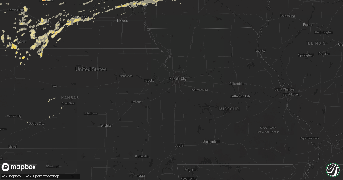
July 10 map
$229
one time, instant access
Download today. No call, no setup
Keep the $229
Bought the map and want the full workflow? Apply the entire $229 to a subscription within 7 days. None of it is wasted.
Every map, not just this one
This buys you this map. Subscription and you get every map we run, in the markets you choose from a few cities to whole states to nationwide. Plus real-time alerts the moment a storm fires.
Contact data
Name, contact info, occupancy, even credit band for addresses in the footprint. You go from where it hit to who to call.
Become the source they trust
Unlimited branding weather history reports on demand. You already have the documented answer ready for the property owner, and you are the one who showed up with it.
Property data and RoofTrace estimates
Pull up any address you have got, its value and the exact code rules for that jurisdiction, straight from One Click Code. Then RoofTrace estimates the squares, pitch, and roof value, priced the way you price.
Storm reports in Minnesota
Minnesota
| Date | Description |
|---|---|
| 07/10/20116:48 PM CDT | Grain bins blown over |
| 07/10/20116:45 PM CDT | A local report indicates 60 MPH wind near 2 E DUMONT |
| 07/10/20116:35 PM CDT | Delayed report from july 10th. From the rwis weather station near graceville. |
| 07/10/20113:15 AM CDT | Trees down |
| 07/10/201112:40 AM CDT | Trees down along highway 61 north of town |
| 07/10/201112:22 AM CDT | Power outages in area |
| 07/10/201112:09 AM CDT | Measured with anemometer. |
| 07/10/201112:00 AM CDT | Powerline down |
| 07/09/201111:58 PM CDT | Wind gusts measured 80 to 100 mph. |
| 07/09/201111:20 PM CDT | A local report indicates 59 MPH wind near WASECA |
| 07/09/201111:08 PM CDT | Several twelve inch diameter trees downed. Occurred in different parts of town. |
| 07/09/201111:00 PM CDT | Trees and power lines down. Some building damage. |
| 07/09/201111:00 PM CDT | Two inch diameter trees down. |
| 07/09/201110:54 PM CDT | Power out in places. |
| 07/09/201110:50 PM CDT | Power out 38th to 44th central ave. |
| 07/09/201110:45 PM CDT | 10 inch tree down. |
| 07/09/201110:45 PM CDT | One foot diameter tree branch felled. |
| 07/09/201110:45 PM CDT | Ten inch diameter tree down. |
| 07/09/201110:42 PM CDT | Numerous powerlines down throughout the county. A large tree downed 1sw henderson. |
| 07/09/201110:30 PM CDT | Two inch diameter tree branches down. |
| 07/09/201110:15 PM CDT | Moderate to severe damage of corn crop |
| 07/09/201110:15 PM CDT | A local report indicates 1.00 inch wind near 3 N WOODSTOCK |
| 07/09/201110:05 PM CDT | A local report indicates 65 MPH wind near 2 NE STEWART |
| 07/09/201110:04 PM CDT | Numerous large branches downed along with several road signs blown down. |
| 07/09/201110:00 PM CDT | Large tree down. |
| 07/09/20119:50 PM CDT | 30 foot pine tree snapped off sunday evening |
| 07/09/20119:30 PM CDT | Damage over a 3/4 mile path |
| 07/09/20119:24 PM CDT | Ovl airport awos estimated time. |
| 07/09/20119:22 PM CDT | Stc airport asos |
| 07/09/20119:15 PM CDT | Power out |
| 07/09/20119:04 PM CDT | A few large trees down. |
| 07/09/20119:00 PM CDT | Est 70 mph winds...one foot diameter trees down. |
| 07/09/20118:59 PM CDT | Eight inch diameter tree down. |
| 07/09/20118:55 PM CDT | Trees down large branches |
| 07/09/20118:48 PM CDT | On the ground. |
| 07/09/20118:48 PM CDT | Estimated location. Multiple reports of a tornado on the ground sighted from grove city. Radar indicates that aeras of rotation were northwest of grove city and not act |
| 07/09/20118:47 PM CDT | Estimated location and time. Multiple reports of a tornado on the ground in this area. A detailed account indicated this was in the middle of a field that was unreachab |
| 07/09/20118:45 PM CDT | Power lines down. |
| 07/09/20118:45 PM CDT | Mndot hwy 23 and mile post 94 |
| 07/09/20118:25 PM CDT | A local report indicates 60 MPH wind near 7 NNE HENDRICKS |
| 07/09/20118:15 PM CDT | A local report indicates 1.00 inch wind near 2 NNE DAWSON |
| 07/09/20118:14 PM CDT | Airport awos |
| 07/09/20118:10 PM CDT | Approximately two hundred trees in sauk centre were either uprooted or snapped with this line of storms. Tree damage was noted from interstate 94 in the south to the sa |
| 07/09/20117:59 PM CDT | Measured at glenwood municipal airport. |
| 07/09/20117:59 PM CDT | Eight inch diameter tree down. |
| 07/09/20117:58 PM CDT | Mehurin us-hwy 212 mile post 1 |
| 07/09/20117:53 PM CDT | Axn airport |
| 07/09/20117:52 PM CDT | Large trees and powerlines down |
| 07/09/20117:50 PM CDT | Scattered large up to 30 diameter trees. |
| 07/09/20117:47 PM CDT | Mndot i-94 and mn hwy 29 mile post 46 |
| 07/09/20117:40 PM CDT | Over a dozen large trees downed within town. Estimated wind speeds 60 to 80 mph. |
| 07/09/20117:30 PM CDT | Large trees downed. |
| 07/09/20117:25 PM CDT | 4 inch diameter branches down in town. |
All States Impacted by Hail Map on July 10, 2011
Cities Impacted by Hail Map on July 10, 2011
- Floresville, TX
- Argyle, WI
- Blanchardville, WI
- Valley, NE
- Weston, NE
- Brainard, NE
- Gretna, NE
- Colon, NE
- Waterloo, NE
- Malmo, NE
- Wahoo, NE
- Ashland, NE
- Mead, NE
- Bennington, NE
- Fremont, NE
- Omaha, NE
- Prague, NE
- Elkhorn, NE
- Yutan, NE
- Pueblo, CO
- McDonald, KS
- Register, GA
- Arthur, NE
- Hankinson, ND
- Wahpeton, ND
- Ellendale, ND
- Forbes, ND
- Broken Bow, NE
- Merna, NE
- Ewing, NE
- Hyannis, NE
- De Soto, WI
- Wilsonville, NE
- Sully, IA
- Glen Ullin, ND
- New Leipzig, ND
- Almont, ND
- Trenton, NE
- Culbertson, NE
- Herndon, KS
- Watertown, WI
- Juneau, WI
- Lowell, WI
- Beaver Dam, WI
- Reeseville, WI
- Statesboro, GA
- Hanover, IL
- Elizabeth, IL
- Glenwood, MN
- Atwood, KS
- Sutherland, NE
- Juda, WI
- Brodhead, WI
- Archer, IA
- Primghar, IA
- Stapleton, NE
- Chassell, MI
- Lake Linden, MI
- Mandan, ND
- Saint Anthony, ND
- Bismarck, ND
- Palisade, NE
- Hancock, IA
- Montevideo, MN
- Sacred Heart, MN
- Maynard, MN
- Granite Falls, MN
- Brady, NE
- Genoa, CO
- Bellingham, MN
- Gibbon, NE
- Shelton, NE
- Oakland, IA
- Minden, IA
- Logandale, NV
- Wentworth, SD
- Strasburg, ND
- Fort Yates, ND
- Richardton, ND
- Elgin, ND
- Bennett, CO
- Kiowa, CO
- Warren, IL
- Gratiot, WI
- Miller, NE
- Fairmount, ND
- Cyrus, MN
- Starbuck, MN
- Hospers, IA
- Paxton, NE
- Agate, CO
- Elizabeth, CO
- Littlefield, AZ
- Pflugerville, TX
- Shullsburg, WI
- Darlington, WI
- Madison, MN
- Marietta, MN
- Dickinson, ND
- Mound City, SD
- Eureka, SD
- Larned, KS
- Leola, SD
- Holbrook, NE
- Arapahoe, NE
- Black Canyon City, AZ
- Baldwin, IA
- Waterloo, WI
- Columbus, WI
- New Salem, ND
- Mott, ND
- Ashley, ND
- Jackson, MN
- Lakefield, MN
- Grinnell, IA
- Tama, IA
- Temple, GA
- Buchanan, GA
- Holmen, WI
- Selfridge, ND
- Kintyre, ND
- Napoleon, ND
- Braddock, ND
- Fennimore, WI
- Lancaster, WI
- Osceola, NE
- Columbus, NE
- Silver Creek, NE
- State Center, IA
- Carson, ND
- Maxwell, NE
- Regent, ND
- Kulm, ND
- Lehr, ND
- Fredonia, ND
- Eustis, NE
- Cambridge, NE
- Boone, IA
- Ogden, IA
- Madrid, IA
- Hecla, SD
- La Crosse, WI
- Cashton, WI
- Ontario, WI
- Scranton, IA
- Jefferson, IA
- Amherst, NE
- Pleasanton, NE
- Hazard, NE
- Lefor, ND
- Gladstone, ND
- Hebron, ND
- Flasher, ND
- Taylor, ND
- Linton, ND
- Menoken, ND
- Dawson, ND
- Hazelton, ND
- Moffit, ND
- Tappen, ND
- Oxford, NE
- Stamford, NE
- Berlin, ND
- Blue Earth, MN
- Granada, MN
- Fairmont, MN
- Cogswell, ND
- Forman, ND
- Chaseburg, WI
- Templeton, IA
- Manning, IA
- Audubon, IA
- Stuart, NE
- Atkinson, NE
- Ravenna, NE
- Enterprise, AL
- Elba, AL
- New Brockton, AL
- Elk River, MN
- Hokah, MN
- Caliente, NV
- Anselmo, NE
- Arnold, NE
- Lidgerwood, ND
- Plymouth, WI
- Minburn, IA
- Fowler, CO
- Olney Springs, CO
- Florence, SD
- Jackson, WI
- Davis, IL
- Durand, IL
- Alexander, KS
- Lismore, MN
- Norton, KS
- Henning, MN
- Phillips, NE
- Alda, NE
- Wood River, NE
- Grand Island, NE
- Doniphan, NE
- Baraboo, WI
- Reedsburg, WI
- Villard, MN
- Alexandria, MN
- Saint Francis, KS
- Brooten, MN
- Sunburg, MN
- New London, MN
- Belgrade, MN
- Dawson, MN
- Revillo, SD
- Labolt, SD
- New Era, MI
- Shelby, MI
- Lenora, KS
- Terril, IA
- Java, SD
- Hosmer, SD
- Campbell, MN
- Runnells, IA
- Pleasant Hill, IA
- Palo, IA
- Dallas Center, IA
- Grimes, IA
- Bouton, IA
- Perry, IA
- Woodward, IA
- Polk City, IA
- Granger, IA
- Marion, AL
- Centreville, AL
- Lawley, AL
- Wakpala, SD
- Mobridge, SD
- Trail City, SD
- Malta, ID
- Elwood, NE
- Lexington, NE
- Norwalk, IA
- Cumming, IA
- Elbow Lake, MN
- Wendell, MN
- Garrison, IA
- Dysart, IA
- La Porte City, IA
- Vinton, IA
- Mount Auburn, IA
- Clutier, IA
- Winter, WI
- Rupert, GA
- Collins, GA
- Henderson, NE
- Callaway, NE
- Masonville, IA
- Walker, IA
- Urbana, IA
- Brandon, IA
- Center Point, IA
- Rowley, IA
- Coggon, IA
- Winthrop, IA
- Traer, IA
- Stoddard, WI
- Hugo, CO
- Cimarron, KS
- Camden, AL
- Mequon, WI
- Milwaukee, WI
- Bagley, IA
- Rippey, IA
- Grand Junction, IA
- Coon Valley, WI
- Edgeley, ND
- Mears, MI
- Hesperia, MI
- Hart, MI
- Woodstock, MN
- Lake Wilson, MN
- Fullerton, ND
- Bowdle, SD
- Frederick, SD
- Crofton, NE
- Bloomfield, NE
- Niobrara, NE
- Springfield, SD
- Wallingford, IA
- Estherville, IA
- Ansley, NE
- Whitehall, MI
- Muskegon, MI
- Twin Lake, MI
- Fremont, MI
- Holton, MI
- Rothbury, MI
- Coon Rapids, IA
- Reynolds, GA
- Butler, GA
- Flagler, CO
- Polk, NE
- Benedict, NE
- Hampton, NE
- Bradshaw, NE
- Tallapoosa, GA
- Fullerton, NE
- Genoa, NE
- Round Lake, MN
- Worthington, MN
- Kenesaw, NE
- Northport, AL
- Victor, IA
- Raymond, NE
- Davey, NE
- Glidden, IA
- Wilmot, SD
- Hartwick, IA
- Deforest, WI
- Rio, WI
- Arlington, WI
- Litchfield, NE
- Randolph, AL
- Westfield, IA
- Marshalltown, IA
- Swea City, IA
- Elmore, MN
- Aurora, NE
- Giltner, NE
- Lost Nation, IA
- Pipestone, MN
- Cozad, NE
- Avoca, IA
- Kearney, NE
- Sisseton, SD
- Peever, SD
- Adrian, MN
- Ellsworth, MN
- Stanton, AL
- Bangor, MI
- Alberta, AL
- Oberlin, KS
- Anoka, MN
- Whitman, NE
- Nordheim, TX
- Hartington, NE
- Florala, AL
- Adair, IA
- New London, WI
- Oakes, ND
- Monroe, WI
- Monticello, WI
- Browntown, WI
- Selden, KS
- Arriba, CO
- Gwinner, ND
- Stirum, ND
- Wellfleet, NE
- Curtis, NE
- Maywood, NE
- West Salem, WI
- Onalaska, WI
- Tryon, NE
- Montague, MI
- Farwell, MN
- Toledo, IA
- Nevada, IA
- Ames, IA
- Egan, SD
- Trent, SD
- Flandreau, SD
- Elbert, CO
- Naponee, NE
- Wilcox, NE
- Prairie City, IA
- Stratford, SD
- Groton, SD
- Okabena, MN
- Ridott, IL
- Pecatonica, IL
- Rock City, IL
- Loomis, NE
- Atlanta, NE
- Holdrege, NE
- Searsboro, IA
- Lynnville, IA
- Reasnor, IA
- Pella, IA
- New Sharon, IA
- Dakota, MN
- Winona, MN
- Shellman, GA
- Potosi, WI
- Colfax, IA
- Axtell, NE
- Minden, NE
- Funk, NE
- Edison, NE
- Stevens Point, WI
- Panora, IA
- Guthrie Center, IA
- Yale, IA
- Lyndon Station, WI
- Rock Springs, WI
- Poynette, WI
- Lodi, WI
- La Valle, WI
- Merrimac, WI
- North Freedom, WI
- Overton, NE
- Lisbon, ND
- Montrose, CO
- Maxwell, IA
- Olin, IA
- Clarence, IA
- Oxford Junction, IA
- Mechanicsville, IA
- Wheatland, IA
- Stanwood, IA
- Lowden, IA
- Stratton, NE
- Wauneta, NE
- Benkelman, NE
- Spirit Lake, IA
- Milford, IA
- North Platte, NE
- Moorefield, NE
- Stromsburg, NE
- Guttenberg, IA
- Holy Cross, IA
- Orlando, FL
- D Hanis, TX
- Shelby, NE
- Loup City, NE
- Mitchellville, IA
- Johnstown, NE
- Green Valley, AZ
- Soldiers Grove, WI
- Larchwood, IA
- Dyersville, IA
- Worthington, IA
- Earlville, IA
- Carroll, IA
- Arcadia, IA
- Chipley, FL
- Bonifay, FL
- Lebanon, NE
- Weyauwega, WI
- Wiota, IA
- Anita, IA
- Tucson, AZ
- Kingsland, GA
- Hilliard, FL
- Folkston, GA
- White Oak, GA
- Sherrill, IA
- Colo, IA
- Arlington, CO
- Cambridge, IA
- Williamsburg, IA
- Oxford, IA
- Pollock, SD
- Britton, SD
- Malcom, IA
- Montezuma, IA
- Sumner, NE
- Ipswich, SD
- San Antonio, TX
- Muscadine, AL
- Ironwood, MI
- Wishek, ND
- Bertrand, NE
- Beaver City, NE
- Kinston, AL
- Arnolds Park, IA
- Okoboji, IA
- Tohatchi, NM
- Bird City, KS
- Stratford, IA
- Stanhope, IA
- Marion, IA
- Springville, IA
- Lyons, GA
- Zeeland, ND
- Elkhart Lake, WI
- Barnes City, IA
- Fort Ransom, ND
- Richland Center, WI
- Timewell, IL
- Camden, IL
- Pardeeville, WI
- Portage, WI
- Webster, SD
- Lawrence, MI
- Paw Paw, MI
- Hartford, MI
- Shellsburg, IA
- Fall River, WI
- Randolph, WI
- Mount Hope, WI
- Sahuarita, AZ
- Pennock, MN
- Akron, IA
- Elk Point, SD
- Le Mars, IA
- Marengo, IA
- South Amana, IA
- Maquoketa, IA
- Verona, ND
- Lamoure, ND
- Eden, SD
- Ramer, AL
- McCook, NE
- Hague, ND
- Fargo, GA
- Du Pont, GA
- Statenville, GA
- Monroe, NE
- Hastings, NE
- Wyoming, IA
- Blue River, WI
- Bangor, WI
- Hillpoint, WI
- Lone Rock, WI
- Grant, MI
- Montour, IA
- Mount Sterling, IL
- Colesburg, IA
- New Vienna, IA
- Holland, MN
- Ruthton, MN
- Dickey, ND
- Overton, NV
- Eufaula, AL
- Midway, AL
- Maple Lake, MN
- Annandale, MN
- La Crescent, MN
- Graettinger, IA
- Carson, IA
- Council Bluffs, IA
- Walnut, IA
- Underwood, IA
- Neola, IA
- McClelland, IA
- Crescent, IA
- Carter Lake, IA
- Treynor, IA
- Honey Creek, IA
- Lewis, IA
- Barrett, MN
- Moose Lake, MN
- Kettle River, MN
- Cedar Rapids, IA
- Toddville, IA
- Hiawatha, IA
- Robins, IA
- Elk Horn, IA
- Marne, IA
- Atlantic, IA
- Brayton, IA
- Shelby, IA
- Garretson, SD
- Jasper, MN
- Galena, IL
- Hazel Green, WI
- East Dubuque, IL
- Casey, IA
- Fountain City, WI
- Lowry, MN
- Ulysses, NE
- Hartland, WI
- Colgate, WI
- Houston, MN
- Malad City, ID
- Morris, MN
- Central City, IA
- Wausa, NE
- Kinsley, KS
- Offerle, KS
- Marion Junction, AL
- Orrville, AL
- Ledyard, IA
- Montgomery, AL
- Brantley, AL
- Anamosa, IA
- Clayton, AL
- Monticello, MN
- Big Lake, MN
- West Bend, WI
- Clearwater, NE
- Gays Mills, WI
- Sparta, WI
- Black River Falls, WI
- Gladbrook, IA
- Clear Lake, MN
- Ladora, IA
- Gilman, IA
- Kellogg, IA
- Renville, MN
- Nekoma, KS
- Danube, MN
- Olivia, MN
- Charlotte, IA
- Goose Lake, IA
- De Witt, IA
- Barney, ND
- Comstock, NE
- Westerville, NE
- Arcadia, NE
- Bellevue, IA
- Farley, IA
- Hopkinton, IA
- Deer Trail, CO
- Ramah, CO
- Gackle, ND
- Streeter, ND
- Punta Gorda, FL
- Pawnee Rock, KS
- Elm Creek, NE
- Rising City, NE
- David City, NE
- Viroqua, WI
- Genoa, WI
- Caledonia, MN
- Hartford, WI
- Oconomowoc, WI
- Lebanon, WI
- Ixonia, WI
- Rubicon, WI
- Ashippun, WI
- Neosho, WI
- Ravenna, MI
- Tuscaloosa, AL
- Palmer, NE
- Safford, AL
- Hordville, NE
- Nogales, AZ
- Rutland, ND
- Heron Lake, MN
- Hortense, GA
- Dixon, IL
- Rockland, WI
- Vona, CO
- Mantador, ND
- Orleans, NE
- Alma, NE
- Hayes Center, NE
- La Crosse, KS
- Magnet, NE
- Mclean, NE
- Randolph, NE
- Wyndmere, ND
- Coleridge, NE
- Lake Benton, MN
- Dresden, KS
- Jennings, KS
- Coalville, UT
- Guernsey, IA
- Monroe, IA
- Simla, CO
- White Cloud, MI
- Walkerville, MI
- Newaygo, MI
- Orangeville, IL
- Tanner, AL
- Windom, MN
- Huxley, IA
- Clemons, IA
- Saint Anthony, IA
- Melbourne, IA
- McCallsburg, IA
- Roland, IA
- Collins, IA
- Story City, IA
- Zearing, IA
- Tony, WI
- Page, NE
- Menlo, IA
- Ringsted, IA
- Superior, IA
- Vining, MN
- Long Lake, SD
- Albany, WI
- Prentice, WI
- Brantwood, WI
- Norcatur, KS
- Republican City, NE
- Hildreth, NE
- Smithfield, NE
- Astoria, IL
- Rushville, IL
- Westby, WI
- Martelle, IA
- Mount Vernon, IA
- Dayton, MN
- Becker, MN
- Saint Michael, MN
- Buffalo, MN
- Albertville, MN
- Rogers, MN
- Slayton, MN
- Balaton, MN
- Castle Rock, CO
- Linden, IA
- Bartley, NE
- Farnam, NE
- Albion, NE
- Glen Haven, WI
- Cassville, WI
- Armstrong, IA
- Norwalk, WI
- Stockholm, SD
- Shields, ND
- Sargent, NE
- Limon, CO
- Clarkfield, MN
- Saint Helena, NE
- Fordyce, NE
- Columbia, SD
- Houghton, SD
- Surprise, NE
- Laurel, NE
- Grenville, SD
- Tampico, IL
- Riverdale, NE
- Garfield, MN
- Fond Du Lac, WI
- Eden, WI
- Fort Dodge, IA
- Veblen, SD
- Chandler, MN
- Platteville, WI
- Warrens, WI
- Cobbtown, GA
- Metter, GA
- Wonewoc, WI
- Elroy, WI
- Fort Gaines, GA
- Abbeville, AL
- Chapman, NE
- Saint Libory, NE
- Donnelly, MN
- Hancock, MN
- Buckeye, AZ
- Newton, IA
- Sheboygan Falls, WI
- Keystone, NE
- Center, NE
- Verdigre, NE
- Hendley, NE
- Readstown, WI
- Lanark, IL
- Milnor, ND
- Galesville, WI
- Westport, SD
- Brunswick, GA
- Waverly, GA
- Waynesville, GA
- Ridgway, CO
- Waubay, SD
- Dalton, WI
- Dell Rapids, SD
- Colman, SD
- Monticello, IA
- Gresham, NE
- Ralston, IA
- Osmond, NE
- Stockville, NE
- Newcastle, NE
- Defuniak Springs, FL
- La Motte, IA
- Zwingle, IA
- Hawkinsville, GA
- Trempealeau, WI
- Brewster, MN
- South Shore, SD
- Watertown, SD
- Oostburg, WI
- Cedar Grove, WI
- Waldo, WI
- Winnetoon, NE
- Creighton, NE
- Junction City, WI
- Custer, WI
- Rosholt, WI
- Aberdeen, SD
- Quasqueton, IA
- Van Meter, IA
- Booneville, IA
- Waukee, IA
- West Des Moines, IA
- Sun Prairie, WI
- Marshall, WI
- Adell, WI
- Fredonia, WI
- Random Lake, WI
- Campbellsport, WI
- Cascade, WI
- Kewaskum, WI
- Savanna, IL
- Ainsworth, NE
- Selby, SD
- Carlisle, IA
- Des Moines, IA
- Indianola, IA
- Swan, IA
- Hartford, IA
- Pleasantville, IA
- Glenbeulah, WI
- Glenwood, AL
- Vesper, WI
- Titus, AL
- Cascade, IA
- Albany, IL
- Fruitport, MI
- Spring Lake, MI
- Ceresco, NE
- Cazenovia, WI
- Inman, NE
- Maplesville, AL
- Brooklyn, IA
- Chelsea, IA
- Hardwick, MN
- Luverne, MN
- Ryan, IA
- Odessa, NE
- Cedartown, GA
- Bayard, IA
- Edgerton, MN
- Lockney, TX
- Chippewa Falls, WI
- Sanderson, FL
- Brandon, MN
- Kensington, MN
- Tulare, SD
- Shorterville, AL
- Bruce, SD
- Toronto, SD
- Rocksprings, TX
- Ladysmith, WI
- Bruce, WI
- Sutherland, IA
- Paullina, IA
- Athens, AL
- Kenneth, MN
- Mentone, AL
- Medina, TX
- Hondo, TX
- Dickens, IA
- Spencer, IA
- Hershey, NE
- Cedar Rapids, NE
- Garwin, IA
- Barnard, SD
- Greenfield, IA
- Fontanelle, IA
- Burlington, CO
- Dedham, IA
- Mineral Point, WI
- Cuba City, WI
- Belmont, WI
- Goodland, KS
- Sheboygan, WI
- Dakota, IL
- Roscoe, SD
- Long Prairie, MN
- Spicer, MN
- Atwater, MN
- Iron Ridge, WI
- Horicon, WI
- Hustisford, WI
- Warner, SD
- Coker, AL
- Buhl, AL


