Hail Map on July 10, 2011
Get this storm
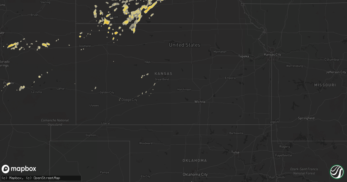
July 10 map
$229
one time, instant access
Download today. No call, no setup
Keep the $229
Bought the map and want the full workflow? Apply the entire $229 to a subscription within 7 days. None of it is wasted.
Every map, not just this one
This buys you this map. Subscription and you get every map we run, in the markets you choose from a few cities to whole states to nationwide. Plus real-time alerts the moment a storm fires.
Contact data
Name, contact info, occupancy, even credit band for addresses in the footprint. You go from where it hit to who to call.
Become the source they trust
Unlimited branding weather history reports on demand. You already have the documented answer ready for the property owner, and you are the one who showed up with it.
Property data and RoofTrace estimates
Pull up any address you have got, its value and the exact code rules for that jurisdiction, straight from One Click Code. Then RoofTrace estimates the squares, pitch, and roof value, priced the way you price.
States Impacted by Hail Map on July 10, 2011
Storm reports
Nevada
| Date | Description |
|---|---|
| 07/10/20116:40 PM CDT | The park service reported that 20 vehicles parked at the las vegas boat harbor had hail of an unknown size and debris such as rocks and mud hit them and break out their |
| 07/10/20113:45 PM CDT | *** 1 inj *** las vegas fire public information officer relayed a report of wires down in the area of the north las vegas airport. In addition...roofing materials were |
| 07/10/20113:42 PM CDT | *** 1 inj *** las vegas fire public information officer and media reported that the 80 percent of the roof was blown off two buildings at an apartment complex and the m |
| 07/10/20113:40 PM CDT | 2 large signs...a wendys and a walrgrees sign...were blown out and onto the ground at the intersection of rancho and washington. The time is estimated. |
| 07/10/20113:30 PM CDT | A 60 foot tall tree was uprooted by thunderstorm winds. |
| 07/10/20113:30 PM CDT | Thunderstorm winds blew a tree onto a house on vegas drive. |
| 07/10/20113:30 PM CDT | Large tree snapped at the base in the rancho circle area. The event time was estimated. |
| 07/10/20113:30 PM CDT | 2 large signs...a wendys and a walrgrees sign...were blown out and onto the ground at the intersection of rancho and washington. The time is estimated. |
| 07/10/20113:30 PM CDT | An entire line of power poles was snapped off...at least a block long...and power was out along cheyenne avenue from valley drive to allen drive. Time is estimated. |
| 07/10/20113:30 PM CDT | Thunderstorm winds blew a tree onto a house on vegas drive near simmons street. The tree landed in the living room of the house. |
| 07/10/20113:28 PM CDT | A local report indicates 64 MPH wind near NORTH LAS VEGAS AP |
North Dakota
| Date | Description |
|---|---|
| 07/10/20116:32 PM CDT | Trees down at farmstead...including tree leaning on house. Surrounding shelterbelts do not seem to have as much damage. |
| 07/10/20116:20 PM CDT | Grain bin damaged. |
| 07/10/20115:40 PM CDT | A local report indicates 60 MPH wind near LIDGERWOOD |
| 07/10/20115:38 PM CDT | Report of trees down in cayuga |
| 07/10/20115:30 PM CDT | Barn and four grain bins blown off their foundations. Pole barn lost its roof. Several trees uprooted and branches up to a foot in diameter snapped. Estimated wind gust |
| 07/10/20115:17 PM CDT | Trained spotter estimates 70 mph wind gust that has knocked over large tree branches |
| 07/10/20115:15 PM CDT | Roof on grain bin collapsed |
| 07/10/20115:10 PM CDT | Roof blown off machine shop. Time approximate. |
| 07/10/20115:06 PM CDT | Law enforcement estimates 60 mph wind gust |
| 07/10/20115:00 PM CDT | Some houses missing shingles off roof. Large trees down in town. |
| 07/10/20114:42 PM CDT | Numerous trees and branches down in and around ludden. |
| 07/10/20114:35 PM CDT | Roof damage to building and sheet metal missing. |
| 07/10/20114:35 PM CDT | Oakes police department reports a tornado on the ground near oakes. |
| 07/10/20114:31 PM CDT | Numerous tree branches down. Winds estimated up to 80 mph. |
| 07/10/20114:30 PM CDT | Grain bins blown over. |
| 07/10/20114:09 PM CDT | Shingles blown off roof. Winds estimated at least 60 mph. |
| 07/10/20114:04 PM CDT | Power lines down. |
| 07/10/20114:02 PM CDT | Winds estimated at 50 to 60 mph...pea size hail. |
| 07/10/20113:48 PM CDT | Delayed report. Damage assessment team surveyed damage at a farmstead 5 miles northwest of merricourt. Residents witnessed a tornado touchdown in a shelterbelt as they |
| 07/10/20113:40 PM CDT | Arb observer reported 70 to 80 miles per hour winds with grain bin blown down. 2.90 inches precipitation in 40 minutes and 3/4 inch hail. |
| 07/10/20113:34 PM CDT | Mcintosh county sheriff reported a tornado on the ground. Relayed by state radio. |
| 07/10/20112:57 PM CDT | A local report indicates 80 MPH wind near 1 SE BURNSTAD |
| 07/10/20112:45 PM CDT | Grain bin with estimated weight of 17 to 20 thousand pounds...10 tons...was lifted and rolled nearly three quarters of a mile from its original location to another farm |
| 07/10/20112:45 PM CDT | Trees uprooted...some as large as 4 feet in diameter and greater than 100 feet tall. |
| 07/10/20112:40 PM CDT | 18 thousand bushel grain bin moved 250 yds. Extensive tree damage with downed trees pointing in random directions. Trees 60 years old...100 ft tall. |
| 07/10/20112:40 PM CDT | Heavy rain. |
| 07/10/20112:40 PM CDT | Possible tornado. 1800 feet of shelter belt missing. Grain bin destroyed and thrown into tree in front yard. Nws damage survey will be conducted. |
| 07/10/20112:35 PM CDT | Empty grain bins damaged. Winds estimated at 85 mph. |
| 07/10/20112:33 PM CDT | A local report indicates 60 MPH wind near 2 E BRADDOCK |
| 07/10/20112:33 PM CDT | Also had 1 inch hail and heavy rain. |
| 07/10/20112:28 PM CDT | Extensive tree branch damage in hazelton. Three inch to six inch in diameter branches blown off of trees. Gas station on the west side of town had damage to the roof ov |
| 07/10/20112:24 PM CDT | Minor damage to farmstead. Shingles blown off of trailer home and small building blown over. Winds estimated at 70 mph. |
| 07/10/20112:20 PM CDT | Double poled wood transmission lines snapped in half. Heavy ranch sign with three foot concrete anchors ripped out of the ground. Camper flipped off of the highway and |
| 07/10/20112:15 PM CDT | Relayed by media. Measured with home anemometer. |
| 07/10/20112:14 PM CDT | Double power lines are snapped about 2 miles south of moffit road on 262nd st se. |
| 07/10/20111:53 PM CDT | Nickel to qaurter size hail. |
| 07/10/20111:52 PM CDT | Nws employee estimated 75 mph wind gusts and penny sized hail. |
| 07/10/20111:50 PM CDT | Lasted until 205 pm. Peak wind speeds around 40 mph. This is falconer estates subdivision. Several homes had roof and gutter damage. Leaves...small branches...and fruit |
| 07/10/20111:50 PM CDT | A local report indicates 1.75 inch wind near 9 S SHIELDS |
| 07/10/20111:45 PM CDT | 2 foot in diamater oak trees were uprooted near huff. Initial estimates of winds in excess of 75 mph. |
| 07/10/20111:43 PM CDT | Lasted 10 minutes |
| 07/10/201112:25 PM CDT | Strong winds lasted 15 minutes. Also pea sized hail. |
| 07/10/201112:02 PM CDT | Nickel to quarter size hail. |
| 07/10/201111:50 AM CDT | A local report indicates 1.75 inch wind near 5 SSE GLEN ULLIN |
| 07/10/201111:30 AM CDT | Mostly pea size hail with a few larger stones. No damage to report. Correction to earlier report. |
| 07/10/201111:30 AM CDT | A local report indicates 2.00 inch wind near 5 SSE GLEN ULLIN |
| 07/10/201111:15 AM CDT | Hail estimated at 2 inches based upon photo provided by media. |
| 07/09/20117:12 PM CDT | Person 5 s of sutton nd sees a tornado 10 miles to his east ... Relayed via wfo bismarck |
Georgia
| Date | Description |
|---|---|
| 07/10/20115:08 PM CDT | One tree down blocking west jones ave. Time estimated by radar. |
| 07/10/20113:30 PM CDT | The emergency manager reported several trees were blown down in the northwest section of the county. The time of the event was based on radar imagery. |
Idaho
| Date | Description |
|---|---|
| 07/09/20119:20 PM CDT | Several small branches were blown out of trees. No size given. |
Mississippi
| Date | Description |
|---|---|
| 07/09/20117:30 PM CDT | Power lines down along flowood drive just east of airport road. |
Nebraska
| Date | Description |
|---|---|
| 07/10/20111:09 AM CDT | Measured thunderstorm gust by home wind equipment on roof. Scattered tree damage with some power outages...mainly on north side of town. |
| 07/10/201112:55 AM CDT | Power outages in newcastle |
| 07/10/201112:32 AM CDT | A local report indicates 60 MPH wind near 2 SW PENDER |
| 07/10/201112:24 AM CDT | A local report indicates 60 MPH wind near WAYNE |
| 07/10/201112:20 AM CDT | Law enforcement reported wind caused structual and tree damage on the west side of oneill to include downed trees 8 inches in diameter and blown out windows. |
| 07/10/201112:15 AM CDT | A local report indicates 60 MPH wind near 2 W ONEILL |
| 07/10/201112:13 AM CDT | A local report indicates 59 MPH wind near NORFOLK |
| 07/10/201112:13 AM CDT | A local report indicates 1.00 inch wind near DAVID CITY |
| 07/10/201112:05 AM CDT | Sustained for 1.5 minutes. Widespread power outages throughout the county. Estimated 3000 to 4000 people without power. |
| 07/10/201112:05 AM CDT | Numerous tree limbs downed...some eight inches in diameter...power out. |
| 07/10/201112:01 AM CDT | A local report indicates 60 MPH wind near 2 NW DAVID CITY |
| 07/09/201111:56 PM CDT | A local report indicates 68 MPH wind near NORFOLK |
| 07/09/201111:36 PM CDT | Numerous trees down...some vehicle damage...damage reports were from 1136 to 1146 pm. |
| 07/09/201111:22 PM CDT | Difficult to keep car on the road |
| 07/09/201111:20 PM CDT | Estimated 50 to 60 mile per hour winds just south of fullerton |
| 07/09/201111:16 PM CDT | Elba is without power. |
| 07/09/201111:03 PM CDT | Numerous reports of trees down in palmer |
| 07/09/201111:02 PM CDT | Quarter size hail lasted 2 minutes with 40 mile per hour winds. |
| 07/09/201111:00 PM CDT | A local report indicates 80 MPH wind near NORTH LOUP |
| 07/09/201110:50 PM CDT | Roof blown off of a shed and knocked a wall down as well. |
| 07/09/201110:43 PM CDT | Estimated 65 mile per hour winds with penny size hail. Some tree branches and power lines down as well. |
| 07/09/201110:43 PM CDT | A local report indicates 64 MPH wind near GRAND ISLAND AIRPORT |
| 07/09/201110:39 PM CDT | 60 mile per hour winds for the past 10 minute on the corner of wildwood and highway 281. |
| 07/09/201110:30 PM CDT | A utility pole was knocked down near 8th and 3rd streets and a large tree was blown over at 31st and e street. Power was knocked out in ravenna. |
| 07/09/201110:20 PM CDT | A local report indicates 60 MPH wind near 4 W GRAND ISLAND |
| 07/09/201110:10 PM CDT | Farmer reported some green snap damage to his corn crop and basketball hoop blown over as thunderstorms passed over his location. Report delayed from evening of july 10 |
| 07/09/201110:10 PM CDT | Farmer reported some green snap damage to his corn crop and basketball hoop blown over as thunderstorms passed over his location. Report delayed from evening of july 10 |
| 07/09/20119:55 PM CDT | A local report indicates 68 MPH wind near KEARNEY |
| 07/09/20119:48 PM CDT | A local report indicates 70 MPH wind near KEARNEY |
| 07/09/20119:45 PM CDT | A local report indicates 1.00 inch wind near LEXINGTON |
| 07/09/20119:42 PM CDT | A local report indicates 60 MPH wind near 7 SW GOTHENBURG |
| 07/09/20119:42 PM CDT | 60 mile per hour wind in axtell with dime size hail. |
| 07/09/20119:37 PM CDT | Trailer house was blown over on the west edge of holdrege. Mulitple power outages across holdredge and tree limbs with a diameter up to 2 to 6 inches blown down. |
| 07/09/20119:37 PM CDT | A local report indicates 60 MPH wind near 10 WSW HAYES CENTER |
| 07/09/20119:37 PM CDT | Trailer house was blown over on the west edge of holdrege. Mulitple power outages across holdredge and tree limbs with a diameter up to 2 to 6 inches blown down. |
| 07/09/20119:33 PM CDT | A local report indicates 1.00 inch wind near 9 E WELLFLEET |
| 07/09/20119:30 PM CDT | A local report indicates 60 MPH wind near 9 E WELLFLEET |
| 07/09/20119:30 PM CDT | A local report indicates 1.50 inch wind near 5 SE HOLDREGE |
| 07/09/20119:29 PM CDT | 60 mile per hour winds northwest of holdrege and nickel size hail. |
| 07/09/20119:28 PM CDT | A local report indicates 70 MPH wind near 2 E FARNAM |
| 07/09/20119:26 PM CDT | Power lines down in holdrege. |
| 07/09/20119:16 PM CDT | A local report indicates 1.25 inch wind near BROKEN BOW |
| 07/09/20119:16 PM CDT | A local report indicates 70 MPH wind near 7 SW HAYES CENTER |
| 07/09/20119:05 PM CDT | Delayed report from evening of july 10th. Southwest public power substation at hayes center recorded a wind gust to 71 mph on automated davis weather station. |
| 07/09/20119:05 PM CDT | A local report indicates 1.00 inch wind near 2 S OXFORD |
| 07/09/20119:05 PM CDT | A local report indicates 2.00 inch wind near 1 NW BROKEN BOW |
| 07/09/20119:05 PM CDT | Said there was tree damage with spiked hailstones the size of tennis balls. |
| 07/09/20118:57 PM CDT | A local report indicates 60 MPH wind near 14 SE STOCKVILLE |
| 07/09/20118:50 PM CDT | A local report indicates 1.50 inch wind near 9 NNE CALLAWAY |
| 07/09/20118:48 PM CDT | A local report indicates 60 MPH wind near 1 W EDISON |
| 07/09/20118:45 PM CDT | A few shingles blown off roof of house. |
| 07/09/20118:45 PM CDT | A local report indicates 60 MPH wind near BENKELMAN |
| 07/09/20118:39 PM CDT | A local report indicates 59 MPH wind near BENKELMAN |
| 07/09/20118:28 PM CDT | Local law enforcement reported 2 to 3 large cottonwood trees were blown down in and just west of edison. A 20 to 30 foot long tree limb that is 8 to 10 inches in diamet |
| 07/09/20118:28 PM CDT | A local report indicates 1.50 inch wind near 8 NE ARNOLD |
| 07/09/20118:20 PM CDT | 7 to 8 inch diameter green tree limbs broken off. |
| 07/09/20118:15 PM CDT | A local report indicates 60 MPH wind near 3 NNW ARNOLD |
| 07/09/20118:15 PM CDT | A local report indicates 1.75 inch wind near 3 NNW ARNOLD |
| 07/09/20117:52 PM CDT | 6 inch diameter tree branches were snapped off his elm tree. |
| 07/09/20117:26 PM CDT | A local report indicates 1.00 inch wind near 9 N TRYON |
Kansas
| Date | Description |
|---|---|
| 07/10/20116:10 PM CDT | The caller also reported dime-sized hail and 0.55 of rain. |
| 07/10/20115:45 PM CDT | Four 4-inch limbs were down. The wind was estimated at least 70 mph. |
| 07/09/20118:00 PM CDT | Also had dime-sized hail. |
| 07/09/20117:25 PM CDT | A local report indicates 1.50 inch wind near 8 S OBERLIN |
Arizona
| Date | Description |
|---|---|
| 07/10/20116:33 PM CDT | Phoenix sky harbor airport asos measured a 66 mph wind gust |
| 07/10/20116:00 PM CDT | Numerous large trees down. Roof blown off a house. |
| 07/09/20119:30 PM CDT | 17 power poles blown down or snapped along state route 95 between milepost markers 112 and 113. |
| 07/09/20117:50 PM CDT | Thunderstorm winds downed a power line in lake mead city near smith road and rainbow road. |
South Dakota
| Date | Description |
|---|---|
| 07/10/20116:30 PM CDT | Estimated 50 mph winds and very heavy rain also |
| 07/10/20115:50 PM CDT | Raws observation |
| 07/10/20115:30 PM CDT | Top half cut off a 12 ft. Tree. 1 inch of rain in 15 min. |
| 07/10/20115:20 PM CDT | Trees down in the town of britton. |
| 07/10/20115:00 PM CDT | A local report indicates 60 MPH wind near 3 N ABERDEEN |
| 07/10/20115:00 PM CDT | Quarter size hail also reported |
| 07/10/20114:55 PM CDT | Trees down |
| 07/10/20114:15 PM CDT | 60 mph winds also...garden is ruined |
| 07/10/20113:45 PM CDT | 60 mph winds also |
| 07/10/20113:45 PM CDT | Wind gust at the sand lake raws station. Time estimated by radar. |
| 07/10/20113:35 PM CDT | A local report indicates 1.00 inch wind near POLLOCK |
| 07/10/20119:17 AM CDT | Medium to large branches down. Hail of unknown size but no hail damage noted. |
| 07/10/20111:35 AM CDT | 4 to 6 inch branches snapped for trees. |
| 07/10/20111:28 AM CDT | Power out |
| 07/10/20111:20 AM CDT | Branches down |
| 07/10/201112:33 AM CDT | Tree limbs down |
| 07/09/20118:00 PM CDT | 6 inch to 8 inch diameter branches down in town of clear lake |
| 07/09/20117:27 PM CDT | A local report indicates 60 MPH wind near MILBANK |
Minnesota
| Date | Description |
|---|---|
| 07/10/20116:48 PM CDT | Grain bins blown over |
| 07/10/20116:45 PM CDT | A local report indicates 60 MPH wind near 2 E DUMONT |
| 07/10/20116:35 PM CDT | Delayed report from july 10th. From the rwis weather station near graceville. |
| 07/10/20113:15 AM CDT | Trees down |
| 07/10/201112:40 AM CDT | Trees down along highway 61 north of town |
| 07/10/201112:22 AM CDT | Power outages in area |
| 07/10/201112:09 AM CDT | Measured with anemometer. |
| 07/10/201112:00 AM CDT | Powerline down |
| 07/09/201111:58 PM CDT | Wind gusts measured 80 to 100 mph. |
| 07/09/201111:20 PM CDT | A local report indicates 59 MPH wind near WASECA |
| 07/09/201111:08 PM CDT | Several twelve inch diameter trees downed. Occurred in different parts of town. |
| 07/09/201111:00 PM CDT | Trees and power lines down. Some building damage. |
| 07/09/201111:00 PM CDT | Two inch diameter trees down. |
| 07/09/201110:54 PM CDT | Power out in places. |
| 07/09/201110:50 PM CDT | Power out 38th to 44th central ave. |
| 07/09/201110:45 PM CDT | Ten inch diameter tree down. |
| 07/09/201110:45 PM CDT | 10 inch tree down. |
| 07/09/201110:45 PM CDT | One foot diameter tree branch felled. |
| 07/09/201110:42 PM CDT | Numerous powerlines down throughout the county. A large tree downed 1sw henderson. |
| 07/09/201110:30 PM CDT | Two inch diameter tree branches down. |
| 07/09/201110:15 PM CDT | Moderate to severe damage of corn crop |
| 07/09/201110:15 PM CDT | A local report indicates 1.00 inch wind near 3 N WOODSTOCK |
| 07/09/201110:05 PM CDT | A local report indicates 65 MPH wind near 2 NE STEWART |
| 07/09/201110:04 PM CDT | Numerous large branches downed along with several road signs blown down. |
| 07/09/201110:00 PM CDT | Large tree down. |
| 07/09/20119:50 PM CDT | 30 foot pine tree snapped off sunday evening |
| 07/09/20119:30 PM CDT | Damage over a 3/4 mile path |
| 07/09/20119:24 PM CDT | Ovl airport awos estimated time. |
| 07/09/20119:22 PM CDT | Stc airport asos |
| 07/09/20119:15 PM CDT | Power out |
| 07/09/20119:04 PM CDT | A few large trees down. |
| 07/09/20119:00 PM CDT | Est 70 mph winds...one foot diameter trees down. |
| 07/09/20118:59 PM CDT | Eight inch diameter tree down. |
| 07/09/20118:55 PM CDT | Trees down large branches |
| 07/09/20118:48 PM CDT | On the ground. |
| 07/09/20118:48 PM CDT | Estimated location. Multiple reports of a tornado on the ground sighted from grove city. Radar indicates that aeras of rotation were northwest of grove city and not act |
| 07/09/20118:47 PM CDT | Estimated location and time. Multiple reports of a tornado on the ground in this area. A detailed account indicated this was in the middle of a field that was unreachab |
| 07/09/20118:45 PM CDT | Mndot hwy 23 and mile post 94 |
| 07/09/20118:45 PM CDT | Power lines down. |
| 07/09/20118:25 PM CDT | A local report indicates 60 MPH wind near 7 NNE HENDRICKS |
| 07/09/20118:15 PM CDT | A local report indicates 1.00 inch wind near 2 NNE DAWSON |
| 07/09/20118:14 PM CDT | Airport awos |
| 07/09/20118:10 PM CDT | Approximately two hundred trees in sauk centre were either uprooted or snapped with this line of storms. Tree damage was noted from interstate 94 in the south to the sa |
| 07/09/20117:59 PM CDT | Measured at glenwood municipal airport. |
| 07/09/20117:59 PM CDT | Eight inch diameter tree down. |
| 07/09/20117:58 PM CDT | Mehurin us-hwy 212 mile post 1 |
| 07/09/20117:53 PM CDT | Axn airport |
| 07/09/20117:52 PM CDT | Large trees and powerlines down |
| 07/09/20117:50 PM CDT | Scattered large up to 30 diameter trees. |
| 07/09/20117:47 PM CDT | Mndot i-94 and mn hwy 29 mile post 46 |
| 07/09/20117:40 PM CDT | Over a dozen large trees downed within town. Estimated wind speeds 60 to 80 mph. |
| 07/09/20117:30 PM CDT | Large trees downed. |
| 07/09/20117:25 PM CDT | 4 inch diameter branches down in town. |
Colorado
| Date | Description |
|---|---|
| 07/10/20114:52 PM CDT | A local report indicates 60 MPH wind near 7 N KIOWA |
| 07/10/20113:30 PM CDT | A local report indicates 58 MPH wind near 2 S LAFAYETTE |
| 07/10/20113:21 PM CDT | A local report indicates 75 MPH wind near SW SUPERIOR |
| 07/10/20112:58 PM CDT | Landspout southerly direction from office. Tube from ground about a third of the way to the cloud base but not connected. Lasted for about 2 minutes. |
| 07/10/20112:58 PM CDT | Landspout reported to have picked up carport and blown it over...damaging car. Also reported to have lifted roof on recreation room causing damage. |
| 07/10/20112:58 PM CDT | Landspout southerly direction from office. Tube from ground about a third of the way to the cloud base but not connected. Lasted for about 2 minutes. Update...media rep |
| 07/09/20118:31 PM CDT | 6 inch live tree branch blow down and several power poles leaned over by wind gust. |
Alabama
| Date | Description |
|---|---|
| 07/10/20114:25 PM CDT | Tin roof partially removed from outbuilding along cr 88. Several trees down along cr 45 and cr 76. Winds estimated around 50 mph. |
| 07/10/20113:05 PM CDT | One tree down on powerline in northeast dale county. Pea size hail also reported. |
Wisconsin
| Date | Description |
|---|---|
| 07/10/20116:58 AM CDT | A local report indicates 62 MPH wind near 2 S BRODHEAD |
| 07/10/20116:56 AM CDT | Dialed voice. Sustained 40 knots gust to 54 knots. Still 38 knots gusting to 51 knots at 706 am. |
| 07/10/20116:25 AM CDT | Reports of trees and powerlines down in various locations in lafayette county. |
| 07/10/20116:05 AM CDT | Car wash building has roof torn off and a brick wall on its side knocked down. |
| 07/10/20116:00 AM CDT | Trees and powerlines down around kieler. |
| 07/10/20115:59 AM CDT | Grain dryer and other farm equipment damaged. Also corn flattened along county road h in same general location. |
| 07/10/20115:57 AM CDT | There was some corn flattened along county road h. |
| 07/10/20114:05 AM CDT | A local report indicates 63 MPH wind near BERLIN |
| 07/10/20113:40 AM CDT | Tree down on johnson road |
| 07/10/20113:25 AM CDT | Trees down in jackson township |
| 07/10/20113:06 AM CDT | Trees down |
| 07/10/20113:05 AM CDT | Trees down in germantown township and around necedah |
| 07/10/20113:04 AM CDT | Some trees down in wisconsin rapids...power outages in marshfield |
| 07/10/20112:40 AM CDT | Tree blown down |
| 07/10/20112:24 AM CDT | 18 inch diameter trees blown down. |
| 07/10/20111:00 AM CDT | Eight inch diameter tree toppled over road. Occurred on 770th ave...bewteen hwy 40 and 808th st. |
| 07/10/201112:31 AM CDT | Pick-up truck with trailer hauling several canoes rolled over. Occurred on highway 170. |
| 07/10/201112:30 AM CDT | Three inch diameter tree fell over road. |
| 07/10/201112:28 AM CDT | Eight inch diameter tree toppled onto powerlines. |
| 07/10/201112:23 AM CDT | Measured with anemometer. |
Illinois
| Date | Description |
|---|---|
| 07/10/20116:53 AM CDT | Estimated 50 to 60 mph winds...relayed by rock falls esda. |
| 07/10/20116:53 AM CDT | A local report indicates 70 MPH wind near STERLING |
| 07/10/20116:50 AM CDT | Time estimated |
| 07/10/20116:47 AM CDT | Sustained wind at 40 to 45 mph. Power outages reported. |
| 07/10/20116:45 AM CDT | Corn flattened near harmon and rock island rd. |
| 07/10/20116:35 AM CDT | A local report indicates 70 MPH wind near 1 ESE NORA |
| 07/10/20116:35 AM CDT | Large tree blown down. |
| 07/10/20116:30 AM CDT | Delayed report. E60 mph. Numerous 12 inch diameter trees down. Trees were snapped off clean approximately 30 feet high. |
| 07/10/20116:27 AM CDT | Storm windows blown in. Metal yard furniture blown around yard. Relayed public report by wrex. |
| 07/10/20116:27 AM CDT | A local report indicates 65 MPH wind near 4 WSW LORAN |
| 07/10/20116:25 AM CDT | A local report indicates 65 MPH wind near 7 NW MOUNT CARROLL |
| 07/10/20116:20 AM CDT | Several large trees blown down along with metal flag pole. |
Michigan
| Date | Description |
|---|---|
| 07/10/20116:36 AM CDT | Measured wind gust at the white river lighthouse. Report courtesy of woodtv. |
| 07/10/20116:34 AM CDT | Spotter reports several 3 inch healthy tree limbs down. |
| 07/10/20116:34 AM CDT | Measured wind gust at the white river lighthouse. Report courtesy of woodtv. |
Utah
| Date | Description |
|---|---|
| 07/09/20118:20 PM CDT | Sr-30 sensor |
Iowa
| Date | Description |
|---|---|
| 07/10/20116:30 AM CDT | Tree branches down blocking streets in maquoketa. Time estimated. Power outage. |
| 07/10/20116:30 AM CDT | 1 inch diameter limbs down in andrew. |
| 07/10/20116:25 AM CDT | Power lines down in town. Time estimated. |
| 07/10/20116:15 AM CDT | Large number of 12 to 16 inch trees down in town...delayed report. |
| 07/10/20116:15 AM CDT | 3 trees blown over lewis access road blocking road to bridge across cedar river. |
| 07/10/20116:15 AM CDT | Damage to shingles on home. |
| 07/10/20116:10 AM CDT | A local report indicates 74 MPH wind near DUBUQUE REGIONAL AIRPOR |
| 07/10/20116:10 AM CDT | Also widespread crop damage. |
| 07/10/20116:07 AM CDT | A local report indicates 64 MPH wind near DUBUQUE REGIONAL AIRPOR |
| 07/10/20116:02 AM CDT | 12 inch diameter trees down on property on top of an outbuilding. |
| 07/10/20116:00 AM CDT | Two large trees blown down. |
| 07/10/20116:00 AM CDT | A local report indicates 72 MPH wind near CHARLOTTE |
| 07/10/20115:55 AM CDT | A local report indicates 60 MPH wind near DUBUQUE REGIONAL AIRPOR |
| 07/10/20115:54 AM CDT | A local report indicates 65 MPH wind near 3 SSW CENTER JUNCTION |
| 07/10/20115:54 AM CDT | Top half of a 12 inch diameter pine tree snapped off. |
| 07/10/20115:50 AM CDT | Asbury area. 24 inch diameter tree split in half. Also 1.3 inches of rain with storm. |
| 07/10/20115:37 AM CDT | Windows broken in some homes...with some power outages being reported as well. |
| 07/10/20115:35 AM CDT | A local report indicates 66 MPH wind near MONTICELLO MUNICIPAL AI |
| 07/10/20115:30 AM CDT | Numerous trees blown over with some cars damaged. |
| 07/10/20115:30 AM CDT | 3 foot diameter tree blown down. Delayed report relayed by des moines nws office. |
| 07/10/20115:28 AM CDT | County ema reports trees down countywide. Occurred between about 520 am and 610 am. |
| 07/10/20115:27 AM CDT | Trees blown down |
| 07/10/20115:25 AM CDT | Numerous power outages reported in town as well as in alburnett. |
| 07/10/20115:24 AM CDT | Semi overturned at center point i-380 truck stop. |
| 07/10/20115:24 AM CDT | Time estimated from radar...relayed by emergency manager. |
| 07/10/20115:24 AM CDT | 60+ mph winds...relayed by emergency manager. |
| 07/10/20115:23 AM CDT | Time estimated from radar. |
| 07/10/20115:21 AM CDT | Metal building completely destroyed with numerous roofs blown over in town. |
| 07/10/20115:20 AM CDT | Lazy acres campground...camper flipped over...time estimated from radar. |
| 07/10/20115:16 AM CDT | 8 small utility size trailers blown over on i-380...lots of flattened crop damage in the area seen as well...time estimated from radar. |
| 07/10/20115:15 AM CDT | Time estimated from radar. |
| 07/10/20115:14 AM CDT | Interstate signs blown over near sunset st exit on i-380...many 4 inch diameter trees snapped off...time estimated from radar. |
| 07/10/20115:12 AM CDT | Time estimated from radar...relayed by emergency manager. |
| 07/10/20115:12 AM CDT | A local report indicates 70 MPH wind near 3 E CEDAR RAPIDS |
| 07/10/20115:12 AM CDT | Since 5 am have had sustained 60 mph winds...reported by county eoc. |
| 07/10/20115:11 AM CDT | A local report indicates 80 MPH wind near 1 SSE CEDAR RAPIDS |
| 07/10/20115:09 AM CDT | Estimated 55 to 60 mph. |
| 07/10/20115:05 AM CDT | 2x4 flew through exterior wall of home...knocking tv over inside home...time estimated from radar. |
| 07/10/20115:05 AM CDT | A local report indicates 60 MPH wind near 1 SSE CEDAR RAPIDS |
| 07/10/20115:03 AM CDT | Numerous 12 to 14 inch trees down in town...crop damage is also being seen. Time estimated from radar. |
| 07/10/20115:01 AM CDT | Semi blown off highway 150 just north of town. |
| 07/10/20115:00 AM CDT | 70+ mph winds being seen at this time. |
| 07/10/20114:58 AM CDT | Reported by benton eoc. |
| 07/10/20114:50 AM CDT | A local report indicates 60 MPH wind near BELLE PLAINE |
| 07/10/20114:50 AM CDT | Large trees down in town with power outages reported on north side. |
| 07/10/20114:49 AM CDT | A local report indicates 75 MPH wind near 3 SE KEYSTONE |
| 07/10/20114:41 AM CDT | Trees limbs down and power out. Swing set wrapped around a tree. |
| 07/10/20114:40 AM CDT | Numerous trees down...windows broke out and rescue crews called out. Time estimated from radar. Report relayed by kwwl tv. |
| 07/10/20114:35 AM CDT | Numerous trees down throughout town. Grain elevators destroyed...roofs damaged by falling trees...and spotters chimney destroyed by the wind. Time estimated from radar. |
| 07/10/20114:35 AM CDT | Numerous trees down. No electricity in neighborhood. Time estimated from radar. Report relayed by kwwl tv. |
| 07/10/20114:30 AM CDT | Many trees and fences down. Bins down at the coop and roof torn off of the legion hall. Possible natural gas leak noted. |
| 07/10/20114:25 AM CDT | A 180 ft radio tower snapped and many trees down. |
| 07/10/20114:25 AM CDT | Trees and powerlines down all over the place. Time estimated from radar. Reported by kwwl. |
| 07/10/20114:25 AM CDT | Barn and brick silo flattened. Many trees down...some up to 3 ft in diameter. Time estimated from radar. |
| 07/10/20114:23 AM CDT | Numerous large trees down with a couple on the house. Outbuilding damage at the residence as well. A funnel cloud was reported near time damage occurred. |
| 07/10/20114:22 AM CDT | 70 to 100 mph winds estimated between montour and toledo. Road signs blown down...power outages. |
| 07/10/20114:20 AM CDT | Measured on personal weather station. Damage noted includes fences down...trees snapped...and siding ripped from houses. |
| 07/10/20114:13 AM CDT | Semi blown over on highway 30...near le grand |
| 07/10/20114:12 AM CDT | Trees down...transformers down...power outages...high winds reported...no estimate of speed. |
| 07/10/20114:09 AM CDT | Extensive damage reported in marshalltown...trees over roads...trees on homes...gas leaks...possible structural damage. |
| 07/10/20114:05 AM CDT | 1 to 2 miles of topped trees along the haverhill blacktop just south of marshalltown. |
| 07/10/20114:04 AM CDT | Power poles snapped in half near highway 30...330 junction. |
| 07/10/20114:00 AM CDT | Delayed report. Time estimated from radar. Roof blown off building. |
| 07/10/20113:57 AM CDT | A local report indicates 64 MPH wind near NW BAXTER |
| 07/10/20113:50 AM CDT | Shed destroyed. Time estimated from radar. |
| 07/10/20113:45 AM CDT | Roof ripped off of a mobile home. Time estimated from radar. |
| 07/10/20113:43 AM CDT | 59 mph wind gust measured at amw asos. |
| 07/10/20113:35 AM CDT | Power lines down along hwy 69 near the polk county line. Time estimated from radar. |
| 07/10/20113:31 AM CDT | Some shingles ripped off the roof of a house. |
| 07/10/20113:31 AM CDT | A local report indicates 70 MPH wind near 5 NNW ANKENY AIRPORT |
| 07/10/20113:30 AM CDT | Numerous 10 to 12 inch in diameter trees snapped...largest trees downed were 3 ft in diameter. Trees laying in different directions. Power lines down across the area. A |
| 07/10/20113:30 AM CDT | Who tv radar blown into a farm field and destroyed. |
| 07/10/20113:25 AM CDT | Trees down |
| 07/10/20113:25 AM CDT | Trees down |
| 07/10/20113:25 AM CDT | Spotter estimated 60 mph gust. |
| 07/10/20113:25 AM CDT | Several large tree branches down along merle hay road. Largest was four to five inches in diameter. Time estimated from radar. |
| 07/10/20113:25 AM CDT | Trees down and crop damage |
| 07/10/20113:22 AM CDT | 4 inch limbs down...heavy rain...wind increasing |
| 07/10/20113:20 AM CDT | Corrugated steel roof from a house ripped off and thrown approximately 120 yards. A section of the roof impaled the side of a neighboring house...with part of the metal |
| 07/10/20113:20 AM CDT | Delayed report. Time estimated. 10 x 34 ft section of a newly constructed house roof blown off and trusses snapped in half. Several 18 to 24 ft diameter trees snapped o |
| 07/10/20113:05 AM CDT | A local report indicates 63 MPH wind near 4 S FORT DODGE |
| 07/10/20112:46 AM CDT | 2 to 4 inch diameter limbs down in yale. |
| 07/10/20112:30 AM CDT | Several large tree branches in area down. Heavy patio table with umbrella toppled and blown many feet. Damage to lawn furniture...garbage containers...yard decor...all |
| 07/10/20112:10 AM CDT | Tree down partially blocking highway 6. |
| 07/10/20112:00 AM CDT | Damage to a garage and branches down |
| 07/10/20111:55 AM CDT | A local report indicates 61 MPH wind near CHEROKEE |
| 07/10/20111:35 AM CDT | Branches and trees down. |
Cities Impacted by Hail Map on July 10, 2011
- Floresville, TX
- Argyle, WI
- Blanchardville, WI
- Valley, NE
- Weston, NE
- Brainard, NE
- Gretna, NE
- Colon, NE
- Waterloo, NE
- Malmo, NE
- Wahoo, NE
- Ashland, NE
- Mead, NE
- Bennington, NE
- Fremont, NE
- Omaha, NE
- Prague, NE
- Elkhorn, NE
- Yutan, NE
- Pueblo, CO
- McDonald, KS
- Register, GA
- Arthur, NE
- Hankinson, ND
- Wahpeton, ND
- Ellendale, ND
- Forbes, ND
- Broken Bow, NE
- Merna, NE
- Ewing, NE
- Hyannis, NE
- De Soto, WI
- Wilsonville, NE
- Sully, IA
- Glen Ullin, ND
- New Leipzig, ND
- Almont, ND
- Trenton, NE
- Culbertson, NE
- Herndon, KS
- Watertown, WI
- Juneau, WI
- Lowell, WI
- Beaver Dam, WI
- Reeseville, WI
- Statesboro, GA
- Hanover, IL
- Elizabeth, IL
- Glenwood, MN
- Atwood, KS
- Sutherland, NE
- Juda, WI
- Brodhead, WI
- Archer, IA
- Primghar, IA
- Stapleton, NE
- Chassell, MI
- Lake Linden, MI
- Mandan, ND
- Saint Anthony, ND
- Bismarck, ND
- Palisade, NE
- Hancock, IA
- Montevideo, MN
- Sacred Heart, MN
- Maynard, MN
- Granite Falls, MN
- Brady, NE
- Genoa, CO
- Bellingham, MN
- Gibbon, NE
- Shelton, NE
- Oakland, IA
- Minden, IA
- Logandale, NV
- Wentworth, SD
- Strasburg, ND
- Fort Yates, ND
- Richardton, ND
- Elgin, ND
- Bennett, CO
- Kiowa, CO
- Warren, IL
- Gratiot, WI
- Miller, NE
- Fairmount, ND
- Cyrus, MN
- Starbuck, MN
- Hospers, IA
- Paxton, NE
- Agate, CO
- Elizabeth, CO
- Littlefield, AZ
- Pflugerville, TX
- Shullsburg, WI
- Darlington, WI
- Madison, MN
- Marietta, MN
- Dickinson, ND
- Mound City, SD
- Eureka, SD
- Larned, KS
- Leola, SD
- Holbrook, NE
- Arapahoe, NE
- Black Canyon City, AZ
- Baldwin, IA
- Waterloo, WI
- Columbus, WI
- New Salem, ND
- Mott, ND
- Ashley, ND
- Jackson, MN
- Lakefield, MN
- Grinnell, IA
- Tama, IA
- Temple, GA
- Buchanan, GA
- Holmen, WI
- Selfridge, ND
- Kintyre, ND
- Napoleon, ND
- Braddock, ND
- Fennimore, WI
- Lancaster, WI
- Osceola, NE
- Columbus, NE
- Silver Creek, NE
- State Center, IA
- Carson, ND
- Maxwell, NE
- Regent, ND
- Kulm, ND
- Lehr, ND
- Fredonia, ND
- Eustis, NE
- Cambridge, NE
- Boone, IA
- Ogden, IA
- Madrid, IA
- Hecla, SD
- La Crosse, WI
- Cashton, WI
- Ontario, WI
- Scranton, IA
- Jefferson, IA
- Amherst, NE
- Pleasanton, NE
- Hazard, NE
- Lefor, ND
- Gladstone, ND
- Hebron, ND
- Flasher, ND
- Taylor, ND
- Linton, ND
- Menoken, ND
- Dawson, ND
- Hazelton, ND
- Moffit, ND
- Tappen, ND
- Oxford, NE
- Stamford, NE
- Berlin, ND
- Blue Earth, MN
- Granada, MN
- Fairmont, MN
- Cogswell, ND
- Forman, ND
- Chaseburg, WI
- Templeton, IA
- Manning, IA
- Audubon, IA
- Stuart, NE
- Atkinson, NE
- Ravenna, NE
- Enterprise, AL
- Elba, AL
- New Brockton, AL
- Elk River, MN
- Hokah, MN
- Caliente, NV
- Anselmo, NE
- Arnold, NE
- Lidgerwood, ND
- Plymouth, WI
- Minburn, IA
- Fowler, CO
- Olney Springs, CO
- Florence, SD
- Jackson, WI
- Davis, IL
- Durand, IL
- Alexander, KS
- Lismore, MN
- Norton, KS
- Henning, MN
- Phillips, NE
- Alda, NE
- Wood River, NE
- Grand Island, NE
- Doniphan, NE
- Baraboo, WI
- Reedsburg, WI
- Villard, MN
- Alexandria, MN
- Saint Francis, KS
- Brooten, MN
- Sunburg, MN
- New London, MN
- Belgrade, MN
- Dawson, MN
- Revillo, SD
- Labolt, SD
- New Era, MI
- Shelby, MI
- Lenora, KS
- Terril, IA
- Java, SD
- Hosmer, SD
- Campbell, MN
- Runnells, IA
- Pleasant Hill, IA
- Palo, IA
- Dallas Center, IA
- Grimes, IA
- Bouton, IA
- Perry, IA
- Woodward, IA
- Polk City, IA
- Granger, IA
- Marion, AL
- Centreville, AL
- Lawley, AL
- Wakpala, SD
- Mobridge, SD
- Trail City, SD
- Malta, ID
- Elwood, NE
- Lexington, NE
- Norwalk, IA
- Cumming, IA
- Elbow Lake, MN
- Wendell, MN
- Garrison, IA
- Dysart, IA
- La Porte City, IA
- Vinton, IA
- Mount Auburn, IA
- Clutier, IA
- Winter, WI
- Rupert, GA
- Collins, GA
- Henderson, NE
- Callaway, NE
- Masonville, IA
- Walker, IA
- Urbana, IA
- Brandon, IA
- Center Point, IA
- Rowley, IA
- Coggon, IA
- Winthrop, IA
- Traer, IA
- Stoddard, WI
- Hugo, CO
- Cimarron, KS
- Camden, AL
- Mequon, WI
- Milwaukee, WI
- Bagley, IA
- Rippey, IA
- Grand Junction, IA
- Coon Valley, WI
- Edgeley, ND
- Mears, MI
- Hesperia, MI
- Hart, MI
- Woodstock, MN
- Lake Wilson, MN
- Fullerton, ND
- Bowdle, SD
- Frederick, SD
- Crofton, NE
- Bloomfield, NE
- Niobrara, NE
- Springfield, SD
- Wallingford, IA
- Estherville, IA
- Ansley, NE
- Whitehall, MI
- Muskegon, MI
- Twin Lake, MI
- Fremont, MI
- Holton, MI
- Rothbury, MI
- Coon Rapids, IA
- Reynolds, GA
- Butler, GA
- Flagler, CO
- Polk, NE
- Benedict, NE
- Hampton, NE
- Bradshaw, NE
- Tallapoosa, GA
- Fullerton, NE
- Genoa, NE
- Round Lake, MN
- Worthington, MN
- Kenesaw, NE
- Northport, AL
- Victor, IA
- Raymond, NE
- Davey, NE
- Glidden, IA
- Wilmot, SD
- Hartwick, IA
- Deforest, WI
- Rio, WI
- Arlington, WI
- Litchfield, NE
- Randolph, AL
- Westfield, IA
- Marshalltown, IA
- Swea City, IA
- Elmore, MN
- Aurora, NE
- Giltner, NE
- Lost Nation, IA
- Pipestone, MN
- Cozad, NE
- Avoca, IA
- Kearney, NE
- Sisseton, SD
- Peever, SD
- Adrian, MN
- Ellsworth, MN
- Stanton, AL
- Bangor, MI
- Alberta, AL
- Oberlin, KS
- Anoka, MN
- Whitman, NE
- Nordheim, TX
- Hartington, NE
- Florala, AL
- Adair, IA
- New London, WI
- Oakes, ND
- Monroe, WI
- Monticello, WI
- Browntown, WI
- Selden, KS
- Arriba, CO
- Gwinner, ND
- Stirum, ND
- Wellfleet, NE
- Curtis, NE
- Maywood, NE
- West Salem, WI
- Onalaska, WI
- Tryon, NE
- Montague, MI
- Farwell, MN
- Toledo, IA
- Nevada, IA
- Ames, IA
- Egan, SD
- Trent, SD
- Flandreau, SD
- Elbert, CO
- Naponee, NE
- Wilcox, NE
- Prairie City, IA
- Stratford, SD
- Groton, SD
- Okabena, MN
- Ridott, IL
- Pecatonica, IL
- Rock City, IL
- Loomis, NE
- Atlanta, NE
- Holdrege, NE
- Searsboro, IA
- Lynnville, IA
- Reasnor, IA
- Pella, IA
- New Sharon, IA
- Dakota, MN
- Winona, MN
- Shellman, GA
- Potosi, WI
- Colfax, IA
- Axtell, NE
- Minden, NE
- Funk, NE
- Edison, NE
- Stevens Point, WI
- Panora, IA
- Guthrie Center, IA
- Yale, IA
- Lyndon Station, WI
- Rock Springs, WI
- Poynette, WI
- Lodi, WI
- La Valle, WI
- Merrimac, WI
- North Freedom, WI
- Overton, NE
- Lisbon, ND
- Montrose, CO
- Maxwell, IA
- Olin, IA
- Clarence, IA
- Oxford Junction, IA
- Mechanicsville, IA
- Wheatland, IA
- Stanwood, IA
- Lowden, IA
- Stratton, NE
- Wauneta, NE
- Benkelman, NE
- Spirit Lake, IA
- Milford, IA
- North Platte, NE
- Moorefield, NE
- Stromsburg, NE
- Guttenberg, IA
- Holy Cross, IA
- Orlando, FL
- D Hanis, TX
- Shelby, NE
- Loup City, NE
- Mitchellville, IA
- Johnstown, NE
- Green Valley, AZ
- Soldiers Grove, WI
- Larchwood, IA
- Dyersville, IA
- Worthington, IA
- Earlville, IA
- Carroll, IA
- Arcadia, IA
- Chipley, FL
- Bonifay, FL
- Lebanon, NE
- Weyauwega, WI
- Wiota, IA
- Anita, IA
- Tucson, AZ
- Kingsland, GA
- Hilliard, FL
- Folkston, GA
- White Oak, GA
- Sherrill, IA
- Colo, IA
- Arlington, CO
- Cambridge, IA
- Williamsburg, IA
- Oxford, IA
- Pollock, SD
- Britton, SD
- Malcom, IA
- Montezuma, IA
- Sumner, NE
- Ipswich, SD
- San Antonio, TX
- Muscadine, AL
- Ironwood, MI
- Wishek, ND
- Bertrand, NE
- Beaver City, NE
- Kinston, AL
- Arnolds Park, IA
- Okoboji, IA
- Tohatchi, NM
- Bird City, KS
- Stratford, IA
- Stanhope, IA
- Marion, IA
- Springville, IA
- Lyons, GA
- Zeeland, ND
- Elkhart Lake, WI
- Barnes City, IA
- Fort Ransom, ND
- Richland Center, WI
- Timewell, IL
- Camden, IL
- Pardeeville, WI
- Portage, WI
- Webster, SD
- Lawrence, MI
- Paw Paw, MI
- Hartford, MI
- Shellsburg, IA
- Fall River, WI
- Randolph, WI
- Mount Hope, WI
- Sahuarita, AZ
- Pennock, MN
- Akron, IA
- Elk Point, SD
- Le Mars, IA
- Marengo, IA
- South Amana, IA
- Maquoketa, IA
- Verona, ND
- Lamoure, ND
- Eden, SD
- Ramer, AL
- McCook, NE
- Hague, ND
- Fargo, GA
- Du Pont, GA
- Statenville, GA
- Monroe, NE
- Hastings, NE
- Wyoming, IA
- Blue River, WI
- Bangor, WI
- Hillpoint, WI
- Lone Rock, WI
- Grant, MI
- Montour, IA
- Mount Sterling, IL
- Colesburg, IA
- New Vienna, IA
- Holland, MN
- Ruthton, MN
- Dickey, ND
- Overton, NV
- Eufaula, AL
- Midway, AL
- Maple Lake, MN
- Annandale, MN
- La Crescent, MN
- Graettinger, IA
- Carson, IA
- Council Bluffs, IA
- Walnut, IA
- Underwood, IA
- Neola, IA
- McClelland, IA
- Crescent, IA
- Carter Lake, IA
- Treynor, IA
- Honey Creek, IA
- Lewis, IA
- Barrett, MN
- Moose Lake, MN
- Kettle River, MN
- Cedar Rapids, IA
- Toddville, IA
- Hiawatha, IA
- Robins, IA
- Elk Horn, IA
- Marne, IA
- Atlantic, IA
- Brayton, IA
- Shelby, IA
- Garretson, SD
- Jasper, MN
- Galena, IL
- Hazel Green, WI
- East Dubuque, IL
- Casey, IA
- Fountain City, WI
- Lowry, MN
- Ulysses, NE
- Hartland, WI
- Colgate, WI
- Houston, MN
- Malad City, ID
- Morris, MN
- Central City, IA
- Wausa, NE
- Kinsley, KS
- Offerle, KS
- Marion Junction, AL
- Orrville, AL
- Ledyard, IA
- Montgomery, AL
- Brantley, AL
- Anamosa, IA
- Clayton, AL
- Monticello, MN
- Big Lake, MN
- West Bend, WI
- Clearwater, NE
- Gays Mills, WI
- Sparta, WI
- Black River Falls, WI
- Gladbrook, IA
- Clear Lake, MN
- Ladora, IA
- Gilman, IA
- Kellogg, IA
- Renville, MN
- Nekoma, KS
- Danube, MN
- Olivia, MN
- Charlotte, IA
- Goose Lake, IA
- De Witt, IA
- Barney, ND
- Comstock, NE
- Westerville, NE
- Arcadia, NE
- Bellevue, IA
- Farley, IA
- Hopkinton, IA
- Deer Trail, CO
- Ramah, CO
- Gackle, ND
- Streeter, ND
- Punta Gorda, FL
- Pawnee Rock, KS
- Elm Creek, NE
- Rising City, NE
- David City, NE
- Viroqua, WI
- Genoa, WI
- Caledonia, MN
- Hartford, WI
- Oconomowoc, WI
- Lebanon, WI
- Ixonia, WI
- Rubicon, WI
- Ashippun, WI
- Neosho, WI
- Ravenna, MI
- Tuscaloosa, AL
- Palmer, NE
- Safford, AL
- Hordville, NE
- Nogales, AZ
- Rutland, ND
- Heron Lake, MN
- Hortense, GA
- Dixon, IL
- Rockland, WI
- Vona, CO
- Mantador, ND
- Orleans, NE
- Alma, NE
- Hayes Center, NE
- La Crosse, KS
- Magnet, NE
- Mclean, NE
- Randolph, NE
- Wyndmere, ND
- Coleridge, NE
- Lake Benton, MN
- Dresden, KS
- Jennings, KS
- Coalville, UT
- Guernsey, IA
- Monroe, IA
- Simla, CO
- White Cloud, MI
- Walkerville, MI
- Newaygo, MI
- Orangeville, IL
- Tanner, AL
- Windom, MN
- Huxley, IA
- Clemons, IA
- Saint Anthony, IA
- Melbourne, IA
- McCallsburg, IA
- Roland, IA
- Collins, IA
- Story City, IA
- Zearing, IA
- Tony, WI
- Page, NE
- Menlo, IA
- Ringsted, IA
- Superior, IA
- Vining, MN
- Long Lake, SD
- Albany, WI
- Prentice, WI
- Brantwood, WI
- Norcatur, KS
- Republican City, NE
- Hildreth, NE
- Smithfield, NE
- Astoria, IL
- Rushville, IL
- Westby, WI
- Martelle, IA
- Mount Vernon, IA
- Dayton, MN
- Becker, MN
- Saint Michael, MN
- Buffalo, MN
- Albertville, MN
- Rogers, MN
- Slayton, MN
- Balaton, MN
- Castle Rock, CO
- Linden, IA
- Bartley, NE
- Farnam, NE
- Albion, NE
- Glen Haven, WI
- Cassville, WI
- Armstrong, IA
- Norwalk, WI
- Stockholm, SD
- Shields, ND
- Sargent, NE
- Limon, CO
- Clarkfield, MN
- Saint Helena, NE
- Fordyce, NE
- Columbia, SD
- Houghton, SD
- Surprise, NE
- Laurel, NE
- Grenville, SD
- Tampico, IL
- Riverdale, NE
- Garfield, MN
- Fond Du Lac, WI
- Eden, WI
- Fort Dodge, IA
- Veblen, SD
- Chandler, MN
- Platteville, WI
- Warrens, WI
- Cobbtown, GA
- Metter, GA
- Wonewoc, WI
- Elroy, WI
- Fort Gaines, GA
- Abbeville, AL
- Chapman, NE
- Saint Libory, NE
- Donnelly, MN
- Hancock, MN
- Buckeye, AZ
- Newton, IA
- Sheboygan Falls, WI
- Keystone, NE
- Center, NE
- Verdigre, NE
- Hendley, NE
- Readstown, WI
- Lanark, IL
- Milnor, ND
- Galesville, WI
- Westport, SD
- Brunswick, GA
- Waverly, GA
- Waynesville, GA
- Ridgway, CO
- Waubay, SD
- Dalton, WI
- Dell Rapids, SD
- Colman, SD
- Monticello, IA
- Gresham, NE
- Ralston, IA
- Osmond, NE
- Stockville, NE
- Newcastle, NE
- Defuniak Springs, FL
- La Motte, IA
- Zwingle, IA
- Hawkinsville, GA
- Trempealeau, WI
- Brewster, MN
- South Shore, SD
- Watertown, SD
- Oostburg, WI
- Cedar Grove, WI
- Waldo, WI
- Winnetoon, NE
- Creighton, NE
- Junction City, WI
- Custer, WI
- Rosholt, WI
- Aberdeen, SD
- Quasqueton, IA
- Van Meter, IA
- Booneville, IA
- Waukee, IA
- West Des Moines, IA
- Sun Prairie, WI
- Marshall, WI
- Adell, WI
- Fredonia, WI
- Random Lake, WI
- Campbellsport, WI
- Cascade, WI
- Kewaskum, WI
- Savanna, IL
- Ainsworth, NE
- Selby, SD
- Carlisle, IA
- Des Moines, IA
- Indianola, IA
- Swan, IA
- Hartford, IA
- Pleasantville, IA
- Glenbeulah, WI
- Glenwood, AL
- Vesper, WI
- Titus, AL
- Cascade, IA
- Albany, IL
- Fruitport, MI
- Spring Lake, MI
- Ceresco, NE
- Cazenovia, WI
- Inman, NE
- Maplesville, AL
- Brooklyn, IA
- Chelsea, IA
- Hardwick, MN
- Luverne, MN
- Ryan, IA
- Odessa, NE
- Cedartown, GA
- Bayard, IA
- Edgerton, MN
- Lockney, TX
- Chippewa Falls, WI
- Sanderson, FL
- Brandon, MN
- Kensington, MN
- Tulare, SD
- Shorterville, AL
- Bruce, SD
- Toronto, SD
- Rocksprings, TX
- Ladysmith, WI
- Bruce, WI
- Sutherland, IA
- Paullina, IA
- Athens, AL
- Kenneth, MN
- Mentone, AL
- Medina, TX
- Hondo, TX
- Dickens, IA
- Spencer, IA
- Hershey, NE
- Cedar Rapids, NE
- Garwin, IA
- Barnard, SD
- Greenfield, IA
- Fontanelle, IA
- Burlington, CO
- Dedham, IA
- Mineral Point, WI
- Cuba City, WI
- Belmont, WI
- Goodland, KS
- Sheboygan, WI
- Dakota, IL
- Roscoe, SD
- Long Prairie, MN
- Spicer, MN
- Atwater, MN
- Iron Ridge, WI
- Horicon, WI
- Hustisford, WI
- Warner, SD
- Coker, AL
- Buhl, AL