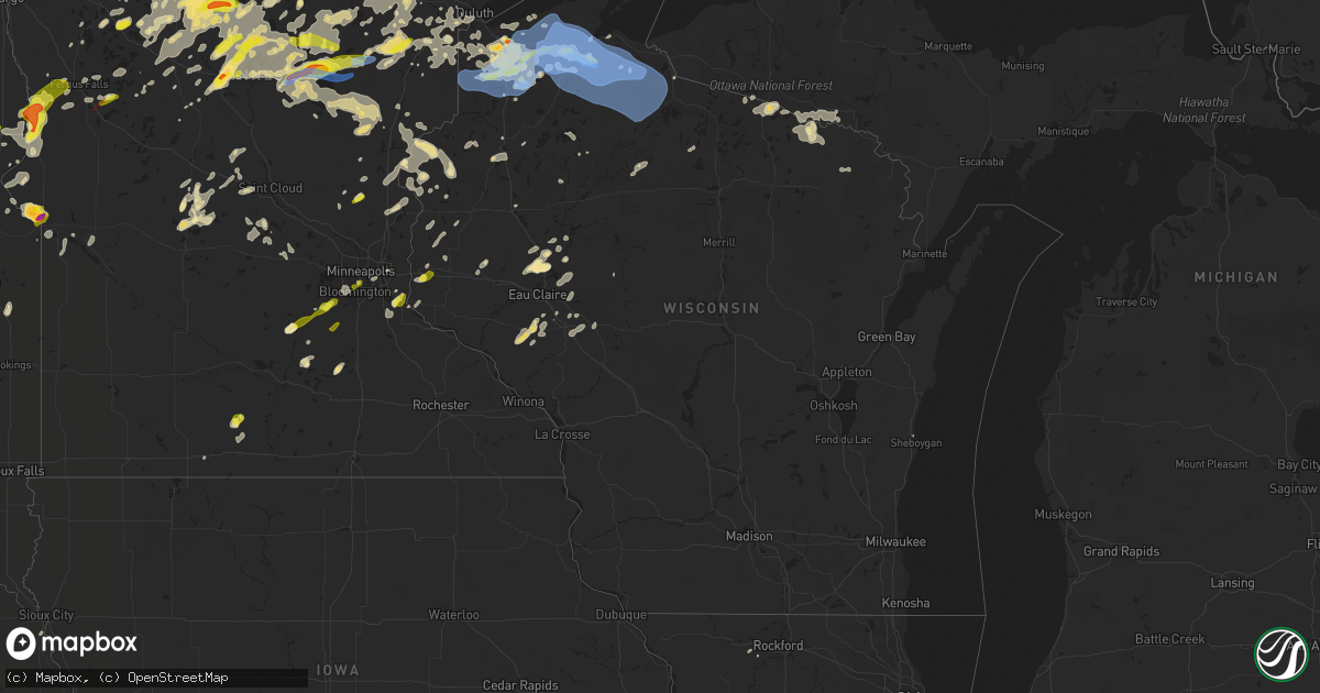
Hail Map in Wisconsin on July 8, 2020
Get this storm
July 8 map
$229
one time, instant access
Download today. No call, no setup
Keep the $229
Bought the map and want the full workflow? Apply the entire $229 to a subscription within 7 days. None of it is wasted.
Every map, not just this one
This buys you this map. Subscription and you get every map we run, in the markets you choose from a few cities to whole states to nationwide. Plus real-time alerts the moment a storm fires.
Contact data
Name, contact info, occupancy, even credit band for addresses in the footprint. You go from where it hit to who to call.
Become the source they trust
Unlimited branding weather history reports on demand. You already have the documented answer ready for the property owner, and you are the one who showed up with it.
Property data and RoofTrace estimates
Pull up any address you have got, its value and the exact code rules for that jurisdiction, straight from One Click Code. Then RoofTrace estimates the squares, pitch, and roof value, priced the way you price.
Storm reports in Wisconsin
Wisconsin
| Date | Description |
|---|---|
| 07/08/20206:50 PM CDT | Quarter to golf ball sized hail reported. |
| 07/08/20206:55 AM CDT | 8 inch diameter branch down and most of a tree down blocking a road. |
| 07/08/20206:55 AM CDT | Corrects previous tstm wnd dmg report from 2 nne tilden. 8 inch diameter branch down and most of a tree down blocking a road. |
| 07/08/20205:06 AM CDT | At 1005 PM CDT, severe thunderstorms were located along a line extending from near Port Wing, to near Barnes, to near Minong, moving east at 50 mph. HAZARD...70 mph wind gusts and nickel size hail. SOURCE...Radar indicated. IMPACT...Expect considerable tree damage. Damage is likely to mobile homes, roofs, and outbuildings. Locations impacted include... Ashland, Washburn, Sanborn, Iron River, Round Lake, Cable, Barnes, Wascott, Barksdale, Brule, Minong, Oulu, Bayfield, Drummond, Port Wing, La Pointe, Ino, Herbster, Cornucopia, and Seeley. |
| 07/08/20205:05 AM CDT | Time estimated. |
| 07/08/20204:56 AM CDT | At 955 PM CDT, severe thunderstorms were located along a line extending from near Wakefield to near Park Falls, moving east at 30 mph. HAZARD...60 mph wind gusts and quarter size hail. SOURCE...Radar indicated. IMPACT...Hail damage to vehicles is expected. Expect wind damage to roofs, siding, and trees. Locations impacted include... Lac Du Flambeau, Boulder Junction, Winchester, Johnson Lake Barrens Natural Area, Border Lakes Natural Area, Rice Creek Natural Area, Arbor Vitae, Woodruff, Presque Isle and Manitowish Waters. |
| 07/08/20204:42 AM CDT | At 942 PM CDT, severe thunderstorms were located along a line extending from near Wisconsin Point, to near Hawthorne, to near Dairyland, moving east at 55 mph. HAZARD...60 mph wind gusts and nickel size hail. SOURCE...Radar indicated. IMPACT...Expect damage to roofs, siding, and trees. Locations impacted include... Superior, Hawthorne, Iron River, Lake Nebagamon, Barnes, Wascott, Maple, Brule, Poplar, Solon Springs, Oulu, Port Wing, Gordon, Dairyland, South Range, Cornucopia, Ino, Herbster, Bennett, and Cloverland. |
| 07/08/20203:03 AM CDT | At 803 PM CDT, a severe thunderstorm was located 8 miles south of Barnes, or 19 miles north of Hayward, moving east at 25 mph. HAZARD...60 mph wind gusts and quarter size hail. SOURCE...Radar indicated. IMPACT...Hail damage to vehicles is expected. Expect wind damage to roofs, siding, and trees. Locations impacted include... Cable, Drummond, Namekagon Lake, Namekagon, Middle Eau Claire Lake, Upper Eau Claire Lake, and Lake Owen. |
| 07/08/20202:59 AM CDT | At 758 PM CDT, a severe thunderstorm was located over Ino, or 37 miles northeast of Hayward, moving east at 25 mph. HAZARD...60 mph wind gusts and quarter size hail. SOURCE...Radar indicated. IMPACT...Hail damage to vehicles is expected. Expect wind damage to roofs, siding, and trees. Locations impacted include... Ashland, Sanborn, Mellen, Marengo, Ino, Benoit, Mason, High Bridge, Bad River Reservation, Franks Field, Copper Falls State Park, and Moquah. |
| 07/08/20201:53 AM CDT | At 653 PM CDT, a severe thunderstorm was located over Poplar, or 19 miles southeast of Superior, moving east at 25 mph. HAZARD...Golf ball size hail. SOURCE...Radar indicated. Also, spotter reported golf ball size hail. IMPACT...People and animals outdoors will be injured. Expect damage to roofs, siding, windows, and vehicles. Locations impacted include... Iron River, Lake Nebagamon, Maple, Brule, Poplar, Oulu, Ino, and Blueberry. |
| 07/07/202011:50 PM CDT | Trees down in town. Also house fire due to lightning strike. |
| 07/07/202010:53 PM CDT | A couple trees down |
| 07/07/202010:50 PM CDT | A few trees down |
| 07/07/202010:39 PM CDT | Asos station kasx ashland airport. |
| 07/07/202010:33 PM CDT | A couple trees down |
| 07/07/202010:30 PM CDT | A few trees down |
| 07/07/202010:13 PM CDT | Trees down over roadways between iron river and delta... Wi. Time estimated by radar. |
| 07/07/202010:05 PM CDT | 9-inch diameter healthy tree down. |
| 07/07/202010:02 PM CDT | Fire department was called to remove a large tree 14 inches in diameter that had fallen and taken out power lines. Department was called at 11:40 pm to move the tree. T |
| 07/07/202010:00 PM CDT | Two trees blown down about 4 to 6 inches in diameter. |
| 07/07/20208:30 PM CDT | Birch tree was downed. Caller said that it was not the healthiest tree as the leaves were looking less healthy than last year. Approximately 10-12 inches in diameter. |
| 07/07/20207:45 PM CDT | Sent to the office via twitter. Tweet included picture of hailstone next to a quarter. |
| 07/07/20207:00 PM CDT | Report relayed via social media. |
All States Impacted by Hail Map on July 8, 2020
Cities Impacted by Hail Map on July 8, 2020
- Alborn, MN
- Lake Norden, SD
- Lake Preston, SD
- Erwin, SD
- Kenton, OH
- Rushsylvania, OH
- Ridgeway, OH
- Weldon, IL
- Olla, LA
- Brookston, MN
- Saginaw, MN
- Bolton Landing, NY
- Huletts Landing, NY
- Hague, NY
- Kingman, IN
- Bloomingdale, IN
- Morristown, MN
- Puposky, MN
- Shevlin, MN
- Motley, MN
- Pillager, MN
- Ortonville, MN
- Long Pine, NE
- Arthur, NE
- Aurora, NE
- Hunter, KS
- Kadoka, SD
- Isle, MN
- Mora, MN
- Charlestown, NH
- Alstead, NH
- Acworth, NH
- South Acworth, NH
- Putney, VT
- Geneva, NE
- Ohiowa, NE
- Milligan, NE
- Exeter, NE
- Fairmont, NE
- Grant Park, IL
- Clay Center, KS
- Minneapolis, KS
- Solomon, KS
- Hope, KS
- Longford, KS
- Talmage, KS
- Miltonvale, KS
- Abilene, KS
- Enterprise, KS
- Lincoln, KS
- Kevil, KY
- Big Stone City, SD
- Clinton, MN
- Corona, SD
- Sumner, IL
- Claremont, IL
- Brainerd, MN
- Wheaton, MN
- Estelline, SD
- Clear Lake, SD
- Loda, IL
- Hampton, MN
- Vermillion, MN
- Hastings, MN
- Lance Creek, WY
- Oconto, NE
- Solon Springs, WI
- New London, MN
- Goodland, MN
- Brook Park, MN
- Hudson, WI
- River Falls, WI
- Valentine, NE
- Bassett, NE
- Ainsworth, NE
- Ogema, MN
- Canyon, MN
- Stillwater, NY
- Belgrade, NE
- Saint Edward, NE
- Fullerton, NE
- Cedar Rapids, NE
- Albion, NE
- Wolbach, NE
- Hanover, KS
- Hollenberg, KS
- Washington, KS
- Faribault, MN
- Edgemont, SD
- Farmington, ME
- Philip, SD
- Whitney, NE
- Ashton, NE
- Oberlin, KS
- Bagley, MN
- Bemidji, MN
- Solway, MN
- Leonard, MN
- North Platte, NE
- Paynesville, MN
- Spicer, MN
- Belgrade, MN
- Sebeka, MN
- Backus, MN
- Staples, MN
- Hinckley, MN
- Wilsonville, NE
- Park Rapids, MN
- Hackensack, MN
- Walker, MN
- Gordon, WI
- Sarona, WI
- Spooner, WI
- Shell Lake, WI
- Wood Lake, NE
- Johnstown, NE
- Hazard, NE
- Paris, IL
- Concordia, KS
- Stockville, NE
- Monticello, IL
- De Land, IL
- Henderson, MN
- Perham, MN
- Frazee, MN
- Henning, IL
- Rossville, IL
- Bloomer, WI
- Chippewa Falls, WI
- Hot Springs, SD
- Derby, KS
- Haysville, KS
- Mason, WI
- Carpenter, SD
- Parks, NE
- Martin, SD
- Tuthill, SD
- Cottage Grove, MN
- Culbertson, NE
- McCook, NE
- Lake Nebagamon, WI
- Brule, WI
- Jordan, MN
- Shakopee, MN
- Eustis, NE
- Elsie, NE
- Centerville, IN
- Richmond, IN
- Cody, NE
- Graytown, OH
- Elmore, OH
- Oak Harbor, OH
- Nevis, MN
- Kimball, NE
- Peetz, CO
- Padroni, CO
- Blackduck, MN
- Wilmot, SD
- Paradise, KS
- Natoma, KS
- Jonesville, LA
- Mankato, KS
- Glen Elder, KS
- Beloit, KS
- Poplar, WI
- Aitkin, MN
- Arapahoe, NE
- Elwood, NE
- Wood River, NE
- Prospect, KY
- Goshen, KY
- Menahga, MN
- Mcgregor, MN
- Tamarack, MN
- Frederic, WI
- Moorefield, NE
- Grand Rapids, MN
- Swatara, MN
- Hill City, MN
- Remer, MN
- Scenic, SD
- Jim Falls, WI
- Cadott, WI
- Thedford, NE
- Gregory, SD
- Hay Springs, NE
- Rushville, NE
- Pine Ridge, SD
- Fairburn, SD
- South Haven, MN
- Watkins, MN
- Dassel, MN
- Kimball, MN
- Cornell, WI
- Cook, MN
- Hendley, NE
- Siren, WI
- Buffalo Gap, SD
- Winfield, PA
- Freeburg, PA
- Middleburg, PA
- Selinsgrove, PA
- Salem, IN
- Crosby, MN
- Lyons, KS
- Fair Haven, VT
- Whitehall, NY
- Ponsford, MN
- Kettle River, MN
- Cromwell, MN
- Spalding, NE
- David City, NE
- Clark, SD
- Willow Lake, SD
- Raymond, SD
- Ely, MN
- Marsland, NE
- Hemingford, NE
- Shelby, NE
- Mason City, NE
- Phillips, ME
- Tiro, OH
- Crestline, OH
- Davenport, NE
- Clifton, TN
- Osage, MN
- Crawfordsville, IN
- Bena, MN
- Champion, NE
- Walpole, NH
- Marenisco, MI
- Ewen, MI
- Bergland, MI
- Bruce Crossing, MI
- Pelican Rapids, MN
- Round Lake, NY
- Mechanicville, NY
- Clifton Park, NY
- Ballston Spa, NY
- Ballston Lake, NY
- Waldo, KS
- Osborne, KS
- South Range, WI
- Maple, WI
- Beecher, IL
- Crete, IL
- Cambridge, NE
- Pequot Lakes, MN
- Nisswa, MN
- Oxford, NE
- Edison, NE
- Holbrook, NE
- Avon, MN
- Milton, VT
- Colchester, VT
- Dix, NE
- Hermosa, SD
- Jewell, KS
- Randall, KS
- Cushing, MN
- Henning, MN
- Amelia, NE
- Trenton, NE
- Dieterich, IL
- Wheeler, IL
- Newton, IL
- Wrenshall, MN
- Bartlett, NE
- Odessa, MN
- Seneca, NE
- Stone Lake, WI
- Springbrook, WI
- Springview, NE
- Baxter, MN
- Wanblee, SD
- Midland, SD
- Westmoreland, NH
- Keene, NH
- Westminster, VT
- Richmond, VT
- Jericho, VT
- Williston, VT
- New Cambria, KS
- Salina, KS
- Gentryville, IN
- Tennyson, IN
- Gaastra, MI
- Caspian, MI
- Iron River, MI
- Sturgeon Lake, MN
- Palisade, MN
- Zimmerman, MN
- Saint Francis, MN
- Lower Brule, SD
- Sherburn, MN
- Otis, KS
- Naper, NE
- Cozad, NE
- Bloomington, NE
- Scottsburg, IN
- Hillsboro, KS
- Newton, KS
- Holyoke, MN
- Center Sandwich, NH
- Holderness, NH
- Center Harbor, NH
- Moultonborough, NH
- Alda, NE
- Grand Island, NE
- New Underwood, SD
- Melrose, MN
- Minneapolis, MN
- Delphos, KS
- Tunkhannock, PA
- Doland, SD
- Clemons, NY
- Wood, SD
- Winner, SD
- Kyle, SD
- Allen, SD
- Rangeley, ME
- Burwell, NE
- Huron, SD
- Hitchcock, SD
- Belleville, IL
- East Saint Louis, IL
- Fairfax, SD
- Crawford, NE
- Detroit, MI
- Highland Park, MI
- Alton, KS
- Keyesport, IL
- Carlyle, IL
- Greenville, IL
- Cotton, MN
- Duluth, MN
- Oneill, NE
- Ericson, NE
- Olmstead, KY
- Luck, WI
- Grantsburg, WI
- Cushing, WI
- Battle Lake, MN
- Dalton, MN
- Waterville, MN
- Port Wing, WI
- Eldridge, IA
- Davenport, IA
- Frankfort, SD
- Clay City, IL
- Osseo, WI
- Fairchild, WI
- Oakdale, NE
- Elgin, NE
- Chisago City, MN
- Stacy, MN
- Lindstrom, MN
- Indianapolis, IN
- Sisseton, SD
- Mondovi, WI
- Eleva, WI
- Strang, NE
- New York Mills, MN
- Saint James, MN
- Superior, WI
- Thorp, WI
- Gordon, NE
- Pecatonica, IL
- Winnebago, IL
- Leaf River, IL
- Deerwood, MN
- Correctionville, IA
- Anthon, IA
- Chase, KS
- Bushton, KS
- Sterling, KS
- Geneseo, KS
- Little River, KS
- Lorraine, KS
- Sutton, NE
- Grafton, NE
- Waverly, MN
- Howard Lake, MN
- Surprise, NE
- Rising City, NE
- Moose Lake, MN
- Long Lake, WI
- Crystal Falls, MI
- Oconee, IL
- Republican City, NE
- Naponee, NE
- Kerrick, MN
- Minong, WI
- Pine River, MN
- Doniphan, NE
- Florence, SD
- Henry, SD
- Roberts, WI
- Clearwater, NE
- Ewing, NE
- Norway, KS
- Jamestown, KS
- Bunker Hill, KS
- Cleveland, MN
- Pfeifer, KS
- Hays, KS
- Webster, WI
- Bradley, SD
- Kokomo, IN
- Center Barnstead, NH
- Barnstead, NH
- West Forks, ME
- Summit, SD
- Thornton, NH
- Campton, NH
- Anselmo, NE
- Carlton, MN
- Barnum, MN
- Poultney, VT
- Wells, VT
- Middletown Springs, VT
- Tintah, MN
- Rosholt, SD
- Campbell, MN
- Fairmount, ND
- Drummond, WI
- Ottertail, MN
- Bingham, NE
- Ashby, NE
- Greenwood, IN
- Bargersville, IN
- Mount Juliet, TN
- Lebanon, TN
- Murfreesboro, TN
- Smyrna, TN
- Cedar Grove, TN
- Esko, MN
- Ridge Farm, IL
- Chrisman, IL
- Garrison, MN
- Alpena, SD
- Greeley, NE
- Chambers, NE
- Primrose, NE
- Kensington, KS
- North Vernon, IN
- Taswell, IN
- Floodwood, MN
- Wilber, NE
- Onamia, MN
- Hillman, MN
- Ironton, MN
- Almena, KS
- Beaver City, NE
- Bowlus, MN
- Holdingford, MN
- Benkelman, NE
- Cass Lake, MN
- Cold Spring, MN
- Saint Joseph, MN
- Saint Cloud, MN
- Silver Lake, IN
- New Ross, IN
- Phillipsburg, KS
- Agra, KS
- Webster, SD
- Russell, KS
- Rockville, IN
- Waveland, IN
- Marshall, IN
- Rochert, MN
- Detroit Lakes, MN
- Iroquois, SD
- Palmer, NE
- Wellfleet, NE
- Maywood, NE
- Waubay, SD
- Chadron, NE
- Fort Wayne, IN
- Dannebrog, NE
- Lebanon, NE
- Bartley, NE
- Danbury, NE
- Indianola, NE
- Cogan Station, PA
- Trout Run, PA
- Ideal, SD
- Wallingford, VT
- Dearborn, MI
- Crofton, KY
- Dawson Springs, KY
- Saint Charles, KY
- Wall, SD
- Manderson, SD
- Talmoon, MN
- Bigfork, MN
- Braham, MN
- Gothenburg, NE
- Monterey, LA
- Celina, OH
- Coldwater, OH
- Rumford, ME
- Curtice, OH
- Millbury, OH
- Bushnell, NE
- Wapakoneta, OH
- Lakewood, IL
- Cowden, IL
- Tower Hill, IL
- Montrose, MN
- Buffalo, MN
- Macy, IN
- Fort Recovery, OH
- Formoso, KS
- Ellsworth, KS
- Browerville, MN
- Merrifield, MN
- New Effington, SD
- Arlington, SD
- Hampton, NY
- Callaway, MN
- Appleton, MN
- Correll, MN
- Bruce, WI
- Bethlehem, IN
- New Washington, IN
- Saint Joseph, IL
- Brady, NE
- Riverton, NE
- Tescott, KS
- Beardsley, MN
- Annandale, MN
- Ravenna, NE
- Hurley, WI
- Mercer, WI
- Genoa, NE
- Wolsey, SD
- Arkansas City, KS
- Iron River, WI
- Wadena, MN
- Hayti, SD
- Alma, WI
- Belle Plaine, MN
- Fifty Lakes, MN
- Crosslake, MN
- Emily, MN
- Hammond, WI
- Baldwin, WI
- Hastings, NE
- Wilton, ME
- Shelby, OH
- Tell City, IN
- Vergas, MN
- Webber, KS
- Wright, MN
- Ontonagon, MI
- Imperial, NE
- Crestwood, KY
- Phelps, WI
- Ojibwa, WI
- Taylor, NE
- Loup City, NE
- Wildersville, TN
- Clearbrook, MN
- Isanti, MN
- Pine City, MN
- Mellen, WI
- Centuria, WI
- Milltown, WI
- Purdum, NE
- Chapman, KS
- Colwich, KS
- Mount Hope, KS
- Conover, WI
- Land O'Lakes, WI
- Highmore, SD
- Hankinson, ND
- English, IN
- Beaver Crossing, NE
- Mulvane, KS
- Udall, KS
- Douglass, KS
- Cerulean, KY
- Calhoun, KY
- Wessington Springs, SD
- Urbana, IL
- Clarissa, MN
- Cambridge, MN
- West Union, IL
- Saint Paul, MN
- Princeton, KY
- Oelrichs, SD
- Strum, WI
- Interior, SD
- Wilson, KS
- Fort Thompson, SD
- Phillips, NE
- Louisville, KY
- Benedict, KS
- Darlington, IN
- Morris, IL
- Channahon, IL
- Minooka, IL
- Swanton, NE
- De Witt, NE
- York, PA
- Center City, MN
- Maxwell, NE
- Hillsboro, IN
- Alamo, IN
- Waynetown, IN
- Berne, IN
- Geneva, IN
- Jacobson, MN
- Cloquet, MN
- Foxboro, WI
- Brooten, MN
- Sauk Centre, MN
- Stamford, NE
- Bedford, IN
- Longville, MN
- Abbyville, KS
- Newman Grove, NE
- Sandstone, MN
- Saint Croix Falls, WI
- North Branch, MN
- Nashwauk, MN
- Trego, WI
- Star Prairie, WI
- Deer Park, WI
- Amery, WI
- New Richmond, WI
- Dunning, NE
- Nickerson, KS
- Outing, MN
- Townshend, VT
- Chester, VT
- Millstadt, IL
- Byron, IL
- Sedgwick, KS
- Burrton, KS
- Minocqua, WI
- Sutherland, NE
- Lewisburg, PA
- Madison, MN
- Bellingham, MN
- Tampa, KS
- Noble, IL
- Cokato, MN
- Frenchboro, ME
- Brule, NE
- Cisne, IL
- West York, IL
- Watersmeet, MI
- Strong City, KS
- Cottonwood Falls, KS
- Elmdale, KS
- Yale, SD
- Mount Pleasant Mills, PA
- Stanchfield, MN
- Grandy, MN
- Prescott, WI
- Willard, WI
- Humbird, WI
- Guide Rock, NE
- Windsor, IL
- Mehoopany, PA
- Sugar Run, PA
- Hardinsburg, IN
- Paoli, IN
- Durham, KS
- Pelkie, MI
- Sergeant Bluff, IA
- Sioux City, IA
- Glasco, KS
- Vining, MN
- Parkers Prairie, MN
- Oblong, IL
- Maize, KS
- Wichita, KS
- Lewisville, MN
- Giltner, NE
- Carleton, NE
- Bluffton, MN
- Deer Creek, MN
- Finlayson, MN
- Pierz, MN
- Akeley, MN
- Verndale, MN
- Wahkon, MN
- McGrath, MN
- Naytahwaush, MN
- Mahnomen, MN
- Waubun, MN
- Robinson, IL
- Palisade, NE
- Grand View, WI
- Williamsport, PA
- Montoursville, PA
- Smith Center, KS
- Athol, KS
- Plainville, KS
- Dunnville, KY
- Phillips, WI
- Gaylord, KS
- Augusta, WI
- Woodbine, KS
- Herington, KS
- Mentone, IN
- Gibbon, NE
- Aurora, KS
- White Plains, KY
- Spencerville, OH
- Homer, IL
- Sidney, IL
- Swanzey, NH
- Waterville, KS
- Orchard, NE
- Winnetoon, NE
- Fergus Falls, MN
- Underwood, MN
- Albany, MN
- Thorntown, IN
- Dumont, MN
- Hershey, NE
- Ashland, WI
- Earlville, NY
- Hamilton, NY
- Osceola, NE
- Deweese, NE
- Fairfield, NE
- Fall Creek, WI
- Independence, WI
- Washta, IA
- Pierson, IA
- Vienna, SD
- Halsey, NE
- Evanston, IN
- Saint Meinrad, IN
- Bedford, KY
- Milton, KY
- Jamestown, IN
- Marengo, IN
- Le Center, MN
- Oral, SD
- Ord, NE
- Bellwood, NE
- Friend, NE
- Northome, MN
- Downs, KS
- Cawker City, KS
- Esbon, KS
- Lanse, MI
- Eagle Bend, MN
- Columbia, IL
- Browns Valley, MN
- Freeport, MN
- Sargent, NE
- North Judson, IN
- Carver, MN
- Sheboygan, WI
- Curtis, NE
- Alma, NE
- Orleans, NE
- Lehigh, KS
- Geddes, SD
- Rockville, NE
- Tipton, IN
- Plevna, KS
- Truman, MN
- Harris, MN
- Rush City, MN
- Bourbonnais, IL
- Hayes Center, NE
- Brooklyn, IN
- Martinsville, IN
- Monrovia, IN
- Mooresville, IN
- Rinard, IL
- Fairmont, MN
- Geneseo, IL
- Hewitt, MN
- Swanton, VT
- Wessington, SD
- Mcpherson, KS
- Inman, KS
- Mills, NE
- Armstrong Creek, WI
- Goodman, WI
- Royalton, MN
- Butte, NE
- Bonesteel, SD
- Lebanon, KS
- Canton, KS
- Cairo, NE
- Colfax, WI
- West Terre Haute, IN
- Tower, MN
- Silver Creek, NE
- Bryant, SD
- Jay, ME
- Dixfield, ME
- Eden Prairie, MN
- Swan River, MN
- Warba, MN
- High Bridge, WI
- Bluffton, IN
- Wyoming, MN
- Herrick, SD
- Castlewood, SD
- Luckey, OH
- Woodville, OH
- Oglala, SD
- Deer River, MN
- Arcadia, NE
- Calhoun, IL
- Moundridge, KS
- Sylvan Grove, KS
- Gilmanton, NH
- Belmont, NH
- Fairbury, NE
- Cicero, IN
- Noblesville, IN
- Effie, MN
- Orr, MN
- Kelliher, MN
- Homer, NE
- Mullen, NE
- Walton, IN
- Whitman, NE
- Boyceville, WI
- Boelus, NE
- Oak, NE
- Lake George, MN
- Laporte, MN
- Verdigre, NE
- Elkton, KY
- Guthrie, KY
- Allensville, KY
- Madison, IN
- Moran, KS
- Beech Grove, IN
- Dresser, WI
- Osceola, WI
- Buckley, IL
- Melvin, IL
- Paxton, IL
- Bennington, KS
- Makinen, MN
- North Loup, NE
- Diller, NE
- Pulaski, TN
- Waterbury, VT
- La Crosse, IN
- Strasburg, IL
- Gilmanton Iron Works, NH
- Alliance, NE
- Knapp, WI
- Strafford, NH
- Otego, NY
- Hayward, WI
- Lopez, PA
- Mildred, PA
- Dushore, PA
- Montezuma, IN
- Clear Lake, WI
- Clayton, WI
- Hagerstown, IN
- Holyrood, KS
- Peever, SD
- Bertha, MN
- Balsam Lake, WI
- Long Grove, IA
- Donahue, IA
- Essex Junction, VT
- Claremont, NH
- Wounded Knee, SD
- Marshall, IL
- Dorchester, NE
- Western, NE
- New Vineyard, ME
- Strong, ME
- Woodston, KS
- Rocky Ridge, OH
- Redlake, MN
- Redby, MN
- Salem, MO
- Virginia, MN
- Nortonville, KY
- Marlborough, NH
- Troy, NH
- Jaffrey, NH
- Litchfield, NE
- Windsor, KY
- Rice Lake, WI
- Cameron, WI
- Saratoga Springs, NY
- Shelton, NE
- Foxhome, MN
- Breckenridge, MN
- Bertrand, NE
- Trout Creek, MI
- Silver Bay, NY
- Plymouth, NE
- Winter, WI
- Hines, MN
- Bethlehem, NH
- Aldrich, MN
- Princeton, MN
- Shickley, NE
- Julesburg, CO
- Venango, NE
- Trumbull, NE
- Glenvil, NE
- Lawrence, NE
- Le Sueur, MN
- Inman, NE
- Savannah, TN
- Courtland, KS
- Atkinson, NE
- Brewster, NE
- Dyer, IN
- Saint John, IN
- Aurora, MN
- Miller, SD
- Claire City, SD
- Kearney, NE
- Marengo, WI
- Gurley, NE
- Sidney, NE
- Big Springs, NE
- Ovid, CO
- Sedgwick, CO
- Chappell, NE
- Lodgepole, NE
- Crook, CO
- Madrid, NE
- Amherst, CO
- Grant, NE
- Hyannis, NE
- Newport, NE
- Stuart, NE
- Axtell, NE
- Loomis, NE
- Franklin, NE
- Smithfield, NE
- Wilcox, NE
- Holdrege, NE
- Minden, NE
- Norton, KS
- Farnam, NE
- Inavale, NE
- Prairie View, KS
- Long Island, KS
- Dickens, NE
- Campbell, NE
- Upland, NE
- Atlanta, NE
- Funk, NE
- Hildreth, NE
- Clay Center, NE
- Wakefield, KS
- Hamilton, KS
- Gresham, NE
- Neosho Rapids, KS
- Burr, NE
- Barneston, NE
- Sprague, NE
- Auburn, NE
- Riley, KS
- Saint George, KS
- Allen, KS
- Cordova, NE
- Hampton, NE
- Goehner, NE
- Lincoln, NE
- Clarks, NE
- Pawnee City, NE
- Tobias, NE
- Marquette, NE
- Scotia, NE
- Table Rock, NE
- Liberty, NE
- Saronville, NE
- Axtell, KS
- Matfield Green, KS
- Raymond, NE
- Saint Marys, KS
- Topeka, KS
- Harvard, NE
- Holstein, NE
- Burr Oak, KS
- Unadilla, NE
- Juniata, NE
- Murdock, NE
- Red Cloud, NE
- Manhattan, KS
- Frankfort, KS
- Sterling, NE
- Leonardville, KS
- Ruskin, NE
- Home, KS
- Marysville, KS
- Clyde, KS
- Crete, NE
- Bremen, KS
- Burlingame, KS
- Filley, NE
- Ong, NE
- Olsburg, KS
- Bern, KS
- Central City, NE
- Elba, NE
- Kenesaw, NE
- Greenleaf, KS
- Council Grove, KS
- Hubbell, NE
- Munden, KS
- Blue Springs, NE
- Steele City, NE
- Malcolm, NE
- Bladen, NE
- Riverdale, NE
- Eskridge, KS
- Crab Orchard, NE
- Haddam, KS
- Cuba, KS
- Saint Paul, NE
- Bruning, NE
- Ogden, KS
- Polk, NE
- Jansen, NE
- Reynolds, NE
- Bennet, NE
- Steinauer, NE
- McFarland, KS
- Belvue, KS
- Randolph, KS
- Linn, KS
- Osage City, KS
- Archer, NE
- Morganville, KS
- Wymore, NE
- Pleasant Dale, NE
- Pleasanton, NE
- Hickman, NE
- Roca, NE
- Belvidere, NE
- Adams, NE
- Deshler, NE
- Benedict, NE
- Paxico, KS
- Edgar, NE
- Harveyville, KS
- Utica, NE
- Chester, NE
- Alexandria, NE
- Saint Libory, NE
- Comstock, NE
- Endicott, NE
- Johnson, NE
- Greenwood, NE
- Narka, KS
- Baileyville, KS
- Virgil, KS
- Morrowville, KS
- Milford, KS
- Oketo, KS
- Emporia, KS
- Avoca, NE
- Madison, KS
- Heartwell, NE
- York, NE
- Vermillion, KS
- Belleville, KS
- Clatonia, NE
- Byron, NE
- Milford, NE
- Walton, NE
- Centralia, KS
- Cortland, NE
- Nelson, NE
- Otoe, NE
- Mahaska, KS
- Seward, NE
- Lewiston, NE
- Garland, NE
- Daykin, NE
- Palmer, KS
- Pickrell, NE
- Beattie, KS
- Alma, KS
- Seneca, KS
- Eureka, KS
- Green, KS
- Odell, NE
- Tecumseh, NE
- Beatrice, NE
- Martell, NE
- Emmett, KS
- Superior, NE
- Virginia, NE
- Firth, NE
- Dunbar, NE
- Elk Creek, NE
- Junction City, KS
- Talmage, NE
- Agenda, KS
- Fort Riley, KS
- Westmoreland, KS
- Syracuse, NE
- Du Bois, NE
- Lorton, NE
- Admire, KS
- Brock, NE
- Panama, NE
- Chapman, NE
- Elmwood, NE
- Cook, NE
- Inland, NE
- Summerfield, KS
- Douglas, NE
- Corning, KS
- Onaga, KS
- Waco, NE
- Alvo, NE
- Clifton, KS
- Hartford, KS
- Gilead, NE
- McCool Junction, NE
- Blue Hill, NE
- Hardy, NE
- Olpe, KS
- Republic, KS
- Roseland, NE
- Staplehurst, NE
- Yates Center, KS
- Scandia, KS
- Ansley, NE
- Westerville, NE
- Burchard, NE
- Nebraska City, NE
- Reading, KS
- Hallam, NE
- Weeping Water, NE
- Havensville, KS
- Stromsburg, NE
- Broken Bow, NE
- Wamego, KS
- Americus, KS
- Maple Hill, KS
- Hebron, NE
- Hordville, NE
- Bradshaw, NE
- Alta Vista, KS
- Auburn, KS
- Humboldt, NE
- Barnes, KS
- Denton, NE
- Ayr, NE
- Waverly, NE
- Blue Rapids, KS
- Gridley, KS
- Henderson, NE
- Farwell, NE
- Davey, NE
- Eagle, NE
- Palmyra, NE
- Eddyville, NE
- Sumner, NE
- Miller, NE
- Lexington, NE
- Amherst, NE
- Callaway, NE
- Elsmere, NE
- Spofford, NH
- Pittsfield, NH
- Lincoln, NH
- Meredith, NH
- Yoder, IN
- Saint Albans, VT
- Fairfield, VT
- Danby, VT
- Pawlet, VT
- East Dorset, VT
- Oxford, ME
- Mount Vernon, ME
- Belgrade, ME
- Kents Hill, ME
- Ashby, MN
- Wahpeton, ND
- Prior Lake, MN
- New Prague, MN
- Oquossoc, ME
- Mexico, ME
- Andover, ME
- Roxbury, ME
- Hanover, ME
- Bethel, ME
- Buckfield, ME
- Sumner, ME
- West Paris, ME
- Peru, ME
- Bryant Pond, ME
- Tenants Harbor, ME
- Bremen, ME
- Round Pond, ME
- Damariscotta, ME
- Cushing, ME
- Waldoboro, ME
- Friendship, ME
- Bristol, ME
- Spruce Head, ME
- Whitefield, NH
- Littleton, NH
- Winchester, NH
- Upson, WI
- Butternut, WI
- Washburn, WI
- Saxon, WI
- Glidden, WI
- Danbury, WI
- Cable, WI
- Iron Belt, WI
- Clam Lake, WI


