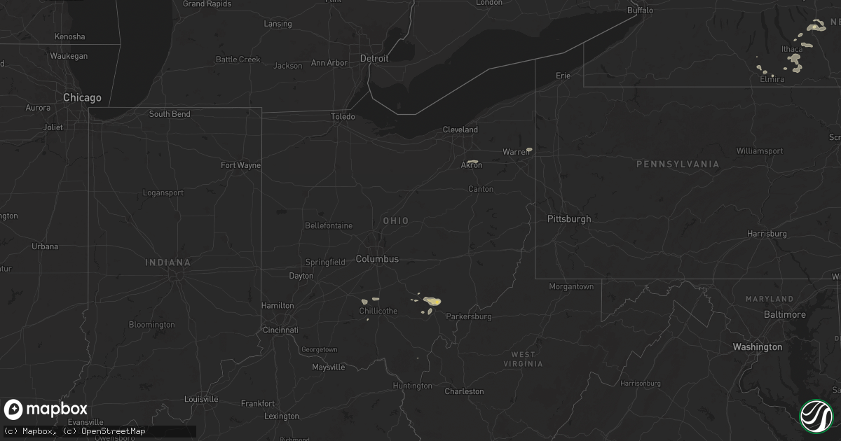
Hail Map in Ohio on July 7, 2025
Get this storm
July 7 map
$229
one time, instant access
Download today. No call, no setup
Keep the $229
Bought the map and want the full workflow? Apply the entire $229 to a subscription within 7 days. None of it is wasted.
Every map, not just this one
This buys you this map. Subscription and you get every map we run, in the markets you choose from a few cities to whole states to nationwide. Plus real-time alerts the moment a storm fires.
Contact data
Name, contact info, occupancy, even credit band for addresses in the footprint. You go from where it hit to who to call.
Become the source they trust
Unlimited branding weather history reports on demand. You already have the documented answer ready for the property owner, and you are the one who showed up with it.
Property data and RoofTrace estimates
Pull up any address you have got, its value and the exact code rules for that jurisdiction, straight from One Click Code. Then RoofTrace estimates the squares, pitch, and roof value, priced the way you price.
Storm reports in Ohio
Ohio
| Date | Description |
|---|---|
| 07/07/20256:55 PM CDT | Tree down along buckeye ridge road. Time estimated via radar. |
| 07/07/20256:50 PM CDT | Tree down along buttermilk hill road 3 miles nnw of mcconnelsville. Time estimated via radar. |
| 07/07/20256:37 PM CDT | Tree down across kasler creek road. Time estimated from radar. Reprt time was 740 pm. |
| 07/07/20254:59 PM CDT | Large tree down on blackwater road. Time estimated from radar. |
| 07/07/20254:59 PM CDT | Trees and power lines down at crouse chapel road and 159. Time estimated from radar. |
| 07/07/20254:32 PM CDT | Corrects previous tstm wnd dmg report from lisbon. Report of multiple wires down in the area. Time estimated based on radar. |
| 07/07/20254:26 PM CDT | Report of multiple wires down in the area. Time estimated based on radar. |
| 07/07/20253:04 PM CDT | Tree down. Time estimated via radar. |
| 07/07/20253:01 PM CDT | Tree down. Time estimated via radar. |
| 07/07/20252:57 PM CDT | An nws cleveland storm survey determined that an ef-0 tornado occurred from chatham township to lafayette township in medina county oh. The tornado began near the inter |
| 07/07/20252:56 PM CDT | Delayed report; time estimated by radar; spotter reported roof damage near the intersection of smith and cartsen. |
| 07/07/20252:46 PM CDT | Several 3 inch tree limbs down. Time estimated via radar. |
| 07/06/20257:02 PM CDT | Three large trees down along route 266. Time estimated via radar. Also water over road... But likely due to a blocked culvert. |
| 07/06/20257:02 PM CDT | Three large trees down along route 266. Time estimated via radar. Also water over road... But likel |
All States Impacted by Hail Map on July 7, 2025
Cities Impacted by Hail Map on July 7, 2025
- Hayes, SD
- Abernathy, TX
- McLaughlin, SD
- Lafayette, LA
- Scott, LA
- Duson, LA
- Bullhead, SD
- Wakpala, SD
- New Effington, SD
- Sisseton, SD
- Rosholt, SD
- Beardsley, MN
- Andover, OH
- Linesville, PA
- Dumont, MN
- Barry, MN
- Graceville, MN
- Forrest City, AR
- Wynne, AR
- Perryville, MO
- Only, TN
- Sedgewickville, MO
- Friedheim, MO
- Searcy, AR
- Buffalo Valley, TN
- Baxter, TN
- Oak Ridge, MO
- Gainesboro, TN
- Bloomington Springs, TN
- Port Byron, NY
- Conroe, TX
- McRae, AR
- Weedsport, NY
- Jordan, NY
- Hilham, TN
- Cookeville, TN
- Malvern, AR
- Santa Fe, TN
- Columbia, TN
- Vevay, IN
- Madison, IN
- Spearsville, LA
- El Dorado, AR
- Junction City, AR
- Akron, OH
- Allons, TN
- Livingston, TN
- Eldorado, TX
- Cuyahoga Falls, OH
- Alpena, SD
- Huron, SD
- Woonsocket, SD
- Saint Paul, NE
- Palmer, NE
- Clay Center, NE
- Wessington Springs, SD
- Ochopee, FL
- Brookfield, OH
- Fowler, OH
- Vienna, OH
- Munroe Falls, OH
- Tallmadge, OH
- Wolbach, NE
- Artesian, SD
- Cavour, SD
- Gilby, ND
- Forest River, ND
- Gregory, SD
- Auxvasse, MO
- Bradford, AR
- Burghill, OH
- Carthage, SD
- Silver Creek, NE
- Bennett, CO
- Fairfield, NE
- Minto, ND
- Strandburg, SD
- Moore Haven, FL
- Decaturville, TN
- Kingdom City, MO
- Fulton, MO
- Williamsburg, MO
- Fedora, SD
- Howard, SD
- Glenvil, NE
- Burke, SD
- McClure, IL
- Thebes, IL
- Manvel, ND
- Correll, MN
- Hermitage, AR
- Jersey, AR
- Osceola, NE
- Winner, SD
- Munich, ND
- Hannaford, ND
- Little Rock, AR
- Fairfax, SD
- Star City, AR
- Pine Bluff, AR
- Monroe, NE
- Platte Center, NE
- Briggsdale, CO
- Columbus, NE
- Letcher, SD
- Bauxite, AR
- Plankinton, SD
- Odessa, MN
- Fort Pierre, SD
- Canova, SD
- Florence, CO
- Wetmore, CO
- Beulah, CO
- Pueblo, CO
- Hill City, SD
- Cooperstown, ND
- Lake Andes, SD
- Wagner, SD
- Beaver Dams, NY
- Corning, NY
- Homer, NY
- Mcville, ND
- Port Allen, LA
- Platte, SD
- Hazel, SD
- Rapid City, SD
- Grand Forks, ND
- East Grand Forks, MN
- Winfred, SD
- Ramona, SD
- Madison, SD
- Edmore, ND
- Fairdale, ND
- Adams, ND
- Lawton, ND
- Willow Lake, SD
- Hayti, SD
- Appleton, MN
- Eminence, KY
- Smithfield, KY
- Shelbyville, KY
- Midland, SD
- Vienna, SD
- Emlenton, PA
- Mabelvale, AR
- Plain Dealing, LA
- Jamestown, ND
- Hensley, AR
- Little York, NY
- Big Flats, NY
- Horseheads, NY
- Bryant, SD
- Spencer, SD
- Mitchell, SD
- Lake Norden, SD
- Cortland, NY
- Preble, NY
- Anton, CO
- Alexandria, SD
- Boyers, PA
- Harrisville, PA
- Groton, NY
- Cimarron, NM
- Ypsilanti, ND
- Montpelier, ND
- Ocate, NM
- Emery, SD
- Humphrey, NE
- Lamy, NM
- Akron, CO
- Clarksburg, OH
- Frankfort, OH
- Tully, NY
- Alsen, ND
- Potter, NE
- Alexander, AR
- Mertzon, TX
- Cincinnatus, NY
- Truxton, NY
- Luverne, ND
- Hope, ND
- Pillsbury, ND
- Madison, NE
- Newfield, NY
- Spencer, NY
- Creston, NE
- Sidney, NE
- Oak Ridge, LA
- Brooktondale, NY
- Ithaca, NY
- Willseyville, NY
- Sterling, CO
- Doniphan, NE
- Trumbull, NE
- Mesquite, NM
- Anthony, NM
- Berino, NM
- Giltner, NE
- Lock Haven, PA
- Page, ND
- Colton, SD
- Chester, SD
- Petersburg, NE
- Iroquois, SD
- Parker, PA
- Gurley, NE
- Guadalupita, NM
- West Pittsburg, PA
- Wampum, PA
- New Castle, PA
- Otis, CO
- Dante, SD
- England, AR
- Freeville, NY
- Lindsay, NE
- Bridgewater, SD
- Niobrara, NE
- Springfield, SD
- Loxahatchee, FL
- Brookhaven, MS
- Elmira, NY
- Candor, NY
- Fordville, ND
- Cadiz, KY
- Dorchester, SC
- Avon, SD
- Orchard, CO
- Dryden, NY
- Ellwood City, PA
- Portersville, PA
- Harmony, PA
- Lynch, NE
- Lesterville, SD
- Utica, SD
- Menno, SD
- Wesson, MS
- Scotland, SD
- Lankin, ND
- Lodgepole, NE
- Verdigre, NE
- Grand Island, NE
- Edinburg, ND
- Wood River, NE
- Marion, ND
- Battle Creek, NE
- Norfolk, NE
- Geddes, SD
- Winnetoon, NE
- Clarkson, NE
- Freeman, SD
- Meadow Grove, NE
- McGraw, NY
- Yuma, CO
- Parkston, SD
- Olivet, SD
- Marion, SD
- Cairo, NE
- Monticello, AR
- Delmont, SD
- Ullin, IL
- Hodges, AL
- Humphrey, AR
- Eckley, CO
- New Raymer, CO
- Viborg, SD
- Hurley, SD
- Dalton, NE
- Irene, SD
- Volin, SD
- Yankton, SD
- Mission Hill, SD
- Centerville, SD
- Wakonda, SD
- Oshkosh, NE
- Lisbon, ND
- Eden, SD
- Nome, ND
- Oriska, ND
- Monroe, SD
- Langford, SD
- Stirum, ND
- Cogswell, ND
- Britton, SD
- Gwinner, ND
- Parker, SD
- Bradley, SD
- Lake Preston, SD
- Oldham, SD
- Aneta, ND
- Michigan, ND
- Montrose, SD
- Henry, SD
- Wallace, SD
- Forman, ND
- Fingal, ND
- Valley City, ND
- Erwin, SD
- Webster, SD
- Canistota, SD
- Roslyn, SD
- Center, NE
- Creighton, NE
- Brunswick, NE
- Chappell, NE
- Orchard, NE
- Pierce, NE
- Van Etten, NY
- Tyndall, SD
- Freedom, PA
- Tabor, SD
- Laurel, NE
- Belden, NE
- Wray, CO
- Haigler, NE
- Vernon, CO
- Idalia, CO
- Saint Francis, KS
- Mekinock, ND
- Humnoke, AR
- Randolph, NE
- Coleridge, NE
- Dickey, ND
- Seminole, TX
- Millfield, OH
- Glouster, OH
- Nelsonville, OH
- Buchtel, OH
- Athens, OH
- Page, NE
- Williamsport, OH
- Chillicothe, OH
- Logan, OH
- New Straitsville, OH
- Kanorado, KS
- Hartington, NE
- Springer, NM
- Tilden, NE
- Plainview, NE
- Royal, NE
- Newman Grove, NE
- Circleville, OH
- Erin, NY
- Ethan, SD
- Marathon, NY
- Neligh, NE
- Carroll, NE
- Talala, OK
- Salem, SD
- Indian Mound, TN
- Newcastle, NE
- Wynot, NE
- Saint Helena, NE
- Wabasso, MN
- Albion, NE
- Clements, MN
- Julesburg, CO
- Amherst, CO
- Fordyce, NE
- Redwood Falls, MN
- Vermillion, SD
- McVeytown, PA
- Atkinson, NE
- Bloomfield, NE
- Verona, ND
- Burbank, SD
- Terry, MS
- Raymond, MS
- Maskell, NE
- Brush, CO
- Moriarty, NM
- Osmond, NE
- Crofton, NE
- Dixon, NE
- Wakefield, NE
- Emerson, NE
- Inman, NE
- Springfield, MN
- Clearwater, NE
- Elgin, NE
- Sanborn, MN
- Lamberton, MN
- Stuttgart, AR
- Trementina, NM
- Hubbard, NE
- Andrews, TX
- Woodlawn, TN
- Oneill, NE
- Comfrey, MN
- Sleepy Eye, MN
- Rebersburg, PA
- Newbern, TN
- Loganton, PA
- Amesville, OH
- Thompson, ND
- Beresford, SD
- Alcester, SD
- Elk Point, SD
- Gayville, SD
- Ribera, NM
- Hanska, MN
- Saint James, MN
- Oakdale, NE
- Hospers, IA
- Sheldon, IA
- Granville, IA
- Ponca, NE
- Jefferson, SD
- Westfield, IA
- Hinton, IA
- North Sioux City, SD
- Sioux City, IA
- Alda, NE
- Pisek, ND
- Branson, CO
- Armour, SD
- Bainbridge, OH
- Vaughn, NM
- Park City, KY
- Jackson, NE
- South Sioux City, NE
- Dakota City, NE
- Sergeant Bluff, IA
- Mission, SD
- Encino, NM
- Mount Vernon, SD
- Ovid, CO
- New Concord, KY
- Ewing, NE
- Owego, NY
- La Junta, CO
- Stickney, SD
- Corsica, SD
- Spalding, NE
- Greeley, NE
- Primrose, NE
- Bird City, KS
- Venango, NE
- Lewellen, NE
- Primghar, IA
- Holyoke, CO
- Ada, MN
- Madelia, MN
- Dimock, SD
- Mill Creek, PA
- Mount Union, PA
- Las Animas, CO
- Tekamah, NE
- Salix, IA
- Decatur, NE
- Sloan, IA
- Macy, NE
- Wayne, NE
- Allen, NE
- Concord, NE
- Hoskins, NE
- Stanton, NE
- Waterbury, NE
- Winside, NE
- Homer, NE
- Pilger, NE
- Winnebago, NE
- Oakland, NE
- West Point, NE
- Bancroft, NE
- Thurston, NE
- Wisner, NE
- Lyons, NE
- Rosalie, NE
- Craig, NE
- Beemer, NE
- Walthill, NE
- Pender, NE
- Howells, NE
- Whiting, IA
- Onawa, IA
- Blencoe, IA
- Little Sioux, IA
- Dodge, NE
- Herman, NE
- North Bend, NE
- Ames, NE
- Uehling, NE
- Hooper, NE
- Scribner, NE
- Winslow, NE
- Nickerson, NE
- Fremont, NE
- Snyder, NE
- Hartley, IA
- Ord, NE
- North Loup, NE
- Chambers, NE
- Mill Hall, PA
- Big Sandy, TN
- Stewart, TN
- Sutherland, IA
- Morgan, MN
- McDonald, KS
- Arlington, NE
- Walnut Grove, MS
- Blair, NE
- Scotia, NE
- Kennard, NE
- Waverly, TN
- Cedar Rapids, NE
- Bassett, NE
- Leigh, NE
- Kim, CO
- Carthage, MS
- Missouri Valley, IA
- Schuyler, NE
- Leslie, AR
- Marshall, AR
- Omaha, NE
- Fort Calhoun, NE
- Malmo, NE
- Colon, NE
- Morse Bluff, NE
- Wahoo, NE
- Cedar Bluffs, NE
- Mead, NE
- Valley, NE
- Yutan, NE
- Ithaca, NE
- Ashland, NE
- Waterloo, NE
- Bennington, NE
- Persia, IA
- Honey Creek, IA
- Gretna, NE
- Modale, IA
- Underwood, IA
- Washington, NE
- Crescent, IA
- Elkhorn, NE
- Minden, IA
- Pisgah, IA
- Logan, IA
- Magnolia, IA
- Mondamin, IA
- Boys Town, NE
- Neola, IA
- Greenwood, NE
- Carter Lake, IA
- La Vista, NE
- Papillion, NE
- Council Bluffs, IA
- Glenwood, IA
- Bellevue, NE
- McClelland, IA
- Carson, IA
- Hancock, IA
- Oakland, IA
- Springfield, NE
- Offutt Afb, NE
- Silver City, IA
- Treynor, IA
- Crookston, MN
- Prague, NE
- New Marshfield, OH
- Capitan, NM
- Stuart, NE
- Comstock, TX
- Amelia, NE
- Red Lake Falls, MN
- Emmet, NE
- Corona, NM
- Union Furnace, OH
- Euclid, MN
- Glencoe, NM
- Ruidoso Downs, NM
- Woodburn, KY
- Bowling Green, KY
- Sims, AR
- Mifflinburg, PA
- Lewisburg, PA
- Story, AR
- Hereford, AZ
- Klamath River, CA
- David City, NE
- Bartlett, NE
- Grant, NE
- Almena, KS
- Wiggins, CO
- Weldona, CO
- Long Pine, NE
- Brainard, NE
- Bellwood, NE
- Tabor, IA
- Sidney, IA
- Chauncey, OH
- Jacksonville, OH
- Randolph, IA
- Kersey, CO
- Galeton, CO
- Ault, CO
- Dallas Center, IA
- Waukee, IA
- Lancaster, MN
- Bouton, IA
- Perry, IA
- Minburn, IA
- Peru, NE
- Saint Edward, NE
- Fort Morgan, CO
- Grimes, IA
- Watson, MO
- Rock Port, MO
- Grover, CO
- Urbandale, IA
- Seward, NE
- South Bend, NE
- Pacific Junction, IA
- Plattsmouth, NE
- Cedar Creek, NE
- Macedonia, IA
- Alvo, NE
- Louisville, NE
- Elmwood, NE
- Murdock, NE
- Mineola, IA
- Weeping Water, NE
- Unadilla, NE
- Nehawka, NE
- Avoca, NE
- Syracuse, NE
- Murray, NE
- Malvern, IA
- Manley, NE
- Percival, IA
- Nebraska City, NE
- Otoe, NE
- Henderson, IA
- Union, NE
- Thurman, IA
- Hastings, IA
- Dunbar, NE
- Farragut, IA
- Emerson, IA
- Imogene, IA
- Riverton, IA
- Hamburg, IA
- Essex, IA
- Shenandoah, IA
- Red Oak, IA
- Stanton, IA
- Clarinda, IA
- Villisca, IA
- Corning, IA
- Elliott, IA
- Griswold, IA
- Nodaway, IA
- Grant, IA
- Carbon, IA
- Prescott, IA
- Massena, IA
- Cumberland, IA
- Bridgewater, IA
- Lewis, IA
- Linwood, NE
- Long Island, KS
- Bruno, NE
- Lenora, KS
- Newport, NE
- Ericson, NE
- Genoa, NE
- Van Meter, IA
- Adel, IA
- Burwell, NE
- Craig, MO
- Patriot, OH
- Weston, NE
- Farnhamville, IA
- Lohrville, IA
- Clive, IA
- Churdan, IA
- Paton, IA
- Palmyra, NE
- Bennet, NE
- Fullerton, NE
- Belgrade, NE
- Stamford, NE
- Pencil Bluff, AR
- Warren, AR
- Auburn, NE
- Garland, NE
- Milford, NE
- Griffithville, AR
- Jamaica, IA
- Dawson, IA
- Bagley, IA
- West Des Moines, IA
- Norwalk, IA
- Prole, IA
- Linden, IA
- Yale, IA
- Booneville, IA
- Saint Charles, IA
- Cumming, IA
- Bevington, IA
- Woodward, IA
- Martensdale, IA
- Saint Marys, IA
- Indianola, IA
- Des Moines, IA
- Granger, IA
- Johnston, IA
- Windsor Heights, IA
- Polk City, IA
- Ankeny, IA
- Madrid, IA
- Huxley, IA
- Elkhart, IA
- Alleman, IA
- Cambridge, IA
- Slater, IA
- Fairfax, MO
- Pleasant Dale, NE
- Tecumseh, NE
- Lewiston, NE
- Steinauer, NE
- Martell, NE
- Hallam, NE
- Crete, NE
- Fairmont, NE
- Geneva, NE
- Brownville, NE
- Elk Creek, NE
- McCool Junction, NE
- Jacksonburg, WV
- Smithfield, WV
- Clovis, NM
- Troy, KS
- Henderson, NE
- Wathena, KS
- Milligan, NE
- Roswell, NM
- Friona, TX
- Texico, NM
- Oak, NE
- Exeter, NE
- Bovina, TX
- Farwell, TX
- Davenport, NE
- Tarkio, MO
- Grafton, NE
- Carleton, NE
- Hebron, NE
- Portales, NM
- Saint Joseph, MO
- De Kalb, MO
- Strang, NE
- Shickley, NE
- Hale Center, TX
- Deshler, NE
- Bedford, IA
- Gravity, IA
- Logan, KS
- Lubbock, TX
- Plainview, TX
- Barnard, MO
- Nelson, NE
- Albia, IA
- Oskaloosa, IA
- Courtland, KS
- Littlefork, MN
- Northboro, IA
- Coin, IA
- Blanchard, IA
- Montgomery City, MO
- New Florence, MO
- Oregon, MO
- Amazonia, MO
- Savannah, MO
- Cosby, MO
- Easton, MO
- Faucett, MO
- Agency, MO
- Elwood, KS
- Gower, MO
- Stewartsville, MO
- Plattsburg, MO
- Dearborn, MO
- Lathrop, MO
- Turney, MO
- Trimble, MO
- Holt, MO
- Smithville, MO
- Camden Point, MO
- Edgerton, MO
- Kansas City, MO
- Weston, MO
- Platte City, MO
- Liberty, MO
- Kearney, MO
- Excelsior Springs, MO
- Lawson, MO


