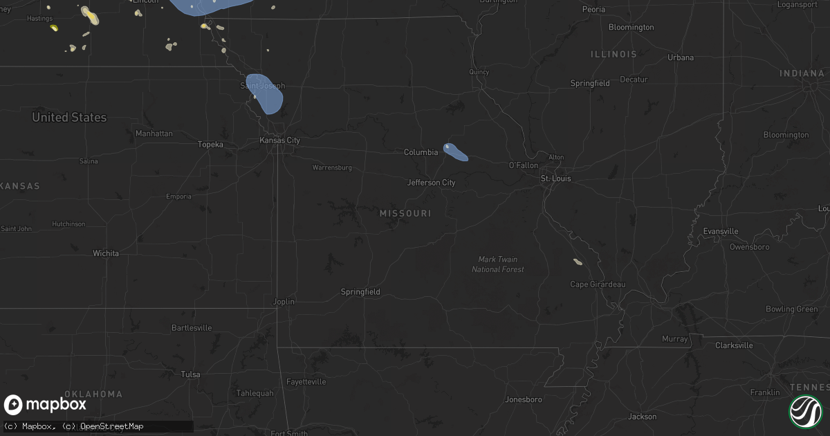
Hail Map in Missouri on July 7, 2025
Get this storm
July 7 map
$229
one time, instant access
Download today. No call, no setup
Keep the $229
Bought the map and want the full workflow? Apply the entire $229 to a subscription within 7 days. None of it is wasted.
Every map, not just this one
This buys you this map. Subscription and you get every map we run, in the markets you choose from a few cities to whole states to nationwide. Plus real-time alerts the moment a storm fires.
Contact data
Name, contact info, occupancy, even credit band for addresses in the footprint. You go from where it hit to who to call.
Become the source they trust
Unlimited branding weather history reports on demand. You already have the documented answer ready for the property owner, and you are the one who showed up with it.
Property data and RoofTrace estimates
Pull up any address you have got, its value and the exact code rules for that jurisdiction, straight from One Click Code. Then RoofTrace estimates the squares, pitch, and roof value, priced the way you price.
Storm reports in Missouri
Missouri
| Date | Description |
|---|---|
| 07/07/20254:25 PM CDT | Very windy as the storm moved through. At least some small twigs downed in the parking lot. Time estimated from radar. |
| 07/07/20253:40 PM CDT | Billboards blown away and an rv tipped over at the i-70 rv center. Multiple rvs damaged. Time estimated from radar. |
| 07/07/20253:20 PM CDT | A local report indicates 68 MPH wind near Auxvasse |
| 07/07/20253:54 AM CDT | Downed tree and wires near sunset hill road. Time estimated from radar. |
| 07/07/20253:16 AM CDT | Downed tree and wires just north of birmingham. Time confirme |
| 07/07/20253:16 AM CDT | Downed tree and wires just north of birmingham. Time confi |
| 07/07/20253:16 AM CDT | Downed tree and wires just north of birmingham. Time confirmed from radar. |
| 07/07/20253:11 AM CDT | Downed tree limb and wires near valleyview lane. Time confirmed from radar. |
| 07/07/20253:10 AM CDT | Social media report and mping report of downed tree limbs in the utica area. Time estimated from radar. |
| 07/07/20252:52 AM CDT | Mping report of tree limbs down. Utility company also reports power outages in the area around this time. Radar indicates from thunderstorm outflow. |
| 07/07/20252:47 AM CDT | Downed tree limb and wires from thunderstorm outflow. Time confirmed from radar. |
| 07/07/20252:47 AM CDT | Downed tree and wires near pennsylvania avenue from thunderstorm outflow. Time confirmed from radar. |
| 07/07/20252:47 AM CDT | Downed tree limbs and wires near 76th street from thunderstorm outflow. Time confirmed from radar. |
| 07/07/20252:35 AM CDT | Downed wires near prairie view road. Time estimated from radar. |
| 07/07/20252:20 AM CDT | Downed tree and wires from thunderstorm outflow near west concord drive. Time confirmed from radar. |
| 07/07/20252:19 AM CDT | Downed tree and wires near burnside avenue. Time confirmed from radar. |
| 07/07/20252:19 AM CDT | Downed tree limbs and wires near hillyard road. Time estimated from radar. |
| 07/07/20251:45 AM CDT | Several reports of downed wires in the st. Joseph area. Time estimated from radar. |
| 07/07/20251:44 AM CDT | Downed tree limbs and wires near route jj. Time estimated from radar. |
| 07/07/20251:33 AM CDT | A local report indicates 59 MPH wind near Saint Joseph Airport |
| 07/07/202512:23 AM CDT | Multiple reports of downed wires and three broken power poles. Time based on dispatch report. Location approximated from radar... With additional reports in holt county |
All States Impacted by Hail Map on July 7, 2025
Cities Impacted by Hail Map on July 7, 2025
- Hayes, SD
- Abernathy, TX
- McLaughlin, SD
- Lafayette, LA
- Scott, LA
- Duson, LA
- Bullhead, SD
- Wakpala, SD
- New Effington, SD
- Sisseton, SD
- Rosholt, SD
- Beardsley, MN
- Andover, OH
- Linesville, PA
- Dumont, MN
- Barry, MN
- Graceville, MN
- Forrest City, AR
- Wynne, AR
- Perryville, MO
- Only, TN
- Sedgewickville, MO
- Friedheim, MO
- Searcy, AR
- Buffalo Valley, TN
- Baxter, TN
- Oak Ridge, MO
- Gainesboro, TN
- Bloomington Springs, TN
- Port Byron, NY
- Conroe, TX
- McRae, AR
- Weedsport, NY
- Jordan, NY
- Hilham, TN
- Cookeville, TN
- Malvern, AR
- Santa Fe, TN
- Columbia, TN
- Vevay, IN
- Madison, IN
- Spearsville, LA
- El Dorado, AR
- Junction City, AR
- Akron, OH
- Allons, TN
- Livingston, TN
- Eldorado, TX
- Cuyahoga Falls, OH
- Alpena, SD
- Huron, SD
- Woonsocket, SD
- Saint Paul, NE
- Palmer, NE
- Clay Center, NE
- Wessington Springs, SD
- Ochopee, FL
- Brookfield, OH
- Fowler, OH
- Vienna, OH
- Munroe Falls, OH
- Tallmadge, OH
- Wolbach, NE
- Artesian, SD
- Cavour, SD
- Gilby, ND
- Forest River, ND
- Gregory, SD
- Auxvasse, MO
- Bradford, AR
- Burghill, OH
- Carthage, SD
- Silver Creek, NE
- Bennett, CO
- Fairfield, NE
- Minto, ND
- Strandburg, SD
- Moore Haven, FL
- Decaturville, TN
- Kingdom City, MO
- Fulton, MO
- Williamsburg, MO
- Fedora, SD
- Howard, SD
- Glenvil, NE
- Burke, SD
- McClure, IL
- Thebes, IL
- Manvel, ND
- Correll, MN
- Hermitage, AR
- Jersey, AR
- Osceola, NE
- Winner, SD
- Munich, ND
- Hannaford, ND
- Little Rock, AR
- Fairfax, SD
- Star City, AR
- Pine Bluff, AR
- Monroe, NE
- Platte Center, NE
- Briggsdale, CO
- Columbus, NE
- Letcher, SD
- Bauxite, AR
- Plankinton, SD
- Odessa, MN
- Fort Pierre, SD
- Canova, SD
- Florence, CO
- Wetmore, CO
- Beulah, CO
- Pueblo, CO
- Hill City, SD
- Cooperstown, ND
- Lake Andes, SD
- Wagner, SD
- Beaver Dams, NY
- Corning, NY
- Homer, NY
- Mcville, ND
- Port Allen, LA
- Platte, SD
- Hazel, SD
- Rapid City, SD
- Grand Forks, ND
- East Grand Forks, MN
- Winfred, SD
- Ramona, SD
- Madison, SD
- Edmore, ND
- Fairdale, ND
- Adams, ND
- Lawton, ND
- Willow Lake, SD
- Hayti, SD
- Appleton, MN
- Eminence, KY
- Smithfield, KY
- Shelbyville, KY
- Midland, SD
- Vienna, SD
- Emlenton, PA
- Mabelvale, AR
- Plain Dealing, LA
- Jamestown, ND
- Hensley, AR
- Little York, NY
- Big Flats, NY
- Horseheads, NY
- Bryant, SD
- Spencer, SD
- Mitchell, SD
- Lake Norden, SD
- Cortland, NY
- Preble, NY
- Anton, CO
- Alexandria, SD
- Boyers, PA
- Harrisville, PA
- Groton, NY
- Cimarron, NM
- Ypsilanti, ND
- Montpelier, ND
- Ocate, NM
- Emery, SD
- Humphrey, NE
- Lamy, NM
- Akron, CO
- Clarksburg, OH
- Frankfort, OH
- Tully, NY
- Alsen, ND
- Potter, NE
- Alexander, AR
- Mertzon, TX
- Cincinnatus, NY
- Truxton, NY
- Luverne, ND
- Hope, ND
- Pillsbury, ND
- Madison, NE
- Newfield, NY
- Spencer, NY
- Creston, NE
- Sidney, NE
- Oak Ridge, LA
- Brooktondale, NY
- Ithaca, NY
- Willseyville, NY
- Sterling, CO
- Doniphan, NE
- Trumbull, NE
- Mesquite, NM
- Anthony, NM
- Berino, NM
- Giltner, NE
- Lock Haven, PA
- Page, ND
- Colton, SD
- Chester, SD
- Petersburg, NE
- Iroquois, SD
- Parker, PA
- Gurley, NE
- Guadalupita, NM
- West Pittsburg, PA
- Wampum, PA
- New Castle, PA
- Otis, CO
- Dante, SD
- England, AR
- Freeville, NY
- Lindsay, NE
- Bridgewater, SD
- Niobrara, NE
- Springfield, SD
- Loxahatchee, FL
- Brookhaven, MS
- Elmira, NY
- Candor, NY
- Fordville, ND
- Cadiz, KY
- Dorchester, SC
- Avon, SD
- Orchard, CO
- Dryden, NY
- Ellwood City, PA
- Portersville, PA
- Harmony, PA
- Lynch, NE
- Lesterville, SD
- Utica, SD
- Menno, SD
- Wesson, MS
- Scotland, SD
- Lankin, ND
- Lodgepole, NE
- Verdigre, NE
- Grand Island, NE
- Edinburg, ND
- Wood River, NE
- Marion, ND
- Battle Creek, NE
- Norfolk, NE
- Geddes, SD
- Winnetoon, NE
- Clarkson, NE
- Freeman, SD
- Meadow Grove, NE
- McGraw, NY
- Yuma, CO
- Parkston, SD
- Olivet, SD
- Marion, SD
- Cairo, NE
- Monticello, AR
- Delmont, SD
- Ullin, IL
- Hodges, AL
- Humphrey, AR
- Eckley, CO
- New Raymer, CO
- Viborg, SD
- Hurley, SD
- Dalton, NE
- Irene, SD
- Volin, SD
- Yankton, SD
- Mission Hill, SD
- Centerville, SD
- Wakonda, SD
- Oshkosh, NE
- Lisbon, ND
- Eden, SD
- Nome, ND
- Oriska, ND
- Monroe, SD
- Langford, SD
- Stirum, ND
- Cogswell, ND
- Britton, SD
- Gwinner, ND
- Parker, SD
- Bradley, SD
- Lake Preston, SD
- Oldham, SD
- Aneta, ND
- Michigan, ND
- Montrose, SD
- Henry, SD
- Wallace, SD
- Forman, ND
- Fingal, ND
- Valley City, ND
- Erwin, SD
- Webster, SD
- Canistota, SD
- Roslyn, SD
- Center, NE
- Creighton, NE
- Brunswick, NE
- Chappell, NE
- Orchard, NE
- Pierce, NE
- Van Etten, NY
- Tyndall, SD
- Freedom, PA
- Tabor, SD
- Laurel, NE
- Belden, NE
- Wray, CO
- Haigler, NE
- Vernon, CO
- Idalia, CO
- Saint Francis, KS
- Mekinock, ND
- Humnoke, AR
- Randolph, NE
- Coleridge, NE
- Dickey, ND
- Seminole, TX
- Millfield, OH
- Glouster, OH
- Nelsonville, OH
- Buchtel, OH
- Athens, OH
- Page, NE
- Williamsport, OH
- Chillicothe, OH
- Logan, OH
- New Straitsville, OH
- Kanorado, KS
- Hartington, NE
- Springer, NM
- Tilden, NE
- Plainview, NE
- Royal, NE
- Newman Grove, NE
- Circleville, OH
- Erin, NY
- Ethan, SD
- Marathon, NY
- Neligh, NE
- Carroll, NE
- Talala, OK
- Salem, SD
- Indian Mound, TN
- Newcastle, NE
- Wynot, NE
- Saint Helena, NE
- Wabasso, MN
- Albion, NE
- Clements, MN
- Julesburg, CO
- Amherst, CO
- Fordyce, NE
- Redwood Falls, MN
- Vermillion, SD
- McVeytown, PA
- Atkinson, NE
- Bloomfield, NE
- Verona, ND
- Burbank, SD
- Terry, MS
- Raymond, MS
- Maskell, NE
- Brush, CO
- Moriarty, NM
- Osmond, NE
- Crofton, NE
- Dixon, NE
- Wakefield, NE
- Emerson, NE
- Inman, NE
- Springfield, MN
- Clearwater, NE
- Elgin, NE
- Sanborn, MN
- Lamberton, MN
- Stuttgart, AR
- Trementina, NM
- Hubbard, NE
- Andrews, TX
- Woodlawn, TN
- Oneill, NE
- Comfrey, MN
- Sleepy Eye, MN
- Rebersburg, PA
- Newbern, TN
- Loganton, PA
- Amesville, OH
- Thompson, ND
- Beresford, SD
- Alcester, SD
- Elk Point, SD
- Gayville, SD
- Ribera, NM
- Hanska, MN
- Saint James, MN
- Oakdale, NE
- Hospers, IA
- Sheldon, IA
- Granville, IA
- Ponca, NE
- Jefferson, SD
- Westfield, IA
- Hinton, IA
- North Sioux City, SD
- Sioux City, IA
- Alda, NE
- Pisek, ND
- Branson, CO
- Armour, SD
- Bainbridge, OH
- Vaughn, NM
- Park City, KY
- Jackson, NE
- South Sioux City, NE
- Dakota City, NE
- Sergeant Bluff, IA
- Mission, SD
- Encino, NM
- Mount Vernon, SD
- Ovid, CO
- New Concord, KY
- Ewing, NE
- Owego, NY
- La Junta, CO
- Stickney, SD
- Corsica, SD
- Spalding, NE
- Greeley, NE
- Primrose, NE
- Bird City, KS
- Venango, NE
- Lewellen, NE
- Primghar, IA
- Holyoke, CO
- Ada, MN
- Madelia, MN
- Dimock, SD
- Mill Creek, PA
- Mount Union, PA
- Las Animas, CO
- Tekamah, NE
- Salix, IA
- Decatur, NE
- Sloan, IA
- Macy, NE
- Wayne, NE
- Allen, NE
- Concord, NE
- Hoskins, NE
- Stanton, NE
- Waterbury, NE
- Winside, NE
- Homer, NE
- Pilger, NE
- Winnebago, NE
- Oakland, NE
- West Point, NE
- Bancroft, NE
- Thurston, NE
- Wisner, NE
- Lyons, NE
- Rosalie, NE
- Craig, NE
- Beemer, NE
- Walthill, NE
- Pender, NE
- Howells, NE
- Whiting, IA
- Onawa, IA
- Blencoe, IA
- Little Sioux, IA
- Dodge, NE
- Herman, NE
- North Bend, NE
- Ames, NE
- Uehling, NE
- Hooper, NE
- Scribner, NE
- Winslow, NE
- Nickerson, NE
- Fremont, NE
- Snyder, NE
- Hartley, IA
- Ord, NE
- North Loup, NE
- Chambers, NE
- Mill Hall, PA
- Big Sandy, TN
- Stewart, TN
- Sutherland, IA
- Morgan, MN
- McDonald, KS
- Arlington, NE
- Walnut Grove, MS
- Blair, NE
- Scotia, NE
- Kennard, NE
- Waverly, TN
- Cedar Rapids, NE
- Bassett, NE
- Leigh, NE
- Kim, CO
- Carthage, MS
- Missouri Valley, IA
- Schuyler, NE
- Leslie, AR
- Marshall, AR
- Omaha, NE
- Fort Calhoun, NE
- Malmo, NE
- Colon, NE
- Morse Bluff, NE
- Wahoo, NE
- Cedar Bluffs, NE
- Mead, NE
- Valley, NE
- Yutan, NE
- Ithaca, NE
- Ashland, NE
- Waterloo, NE
- Bennington, NE
- Persia, IA
- Honey Creek, IA
- Gretna, NE
- Modale, IA
- Underwood, IA
- Washington, NE
- Crescent, IA
- Elkhorn, NE
- Minden, IA
- Pisgah, IA
- Logan, IA
- Magnolia, IA
- Mondamin, IA
- Boys Town, NE
- Neola, IA
- Greenwood, NE
- Carter Lake, IA
- La Vista, NE
- Papillion, NE
- Council Bluffs, IA
- Glenwood, IA
- Bellevue, NE
- McClelland, IA
- Carson, IA
- Hancock, IA
- Oakland, IA
- Springfield, NE
- Offutt Afb, NE
- Silver City, IA
- Treynor, IA
- Crookston, MN
- Prague, NE
- New Marshfield, OH
- Capitan, NM
- Stuart, NE
- Comstock, TX
- Amelia, NE
- Red Lake Falls, MN
- Emmet, NE
- Corona, NM
- Union Furnace, OH
- Euclid, MN
- Glencoe, NM
- Ruidoso Downs, NM
- Woodburn, KY
- Bowling Green, KY
- Sims, AR
- Mifflinburg, PA
- Lewisburg, PA
- Story, AR
- Hereford, AZ
- Klamath River, CA
- David City, NE
- Bartlett, NE
- Grant, NE
- Almena, KS
- Wiggins, CO
- Weldona, CO
- Long Pine, NE
- Brainard, NE
- Bellwood, NE
- Tabor, IA
- Sidney, IA
- Chauncey, OH
- Jacksonville, OH
- Randolph, IA
- Kersey, CO
- Galeton, CO
- Ault, CO
- Dallas Center, IA
- Waukee, IA
- Lancaster, MN
- Bouton, IA
- Perry, IA
- Minburn, IA
- Peru, NE
- Saint Edward, NE
- Fort Morgan, CO
- Grimes, IA
- Watson, MO
- Rock Port, MO
- Grover, CO
- Urbandale, IA
- Seward, NE
- South Bend, NE
- Pacific Junction, IA
- Plattsmouth, NE
- Cedar Creek, NE
- Macedonia, IA
- Alvo, NE
- Louisville, NE
- Elmwood, NE
- Murdock, NE
- Mineola, IA
- Weeping Water, NE
- Unadilla, NE
- Nehawka, NE
- Avoca, NE
- Syracuse, NE
- Murray, NE
- Malvern, IA
- Manley, NE
- Percival, IA
- Nebraska City, NE
- Otoe, NE
- Henderson, IA
- Union, NE
- Thurman, IA
- Hastings, IA
- Dunbar, NE
- Farragut, IA
- Emerson, IA
- Imogene, IA
- Riverton, IA
- Hamburg, IA
- Essex, IA
- Shenandoah, IA
- Red Oak, IA
- Stanton, IA
- Clarinda, IA
- Villisca, IA
- Corning, IA
- Elliott, IA
- Griswold, IA
- Nodaway, IA
- Grant, IA
- Carbon, IA
- Prescott, IA
- Massena, IA
- Cumberland, IA
- Bridgewater, IA
- Lewis, IA
- Linwood, NE
- Long Island, KS
- Bruno, NE
- Lenora, KS
- Newport, NE
- Ericson, NE
- Genoa, NE
- Van Meter, IA
- Adel, IA
- Burwell, NE
- Craig, MO
- Patriot, OH
- Weston, NE
- Farnhamville, IA
- Lohrville, IA
- Clive, IA
- Churdan, IA
- Paton, IA
- Palmyra, NE
- Bennet, NE
- Fullerton, NE
- Belgrade, NE
- Stamford, NE
- Pencil Bluff, AR
- Warren, AR
- Auburn, NE
- Garland, NE
- Milford, NE
- Griffithville, AR
- Jamaica, IA
- Dawson, IA
- Bagley, IA
- West Des Moines, IA
- Norwalk, IA
- Prole, IA
- Linden, IA
- Yale, IA
- Booneville, IA
- Saint Charles, IA
- Cumming, IA
- Bevington, IA
- Woodward, IA
- Martensdale, IA
- Saint Marys, IA
- Indianola, IA
- Des Moines, IA
- Granger, IA
- Johnston, IA
- Windsor Heights, IA
- Polk City, IA
- Ankeny, IA
- Madrid, IA
- Huxley, IA
- Elkhart, IA
- Alleman, IA
- Cambridge, IA
- Slater, IA
- Fairfax, MO
- Pleasant Dale, NE
- Tecumseh, NE
- Lewiston, NE
- Steinauer, NE
- Martell, NE
- Hallam, NE
- Crete, NE
- Fairmont, NE
- Geneva, NE
- Brownville, NE
- Elk Creek, NE
- McCool Junction, NE
- Jacksonburg, WV
- Smithfield, WV
- Clovis, NM
- Troy, KS
- Henderson, NE
- Wathena, KS
- Milligan, NE
- Roswell, NM
- Friona, TX
- Texico, NM
- Oak, NE
- Exeter, NE
- Bovina, TX
- Farwell, TX
- Davenport, NE
- Tarkio, MO
- Grafton, NE
- Carleton, NE
- Hebron, NE
- Portales, NM
- Saint Joseph, MO
- De Kalb, MO
- Strang, NE
- Shickley, NE
- Hale Center, TX
- Deshler, NE
- Bedford, IA
- Gravity, IA
- Logan, KS
- Lubbock, TX
- Plainview, TX
- Barnard, MO
- Nelson, NE
- Albia, IA
- Oskaloosa, IA
- Courtland, KS
- Littlefork, MN
- Northboro, IA
- Coin, IA
- Blanchard, IA
- Montgomery City, MO
- New Florence, MO
- Oregon, MO
- Amazonia, MO
- Savannah, MO
- Cosby, MO
- Easton, MO
- Faucett, MO
- Agency, MO
- Elwood, KS
- Gower, MO
- Stewartsville, MO
- Plattsburg, MO
- Dearborn, MO
- Lathrop, MO
- Turney, MO
- Trimble, MO
- Holt, MO
- Smithville, MO
- Camden Point, MO
- Edgerton, MO
- Kansas City, MO
- Weston, MO
- Platte City, MO
- Liberty, MO
- Kearney, MO
- Excelsior Springs, MO
- Lawson, MO


