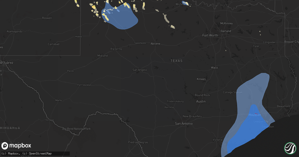
Hail Map in Texas on July 7, 2024
Get this storm
July 7 map
$229
one time, instant access
Download today. No call, no setup
Keep the $229
Bought the map and want the full workflow? Apply the entire $229 to a subscription within 7 days. None of it is wasted.
Every map, not just this one
This buys you this map. Subscription and you get every map we run, in the markets you choose from a few cities to whole states to nationwide. Plus real-time alerts the moment a storm fires.
Contact data
Name, contact info, occupancy, even credit band for addresses in the footprint. You go from where it hit to who to call.
Become the source they trust
Unlimited branding weather history reports on demand. You already have the documented answer ready for the property owner, and you are the one who showed up with it.
Property data and RoofTrace estimates
Pull up any address you have got, its value and the exact code rules for that jurisdiction, straight from One Click Code. Then RoofTrace estimates the squares, pitch, and roof value, priced the way you price.
Storm reports in Texas
Texas
| Date | Description |
|---|---|
| 07/07/20246:58 PM CDT | A local report indicates 71 MPH wind near 3 NNW Mcadoo |
| 07/07/20246:53 PM CDT | A local report indicates 66 MPH wind near 1 NNW Lubbock Int. Airp |
| 07/07/20246:53 PM CDT | A local report indicates 60 MPH wind near 6 S Wolfforth |
| 07/07/20246:50 PM CDT | Tree trunk snapped at phil hoel park. Time estimated by radar. |
| 07/07/20246:50 PM CDT | Wind gusts estimated in the 70 to 80 mph range from 6:45 to 6:50 pm. |
| 07/07/20246:46 PM CDT | A local report indicates 58 MPH wind near 3 WNW Lubbock |
| 07/07/20246:43 PM CDT | A local report indicates 66 MPH wind near 6 ENE Abernathy |
| 07/07/20246:40 PM CDT | A local report indicates 65 MPH wind near Reese Center |
| 07/07/20246:35 PM CDT | Report from mping: quarter |
| 07/07/20245:47 PM CDT | 1.25-1.50 inches. |
| 07/07/20242:54 PM CDT | Trees down in the 900 block of old highway 59. |
| 07/07/20242:53 PM CDT | Trees down in the 4600 block of highway 69 north just northwest of lufkin. |
| 07/07/20242:48 PM CDT | Trees down on bethlehem road in hudson. |
| 07/07/20242:30 PM CDT | Two trees were downed onto power lines near the intersection of fm 58 and southern drive. |
| 07/07/20241:55 PM CDT | Severe thunderstorm wind gusts damaged trees across northern tyler county. 888 customers were out of power due to large trees falling on transformers and power lines. |
| 07/07/20242:40 AM CDT | Pcnt2 - port oconnor. |
| 07/06/202410:55 PM CDT | A local report indicates 60 MPH wind near 3 NNW Seymour |
| 07/06/20249:32 PM CDT | A local report indicates 72 MPH wind near Sheppard Afb |
| 07/06/20249:19 PM CDT | 5-6 inch tree limbs down. |
| 07/06/20249:11 PM CDT | A local report indicates 64 MPH wind near 3 E Snyder |
| 07/06/20248:50 PM CDT | A local report indicates 61 MPH wind near 1 SSE Jayton |
| 07/06/20248:42 PM CDT | Report from mping: quarter |
| 07/06/20248:17 PM CDT | A local report indicates 59 MPH wind near 1 NW Lake Alan Henry |
| 07/06/20248:02 PM CDT | Corrects previous non-tstm wnd gst report from white river lake. |
| 07/06/20248:00 PM CDT | Corrects previous non-tstm wnd gst report from 5 ssw graham. |
| 07/06/20247:56 PM CDT | Corrects previous non-tstm wnd gst report from 1 ne post. |
| 07/06/20247:31 PM CDT | A local report indicates 75 MPH wind near 1 SE Ralls |
| 07/06/20247:30 PM CDT | Public submitted a video to broadcast media of a possible tornado near 11th street and north street as well as martin luther king and i-10. |
| 07/06/20247:29 PM CDT | A local report indicates 67 MPH wind near 1 SE Ralls |
| 07/06/20247:25 PM CDT | Shipping container overturned. |
| 07/06/20247:19 PM CDT | A local report indicates 66 MPH wind near 2 NE Slaton |
| 07/06/20247:01 PM CDT | Report from mping: 1-inch tree limbs broken; shingles blown off. |
| 07/06/20247:01 PM CDT | A local report indicates 74 MPH wind near 4 E Lubbock |
All States Impacted by Hail Map on July 7, 2024
Cities Impacted by Hail Map on July 7, 2024
- Noble, OK
- Lexington, OK
- Norman, OK
- Wanette, OK
- Macomb, OK
- Tecumseh, OK
- Asher, OK
- Konawa, OK
- Ada, OK
- Stratford, OK
- Sasakwa, OK
- Roff, OK
- Mill Creek, OK
- Sulphur, OK
- Tishomingo, OK
- Stonewall, OK
- Coalgate, OK
- Lawson, MO
- Rayville, MO
- Richmond, MO
- Polo, MO
- Atoka, OK
- Kahoka, MO
- Wheeling, MO
- Meadville, MO
- Luray, MO
- Caddo, OK
- Caney, OK
- Wayland, MO
- Farmington, IA
- Higginsville, MO
- Keota, OK
- Argyle, IA
- Chambers, NE
- Corder, MO
- Rutledge, MO
- Knox City, MO
- Edina, MO
- Montrose, IA
- Revere, MO
- Linneus, MO
- Trenton, MO
- Galt, MO
- Browning, MO
- Humphreys, MO
- Lexington, MO
- La Belle, MO
- Wyaconda, MO
- Bassett, NE
- Spiro, OK
- Ewing, NE
- Hardin, MO
- Norborne, MO
- Mayview, MO
- Odessa, MO
- Williamstown, MO
- Burwell, NE
- Cameron, OK
- Bokoshe, OK
- Shady Point, OK
- Minocqua, WI
- Mendon, MO
- Rothville, MO
- Poteau, OK
- Saint Patrick, MO
- Monticello, MO
- Marceline, MO
- Novelty, MO
- Canton, MO
- Bartlett, NE
- Wolford, ND
- Rugby, ND
- Oneill, NE
- Defuniak Springs, FL
- Briggsdale, CO
- Alexandria, MO
- Kersey, CO
- Orchard, CO
- Warsaw, IL
- Elgin, NE
- Clearwater, NE
- Malta Bend, MO
- Weldona, CO
- Wiggins, CO
- Raton, NM
- Pierce, NE
- Britton, SD
- Colorado Springs, CO
- Neligh, NE
- Lewistown, MO
- Campbell, MN
- Fort Morgan, CO
- Gilmer, TX
- Big Sandy, TX
- Richardton, ND
- Langford, SD
- Breckenridge, MN
- Sutter, IL
- Fountain, CO
- Pittsburg, TX
- Madison, MO
- Holliday, MO
- Troy, AL
- Paris, MO
- Shelbina, MO
- Ewing, MO
- Pueblo, CO
- Ord, NE
- Elyria, NE
- Ericson, NE
- Durham, MO
- Osmond, NE
- Jakin, GA
- Leesburg, TX
- Winnsboro, TX
- Seale, AL
- Binger, OK
- Gracemont, OK
- Westminster, SC
- Quincy, IL
- Hoskins, NE
- Randolph, NE
- Woodrow, CO
- Lake Park, GA
- Statenville, GA
- Carroll, NE
- Yoder, CO
- Rush, CO
- Akron, CO
- Lindon, CO
- Minco, OK
- Norfolk, NE
- Albion, NE
- Mendon, IL
- Fowler, IL
- Winside, NE
- Hinton, OK
- Anadarko, OK
- El Reno, OK
- Union City, OK
- Fort Cobb, OK
- Coatsburg, IL
- Camp Point, IL
- Paloma, IL
- Anton, CO
- Marshallville, GA
- Granite, OK
- Hatchechubbee, AL
- Fort Mitchell, AL
- Boone, CO
- Napoleon, ND
- Sudan, TX
- Fargo, GA
- Amherst, TX
- Cope, CO
- Wayne, NE
- Cedar Rapids, NE
- New Berlin, WI
- Pocasset, OK
- Barry, TX
- Greeley, NE
- Wolbach, NE
- Lockney, TX
- Garner, IA
- Spalding, NE
- Leola, SD
- Murrayville, GA
- Cleveland, GA
- Primrose, NE
- Saint Edward, NE
- Belgrade, NE
- Littlefield, TX
- Flagler, CO
- Pep, TX
- Arriba, CO
- Sergeant Bluff, IA
- Sioux City, IA
- Dakota City, NE
- Brookfield, WI
- Waukesha, WI
- Earth, TX
- Verden, OK
- Amber, OK
- Chickasha, OK
- Ninnekah, OK
- Blanchard, OK
- Cement, OK
- Apache, OK
- Cyril, OK
- Bronson, IA
- Lawton, IA
- Moville, IA
- Lone Wolf, OK
- Gainesville, GA
- Hale Center, TX
- Springlake, TX
- Forest City, IA
- Dahlonega, GA
- Sentinel, OK
- Tuttle, OK
- Elm Grove, WI
- Palmer, NE
- Fullerton, NE
- Chatham, LA
- Jonesboro, LA
- Seibert, CO
- Ventura, IA
- Weston, CO
- Clovis, NM
- Matador, TX
- Cannon Afb, NM
- Cripple Creek, CO
- Florissant, CO
- Levelland, TX
- Crescent, IA
- Council Bluffs, IA
- Honey Creek, IA
- Strasburg, CO
- Byers, CO
- Muleshoe, TX
- Olton, TX
- Floydada, TX
- Ionia, IA
- Nashua, IA
- Alex, OK
- Herreid, SD
- Hague, ND
- Portales, NM
- Lindsay, OK
- Elbert, CO
- Kiowa, CO
- Vona, CO
- Plainview, TX
- Deer Trail, CO
- Anthon, IA
- Hornick, IA
- Climbing Hill, IA
- Lubbock, TX
- Wolfforth, TX
- Pollock, SD
- Calhan, CO
- Abernathy, TX
- Peyton, CO
- Bradley, OK
- Ipswich, SD
- New Hampton, IA
- Mountain View, OK
- Fletcher, OK
- Rush Springs, OK
- Ropesville, TX
- Platte Center, NE
- Purcell, OK
- Neola, IA
- Underwood, IA
- Stratton, CO
- Shallowater, TX
- Colorado City, CO
- Rye, CO
- Winnebago, NE
- Homer, NE
- Columbus, NE
- Petersburg, TX
- Hobart, OK
- Roosevelt, OK
- Guffey, CO
- Mangum, OK
- Walsenburg, CO
- Trinidad, CO
- Blair, OK
- Idalou, TX
- Bethune, CO
- Rogers, NM
- Childress, TX
- Maysville, OK
- McClelland, IA
- Foster, OK
- Elmore City, OK
- Roaring Springs, TX
- Minden, IA
- Lorenzo, TX
- Hephzibah, GA
- Mcadoo, TX
- Wetumpka, AL
- Union, SC
- Oakwood, GA
- Rushford, MN
- Holstein, IA
- Schuyler, NE
- Causey, NM
- Pauls Valley, OK
- Cheyenne Wells, CO
- Enochs, TX
- Ralls, TX
- Karval, CO
- Hugo, CO
- Wilson, TX
- Calhoun, LA
- Crosbyton, TX
- Dickens, TX
- Augusta, GA
- Burlington, CO
- Missouri Valley, IA
- Mountain Park, OK
- Snyder, OK
- Montgomery, AL
- Tahoka, TX
- New Deal, TX
- Slaton, TX
- Ransom Canyon, TX
- Anton, TX
- Smyer, TX
- Monroe, NE
- Frederick, OK
- Tuttle, ND
- Dupree, SD
- Downsville, LA
- Strasburg, ND
- Braselton, GA
- Scottdale, GA
- Decatur, GA
- Avondale Estates, GA
- Post, TX
- Afton, TX
- Persia, IA
- Logan, IA
- Canon City, CO
- Rogers, NE
- Linwood, NE
- Model, CO
- Paducah, TX
- Thomasville, AL
- Robinson, ND
- Comanche, OK
- Stone Mountain, GA
- Ratliff City, OK
- Tussy, OK
- Hennepin, OK
- Kit Carson, CO
- Haswell, CO
- Loveland, OK
- Chaseley, ND
- David City, NE
- Clarkston, GA
- Olney Springs, CO
- Rocky Ford, CO
- Spur, TX
- Justiceburg, TX
- Lithonia, GA
- Harvard, NE
- Indiahoma, OK
- Eads, CO
- Chattanooga, OK
- Buford, GA
- Trumbull, NE
- Giltner, NE
- Boncarbo, CO
- Fowler, CO
- Duncan, OK
- Hollister, OK
- Davidson, OK
- Davis, OK
- Springer, OK
- Ordway, CO
- Walters, OK
- Waurika, OK
- Manzanola, CO
- Crowley, CO
- Suwanee, GA
- Beulah, CO
- Temple, OK
- Sugar City, CO
- Wagon Mound, NM
- Miami, NM
- Springer, NM
- Crowell, TX
- Devol, OK
- Grandfield, OK
- Canton, GA
- Jayton, TX
- Snyder, TX
- Girard, TX
- Aspermont, TX
- Fontanelle, IA
- Burkburnett, TX
- Bridgewater, IA
- Greenfield, IA
- Farragut, IA
- Ringling, OK
- Stuart, IA
- Randlett, OK
- Sheppard Afb, TX
- Wichita Falls, TX
- Ryan, OK
- Avondale, CO
- Dexter, IA
- Winterset, IA
- Vernon, TX
- Henrietta, TX
- Seymour, TX
- Monroe, IA
- Earlham, IA
- Byers, TX
- Prairie City, IA
- Sully, IA
- Reasnor, IA
- Newton, IA
- Kim, CO
- Kellogg, IA
- Lynnville, IA
- La Junta, CO
- Throckmorton, TX
- Trinchera, CO
- Pella, IA
- Leighton, IA
- New Sharon, IA
- Oskaloosa, IA
- Woodson, TX
- Graham, TX
- Newcastle, TX
- Ellenwood, GA
- Elmaton, TX
- Palacios, TX
- Matagorda, TX
- Bay City, TX
- Port Lavaca, TX
- Brazoria, TX
- Freeport, TX
- Elk City, OK
- Gladstone, NM
- Blessing, TX
- Markham, TX
- Van Vleck, TX
- Sweeny, TX
- Lolita, TX
- Midfield, TX
- Grove, OK
- El Campo, TX
- Louise, TX
- Lake Jackson, TX
- Clute, TX
- Ganado, TX
- Wharton, TX
- Port O'Connor, TX
- Seadrift, TX
- Vanderbilt, TX
- Edna, TX
- Rockport, TX
- Tivoli, TX
- Bloomington, TX
- La Salle, TX
- Angleton, TX
- West Columbia, TX
- Pledger, TX
- Boling, TX
- Damon, TX
- Las Vegas, NM
- Trementina, NM
- Sapello, NM
- Danbury, TX
- Galveston, TX
- Melrose, NM
- Cuervo, NM
- Mosquero, NM
- Conchas Dam, NM
- Garita, NM
- Newkirk, NM
- House, NM
- Floyd, NM
- Santa Rosa, NM
- Liverpool, TX
- Hitchcock, TX
- Port Bolivar, TX
- La Marque, TX
- Seabrook, TX
- Santa Fe, TX
- Manvel, TX
- Rosharon, TX
- Alvin, TX
- Pearland, TX
- South Houston, TX
- Missouri City, TX
- Dickinson, TX
- Webster, TX
- Kemah, TX
- Houston, TX
- League City, TX
- Pasadena, TX
- Texas City, TX
- Bacliff, TX
- Friendswood, TX
- Baytown, TX
- La Porte, TX
- Richmond, TX
- Beasley, TX
- Sugar Land, TX
- Guy, TX
- Fresno, TX
- Stafford, TX
- East Bernard, TX
- Rosenberg, TX
- Needville, TX
- Glen Flora, TX
- Fitzhugh, OK
- Eagle Lake, TX
- Wallis, TX
- Deer Park, TX
- Bellaire, TX
- Katy, TX
- Fulshear, TX
- Fort Sumner, NM
- Kingwood, TX
- Humble, TX
- Galena Park, TX
- Channelview, TX
- Cypress, TX
- Brookshire, TX
- Dayton, TX
- Highlands, TX
- Crosby, TX
- Anahuac, TX
- Chillicothe, TX
- Lookeba, OK
- Spring, TX
- Porter, TX
- Tomball, TX
- Hollis, OK
- Sealy, TX
- Hockley, TX
- Taiban, NM
- Waller, TX
- Magnolia, TX
- Pinehurst, TX
- Huffman, TX
- Conroe, TX
- New Caney, TX
- Plantersville, TX
- Montgomery, TX
- Willis, TX
- Splendora, TX
- Cleveland, TX
- Hempstead, TX
- Bellville, TX
- Prairie View, TX
- Navasota, TX
- Washington, TX
- Richards, TX
- Anderson, TX
- Coldspring, TX
- Shepherd, TX
- Livingston, TX
- New Waverly, TX
- Huntsville, TX
- Oakhurst, TX
- Pointblank, TX
- Iola, TX
- Bedias, TX
- Bryan, TX
- Victor, CO
- Brush, CO
- Midway, TX
- Madisonville, TX
- Lovelady, TX
- Trinity, TX
- North Zulch, TX
- Groveton, TX
- Onalaska, TX
- Goodrich, TX
- Lufkin, TX
- Diboll, TX
- Corrigan, TX
- Moscow, TX
- Pennington, TX
- Crockett, TX
- Kennard, TX
- Apple Springs, TX
- Beaumont, TX


