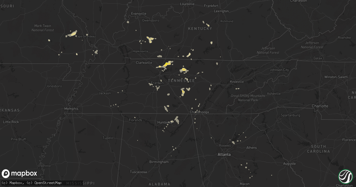
Hail Map in Tennessee on July 7, 2022
Get this storm
July 7 map
$229
one time, instant access
Download today. No call, no setup
Keep the $229
Bought the map and want the full workflow? Apply the entire $229 to a subscription within 7 days. None of it is wasted.
Every map, not just this one
This buys you this map. Subscription and you get every map we run, in the markets you choose from a few cities to whole states to nationwide. Plus real-time alerts the moment a storm fires.
Contact data
Name, contact info, occupancy, even credit band for addresses in the footprint. You go from where it hit to who to call.
Become the source they trust
Unlimited branding weather history reports on demand. You already have the documented answer ready for the property owner, and you are the one who showed up with it.
Property data and RoofTrace estimates
Pull up any address you have got, its value and the exact code rules for that jurisdiction, straight from One Click Code. Then RoofTrace estimates the squares, pitch, and roof value, priced the way you price.
Storm reports in Tennessee
Tennessee
| Date | Description |
|---|---|
| 07/07/20224:40 PM CDT | Public report of a large tree down at the bedford county board of education building on madison st in shelbyville. |
| 07/07/20224:35 PM CDT | Tree fell and crushed a garage on fairfield pike. |
| 07/07/20224:30 PM CDT | Public report of two large trees down near a home at the corner of union street and woodmont drive in shelbyville. |
| 07/07/20224:30 PM CDT | Public report of a tree snapped in the front yard of a home in the union station subdivision on the nw side of shelbyville... Tn. |
| 07/07/20224:24 PM CDT | Public report of a tree down on midland road in north-central bedford county. |
| 07/07/20224:10 PM CDT | White county ema reported downed power lines in the sparta city limit that resulted in power outages. Sparta fd was responding. Report relayed via newstalk941.com. |
| 07/07/20224:00 PM CDT | Report of a tree down on smartt station road bringing down power lines as well. |
| 07/07/20223:50 PM CDT | Warren county 911 relayed 16 reports of trees and power lines down in and around mcminnville. One power line fell and caused fire damage to the roofs of two homes on wi |
| 07/07/20223:50 PM CDT | Facebook report and photo of a large tree branch down on a house on highway 62. |
| 07/07/20223:30 PM CDT | Corrects previous tstm wnd dmg report from 1 se sparta. White county ema reported downed power lines in the sparta city limit that resulted in power outages. Sparta fd |
| 07/07/20223:30 PM CDT | A few trees were blown down in overton county. |
| 07/07/20223:30 PM CDT | Minor structural damage to a barn as well as large tree limbs down damaging a fence on highway 70s near the cannon county line. |
| 07/07/20223:28 PM CDT | Multiple reports of trees down in cookeville including the macedonia area and near s. Jefferson avenue. |
| 07/07/20223:05 PM CDT | Several trees were blown down across the county. |
| 07/07/20222:45 PM CDT | Hail up to quarter size fell on pinewood road. |
| 07/07/20222:41 PM CDT | Report from mping: 3-inch tree limbs broken; power poles broken. |
| 07/07/20222:40 PM CDT | Facebook report of silver dollar size hail near portland. Time and location estimated. |
| 07/07/20222:20 PM CDT | Facebook report of top of tree blown off and into power lines. Also pea size hail. |
| 07/07/20221:45 PM CDT | Twitter tspotter report and photo of trees down in the owl creek area of brentwood. |
| 07/07/20221:45 PM CDT | Fb report of a tree split near norene. Time estimated via radar. |
| 07/07/20221:00 PM CDT | Couple trees down reported by 911 county dispatch. Time estimated by radar. |
| 07/07/202212:15 PM CDT | Corrects previous tstm wnd dmg report from 5 ne hendersonville. Wsmv reported a tree down at 137 mulberry grove. |
| 07/07/202212:15 PM CDT | Wsmv reported a tree down in hendersonville. Location and time estimated. |
| 07/07/202212:15 PM CDT | Corrects previous tstm wnd dmg report from 5 ne hendersonville. Corrects previous tstm wnd dmg report from 5 ne hendersonville. Wsmv reported a tree down at 137 mulberr |
| 07/07/20223:08 AM CDT | At 807 PM EDT, a severe thunderstorm was located 8 miles southeast of Eagleton Village, or 9 miles east of Maryville, moving east at 20 mph. HAZARD...60 mph wind gusts and penny size hail. SOURCE...Radar indicated. IMPACT...Expect damage to roofs, siding, and trees. Locations impacted include... Gatlinburg, Pigeon Forge, Townsend, Wears Valley, Walland, Elkmont, Roundtop Mountain State Park and Great Smoky Mountains National Park. |
| 07/06/202211:17 PM CDT | At 416 PM CDT, severe thunderstorms were located along a line extending from near Clarkrange to near Crossville, moving east at 30 mph. HAZARD...60 mph wind gusts and penny size hail. SOURCE...Radar indicated. IMPACT...Expect damage to roofs, siding, and trees. Locations impacted include... Crossville, Fairfield Glade, Crab Orchard, Grimsley, Lake Tansi, Cumberland Mountain State Park, Slate Springs and Clarkrange.This includes Interstate 40 between mile markers 313 and 339. |
| 07/06/202211:07 PM CDT | At 407 PM CDT, severe thunderstorms were located along a line extending from near Spencer to Viola, moving east at 15 mph. HAZARD...60 mph wind gusts and penny size hail. SOURCE...Radar indicated. IMPACT...Expect damage to roofs, siding, and trees. Locations impacted include... Spencer, Gruetli-Laager, Altamont, Coalmont, Palmer, Beersheba Springs, Viola and Fall Creek Falls State Park. |
| 07/06/202210:48 PM CDT | At 348 PM CDT, a severe thunderstorm was located near McMinnville, moving east at 15 mph. HAZARD...60 mph wind gusts and penny size hail. SOURCE...Radar indicated. IMPACT...Expect damage to roofs, siding, and trees. Locations impacted include... McMinnville, Morrison, Centertown and Viola. |
| 07/06/202210:46 PM CDT | At 346 PM CDT, a severe thunderstorm was located near Monterey, or 12 miles northeast of Sparta, moving east at 15 mph. HAZARD...60 mph wind gusts and penny size hail. SOURCE...Radar indicated. IMPACT...Expect damage to roofs, siding, and trees. Locations impacted include... Crossville, Monterey, Pleasant Hill, Lake Tansi and Slate Springs. This includes Interstate 40 between mile markers 297 and 321. |
| 07/06/202210:10 PM CDT | At 310 PM CDT, severe thunderstorms were located along a line extending from near Gainesboro to near Smithville, moving east at 20 mph. HAZARD...60 mph wind gusts and penny size hail. SOURCE...Radar indicated. IMPACT...Expect damage to roofs, siding, and trees. Locations impacted include... Cookeville, Sparta, Livingston, Gainesboro, Algood, Baxter, Doyle, Hamptons Crossroads, Bakers Crossroads, Burgess Falls State Park, Rickman and Cummins Falls State Park.This includes Interstate 40 between mile markers 273 and 299. |
| 07/06/20229:54 PM CDT | At 254 PM CDT, a severe thunderstorm was located 7 miles southeast of Fairview, or 9 miles west of Franklin, moving east at 15 mph. HAZARD...60 mph wind gusts and penny size hail. SOURCE...Radar indicated. IMPACT...Expect damage to roofs, siding, and trees. Locations impacted include... Franklin, Brentwood, Spring Hill, Thompson's Station, Leipers Fork and Natchez Trace At Highway 96.This includes the following highways... Interstate 65 between mile markers 53 and 70. Interstate 840 between mile markers 12 and 32. |
| 07/06/20229:47 PM CDT | At 246 PM CDT, severe thunderstorms were located along a line extending from near Red Boiling Springs to Dowelltown, moving east at 15 mph. HAZARD...60 mph wind gusts and penny size hail. SOURCE...Radar indicated. IMPACT...Expect damage to roofs, siding, and trees. Locations impacted include... Smithville, Gainesboro, Baxter, Gordonsville, Hickman, Dowelltown, Liberty, Center Hill Lake, Whitleyville, Granville and Edgar Evans State Park.This includes Interstate 40 between mile markers 260 and 280. |
| 07/06/20229:36 PM CDT | At 236 PM CDT, severe thunderstorms were located along a line extending from near Westmoreland to Millersville, moving east at 15 mph. HAZARD...60 mph wind gusts and penny size hail. SOURCE...Radar indicated. IMPACT...Expect damage to roofs, siding, and trees. Locations impacted include... Gallatin, Hartsville, Goodlettsville, White House, Millersville, Westmoreland, Cottontown, Bethpage, Oak Grove and Bledsoe Creek State Park.This includes Interstate 65 near mile marker 100. |
| 07/06/20229:19 PM CDT | At 219 PM CDT, a severe thunderstorm was located 7 miles north of Tompkinsville, moving east at 20 mph. HAZARD...60 mph wind gusts and quarter size hail. SOURCE...Radar indicated. IMPACT...Hail damage to vehicles is expected. Expect wind damage to roofs, siding, and trees. This severe thunderstorm will remain over mainly rural areas of Monroe, western Cumberland and southern Metcalfe Counties, including the following locations... Littrell, Meshack, Blythe, Harlan Crossroads, Ellington, Willow Shade, Grider, Peytonsburg, Raydure and Arat. |
| 07/06/20229:13 PM CDT | At 213 PM CDT, a severe thunderstorm was located over Ridgetop, or 7 miles southeast of Springfield, moving east at 15 mph. HAZARD...60 mph wind gusts and penny size hail. SOURCE...Radar indicated. IMPACT...Expect damage to roofs, siding, and trees. Locations impacted include... Springfield, Hendersonville, Goodlettsville, White House, Millersville, Greenbrier, Ridgetop, Joelton and Cottontown.This includes the following highways... Interstate 65 between mile markers 95 and 110. Interstate 24 between mile markers 33 and 39. |
| 07/06/20228:58 PM CDT | At 157 PM CDT, a severe thunderstorm was located 11 miles northwest of Portland, moving east at 30 mph. HAZARD...60 mph wind gusts and penny size hail. SOURCE...Radar indicated. IMPACT...Expect damage to roofs, siding, and trees. This severe thunderstorm will remain over mainly rural areas of southeastern Logan and Simpson Counties, including the following locations... Hillsdale, Black Jack, Neosheo, Geddes, Mcelroy Ford, Salmons, Schochoh, Middleton, Schweizer and Prices Mill. |
| 07/06/20228:32 PM CDT | At 132 PM CDT, a severe thunderstorm was located 5 miles northeast of Walterhill, or 13 miles northeast of Murfreesboro, moving east at 10 mph. HAZARD...60 mph wind gusts and penny size hail. SOURCE...Radar indicated. IMPACT...Expect damage to roofs, siding, and trees. Locations impacted include... Walterhill, Auburntown, Cedars Of Lebanon State Park, Lascassas and Milton. |
| 07/06/20228:25 PM CDT | At 125 PM CDT, a severe thunderstorm was located over Nolensville, or 7 miles east of Franklin, moving southeast at 10 mph. HAZARD...60 mph wind gusts and penny size hail. SOURCE...Radar indicated. IMPACT...Expect damage to roofs, siding, and trees. Locations impacted include... Franklin, Smyrna, Brentwood, La Vergne, Nolensville and Triune. This includes the following highways... Interstate 65 between mile markers 65 and 72. Interstate 24 between mile markers 60 and 72. Interstate 840 between mile markers 38 and 49, and near mile marker60. |
| 07/06/20227:15 PM CDT | A couple trees were blown down. |
All States Impacted by Hail Map on July 7, 2022
Cities Impacted by Hail Map on July 7, 2022
- Shelby, MT
- Somers, MT
- Lakeside, MT
- Kalispell, MT
- Highwood, MT
- Floweree, MT
- Fort Benton, MT
- Upton, WY
- Choteau, MT
- Howes, SD
- Trout Creek, MT
- Almont, ND
- Glen Ullin, ND
- Grover, CO
- Carpenter, WY
- Mud Butte, SD
- Columbia Falls, MT
- Fairfield, MT
- Ten Sleep, WY
- Raynesford, MT
- Geyser, MT
- Meeteetse, WY
- Cody, WY
- Geraldine, MT
- Canyon Creek, MT
- Wise River, MT
- Charlo, MT
- Arlee, MT
- Havre, MT
- Winifred, MT
- Valier, MT
- Union Center, SD
- Dupree, SD
- Faith, SD
- Elliston, MT
- Avon, MT
- Marysville, MT
- Condon, MT
- Belt, MT
- Great Falls, MT
- Reva, SD
- Buffalo, SD
- Newell, SD
- Sunburst, MT
- Whitlash, MT
- Sheridan, WY
- Elgin, ND
- Elmo, MT
- Kila, MT
- Dayton, MT
- Proctor, MT
- Lonepine, MT
- Hot Springs, MT
- Polson, MT
- Big Arm, MT
- Rollins, MT
- White Plains, KY
- Dutton, MT
- Chugwater, WY
- Wheatland, WY
- Cut Bank, MT
- Hilger, MT
- Lewistown, MT
- Browning, MT
- Lincoln, MT
- Enning, SD
- Denton, MT
- Kaycee, WY
- Corvallis, MT
- Stevensville, MT
- Victor, MT
- Missoula, MT
- Mobridge, SD
- Ralph, SD
- Sturgis, SD
- Nemo, SD
- Piedmont, SD
- Wolf Creek, MT
- Tower Hill, IL
- Harrison, NE
- Bynum, MT
- Vaughn, MT
- Power, MT
- Black Eagle, MT
- Sun River, MT
- Fort Shaw, MT
- Elizabethtown, IL
- Herod, IL
- Wakpala, SD
- Bendena, KS
- Troy, KS
- Robinson, KS
- Highland, KS
- Denton, KS
- Jordan, MT
- Fort Peck, MT
- Buffalo Gap, SD
- Jay Em, WY
- Auburn, NE
- Johnson, NE
- Brock, NE
- Gillette, WY
- Chadron, NE
- Whitney, NE
- Clinton, MT
- Florence, MT
- Charleston, MO
- Hendersonville, TN
- Gallatin, TN
- Bonner, MT
- Torrington, WY
- Morrill, NE
- Dawson, NE
- Dalton, NE
- Broadwater, NE
- Merino, CO
- Wright, WY
- Dillon, MT
- Thompson Falls, MT
- Vale, SD
- Snyder, CO
- Hermosa, SD
- Keystone, SD
- Custer, SD
- Hill City, SD
- Rush, CO
- Ordway, CO
- Shawmut, MT
- Melville, MT
- Perryville, KY
- Parksville, KY
- Gravel Switch, KY
- Springfield, KY
- Danville, KY
- Oregon, MO
- Forest City, MO
- Rockham, SD
- Faulkton, SD
- Drummond, MT
- Lexington, TN
- Merriman, NE
- Hugo, CO
- Brunswick, GA
- Kim, CO
- Mcminnville, TN
- Morrison, TN
- Woodbury, TN
- Flowery Branch, GA
- Chattanooga, TN
- Bethpage, TN
- Roebuck, SC
- Pauline, SC
- Model, CO
- Trilla, IL
- Neoga, IL
- Spartanburg, SC
- Cookeville, TN
- Gallant, AL
- Altoona, AL
- Oneonta, AL
- Darden, TN
- Parsons, TN
- Buford, GA
- Suwanee, GA
- Cumming, GA
- Spring Lake, NC
- Fort Bragg, NC
- Pope Army Airfield, NC
- Eatonton, GA
- Watertown, TN
- Brush Creek, TN
- Brentwood, TN
- Raleigh, NC
- Menlo, GA
- Rising Fawn, GA
- Smithville, TN
- Sparta, TN
- Holland, KY
- Scottsville, KY
- Maryville, TN
- Longdale, OK
- Seiling, OK
- Signal Mountain, TN
- Madison, GA
- Newborn, GA
- Ryegate, MT
- Bayard, NE
- Rye, CO
- Colorado City, CO
- Pueblo, CO
- Greenville, KY
- Limon, CO
- Glenallen, MO
- Marble Hill, MO
- Patton, MO
- Rock Island, TN
- Ellington, MO
- Tompkinsville, KY
- Portland, TN
- Seeley Lake, MT
- Dixon, MT
- Whitewater, MO
- Crofton, KY
- Sedan, NM
- Scottsboro, AL
- Woodville, AL
- Hollytree, AL
- Keystone Heights, FL
- Melrose, FL
- Goodlettsville, TN
- White House, TN
- Joelton, TN
- Westmoreland, TN
- Greenbrier, TN
- Cottontown, TN
- Louisville, GA
- Madison, TN
- Old Hickory, TN
- Laceys Spring, AL
- Lead, SD
- Harrisonville, MO
- Lavina, MT
- Edinburg, IL
- Pawnee, IL
- Rochester, IL
- Pritchett, CO
- Las Animas, CO
- Colorado Springs, CO
- Penrose, CO
- Florissant, CO
- Harrisburg, NE
- Gamaliel, KY
- Fountain Run, KY
- Edmonton, KY
- Burkesville, KY
- Greenville, MO
- Marquand, MO
- Easley, SC
- Pickens, SC
- Marietta, SC
- Jansen, NE
- Fairbury, NE
- Summerville, GA
- Gainesville, GA
- Milledgeville, GA
- Thompsons Station, TN
- Franklin, TN
- Fairview, OK
- Tulia, TX
- Monticello, GA
- Mansfield, GA
- Shelbyville, TN
- Bell Buckle, TN
- Enoree, SC
- Gray Court, SC
- Woodruff, SC
- Auburn, KY
- Braselton, GA
- Lebanon, TN
- Ronan, MT
- Hazlehurst, GA
- Currie, NC
- Pleasant Shade, TN
- Walland, TN
- Garnett, KS
- Norris City, IL
- Midway, GA
- Fort Myers, FL
- Pine Bluffs, WY
- Bushnell, NE
- Maitland, MO
- Fillmore, MO
- Reynolds, NE
- Punta Gorda, FL
- Paint Rock, AL
- Gainesboro, TN
- Carthage, TN
- Elmwood, TN
- Poplar Bluff, MO
- Steele, AL
- Rainbow City, AL
- Ashville, AL
- Manchester, TN
- Nancy, KY
- Russell Springs, KY
- Haddock, GA
- Gray, GA
- Helena, MO
- Savannah, MO
- Redfield, SD
- Dimmitt, TX
- Amity, MO
- Rea, MO
- Union Star, MO
- Rosendale, MO
- Cosby, MO
- Maysville, MO
- Springfield, CO
- Branson, CO
- Lyons, CO
- Wray, CO
- Hunnewell, MO
- Emden, MO
- Selma, NC
- Kenly, NC
- Granville, TN
- Buffalo Valley, TN
- Chestnut Mound, TN
- Riddleton, TN
- Campo, CO
- Bowling Green, KY
- Alvaton, KY
- College Grove, TN
- Spring Hill, TN
- Camden, IL
- Littleton, IL
- Plymouth, IL
- Cheyenne, WY
- Haleyville, AL
- Rushville, IL
- Huntsville, IL
- Primm Springs, TN
- Beulah, CO
- Sylvester, GA
- Poulan, GA
- Amsterdam, MO
- Parker, KS
- Centerville, KS
- Kit Carson, CO
- Fort Morgan, CO
- Clayton, NC
- Gurley, AL
- Trenton, AL
- Chaffee, MO
- Owens Cross Roads, AL
- Walsh, CO
- Somerville, AL
- Bethany, IL
- Hestand, KY
- Moss, TN
- Bardwell, KY
- Arlington, KY
- Ellabell, GA
- Silver Point, TN
- Rockledge, GA
- Townsend, GA
- Walsenburg, CO
- Central City, KY
- Drakesboro, KY
- Mahaska, KS
- Hubbell, NE
- Liberty, TN
- Plains, GA
- Fayetteville, TN
- Mulberry, TN
- Flintville, TN
- Genoa, CO
- Manville, WY
- Osawatomie, KS
- Beechmont, KY
- Beech Creek, KY
- Belton, KY
- Powderly, KY
- Browder, KY
- Graham, KY
- Dunlap, TN
- Adamsville, TN
- Maysville, GA
- Morganfield, KY
- Uniontown, KY
- Glendo, WY
- Hortense, GA
- Georgetown, FL
- Crescent City, FL
- Dixon, KY
- Slaughters, KY
- Florence, AL
- Muscle Shoals, AL
- Riceboro, GA
- Whitwell, TN
- Central, SC
- Pendleton, SC
- Saint Ignatius, MT
- Rocky Point, NC
- Castlewood, SD
- Pine Ridge, SD
- Newcastle, WY
- Huntsville, AL
- Essex, MO
- Dexter, MO
- Bethel Springs, TN
- Crawford, TN
- Lane, KS
- Rantoul, KS
- Richmond, KS
- Odenville, AL
- Cave In Rock, IL
- Cleveland, SC
- Lula, GA
- Sequatchie, TN
- Hot Springs, SD
- Washington, KS
- Hanover, KS
- Hollenberg, KS
- Minatare, NE
- Millersville, MO
- Cook, NE
- Princeton, KS
- Parkton, NC
- Lumber Bridge, NC
- Nicholls, GA
- Clarence, MO
- Lentner, MO
- Shelbina, MO
- Cape Girardeau, MO
- Science Hill, KY
- Windsor, KY
- Archie, MO
- Drexel, MO
- Freeman, MO
- Louisburg, KS
- Paola, KS
- Mount Vernon, IN
- Nortonville, KY
- Bridgeport, NE
- Brownsboro, AL
- Oneida, TN
- Lodgepole, NE
- Harrisburg, IL
- Spring City, TN
- Hereford, TX
- Hampstead, NC
- Cartersville, GA
- Russellville, KY
- Adairville, KY
- Franklin, KY
- East Prairie, MO
- Stearns, KY
- Grandview, TN
- Kelso, TN
- Jacksonville, FL
- Yulee, FL
- White Owl, SD
- Prairie City, SD
- Fort Meade, SD
- Casper, WY
- Bigfork, MT
- White Bird, ID
- Grangeville, ID
- Sugar City, CO
- Bowdle, SD
- Roscoe, SD
- Ipswich, SD
- Tulare, SD
- Kyle, SD
- Manderson, SD
- Wall, SD
- Oglala, SD
- Wounded Knee, SD
- Batesland, SD
- Rushville, NE
- Saint Joseph, MO
- Elwood, KS
- Wathena, KS
- Amazonia, MO
- Clarksdale, MO
- King City, MO


