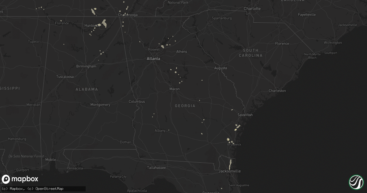
Hail Map in Georgia on July 7, 2022
Get this storm
July 7 map
$229
one time, instant access
Download today. No call, no setup
Keep the $229
Bought the map and want the full workflow? Apply the entire $229 to a subscription within 7 days. None of it is wasted.
Every map, not just this one
This buys you this map. Subscription and you get every map we run, in the markets you choose from a few cities to whole states to nationwide. Plus real-time alerts the moment a storm fires.
Contact data
Name, contact info, occupancy, even credit band for addresses in the footprint. You go from where it hit to who to call.
Become the source they trust
Unlimited branding weather history reports on demand. You already have the documented answer ready for the property owner, and you are the one who showed up with it.
Property data and RoofTrace estimates
Pull up any address you have got, its value and the exact code rules for that jurisdiction, straight from One Click Code. Then RoofTrace estimates the squares, pitch, and roof value, priced the way you price.
Storm reports in Georgia
Georgia
| Date | Description |
|---|---|
| 07/07/20225:05 PM CDT | Metal equipment canopy heavily damaged with the roof torn off and several metal beams bent. Time estimated based on radar. |
| 07/07/20225:05 PM CDT | Em reported damage to a fireworks trailer and shopping cart corral in the parking lot of a walmart in thomson. Public reports relayed from local media also indicate som |
| 07/07/20224:30 PM CDT | Two trees down at apaloosa ln and ivy creek rd |
| 07/07/20224:20 PM CDT | Tree down at tuggle rd and hamilton rd |
| 07/07/20223:20 PM CDT | Tree reported down at hwy 41 and grassdale rd |
| 07/07/20223:00 PM CDT | Several trees downed within an approximately half mile radius of lanier point park |
| 07/07/20222:13 PM CDT | 56 kt gust reported by rmg asos |
| 07/07/20221:24 PM CDT | Tree down at phillips street and warnock pond rd |
| 07/07/20221:24 PM CDT | 4 trees down in the vicinity of phillips street and warnock pond rd |
| 07/07/202212:49 PM CDT | Trees/power lines were reported down at w gwinnett street and whitaker street... W us hwy 80 and talmadge ave... Stiles ave and addie b byers drive... Us hwy 80 and sha |
| 07/07/20223:45 AM CDT | At 845 PM EDT, a severe thunderstorm was located over Haddock, or near Gray, and is nearly stationary. HAZARD...60 mph wind gusts and quarter size hail. SOURCE...Radar indicated. IMPACT...Hail damage to vehicles is expected. Expect wind damage to roofs, siding, and trees. Locations impacted include... Gray, Bradley, Wayside, Browns Crossing, Haddock, Clinton and Jarrell Plantation. |
| 07/07/202212:17 AM CDT | At 516 PM EDT, a severe thunderstorm was located over Sugar Hill, or 8 miles southeast of Cumming, moving southeast at 5 mph. HAZARD...60 mph wind gusts and quarter size hail. SOURCE...Radar indicated. IMPACT...Hail damage to vehicles is expected. Expect wind damage to roofs, siding, and trees. Locations impacted include... Cumming, Sugar Hill, Suwanee, Buford, Braselton, Flowery Branch, Oakwood, Rest Haven, Aqualand Park, Buford Dam-Lake Lanier Parks, Brookwood and Lake Lanier Islands. |
| 07/06/20229:55 PM CDT | At 255 PM EDT, severe thunderstorms were located along a line extending from 13 miles northeast of Toccoa to near Walhalla, moving southeast at 10 mph. New storms could form south of this line and quickly become severe as well. HAZARD...60 mph wind gusts and quarter size hail. SOURCE...Radar indicated. IMPACT...Minor hail damage to vehicles is expected. Expect wind damage to trees and power lines. Locations impacted include... Clemson, Seneca, Walhalla, Central, Westminster, Long Creek, Oakway, Tallulah Gorge State Park and Lake Keowee. |
| 07/06/20229:36 PM CDT | At 236 PM EDT, a severe thunderstorm was located over Hooker, or 7 miles northeast of Trenton, moving southeast at 25 mph. HAZARD...60 mph wind gusts and penny size hail. SOURCE...Radar indicated. IMPACT...Expect damage to roofs, siding, and trees. Locations impacted include... Trenton, Lookout Mountain, Fairview, Stephensville, Chattanooga Valley, New England, Morganville, Hooker, Cloudland Canyon State Park, Cole City, Wildwood and Lakeview. |
| 07/06/20228:25 PM CDT | At 125 PM EDT, a severe thunderstorm was located near Minter, or 10 miles east of Dublin, moving southeast at 10 mph. HAZARD...60 mph wind gusts and penny size hail. SOURCE...Radar indicated. IMPACT...Expect damage to roofs, siding, and trees. Locations impacted include... Soperton, Adrian, Lothair, Orland, Rockledge, Orianna, Blackville, Norristown, Gillis Springs, Scott and Minter. |
All States Impacted by Hail Map on July 7, 2022
Cities Impacted by Hail Map on July 7, 2022
- Shelby, MT
- Somers, MT
- Lakeside, MT
- Kalispell, MT
- Highwood, MT
- Floweree, MT
- Fort Benton, MT
- Upton, WY
- Choteau, MT
- Howes, SD
- Trout Creek, MT
- Almont, ND
- Glen Ullin, ND
- Grover, CO
- Carpenter, WY
- Mud Butte, SD
- Columbia Falls, MT
- Fairfield, MT
- Ten Sleep, WY
- Raynesford, MT
- Geyser, MT
- Meeteetse, WY
- Cody, WY
- Geraldine, MT
- Canyon Creek, MT
- Wise River, MT
- Charlo, MT
- Arlee, MT
- Havre, MT
- Winifred, MT
- Valier, MT
- Union Center, SD
- Dupree, SD
- Faith, SD
- Elliston, MT
- Avon, MT
- Marysville, MT
- Condon, MT
- Belt, MT
- Great Falls, MT
- Reva, SD
- Buffalo, SD
- Newell, SD
- Sunburst, MT
- Whitlash, MT
- Sheridan, WY
- Elgin, ND
- Elmo, MT
- Kila, MT
- Dayton, MT
- Proctor, MT
- Lonepine, MT
- Hot Springs, MT
- Polson, MT
- Big Arm, MT
- Rollins, MT
- White Plains, KY
- Dutton, MT
- Chugwater, WY
- Wheatland, WY
- Cut Bank, MT
- Hilger, MT
- Lewistown, MT
- Browning, MT
- Lincoln, MT
- Enning, SD
- Denton, MT
- Kaycee, WY
- Corvallis, MT
- Stevensville, MT
- Victor, MT
- Missoula, MT
- Mobridge, SD
- Ralph, SD
- Sturgis, SD
- Nemo, SD
- Piedmont, SD
- Wolf Creek, MT
- Tower Hill, IL
- Harrison, NE
- Bynum, MT
- Vaughn, MT
- Power, MT
- Black Eagle, MT
- Sun River, MT
- Fort Shaw, MT
- Elizabethtown, IL
- Herod, IL
- Wakpala, SD
- Bendena, KS
- Troy, KS
- Robinson, KS
- Highland, KS
- Denton, KS
- Jordan, MT
- Fort Peck, MT
- Buffalo Gap, SD
- Jay Em, WY
- Auburn, NE
- Johnson, NE
- Brock, NE
- Gillette, WY
- Chadron, NE
- Whitney, NE
- Clinton, MT
- Florence, MT
- Charleston, MO
- Hendersonville, TN
- Gallatin, TN
- Bonner, MT
- Torrington, WY
- Morrill, NE
- Dawson, NE
- Dalton, NE
- Broadwater, NE
- Merino, CO
- Wright, WY
- Dillon, MT
- Thompson Falls, MT
- Vale, SD
- Snyder, CO
- Hermosa, SD
- Keystone, SD
- Custer, SD
- Hill City, SD
- Rush, CO
- Ordway, CO
- Shawmut, MT
- Melville, MT
- Perryville, KY
- Parksville, KY
- Gravel Switch, KY
- Springfield, KY
- Danville, KY
- Oregon, MO
- Forest City, MO
- Rockham, SD
- Faulkton, SD
- Drummond, MT
- Lexington, TN
- Merriman, NE
- Hugo, CO
- Brunswick, GA
- Kim, CO
- Mcminnville, TN
- Morrison, TN
- Woodbury, TN
- Flowery Branch, GA
- Chattanooga, TN
- Bethpage, TN
- Roebuck, SC
- Pauline, SC
- Model, CO
- Trilla, IL
- Neoga, IL
- Spartanburg, SC
- Cookeville, TN
- Gallant, AL
- Altoona, AL
- Oneonta, AL
- Darden, TN
- Parsons, TN
- Buford, GA
- Suwanee, GA
- Cumming, GA
- Spring Lake, NC
- Fort Bragg, NC
- Pope Army Airfield, NC
- Eatonton, GA
- Watertown, TN
- Brush Creek, TN
- Brentwood, TN
- Raleigh, NC
- Menlo, GA
- Rising Fawn, GA
- Smithville, TN
- Sparta, TN
- Holland, KY
- Scottsville, KY
- Maryville, TN
- Longdale, OK
- Seiling, OK
- Signal Mountain, TN
- Madison, GA
- Newborn, GA
- Ryegate, MT
- Bayard, NE
- Rye, CO
- Colorado City, CO
- Pueblo, CO
- Greenville, KY
- Limon, CO
- Glenallen, MO
- Marble Hill, MO
- Patton, MO
- Rock Island, TN
- Ellington, MO
- Tompkinsville, KY
- Portland, TN
- Seeley Lake, MT
- Dixon, MT
- Whitewater, MO
- Crofton, KY
- Sedan, NM
- Scottsboro, AL
- Woodville, AL
- Hollytree, AL
- Keystone Heights, FL
- Melrose, FL
- Goodlettsville, TN
- White House, TN
- Joelton, TN
- Westmoreland, TN
- Greenbrier, TN
- Cottontown, TN
- Louisville, GA
- Madison, TN
- Old Hickory, TN
- Laceys Spring, AL
- Lead, SD
- Harrisonville, MO
- Lavina, MT
- Edinburg, IL
- Pawnee, IL
- Rochester, IL
- Pritchett, CO
- Las Animas, CO
- Colorado Springs, CO
- Penrose, CO
- Florissant, CO
- Harrisburg, NE
- Gamaliel, KY
- Fountain Run, KY
- Edmonton, KY
- Burkesville, KY
- Greenville, MO
- Marquand, MO
- Easley, SC
- Pickens, SC
- Marietta, SC
- Jansen, NE
- Fairbury, NE
- Summerville, GA
- Gainesville, GA
- Milledgeville, GA
- Thompsons Station, TN
- Franklin, TN
- Fairview, OK
- Tulia, TX
- Monticello, GA
- Mansfield, GA
- Shelbyville, TN
- Bell Buckle, TN
- Enoree, SC
- Gray Court, SC
- Woodruff, SC
- Auburn, KY
- Braselton, GA
- Lebanon, TN
- Ronan, MT
- Hazlehurst, GA
- Currie, NC
- Pleasant Shade, TN
- Walland, TN
- Garnett, KS
- Norris City, IL
- Midway, GA
- Fort Myers, FL
- Pine Bluffs, WY
- Bushnell, NE
- Maitland, MO
- Fillmore, MO
- Reynolds, NE
- Punta Gorda, FL
- Paint Rock, AL
- Gainesboro, TN
- Carthage, TN
- Elmwood, TN
- Poplar Bluff, MO
- Steele, AL
- Rainbow City, AL
- Ashville, AL
- Manchester, TN
- Nancy, KY
- Russell Springs, KY
- Haddock, GA
- Gray, GA
- Helena, MO
- Savannah, MO
- Redfield, SD
- Dimmitt, TX
- Amity, MO
- Rea, MO
- Union Star, MO
- Rosendale, MO
- Cosby, MO
- Maysville, MO
- Springfield, CO
- Branson, CO
- Lyons, CO
- Wray, CO
- Hunnewell, MO
- Emden, MO
- Selma, NC
- Kenly, NC
- Granville, TN
- Buffalo Valley, TN
- Chestnut Mound, TN
- Riddleton, TN
- Campo, CO
- Bowling Green, KY
- Alvaton, KY
- College Grove, TN
- Spring Hill, TN
- Camden, IL
- Littleton, IL
- Plymouth, IL
- Cheyenne, WY
- Haleyville, AL
- Rushville, IL
- Huntsville, IL
- Primm Springs, TN
- Beulah, CO
- Sylvester, GA
- Poulan, GA
- Amsterdam, MO
- Parker, KS
- Centerville, KS
- Kit Carson, CO
- Fort Morgan, CO
- Clayton, NC
- Gurley, AL
- Trenton, AL
- Chaffee, MO
- Owens Cross Roads, AL
- Walsh, CO
- Somerville, AL
- Bethany, IL
- Hestand, KY
- Moss, TN
- Bardwell, KY
- Arlington, KY
- Ellabell, GA
- Silver Point, TN
- Rockledge, GA
- Townsend, GA
- Walsenburg, CO
- Central City, KY
- Drakesboro, KY
- Mahaska, KS
- Hubbell, NE
- Liberty, TN
- Plains, GA
- Fayetteville, TN
- Mulberry, TN
- Flintville, TN
- Genoa, CO
- Manville, WY
- Osawatomie, KS
- Beechmont, KY
- Beech Creek, KY
- Belton, KY
- Powderly, KY
- Browder, KY
- Graham, KY
- Dunlap, TN
- Adamsville, TN
- Maysville, GA
- Morganfield, KY
- Uniontown, KY
- Glendo, WY
- Hortense, GA
- Georgetown, FL
- Crescent City, FL
- Dixon, KY
- Slaughters, KY
- Florence, AL
- Muscle Shoals, AL
- Riceboro, GA
- Whitwell, TN
- Central, SC
- Pendleton, SC
- Saint Ignatius, MT
- Rocky Point, NC
- Castlewood, SD
- Pine Ridge, SD
- Newcastle, WY
- Huntsville, AL
- Essex, MO
- Dexter, MO
- Bethel Springs, TN
- Crawford, TN
- Lane, KS
- Rantoul, KS
- Richmond, KS
- Odenville, AL
- Cave In Rock, IL
- Cleveland, SC
- Lula, GA
- Sequatchie, TN
- Hot Springs, SD
- Washington, KS
- Hanover, KS
- Hollenberg, KS
- Minatare, NE
- Millersville, MO
- Cook, NE
- Princeton, KS
- Parkton, NC
- Lumber Bridge, NC
- Nicholls, GA
- Clarence, MO
- Lentner, MO
- Shelbina, MO
- Cape Girardeau, MO
- Science Hill, KY
- Windsor, KY
- Archie, MO
- Drexel, MO
- Freeman, MO
- Louisburg, KS
- Paola, KS
- Mount Vernon, IN
- Nortonville, KY
- Bridgeport, NE
- Brownsboro, AL
- Oneida, TN
- Lodgepole, NE
- Harrisburg, IL
- Spring City, TN
- Hereford, TX
- Hampstead, NC
- Cartersville, GA
- Russellville, KY
- Adairville, KY
- Franklin, KY
- East Prairie, MO
- Stearns, KY
- Grandview, TN
- Kelso, TN
- Jacksonville, FL
- Yulee, FL
- White Owl, SD
- Prairie City, SD
- Fort Meade, SD
- Casper, WY
- Bigfork, MT
- White Bird, ID
- Grangeville, ID
- Sugar City, CO
- Bowdle, SD
- Roscoe, SD
- Ipswich, SD
- Tulare, SD
- Kyle, SD
- Manderson, SD
- Wall, SD
- Oglala, SD
- Wounded Knee, SD
- Batesland, SD
- Rushville, NE
- Saint Joseph, MO
- Elwood, KS
- Wathena, KS
- Amazonia, MO
- Clarksdale, MO
- King City, MO


