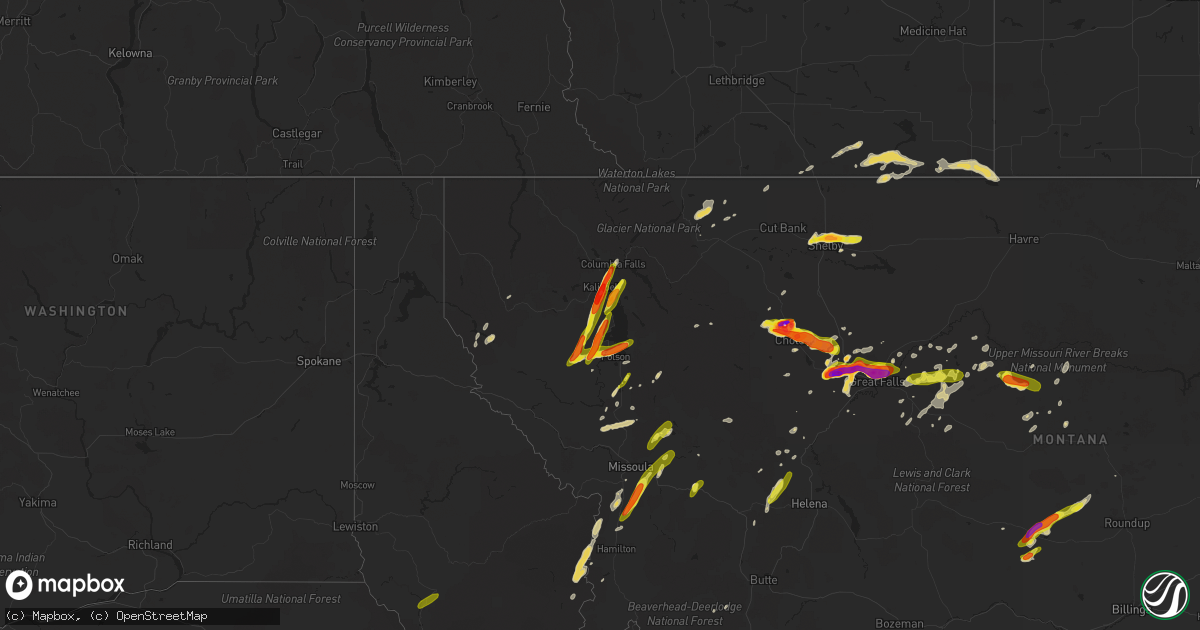
Hail Map on July 7, 2022
Get this storm
July 7 map
$229
one time, instant access
Download today. No call, no setup
Keep the $229
Bought the map and want the full workflow? Apply the entire $229 to a subscription within 7 days. None of it is wasted.
Every map, not just this one
This buys you this map. Subscription and you get every map we run, in the markets you choose from a few cities to whole states to nationwide. Plus real-time alerts the moment a storm fires.
Contact data
Name, contact info, occupancy, even credit band for addresses in the footprint. You go from where it hit to who to call.
Become the source they trust
Unlimited branding weather history reports on demand. You already have the documented answer ready for the property owner, and you are the one who showed up with it.
Property data and RoofTrace estimates
Pull up any address you have got, its value and the exact code rules for that jurisdiction, straight from One Click Code. Then RoofTrace estimates the squares, pitch, and roof value, priced the way you price.
States Impacted by Hail Map on July 7, 2022
Storm reports
North Carolina
| Date | Description |
|---|---|
| 07/07/20226:10 PM CDT | Vinyl siding torn from house in 4800 block of malpass road |
| 07/07/20226:06 PM CDT | Several trees fell over roadway approximately 100 yards east of the highway 421 and malpass road intersection. |
| 07/07/20225:30 PM CDT | Tree down in the glenwood village area damaged power equipment resulting in a power outage. Time estimated by radar. |
| 07/07/20225:30 PM CDT | Tree blown down blocking the roadway along york rd in raleigh. Time estimated by radar. |
| 07/07/20225:25 PM CDT | Multiple trees down near the buckhorn reservoir. Time estimated by radar. |
| 07/07/20225:00 PM CDT | Concentrated... Microburst wind damage... With numerous trees and power lines down... Including four trees on houses. |
| 07/07/20225:00 PM CDT | Tree blown down onto a house. At least partial structure collapse. Time estimated by radar. |
| 07/07/20225:00 PM CDT | Fallen trees or limbs damaged equipment and resulted in 2k customer power outage. Time estimated by radar. |
| 07/07/20224:44 PM CDT | Fallen trees or limbs damaged equipment and resulted in 3k customer power outage first reported at 545 pm. Time of occurrence estimated by radar. |
| 07/07/20224:20 PM CDT | One tree blown down along white daisies ct. Near brookshadow dr. |
| 07/07/20227:15 AM CDT | At 1215 AM EDT, a severe thunderstorm was located near Pleasant Hill, or 12 miles south of Kinston, moving southeast at 25 mph. HAZARD...60 mph wind gusts. SOURCE...Radar indicated. IMPACT...Expect damage to roofs, siding, and trees. Locations impacted include... Jacksonville, Kinston, Half Moon, Phillips Crossroads, Richlands, Deep Run, Maysville, Catherine Lake, Comfort, Potters Hill, Petersburg, Pleasant Hill, Wyse Fork, Albertson, Albert J Ellis Airport, Richlands South, Pink Hill, Loco VFD, Pollocksville and Hargetts Crossroads. |
| 07/07/20223:22 AM CDT | At 821 PM EDT, a severe thunderstorm was located near Uptown Charlotte, or over Freedom Park, and is nearly stationary. HAZARD...60 mph wind gusts and quarter size hail. SOURCE...Radar indicated. IMPACT...Minor hail damage to vehicles is expected. Expect wind damage to trees and power lines. Locations impacted include... Charlotte, Freedom Park, Reedy Creek Park, The Plaza and Charlotte Douglas Airport. |
| 07/07/20223:14 AM CDT | At 814 PM EDT, a severe thunderstorm was located near Smithfield, moving southeast at 10 mph. HAZARD...60 mph wind gusts. SOURCE...Radar indicated. IMPACT...Expect damage to roofs, siding, and trees. Locations impacted include... Goldsboro, Smithfield, Fremont, Micro, Selma, Four Oaks, Pine Level, Princeton, Nahunta and Grantham. |
| 07/07/20222:36 AM CDT | At 735 PM EDT, a severe thunderstorm was located near Clayton, or near Smithfield, moving east at 10 mph. HAZARD...60 mph wind gusts. SOURCE...Radar indicated. IMPACT...Expect damage to roofs, siding, and trees. Locations impacted include... Smithfield, Bailey, Micro, Selma, Four Oaks, Pine Level, Kenly, Princeton, Middlesex and Emit. |
| 07/07/20222:12 AM CDT | At 712 PM EDT, a severe thunderstorm was located 7 miles north of Bailey, or 9 miles southwest of Nashville, moving east at 10 mph. HAZARD...60 mph wind gusts. SOURCE...Radar indicated. IMPACT...Expect damage to roofs, siding, and trees. Locations impacted include... Rocky Mount, Wilson, Elm City, Bailey, Sharpsburg, Spring Hope, Sims, Tar River Reservoir and New Hope. |
| 07/07/20222:08 AM CDT | At 708 PM EDT, a severe thunderstorm was located near Clayton, or 11 miles southeast of Raleigh, moving southeast at 10 mph. HAZARD...60 mph wind gusts. SOURCE...Radar indicated. IMPACT...Expect damage to roofs, siding, and trees. Locations impacted include... Raleigh, Smithfield, Garner, Clayton, Zebulon, Knightdale, Wendell, Coats Crossroads, Flowers and Lake Benson. |
| 07/07/20221:57 AM CDT | At 656 PM EDT, a severe thunderstorm was located over Malpass Corner, or 7 miles southwest of Burgaw, moving northwest at 10 mph. HAZARD...60 mph wind gusts. SOURCE...Radar indicated. IMPACT...Expect wind damage to trees and power lines. Locations impacted include... Penderlea, Point Caswell, Currie, Long Creek, Wards Corner, Montague, Rooks, Malpass Corner and Atkinson. |
| 07/07/20221:28 AM CDT | At 628 PM EDT, a severe thunderstorm was located near Raleigh, moving southeast at 10 mph. HAZARD...60 mph wind gusts and penny size hail. SOURCE...Radar indicated. IMPACT...Expect damage to roofs, siding, and trees. Locations impacted include... Raleigh, Cary, Garner, RDU International, Apex, Morrisville, Lake Wheeler, William B Umstead State Park and Lake Benson. |
| 07/07/20221:22 AM CDT | At 622 PM EDT, a severe thunderstorm was located 10 miles south of Bailey, or 13 miles northeast of Smithfield, moving east at 10 mph. HAZARD...60 mph wind gusts and penny size hail. SOURCE...Radar indicated. IMPACT...Expect damage to roofs, siding, and trees. Locations impacted include... Wilson, Fremont, Micro, Kenly, Lucama, Black Creek, Pikeville, Buckhorn Reservoir and Nahunta. |
| 07/07/202212:46 AM CDT | At 547 PM EDT, a severe thunderstorm was located over Castle Hayne, or 10 miles northwest of Figure Eight Island, moving south at 10 mph. HAZARD...60 mph wind gusts. SOURCE...Radar indicated. IMPACT...Expect wind damage to trees and power lines. Locations impacted include... Ashton, Castle Hayne and Rocky Point. |
| 07/07/202212:42 AM CDT | At 542 PM EDT, a severe thunderstorm was located near Clayton, or 13 miles southeast of Raleigh, moving southeast at 15 mph. HAZARD...60 mph wind gusts. SOURCE...Radar indicated. IMPACT...Expect damage to roofs, siding, and trees. Locations impacted include... Smithfield, Garner, Clayton, Knightdale, Selma, Wendell, Emit, Flowers and Buckhorn Reservoir. |
| 07/07/202212:10 AM CDT | At 510 PM EDT, a severe thunderstorm was located 7 miles northeast of Beautancus, or 7 miles east of Mount Olive, moving east at 15 mph. HAZARD...60 mph wind gusts and penny size hail. SOURCE...Radar indicated. IMPACT...Expect damage to roofs, siding, and trees. Locations impacted include... Seven Springs and Cliffs Of The Neuse State Park. |
| 07/06/20229:14 PM CDT | At 214 PM EDT, a severe thunderstorm was located 10 miles north of Pickens, or near Table Rock State Park, and is nearly stationary. HAZARD...60 mph wind gusts and quarter size hail. SOURCE...Radar indicated. IMPACT...Minor hail damage to vehicles is expected. Expect wind damage to trees and power lines. Locations impacted include... Table Rock State Park, Sunset, Pumpkintown, Dacusville, Sassafras Mountain, Rocky Bottom and Jocassee Gorges. |
| 07/06/20229:04 PM CDT | At 204 PM EDT, a severe thunderstorm was located 13 miles southeast of Brevard, or near Jones Gap State Park, moving southeast at 15 mph. HAZARD...60 mph wind gusts and quarter size hail. SOURCE...Radar indicated. IMPACT...Minor hail damage to vehicles is expected. Expect wind damage to trees and power lines. Locations impacted include... Berea, Travelers Rest, Slater-Marietta, Paris Mountain State Park, Tigerville, Lake Robinson, Pleasant Ridge State Park, Jones Gap State Park, Cherrydale Point and Furman University. |
| 07/06/20228:20 PM CDT | Small tree down on colony drive. |
| 07/06/20227:26 PM CDT | 911 call center and public reported powerlines down in the myers park and park road area |
| 07/06/20227:20 PM CDT | Downed trees reported in the rosewood area. Near rosewood drive and oakland church road. Time estimated by radar. |
| 07/06/20227:05 PM CDT | Two trees down in the hamptonville area. |
Indiana
| Date | Description |
|---|---|
| 07/07/20227:20 AM CDT | At 1219 PM CDT, a severe thunderstorm was located near Winslow, or near Petersburg, moving east at 25 mph. HAZARD...60 mph wind gusts and penny size hail. SOURCE...Radar indicated. IMPACT...Expect damage to roofs, siding, and trees. This severe thunderstorm will remain over mainly rural areas of northeastern Pike County.This includes Interstate 69 in Indiana between Mile Markers 44 and52. |
| 07/06/20229:58 PM CDT | At 258 PM CDT, a severe thunderstorm was located near Corydon, or 8 miles west of Henderson, moving east at 35 mph. HAZARD...60 mph wind gusts and nickel size hail. SOURCE...Radar indicated. IMPACT...Expect damage to roofs, siding, and trees. This severe thunderstorm will be near... Henderson around 315 PM CDT.This includes the following highways... Interstate 69 in Kentucky between Mile Markers 138 and 148. Audubon Parkway between Mile Markers 1 and 6. |
Nebraska
| Date | Description |
|---|---|
| 07/07/20226:12 PM CDT | A local report indicates 1.00 inch wind near 5 WSW CHADRON AIRPORT |
Georgia
| Date | Description |
|---|---|
| 07/07/20225:05 PM CDT | Em reported damage to a fireworks trailer and shopping cart corral in the parking lot of a walmart in thomson. Public reports relayed from local media also indicate som |
| 07/07/20225:05 PM CDT | Metal equipment canopy heavily damaged with the roof torn off and several metal beams bent. Time estimated based on radar. |
| 07/07/20224:30 PM CDT | Two trees down at apaloosa ln and ivy creek rd |
| 07/07/20224:20 PM CDT | Tree down at tuggle rd and hamilton rd |
| 07/07/20223:20 PM CDT | Tree reported down at hwy 41 and grassdale rd |
| 07/07/20223:00 PM CDT | Several trees downed within an approximately half mile radius of lanier point park |
| 07/07/20222:13 PM CDT | 56 kt gust reported by rmg asos |
| 07/07/20221:24 PM CDT | 4 trees down in the vicinity of phillips street and warnock pond rd |
| 07/07/20221:24 PM CDT | Tree down at phillips street and warnock pond rd |
| 07/07/202212:49 PM CDT | Trees/power lines were reported down at w gwinnett street and whitaker street... W us hwy 80 and talmadge ave... Stiles ave and addie b byers drive... Us hwy 80 and sha |
| 07/07/20223:45 AM CDT | At 845 PM EDT, a severe thunderstorm was located over Haddock, or near Gray, and is nearly stationary. HAZARD...60 mph wind gusts and quarter size hail. SOURCE...Radar indicated. IMPACT...Hail damage to vehicles is expected. Expect wind damage to roofs, siding, and trees. Locations impacted include... Gray, Bradley, Wayside, Browns Crossing, Haddock, Clinton and Jarrell Plantation. |
| 07/07/202212:17 AM CDT | At 516 PM EDT, a severe thunderstorm was located over Sugar Hill, or 8 miles southeast of Cumming, moving southeast at 5 mph. HAZARD...60 mph wind gusts and quarter size hail. SOURCE...Radar indicated. IMPACT...Hail damage to vehicles is expected. Expect wind damage to roofs, siding, and trees. Locations impacted include... Cumming, Sugar Hill, Suwanee, Buford, Braselton, Flowery Branch, Oakwood, Rest Haven, Aqualand Park, Buford Dam-Lake Lanier Parks, Brookwood and Lake Lanier Islands. |
| 07/06/20229:55 PM CDT | At 255 PM EDT, severe thunderstorms were located along a line extending from 13 miles northeast of Toccoa to near Walhalla, moving southeast at 10 mph. New storms could form south of this line and quickly become severe as well. HAZARD...60 mph wind gusts and quarter size hail. SOURCE...Radar indicated. IMPACT...Minor hail damage to vehicles is expected. Expect wind damage to trees and power lines. Locations impacted include... Clemson, Seneca, Walhalla, Central, Westminster, Long Creek, Oakway, Tallulah Gorge State Park and Lake Keowee. |
| 07/06/20229:36 PM CDT | At 236 PM EDT, a severe thunderstorm was located over Hooker, or 7 miles northeast of Trenton, moving southeast at 25 mph. HAZARD...60 mph wind gusts and penny size hail. SOURCE...Radar indicated. IMPACT...Expect damage to roofs, siding, and trees. Locations impacted include... Trenton, Lookout Mountain, Fairview, Stephensville, Chattanooga Valley, New England, Morganville, Hooker, Cloudland Canyon State Park, Cole City, Wildwood and Lakeview. |
| 07/06/20228:25 PM CDT | At 125 PM EDT, a severe thunderstorm was located near Minter, or 10 miles east of Dublin, moving southeast at 10 mph. HAZARD...60 mph wind gusts and penny size hail. SOURCE...Radar indicated. IMPACT...Expect damage to roofs, siding, and trees. Locations impacted include... Soperton, Adrian, Lothair, Orland, Rockledge, Orianna, Blackville, Norristown, Gillis Springs, Scott and Minter. |
Washington
| Date | Description |
|---|---|
| 07/07/20227:09 AM CDT | At 1209 AM PDT, a severe thunderstorm was located 10 miles west of Hanford Reservation, or 20 miles northeast of Sunnyside, moving northeast at 40 mph. HAZARD...60 mph wind gusts and quarter size hail. SOURCE...Radar indicated. IMPACT...Hail damage to vehicles is expected. Expect wind damage to roofs, siding, and trees. Locations impacted include... Hanford Reservation. |
Missouri
| Date | Description |
|---|---|
| 07/07/20226:55 PM CDT | 4 large branches broken in penermon and the area sw of town. Time estimated from radar. |
| 07/07/20226:55 PM CDT | Tree snapped 4 feet off of ground at intersection of hwy 114 and hwy kk. Also a lot of small and minor tree damage in essex with smaller branches broken off. Time estim |
| 07/07/20225:24 AM CDT | At 1024 PM CDT, a severe thunderstorm was located over Fillmore, or 11 miles northwest of Savannah, moving east at 20 mph. HAZARD...60 mph wind gusts and quarter size hail. SOURCE...Radar indicated. IMPACT...Hail damage to vehicles is expected. Expect wind damage to roofs, siding, and trees. Locations impacted include... Savannah, Fillmore, Bolckow, Rosendale and Rea. This includes Interstate 29 between mile markers 62 and 72. |
| 07/07/20224:00 AM CDT | Rainbow hills and hunters run area of apache flats had several tree limbs down blocking roads. Trash cans were blown around and public works barricades were blown over. |
| 07/07/20221:48 AM CDT | At 647 PM CDT, a severe thunderstorm was located near Essex, or 7 miles east of Dexter, moving south at 5 mph. HAZARD...60 mph wind gusts and quarter size hail. SOURCE...Radar indicated. IMPACT...Hail damage to vehicles is expected. Expect wind damage to roofs, siding, and trees. This severe thunderstorm will remain over mainly rural areas of southeastern Stoddard County, including the following locations... Essex, Baker and Penermon. |
| 07/07/20221:45 AM CDT | Moniteau county sheriffs office called with reports from tipton... Mo of trees and power lines down damaging vehicles and houses. Along ferguson avenue... There was a s |
| 07/07/202212:54 AM CDT | Power lines down. |
| 07/07/202212:50 AM CDT | A local report indicates 60 MPH wind near KINGSTON |
| 07/07/202212:39 AM CDT | A local report indicates 61 MPH wind near 2 SE CAMERON |
| 07/07/202212:25 AM CDT | A local report indicates 60 MPH wind near MAYSVILLE |
| 07/06/202211:49 PM CDT | 59 mph wind gust measured at stj asos. |
| 07/06/202211:24 PM CDT | At 424 PM CDT, a severe thunderstorm was located near Marble Hill, moving northeast at 10 mph. HAZARD...60 mph wind gusts and nickel size hail. SOURCE...Radar indicated. IMPACT...Expect damage to roofs, siding, and trees. Locations impacted include... Bollinger Mill State Historic Site, Burfordville and Millersville. |
| 07/06/202210:36 PM CDT | At 336 AM CDT, a severe thunderstorm was located over Bethany, moving east at 45 mph. HAZARD...60 mph wind gusts. SOURCE...Radar indicated. IMPACT...Expect damage to roofs, siding, and trees. Locations impacted include... Bethany, Princeton, Ridgeway, Gilman City, Mercer, Eagleville, Cainsville, Spickard, Blythedale, Mount Moriah, Tindall, Brimson, Modena, Hatfield, Mill Grove and Martinsville.This includes Interstate 35 in Missouri between mile markers 83 and113. |
| 07/06/20229:49 PM CDT | At 249 PM CDT, a severe thunderstorm was located 7 miles south of Ware, or 8 miles southeast of Trail Of Tears State Park, moving southeast at 5 mph. HAZARD...60 mph wind gusts and quarter size hail. SOURCE...Radar indicated. IMPACT...Hail damage to vehicles is expected. Expect wind damage to roofs, siding, and trees. This severe thunderstorm will remain over mainly rural areas of southwestern Union, northwestern Alexander and east central Cape Girardeau Counties, including the following locations... Mill Creek. |
| 07/06/20229:27 PM CDT | At 226 PM CDT, a severe thunderstorm was located near Milltown, or near Poplar Bluff, and is nearly stationary. HAZARD...60 mph wind gusts and penny size hail. SOURCE...Radar indicated. IMPACT...Expect damage to roofs, siding, and trees. Locations impacted include... Milltown. |
| 07/06/20229:09 PM CDT | At 209 PM CDT, a severe thunderstorm was located 7 miles north of Garwood, moving southeast at 10 mph. HAZARD...60 mph wind gusts and quarter size hail. SOURCE...Radar indicated. IMPACT...Hail damage to vehicles is expected. Expect wind damage to roofs, siding, and trees. Locations impacted include... Garwood.This also includes Clearwater Lake Recreational Area. |
Kentucky
| Date | Description |
|---|---|
| 07/07/20225:19 PM CDT | Couple of trees down north of russellville near highway 431. |
| 07/07/20224:20 PM CDT | Multiple trees down in the strunk area. |
| 07/07/20224:20 PM CDT | Tree down in the luzerne area across hwy 601. Time estimated from radar. |
| 07/07/20222:20 PM CDT | Power lines reported down on the west side of tompkinsville. Time estimated from radar. |
| 07/07/202212:43 AM CDT | At 543 PM EDT, a severe thunderstorm was located over Cains Store, or 13 miles west of Somerset, moving south at 10 mph. HAZARD...60 mph wind gusts and quarter size hail. SOURCE...Radar indicated. IMPACT...Hail damage to vehicles is expected. Expect wind damage to roofs, siding, and trees. This severe thunderstorm will be near... Faubush around 600 PM EDT.Other locations in the path of this severe thunderstorm includeNaomi. |
| 07/07/202212:01 AM CDT | At 501 PM EDT, a severe thunderstorm was located over Stearns, or over Whitley City, moving southeast at 15 mph. HAZARD...60 mph wind gusts and quarter size hail. SOURCE...Radar indicated. IMPACT...Hail damage to vehicles is expected. Expect wind damage to roofs, siding, and trees. This severe thunderstorm will be near... Pine Knot around 510 PM EDT. Strunk around 520 PM EDT.Other locations in the path of this severe thunderstorm includeHollyhill. |
| 07/06/202211:43 PM CDT | At 443 PM CDT, severe thunderstorms were located along a line extending from 8 miles northeast of Dunmor to 9 miles east of Crofton, moving southeast at 15 mph. HAZARD...60 mph wind gusts and penny size hail. SOURCE...Radar indicated. IMPACT...Expect damage to roofs, siding, and trees. These severe thunderstorms will remain over mainly rural areas of northwestern Logan and southwestern Butler Counties, including the following locations... Justice, Insco, Huntsville, Dimple, Spa, Epleys, Leetown, Wolf Lick, Everett and Crossroad. |
| 07/06/202211:41 PM CDT | At 441 PM CDT, a severe thunderstorm was located 7 miles south of Weir, or 16 miles northwest of Elkton, moving southeast at 15 mph. HAZARD...60 mph wind gusts and penny size hail. SOURCE...Radar indicated. IMPACT...Expect damage to roofs, siding, and trees. This severe thunderstorm will remain over mainly rural areas of south central Muhlenberg, east central Christian and northern Todd Counties, including the following locations... Clifty and Allegre. |
| 07/06/202211:19 PM CDT | At 419 PM CDT, a severe thunderstorm was located near Powderly, or 9 miles south of Central City, moving southeast at 15 mph. HAZARD...60 mph wind gusts and penny size hail. SOURCE...Emergency management reported two trees down in Greenville Kentucky at 414 pm CDT. IMPACT...Expect damage to roofs, siding, and trees. Locations impacted include... Dunmor. |
Colorado
| Date | Description |
|---|---|
| 07/07/20223:10 AM CDT | At 809 PM MDT, a severe thunderstorm was located 10 miles northeast of Greenhorn Mountain, or 16 miles southeast of Junkins Burn Scar, moving northeast at 5 mph. HAZARD...60 mph wind gusts and half dollar size hail. SOURCE...Radar indicated. IMPACT...Hail damage to vehicles is expected. Expect wind damage to roofs, siding, and trees. This severe thunderstorm will remain over mainly rural areas of southwestern Pueblo County, including the following locations... Colorado City. |
| 07/07/202212:02 AM CDT | At 502 PM MDT, severe thunderstorms were located along a line extending from 3 miles west of Punkin Center to 9 miles south of Forder, or along a line extending from 28 miles south of Limon to 39 miles north of North La Junta, moving east at 15 mph. HAZARD...60 mph wind gusts and quarter size hail. SOURCE...Radar indicated. IMPACT...Expect damage to roofs, siding, and trees. Hail damage to vehicles is expected. These severe thunderstorms will remain over mainly rural areas of southwestern Lincoln County. |
| 07/06/202211:59 PM CDT | At 459 PM MDT, a severe thunderstorm was located 10 miles south of Forder, or 38 miles north of La Junta, moving southeast at 20 mph. HAZARD...60 mph wind gusts and quarter size hail. SOURCE...Radar indicated. IMPACT...Hail damage to vehicles is expected. Expect wind damage to roofs, siding, and trees. This severe thunderstorm will remain over mainly rural areas of northeastern Crowley County. |
| 07/06/202211:33 PM CDT | At 433 PM MDT, a severe thunderstorm was located 10 miles west of Forder, or 41 miles south of Limon, moving east at 20 mph. HAZARD...60 mph wind gusts and quarter size hail. SOURCE...Radar indicated. IMPACT...Expect damage to roofs, siding, and trees. Hail damage to vehicles is expected. Locations impacted include... Forder. |
| 07/06/202210:39 PM CDT | At 339 PM MDT, a severe thunderstorm was located 13 miles northeast of Pawnee Buttes, or 21 miles south of Kimball, moving east at 20 mph. HAZARD...60 mph wind gusts. SOURCE...Radar indicated. IMPACT...Expect damage to roofs, siding, and trees. Locations impacted include... Westplains. |
| 07/06/202210:36 PM CDT | At 336 PM MDT, a severe thunderstorm was located near Antelope Springs, or 10 miles north of Fort Morgan, moving east at 20 mph. HAZARD...60 mph wind gusts and quarter size hail. SOURCE...Radar indicated. IMPACT...Expect damage to roofs, siding, and trees. Hail damage to vehicles is expected. Locations impacted include... Snyder and Hillrose. |
South Carolina
| Date | Description |
|---|---|
| 07/07/20226:57 PM CDT | Highway patrol reported the roadway blocked by a downed tree at cromer road and autumn oaks lane. |
| 07/07/20226:57 PM CDT | Highway patrol reported a tree in the roadway at cromer road and mineral springs road. |
| 07/07/20226:38 PM CDT | Report from mping of large limbs down just north northwest of pelion. |
| 07/07/20226:20 PM CDT | Sheriff dispatch reported trees down near the intersection of surrey race road and salley road. |
| 07/07/20226:11 PM CDT | Sheriff dispatch reported trees down along valley road near oak street nw. |
| 07/07/20226:11 PM CDT | Highway patrol reported a tree in the roadway at evans road in the city of aiken. |
| 07/07/20226:10 PM CDT | Sheriff dispatch reported trees down along wrights mill road near main drive. |
| 07/07/20226:01 PM CDT | Sheriff dispatch reported trees down near the intersection of new bridge road and twin creek farm road. |
| 07/07/20225:56 PM CDT | Highway patrol reported a tree in the roadway at the intersection of atomic road and double springs road. |
| 07/07/20225:56 PM CDT | Report of tree down on a p nivens st. Time estimated based on radar. |
| 07/07/20225:52 PM CDT | Sheriff dispatch reported trees down along edgefield road near sterling drive in the town of belvedere. |
| 07/07/20225:50 PM CDT | Sheriff dispatch reported treed down near the intersection of silver bluff road and foreman road. |
| 07/07/20225:45 PM CDT | Sheriff dispatch reported trees and power lines down along a p nivens street near gregg street in graniteville. |
| 07/07/20225:34 PM CDT | Sheriff dispatch reported trees down on evans street in the town of edgefield. |
| 07/07/20225:26 PM CDT | Sheriff dispatch reported trees and power lines down at the intersection of hwy. 23 and key road between the towns of edgefield and modoc. |
| 07/07/20225:19 PM CDT | Tree down across prices mill rd. Time estimated based on radar. |
| 07/07/20225:14 PM CDT | Tree down across roadway near the intersection of hwy 378 w and ghilcrist rd. Time estimated based on radar. |
| 07/07/20225:05 PM CDT | Tree down across roadway near the intersection of liberty hill rd and harmony rd. Time estimated based on radar. |
| 07/07/20224:55 PM CDT | Tree down across upper mill rd. Time estimated based on radar. |
| 07/07/20224:55 PM CDT | Highway patrol reported a tree blocking the roadway at the intersection of hwy. 378 and liberty hill road. |
| 07/07/20224:53 PM CDT | Tree down across whitetown rd near stevens creek. Time estimated based on radar. |
| 07/07/20224:51 PM CDT | Tree and power line down across roadway. Time estimated based on radar. |
| 07/07/20224:51 PM CDT | Tree down across chestnut ridge rd. Time estimated based on radar. |
| 07/07/20224:48 PM CDT | Tree down on power line near the intersection of troy west rd and s mine st. |
| 07/07/20224:48 PM CDT | Sheriff dispatch reported a tree down across whitetown road near the town of mccormick. |
| 07/07/20223:10 PM CDT | A couple of trees down on the southeast side of spartanburg. |
| 07/07/20221:30 PM CDT | Several trees down in northern greenville county. |
| 07/07/20221:15 PM CDT | 911 call center reported large tree blocking roadway on hwy 8 |
| 07/07/20221:10 PM CDT | 911 call center reported a large tree blocking roadway near hwy 11 |
| 07/07/20221:08 PM CDT | Tree down on house. |
| 07/07/20225:12 AM CDT | At 1012 PM EDT, a severe thunderstorm was located near Bennettsville, moving east at 30 mph. HAZARD...60 mph wind gusts and penny size hail. SOURCE...Radar indicated. IMPACT...Expect wind damage to trees and power lines. Locations impacted include... Bennettsville, Chavistown, Wallace and Gibson. |
| 07/07/20224:52 AM CDT | At 952 PM EDT, a severe thunderstorm was located near Chesterfield, or 15 miles south of Wadesboro, moving east at 55 mph. HAZARD...60 mph wind gusts. SOURCE...Radar indicated. IMPACT...Expect damage to trees and powerlines. Locations impacted include... Cheraw, Chesterfield, Carolina Sandhills Wildlife Refuge, Cheraw State Park, Northeastern Technical College, Cheraw Municipal Airport, Ruby, Patrick, Mount Croghan, Chesterfield Ruby Middle School, Cheraw Fish Hatchery, Alligator Fire Station, Middendorf, Bay Springs Fire Station and Chesterfield Detention Center. |
| 07/07/20223:11 AM CDT | At 810 PM EDT, a severe thunderstorm was located over St. Andrews, moving north at 20 mph. HAZARD...60 mph wind gusts. SOURCE...Radar indicated. IMPACT...Expect damage to trees and powerlines. Locations impacted include... Columbia, Lexington, West Columbia, Cayce, Irmo, Forest Acres, Winnsboro, Springdale, St. Andrews, Highway 6 at Lake Murray Dam, Dentsville, Oak Grove, Arcadia Lakes, Fairfield County Airport, Villages at Sandhill, Columbia International University, Killian, Harbison State Forest, Riverbanks Zoo and Woodfield.This includes the following highways... Interstate 126 between mile markers 0 and 3. Interstate 20 in South Carolina between mile markers 58 and 77. Interstate 26 between mile markers 96 and 114. Interstate 77 between mile markers 2 and 6, and between mile markers9 and 37. |
| 07/07/20222:37 AM CDT | At 736 PM EDT, a severe thunderstorm was located near Red Bank, moving northeast at 25 mph. HAZARD...60 mph wind gusts. SOURCE...Radar indicated. IMPACT...Expect damage to trees and powerlines. Locations impacted include... Columbia, Lexington, West Columbia, Cayce, Irmo, Forest Acres, Batesburg-Leesville, Springdale, St. Andrews, Oak Grove, Highway 6 at Lake Murray Dam, Red Bank, Dentsville, South Congaree, Pine Ridge, Gaston, Arcadia Lakes, Columbia International University, Harbison State Forest and SC State Fair Grounds.This includes the following highways... Interstate 126 between mile markers 0 and 3. Interstate 20 in South Carolina between mile markers 38 and 72. Interstate 26 between mile markers 100 and 129. Interstate 77 between mile markers 0 and 13. |
| 07/07/20222:17 AM CDT | At 717 PM EDT, a severe thunderstorm was located 7 miles south of Uptown Charlotte, or near Pineville, and is nearly stationary. It will eventually drift slowly to the east. HAZARD...60 mph wind gusts and quarter size hail. SOURCE...Radar indicated. IMPACT...Minor hail damage to vehicles is expected. Expect wind damage to trees and power lines. Locations impacted include... South Charlotte, Matthews, Weddington, Pineville, The Arboretum, Southpark Mall, Stallings, Mint Hill and Indian Trail. |
| 07/07/20221:58 AM CDT | At 657 PM EDT, a severe thunderstorm was located 8 miles east of Aiken State Park, or 19 miles northwest of Denmark, moving east at 20 mph. HAZARD...60 mph wind gusts and penny size hail. SOURCE...Radar indicated. IMPACT...Expect damage to trees and powerlines. Locations impacted include... Williston, Blackville, North, Springfield, Neeses, Norway, Elko, Woodford, Livingston and Edisto. |
| 07/07/20221:25 AM CDT | At 624 PM EDT, severe thunderstorms were located along a line extending from near Saluda County Airport to near Thomson, moving southeast at 20 mph. Additional widespread strong to severe thunderstorms are developing ahead of the line of storms. HAZARD...60 mph wind gusts. SOURCE...McCormick County Emergency management reported trees down. IMPACT...Expect damage to trees and powerlines. Locations impacted include... Aiken, North Augusta, Grovetown, Evans, Thomson, Batesburg-Leesville, Fort Gordon, Augusta, Clearwater, Martinez, Aiken Mall, Belvedere, Edgefield, Hephzibah, Harlem, Johnston, New Ellenton, Jackson, Ridge Spring and Glendale.This includes the following highways... Interstate 20 in Georgia between mile markers 170 and 201. Interstate 20 in South Carolina between mile markers 0 and 42. Interstate 520 in Georgia between mile markers 1 and 15. Interstate 520 in South Carolina between mile markers 16 and 23. |
| 07/07/202212:44 AM CDT | At 543 PM EDT, severe thunderstorms were located along a line extending from 7 miles northeast of Troy to Lincolnton, moving southeast at 20 mph. HAZARD...60 mph wind gusts. SOURCE...Radar indicated. IMPACT...Expect damage to trees and powerlines. Locations impacted include... Edgefield, McCormick, Johnston, Lincolnton, Appling, Clarks Hill Recreation Area, Elijah Clark State Park, Mistletoe State Park, Hamilton Branch State Park, J. Strom Thurmond Dam, Mccormick County Airport, Parksville, Plum Branch, Bordeaux, Scott's Landing, Northside Fire Station Main, Knox Scout Reservation, Double Branches, Wildwood Park and Cleora.This includes Interstate 20 in Georgia between mile markers 180 and183. |
| 07/06/202211:05 PM CDT | At 405 PM EDT, a severe thunderstorm was located 4 miles south of Spartanburg, or near Cedar Springs, and is nearly stationary. HAZARD...60 mph wind gusts and quarter size hail. SOURCE...Radar indicated. IMPACT...Minor hail damage to vehicles is expected. Expect wind damage to trees and power lines. Locations impacted include... Spartanburg, Pacolet, Roebuck, Pacolet Mills, Croft State Park, Cedar Springs and Pauline. |
| 07/06/202210:58 PM CDT | At 358 PM EDT, a severe thunderstorm was located 12 miles northeast of Laurens, or 10 miles southeast of Woodruff, and is nearly stationary. HAZARD...60 mph wind gusts and quarter size hail. SOURCE...Radar indicated. IMPACT...Minor hail damage to vehicles is expected. Expect wind damage to trees and power lines. Locations impacted include... Cross Keys, Sedalia, Enoree, Cross Anchor, Ora and Clinton. |
| 07/06/20229:48 PM CDT | At 248 PM EDT, a severe thunderstorm was located 7 miles north of Downtown Greenville, or near Paris Mountain State Park, and is nearly stationary, but should eventually drift slowly south or southeast. HAZARD...60 mph wind gusts and quarter size hail. SOURCE...Radar indicated. IMPACT...Minor hail damage to vehicles is expected. Expect wind damage to trees and power lines. Locations impacted include... Greenville, Greer, Taylors, Travelers Rest, Paris Mountain State Park, Lake Robinson, Cherrydale Point and Furman University. |
| 07/06/20227:48 PM CDT | Highway patrol reported a tree in the roadway along broad river road near i-26 and exit 97. |
| 07/06/20227:45 PM CDT | Tree in roadway along broad river rd near i-26 exit 97. |
| 07/06/20227:40 PM CDT | Tree on power line along barger cir. |
| 07/06/20227:35 PM CDT | Tree in roadway along e. Buchanan dr. |
| 07/06/20227:27 PM CDT | Public reported via social media a tree down on brentwood drive. |
| 07/06/20227:19 PM CDT | Tree in roadway along pine belt rd. |
| 07/06/20227:18 PM CDT | Tree in roadway along clement rd. |
| 07/06/20227:15 PM CDT | Richland county em reported power lines fell on a residence in columbia. |
Florida
| Date | Description |
|---|---|
| 07/07/20224:00 PM CDT | Tree fell down onto power lines. |
Kansas
| Date | Description |
|---|---|
| 07/07/20226:25 AM CDT | At 1125 PM CDT, severe thunderstorms were located along a line extending from near Amazonia to near Troy to 8 miles southeast of Highland to near Denton, moving east at 25 mph. HAZARD...60 mph wind gusts and nickel size hail. SOURCE...Radar indicated. IMPACT...Expect damage to roofs, siding, and trees. Locations impacted include... St. Joseph, Savannah, Wathena, Elwood, Troy, Country Club Villa, Country Club, Agency, Amazonia, Denton, Doniphan, Easton, Cosby, Severance, St. Joseph Airport, Faucett, Bendena, Helena and Fanning.This includes the following highways... Interstate 29 between mile markers 35 and 66. Interstate 229 between mile markers 0 and 14. |
| 07/07/20226:11 AM CDT | At 1111 PM CDT, a severe thunderstorm was located over Hanover, moving southeast at 30 mph. HAZARD...60 mph wind gusts and penny size hail. SOURCE...Radar indicated. IMPACT...Expect damage to roofs, siding, and trees. This severe thunderstorm will be near... Bremen around 1120 PM CDT. Marysville around 1135 PM CDT. |
| 07/06/20229:07 PM CDT | At 206 AM CDT, severe thunderstorms were located along a line extending from near Shenandoah to near Skidmore to near Nortonville, moving northeast at 50 mph. HAZARD...60 mph wind gusts and nickel size hail. SOURCE...Radar indicated. IMPACT...Expect damage to roofs, siding, and trees. Locations impacted include... St. Joseph, Maryville, Savannah, Albany, Tarkio, Wathena, Elwood, Stanberry, Mound City, Maysville, Highland, Troy, Country Club Villa, Country Club, King City, Grant City, Oregon, Stewartsville, Fairfax and Burlington Junction.This includes the following highways... Interstate 29 between mile markers 44 and 93. Interstate 229 between mile markers 2 and 14. |
Idaho
| Date | Description |
|---|---|
| 07/07/20222:59 AM CDT | At 759 PM PDT, a severe thunderstorm was located near Grangeville, moving northeast at 25 mph. HAZARD...60 mph wind gusts and quarter size hail. SOURCE...Radar indicated. IMPACT...Hail damage to vehicles is expected. Expect wind damage to roofs, siding, and trees. Locations impacted include... Grangeville. |
| 07/06/202210:05 PM CDT | A local report indicates 1.00 inch wind near 2 SSW GRANGEVILLE |
Illinois
| Date | Description |
|---|---|
| 07/06/20228:52 PM CDT | At 152 PM CDT, a severe thunderstorm was located near Norris City, or 9 miles south of Carmi, moving southeast at 20 mph. HAZARD...60 mph wind gusts and penny size hail. SOURCE...Radar indicated. IMPACT...Expect damage to roofs, siding, and trees. This severe thunderstorm will remain over mainly rural areas of southern White County. |
Maryland
| Date | Description |
|---|---|
| 07/07/20227:25 AM CDT | At 1225 AM EDT, a severe thunderstorm was located over Dale City, moving southeast at 20 mph. HAZARD...60 mph wind gusts. SOURCE...Radar indicated. IMPACT...Damaging winds will cause some trees and large branches to fall. This could injure those outdoors, as well as damage homes and vehicles. Roadways may become blocked by downed trees. Localized power outages are possible. Unsecured light objects may become projectiles. Locations impacted include... Waldorf, Dale City, La Plata, Woodbridge, Quantico, Nanjemoy Creek, Port Tobacco River, Lake Ridge, Montclair, Triangle, Dumfries, Saint Charles, Cherry Hill, Independent Hill, Bryans Road, Mason Neck, Potomac Heights, Pomfret, Port Tobacco Village and Ironsides. |
Alabama
| Date | Description |
|---|---|
| 07/06/202211:21 PM CDT | At 421 PM CDT, a severe thunderstorm was located near Fayetteville, moving southeast at 15 mph. HAZARD...60 mph wind gusts and penny size hail. SOURCE...Radar indicated. IMPACT...Expect damage to roofs, siding, and trees. Locations impacted include... Fayetteville, Lincoln, Mulberry, Belleville, Elora, Hurdlow, Mimosa, Booneville, Marble Hill and Skinem. |
| 07/06/20229:11 PM CDT | At 211 PM EDT/111 PM CDT/, a severe thunderstorm was located near Jasper, moving southeast at 15 mph. HAZARD...60 mph wind gusts and penny size hail. SOURCE...Radar indicated. IMPACT...Expect damage to roofs, siding, and trees. Locations impacted include... Chattanooga, Jasper, Rossville, South Pittsburg, Whitwell, Kimball, Powells Crossroads, Martin Springs, Lookout Mountain and Lakeview. |
Oklahoma
| Date | Description |
|---|---|
| 07/07/20222:07 AM CDT | At 706 PM CDT, a severe thunderstorm was located 8 miles east of Orion, moving east at 15 mph. HAZARD...60 mph wind gusts and quarter size hail. SOURCE...Radar indicated. IMPACT...Hail damage to vehicles is expected. Expect wind damage to roofs, siding, and trees. Locations impacted include... Fairview, Cleo Springs, Isabella and Orienta. |
| 07/07/20221:24 AM CDT | At 623 PM CDT, a severe thunderstorm was located near Canton Lake, moving northeast at 20 mph. HAZARD...60 mph wind gusts. SOURCE...Radar indicated. IMPACT...Expect damage to roofs, siding, and trees. Locations impacted include... Fairview, Canton, Cleo Springs, Longdale, Canton Lake, Orienta and Isabella. |
| 07/07/20221:15 AM CDT | At 614 PM CDT, a severe thunderstorm was located 6 miles west of Weatherford, moving northeast at 10 mph. HAZARD...60 mph wind gusts. SOURCE...Radar indicated. IMPACT...Expect damage to roofs, siding, and trees. Locations impacted include... Weatherford. |
Montana
| Date | Description |
|---|---|
| 07/07/20226:50 PM CDT | Pictures submitted of large hail in black eagle. |
| 07/07/20226:49 PM CDT | Photos submitted of nearly 2 inch hail. |
| 07/07/20226:48 PM CDT | Several photos from members of public of 2 inch hail in the riverview area. |
| 07/07/20226:48 PM CDT | Photos submitted of large hail in nw great falls. |
| 07/07/20226:48 PM CDT | Updated report to increase hail size based on new photos. Previous report. Several photos from members of public of 2 inch hail in the riverview area. |
| 07/07/20226:45 PM CDT | Hail estimated via photo. |
| 07/07/20226:45 PM CDT | A local report indicates 1.75 inch wind near 1 N BLACK EAGLE |
| 07/07/20226:26 PM CDT | Report from mping: hen egg |
| 07/07/20226:24 PM CDT | A local report indicates 2.00 inch wind near 3 NE SUN PRAIRIE |
| 07/07/20226:18 PM CDT | A local report indicates 1.00 inch wind near 15 ENE MELVILLE |
| 07/07/20226:06 PM CDT | Storm chaser submitted photos of very large hail along interstate 15. Largest stone measured was 2.25 inches. Traffic on interstate 15 was brought to a halt. Hail laste |
| 07/07/20226:06 PM CDT | Report from mping: quarter |
| 07/07/20226:05 PM CDT | A local report indicates 1.50 inch wind near 3 NNW VAUGHN |
| 07/07/20226:05 PM CDT | Corrects previous hail report from 3 nnw vaughn. |
| 07/07/20225:42 PM CDT | Corrects previous hail time of report from 3 nw sun river. Report from mping: hen egg |
| 07/07/20225:38 PM CDT | Time of occurrence estimated from radar. |
| 07/07/20225:32 PM CDT | Spotter reported 3.25 inch hail near sun river. Photos from the area submitted by general public appear to verify this report. |
| 07/07/20225:30 PM CDT | Near welker farms... Just ne of shelby. Golf ball-sized hail. Damaged crops. |
| 07/07/20225:25 PM CDT | A local report indicates 1.00 inch wind near 3 NW SUN RIVER |
| 07/07/20225:11 PM CDT | Largest hailstone was 1 inch... Most were nickel-sized. |
| 07/07/20224:59 PM CDT | Report from mping: ping pong ball |
| 07/07/20224:56 PM CDT | Reported half inch to three-quarters inch hail... Some slightly larger. |
| 07/07/20224:48 PM CDT | Report from mping: golf ball |
| 07/07/20224:45 PM CDT | Hail stones were bouncing several feet off of the ground. |
| 07/07/20224:42 PM CDT | Location and time estimated. |
| 07/07/20224:18 PM CDT | Began with golf ball size hail... But has increased to baseballs. |
| 07/07/20224:15 PM CDT | Report from mping: golf ball |
| 07/07/20224:12 PM CDT | Report from mping: ping pong ball |
| 07/07/20223:24 PM CDT | Measured at lj johnson farms via ambient weather. Temp dropped from 75 degrees to 55 degrees with passage of storm. |
| 07/07/20224:35 AM CDT | At 935 PM MDT, a severe thunderstorm was located near Columbia Falls, or near Evergreen, moving north at 25 mph. HAZARD...Golf ball size hail and 60 mph wind gusts. SOURCE...Radar indicated. IMPACT...People and animals outdoors will be injured. Expect hail damage to roofs, siding, windows, and vehicles. Expect wind damage to roofs, siding, and trees. Locations impacted include... Kalispell, Evergreen, Columbia Falls, West Glacier, Apgar, Martin City, Coram, Hungry Horse and La Salle. |
| 07/07/20224:25 AM CDT | At 925 PM MDT, a severe thunderstorm was located near Big Arm, or 11 miles northwest of Polson, moving northeast at 25 mph. HAZARD...Golf ball size hail and 60 mph wind gusts. SOURCE...Radar indicated. IMPACT...People and animals outdoors will be injured. Expect hail damage to roofs, siding, windows, and vehicles. Expect wind damage to roofs, siding, and trees. Locations impacted include... Big Arm, Proctor, Lakeside, Lake Mary Ronan, Elmo, Rollins and Dayton. |
| 07/07/20224:12 AM CDT | At 912 PM MDT, a severe thunderstorm was located over Kalispell, moving north at 25 mph. HAZARD...Ping pong ball size hail and 60 mph wind gusts. SOURCE...Radar indicated. IMPACT...People and animals outdoors will be injured. Expect hail damage to roofs, siding, windows, and vehicles. Expect wind damage to roofs, siding, and trees. Locations impacted include... Kalispell, Evergreen, Whitefish, Columbia Falls, La Salle and Somers. |
| 07/07/20224:09 AM CDT | At 908 PM MDT, severe thunderstorms were located along a line extending from 10 miles north of Belt to near Highwood to 16 miles west of Geraldine to near Geyser, moving northeast at 30 mph. HAZARD...Quarter size hail. SOURCE...Radar indicated. IMPACT...Damage to vehicles is expected. Locations impacted include... Fort Benton, Geraldine, Highwood, Geyser, Shonkin and Square Butte. |
| 07/07/20224:02 AM CDT | At 902 PM MDT, a severe thunderstorm was located 11 miles southwest of Big Arm, or 13 miles west of Polson, moving northeast at 25 mph. HAZARD...Golf ball size hail and 60 mph wind gusts. SOURCE...Radar indicated. IMPACT...People and animals outdoors will be injured. Expect hail damage to roofs, siding, windows, and vehicles. Expect wind damage to roofs, siding, and trees. Locations impacted include... Big Arm and Elmo. |
| 07/07/20223:51 AM CDT | At 851 PM MDT, a severe thunderstorm was located 12 miles south of Kalispell, moving north at 25 mph. HAZARD...60 mph wind gusts and quarter size hail. SOURCE...Radar indicated. IMPACT...Hail damage to vehicles is expected. Expect wind damage to roofs, siding, and trees. Locations impacted include... Kalispell, Evergreen, Kila and Somers. |
| 07/07/20223:49 AM CDT | At 848 PM MDT, severe thunderstorms were located along a line extending from 12 miles east of Black Eagle to near Belt to 10 miles west of Geyser, moving northeast at 20 mph. HAZARD...Quarter size hail. SOURCE...Radar indicated. IMPACT...Damage to vehicles is expected. Locations impacted include... Belt, Highwood, Raynesford and Armington. |
| 07/07/20223:40 AM CDT | At 839 PM MDT, a severe thunderstorm was located near Fort Shaw, or 22 miles southeast of Choteau, moving northeast at 20 mph. HAZARD...Quarter size hail. SOURCE...Radar indicated. IMPACT...Damage to vehicles is expected. Locations impacted include... Power. |
| 07/07/20223:33 AM CDT | At 832 PM MDT, a severe thunderstorm was located 9 miles west of Seeley Lake, or 24 miles northeast of Missoula, moving northeast at 25 mph. HAZARD...60 mph wind gusts and quarter size hail. SOURCE...Radar indicated. IMPACT...Hail damage to vehicles is expected. Expect wind damage to roofs, siding, and trees. Locations impacted include... Seeley Lake. |
| 07/07/20223:24 AM CDT | At 823 PM MDT, severe thunderstorms were located along a line extending from 17 miles southeast of Belt to 8 miles south of Geyser to near Stanford, moving northeast at 20 mph. HAZARD...Quarter size hail. SOURCE...Radar indicated. IMPACT...Damage to vehicles is expected. Locations impacted include... Stanford, Denton, Geyser and Coffee Creek. |
| 07/07/20223:17 AM CDT | At 816 PM MDT, a severe thunderstorm was located 9 miles east of Fort Shaw, or 14 miles west of Great Falls, moving northeast at 30 mph. HAZARD...Half dollar size hail. SOURCE...Radar indicated. IMPACT...Damage to vehicles is expected. Locations impacted include... Vaughn and First Peoples Buffalo Jump State Park. |
| 07/07/20223:13 AM CDT | At 812 PM MDT, a severe thunderstorm was located 14 miles north of Denton, or 30 miles northeast of Stanford, moving east at 15 mph. HAZARD...60 mph wind gusts and half dollar size hail. SOURCE...Radar indicated. IMPACT...Hail damage to vehicles is expected. Expect wind damage to roofs, siding, and trees. Locations impacted include... Winifred and Iliad. |
| 07/07/20223:07 AM CDT | At 807 PM MDT, a severe thunderstorm was located near Big Arm, or 8 miles west of Polson, moving east at 30 mph. HAZARD...Golf ball size hail and 60 mph wind gusts. SOURCE...Radar indicated. IMPACT...People and animals outdoors will be injured. Expect hail damage to roofs, siding, windows, and vehicles. Expect wind damage to roofs, siding, and trees. Locations impacted include... Polson, Rocky Point, Jette, Kerr, Kings Point, Big Arm and Finley Point. |
| 07/07/20222:56 AM CDT | At 756 PM MDT, a severe thunderstorm was located 14 miles west of Big Arm, or 19 miles west of Polson, moving northeast at 20 mph. HAZARD...Golf ball size hail and 60 mph wind gusts. SOURCE...Radar indicated. IMPACT...People and animals outdoors will be injured. Expect hail damage to roofs, siding, windows, and vehicles. Expect wind damage to roofs, siding, and trees. Locations impacted include... Niarada and Lonepine. |
| 07/07/20222:55 AM CDT | At 755 PM MDT, a severe thunderstorm was located 7 miles southwest of Bigfork, or 12 miles south of Kalispell, moving northeast at 20 mph. HAZARD...Ping pong ball size hail and 60 mph wind gusts. SOURCE...Radar indicated. IMPACT...People and animals outdoors will be injured. Expect hail damage to roofs, siding, windows, and vehicles. Expect wind damage to roofs, siding, and trees. Locations impacted include... Bigfork, Woods Bay, Creston, Somers and Lakeside. |
| 07/07/20222:50 AM CDT | A local report indicates 1.00 inch wind near CHARLO |
| 07/07/20222:48 AM CDT | At 748 PM MDT, severe thunderstorms were located along a line extending from 19 miles south of Winifred to 15 miles northwest of Lewistown to 11 miles southeast of Denton, moving northeast at 25 mph. HAZARD...Quarter size hail. SOURCE...Radar indicated. IMPACT...Damage to vehicles is expected. Locations impacted include... Danvers, Hilger and Christina. |
| 07/07/20222:41 AM CDT | At 741 PM MDT, a severe thunderstorm was located 16 miles northeast of Plains, or 23 miles west of Polson, moving northeast at 15 mph. HAZARD...Golf ball size hail and 60 mph wind gusts. SOURCE...Radar indicated. IMPACT...People and animals outdoors will be injured. Expect hail damage to roofs, siding, windows, and vehicles. Expect wind damage to roofs, siding, and trees. Locations impacted include... Hot Springs, Camas and Lonepine. |
| 07/07/20222:16 AM CDT | At 715 PM MDT, a severe thunderstorm was located 8 miles east of Florence, or 17 miles south of Missoula, moving northeast at 30 mph. HAZARD...Two inch hail and 70 mph wind gusts. SOURCE...Radar indicated. IMPACT...People and animals outdoors will be injured. Expect hail damage to roofs, siding, windows, and vehicles. Expect considerable tree damage. Wind damage is also likely to mobile homes, roofs, and outbuildings. Locations impacted include... Bonner-West Riverside, Clinton and Turah. |
| 07/07/20222:08 AM CDT | At 708 PM MDT, severe thunderstorms were located along a line extending from 8 miles northeast of Fort Benton to near Geraldine, moving east at 35 mph. HAZARD...60 mph wind gusts and quarter size hail. SOURCE...Radar indicated. IMPACT...Hail damage to vehicles is expected. Expect wind damage to roofs, siding, and trees.These storms have a history of producing funnel clouds. Locations impacted include... Fort Benton, Geraldine, St. Pierre, Parker School, Loma, Square Butte, Judith Landing, Iliad and Virgelle. |
| 07/07/20222:01 AM CDT | At 701 PM MDT, a severe thunderstorm was located near Drummond, moving east at 15 mph. HAZARD...60 mph wind gusts and half dollar size hail. SOURCE...Radar indicated. IMPACT...Hail damage to vehicles is expected. Expect wind damage to roofs, siding, and trees. Locations impacted include... Drummond, New Chicago and Bearmouth. |
| 07/07/20221:57 AM CDT | At 656 PM MDT, a severe thunderstorm was located over Stevensville, or 20 miles north of Hamilton, moving northeast at 20 mph. HAZARD...Ping pong ball size hail and 60 mph wind gusts. SOURCE...Radar indicated. IMPACT...People and animals outdoors will be injured. Expect hail damage to roofs, siding, windows, and vehicles. Expect wind damage to roofs, siding, and trees. Locations impacted include... Stevensville, Florence and Bell Crossing. |
| 07/07/20221:30 AM CDT | At 629 PM MDT, a severe thunderstorm was located 33 miles north of Beaver Creek, or 35 miles northwest of Havre, moving southeast at 30 mph. HAZARD...Golf ball size hail. SOURCE...Radar indicated. IMPACT...People and animals outdoors will be injured. Expect damage to roofs, siding, windows, and vehicles. This severe thunderstorm will remain over mainly rural areas of northwestern Blaine and northeastern Hill Counties. |
| 07/07/20221:25 AM CDT | At 624 PM MDT, a severe thunderstorm was located 18 miles northwest of Helena, moving northeast at 20 mph. HAZARD...60 mph wind gusts and half dollar size hail. SOURCE...Radar indicated. IMPACT...Hail damage to vehicles is expected. Expect wind damage to roofs, siding, and trees. Locations impacted include... Wolf Creek, Marysville, Canyon Creek, Black Sandy State Park, Austin and Spring Meadow Lake State Park. |
| 07/07/20221:22 AM CDT | At 622 PM MDT, severe thunderstorms were located along a line extending from 15 miles southwest of Fort Benton to near Highwood to 16 miles northeast of Belt, moving east at 30 mph. HAZARD...70 mph wind gusts and quarter size hail. SOURCE...Radar indicated. IMPACT...Hail damage to vehicles is expected. Expect considerable tree damage. Wind damage is also likely to mobile homes, roofs, and outbuildings.These storms have a history of producing 2 inch diameter hail and funnel clouds. Locations impacted include... Fort Benton, Geraldine, Highwood, Carter, Shonkin, Floweree, Loma and Square Butte. |
| 07/07/202212:58 AM CDT | At 558 PM MDT, a severe thunderstorm was located 13 miles northeast of Deadmans Basin Reservoir, or 27 miles east of Harlowton, moving northeast at 30 mph. HAZARD...Ping pong ball size hail and 60 mph wind gusts. SOURCE...Radar indicated. IMPACT...People and animals outdoors will be injured. Expect hail damage to roofs, siding, windows, and vehicles. Expect wind damage to roofs, siding, and trees. This severe thunderstorm will remain over mainly rural areas of northwestern Musselshell and northeastern Golden Valley Counties.This replaces the warning previously in effect for this area. |
| 07/07/202212:55 AM CDT | At 555 PM MDT, a severe thunderstorm was located 16 miles east of Garrison, or 17 miles northeast of Deer Lodge, moving northeast at 15 mph. HAZARD...Quarter size hail. SOURCE...Radar indicated. IMPACT...Damage to vehicles is expected. Locations impacted include... Elliston. |
| 07/07/202212:35 AM CDT | At 534 PM MDT, severe thunderstorms were located along a line extending from 6 miles northeast of Power to near Black Eagle to near Belt, moving east at 25 mph. HAZARD...60 mph wind gusts and half dollar size hail. SOURCE...Radar indicated. IMPACT...Hail damage to vehicles is expected. Expect wind damage to roofs, siding, and trees. Locations impacted include... Great Falls, Fort Benton, Belt, Geraldine, Black Eagle, Highwood, Carter, Floweree, Portage, Malmstrom Afb, Tracy, Centerville, Shonkin and Sand Coulee.Funnel clouds have been observed north of Great Falls. |
| 07/07/202212:05 AM CDT | At 505 PM MDT, a severe thunderstorm was located 12 miles southwest of Deadmans Basin Reservoir, or 22 miles southeast of Harlowton, moving east at 10 mph. HAZARD...60 mph wind gusts and quarter size hail. SOURCE...Radar indicated. IMPACT...Hail damage to vehicles is expected. Expect wind damage to roofs, siding, and trees. Locations impacted include... Ryegate, Deadmans Basin Reservoir, Franklin and Shawmut. |
| 07/06/202211:51 PM CDT | At 451 PM MDT, severe thunderstorms were located along a line extending from Dutton to near Power to 11 miles northeast of Fort Shaw, moving east northeast at 25 mph. HAZARD...60 mph wind gusts and quarter size hail. SOURCE...Radar indicated. IMPACT...Hail damage to vehicles is expected. Expect wind damage to roofs, siding, and trees. Locations impacted include... Great Falls, Dutton, The Knees, Black Eagle, Power, Carter, Floweree, Portage, Vaughn, First Peoples Buffalo Jump State Park and Malmstrom Afb. |
| 07/06/202211:39 PM CDT | At 438 PM MDT, a severe thunderstorm was located 13 miles east of Shelby, moving east at 15 mph. HAZARD...60 mph wind gusts and quarter size hail. SOURCE...Radar indicated. IMPACT...Hail damage to vehicles is expected. Expect wind damage to roofs, siding, and trees. Locations impacted include... Devon, Galata and Dunkirk. |
| 07/06/202211:09 PM CDT | At 409 PM MDT, severe thunderstorms were located along a line extending from 10 miles east of Choteau to near Fairfield to near Fort Shaw, moving east northeast at 20 mph. HAZARD...60 mph wind gusts and half dollar size hail. SOURCE...Radar indicated. IMPACT...Hail damage to vehicles is expected. Expect wind damage to roofs, siding, and trees. Locations impacted include... Fairfield, Dutton, Fort Shaw, Fort Shaw, Power, Ulm, Vaughn, First Peoples Buffalo Jump State Park, Simms and Sun River. |
| 07/06/202210:56 PM CDT | At 356 PM MDT, a severe thunderstorm was located over Choteau, moving east at 10 mph. HAZARD...60 mph wind gusts and half dollar size hail. SOURCE...Radar indicated. IMPACT...Hail damage to vehicles is expected. Expect wind damage to roofs, siding, and trees. Locations impacted include... Choteau, Farmington and Collins. |
| 07/06/202210:48 PM CDT | Facebook report. Hail ranged from pea sized up to 1.25 inch in diameter. Also reported a lightning strike to their barn. |
| 07/06/202210:46 PM CDT | At 346 PM MDT, a severe thunderstorm was located near Shelby, moving northeast at 10 mph. HAZARD...60 mph wind gusts and half dollar size hail. SOURCE...Radar indicated. IMPACT...Hail damage to vehicles is expected. Expect wind damage to roofs, siding, and trees. Locations impacted include... Shelby, Kevin, Ferdig, Ethridge and Oilmont. |
| 07/06/202210:45 PM CDT | A local report indicates 1.00 inch wind near COLUMBIA FALLS |
| 07/06/202210:36 PM CDT | Hail size ranged between ping pongs and golf balls. |
| 07/06/202210:32 PM CDT | A local report indicates 1.50 inch wind near 2 ESE ELMO |
| 07/06/202210:21 PM CDT | At 320 PM MDT, a severe thunderstorm was located 7 miles north of Choteau, moving east at 15 mph. THIS IS A DESTRUCTIVE STORM FOR Baseball Size hail. HAZARD...Baseball size hail and 60 mph wind gusts. SOURCE...Trained weather spotters. IMPACT...People and animals outdoors will be severely injured. Expect shattered windows, extensive damage to roofs, siding, and vehicles. Locations impacted include... Choteau, Brady, Collins, Farmington and Bynum. |
| 07/06/202210:20 PM CDT | A local report indicates 1.75 inch wind near 1 S KALISPELL |
| 07/06/202210:20 PM CDT | A local report indicates 1.75 inch wind near EVERGREEN |
| 07/06/202210:18 PM CDT | Facebook report from evergreen area. 40-50 mph winds and heavy rain accompanied the hail... Which ranged between golf ball and lime sized. |
| 07/06/202210:18 PM CDT | Reports numerous broken windshields. |
| 07/06/202210:12 PM CDT | Reports damage to cars in the neighborhood. |
| 07/06/202210:08 PM CDT | A local report indicates 1.75 inch wind near 2 S KALISPELL |
| 07/06/20229:54 PM CDT | A local report indicates 1.00 inch wind near SEELEY LAKE |
| 07/06/20229:38 PM CDT | At 237 PM MDT, a severe thunderstorm was located 17 miles northwest of Choteau, moving east at 10 mph. HAZARD...Quarter size hail. SOURCE...Radar indicated. IMPACT...Damage to vehicles is expected. Locations impacted include... Pendroy and Bynum. |
| 07/06/20229:35 PM CDT | Large quantity of nickel size hail that caused significant damage to a greenhouse business. Strong winds broke decent size tree branches... But unable to estimate wind |
| 07/06/20229:18 PM CDT | A local report indicates 1.00 inch wind near 3 SSE CRESTON |
| 07/06/20229:05 PM CDT | A local report indicates 1.00 inch wind near SOMERS |
| 07/06/20228:50 PM CDT | A local report indicates 1.25 inch wind near 2 SSE LONEPINE |
| 07/06/20228:29 PM CDT | Received a call about a fallen tree and a barn roof ripped off. The caller stated that he either had a very localized microburst or a tornado. The damage was very local |
| 07/06/20228:27 PM CDT | At 127 PM MDT, a severe thunderstorm was located 15 miles northwest of North Browning, moving northeast at 20 mph. HAZARD...Quarter size hail. SOURCE...Radar indicated. IMPACT...Damage to vehicles is expected. This severe thunderstorm will remain over mainly rural areas of northeastern Glacier County. |
| 07/06/20228:25 PM CDT | A local report indicates 1.00 inch wind near 4 E FLORENCE |
| 07/06/20228:20 PM CDT | Strong winds causing power outage and a broken cottonwood tree. |
| 07/06/20228:15 PM CDT | Picture sent in by twitter. |
| 07/06/20228:15 PM CDT | Sent in by twitter. |
| 07/06/20228:06 PM CDT | A local report indicates 1.50 inch wind near 3 SSE FLORENCE |
| 07/06/20227:02 PM CDT | Report from mping: quarter |
South Dakota
| Date | Description |
|---|---|
| 07/07/20225:48 PM CDT | Reported the wind gusts were shaking a mobile home. |
| 07/07/20224:13 PM CDT | A local report indicates 61 MPH wind near 1 W WIND CAVE VISITORS |
| 07/07/20224:00 PM CDT | A local report indicates 61 MPH wind near 1 W WIND CAVE VISITORS |
| 07/07/202212:33 PM CDT | A local report indicates 1.00 inch wind near 1 W ZELL |
| 07/07/202210:07 AM CDT | Mesonet station 216 bowdle |
| 07/07/20227:26 AM CDT | At 1226 PM CDT, a severe thunderstorm was located over Zell, or 8 miles west of Redfield, moving northeast at 20 mph. HAZARD...60 mph wind gusts and quarter size hail. SOURCE...Radar indicated. IMPACT...Hail damage to vehicles is expected. Expect wind damage to roofs, siding, and trees. This severe thunderstorm will be near... Redfield around 1245 PM CDT.Other locations in the path of this severe thunderstorm includeAthol. |
| 07/07/20226:22 AM CDT | At 1122 AM CDT, a severe thunderstorm was located near Blumengard Colony, or 12 miles south of Ipswich, moving east at 20 mph. HAZARD...60 mph wind gusts. SOURCE...Radar indicated. IMPACT...Expect damage to roofs, siding, and trees. This severe thunderstorm will be near... Pembrook Colony around 1135 AM CDT.Other locations in the path of this severe thunderstorm includeCresbard. |
| 07/07/20223:00 AM CDT | At 800 PM MDT, a severe thunderstorm was located near Dalton Lake, or 10 miles south of Sturgis, moving south at 20 mph. HAZARD...Golf ball size hail and 60 mph wind gusts. SOURCE...Radar indicated. IMPACT...People and animals outdoors will be injured. Expect hail damage to roofs, siding, windows, and vehicles. Expect wind damage to roofs, siding, and trees. Locations impacted include... Summerset, Johnson Siding, Nemo, Piedmont, Silver City, Hisega, Mystic, Pactola Reservoir and Dalton Lake.This includes Interstate 90 in South Dakota between Mile Markers 41and 48. |
| 07/07/20222:23 AM CDT | At 722 PM MDT, a severe thunderstorm was located 3 miles northeast of Fort Meade, or 4 miles east of Sturgis, moving southwest at 20 mph. HAZARD...Half dollar size hail. SOURCE...Radar indicated. IMPACT...Damage to vehicles is expected. Locations impacted include... Sturgis, Tilford, Bear Butte State Park and Fort Meade. This includes Interstate 90 in South Dakota between Mile Markers 32and 42. |
| 07/07/20221:57 AM CDT | A local report indicates 59 MPH wind near 10 W EDGEMONT |
| 07/07/20221:54 AM CDT | At 653 PM MDT, a severe thunderstorm was located 10 miles southeast of Vale, or 16 miles northeast of Sturgis, moving south at 15 mph. HAZARD...Quarter size hail. SOURCE...Radar indicated. IMPACT...Damage to vehicles is expected. This severe thunderstorm will remain over mainly rural areas of southwestern Meade County. |
| 07/07/202212:43 AM CDT | At 542 PM MDT, severe thunderstorms were located along a line extending from near Batesland to 8 miles north of Rushville to near Red Cloud Campground, moving southeast at 25 mph. HAZARD...60 mph wind gusts and penny size hail. SOURCE...Radar indicated. IMPACT...Expect damage to roofs, siding, and trees. Locations impacted include... Gordon, Rushville, Hay Springs, Clinton, Lone Butte, Irwin, Mount Maria, Walgren Lake State Recreation Area, Shell Lake State Wildlife Management Area, Bayonne, and Hoover Lake This includes the following highways... Highway 20 between mile markers 75 and 118. Highway 250 between mile markers 32 and 48. |
| 07/07/202212:15 AM CDT | At 515 PM MDT, severe thunderstorms were located along a line extending from 4 miles northwest of Yellow Bear Canyon to 3 miles southeast of Porcupine Butte Housing to 4 miles southwest of White Clay, moving southeast at 25 mph. HAZARD...60 mph wind gusts. SOURCE...Radar indicated. IMPACT...Expect damage to roofs, siding, and trees. Locations impacted include... Pine Ridge, Martin, Porcupine, Allen, Wounded Knee, Batesland, Wakpamni, Swett, LaCreek North Housing, Sunrise Housing, Calico, Wolf Creek Housing, Porcupine Butte Housing, Yellow Bear Canyon, southwestern Lacreek Wildlife Refuge and Pine Ridge Reservation. |
| 07/06/202211:56 PM CDT | At 455 PM MDT, a severe thunderstorm was located near Chadron Airport, or 9 miles west of Chadron, moving southeast at 20 mph. HAZARD...60 mph wind gusts and quarter size hail. SOURCE...Radar indicated. IMPACT...Hail damage to vehicles is expected. Expect wind damage to roofs, siding, and trees. Locations impacted include... Chadron, Red Cloud Campground, Chadron Airport, Chadron Campground, Whitney and Chadron St Park. |
| 07/06/202211:50 PM CDT | At 449 PM MDT, a severe thunderstorm was located over Plainview, or 30 miles south of Faith, moving south at 25 mph. HAZARD...60 mph wind gusts and quarter size hail. SOURCE...Radar indicated. IMPACT...Hail damage to vehicles is expected. Expect wind damage to roofs, siding, and trees. Locations impacted include... Plainview, Marcus, Bridger, Howes, White Owl and Takini. |
| 07/06/202211:42 PM CDT | At 442 PM MDT, severe thunderstorms were located along a line extending from near Rockyford to near Oglala to near Whitney Lake, moving southeast at 30 mph. HAZARD...60 mph wind gusts and penny size hail. SOURCE...Radar indicated. IMPACT...Expect damage to roofs, siding, and trees. Locations impacted include... Rushville, Hay Springs, White Clay, Pine Ridge, Intersection of Highway 87 and Craven Creek Road, Metcalf State Wildlife Management Area, Intersection of Beaver Creek Road and White Clay Creek Road, Intersection of Highway 87 and Larabee Road, Mount Maria, Intersection of Highway 87 and Antelope Road and Walgren Lake State Recreation Area.This includes the following highways... Highway 20 between mile markers 74 and 95. Highway 250 between mile markers 46 and 48. |
| 07/06/202211:35 PM CDT | At 435 PM MDT, a severe thunderstorm was located 4 miles northwest of Slim Buttes Housing, or 15 miles northwest of Pine Ridge, moving southeast at 25 mph. HAZARD...60 mph wind gusts and penny size hail. SOURCE...Radar indicated. IMPACT...Expect damage to roofs, siding, and trees. Locations impacted include... Pine Ridge, Oglala, Loneman, Number 4, South Lakeside, Calico, Wolf Creek Housing, Slim Butte and Slim Buttes Housing. |
| 07/06/202211:31 PM CDT | At 431 PM MDT, a severe thunderstorm was located 4 miles southeast of Sheep Buttes, or 35 miles southeast of Buffalo, moving southeast at 20 mph. HAZARD...60 mph wind gusts and half dollar size hail. SOURCE...Radar indicated. IMPACT...Hail damage to vehicles is expected. Expect wind damage to roofs, siding, and trees. Locations impacted include... Zeona and Sheep Buttes. |
| 07/06/202211:11 PM CDT | At 411 PM MDT, a severe thunderstorm was located over southwestern Badlands National Park, or 35 miles north of Pine Ridge, moving southeast at 30 mph. HAZARD...60 mph wind gusts and penny size hail. SOURCE...Radar indicated. IMPACT...Expect damage to roofs, siding, and trees. This severe thunderstorm will be near... Rockyford around 425 PM MDT. Lonesome Valley around 430 PM MDT.Other locations in the path of this severe thunderstorm includeThunder Valley, Goose Neck Housing, Sharps Corner, Evergreen,Porcupine and Porcupine Butte Housing. |
| 07/06/20229:54 PM CDT | At 254 PM MDT, a severe thunderstorm was located over western Wind Cave National Park, or 10 miles north of Hot Springs, moving south at 15 mph. HAZARD...60 mph wind gusts and half dollar size hail. SOURCE...Radar indicated. IMPACT...Hail damage to vehicles is expected. Expect wind damage to roofs, siding, and trees. Locations impacted include... Hot Springs, Buffalo Gap, Pringle, Wind Cave National Park, Maverick Junction, Cold Brook Reservoir, northwestern Angostura Reservoir and southern Custer State Park. |
| 07/06/20228:26 PM CDT | A local report indicates 2.00 inch wind near 5 E STURGIS |
Tennessee
| Date | Description |
|---|---|
| 07/07/20224:40 PM CDT | Public report of a large tree down at the bedford county board of education building on madison st in shelbyville. |
| 07/07/20224:35 PM CDT | Tree fell and crushed a garage on fairfield pike. |
| 07/07/20224:30 PM CDT | Public report of two large trees down near a home at the corner of union street and woodmont drive in shelbyville. |
| 07/07/20224:30 PM CDT | Public report of a tree snapped in the front yard of a home in the union station subdivision on the nw side of shelbyville... Tn. |
| 07/07/20224:24 PM CDT | Public report of a tree down on midland road in north-central bedford county. |
| 07/07/20224:10 PM CDT | White county ema reported downed power lines in the sparta city limit that resulted in power outages. Sparta fd was responding. Report relayed via newstalk941.com. |
| 07/07/20224:00 PM CDT | Report of a tree down on smartt station road bringing down power lines as well. |
| 07/07/20223:50 PM CDT | Facebook report and photo of a large tree branch down on a house on highway 62. |
| 07/07/20223:50 PM CDT | Warren county 911 relayed 16 reports of trees and power lines down in and around mcminnville. One power line fell and caused fire damage to the roofs of two homes on wi |
| 07/07/20223:30 PM CDT | A few trees were blown down in overton county. |
| 07/07/20223:30 PM CDT | Corrects previous tstm wnd dmg report from 1 se sparta. White county ema reported downed power lines in the sparta city limit that resulted in power outages. Sparta fd |
| 07/07/20223:30 PM CDT | Minor structural damage to a barn as well as large tree limbs down damaging a fence on highway 70s near the cannon county line. |
| 07/07/20223:28 PM CDT | Multiple reports of trees down in cookeville including the macedonia area and near s. Jefferson avenue. |
| 07/07/20223:05 PM CDT | Several trees were blown down across the county. |
| 07/07/20222:45 PM CDT | Hail up to quarter size fell on pinewood road. |
| 07/07/20222:41 PM CDT | Report from mping: 3-inch tree limbs broken; power poles broken. |
| 07/07/20222:40 PM CDT | Facebook report of silver dollar size hail near portland. Time and location estimated. |
| 07/07/20222:20 PM CDT | Facebook report of top of tree blown off and into power lines. Also pea size hail. |
| 07/07/20221:45 PM CDT | Twitter tspotter report and photo of trees down in the owl creek area of brentwood. |
| 07/07/20221:45 PM CDT | Fb report of a tree split near norene. Time estimated via radar. |
| 07/07/20221:00 PM CDT | Couple trees down reported by 911 county dispatch. Time estimated by radar. |
| 07/07/202212:15 PM CDT | Corrects previous tstm wnd dmg report from 5 ne hendersonville. Corrects previous tstm wnd dmg report from 5 ne hendersonville. Wsmv reported a tree down at 137 mulberr |
| 07/07/202212:15 PM CDT | Wsmv reported a tree down in hendersonville. Location and time estimated. |
| 07/07/202212:15 PM CDT | Corrects previous tstm wnd dmg report from 5 ne hendersonville. Wsmv reported a tree down at 137 mulberry grove. |
| 07/07/20223:08 AM CDT | At 807 PM EDT, a severe thunderstorm was located 8 miles southeast of Eagleton Village, or 9 miles east of Maryville, moving east at 20 mph. HAZARD...60 mph wind gusts and penny size hail. SOURCE...Radar indicated. IMPACT...Expect damage to roofs, siding, and trees. Locations impacted include... Gatlinburg, Pigeon Forge, Townsend, Wears Valley, Walland, Elkmont, Roundtop Mountain State Park and Great Smoky Mountains National Park. |
| 07/06/202211:17 PM CDT | At 416 PM CDT, severe thunderstorms were located along a line extending from near Clarkrange to near Crossville, moving east at 30 mph. HAZARD...60 mph wind gusts and penny size hail. SOURCE...Radar indicated. IMPACT...Expect damage to roofs, siding, and trees. Locations impacted include... Crossville, Fairfield Glade, Crab Orchard, Grimsley, Lake Tansi, Cumberland Mountain State Park, Slate Springs and Clarkrange.This includes Interstate 40 between mile markers 313 and 339. |
| 07/06/202211:07 PM CDT | At 407 PM CDT, severe thunderstorms were located along a line extending from near Spencer to Viola, moving east at 15 mph. HAZARD...60 mph wind gusts and penny size hail. SOURCE...Radar indicated. IMPACT...Expect damage to roofs, siding, and trees. Locations impacted include... Spencer, Gruetli-Laager, Altamont, Coalmont, Palmer, Beersheba Springs, Viola and Fall Creek Falls State Park. |
| 07/06/202210:48 PM CDT | At 348 PM CDT, a severe thunderstorm was located near McMinnville, moving east at 15 mph. HAZARD...60 mph wind gusts and penny size hail. SOURCE...Radar indicated. IMPACT...Expect damage to roofs, siding, and trees. Locations impacted include... McMinnville, Morrison, Centertown and Viola. |
| 07/06/202210:46 PM CDT | At 346 PM CDT, a severe thunderstorm was located near Monterey, or 12 miles northeast of Sparta, moving east at 15 mph. HAZARD...60 mph wind gusts and penny size hail. SOURCE...Radar indicated. IMPACT...Expect damage to roofs, siding, and trees. Locations impacted include... Crossville, Monterey, Pleasant Hill, Lake Tansi and Slate Springs. This includes Interstate 40 between mile markers 297 and 321. |
| 07/06/202210:10 PM CDT | At 310 PM CDT, severe thunderstorms were located along a line extending from near Gainesboro to near Smithville, moving east at 20 mph. HAZARD...60 mph wind gusts and penny size hail. SOURCE...Radar indicated. IMPACT...Expect damage to roofs, siding, and trees. Locations impacted include... Cookeville, Sparta, Livingston, Gainesboro, Algood, Baxter, Doyle, Hamptons Crossroads, Bakers Crossroads, Burgess Falls State Park, Rickman and Cummins Falls State Park.This includes Interstate 40 between mile markers 273 and 299. |
| 07/06/20229:54 PM CDT | At 254 PM CDT, a severe thunderstorm was located 7 miles southeast of Fairview, or 9 miles west of Franklin, moving east at 15 mph. HAZARD...60 mph wind gusts and penny size hail. SOURCE...Radar indicated. IMPACT...Expect damage to roofs, siding, and trees. Locations impacted include... Franklin, Brentwood, Spring Hill, Thompson's Station, Leipers Fork and Natchez Trace At Highway 96.This includes the following highways... Interstate 65 between mile markers 53 and 70. Interstate 840 between mile markers 12 and 32. |
| 07/06/20229:47 PM CDT | At 246 PM CDT, severe thunderstorms were located along a line extending from near Red Boiling Springs to Dowelltown, moving east at 15 mph. HAZARD...60 mph wind gusts and penny size hail. SOURCE...Radar indicated. IMPACT...Expect damage to roofs, siding, and trees. Locations impacted include... Smithville, Gainesboro, Baxter, Gordonsville, Hickman, Dowelltown, Liberty, Center Hill Lake, Whitleyville, Granville and Edgar Evans State Park.This includes Interstate 40 between mile markers 260 and 280. |
| 07/06/20229:36 PM CDT | At 236 PM CDT, severe thunderstorms were located along a line extending from near Westmoreland to Millersville, moving east at 15 mph. HAZARD...60 mph wind gusts and penny size hail. SOURCE...Radar indicated. IMPACT...Expect damage to roofs, siding, and trees. Locations impacted include... Gallatin, Hartsville, Goodlettsville, White House, Millersville, Westmoreland, Cottontown, Bethpage, Oak Grove and Bledsoe Creek State Park.This includes Interstate 65 near mile marker 100. |
| 07/06/20229:19 PM CDT | At 219 PM CDT, a severe thunderstorm was located 7 miles north of Tompkinsville, moving east at 20 mph. HAZARD...60 mph wind gusts and quarter size hail. SOURCE...Radar indicated. IMPACT...Hail damage to vehicles is expected. Expect wind damage to roofs, siding, and trees. This severe thunderstorm will remain over mainly rural areas of Monroe, western Cumberland and southern Metcalfe Counties, including the following locations... Littrell, Meshack, Blythe, Harlan Crossroads, Ellington, Willow Shade, Grider, Peytonsburg, Raydure and Arat. |
| 07/06/20229:13 PM CDT | At 213 PM CDT, a severe thunderstorm was located over Ridgetop, or 7 miles southeast of Springfield, moving east at 15 mph. HAZARD...60 mph wind gusts and penny size hail. SOURCE...Radar indicated. IMPACT...Expect damage to roofs, siding, and trees. Locations impacted include... Springfield, Hendersonville, Goodlettsville, White House, Millersville, Greenbrier, Ridgetop, Joelton and Cottontown.This includes the following highways... Interstate 65 between mile markers 95 and 110. Interstate 24 between mile markers 33 and 39. |
| 07/06/20228:58 PM CDT | At 157 PM CDT, a severe thunderstorm was located 11 miles northwest of Portland, moving east at 30 mph. HAZARD...60 mph wind gusts and penny size hail. SOURCE...Radar indicated. IMPACT...Expect damage to roofs, siding, and trees. This severe thunderstorm will remain over mainly rural areas of southeastern Logan and Simpson Counties, including the following locations... Hillsdale, Black Jack, Neosheo, Geddes, Mcelroy Ford, Salmons, Schochoh, Middleton, Schweizer and Prices Mill. |
| 07/06/20228:32 PM CDT | At 132 PM CDT, a severe thunderstorm was located 5 miles northeast of Walterhill, or 13 miles northeast of Murfreesboro, moving east at 10 mph. HAZARD...60 mph wind gusts and penny size hail. SOURCE...Radar indicated. IMPACT...Expect damage to roofs, siding, and trees. Locations impacted include... Walterhill, Auburntown, Cedars Of Lebanon State Park, Lascassas and Milton. |
| 07/06/20228:25 PM CDT | At 125 PM CDT, a severe thunderstorm was located over Nolensville, or 7 miles east of Franklin, moving southeast at 10 mph. HAZARD...60 mph wind gusts and penny size hail. SOURCE...Radar indicated. IMPACT...Expect damage to roofs, siding, and trees. Locations impacted include... Franklin, Smyrna, Brentwood, La Vergne, Nolensville and Triune. This includes the following highways... Interstate 65 between mile markers 65 and 72. Interstate 24 between mile markers 60 and 72. Interstate 840 between mile markers 38 and 49, and near mile marker60. |
| 07/06/20227:15 PM CDT | A couple trees were blown down. |
Wyoming
| Date | Description |
|---|---|
| 07/07/20221:50 AM CDT | At 650 PM MDT, a severe thunderstorm was located near Mayoworth, or 13 miles northwest of Kaycee, moving northeast at 20 mph. HAZARD...60 mph wind gusts. SOURCE...Radar indicated. IMPACT...Expect damage to roofs, siding, and trees. This severe thunderstorm will be near... Mayoworth around 705 PM MDT.This includes Interstate 25 between mile markers 255 and 273. |
| 07/06/202210:33 PM CDT | At 331 PM MDT, a cluster of severe thunderstorms were located near Chugwater, moving southeast at 15 mph. HAZARD...Quarter size hail and large accumulations of small hail. SOURCE...Radar indicated. IMPACT...Damage to vehicles is expected. Accumulation of hail could make for hazardous travel conditions. Locations impacted include... Chugwater and Slater. This includes Interstate 25 in Wyoming between mile markers 39 and64. |
| 07/06/202210:18 PM CDT | At 318 PM MDT, a severe thunderstorm was located near Pine Bluffs, or 19 miles west of Kimball, moving east at 15 mph. HAZARD...Quarter size hail. SOURCE...Radar indicated. IMPACT...Damage to vehicles is expected. Locations impacted include... Pine Bluffs, Oliver Campground, Oliver Reservoir and Bushnell. This includes the following highways... Interstate 80 in Wyoming between mile markers 401 and 402. Interstate 80 in Nebraska between mile markers 1 and 13. |
Cities Impacted by Hail Map on July 7, 2022
- Shelby, MT
- Somers, MT
- Lakeside, MT
- Kalispell, MT
- Highwood, MT
- Floweree, MT
- Fort Benton, MT
- Upton, WY
- Choteau, MT
- Howes, SD
- Trout Creek, MT
- Almont, ND
- Glen Ullin, ND
- Grover, CO
- Carpenter, WY
- Mud Butte, SD
- Columbia Falls, MT
- Fairfield, MT
- Ten Sleep, WY
- Raynesford, MT
- Geyser, MT
- Meeteetse, WY
- Cody, WY
- Geraldine, MT
- Canyon Creek, MT
- Wise River, MT
- Charlo, MT
- Arlee, MT
- Havre, MT
- Winifred, MT
- Valier, MT
- Union Center, SD
- Dupree, SD
- Faith, SD
- Elliston, MT
- Avon, MT
- Marysville, MT
- Condon, MT
- Belt, MT
- Great Falls, MT
- Reva, SD
- Buffalo, SD
- Newell, SD
- Sunburst, MT
- Whitlash, MT
- Sheridan, WY
- Elgin, ND
- Elmo, MT
- Kila, MT
- Dayton, MT
- Proctor, MT
- Lonepine, MT
- Hot Springs, MT
- Polson, MT
- Big Arm, MT
- Rollins, MT
- White Plains, KY
- Dutton, MT
- Chugwater, WY
- Wheatland, WY
- Cut Bank, MT
- Hilger, MT
- Lewistown, MT
- Browning, MT
- Lincoln, MT
- Enning, SD
- Denton, MT
- Kaycee, WY
- Corvallis, MT
- Stevensville, MT
- Victor, MT
- Missoula, MT
- Mobridge, SD
- Ralph, SD
- Sturgis, SD
- Nemo, SD
- Piedmont, SD
- Wolf Creek, MT
- Tower Hill, IL
- Harrison, NE
- Bynum, MT
- Vaughn, MT
- Power, MT
- Black Eagle, MT
- Sun River, MT
- Fort Shaw, MT
- Elizabethtown, IL
- Herod, IL
- Wakpala, SD
- Bendena, KS
- Troy, KS
- Robinson, KS
- Highland, KS
- Denton, KS
- Jordan, MT
- Fort Peck, MT
- Buffalo Gap, SD
- Jay Em, WY
- Auburn, NE
- Johnson, NE
- Brock, NE
- Gillette, WY
- Chadron, NE
- Whitney, NE
- Clinton, MT
- Florence, MT
- Charleston, MO
- Hendersonville, TN
- Gallatin, TN
- Bonner, MT
- Torrington, WY
- Morrill, NE
- Dawson, NE
- Dalton, NE
- Broadwater, NE
- Merino, CO
- Wright, WY
- Dillon, MT
- Thompson Falls, MT
- Vale, SD
- Snyder, CO
- Hermosa, SD
- Keystone, SD
- Custer, SD
- Hill City, SD
- Rush, CO
- Ordway, CO
- Shawmut, MT
- Melville, MT
- Perryville, KY
- Parksville, KY
- Gravel Switch, KY
- Springfield, KY
- Danville, KY
- Oregon, MO
- Forest City, MO
- Rockham, SD
- Faulkton, SD
- Drummond, MT
- Lexington, TN
- Merriman, NE
- Hugo, CO
- Brunswick, GA
- Kim, CO
- Mcminnville, TN
- Morrison, TN
- Woodbury, TN
- Flowery Branch, GA
- Chattanooga, TN
- Bethpage, TN
- Roebuck, SC
- Pauline, SC
- Model, CO
- Trilla, IL
- Neoga, IL
- Spartanburg, SC
- Cookeville, TN
- Gallant, AL
- Altoona, AL
- Oneonta, AL
- Darden, TN
- Parsons, TN
- Buford, GA
- Suwanee, GA
- Cumming, GA
- Spring Lake, NC
- Fort Bragg, NC
- Pope Army Airfield, NC
- Eatonton, GA
- Watertown, TN
- Brush Creek, TN
- Brentwood, TN
- Raleigh, NC
- Menlo, GA
- Rising Fawn, GA
- Smithville, TN
- Sparta, TN
- Holland, KY
- Scottsville, KY
- Maryville, TN
- Longdale, OK
- Seiling, OK
- Signal Mountain, TN
- Madison, GA
- Newborn, GA
- Ryegate, MT
- Bayard, NE
- Rye, CO
- Colorado City, CO
- Pueblo, CO
- Greenville, KY
- Limon, CO
- Glenallen, MO
- Marble Hill, MO
- Patton, MO
- Rock Island, TN
- Ellington, MO
- Tompkinsville, KY
- Portland, TN
- Seeley Lake, MT
- Dixon, MT
- Whitewater, MO
- Crofton, KY
- Sedan, NM
- Scottsboro, AL
- Woodville, AL
- Hollytree, AL
- Keystone Heights, FL
- Melrose, FL
- Goodlettsville, TN
- White House, TN
- Joelton, TN
- Westmoreland, TN
- Greenbrier, TN
- Cottontown, TN
- Louisville, GA
- Madison, TN
- Old Hickory, TN
- Laceys Spring, AL
- Lead, SD
- Harrisonville, MO
- Lavina, MT
- Edinburg, IL
- Pawnee, IL
- Rochester, IL
- Pritchett, CO
- Las Animas, CO
- Colorado Springs, CO
- Penrose, CO
- Florissant, CO
- Harrisburg, NE
- Gamaliel, KY
- Fountain Run, KY
- Edmonton, KY
- Burkesville, KY
- Greenville, MO
- Marquand, MO
- Easley, SC
- Pickens, SC
- Marietta, SC
- Jansen, NE
- Fairbury, NE
- Summerville, GA
- Gainesville, GA
- Milledgeville, GA
- Thompsons Station, TN
- Franklin, TN
- Fairview, OK
- Tulia, TX
- Monticello, GA
- Mansfield, GA
- Shelbyville, TN
- Bell Buckle, TN
- Enoree, SC
- Gray Court, SC
- Woodruff, SC
- Auburn, KY
- Braselton, GA
- Lebanon, TN
- Ronan, MT
- Hazlehurst, GA
- Currie, NC
- Pleasant Shade, TN
- Walland, TN
- Garnett, KS
- Norris City, IL
- Midway, GA
- Fort Myers, FL
- Pine Bluffs, WY
- Bushnell, NE
- Maitland, MO
- Fillmore, MO
- Reynolds, NE
- Punta Gorda, FL
- Paint Rock, AL
- Gainesboro, TN
- Carthage, TN
- Elmwood, TN
- Poplar Bluff, MO
- Steele, AL
- Rainbow City, AL
- Ashville, AL
- Manchester, TN
- Nancy, KY
- Russell Springs, KY
- Haddock, GA
- Gray, GA
- Helena, MO
- Savannah, MO
- Redfield, SD
- Dimmitt, TX
- Amity, MO
- Rea, MO
- Union Star, MO
- Rosendale, MO
- Cosby, MO
- Maysville, MO
- Springfield, CO
- Branson, CO
- Lyons, CO
- Wray, CO
- Hunnewell, MO
- Emden, MO
- Selma, NC
- Kenly, NC
- Granville, TN
- Buffalo Valley, TN
- Chestnut Mound, TN
- Riddleton, TN
- Campo, CO
- Bowling Green, KY
- Alvaton, KY
- College Grove, TN
- Spring Hill, TN
- Camden, IL
- Littleton, IL
- Plymouth, IL
- Cheyenne, WY
- Haleyville, AL
- Rushville, IL
- Huntsville, IL
- Primm Springs, TN
- Beulah, CO
- Sylvester, GA
- Poulan, GA
- Amsterdam, MO
- Parker, KS
- Centerville, KS
- Kit Carson, CO
- Fort Morgan, CO
- Clayton, NC
- Gurley, AL
- Trenton, AL
- Chaffee, MO
- Owens Cross Roads, AL
- Walsh, CO
- Somerville, AL
- Bethany, IL
- Hestand, KY
- Moss, TN
- Bardwell, KY
- Arlington, KY
- Ellabell, GA
- Silver Point, TN
- Rockledge, GA
- Townsend, GA
- Walsenburg, CO
- Central City, KY
- Drakesboro, KY
- Mahaska, KS
- Hubbell, NE
- Liberty, TN
- Plains, GA
- Fayetteville, TN
- Mulberry, TN
- Flintville, TN
- Genoa, CO
- Manville, WY
- Osawatomie, KS
- Beechmont, KY
- Beech Creek, KY
- Belton, KY
- Powderly, KY
- Browder, KY
- Graham, KY
- Dunlap, TN
- Adamsville, TN
- Maysville, GA
- Morganfield, KY
- Uniontown, KY
- Glendo, WY
- Hortense, GA
- Georgetown, FL
- Crescent City, FL
- Dixon, KY
- Slaughters, KY
- Florence, AL
- Muscle Shoals, AL
- Riceboro, GA
- Whitwell, TN
- Central, SC
- Pendleton, SC
- Saint Ignatius, MT
- Rocky Point, NC
- Castlewood, SD
- Pine Ridge, SD
- Newcastle, WY
- Huntsville, AL
- Essex, MO
- Dexter, MO
- Bethel Springs, TN
- Crawford, TN
- Lane, KS
- Rantoul, KS
- Richmond, KS
- Odenville, AL
- Cave In Rock, IL
- Cleveland, SC
- Lula, GA
- Sequatchie, TN
- Hot Springs, SD
- Washington, KS
- Hanover, KS
- Hollenberg, KS
- Minatare, NE
- Millersville, MO
- Cook, NE
- Princeton, KS
- Parkton, NC
- Lumber Bridge, NC
- Nicholls, GA
- Clarence, MO
- Lentner, MO
- Shelbina, MO
- Cape Girardeau, MO
- Science Hill, KY
- Windsor, KY
- Archie, MO
- Drexel, MO
- Freeman, MO
- Louisburg, KS
- Paola, KS
- Mount Vernon, IN
- Nortonville, KY
- Bridgeport, NE
- Brownsboro, AL
- Oneida, TN
- Lodgepole, NE
- Harrisburg, IL
- Spring City, TN
- Hereford, TX
- Hampstead, NC
- Cartersville, GA
- Russellville, KY
- Adairville, KY
- Franklin, KY
- East Prairie, MO
- Stearns, KY
- Grandview, TN
- Kelso, TN
- Jacksonville, FL
- Yulee, FL
- White Owl, SD
- Prairie City, SD
- Fort Meade, SD
- Casper, WY
- Bigfork, MT
- White Bird, ID
- Grangeville, ID
- Sugar City, CO
- Bowdle, SD
- Roscoe, SD
- Ipswich, SD
- Tulare, SD
- Kyle, SD
- Manderson, SD
- Wall, SD
- Oglala, SD
- Wounded Knee, SD
- Batesland, SD
- Rushville, NE
- Saint Joseph, MO
- Elwood, KS
- Wathena, KS
- Amazonia, MO
- Clarksdale, MO
- King City, MO