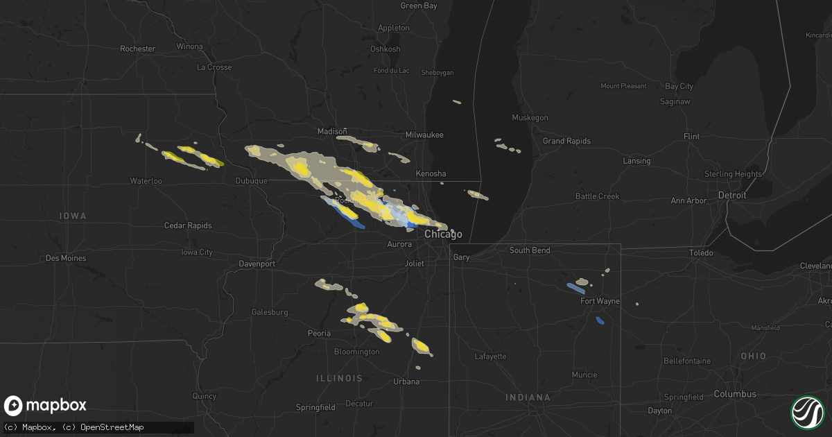
Hail Map on July 4, 2022
Get this storm
July 4 map
$229
one time, instant access
Download today. No call, no setup
Keep the $229
Bought the map and want the full workflow? Apply the entire $229 to a subscription within 7 days. None of it is wasted.
Every map, not just this one
This buys you this map. Subscription and you get every map we run, in the markets you choose from a few cities to whole states to nationwide. Plus real-time alerts the moment a storm fires.
Contact data
Name, contact info, occupancy, even credit band for addresses in the footprint. You go from where it hit to who to call.
Become the source they trust
Unlimited branding weather history reports on demand. You already have the documented answer ready for the property owner, and you are the one who showed up with it.
Property data and RoofTrace estimates
Pull up any address you have got, its value and the exact code rules for that jurisdiction, straight from One Click Code. Then RoofTrace estimates the squares, pitch, and roof value, priced the way you price.
States Impacted by Hail Map on July 4, 2022
Storm reports
South Carolina
| Date | Description |
|---|---|
| 07/04/20223:20 PM CDT | Tree down at ritter rd at white hall rd and another tree down at ritter rd at hendersonville hwy. |
| 07/04/20223:19 PM CDT | Tree and power lines down on lowcountry hwy due to thunderstorm outflow. |
| 07/04/20223:15 PM CDT | Tree down on bells hwy due to thunderstorm outflow. |
| 07/04/20223:12 PM CDT | Tree down at ace basin pkwy and ivenia brown rd. |
| 07/04/20223:10 PM CDT | Tree down at ace basin pkwy and bennetts point rd. |
| 07/04/20222:52 PM CDT | Tree down at churchill rd at overhill rd due to thunderstorm outflow. |
| 07/04/20222:45 PM CDT | Tree down at charleston hwy and ritter rd due to thunderstorm outflow. |
| 07/04/20222:45 PM CDT | Tree down at charleston hwy and saint peters rd due to thunderstorm outflow. |
| 07/04/20222:39 PM CDT | Tree down at cottageville hwy/featherbed rd due to thunderstorm outflow. |
| 07/04/20221:20 PM CDT | Tree down along old moncks corner rd. Time estimated by radar. |
| 07/03/202210:18 PM CDT | At 317 PM EDT, a severe thunderstorm was located over Delemar Crossroads, moving southwest at 10 mph. HAZARD...60 mph wind gusts and penny size hail. SOURCE...Radar indicated. IMPACT...Expect damage to trees and powerlines. Locations impacted include: West Ashley, Hollywood, Ravenel, Meggett, Delemar Crossroads, Yonges Island, Adams Run, Jacksonboro and Bears Bluff. |
Wyoming
| Date | Description |
|---|---|
| 07/04/20226:45 PM CDT | A local report indicates 1.25 inch wind near 8 N NEWCASTLE |
| 07/04/20221:44 AM CDT | At 644 PM MDT, a severe thunderstorm was located 9 miles southeast of Moorcroft, or 27 miles southwest of Sundance, moving northeast at 25 mph. HAZARD...60 mph wind gusts and quarter size hail. SOURCE...Radar indicated. IMPACT...Hail damage to vehicles is expected. Expect wind damage to roofs, siding, and trees. Locations impacted include... Pine Haven and eastern Keyhole Reservoir. This includes Interstate 90 in Wyoming between Mile Markers 158 and181. |
| 07/04/20221:12 AM CDT | At 612 PM MDT, a severe thunderstorm was located over Clareton, or 24 miles west of Newcastle, moving northeast at 15 mph. HAZARD...60 mph wind gusts and half dollar size hail. SOURCE...Radar indicated. IMPACT...Hail damage to vehicles is expected. Expect wind damage to roofs, siding, and trees. Locations impacted include... Clareton. |
| 07/04/202212:49 AM CDT | At 549 PM MDT, a severe thunderstorm was located 18 miles northwest of Clareton, or 27 miles east of Wright, moving northeast at 35 mph. HAZARD...Ping pong ball size hail and 60 mph wind gusts. SOURCE...Radar indicated. IMPACT...People and animals outdoors will be injured. Expect hail damage to roofs, siding, windows, and vehicles. Expect wind damage to roofs, siding, and trees. Locations impacted include... Upton, Pine Haven and southeastern Keyhole Reservoir. This includes Interstate 90 in Wyoming between Mile Markers 158 and169. |
| 07/03/20229:15 PM CDT | A local report indicates 1.00 inch wind near 8 ESE SUNDANCE |
| 07/03/20228:00 PM CDT | A local report indicates 1.00 inch wind near NEWCASTLE |
| 07/03/20227:27 PM CDT | Time estimated via radar |
| 07/03/20227:20 PM CDT | A local report indicates 1.00 inch wind near 1 E CLARETON |
| 07/03/20227:10 PM CDT | A local report indicates 1.00 inch wind near 19 SW UPTON |
Illinois
| Date | Description |
|---|---|
| 07/04/20226:59 PM CDT | Power lines downed. |
| 07/04/20226:25 PM CDT | Delayed report. Measured 75 mph wind gust. Relayed by wcia-tv. Time estimated. |
| 07/04/20226:25 PM CDT | Delayed report. Two power poles down and corn flattened. Time estimated. Relayed by wcia-tv. |
| 07/04/20226:15 PM CDT | Power lines down. Time estimated by radar. |
| 07/04/20225:45 PM CDT | Photos shared via social media show numerous small branches downed in multiple locations across buckley. Some branches at least a couple inches in diameter. |
| 07/04/20225:23 PM CDT | Report of tree downed onto power line in gibson city. Relayed via broadcast media. Time estimated by radar. |
| 07/04/20225:10 PM CDT | Photo shared via social media shows flattened corn south of cissna park. Time estimated by radar. |
| 07/04/20224:40 PM CDT | Measured gust at 60 mph... Minor tree damage with 2 inch branches down. |
| 07/04/20224:26 PM CDT | Picture of large tree down relayed via social media. Tree does appear to be unhealthy. |
| 07/04/20224:22 PM CDT | Media reports several poles down and a barn collapsed. |
| 07/04/20224:06 PM CDT | Report of tree limbs down relayed by media. |
| 07/04/20224:01 PM CDT | Several spotter reports of estimated 60 mph wind gusts and corn blown over. |
| 07/04/20224:00 PM CDT | High tensile fence destroyed... Numerous trees blown down... And several windows blown in on outbuildings. Machine shed destroyed. Reported relayed via social media. |
| 07/04/20223:43 PM CDT | Report relayed by media of several trees down along east indiana ave. |
| 07/04/20223:41 PM CDT | Media relayed report of several tree branches down... One of which fell on a car. |
| 07/04/20223:39 PM CDT | Spotter reports part of a barn roof was blown off and several twigs blown around. Time estimated from radar. |
| 07/04/20223:35 PM CDT | Report of uprooted/split trees as well as multiple power lines down in pontiac. Time estimated based on radar and social media report. |
| 07/04/20223:26 PM CDT | 8 inch diameter limb down on washington street in ridott. Time estimated based off of radar. |
| 07/04/20222:50 PM CDT | 8 to 12 inch diameter based on photo shared on social media. Time of the event was estimated using radar. |
| 07/04/20222:30 PM CDT | Tree branches downed in cedar point. Time estimated by radar. |
| 07/04/20222:30 PM CDT | Garage door damaged along with a few trees down. Broad area of heavily leaning corn to the west... East... And south of property. Corrects previous tstm wnd dmg report |
| 07/04/20222:30 PM CDT | Garage door damaged along with a few trees down on property. Erratic corn damage in fields near residence. Possible tornado damage. |
| 07/04/20222:30 PM CDT | Highest wind lasted 5 min... With winds over 55 mph lasting approx. 10 min. Torrential rain occurred during entire time. |
| 07/04/20222:30 PM CDT | Tree branches downed in peru. Time estimated by radar. |
| 07/04/20221:57 PM CDT | 12 inch diameter tree down. Relayed by lot. |
| 07/04/20226:58 AM CDT | At 1158 PM CDT, numerous severe thunderstorm were located from Hampshire to Elgin, all moving southeast at 40 mph. HAZARD...60 mph wind gusts. SOURCE...Radar indicated. IMPACT...Expect damage to roofs, siding, and trees. Locations impacted include... Elgin, Arlington Heights, Schaumburg, Palatine, Des Plaines, Mount Prospect, Wheaton, Hoffman Estates, Downers Grove, Elmhurst, Lombard, Buffalo Grove, Bartlett, Streamwood, Carol Stream, Hanover Park, Carpentersville, Wheeling, Addison and Glendale Heights.Including the following interstates... I-88 between mile markers 134 and 139. I-90 between mile markers 56 and 74. I-290 between mile markers 1 and 15. I-355 between mile markers 23 and 30.This includes... Schaumburg Boomers Baseball, College of DuPage,DuPage County Fairgrounds, Elgin Community College, Harper College,and Wheaton College. |
| 07/04/20226:51 AM CDT | At 1150 PM CDT, a severe thunderstorm was located over Schaumburg, moving southeast at 30 mph. HAZARD...60 mph wind gusts and quarter size hail. SOURCE...Radar indicated. IMPACT...Hail damage to vehicles is expected. Expect wind damage to roofs, siding, and trees. Locations impacted include... Chicago, Cicero, Schaumburg, Berwyn, Oak Park, Elmhurst, Ohare Airport, Addison, Elk Grove Village, West Town, Austin, Bridgeport, Chicago Loop, South Lawndale, Lincoln Park, Irving Park, Melrose Park, Maywood, Brookfield and Franklin Park.Including the following interstates... I-55 between mile markers 288 and 294. I-88 near mile marker 140. I-94 between mile markers 47 and 56. I-290 between mile markers 3 and 29. I-294 between mile markers 47 and 56.This includes... Brookfield Zoo, Triton College, Hawthorne Park,Soldier Field, University of Illinois Chicago, Guaranteed RateField...IL Institute of Technology, The Loop, Museum Campus, andNortherly Island. |
| 07/04/20226:22 AM CDT | At 1122 PM CDT, a severe thunderstorm was located near Poplar Grove, moving southeast at 30 mph. HAZARD...60 mph wind gusts. SOURCE...Radar indicated. IMPACT...Expect damage to roofs, siding, and trees. Locations impacted include... Elgin, Crystal Lake, Carpentersville, Algonquin, Lake in the Hills, McHenry, Woodstock, Huntley, Island Lake, Marengo, Cary, Pingree Grove, Gilberts, West Dundee, Hampshire, Fox River Grove, Barrington Hills, Lakewood, Sleepy Hollow and East Dundee.Including the following interstate... I-90 between mile markers 32 and 56. This includes... Mchenry County College, Mchenry County Fairgrounds,and Moraine Hills State Park. |
| 07/04/20226:16 AM CDT | At 1115 PM CDT, a severe thunderstorm was located over Barrington, moving east at 40 mph. HAZARD...60 mph wind gusts. SOURCE...Trained weather spotters. A 64 mph wind gust was measured in Wonder Lake with this storm! IMPACT...Expect damage to roofs, siding, and trees. Locations impacted include... Chicago, Arlington Heights, Evanston, Schaumburg, Palatine, Skokie, Des Plaines, Mount Prospect, Hoffman Estates, Glenview, Buffalo Grove, Ohare Airport, Streamwood, Wheeling, Park Ridge, Northbrook, Elk Grove Village, North Chicago, Mundelein and Niles.Including the following interstates... I-90 between mile markers 59 and 84. I-94 between mile markers 15 and 46. I-290 between mile markers 1 and 3. I-294 between mile markers 15 and 46.This includes... Lincoln Park Zoo, Loyola University, OaktonCommunity College, Harper College, Lake Forest College, NortheasternIllinois University, Northwestern University, Ravinia Music Festival,and Wrigley Field. |
| 07/04/20226:04 AM CDT | At 1104 PM CDT, a severe thunderstorm was located over Loves Park, moving southeast at 25 mph. HAZARD...60 mph wind gusts. SOURCE...Radar indicated. IMPACT...Expect damage to roofs, siding, and trees. Locations impacted include... Rockford, Belvidere, Loves Park, Machesney Park, Roscoe, Poplar Grove, Candlewick Lake, Cherry Valley, Timberlane, Garden Prairie and Caledonia.Including the following interstates... I-39 between mile markers 121 and 123. I-90 between mile markers 5 and 31.This includes... Boone County Fairgrounds, Rock Cut State Park, RockValley College, Rockford Rivets Baseball, and Rockford Speedway. |
| 07/04/20225:55 AM CDT | At 1055 PM CDT, a severe thunderstorm was located over Lakewood, or near Crystal Lake, moving southeast at 25 mph. HAZARD...60 mph wind gusts. SOURCE...Radar indicated. IMPACT...Expect damage to roofs, siding, and trees. Locations impacted include... Elgin, Hoffman Estates, Crystal Lake, Carpentersville, Mundelein, Algonquin, Lake in the Hills, McHenry, Woodstock, Huntley, Grayslake, Libertyville, Lake Zurich, Round Lake, Wauconda, Barrington, Island Lake, Cary, Gilberts and Hawthorn Woods.Including the following interstate... I-90 between mile markers 55 and 58. This includes... Lake County IL Fairgrounds, Mchenry County College,Mchenry County Fairgrounds, and Moraine Hills State Park. |
| 07/04/20225:42 AM CDT | At 1042 PM CDT, severe thunderstorms were located along a line extending from near Lake Summerset to Buena Vista, moving southeast at 30 mph. HAZARD...60 mph wind gusts and quarter size hail. SOURCE...Radar indicated. IMPACT...Hail damage to vehicles is expected. Expect wind damage to roofs, siding, and trees. Locations impacted include... Freeport, Cedarville, Davis, Dakota, German Valley, Rock City, Ridott, Buena Vista, Rock Grove, Oneco, Orangeville, Red Oak, Afolkey, Winneshiek, Dakota Dornink Airport and Lake Summerset. |
| 07/04/20225:10 AM CDT | At 1010 PM CDT, a severe thunderstorm was located near Argyle, or 9 miles west of Monroe, moving southeast at 25 mph. HAZARD...60 mph wind gusts and nickel size hail. SOURCE...Radar indicated. IMPACT...Expect damage to roofs, siding, and trees. Locations impacted include... Monroe, Browntown and Jordan Center. |
| 07/04/20225:05 AM CDT | At 1005 PM CDT, a severe thunderstorm was located over Capron, or near Poplar Grove, moving southeast at 25 mph. HAZARD...60 mph wind gusts. SOURCE...Radar indicated. IMPACT...Expect damage to roofs, siding, and trees. Locations impacted include... Woodstock, Harvard, Marengo, Capron, Hebron, Union and Chemung. |
| 07/04/20224:19 AM CDT | At 919 PM CDT, a severe thunderstorm was located near Argyle, or 8 miles northwest of Monroe, moving southeast at 30 mph. HAZARD...60 mph wind gusts and quarter size hail. SOURCE...Radar indicated. IMPACT...Hail damage to vehicles is expected. Expect wind damage to roofs, siding, and trees. Locations impacted include... Monroe, Brodhead, Browntown, Juda and Jordan Center. |
| 07/04/20224:11 AM CDT | At 911 PM CDT, a severe thunderstorm was located near Footville, or near Janesville, moving east at 25 mph. HAZARD...60 mph wind gusts and quarter size hail. SOURCE...Radar indicated. IMPACT...Hail damage to vehicles is expected. Expect wind damage to roofs, siding, and trees. Locations impacted include... Janesville, Beloit, South Beloit, Clinton, Tiffany, Hanover, Foxhollow, Avalon, Afton, Shopiere and Emerald Grove. |
| 07/04/20223:32 AM CDT | At 832 PM CDT, a severe thunderstorm was located near Beloit, moving southeast at 35 mph. HAZARD...60 mph wind gusts and quarter size hail. This storm is also exhibiting weak low-level rotation. SOURCE...Radar indicated. IMPACT...Hail damage to vehicles is expected. Expect wind damage to roofs, siding, and trees. Locations impacted include... Beloit, Roscoe, Harvard, South Beloit, Rockton, Poplar Grove, Candlewick Lake, Sharon, Capron, Hebron, Timberlane, Garden Prairie, Chemung and Caledonia.Including the following interstate... I-90 between mile markers 0 and 5. |
| 07/04/20223:27 AM CDT | At 827 PM CDT, a severe thunderstorm was located near Beloit, moving southeast at 30 mph. HAZARD...60 mph wind gusts and quarter size hail. SOURCE...Radar indicated. IMPACT...Hail damage to vehicles is expected. Expect wind damage to roofs, siding, and trees. Locations impacted include... Janesville, Beloit, South Beloit, Walworth, Clinton, Fontana-On-Geneva Lake, Sharon, Darien, Tiffany, Allens Grove, Avalon, Afton, Shopiere, Emerald Grove, Foxhollow and Delavan Lake.People attending ABC Supply Stadium should seek safe shelterimmediately! |
| 07/04/20222:48 AM CDT | At 748 PM CDT, a severe thunderstorm was located over Orfordville, or 7 miles east of Brodhead, moving southeast at 25 mph. HAZARD...60 mph wind gusts and quarter size hail. SOURCE...Radar indicated. IMPACT...Hail damage to vehicles is expected. Expect wind damage to roofs, siding, and trees. Locations impacted include... Janesville, Beloit, South Beloit, Orfordville, Footville, Tiffany, Hanover, Avalon, Afton and Shopiere.People attending ABC Supply Stadium should seek safe shelterimmediately! |
| 07/04/20222:19 AM CDT | Report of multiple tree branches and limbs downed near higgins road and jones road in schaumburg. Also damage to a fence and connected brick wall. Time estimated by rad |
| 07/04/202212:44 AM CDT | At 543 PM CDT, a severe thunderstorm was located over Aurora, moving southeast at 30 mph. HAZARD...60 mph wind gusts and quarter size hail. SOURCE...Radar indicated. IMPACT...Hail damage to vehicles is expected. Expect wind damage to roofs, siding, and trees. Locations impacted include... Aurora, Joliet, Naperville, Bolingbrook, Orland Park, Downers Grove, Romeoville, Plainfield, Woodridge, Oswego, Lockport, New Lenox, Homer Glen, Palos Hills, Yorkville, Lemont, Burr Ridge, Lisle, Darien and Crest Hill.Including the following interstates... I-55 between mile markers 255 and 273. I-80 between mile markers 131 and 140. I-88 between mile markers 118 and 125. I-355 between mile markers 1 and 16.This includes... Argonne National Laboratory, University of St.Francis, Aurora University, Benedictine University, ChicagolandSpeedway...Route 66 Raceway, Joliet Slammers Baseball, LewisUniversity, and North Central College. |
| 07/04/202212:42 AM CDT | Numerous small branches downed across southern downers grove. |
| 07/04/202212:29 AM CDT | 61 mph wind gust measured by handheld anemometer. |
| 07/04/202212:25 AM CDT | Photo shared via social media shows large tree uprooted in niles. Location approximate. Time estimated by radar. |
| 07/04/202212:25 AM CDT | Photo relayed via social media of roof damage to an apartment building in park ridge. Time estimated based on radar and report. |
| 07/04/202212:21 AM CDT | Reports received of multiple large power poles snapped along keslinger road near dauberman road. Poles snapped from north to south. Time estimated by radar. |
| 07/04/202212:21 AM CDT | Photo shared via social media shows large tree limb downed in schaumburg. Location estimated. Time estimated by radar. |
| 07/04/202212:12 AM CDT | At 512 PM CDT, severe thunderstorms were located along a line extending from near Hoopeston to Rankin to near Paxton, moving southeast at 25 mph. HAZARD...60 mph wind gusts. SOURCE...Radar indicated. IMPACT...Expect damage to roofs, siding, and trees. Severe thunderstorms will be near... Hoopeston around 520 PM CDT.Other locations in the path of these severe thunderstorms includeRossville. |
| 07/04/202212:10 AM CDT | Extensive tree damage across the elgin historic area with uprooting and trees on houses. Time estimated based on radar. Relayed via social media. |
| 07/04/202212:10 AM CDT | Tree damage near landmeier road and tonne road in elk grove village. Relayed via social media. Time estimated by radar. |
| 07/04/202212:04 AM CDT | Industrial building damaged by thunderstorm winds. Time estimated based on radar. |
| 07/04/202212:04 AM CDT | Several homes and buildings damaged in the vicinity of jarvis and louis avenue. Time estimated based on radar. |
| 07/04/202212:02 AM CDT | Photo shared via social media shows large tree downed onto fence in hampshire. Location approximate. Time estimated by radar. |
| 07/04/202212:00 AM CDT | Large oak tree snapped at the base near sleepy hollow. Time estimated based on radar. |
| 07/03/202211:59 PM CDT | At 458 PM CDT, a severe thunderstorm was located near Colfax, or 8 miles south of Fairbury, moving southeast at 25 mph. HAZARD...60 mph wind gusts. SOURCE...Radar indicated. IMPACT...Expect damage to roofs, siding, and trees. This severe thunderstorm will remain over mainly rural areas of northeastern McLean County, including the following locations... Cropsey and Anchor. |
| 07/03/202211:49 PM CDT | At 449 PM CDT, a severe thunderstorm was located near Fairbury, moving southeast at 25 mph. HAZARD...60 mph wind gusts and quarter size hail. SOURCE...Radar indicated. IMPACT...Hail damage to vehicles is expected. Expect wind damage to roofs, siding, and trees. Locations impacted include... Paxton, Gibson City, Melvin, Roberts, Elliott and Sibley. Including the following interstate... I-57 near mile marker 258. |
| 07/03/202211:34 PM CDT | At 434 PM CDT, a severe thunderstorm was located near Chenoa, or near Fairbury, moving east at 30 mph. HAZARD...60 mph wind gusts and quarter size hail. SOURCE...Radar indicated. IMPACT...Hail damage to vehicles is expected. Expect wind damage to roofs, siding, and trees. Locations impacted include... Fairbury, Forrest and Strawn. Including the following interstate... I-55 between mile markers 189 and 191. |
| 07/03/202211:32 PM CDT | At 432 PM CDT, a severe thunderstorm was located near Piper City, or 7 miles southeast of Chatsworth, moving southeast at 30 mph. HAZARD...60 mph wind gusts. SOURCE...Trained weather spotters. IMPACT...Expect damage to roofs, siding, and trees. Locations impacted include... Chatsworth, Piper City and Roberts. |
| 07/03/202211:30 PM CDT | At 429 PM CDT, severe thunderstorms were located along a line extending from near Fairbury to near Lexington, moving east at 30 mph. HAZARD...60 mph wind gusts and quarter size hail. SOURCE...Radar indicated. IMPACT...Hail damage to vehicles is expected. Expect wind damage to roofs, siding, and trees. Severe thunderstorms will be near... Colfax around 445 PM CDT.This includes Interstate 55 between mile markers 180 and 187. |
| 07/03/202211:25 PM CDT | Photo shows damage to grain bins and agricultural structures near garden prairie. Relayed via broadcast media. Location approximate. Time estimated by radar. |
| 07/03/202211:20 PM CDT | Large tree blocking road. Old sutton road and il route 72 higgins road. Via hanover township emergency management. |
| 07/03/202211:18 PM CDT | Report of trees down on garden prairie road. Time estimated based on radar and call time. |
| 07/03/202211:16 PM CDT | At 416 PM CDT, a severe thunderstorm was located near Chatsworth, moving southeast at 25 mph. This storm has a history of producing wind damage! HAZARD...60 mph wind gusts. SOURCE...Trained weather spotters. IMPACT...Expect damage to roofs, siding, and trees. Locations impacted include... Paxton, Gilman, Onarga, Cissna Park, Buckley, Melvin, Loda, Roberts, Thawville, Clarence and Claytonville.Including the following interstate... I-57 between mile markers 258 and 282. |
| 07/03/202211:16 PM CDT | Report of several trees down near russellville and grange hall roads. Time estimated based on radar and time of report call. |
| 07/03/202211:10 PM CDT | Ten inch diameter tree down across road. Rohrssen road and cardinal lane. Time estimated from radar. Via hanover township emergency management. |
| 07/03/202211:07 PM CDT | At 407 PM CDT, a severe thunderstorm was located over Davis Junction, or just south of the Rockford Airport, moving southeast at 25 mph. A trained spotter earlier reported wind damage near Seward. HAZARD...60 mph wind gusts and quarter size hail. SOURCE...Trained weather spotters. IMPACT...Hail damage to vehicles is expected. Expect wind damage to roofs, siding, and trees. Locations impacted include... DeKalb, Sycamore, Rochelle, Genoa, Cortland, Kirkland, Hillcrest, Maple Park, Kingston, Malta, Creston, Lindenwood, Monroe Center, Fairdale and Kings.Including the following interstates... I-39 between mile markers 98 and 112. I-88 between mile markers 79 and 101.This includes... Northern Illinois University. |
| 07/03/202211:05 PM CDT | Multiple large 1.5-2 foot diameter trees snapped or uprooted along crystal lake avenue. Time estimated based on radar. |
| 07/03/202211:00 PM CDT | Large tree down across road at wakefield and il route 68. Time approximate from radar. Via hanover township emergency management. |
| 07/03/202210:50 PM CDT | Private weather station recorded 64mph wind gust west of wonder lake. Time estimated by radar. |
| 07/03/202210:44 PM CDT | At 343 PM CDT, numerous severe thunderstorms was located over southwestern livingston county from Benson to Flanagan, moving east at 25 to 30 mph. HAZARD...60 mph wind gusts. SOURCE...Radar indicated. IMPACT...Expect damage to roofs, siding, and trees. Locations impacted include... Pontiac, Chenoa, Gridley and Flanagan. Including the following interstate... I-55 between mile markers 188 and 206. |
| 07/03/202210:34 PM CDT | At 334 PM CDT, a severe thunderstorm was located near German Valley, or 11 miles northwest of Byron, moving southeast at 30 mph. HAZARD...60 mph wind gusts and half dollar size hail. SOURCE...Radar indicated. IMPACT...Hail damage to vehicles is expected. Expect wind damage to roofs, siding, and trees. Locations impacted include... Rockford, Byron, Rockford Airport, Cherry Valley, Winnebago, Davis Junction, Pecatonica, Stillman Valley, New Milford, Monroe Center, Leaf River, Seward and Kings.Including the following interstates... I-39 between mile markers 109 and 123. I-90 near mile marker 18.This includes... Winnebago County Fairgrounds. |
| 07/03/202210:31 PM CDT | At 331 PM CDT, a severe thunderstorm was located over Pontiac, moving east at 30 mph. HAZARD...60 mph wind gusts and quarter size hail. SOURCE...Radar indicated. IMPACT...Hail damage to vehicles is expected. Expect wind damage to roofs, siding, and trees. Locations impacted include... Fairbury, Chatsworth, Forrest, Piper City, Cullom, Saunemin and Kempton. |
| 07/03/202210:24 PM CDT | At 323 PM CDT, a severe thunderstorm was located near Minonk, or 13 miles northeast of Eureka, moving northeast at 25 mph. HAZARD...60 mph wind gusts and quarter size hail. SOURCE...Radar indicated. IMPACT...Hail damage to vehicles is expected. Expect wind damage to roofs, siding, and trees. This severe thunderstorm will be near... Minonk around 340 PM CDT.This includes Interstate 39 between mile markers 21 and 31. |
| 07/03/202210:12 PM CDT | At 312 PM CDT, a severe thunderstorm was located near Flanagan, or near Pontiac, moving east at 30 mph. HAZARD...60 mph wind gusts and quarter size hail. SOURCE...Radar indicated. IMPACT...Hail damage to vehicles is expected. Expect wind damage to roofs, siding, and trees. Locations impacted include... Pontiac and Flanagan. Including the following interstate... I-55 between mile markers 190 and 206. |
| 07/03/20229:40 PM CDT | At 240 PM CDT, a severe thunderstorm was located near Wenona, or 11 miles southwest of Streator, moving east at 30 mph. HAZARD...Ping pong ball size hail and 60 mph wind gusts. SOURCE...Radar indicated. IMPACT...People and animals outdoors will be injured. Expect hail damage to roofs, siding, windows, and vehicles. Expect wind damage to roofs, siding, and trees. Locations impacted include... Streator, Pontiac, Wenona, South Streator, Cornell, Ransom, Rutland, Long Point and Dana.Including the following interstate... I-55 between mile markers 197 and 201. |
| 07/03/20229:30 PM CDT | At 230 PM CDT, a severe thunderstorm was located over South Wayne, or 13 miles southeast of Darlington, moving east southeast at 50 mph. HAZARD...60 mph wind gusts. SOURCE...Trained weather spotters. IMPACT...Expect damage to roofs, siding, and trees. Locations impacted include... Freeport, Lena, Cedarville, Davis, Dakota, German Valley, Winslow, Rock City, Ridott, Buena Vista, Rock Grove, Oneco, Orangeville, Eleroy, Damascus, Lake Le-Aqua- na State Park, Mc Connell, Scioto Mills, Winneshiek and Stephenson County Fairgrounds. |
| 07/03/20229:28 PM CDT | At 228 PM CDT, a severe thunderstorm was located over McNabb, or 7 miles southeast of Hennepin, moving east at 25 mph. HAZARD...60 mph wind gusts. SOURCE...Radar indicated. IMPACT...Expect damage to roofs, siding, and trees. Locations impacted include... Hennepin, Henry, Granville, McNabb, Putnam, Mark, Magnolia, Standard, Lake Thunderbird and Florid. |
| 07/03/20229:05 PM CDT | At 204 PM CDT, a severe thunderstorm was located over Bureau Junction, or near Hennepin, moving east at 25 mph. HAZARD...60 mph wind gusts and quarter size hail. SOURCE...Radar indicated. IMPACT...Hail damage to vehicles is expected. Expect wind damage to roofs, siding, and trees. Locations impacted include... Ottawa, Peru, La Salle, Spring Valley, Oglesby, North Utica, Wenona, Tonica, Grand Ridge, Naplate, Lostant, Cedar Point, Kangley and Leonore.Including the following interstates... I-39 between mile markers 41 and 58. I-80 between mile markers 73 and 75.This includes... Buffalo Rock State Park, Illinois Valley CommunityCollege, Matthiessen State Park, and Starved Rock State Park. |
| 07/03/20228:57 PM CDT | At 157 PM CDT, a severe thunderstorm was located over Tiskilwa, or 7 miles west of Hennepin, moving east at 20 mph. HAZARD...60 mph wind gusts and quarter size hail. SOURCE...Radar indicated. IMPACT...Hail damage to vehicles is expected. Expect wind damage to roofs, siding, and trees. Locations impacted include... Princeton, Hennepin, Spring Valley, DePue, Granville, Tiskilwa, Dalzell, Bureau Junction, McNabb, Putnam, Mark, Seatonville, Magnolia, Standard, Spring Valley Airport, Ottville, Lake Thunderbird, Florid and Lone Tree Corners. |
Wisconsin
| Date | Description |
|---|---|
| 07/04/20222:15 PM CDT | Tree down with power line. 1 roof sustained some damage. Localized flash flooding where storm drains clogged up. |
| 07/04/20222:05 PM CDT | Large diamond construction sign came off pole exit 40 from highway 151. |
| 07/04/20221:59 PM CDT | Tree down power line involved. |
| 07/04/20221:50 PM CDT | Tree down with power line involved 1:45 pm - 1:50 pm. |
| 07/04/20225:22 AM CDT | At 1022 PM CDT, a severe thunderstorm was located over Browntown, or near Monroe, moving east at 40 mph. HAZARD...60 mph wind gusts and quarter size hail. SOURCE...Radar indicated. IMPACT...Hail damage to vehicles is expected. Expect wind damage to roofs, siding, and trees. Locations impacted include... Davis, Dakota, Winslow, Rock City, Buena Vista, Rock Grove, Oneco, Orangeville, Dakota Dornink Airport, Afolkey, Mc Connell and Lake Summerset. |
| 07/04/20224:38 AM CDT | At 938 PM CDT, a severe thunderstorm was located near Darlington, moving southeast at 25 mph. HAZARD...60 mph wind gusts and quarter size hail. SOURCE...Radar indicated. IMPACT...Hail damage to vehicles is expected. Expect wind damage to roofs, siding, and trees. Locations impacted include... Darlington, Argyle, Wiota, South Wayne, Fayette, Lamont, Gratiot, Yellowstone Lake St Park, Calamine and Woodford. |
| 07/04/20224:35 AM CDT | At 935 PM CDT, a severe thunderstorm was located near Monticello, or near Monroe, moving east at 40 mph. HAZARD...60 mph wind gusts and quarter size hail. SOURCE...Radar indicated. IMPACT...Hail damage to vehicles is expected. Expect wind damage to roofs, siding, and trees. Locations impacted include... Brodhead, Monticello, Albany and Attica. |
| 07/04/20224:30 AM CDT | At 930 PM CDT, a severe thunderstorm was located over Beloit, moving southeast at 30 mph. HAZARD...60 mph wind gusts and quarter size hail. SOURCE...Radar indicated. IMPACT...Hail damage to vehicles is expected. Expect wind damage to roofs, siding, and trees. Locations impacted include... Beloit, Roscoe, South Beloit, Rockton, Poplar Grove, Candlewick Lake, Capron and Caledonia.Including the following interstate... I-90 between mile markers 0 and 5. |
| 07/04/20224:17 AM CDT | At 917 PM CDT, a severe thunderstorm was located near Whitewater, moving east at 40 mph. HAZARD...60 mph wind gusts and quarter size hail. SOURCE...Radar indicated. IMPACT...Hail damage to vehicles is expected. Expect wind damage to roofs, siding, and trees. Locations impacted include... Whitewater, Fort Atkinson, Mukwonago, East Troy, North Prairie, Palmyra, Potter Lake, Rome, Eagle, Hebron and Troy Center.This includes the following Location Ottawa Lake Recreation Area. |
| 07/04/20223:49 AM CDT | At 848 PM CDT, a severe thunderstorm was located over Colesburg, or 9 miles southwest of Guttenberg, moving east at 20 mph. HAZARD...60 mph wind gusts and quarter size hail. SOURCE...Radar indicated. IMPACT...Hail damage to vehicles is expected. Expect wind damage to roofs, siding, and trees. This severe thunderstorm will be near... Cassville around 910 PM CDT.Other locations impacted by this severe thunderstorm includeRockville, Burton, Big H Campground, Nelson Dewey State Park, NorthBuena Vista, Millville and Turkey River. |
| 07/04/20223:45 AM CDT | At 845 PM CDT, a severe thunderstorm was located over Fairview, or 7 miles southwest of Guttenberg, moving east at 35 mph. HAZARD...60 mph wind gusts and quarter size hail. SOURCE...Radar indicated. IMPACT...Hail damage to vehicles is expected. Expect wind damage to roofs, siding, and trees. Locations impacted include... Dubuque, Asbury, Epworth, Peosta, New Vienna, Colesburg, Holy Cross, Luxemburg, Rickardsville, Sherrill, Centralia, Sageville, Balltown, Bankston, Durango, Graf, Bankston Park, Rockdale, Cottage Hill and Waupeton. |
| 07/04/20223:44 AM CDT | At 844 PM CDT, a severe thunderstorm was located near Albany, or near Evansville, moving east at 25 mph. HAZARD...60 mph wind gusts and quarter size hail. SOURCE...Radar indicated. IMPACT...Hail damage to vehicles is expected. Expect wind damage to roofs, siding, and trees. Locations impacted include... Janesville, Evansville, Brodhead, Orfordville, Footville, Magnolia, Hanover and Leyden. |
| 07/04/20223:11 AM CDT | At 811 PM CDT, a severe thunderstorm was located near Volga, or near Elkader, moving east at 25 mph. HAZARD...60 mph wind gusts and quarter size hail. SOURCE...Radar indicated. IMPACT...Hail damage to vehicles is expected. Expect wind damage to roofs, siding, and trees. This severe thunderstorm will be near... Elkader around 815 PM CDT. Guttenberg around 855 PM CDT.Other locations impacted by this severe thunderstorm includeFairview, Mederville, Garber, Motor, Elkport, Communia and Osterdock. |
| 07/04/20223:08 AM CDT | At 808 PM CDT, a severe thunderstorm was located over Belmont, or near Platteville, moving east at 25 mph. HAZARD...60 mph wind gusts and quarter size hail. SOURCE...Radar indicated. IMPACT...Hail damage to vehicles is expected. Expect wind damage to roofs, siding, and trees. Locations impacted include... Darlington, Belmont, Fayette, Lamont, Gratiot, Platte Mounds, Yellowstone Lake St Park and Calamine. |
| 07/04/20222:58 AM CDT | At 758 PM CDT, a severe thunderstorm was located near Blanchardville, or 14 miles south of Mount Horeb, moving east at 35 mph. HAZARD...60 mph wind gusts and quarter size hail. SOURCE...Radar indicated. IMPACT...Hail damage to vehicles is expected. Expect wind damage to roofs, siding, and trees. Locations impacted include... Belleville, New Glarus, Brooklyn, Monticello, Albany, Dayton and Attica.This includes the following Location York Memorial Church. |
| 07/04/20222:41 AM CDT | At 741 PM CDT, a severe thunderstorm was located near Platteville, moving east at 35 mph. HAZARD...60 mph wind gusts and quarter size hail. SOURCE...Radar indicated. IMPACT...Hail damage to vehicles is expected. Expect wind damage to roofs, siding, and trees. This severe thunderstorm will be near... Platteville around 750 PM CDT.Other locations impacted by this severe thunderstorm include Union. |
| 07/03/20229:50 PM CDT | Delayed report. Large tree snapped and fell on a vehicle. |
| 07/03/20229:50 PM CDT | At 249 PM CDT, severe thunderstorms were located along a line extending from near Lena to 7 miles southeast of Monroe to near Evansville, moving southeast at 35 mph. These storms have a history of producing wind damage in Lafayette county. HAZARD...60 mph wind gusts and penny size hail. SOURCE...Radar indicated. IMPACT...Expect damage to roofs, siding, and trees. Locations impacted include... Rockford, Loves Park, Machesney Park, Roscoe, South Beloit, Rockton, Poplar Grove, Rockford Airport, Candlewick Lake, Cherry Valley, Winnebago, Pecatonica, Durand, Timberlane, Seward, Caledonia, Shirland, Lake Summerset and Harrison.Including the following interstate... I-90 between mile markers 1 and 17. This includes... Rock Cut State Park, Rock Valley College, RockfordRivets Baseball, Rockford Speedway, and Winnebago County Fairgrounds. |
| 07/03/20229:26 PM CDT | At 226 PM CDT, severe thunderstorms were located along a line extending from near Monticello to near Apple River, moving southeast at 35 mph. HAZARD...60 mph wind gusts. SOURCE...Law enforcement. IMPACT...Expect damage to roofs, siding, and trees. Locations impacted include... Monroe, Brodhead, New Glarus, Monticello, Argyle, Wiota, South Wayne, Browntown, Gratiot, Juda, Avon, Jordan Center and Woodford. |
| 07/03/20229:25 PM CDT | Tree down in the western portion of green county. |
| 07/03/20228:58 PM CDT | At 157 PM CDT, severe thunderstorms were located along a line extending from near Mount Horeb to near Cuba City, moving southeast at 35 mph. HAZARD...60 mph wind gusts. SOURCE...Radar indicated. IMPACT...Expect damage to roofs, siding, and trees. Locations impacted include... Monroe, Brodhead, Darlington, New Glarus, Shullsburg, Monticello, Albany, Belmont, Benton, Argyle, Blanchardville, Apple River, Wiota, New Diggings, South Wayne, Waldwick, Elk Grove, Fayette, Lamont and Hollandale.This includes the following Location York Memorial Church. |
| 07/03/20228:07 PM CDT | A few trees down on the west side of rock county. |
Montana
| Date | Description |
|---|---|
| 07/04/20224:21 PM CDT | 64 mph wind gust at the dot sensor on macdonald pass. Heavy rain also falling. |
| 07/04/20226:15 AM CDT | A local report indicates 1.00 inch wind near 11 SE WEBSTER |
| 07/04/20225:50 AM CDT | Picture sent by spotter via social media. |
| 07/04/20225:49 AM CDT | A local report indicates 1.25 inch wind near 1 W COLSTRIP |
| 07/04/20225:45 AM CDT | Spotter report of rain and golf ball sized hail. |
| 07/04/20225:41 AM CDT | At 1041 PM MDT, a severe thunderstorm was located near Hillside, or 33 miles southeast of Jordan, moving east at 60 mph. HAZARD...Half dollar size hail. SOURCE...Radar indicated. IMPACT...Damage to vehicles is expected. Locations impacted include... Cohagen, Hillside, Brockway, Mccloud, Crow Rock and Watkins. |
| 07/04/20224:47 AM CDT | At 946 PM MDT, a severe thunderstorm was located 14 miles south of Edwards, or 31 miles southwest of Jordan, moving east at 50 mph. HAZARD...Half dollar size hail. SOURCE...Radar indicated. IMPACT...Damage to vehicles is expected. Locations impacted include... Sand Springs, Cohagen, Edwards and Hillside. |
| 07/04/20224:29 AM CDT | At 929 PM MDT, a severe thunderstorm was located 16 miles south of Sand Springs, or 40 miles east of Winnett, moving east at 30 mph. HAZARD...Ping pong ball size hail and 60 mph wind gusts. SOURCE...Radar indicated. IMPACT...People and animals outdoors will be injured. Expect hail damage to roofs, siding, windows, and vehicles. Expect wind damage to roofs, siding, and trees. This severe thunderstorm will remain over mainly rural areas of north central Rosebud County. |
| 07/04/20224:25 AM CDT | A local report indicates 87 MPH wind near 13 NE BAKER |
| 07/04/20223:56 AM CDT | A local report indicates 1.00 inch wind near 1 W BALLANTINE |
| 07/04/20223:45 AM CDT | A local report indicates 2.00 inch wind near 2 S HUNTLEY |
| 07/04/20223:44 AM CDT | A local report indicates 1.00 inch wind near 1 NNE SHEPHERD |
| 07/04/20223:38 AM CDT | A local report indicates 2.00 inch wind near HUNTLEY |
| 07/04/20223:35 AM CDT | A local report indicates 2.75 inch wind near BILLINGS |
| 07/04/20223:35 AM CDT | A local report indicates 1.25 inch wind near 2 W SHEPHERD |
| 07/04/20223:34 AM CDT | A local report indicates 1.50 inch wind near SHEPHERD |
| 07/04/20223:33 AM CDT | A local report indicates 2.00 inch wind near 4 SSW SHEPHERD |
| 07/04/20223:30 AM CDT | A local report indicates 1.50 inch wind near 4 NNE BILLINGS |
| 07/04/20223:30 AM CDT | A local report indicates 1.50 inch wind near SHEPHERD |
| 07/04/20223:26 AM CDT | A local report indicates 2.00 inch wind near 9 N BILLINGS |
| 07/04/20223:25 AM CDT | A local report indicates 2.00 inch wind near 7 NE BILLINGS |
| 07/04/20223:24 AM CDT | A local report indicates 1.00 inch wind near 4 N BILLINGS |
| 07/04/20223:23 AM CDT | A local report indicates 2.00 inch wind near SHEPHERD |
| 07/04/20223:18 AM CDT | At 818 PM MDT, a severe thunderstorm was located near Winnett, moving east at 30 mph. HAZARD...Quarter size hail. SOURCE...Radar indicated. IMPACT...Damage to vehicles is expected. Locations impacted include... Winnett, Mosby, Petrolia Lake and Cat Creek. |
| 07/04/20222:43 AM CDT | At 742 PM MDT, a severe thunderstorm was located 27 miles northeast of Deadmans Basin Reservoir, or 27 miles southeast of Lewistown, moving east at 25 mph. HAZARD...60 mph wind gusts and half dollar size hail. SOURCE...Radar indicated. IMPACT...Hail damage to vehicles is expected. Expect wind damage to roofs, siding, and trees. This severe thunderstorm will remain over mainly rural areas of northwestern Musselshell and north central Golden Valley Counties. |
| 07/04/20222:39 AM CDT | At 738 PM MDT, severe thunderstorms were located along a line extending from 24 miles southeast of Lewistown to 7 miles northwest of Grass Range, moving east at 20 mph. HAZARD...60 mph wind gusts and quarter size hail. SOURCE...Radar indicated. IMPACT...Hail damage to vehicles is expected. Expect wind damage to roofs, siding, and trees. Localized flash flooding will be possible. Locations impacted include... Grass Range and Forestgrove. |
| 07/04/20222:18 AM CDT | Time estimated from radar. |
| 07/04/20222:13 AM CDT | At 711 PM MDT, a severe thunderstorm was located over Harlowton, moving northeast at 30 mph. Additional severe storms were located over far northeast Wheatland county, moving northeast at 25 mph. HAZARD...Ping pong ball size hail and 60 mph wind gusts. SOURCE...Radar indicated. IMPACT...People and animals outdoors will be injured. Expect hail damage to roofs, siding, windows, and vehicles. Expect wind damage to roofs, siding, and trees. This severe thunderstorm will remain over mainly rural areas of eastern Wheatland and north central Golden Valley Counties.This replaces the previous warning for this area. |
| 07/04/20221:52 AM CDT | At 652 PM MDT, a severe thunderstorm was located near Harlowton, moving northeast at 30 mph. HAZARD...60 mph wind gusts and half dollar size hail. SOURCE...Radar indicated. IMPACT...Hail damage to vehicles is expected. Expect wind damage to roofs, siding, and trees. This severe thunderstorm will be near... Harlowton around 705 PM MDT. |
| 07/04/20221:40 AM CDT | At 639 PM MDT, a severe thunderstorm was located 16 miles south of Winifred, or 17 miles north of Lewistown, moving east at 30 mph. HAZARD...60 mph wind gusts and quarter size hail. SOURCE...Radar indicated. IMPACT...Hail damage to vehicles is expected. Expect wind damage to roofs, siding, and trees. Locations impacted include... Roy, Fergus, Hilger and Christina. |
| 07/04/20221:24 AM CDT | At 624 PM MDT, a severe thunderstorm was located near Moore, or 9 miles west of Lewistown, moving north at 15 mph. HAZARD...60 mph wind gusts and penny size hail. SOURCE...Radar indicated. IMPACT...Expect damage to roofs, siding, and trees. Locations impacted include... Lewistown, Moore, Danvers and Glengarry. |
| 07/04/20221:18 AM CDT | Time estimated from radar. |
| 07/04/202212:49 AM CDT | At 549 PM MDT, a severe thunderstorm was located 12 miles northeast of Bredette, or 21 miles southeast of Scobey, moving east at 30 mph. HAZARD...Golf ball size hail and 60 mph wind gusts. SOURCE...Radar indicated. IMPACT...People and animals outdoors will be injured. Expect hail damage to roofs, siding, windows, and vehicles. Expect wind damage to roofs, siding, and trees. Locations impacted include... Plentywood, Medicine Lake, Bainville, Froid, Flaxville, Archer, Redstone, Reserve, Dagmar, Homestead, Navajo, Mccabe, Antelope and Coalridge. |
| 07/04/202212:09 AM CDT | At 509 PM MDT, a severe thunderstorm was located near Cascade, moving east at 25 mph. HAZARD...60 mph wind gusts and quarter size hail. SOURCE...Radar indicated. IMPACT...Hail damage to vehicles is expected. Expect wind damage to roofs, siding, and trees. Localized flash flooding possible. Locations impacted include... Cascade, First Peoples Buffalo Jump State Park and Ulm. |
| 07/03/202211:29 PM CDT | At 429 PM MDT, a severe thunderstorm was located 12 miles west of Drummond, moving north at 20 mph. HAZARD...Ping pong ball size hail and 60 mph wind gusts. SOURCE...Radar indicated. IMPACT...People and animals outdoors will be injured. Expect hail damage to roofs, siding, windows, and vehicles. Expect wind damage to roofs, siding, and trees. Locations impacted include... Garnet, Nimrod and Bearmouth. |
| 07/03/202211:06 PM CDT | At 406 PM MDT, a severe thunderstorm was located 12 miles west of Drummond, moving north at 30 mph. HAZARD...Ping pong ball size hail and 60 mph wind gusts. SOURCE...Radar indicated. IMPACT...People and animals outdoors will be injured. Expect hail damage to roofs, siding, windows, and vehicles. Expect wind damage to roofs, siding, and trees. Locations impacted include... Drummond, Garnet, Hall and Bearmouth. |
| 07/03/202210:48 PM CDT | At 347 PM MDT, a severe thunderstorm was located 14 miles northwest of Helena, moving north at 50 mph. HAZARD...60 mph wind gusts and quarter size hail. SOURCE...Radar indicated. IMPACT...Hail damage to vehicles is expected. Expect wind damage to roofs, siding, and trees. Localized flash flooding possible. Locations impacted include... Wolf Creek, Marysville, Canyon Creek and Austin. |
| 07/03/20229:45 PM CDT | Quarter size hail blown into drifts along trees with wind damage. |
| 07/03/20229:45 PM CDT | Nickel size hail blown into drifts along trees with wind damage. |
| 07/03/20229:20 PM CDT | Hail the size of large peas covering the ground... Heavy rainfall observed. |
| 07/03/20228:15 PM CDT | Hail reported after storm. |
| 07/03/20227:55 PM CDT | Mostly dime size hail with golf ball size hail reported via social media. |
| 07/03/20227:00 PM CDT | Report relayed from facebook. |
Iowa
| Date | Description |
|---|---|
| 07/04/20223:53 AM CDT | At 853 PM CDT, a severe thunderstorm was located over Maynard, or near Oelwein, moving southeast at 25 mph. HAZARD...60 mph wind gusts and quarter size hail. SOURCE...Radar indicated. IMPACT...Hail damage to vehicles is expected. Expect wind damage to roofs, siding, and trees. This severe thunderstorm will be near... Arlington around 915 PM CDT. Strawberry Point around 935 PM CDT.Other locations impacted by this severe thunderstorm includeThomasville, Highways 3 And 187, County Road W 33 And 187, CountyRoad W 45 And 187, Joy Springs County Park, County Roads 3 And W 45and Saint Sebald. |
| 07/04/20222:26 AM CDT | At 725 PM CDT, a severe thunderstorm was located near Fayette, or 7 miles southeast of West Union, moving east at 20 mph. HAZARD...60 mph wind gusts and quarter size hail. SOURCE...Radar indicated. IMPACT...Hail damage to vehicles is expected. Expect wind damage to roofs, siding, and trees. This severe thunderstorm will be near... Volga around 755 PM CDT. Elkader around 810 PM CDT.Other locations impacted by this severe thunderstorm include VolgaRiver State Park, Wadena, Thomasville, Saint Sebald, and Albany. |
| 07/03/20228:30 PM CDT | One tree down. |
| 07/03/20228:30 PM CDT | A local report indicates 1.00 inch wind near ELKPORT |
| 07/03/20228:25 PM CDT | A local report indicates 1.00 inch wind near LITTLEPORT |
Georgia
| Date | Description |
|---|---|
| 07/04/20223:00 AM CDT | At 800 PM EDT, a severe thunderstorm was located over Huntington, or 7 miles southeast of Americus, moving northwest at 15 mph. HAZARD...60 mph wind gusts and quarter size hail. SOURCE...Radar indicated. IMPACT...Hail damage to vehicles is expected. Expect wind damage to roofs, siding, and trees. Locations impacted include... Americus, Leslie, De Soto, Desoto, Lamar, Maddox, New Era and Huntington. |
South Dakota
| Date | Description |
|---|---|
| 07/04/20225:58 PM CDT | A local report indicates 1.00 inch wind near 1 WNW STURGIS |
| 07/04/20224:39 PM CDT | A local report indicates 1.00 inch wind near 4 NE HAYWARD |
| 07/04/20227:54 AM CDT | At 1254 AM CDT, severe thunderstorms were located along a line extending from near Groton to near Camrose Colony, moving east at 35 mph. HAZARD...60 mph wind gusts. SOURCE...Radar indicated. IMPACT...Expect damage to roofs, siding, and trees. Severe thunderstorms will be near... Andover around 105 AM CDT.Other locations in the path of these severe thunderstorms includeRaymond, Bristol, Butler, Clark and Webster. |
| 07/04/20227:42 AM CDT | At 1242 AM CDT, a severe thunderstorm was located near Joe Creek Rec Area, or 9 miles west of Lower Brule, moving east at 35 mph. HAZARD...60 mph wind gusts. SOURCE...Radar indicated. IMPACT...Expect damage to roofs, siding, and trees. This severe thunderstorm will be near... Lower Brule and Medicine Butte around 100 AM CDT.Other locations in the path of this severe thunderstorm includeCounselor Creek Boat Access Area, Tailrace Rec Area, Lake Sharpe,Fort Thompson, Lees Corner, Crow Creek Housing, Shelby and EtbauerHill. |
| 07/04/20227:39 AM CDT | At 1238 AM CDT/1138 PM MDT/, severe thunderstorms were located along a line extending from 5 miles northwest of Taylor to 4 miles southwest of Mott to 7 miles southwest of Hettinger, moving east at 40 mph. HAZARD...70 mph wind gusts. SOURCE...Radar indicated. IMPACT...Expect considerable tree damage. Damage is likely to mobile homes, roofs, and outbuildings. Severe thunderstorms will be near... Mott around 1145 PM MDT. Richardton around 1150 PM MDT.Other locations in the path of these severe thunderstorms includeHaynes, Hebron, New Leipzig, Elgin, North Lemmon and Carson. |
| 07/04/20227:30 AM CDT | At 1230 AM CDT, severe thunderstorms were located along a line extending from 8 miles northwest of Vivian to 8 miles southwest of 5 Mile Corner to 8 miles north of Mosher to near Fairgrounds Housing, moving east at 45 mph. HAZARD...60 mph wind gusts and penny size hail. SOURCE...Radar indicated. IMPACT...Expect damage to roofs, siding, and trees. Locations impacted include... Winner, Mission, White River, Rosebud, Okreek, Ideal, Wood, Carter, Mosher, Witten, Hamill, Soldier Creek, Ideal South Housing, Butte Creek, Swift Bear, Ring Thunder, Fairgrounds Housing, Antelope, Horse Creek and Hidden Timber. |
| 07/04/20227:26 AM CDT | At 1226 AM CDT, a severe thunderstorm was located near Stratford, or 10 miles southeast of Aberdeen, moving east at 15 mph. HAZARD...60 mph wind gusts. SOURCE...Radar indicated. IMPACT...Expect damage to roofs, siding, and trees. Locations impacted include... Verdon and Ferney. |
| 07/04/20227:15 AM CDT | At 1214 AM CDT, a severe thunderstorm was located 12 miles east of Westover, or 18 miles southeast of Murdo, moving east at 40 mph. HAZARD...60 mph wind gusts. SOURCE...Radar indicated. IMPACT...Expect damage to roofs, siding, and trees. This severe thunderstorm will remain over mainly rural areas of southeastern Jones and southwestern Lyman Counties. |
| 07/04/20227:08 AM CDT | At 1208 AM CDT, a severe thunderstorm was located near Mellette, or 17 miles north of Redfield, moving east at 35 mph. HAZARD...60 mph wind gusts. SOURCE...Radar indicated. IMPACT...Expect damage to roofs, siding, and trees. This severe thunderstorm will be near... Brentford around 1215 AM CDT.Other locations in the path of this severe thunderstorm include Condeand Turton. |
| 07/04/20227:04 AM CDT | At 1203 AM CDT, a severe thunderstorm was located over Warner, or 8 miles south of Aberdeen, moving east at 35 mph. HAZARD...70 mph wind gusts. SOURCE...Radar indicated. IMPACT...Expect considerable tree damage. Damage is likely to mobile homes, roofs, and outbuildings. This severe thunderstorm will be near... Stratford around 1215 AM CDT.Other locations in the path of this severe thunderstorm includeVerdon. |
| 07/04/20226:55 AM CDT | A local report indicates 1.75 inch wind near 4 ESE LADNER |
| 07/04/20226:55 AM CDT | A local report indicates 1.25 inch wind near 2 E LADNER |
| 07/04/20223:13 AM CDT | At 813 PM MDT, a severe thunderstorm was located 4 miles north of Moskee, or 9 miles southeast of Sundance, moving northeast at 30 mph. HAZARD...60 mph wind gusts and quarter size hail. SOURCE...Radar indicated. IMPACT...Hail damage to vehicles is expected. Expect wind damage to roofs, siding, and trees. Locations impacted include... Spearfish, Beulah, Moskee, Iron Creek Lake, Crow Peak, Cement Ridge Lookout and northern Spearfish Canyon.This includes... Interstate 90 in South Dakota between Mile Markers 1 and 13. Interstate 90 in Wyoming between Mile Markers 201 and 207. |
| 07/04/20222:43 AM CDT | At 743 PM MDT, a severe thunderstorm was located 3 miles south of Newcastle, moving east at 20 mph. HAZARD...60 mph wind gusts and half dollar size hail. SOURCE...Radar indicated. IMPACT...Hail damage to vehicles is expected. Expect wind damage to roofs, siding, and trees. Locations impacted include... Newcastle, Moon and Jewel Cave National Monument. |
| 07/04/20221:52 AM CDT | At 651 PM MDT, a severe thunderstorm was located 7 miles west of Newcastle, moving northeast at 30 mph. HAZARD...Ping pong ball size hail and 60 mph wind gusts. SOURCE...Radar indicated. IMPACT...People and animals outdoors will be injured. Expect hail damage to roofs, siding, windows, and vehicles. Expect wind damage to roofs, siding, and trees. Locations impacted include... Newcastle, Flag Mountain, Moon, Four Corners, Buckhorn, Deerfield, Deerfield Reservoir, O'Neil Pass, Medicine Mountain, Redbank Spring Campground, Crooks Tower, Mallo Camp and Black Fox Campground. |
| 07/04/202212:56 AM CDT | At 556 PM MDT, a severe thunderstorm was located near Redbird, or 23 miles west of Edgemont, moving northeast at 20 mph. HAZARD...60 mph wind gusts and nickel size hail. SOURCE...Radar indicated. IMPACT...Expect damage to roofs, siding, and trees. Locations impacted include... Mule Creek Junction and Redbird. |
| 07/04/202212:30 AM CDT | At 530 PM MDT, a severe thunderstorm was located 3 miles northwest of Newcastle, moving northeast at 30 mph. HAZARD...Ping pong ball size hail and 60 mph wind gusts. SOURCE...Radar indicated. IMPACT...People and animals outdoors will be injured. Expect hail damage to roofs, siding, windows, and vehicles. Expect wind damage to roofs, siding, and trees. Locations impacted include... Newcastle, Flag Mountain, Moon, Four Corners, Deerfield, Buckhorn, Deerfield Reservoir, Crooks Tower, Mallo Camp, O'Neil Pass, Black Fox Campground and Redbank Spring Campground. |
| 07/03/202211:50 PM CDT | At 450 PM MDT, a severe thunderstorm was located near Sturgis, moving northeast at 25 mph. HAZARD...Half dollar size hail. SOURCE...Radar indicated. IMPACT...Damage to vehicles is expected. Locations impacted include... Sturgis, Vale, Apple Springs, Bear Butte State Park and Fort Meade.This includes Interstate 90 in South Dakota between Mile Markers 28and 37. |
| 07/03/202210:19 PM CDT | At 319 PM MDT, a severe thunderstorm was located 3 miles north of Hayward, or 11 miles south of Rapid City, moving southeast at 25 mph. HAZARD...60 mph wind gusts and half dollar size hail. SOURCE...Radar indicated. IMPACT...Hail damage to vehicles is expected. Expect wind damage to roofs, siding, and trees. This severe thunderstorm will be near... Hart Ranch around 325 PM MDT. Hermosa around 335 PM MDT. Folsom around 410 PM MDT. |
| 07/03/20229:03 PM CDT | At 203 AM CDT, severe thunderstorms were located along a line extending from near Etbauer Hill to 6 miles west of Kimball to 7 miles east of Iona, moving east at 40 mph. HAZARD...60 mph wind gusts and penny size hail. SOURCE...Radar indicated. IMPACT...Expect damage to roofs, siding, and trees. Severe thunderstorms will be near... Kimball around 215 AM CDT. Grass Ranch Colony around 220 AM CDT.Other locations in the path of these severe thunderstorms includeWhite Lake, Wessington Springs and Plankinton. |
| 07/03/20228:36 PM CDT | At 136 AM CDT, severe thunderstorms were located along a line extending from near Stephan to near Dude Ranch to near Hamill, moving east at 30 mph. HAZARD...60 mph wind gusts and penny size hail. SOURCE...Radar indicated. IMPACT...Expect damage to roofs, siding, and trees. Severe thunderstorms will be near... Lake Francis Case around 140 AM CDT. Chamberlain around 150 AM CDT.Other locations in the path of these severe thunderstorms includeKimball. |
| 07/03/20228:32 PM CDT | At 132 AM CDT, severe thunderstorms were located along a line extending from 6 miles north of Stephan to near Oacoma to 10 miles south of Hamill, moving east at 30 mph. HAZARD...60 mph wind gusts. SOURCE...Radar indicated. IMPACT...Expect damage to roofs, siding, and trees. Severe thunderstorms will be near... Oacoma and Dude Ranch around 135 AM CDT. Crow Creek Housing around 145 AM CDT. Shelby and Iona around 150 AM CDT.Other locations in the path of these severe thunderstorms includeSunshine Bible Academy, Pleasant Valley Country Church and RosehillDam. |
North Dakota
| Date | Description |
|---|---|
| 07/04/20225:31 AM CDT | Social media photos of ping pong size hail. |
| 07/03/20228:40 PM CDT | At 139 AM CDT/1239 AM MDT/, severe thunderstorms were located along a line extending from 12 miles northeast of Glen Ullin to near Carson to Keldron, moving east at 45 mph. HAZARD...60 mph wind gusts. SOURCE...Radar indicated. IMPACT...Expect damage to roofs, siding, and trees. Severe thunderstorms will be near... New Salem around 155 AM CDT. Flasher around 200 AM CDT.Other locations impacted by these severe thunderstorms include Heil,Raleigh, St. Gertrude, Sweet Briar Lake, Porcupine, Crown Butte Lake,Breien, Leith, Lark and Judson. |
Texas
| Date | Description |
|---|---|
| 07/03/20227:34 PM CDT | A local report indicates 61 MPH wind near 1 ENE MORTON |
Nebraska
| Date | Description |
|---|---|
| 07/04/20225:50 PM CDT | Mesonet station fw8225 sidney. |
| 07/04/20225:50 AM CDT | At 1049 PM CDT/949 PM MDT/, a severe thunderstorm was located 10 miles west of Merritt Reservoir, or 28 miles southwest of Valentine, moving northeast at 35 mph. HAZARD...60 mph wind gusts and quarter size hail. SOURCE...Radar indicated. IMPACT...Hail damage to vehicles is expected. Expect wind damage to roofs, siding, and trees. Locations impacted include... Kilgore, Nenzel, Merritt Reservoir, Crookston, Anderson Bridge State Wildlife Management Area, Schlagel Creek State Wildlife Management Area, Highway 97 crossing the Niobrara River and Big Alkali Lake State Wildlife Management Area.This includes the following highways... Highway 20 between mile markers 168 and 184. Highway 97 between mile markers 109 and 137. Highway 83 between mile markers 194 and 204. |
| 07/04/20223:41 AM CDT | At 840 PM MDT, a severe thunderstorm was located 19 miles southwest of Medicine Lake, or 26 miles southeast of Gordon, moving northeast at 30 mph. HAZARD...60 mph wind gusts and quarter size hail. SOURCE...Radar indicated. IMPACT...Hail damage to vehicles is expected. Expect wind damage to roofs, siding, and trees. Locations impacted include... Highway 61 Crossing The Niobrara River, Intersection of Highway 61 and Shadbolt Road, Indian Hill and Highway 61 crossing the Snake River.This includes the following highways... Highway 20 near mile marker 133. Highway 61 between mile markers 189 and 222. |
| 07/04/20222:37 AM CDT | At 737 PM CDT, a severe thunderstorm was located near McCook, moving east at 10 mph. HAZARD...70 mph wind gusts and penny size hail. SOURCE...Radar indicated. IMPACT...Expect considerable tree damage. Damage is likely to mobile homes, roofs, and outbuildings. Locations impacted include... Indianola. |
| 07/04/20221:12 AM CDT | At 612 PM MDT, a severe thunderstorm was located 10 miles southwest of Hay Springs, moving northeast at 20 mph. HAZARD...60 mph wind gusts and half dollar size hail. SOURCE...Radar indicated. IMPACT...Hail damage to vehicles is expected. Expect wind damage to roofs, siding, and trees. This severe thunderstorm will remain over mainly rural areas of southeastern Dawes County. |
| 07/03/20227:48 PM CDT | Corrects previous non-tstm wnd gst report from 2 e mccook. Asos station kmck mccook airport. |
| 07/03/20227:30 PM CDT | Sustained at 54 mph. |
| 07/03/20227:30 PM CDT | Reported via social media. Gusts of 60 mph continued over a duration of 15 minutes. |
| 07/03/20227:00 PM CDT | Chadron state park employee reports approximately 15 mins of hail...largest hail sizes reported over the phone were nickel to quarter sized. |
Washington
| Date | Description |
|---|---|
| 07/04/20225:35 PM CDT | Entiat raws sensor. |
| 07/04/20224:38 PM CDT | Corrects previous tstm wnd gst report from 4 nnw entiat. Entiat raws sensor. Time estimated from radar. |
New Mexico
| Date | Description |
|---|---|
| 07/04/20223:13 PM CDT | Numerous reports of broken tree limbs in town. |
Arizona
| Date | Description |
|---|---|
| 07/04/20227:13 AM CDT | At 1212 PM MST, a severe thunderstorm was located 8 miles south of Lyman Lake State Park, or 9 miles northwest of Springerville, moving northeast at 15 mph. HAZARD...60 mph wind gusts and quarter size hail. SOURCE...Radar indicated. IMPACT...Hail damage to vehicles is expected. Expect wind damage to roofs, siding, and trees. Locations impacted include... Lyman Lake State Park and Lyman Lake. |
| 07/03/20228:53 PM CDT | At 152 PM MST, a severe thunderstorm was located 10 miles west of Green Valley, moving north at 10 mph. HAZARD...70 mph wind gusts and quarter size hail. SOURCE...Radar indicated. IMPACT...Hail damage to vehicles is expected. Expect considerable tree damage. Wind damage is also likely to mobile homes, roofs, and outbuildings. Locations impacted include... Far western Green Valley, Drexel Heights, Three Points, Pascua Pueblo Yaqui Reservation and Valencia West. |
| 07/03/20228:42 PM CDT | At 142 PM MST, a severe thunderstorm was located over Huachuca City, or 12 miles northwest of Sierra Vista, moving north at 10 mph. HAZARD...60 mph wind gusts and quarter size hail. SOURCE...Radar indicated. IMPACT...Hail damage to vehicles is expected. Expect wind damage to roofs, siding, and trees. Locations impacted include... Whetstone, Huachuca City and Fort Huachuca. |
| 07/03/20227:27 PM CDT | Two trees uprooted at city hall. |
Cities Impacted by Hail Map on July 4, 2022
- Denton, MT
- Lewistown, MT
- Cascade, MT
- Haviland, OH
- Gregory, SD
- Dallas, SD
- Armour, SD
- Geddes, SD
- Lake Andes, SD
- Hemingford, NE
- Hettinger, ND
- Hay Springs, NE
- Bradshaw, NE
- Benedict, NE
- Polk, NE
- Volborg, MT
- Leslie, GA
- Strawberry Point, IA
- Garber, IA
- Elkader, IA
- Volga, IA
- Guttenberg, IA
- Arlington, IA
- Edgewood, IA
- Colesburg, IA
- Wadena, IA
- Elkport, IA
- Fayette, IA
- Elgin, IA
- York, NE
- Hardin, MT
- Bighorn, MT
- Colstrip, MT
- Forsyth, MT
- Glendale Heights, IL
- Hanover Park, IL
- Carol Stream, IL
- West Chicago, IL
- Bloomingdale, IL
- Bartlett, IL
- Two Dot, MT
- Alliance, NE
- Roberts, IL
- Cottageville, SC
- Ridgeville, SC
- Lavina, MT
- Billings, MT
- Pecatonica, IL
- Winnebago, IL
- Newcastle, WY
- Ryegate, MT
- Shawmut, MT
- Harlowton, MT
- Osage, WY
- Laotto, IN
- Churubusco, IN
- Camp Crook, SD
- Baker, MT
- Ekalaka, MT
- Buffalo, SD
- Fredericksburg, IA
- Sumner, IA
- Ionia, IA
- Upton, WY
- Moorcroft, WY
- Custer, SD
- Valentine, NE
- Miles City, MT
- Livingston, MT
- Molt, MT
- Huntley, MT
- Ballantine, MT
- Rapelje, MT
- Wilsall, MT
- Worden, MT
- Pompeys Pillar, MT
- Big Timber, MT
- Acton, MT
- Shepherd, MT
- Melville, MT
- Broadview, MT
- Springfield, GA
- Gridley, IL
- Whitewater, WI
- Palmyra, WI
- Bowman, ND
- Scranton, ND
- Rosebud, MT
- Avilla, IN
- Albion, IN
- Columbia City, IN
- Fort Benton, MT
- Hanahan, SC
- Sundance, WY
- Beulah, WY
- Alexandria, SD
- Merriman, NE
- Whitney, NE
- Chadron, NE
- Bayard, NE
- Burke, SD
- Andersonville, GA
- Americus, GA
- Lodgepole, SD
- Whitman, NE
- Jonesboro, GA
- Keystone, SD
- Rapid City, SD
- Drummond, MT
- Clinton, MT
- Lance Creek, WY
- Paxton, IL
- Cissna Park, IL
- Loda, IL
- Rankin, IL
- Buckley, IL
- Hilger, MT
- Helena, MT
- Amidon, ND
- Jefferson, WI
- Stoughton, WI
- Fort Atkinson, WI
- Mcfarland, WI
- Cambridge, WI
- Cottage Grove, WI
- Deerfield, WI
- Otter, MT
- Fort Meade, SD
- Fort Valley, GA
- Perry, GA
- Marshallville, GA
- Maynard, IA
- Westgate, IA
- Prairie City, SD
- Moore, MT
- Putnam, IL
- Tiskilwa, IL
- Buda, IL
- Bradford, IL
- Hennepin, IL
- Princeton, IL
- Mark, IL
- Wyanet, IL
- Granville, IL
- Cody, NE
- Grass Range, MT
- Winnett, MT
- Forest Grove, MT
- Stickney, SD
- Aiken, SC
- Ridge Spring, SC
- Meridian, MS
- Rushville, NE
- Roundup, MT
- Mosby, MT
- Judith Gap, MT
- Sand Springs, MT
- Ingomar, MT
- Brusett, MT
- Cohagen, MT
- Reeder, ND
- Mott, ND
- Culver, IN
- Tonica, IL
- Peru, IL
- Lostant, IL
- Flaxville, MT
- Brockton, MT
- Barrington, IL
- Lake Zurich, IL
- Saint George, SC
- North Charleston, SC
- Ladson, SC
- Nashua, IA
- New Hampton, IA
- Ravenel, SC
- Adams Run, SC
- Randalia, IA
- Aurora, IA
- Oelwein, IA
- Lamont, IA
- Long Pine, NE
- Ainsworth, NE
- Poplar, MT
- Reserve, MT
- Scobey, MT
- Benson, IL
- Dodgeville, WI
- Mineral Point, WI
- Quitman, MS
- Rhame, ND
- Waterloo, IN
- Ismay, MT
- Auburn, IN
- Summerville, SC
- Angora, NE
- Penfield, IL
- Gifford, IL
- Rantoul, IL
- Albany, WI
- Monticello, WI
- Round O, SC
- Argyle, WI
- South Wayne, WI
- Monroe, WI
- Browntown, WI
- Darlington, WI
- Gratiot, WI
- Woodford, WI
- Chicago, IL
- Orangeville, IL
- Dakota, IL
- Durand, IL
- Wood, SD
- White River, SD
- Caledonia, IL
- Roscoe, IL
- Sycamore, IL
- Machesney Park, IL
- Burlington, IL
- Cherry Valley, IL
- Rockford, IL
- Garden Prairie, IL
- Poplar Grove, IL
- Marengo, IL
- Capron, IL
- Genoa, IL
- Harvard, IL
- Huntley, IL
- Union, IL
- Loves Park, IL
- Belvidere, IL
- Hampshire, IL
- Arlington Heights, IL
- Schaumburg, IL
- Des Plaines, IL
- Palatine, IL
- Streamwood, IL
- Elk Grove Village, IL
- Hoffman Estates, IL
- Mount Prospect, IL
- Rolling Meadows, IL
- Lancaster, WI
- Forrest, IL
- Fairbury, IL
- Graymont, IL
- Minonk, IL
- Pontiac, IL
- Flanagan, IL
- Rockton, IL
- Streator, IL
- Marsland, NE
- Burlington, WI
- Kansasville, WI
- East Troy, WI
- Rochester, WI
- Eagle, WI
- Waterford, WI
- Orfordville, WI
- Clinton, WI
- Beloit, WI
- Janesville, WI
- South Beloit, IL
- Park Ridge, IL
- Cary, IL
- Niles, IL
- Dundee, IL
- Algonquin, IL
- Fox River Grove, IL
- Crystal Lake, IL
- Carpentersville, IL
- Lake In The Hills, IL
- Colfax, IL
- Chenoa, IL
- Chatsworth, IL
- Wenona, IL
- Toluca, IL
- El Paso, IL
- Dana, IL
- Roanoke, IL
- Washburn, IL
- Ancona, IL
- Sibley, IL
- Cropsey, IL
- Long Point, IL
- Rutland, IL
- Belmont, WI
- Rock City, IL
- New Glarus, WI
- Belleville, WI
- Davis, IL
- Roselle, IL
- Hollandale, WI
- Lincolnwood, IL
- Wayne, IL
- Freeport, IL
- Saint Charles, IL
- Glenview, IL
- Winslow, IL
- Bensenville, IL
- Kirkland, IL
- Juda, WI
- Woodstock, IL
- Shirland, IL
- Morton Grove, IL
- Livingston, WI
- Afton, WI
- Kingston, IL
- Itasca, IL
- Wood Dale, IL
- Brodhead, WI
- Maple Park, IL
- Ridott, IL
- Medinah, IL
- Sharon, WI
- Fennimore, WI
- Evansville, WI
- Stitzer, WI
- Skokie, IL
- Elgin, IL
- Brooklyn, WI
- Harwood Heights, IL
- Rewey, WI
- South Elgin, IL
- Prospect Heights, IL
- Gilberts, IL
- Blanchardville, WI
- McConnell, IL
- Platteville, WI
- Holcomb, IL
- Stillman Valley, IL
- German Valley, IL
- Leaf River, IL
- Byron, IL
- Esmond, IL
- Lindenwood, IL
- Davis Junction, IL
- Monroe Center, IL
- Rochelle, IL
- Froid, MT
- Homestead, MT
- Medicine Lake, MT
- Springerville, AZ
- Deadwood, SD
- Sturgis, SD
- Mule Creek, NM
- Arcola, IN
- Fort Wayne, IN
- Larwill, IN
- Pierceton, IN
- Craigville, IN
- Ossian, IN
- Decatur, IN
- Malta, IL
- Chana, IL
- Wonder Lake, IL
- McCook, NE
- Marmarth, ND
- Plevna, MT
- Sentinel Butte, ND
- Spearfish, SD
- Reed Point, MT
- Broadus, MT
- Gordon, NE