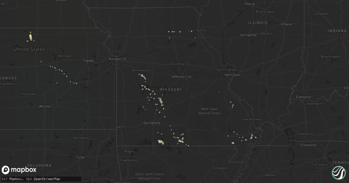
Hail Map in Missouri on July 1, 2020
Get this storm
July 1 map
$229
one time, instant access
Download today. No call, no setup
Keep the $229
Bought the map and want the full workflow? Apply the entire $229 to a subscription within 7 days. None of it is wasted.
Every map, not just this one
This buys you this map. Subscription and you get every map we run, in the markets you choose from a few cities to whole states to nationwide. Plus real-time alerts the moment a storm fires.
Contact data
Name, contact info, occupancy, even credit band for addresses in the footprint. You go from where it hit to who to call.
Become the source they trust
Unlimited branding weather history reports on demand. You already have the documented answer ready for the property owner, and you are the one who showed up with it.
Property data and RoofTrace estimates
Pull up any address you have got, its value and the exact code rules for that jurisdiction, straight from One Click Code. Then RoofTrace estimates the squares, pitch, and roof value, priced the way you price.
Storm reports in Missouri
Missouri
| Date | Description |
|---|---|
| 07/01/202012:00 PM CDT | Electric coop reported power lines/limbs down in the tecumseh area. Time estimated via radar. |
| 07/01/202011:24 AM CDT | Tree down over county road 178. Time estimated by radar. |
| 07/01/20208:57 AM CDT | Tree down on highway 133. Nearby weather stations recorded wind gusts of 35 to 45 mph. Time estimated based on radar. |
| 07/01/20208:30 AM CDT | Tree down on power lines. Nearby weather station in camdenton recorded wind gust of 43 mph. |
| 07/01/20207:15 AM CDT | At 1215 PM CDT, a severe thunderstorm was located near Alliance, or 13 miles east of Fredericktown, moving southeast at 25 mph. HAZARD...60 mph wind gusts and quarter size hail. SOURCE...Radar indicated. IMPACT...Hail damage to vehicles is expected. Expect wind damage to roofs, siding, and trees. Locations impacted include... Perryville, Marble Hill, Patton, Alliance, Daisy, Sedgewickville, Old Appleton and Silver Lake.This includes Interstate 55 between Mile Markers 114 and 130. |
| 07/01/20207:00 AM CDT | At 1200 PM CDT, severe thunderstorms were located along a line extending from 7 miles northeast of Diamond City to near Bakersfield to near West Plains, moving southeast at 30 mph. HAZARD...60 mph wind gusts and quarter size hail. SOURCE...Radar indicated. IMPACT...Hail damage to vehicles is expected. Expect wind damage to roofs, siding, and trees. Locations impacted include... West Plains... Bull Shoals Lake... Norfork Lake... Gainesville... Bakersfield... Theodosia... South Fork... Pontiac... Brandsville... Sundown... Lanton... Tecumseh... Pottersville... Caulfield... Udall... Hardenville... Protem... Rueter... Moody... Isabella... |
| 07/01/20206:51 AM CDT | At 1150 AM CDT, severe thunderstorms were located along a line extending from near Diamond City to 6 miles northwest of Bakersfield, moving southeast at 25 mph. HAZARD...60 mph wind gusts and quarter size hail. SOURCE...Radar indicated. IMPACT...Hail damage to vehicles is expected. Expect wind damage to roofs, siding, and trees. Locations impacted include... Harrison... Mountain Home... Bull Shoals... Salem in Fulton County... Yellville... Gassville... Flippin... Lakeview in Baxter County... Diamond City... Salesville... Bergman... Viola... Lead Hill... Briarcliff... Pyatt... Arkawana... Bexar... Flint Springs... Ott... Lakeway... |
| 07/01/20206:36 AM CDT | At 1136 AM CDT, a severe thunderstorm was located 10 miles north of Diamond City, or 12 miles southeast of Forsyth, moving southeast at 30 mph. HAZARD...60 mph wind gusts and quarter size hail. SOURCE...Radar indicated. IMPACT...Hail damage to vehicles is expected. Expect wind damage to roofs, siding, and trees. Locations impacted include... Bull Shoals Lake... Protem... Rueter... |
| 07/01/20206:20 AM CDT | At 1120 AM CDT, a severe thunderstorm was located 16 miles north of Gainesville, or 20 miles southeast of Ava, moving southeast at 40 mph. HAZARD...60 mph wind gusts and quarter size hail. SOURCE...Radar indicated. IMPACT...Hail damage to vehicles is expected. Expect wind damage to roofs, siding, and trees. Locations impacted include... Norfork Lake... Gainesville... Bakersfield... South Fork... Wasola... Brixey... Noble... Willhoit... Tecumseh... Pottersville... Caulfield... Udall... Gentryville... Hardenville... Siloam Springs... Moody... Sycamore... Dora... Rockbridge... Zanoni... |
| 07/01/20201:14 AM CDT | At 613 AM CDT, severe thunderstorms were located along a line extending from near Mayview to near Odessa to 8 miles north of Kingsville to near Lone Jack to Baldwin Park, moving southeast at 25 mph. HAZARD...60 mph wind gusts and quarter size hail. SOURCE...Radar indicated. IMPACT...Hail damage to vehicles is expected. Expect wind damage to roofs, siding, and trees. Locations impacted include... Lee's Summit, Blue Springs, Warrensburg, Pleasant Hill, Oak Grove, Odessa, Greenwood, Higginsville, Windsor, Knob Noster, Holden, Lake Lotawana, Garden City, Whiteman Air Force Base, La Monte, Lone Jack, Leeton, Creighton, Chilhowee and East Lynne.This includes the following highways... Interstate 70 in Missouri between mile markers 28 and 55. Interstate 470 between mile markers 10 and 11. |
| 06/30/202011:27 PM CDT | At 426 AM CDT, severe thunderstorms were located along a line extending from near Clarksdale to near Agency to near Dearborn to near Camden Point to near Weston, moving southeast at 35 mph. HAZARD...60 mph wind gusts and quarter size hail. SOURCE...Radar indicated. IMPACT...Hail damage to vehicles is expected. Expect wind damage to roofs, siding, and trees. Locations impacted include... St. Joseph, Leavenworth, Liberty, Gladstone, Lansing, Excelsior Springs, Atchison, Smithville, Kearney, Bonner Springs, Parkville, Tonganoxie, Platte City, Basehor, Edwardsville, North Kansas City, Riverside, Lawson, Plattsburg and Lathrop.This includes the following highways... Interstate 70 in Kansas between mile markers 410 and 418. Interstate 35 in Missouri between mile markers 5 and 49. Interstate 29 between mile markers 0 and 47. Interstate 635 between mile markers 5 and 12. Interstate 435 between mile markers 12 and 55. Interstate 229 between mile markers 0 and 2. Kansas Turnpike between mile markers 215 and 226. |
| 06/30/20209:01 PM CDT | At 201 AM CDT, severe thunderstorms were located along a line extending from 7 miles southeast of Emerson to near Shenandoah to 8 miles southeast of Riverton, moving east at 30 mph. HAZARD...60 mph wind gusts. SOURCE...Radar indicated. IMPACT...Expect damage to roofs, siding, and trees. Locations impacted include... Clarinda, Shenandoah, Hamburg, Essex, Farragut, Riverton, Coin, College Springs, Shambaugh, Braddyville, Yorktown, Imogene, Northboro, Blanchard, Hepburn and Pierce Recreation Area. |
All States Impacted by Hail Map on July 1, 2020
Cities Impacted by Hail Map on July 1, 2020
- Lumberton, MS
- Orange City, FL
- Deltona, FL
- Crowell, TX
- Quanah, TX
- Cedarcreek, MO
- Ballinger, TX
- Paint Rock, TX
- Rowena, TX
- Annapolis, MD
- Edgewater, MD
- Severna Park, MD
- Arnold, MD
- Woodbine, NJ
- Ocean View, NJ
- Estell Manor, NJ
- Lucedale, MS
- Moss Point, MS
- Vancourt, TX
- Greenwood, MS
- Talpa, TX
- Deerfield, KS
- Satanta, KS
- Northport, AL
- Manchester Township, NJ
- Lakehurst, NJ
- Cobbs Creek, VA
- Hallieford, VA
- Hudgins, VA
- Bardwell, KY
- Sidon, MS
- Cruger, MS
- Macon, MS
- Carthage, MS
- Bush, LA
- Ulysses, KS
- Ozona, TX
- Cape Charles, VA
- Hermitage, MO
- Viola, AR
- Salem, AR
- Wingo, KY
- Norway, KS
- Courtland, KS
- Westbrook, TX
- Loraine, TX
- Powhatan, VA
- Eufaula, AL
- Chaseley, ND
- Harvey, ND
- Andalusia, AL
- Altavista, VA
- Gladys, VA
- Lynchburg, VA
- Rustburg, VA
- San Angelo, TX
- Williford, AR
- Charles City, VA
- Dyersburg, TN
- De Kalb, MS
- Collinsville, MS
- Daleville, MS
- Porterville, MS
- Bailey, MS
- Eden, TX
- Picayune, MS
- Perkinston, MS
- Deepwater, MO
- Morton, MS
- Lakin, KS
- Manila, AR
- Lauderdale, MS
- Cuba, AL
- Ashford, AL
- Cottonwood, AL
- Forgan, OK
- Sonora, TX
- Leoti, KS
- Cando, ND
- Egeland, ND
- Louisville, MS
- Noxapater, MS
- Dryden, TX
- Winters, TX
- Greenwood, DE
- Milford, DE
- Houston, DE
- Colorado City, TX
- Eupora, MS
- Mathiston, MS
- Hopkins, SC
- Columbia, SC
- Eastover, SC
- Lena, MS
- Eldorado, TX
- Moscow, KS
- Bainbridge, GA
- Colquitt, GA
- Scottsville, VA
- Caulfield, MO
- Salem, CT
- Old Lyme, CT
- East Haddam, CT
- Christoval, TX
- Virginia Beach, VA
- Evington, VA
- Hardy, AR
- Lincoln, DE
- Bowdon, ND
- Disputanta, VA
- Camden, AL
- Sedalia, KY
- Dora, MO
- Sweetwater, TX
- Chesapeake, VA
- Haines City, FL
- Winter Haven, FL
- Dundee, FL
- Kismet, KS
- Emporia, KS
- Roach, MO
- Rotan, TX
- McLain, MS
- Atlanta, MO
- Mechanicsville, MD
- Charlotte Hall, MD
- Hughesville, MD
- Onley, VA
- Accomac, VA
- Council Grove, KS
- White City, KS
- Letohatchee, AL
- Hardyville, VA
- Deltaville, VA
- Wake, VA
- Colchester, CT
- Marion, KS
- Lawn, TX
- Ovalo, TX
- Windsor, MO
- Wheatland, MO
- Edwards, MO
- Brewton, AL
- Diberville, MS
- Biloxi, MS
- Gulfport, MS
- New Egypt, NJ
- Dover, DE
- Harrington, DE
- Camden Wyoming, DE
- Felton, DE
- Viola, DE
- Magnolia, DE
- Jackson, AL
- Sainte Genevieve, MO
- Gates, NC
- Corapeake, NC
- Calico Rock, AR
- Prairie, MS
- Gatesville, NC
- Tyner, NC
- Sunbury, NC
- Belvidere, NC
- Hobbsville, NC
- Hertford, NC
- Whiteville, TN
- Somerville, TN
- Roscoe, TX
- Carlsbad, TX
- Cathay, ND
- Leonard, MO
- Pulaski, MS
- Camden, NC
- Aspermont, TX
- Samson, AL
- Oberon, ND
- Sea Isle City, NJ
- Strathmere, NJ
- Marmora, NJ
- Ocean City, NJ
- Cape May Court House, NJ
- Mountain View, AR
- Windsor, NC
- Hattiesburg, MS
- Jarvisburg, NC
- Grandy, NC
- Powells Point, NC
- Norton, TX
- Pasadena, MD
- Davidsonville, MD
- Crownsville, MD
- Riva, MD
- Melbourne, AR
- Vincentown, NJ
- Ava, MO
- Chatom, AL
- Onancock, VA
- Parksley, VA
- Melfa, VA
- Maben, MS
- Spring Grove, VA
- Walnut Grove, MS
- Brooksville, MS
- Coffeeville, MS
- Bells, TN
- Mize, MS
- Emelle, AL
- Kendall, KS
- Drew, MS
- Starkville, MS
- Gordon, AL
- Jakin, GA
- Flemington, MO
- Lebanon, MO
- Phillipsburg, MO
- Mobile, AL
- Brixey, MO
- Wasola, MO
- Benton, MS
- Bentonia, MS
- Ellendale, DE
- Eldorado, OK
- Meridian, MS
- Senatobia, MS
- Greenville, AL
- Preston, CT
- Ledyard, CT
- West Plains, MO
- Moody, MO
- Gamaliel, AR
- Pine Apple, AL
- Valdosta, GA
- Leonardtown, MD
- Elk City, OK
- Dexter, MO
- Novice, TX
- Diggs, VA
- Moon, VA
- Gwynn, VA
- Newton, AL
- New Rockford, ND
- Mountain Home, AR
- Gassville, AR
- Rueter, MO
- Bradleyville, MO
- Kissee Mills, MO
- Baker, FL
- Holt, FL
- Egg Harbor Township, NJ
- Toone, TN
- Medon, TN
- Silas, AL
- Bowie, MD
- Upper Marlboro, MD
- Prince George, VA
- Fort Lee, VA
- Petersburg, VA
- Sublette, KS
- Sheyenne, ND
- Poughkeepsie, AR
- Bay Springs, MS
- Edenton, NC
- Saraland, AL
- Daphne, AL
- Warsaw, MO
- Greenbush, VA
- Forest, MS
- Stockton, AL
- Vancleave, MS
- Sturkie, AR
- Theodore, AL
- Brandon, MS
- Canton, MS
- Corolla, NC
- Pearl, IL
- Pottersville, MO
- Coila, MS
- Bradford, AR
- Leeton, MO
- Warrensburg, MO
- Shiloh, NC
- Harbinger, NC
- Boston, GA
- Thomasville, GA
- Pavo, GA
- Yaphank, NY
- Ridge, NY
- Manorville, NY
- Shirley, NY
- Citronelle, AL
- Leakesville, MS
- Maddock, ND
- Blakely, GA
- McCool, MS
- Millry, AL
- Harrellsville, NC
- Cofield, NC
- Colerain, NC
- Aberdeen, MS
- Birdsnest, VA
- Painter, VA
- Deer Park, AL
- Fruitdale, AL
- Vinegar Bend, AL
- Campbell, MO
- Qulin, MO
- Poplar Bluff, MO
- Livingston, AL
- Bolivar, MO
- Ravenden, AR
- Woodbine, KS
- Philadelphia, MS
- Cross Timbers, MO
- Chesterfield, VA
- Richmond, VA
- Dudley, MO
- Bloomfield, MO
- Arlington, KY
- Smithville, AR
- Cunningham, KY
- Topping, VA
- White Stone, VA
- Opp, AL
- Milton, FL
- Shawboro, NC
- Kosciusko, MS
- Sallis, MS
- Glen Allen, VA
- Grenada, MS
- Scobey, MS
- Tillatoba, MS
- Pelahatchie, MS
- New Madrid, MO
- Clinton, MO
- Scandia, KS
- Jamestown, KS
- Cuthbert, GA
- Red Level, AL
- Surry, VA
- Smithfield, VA
- Carrollton, VA
- Blackwell, MO
- Martin, TN
- Dukedom, TN
- Cottage Grove, TN
- Puryear, TN
- Java, VA
- Chatham, VA
- Water Valley, MS
- Emporia, VA
- Forest Home, AL
- Georgiana, AL
- Beaumont, MS
- Geneva, FL
- Louin, MS
- Raleigh, MS
- Callao, MO
- Bevier, MO
- Palmyra, MO
- Jackson, NJ
- Preston, MO
- Kinston, AL
- Bethel, MO
- Buffalo, MO
- Adel, GA
- Hahira, GA
- Long Beach, MS
- Woodland, MS
- Houston, MS
- Coffeeville, AL
- Thomasville, AL
- Mertzon, TX
- Moseley, VA
- Mansfield, MO
- Bernie, MO
- Parma, MO
- Bexar, AR
- Elizabeth, AR
- Elrod, AL
- Gordo, AL
- Heber Springs, AR
- Drasco, AR
- Higden, AR
- Abbeville, AL
- Abita Springs, LA
- Ewing, MO
- Vardaman, MS
- Calhoun City, MS
- Clinton, KY
- Mayfield, KY
- Bolivar, TN
- Grove Hill, AL
- Norfolk, VA
- Matthews, MO
- Itta Bena, MS
- Winona, MS
- Midlothian, VA
- Sturgis, MS
- Murray, KY
- Enid, MS
- Lothian, MD
- Jonesboro, AR
- Osceola, AR
- Herington, KS
- Elkland, MO
- Conway, MO
- Yellville, AR
- Columbia, AL
- Puxico, MO
- Paragould, AR
- Uncasville, CT
- Oakdale, CT
- Moyock, NC
- Milton, DE
- Dunnegan, MO
- Fair Play, MO
- Solomon, KS
- Oxford, MS
- Charleston, MS
- Covington, TN
- Sterling City, TX
- Theodosia, MO
- Protem, MO
- Killingworth, CT
- Higganum, CT
- Powhatan, AR
- Crescent City, FL
- Charlottesville, VA
- Tibbie, AL
- Pass Christian, MS
- Hazel, KY
- Evergreen, AL
- Niangua, MO
- Tunas, MO
- Macks Creek, MO
- Loxahatchee, FL
- Grand Bay, AL
- New Orleans, LA
- Pickens, MS
- Lexington, MS
- Concordia, KS
- East Prairie, MO
- Dundalk, MD
- Durant, MS
- Tribune, KS
- Onemo, VA
- Roby, TX
- Marion Station, MD
- Paris, TN
- Neely, MS
- Leroy, AL
- Chapman, KS
- Anaconda, MT
- Port Haywood, VA
- Susan, VA
- Tecumseh, MO
- Jewell, KS
- Gales Ferry, CT
- Bertrand, MO
- Oakland, MS
- Chunchula, AL
- Waldorf, MD
- Kiln, MS
- Camden, TN
- Oldfield, MO
- Fessenden, ND
- Fulton, KY
- Hickory Valley, TN
- Donalsonville, GA
- Brinson, GA
- Iron City, GA
- Hopewell, VA
- Palmersville, TN
- Chester, CT
- Woodside, DE
- Chadwick, MO
- Henrico, VA
- Louisburg, MO
- Coffee Springs, AL
- Warwick, ND
- McEwen, TN
- Lakeland, GA
- Ray City, GA
- Essex, MO
- Stonewall, MS
- Weems, VA
- Irvington, VA
- Lancaster, VA
- Wallops Island, VA
- Plains, KS
- Winchester, IL
- Pontotoc, MS
- Bono, AR
- Cedarbluff, MS
- Vaiden, MS
- Millersville, MD
- Glen Burnie, MD
- Mays Landing, NJ
- Cameron, SC
- Saucier, MS
- Fredericktown, MO
- Medford, NY
- Lisman, AL
- Windyville, MO
- Elmer, MO
- Enterprise, KS
- Farmington, MO
- Shuqualak, MS
- Clewiston, FL
- Batesville, AR
- Long Island, VA
- Holcomb, KS
- Goodman, MS
- West, MS
- Camden, MS


