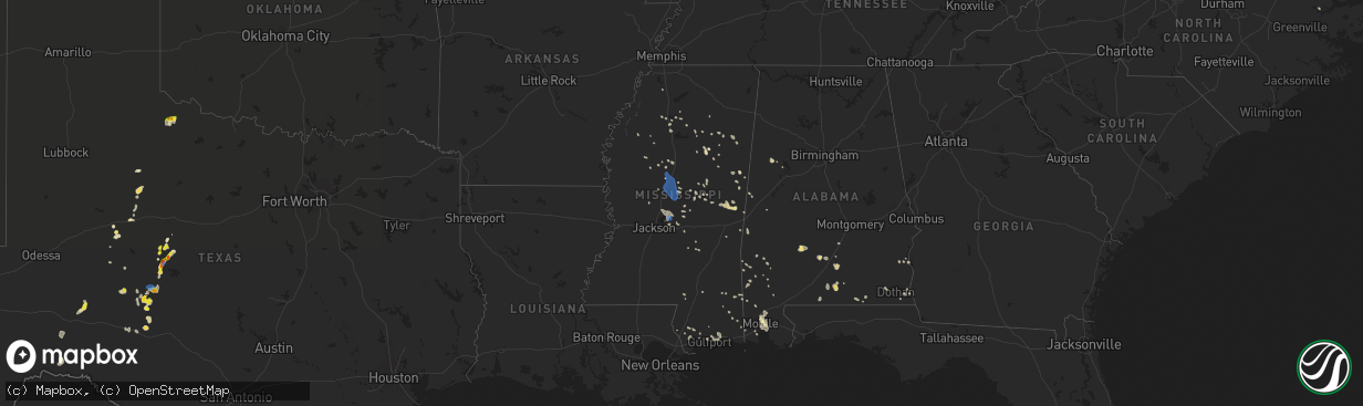
Hail Map in Mississippi on July 1, 2020
The weather event in Mississippi on July 1, 2020 includes Hail, Wind, and Tornado maps. 23 states and 515 cities were impacted and suffered possible damage. The total estimated number of properties impacted is 0.
Want more than just the map?
Turn this storm into a full workflow.
- Owner + property data so you know who to knock
- OnDemand branded weather history reports to win the "did we even have hail?" argument
- RoofTrace estimate so reps stop guessing numbers at the door
Bought this map? Upgrade within 7 days and we'll credit the $230. (10-15 min setup call)
Hail
Wind
Tornado
0
Estimated number of impacted properties by a 1.00" hail or larger0
Estimated number of impacted properties by a 1.75" hail or larger0
Estimated number of impacted properties by a 2.50" hail or largerStorm reports in Mississippi
Mississippi
| Date | Description |
|---|---|
| 07/01/20206:30 PM CDT | Tree down on graham rd. |
| 07/01/20206:15 PM CDT | Large tree down on county road 544 and another tree down on county road 518. |
| 07/01/20206:15 PM CDT | Power lines down on county roads 548 and 500 south of kossuth. |
| 07/01/20206:10 PM CDT | Numerous large branches down across town. |
| 07/01/20203:39 AM CDT | At 838 PM CDT, severe thunderstorms were located along a line extending from near Little Rock to near Forest to Fannin, moving south at 40 mph. HAZARD...60 mph wind gusts and penny size hail. SOURCE...Radar indicated. IMPACT...Expect damage to roofs, siding, and trees. Severe thunderstorms will be near... Pulaski around 845 PM CDT. Homewood around 850 PM CDT. Pineville and Burns around 900 PM CDT. Raleigh around 910 PM CDT. Cato, Johns and Rose Hill around 915 PM CDT. Bay Springs, Center Ridge and Piney Woods around 920 PM CDT. Orange around 925 PM CDT. Mendenhall and Martinville around 930 PM CDT.Other locations impacted by these severe thunderstorms includeSylvarena, Mize, Louin, Puckett, Polkville, D'Lo, Chunky, Montrose,Braxton and Hickory. |
| 07/01/20203:11 AM CDT | At 810 PM CDT, severe thunderstorms were located along a line extending from near Forestdale to Dowdville to near Farmhaven, moving south at 35 mph. HAZARD...60 mph wind gusts and penny size hail. SOURCE...Radar indicated. IMPACT...Expect damage to roofs, siding, and trees. Locations impacted include... Brandon, Canton, Forest, Morton, Prospect, Harperville, Neshoba, Decatur, Pelahatchie, Leesburg, Farmhaven, Goshen Springs, Ludlow, Sharon, Forkville, Pisgah, Branch, Conehatta, Herbert Springs and Stratton. |
| 07/01/20202:31 AM CDT | At 731 PM CDT, severe thunderstorms were located along a line extending from 9 miles northeast of Zama to Kosciusko to near Mcmillan, moving south at 45 mph. HAZARD...60 mph wind gusts and penny size hail. SOURCE...Radar indicated. IMPACT...Expect damage to roofs, siding, and trees. Severe thunderstorms will be near... Smyrna around 740 PM CDT. Pickens, Singleton and Renfroe around 750 PM CDT. Cameron and Vaughan around 755 PM CDT. Carthage, Camden and Way around 800 PM CDT. Sharon, Tuscola and Madden around 810 PM CDT. Farmhaven around 815 PM CDT.Other locations impacted by these severe thunderstorms include Lena,Walnut Grove, Sallis, Redwater and Standing Pine. |
| 07/01/202012:32 AM CDT | At 532 PM CDT, a severe thunderstorm was located over Burnside, or near Philadelphia, moving east at 20 mph. HAZARD...60 mph wind gusts and nickel size hail. SOURCE...Radar indicated. IMPACT...Expect damage to roofs, siding, and trees. This severe thunderstorm will be near... Burnside around 535 PM CDT. Stallo around 540 PM CDT. Forestdale around 600 PM CDT. Nanih Waiya around 605 PM CDT.Other locations impacted by this severe thunderstorm includeNoxapater and Tucker. |
| 06/30/202011:23 PM CDT | At 423 PM CDT, a severe thunderstorm was located near Tillmans Corner, moving south at 35 mph. HAZARD...60 mph wind gusts. SOURCE...Radar indicated. IMPACT...Expect damage to roofs, siding, and trees. Locations impacted include... Theodore, Grand Bay, Bayou La Batre, Dauphin Island, Coden, Fort Morgan and Alabama Port. |
| 06/30/20209:20 PM CDT | At 219 PM CDT, severe thunderstorms were located along a line extending from Homewood to near Raleigh, moving east at 25 mph. HAZARD...60 mph wind gusts and nickel size hail. SOURCE...Radar indicated. IMPACT...Expect damage to roofs, siding, and trees. Severe thunderstorms will be near... Center Ridge around 230 PM CDT. Pineville around 235 PM CDT. Stringer, Lawrence and Bay Springs around 255 PM CDT. Roberts, Turnerville, Garlandville and Vernon around 300 PM CDT.Other locations impacted by these severe thunderstorms includeSylvarena, Lake, Montrose and Louin. |
| 06/30/20208:52 PM CDT | Tree down on utility equipment. |
| 06/30/20208:51 PM CDT | Tree down across power lines along 541 near the strong river bridge. |
| 06/30/20208:39 PM CDT | Trees and power lines down. |
| 06/30/20208:35 PM CDT | Trees down in lake. |
| 06/30/20208:35 PM CDT | Tree down near oakdale and wagoner. |
| 06/30/20207:55 PM CDT | Tree down on ben lucket rd. |
| 06/30/20207:52 PM CDT | Tree down on marty steward rd near the arlington community. |
| 06/30/20207:50 PM CDT | Tree down on highway 395. |
| 06/30/20207:45 PM CDT | Two trees down in leake county. |
| 06/30/20207:25 PM CDT | Large limb down on plum rd reported by broadcast media. |
| 06/30/20207:15 PM CDT | Tree down on keytown rd. |
All States Impacted by Hail Map on July 1, 2020
Cities Impacted by Hail Map on July 1, 2020
- Lumberton, MS
- Orange City, FL
- Deltona, FL
- Crowell, TX
- Quanah, TX
- Cedarcreek, MO
- Ballinger, TX
- Paint Rock, TX
- Rowena, TX
- Annapolis, MD
- Edgewater, MD
- Severna Park, MD
- Arnold, MD
- Woodbine, NJ
- Ocean View, NJ
- Estell Manor, NJ
- Lucedale, MS
- Moss Point, MS
- Vancourt, TX
- Greenwood, MS
- Talpa, TX
- Deerfield, KS
- Satanta, KS
- Northport, AL
- Manchester Township, NJ
- Lakehurst, NJ
- Cobbs Creek, VA
- Hallieford, VA
- Hudgins, VA
- Bardwell, KY
- Sidon, MS
- Cruger, MS
- Macon, MS
- Carthage, MS
- Bush, LA
- Ulysses, KS
- Ozona, TX
- Cape Charles, VA
- Hermitage, MO
- Viola, AR
- Salem, AR
- Wingo, KY
- Norway, KS
- Courtland, KS
- Westbrook, TX
- Loraine, TX
- Powhatan, VA
- Eufaula, AL
- Chaseley, ND
- Harvey, ND
- Andalusia, AL
- Altavista, VA
- Gladys, VA
- Lynchburg, VA
- Rustburg, VA
- San Angelo, TX
- Williford, AR
- Charles City, VA
- Dyersburg, TN
- De Kalb, MS
- Collinsville, MS
- Daleville, MS
- Porterville, MS
- Bailey, MS
- Eden, TX
- Picayune, MS
- Perkinston, MS
- Deepwater, MO
- Morton, MS
- Lakin, KS
- Manila, AR
- Lauderdale, MS
- Cuba, AL
- Ashford, AL
- Cottonwood, AL
- Forgan, OK
- Sonora, TX
- Leoti, KS
- Cando, ND
- Egeland, ND
- Louisville, MS
- Noxapater, MS
- Dryden, TX
- Winters, TX
- Greenwood, DE
- Milford, DE
- Houston, DE
- Colorado City, TX
- Eupora, MS
- Mathiston, MS
- Hopkins, SC
- Columbia, SC
- Eastover, SC
- Lena, MS
- Eldorado, TX
- Moscow, KS
- Bainbridge, GA
- Colquitt, GA
- Scottsville, VA
- Caulfield, MO
- Salem, CT
- Old Lyme, CT
- East Haddam, CT
- Christoval, TX
- Virginia Beach, VA
- Evington, VA
- Hardy, AR
- Lincoln, DE
- Bowdon, ND
- Disputanta, VA
- Camden, AL
- Sedalia, KY
- Dora, MO
- Sweetwater, TX
- Chesapeake, VA
- Haines City, FL
- Winter Haven, FL
- Dundee, FL
- Kismet, KS
- Emporia, KS
- Roach, MO
- Rotan, TX
- McLain, MS
- Atlanta, MO
- Mechanicsville, MD
- Charlotte Hall, MD
- Hughesville, MD
- Onley, VA
- Accomac, VA
- Council Grove, KS
- White City, KS
- Letohatchee, AL
- Hardyville, VA
- Deltaville, VA
- Wake, VA
- Colchester, CT
- Marion, KS
- Lawn, TX
- Ovalo, TX
- Windsor, MO
- Wheatland, MO
- Edwards, MO
- Brewton, AL
- Diberville, MS
- Biloxi, MS
- Gulfport, MS
- New Egypt, NJ
- Dover, DE
- Harrington, DE
- Camden Wyoming, DE
- Felton, DE
- Viola, DE
- Magnolia, DE
- Jackson, AL
- Sainte Genevieve, MO
- Gates, NC
- Corapeake, NC
- Calico Rock, AR
- Prairie, MS
- Gatesville, NC
- Tyner, NC
- Sunbury, NC
- Belvidere, NC
- Hobbsville, NC
- Hertford, NC
- Whiteville, TN
- Somerville, TN
- Roscoe, TX
- Carlsbad, TX
- Cathay, ND
- Leonard, MO
- Pulaski, MS
- Camden, NC
- Aspermont, TX
- Samson, AL
- Oberon, ND
- Sea Isle City, NJ
- Strathmere, NJ
- Marmora, NJ
- Ocean City, NJ
- Cape May Court House, NJ
- Mountain View, AR
- Windsor, NC
- Hattiesburg, MS
- Jarvisburg, NC
- Grandy, NC
- Powells Point, NC
- Norton, TX
- Pasadena, MD
- Davidsonville, MD
- Crownsville, MD
- Riva, MD
- Melbourne, AR
- Vincentown, NJ
- Ava, MO
- Chatom, AL
- Onancock, VA
- Parksley, VA
- Melfa, VA
- Maben, MS
- Spring Grove, VA
- Walnut Grove, MS
- Brooksville, MS
- Coffeeville, MS
- Bells, TN
- Mize, MS
- Emelle, AL
- Kendall, KS
- Drew, MS
- Starkville, MS
- Gordon, AL
- Jakin, GA
- Flemington, MO
- Lebanon, MO
- Phillipsburg, MO
- Mobile, AL
- Brixey, MO
- Wasola, MO
- Benton, MS
- Bentonia, MS
- Ellendale, DE
- Eldorado, OK
- Meridian, MS
- Senatobia, MS
- Greenville, AL
- Preston, CT
- Ledyard, CT
- West Plains, MO
- Moody, MO
- Gamaliel, AR
- Pine Apple, AL
- Valdosta, GA
- Leonardtown, MD
- Elk City, OK
- Dexter, MO
- Novice, TX
- Diggs, VA
- Moon, VA
- Gwynn, VA
- Newton, AL
- New Rockford, ND
- Mountain Home, AR
- Gassville, AR
- Rueter, MO
- Bradleyville, MO
- Kissee Mills, MO
- Baker, FL
- Holt, FL
- Egg Harbor Township, NJ
- Toone, TN
- Medon, TN
- Silas, AL
- Bowie, MD
- Upper Marlboro, MD
- Prince George, VA
- Fort Lee, VA
- Petersburg, VA
- Sublette, KS
- Sheyenne, ND
- Poughkeepsie, AR
- Bay Springs, MS
- Edenton, NC
- Saraland, AL
- Daphne, AL
- Warsaw, MO
- Greenbush, VA
- Forest, MS
- Stockton, AL
- Vancleave, MS
- Sturkie, AR
- Theodore, AL
- Brandon, MS
- Canton, MS
- Corolla, NC
- Pearl, IL
- Pottersville, MO
- Coila, MS
- Bradford, AR
- Leeton, MO
- Warrensburg, MO
- Shiloh, NC
- Harbinger, NC
- Boston, GA
- Thomasville, GA
- Pavo, GA
- Yaphank, NY
- Ridge, NY
- Manorville, NY
- Shirley, NY
- Citronelle, AL
- Leakesville, MS
- Maddock, ND
- Blakely, GA
- McCool, MS
- Millry, AL
- Harrellsville, NC
- Cofield, NC
- Colerain, NC
- Aberdeen, MS
- Birdsnest, VA
- Painter, VA
- Deer Park, AL
- Fruitdale, AL
- Vinegar Bend, AL
- Campbell, MO
- Qulin, MO
- Poplar Bluff, MO
- Livingston, AL
- Bolivar, MO
- Ravenden, AR
- Woodbine, KS
- Philadelphia, MS
- Cross Timbers, MO
- Chesterfield, VA
- Richmond, VA
- Dudley, MO
- Bloomfield, MO
- Arlington, KY
- Smithville, AR
- Cunningham, KY
- Topping, VA
- White Stone, VA
- Opp, AL
- Milton, FL
- Shawboro, NC
- Kosciusko, MS
- Sallis, MS
- Glen Allen, VA
- Grenada, MS
- Scobey, MS
- Tillatoba, MS
- Pelahatchie, MS
- New Madrid, MO
- Clinton, MO
- Scandia, KS
- Jamestown, KS
- Cuthbert, GA
- Red Level, AL
- Surry, VA
- Smithfield, VA
- Carrollton, VA
- Blackwell, MO
- Martin, TN
- Dukedom, TN
- Cottage Grove, TN
- Puryear, TN
- Java, VA
- Chatham, VA
- Water Valley, MS
- Emporia, VA
- Forest Home, AL
- Georgiana, AL
- Beaumont, MS
- Geneva, FL
- Louin, MS
- Raleigh, MS
- Callao, MO
- Bevier, MO
- Palmyra, MO
- Jackson, NJ
- Preston, MO
- Kinston, AL
- Bethel, MO
- Buffalo, MO
- Adel, GA
- Hahira, GA
- Long Beach, MS
- Woodland, MS
- Houston, MS
- Coffeeville, AL
- Thomasville, AL
- Mertzon, TX
- Moseley, VA
- Mansfield, MO
- Bernie, MO
- Parma, MO
- Bexar, AR
- Elizabeth, AR
- Elrod, AL
- Gordo, AL
- Heber Springs, AR
- Drasco, AR
- Higden, AR
- Abbeville, AL
- Abita Springs, LA
- Ewing, MO
- Vardaman, MS
- Calhoun City, MS
- Clinton, KY
- Mayfield, KY
- Bolivar, TN
- Grove Hill, AL
- Norfolk, VA
- Matthews, MO
- Itta Bena, MS
- Winona, MS
- Midlothian, VA
- Sturgis, MS
- Murray, KY
- Enid, MS
- Lothian, MD
- Jonesboro, AR
- Osceola, AR
- Herington, KS
- Elkland, MO
- Conway, MO
- Yellville, AR
- Columbia, AL
- Puxico, MO
- Paragould, AR
- Uncasville, CT
- Oakdale, CT
- Moyock, NC
- Milton, DE
- Dunnegan, MO
- Fair Play, MO
- Solomon, KS
- Oxford, MS
- Charleston, MS
- Covington, TN
- Sterling City, TX
- Theodosia, MO
- Protem, MO
- Killingworth, CT
- Higganum, CT
- Powhatan, AR
- Crescent City, FL
- Charlottesville, VA
- Tibbie, AL
- Pass Christian, MS
- Hazel, KY
- Evergreen, AL
- Niangua, MO
- Tunas, MO
- Macks Creek, MO
- Loxahatchee, FL
- Grand Bay, AL
- New Orleans, LA
- Pickens, MS
- Lexington, MS
- Concordia, KS
- East Prairie, MO
- Dundalk, MD
- Durant, MS
- Tribune, KS
- Onemo, VA
- Roby, TX
- Marion Station, MD
- Paris, TN
- Neely, MS
- Leroy, AL
- Chapman, KS
- Anaconda, MT
- Port Haywood, VA
- Susan, VA
- Tecumseh, MO
- Jewell, KS
- Gales Ferry, CT
- Bertrand, MO
- Oakland, MS
- Chunchula, AL
- Waldorf, MD
- Kiln, MS
- Camden, TN
- Oldfield, MO
- Fessenden, ND
- Fulton, KY
- Hickory Valley, TN
- Donalsonville, GA
- Brinson, GA
- Iron City, GA
- Hopewell, VA
- Palmersville, TN
- Chester, CT
- Woodside, DE
- Chadwick, MO
- Henrico, VA
- Louisburg, MO
- Coffee Springs, AL
- Warwick, ND
- McEwen, TN
- Lakeland, GA
- Ray City, GA
- Essex, MO
- Stonewall, MS
- Weems, VA
- Irvington, VA
- Lancaster, VA
- Wallops Island, VA
- Plains, KS
- Winchester, IL
- Pontotoc, MS
- Bono, AR
- Cedarbluff, MS
- Vaiden, MS
- Millersville, MD
- Glen Burnie, MD
- Mays Landing, NJ
- Cameron, SC
- Saucier, MS
- Fredericktown, MO
- Medford, NY
- Lisman, AL
- Windyville, MO
- Elmer, MO
- Enterprise, KS
- Farmington, MO
- Shuqualak, MS
- Clewiston, FL
- Batesville, AR
- Long Island, VA
- Holcomb, KS
- Goodman, MS
- West, MS
- Camden, MS


