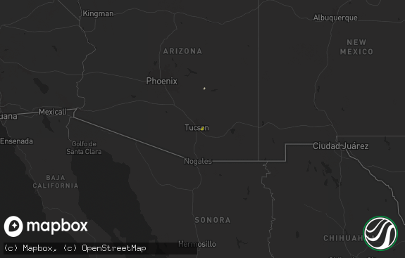
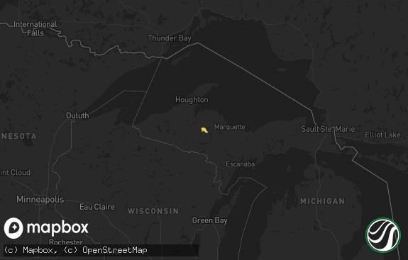
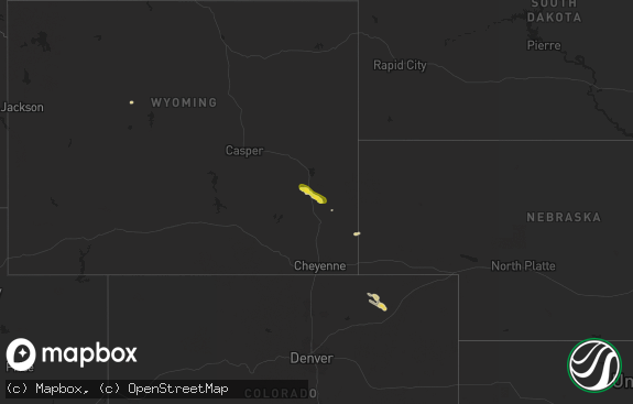
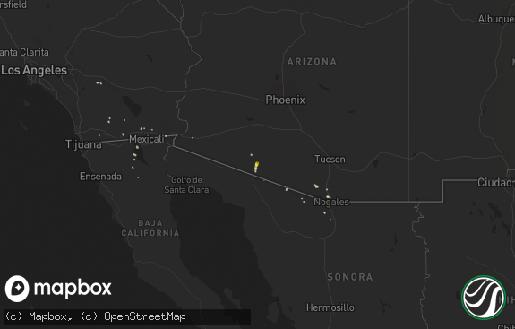
Hail Map in Wyoming on June 30, 2024
The weather event in Wyoming on June 30, 2024 includes Hail and Wind maps. 31 states and 458 cities were impacted and suffered possible damage. The total estimated number of properties impacted is 1,186.

Hail
Wind
1,186
Estimated number of impacted properties by a 1.00" hail or larger0
Estimated number of impacted properties by a 1.75" hail or larger0
Estimated number of impacted properties by a 2.50" hail or largerStorm reports in Wyoming
Wyoming
| Date | Description |
|---|---|
| 06/30/20246:32 PM CDT | A local report indicates 60 MPH wind near 9 SSW Clareton |
| 06/30/20246:09 PM CDT | A local report indicates 60 MPH wind near 7 NNE Rochelle |
| 06/30/20244:25 PM CDT | Largest stones up to ping pong ball sized. |
| 06/30/20244:21 PM CDT | Quarter sized hail at the gurnsey state park dam. |
| 06/30/20243:44 PM CDT | Mesonet station wy40 7.5 s chugwater |
| 06/30/20243:44 PM CDT | Mesonet station wy40 7.5 s chu |
| 06/30/20243:36 PM CDT | Mesonet station wy40 7.5 s chugwater |
| 06/30/20243:16 PM CDT | A local report indicates 58 MPH wind near 17 WSW Wright |
| 06/30/20242:12 PM CDT | Mesonet station wy62 i25 us87 - smokey gap. |
| 06/30/20244:52 AM CDT | Mesonet station wy19 2.9 nw elk mountain |
| 06/29/20249:25 PM CDT | Measured wind from handheld kestrel. |
| 06/29/20249:20 PM CDT | Reports of numerous pole barns being destroyed northeast of intersection of iron mountain road and powderhouse road. |
| 06/29/20249:19 PM CDT | Half an inch of rain in 30 minutes as well. |
| 06/29/20249:18 PM CDT | Strong winds estimated on the north side of cheyenne. |
| 06/29/20248:08 PM CDT | Raws mesonet station gnrw4 located 6 nw hartville. |
| 06/29/20247:52 PM CDT | A local report indicates 60 MPH wind near 2 SW Newcastle |
| 06/29/20247:21 PM CDT | A local report indicates 73 MPH wind near 5 S Newcastle |
| 06/29/20247:11 PM CDT | A local report indicates 60 MPH wind near 7 NNW Morrisey |
All States Impacted by Hail Map on June 30, 2024
Cities Impacted by Hail Map on June 30, 2024
- Seney, MI
- McMillan, MI
- Newberry, MI
- Engadine, MI
- Scottsville, KY
- Holland, KY
- Hancock, NY
- East Branch, NY
- Fishs Eddy, NY
- Long Eddy, NY
- Roscoe, NY
- Parksville, NY
- Willow, NY
- Bearsville, NY
- Woodstock, NY
- Mount Tremper, NY
- Saugerties, NY
- Red Hook, NY
- McDaniels, KY
- Clinton Corners, NY
- Stanfordville, NY
- Salt Point, NY
- Hyde Park, NY
- Staatsburg, NY
- Millbrook, NY
- Leitchfield, KY
- New Milford, CT
- Washington Depot, CT
- Bellefonte, PA
- Howard, PA
- Washington, CT
- Roxbury, CT
- Sarasota, FL
- Rebersburg, PA
- Osprey, FL
- Carmel, NY
- Holmes, NY
- Stormville, NY
- West Point, VA
- Barhamsville, VA
- Patterson, NY
- Clinton, AR
- Center Ridge, AR
- Bridgewater, CT
- Brookfield, CT
- Pawling, NY
- Sherman, CT
- New Fairfield, CT
- Springfield, AR
- Selinsgrove, PA
- Woodbury, CT
- Southbury, CT
- Greenbrier, AR
- Bee Branch, AR
- Hattieville, AR
- Newtown, CT
- Sandy Hook, CT
- Hebron, CT
- Marlborough, CT
- Glastonbury, CT
- Arkadelphia, AR
- Jerusalem, AR
- Damascus, AR
- Amston, CT
- Sunbury, PA
- Middlebury, CT
- Oakville, CT
- Watertown, CT
- Waterbury, CT
- Bethlehem, CT
- Lebanon, CT
- Columbia, CT
- Naugatuck, CT
- Oxford, CT
- Aberdeen, NC
- West End, NC
- Wolcott, CT
- Willimantic, CT
- Andover, CT
- Coventry, CT
- Bethany, CT
- Beacon Falls, CT
- Prospect, CT
- Mansfield Center, CT
- Windham, CT
- Millinocket, ME
- Colchester, CT
- Cheshire, CT
- South Windham, CT
- North Windham, CT
- Hampton, CT
- Pickens, SC
- Pinehurst, NC
- Canterbury, CT
- Newton, NJ
- Castlewood, VA
- Saint Paul, VA
- Coeburn, VA
- Hamden, CT
- Wallingford, CT
- Baltic, CT
- Jewett City, CT
- Scotland, CT
- North Haven, CT
- Benton, AR
- Traskwood, AR
- Plainfield, CT
- Sparta, NJ
- Andover, NJ
- Moosup, CT
- Lafayette, NJ
- Manheim, PA
- Palmyra, PA
- Northford, CT
- Durham, CT
- Guilford, CT
- Easley, SC
- Lititz, PA
- Newfoundland, NJ
- Rockaway, NJ
- Palmerton, PA
- Walnutport, PA
- Lehighton, PA
- Lake Hopatcong, NJ
- Dungannon, VA
- Fort Blackmore, VA
- Mount Gretna, PA
- Lebanon, PA
- Bath, NH
- Wells River, VT
- Woodsville, NH
- Lisbon, NH
- Franconia, NH
- Lincoln, NH
- Stevens, PA
- Ephrata, PA
- Bangor, PA
- Pen Argyl, PA
- Nazareth, PA
- North Haverhill, NH
- Danielsville, PA
- Kunkletown, PA
- Newbury, VT
- Greer, SC
- Denver, PA
- Cordell, OK
- Woodruff, SC
- Simpsonville, SC
- Easton, PA
- Fountain Run, KY
- Carbondale, PA
- Booneville, AR
- Cape Charles, VA
- Lima, MT
- Colony, OK
- Warren, NH
- Oxford, ME
- Casco, ME
- Harrison, ME
- Poland, ME
- Cheyenne, WY
- Burnham, ME
- Unity, ME
- Parks, AR
- Harvey, AR
- Clinton, ME
- York, PA
- Lewisville, AR
- Hope, AR
- San Simon, AZ
- Troy, ME
- Wrightsville, PA
- Oden, AR
- Pencil Bluff, AR
- Chugwater, WY
- Laramie, WY
- Morganton, NC
- Clark, NJ
- Colonia, NJ
- Newmanstown, PA
- Chaparral, NM
- Gillette, WY
- Bird In Hand, PA
- Leola, PA
- Strasburg, PA
- Meriden, WY
- Lagrange, WY
- White Sands Missile Range, NM
- Sierra Blanca, TX
- Elfrida, AZ
- Robesonia, PA
- Coatesville, PA
- Cloudcroft, NM
- Staten Island, NY
- Perth Amboy, NJ
- Fords, NJ
- Keasbey, NJ
- Virginia City, MT
- West Chester, PA
- Kennett Square, PA
- Las Cruces, NM
- Guernsey, WY
- Hanover, MD
- Annapolis Junction, MD
- Jessup, MD
- Severn, MD
- Fort George G Meade, MD
- Wheatland, WY
- Hartville, WY
- Gambrills, MD
- Odenton, MD
- Millersville, MD
- Cameron, MT
- Folsom, PA
- Woodlyn, PA
- Wallingford, PA
- Swarthmore, PA
- Ronks, PA
- Thornton, PA
- Glen Mills, PA
- Oxford, NC
- North East, MD
- Annapolis, MD
- Severna Park, MD
- Crownsville, MD
- Arnold, MD
- Bozeman, MT
- Garnet Valley, PA
- Aston, PA
- Marcus Hook, PA
- Stem, NC
- Princeton, NJ
- Swedesboro, NJ
- Bridgeport, NJ
- Edgewater, MD
- Hillsborough, NJ
- Somerset, NJ
- Sewell, NJ
- Mantua, NJ
- Warwick, MD
- Earleville, MD
- Elgin, SC
- Clarksboro, NJ
- Mickleton, NJ
- Spotsylvania, VA
- Whitehouse Station, NJ
- Willcox, AZ
- Kendall Park, NJ
- Monroe Township, NJ
- Monmouth Junction, NJ
- Dayton, NJ
- Aiken, SC
- Woodford, VA
- Mathiston, MS
- Middletown, DE
- Livingston Manor, NY
- Old Bridge, NJ
- Livingston, MT
- Ruther Glen, VA
- Townsend, DE
- Castle Rock, CO
- Cranbury, NJ
- Forest City, PA
- Oak Ridge, NJ
- Bowie, MD
- Upper Marlboro, MD
- Lanham, MD
- Hyattsville, MD
- Dermott, AR
- Mount Laurel, NJ
- Maple Shade, NJ
- Cherry Hill, NJ
- Marlton, NJ
- Voorhees, NJ
- Medford, NJ
- Vincentown, NJ
- Franktown, CO
- Wilsall, MT
- Batesburg, SC
- Emigrant, MT
- Pray, MT
- Smyrna, DE
- Milford, VA
- Gallatin Gateway, MT
- Saint David, AZ
- Douglas, WY
- Barnegat, NJ
- Chatsworth, NJ
- Delhi, LA
- Media, PA
- Elbert, CO
- Rhinebeck, NY
- Nogales, AZ
- Patagonia, AZ
- West Creek, NJ
- Tuckerton, NJ
- Beach Haven, NJ
- Egg Harbor City, NJ
- Sicklerville, NJ
- Williamstown, NJ
- Clementon, NJ
- West Berlin, NJ
- Berlin, NJ
- Gibbsboro, NJ
- Atco, NJ
- Waterford Works, NJ
- Hammonton, NJ
- Stratford, NJ
- Mays Landing, NJ
- New Gretna, NJ
- Absecon, NJ
- Port Republic, NJ
- Brigantine, NJ
- Somerdale, NJ
- Manahawkin, NJ
- Newcastle, WY
- Larkspur, CO
- Rising Sun, MD
- Nottingham, PA
- Amenia, NY
- Davidsonville, MD
- Lothian, MD
- Springfield, PA
- Broomall, PA
- Baskin, LA
- Lance Creek, WY
- Wenonah, NJ
- Rayville, LA
- Mangham, LA
- Columbia, LA
- Ward, AL
- Buckhorn, NM
- Montpelier, VA
- Richland, GA
- Cusseta, GA
- Elkton, MD
- Colorado Springs, CO
- Chester, PA
- Brookhaven, PA
- Tracys Landing, MD
- Dunkirk, MD
- Deale, MD
- Glen Allen, VA
- Ashland, VA
- Lorton, VA
- Fort Belvoir, VA
- Butler, AL
- Pennington, AL
- Newport, NJ
- Rockville, VA
- North Beach, MD
- Lincoln University, PA
- West Grove, PA
- Landenberg, PA
- Jachin, AL
- Newark, DE
- Port Deposit, MD
- Elk Mills, MD
- Shawmut, MT
- Summerville, GA
- Doswell, VA
- Beaverdam, VA
- Winnsboro, LA
- Hockessin, DE
- Avondale, PA
- Waldorf, MD
- Bryans Road, MD
- Indian Head, MD
- Matheson, CO
- White Plains, MD
- La Plata, MD
- Pomfret, MD
- Chesapeake City, MD
- Edgemont, SD
- Custer, SD
- Limon, CO
- Brandywine, MD
- Hughesville, MD
- Bryantown, MD
- Harwood, MD
- Bonifay, FL
- Shoup, ID
- Greenwich, NJ
- Hanover, VA
- Denmark, SC
- Mechanicsville, VA
- Graceville, FL
- Chipley, FL
- Fredericksburg, VA
- Paonia, CO
- Charlotte Hall, MD
- Mechanicsville, MD
- Henrico, VA
- Hugo, CO
- Ramah, CO
- Glen Burnie, MD
- Pasadena, MD
- Gibson Island, MD
- Pagosa Springs, CO
- Boone, CO
- Alexandria, VA
- Hysham, MT
- Barnwell, SC
- Forsyth, MT
- Fe Warren Afb, WY
- Villa Grove, CO
- Custer, MT
- Rosebud, MT
- Allendale, SC
- Chestertown, MD
- Bighorn, MT
- Sanders, MT
- Lebanon, NJ
- Millen, GA
- Somerville, NJ
- Hathaway, MT
- Riva, MD
- Chadds Ford, PA
- Cedarville, NJ
- Centreville, MD
- Hillsdale, WY
- Carpenter, WY
- Burns, WY
- Kinsey, MT
- Sanford, NC
- Moncure, NC
- Pittsboro, NC
- Garfield, GA
- Kit Carson, CO
- Portal, GA
- Cohagen, MT
- Terry, MT
- Jordan, MT
- Karval, CO
- Circle, MT
- Brockway, MT
- Haswell, CO
- Lindsay, MT
- Chauncey, GA
- Eastman, GA
- Calhan, CO
- Simla, CO
- Agate, CO
- Cheyenne Wells, CO
- Genoa, CO
- Hill City, KS
- Rocky Ford, GA
- Rush, CO
- Zap, ND
- Beulah, ND
- Bogue, KS
- Hazen, ND
- Stanton, ND
- Lenora, KS
- Logan, KS
- Underwood, ND
- Coleharbor, ND
- Riverdale, ND


