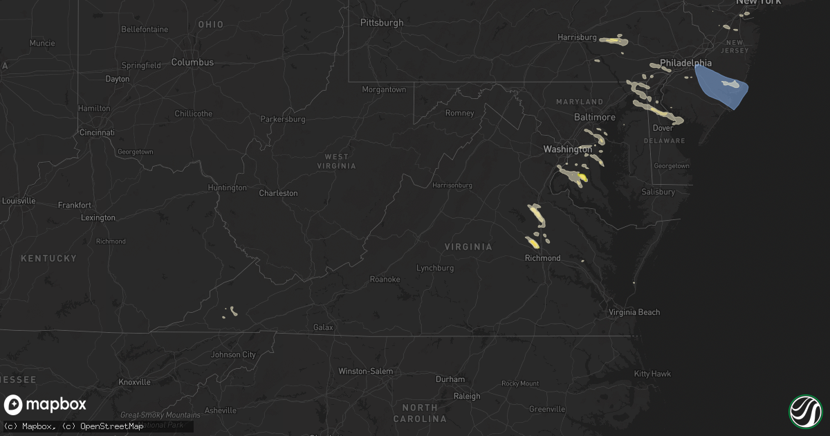
Hail Map in Virginia on June 30, 2024
Get this storm
June 30 map
$229
one time, instant access
Download today. No call, no setup
Keep the $229
Bought the map and want the full workflow? Apply the entire $229 to a subscription within 7 days. None of it is wasted.
Every map, not just this one
This buys you this map. Subscription and you get every map we run, in the markets you choose from a few cities to whole states to nationwide. Plus real-time alerts the moment a storm fires.
Contact data
Name, contact info, occupancy, even credit band for addresses in the footprint. You go from where it hit to who to call.
Become the source they trust
Unlimited branding weather history reports on demand. You already have the documented answer ready for the property owner, and you are the one who showed up with it.
Property data and RoofTrace estimates
Pull up any address you have got, its value and the exact code rules for that jurisdiction, straight from One Click Code. Then RoofTrace estimates the squares, pitch, and roof value, priced the way you price.
Storm reports in Virginia
Virginia
| Date | Description |
|---|---|
| 06/30/20246:20 PM CDT | Trees down on route 1 near |
| 06/30/20246:20 PM CDT | Trees down on route 1 near the border with hanover county. |
| 06/30/20246:20 PM CDT | Trees down in various places throughout the southern portion of caroline county. |
| 06/30/20246:17 PM CDT | Debris on i-95 near kings dominion due to tstm winds. Report via waze app. |
| 06/30/20245:55 PM CDT | A tree was blown down by thunderstorm winds along west lake road. |
| 06/30/20245:42 PM CDT | Trees down on golansville road in caroline county. Time estimated. |
| 06/30/20245:40 PM CDT | Multiple trees down in ladysmith. Time estimated from radar data. |
| 06/30/20245:27 PM CDT | A tree was down along ham ford road and marye road. The tree fell onto a powerline. |
| 06/30/20245:19 PM CDT | Thunderstorm winds blew down one tree on to an outbuilding along the 100 block of ruskin street. |
| 06/30/20245:15 PM CDT | Several trees down around partlow road. |
| 06/30/20245:11 PM CDT | A tree was down along courthouse road at cloverhill road. |
| 06/30/20244:57 PM CDT | Tree down across portion of milton highway. Time based on radar. |
| 06/30/20244:55 PM CDT | Tree down in runnett bag just north of the franklin/patrick county line. Time estimated from radar. |
| 06/30/20244:30 PM CDT | Corrects time and description of previous tstm wnd dmg report from 1 sse victoria. Multiple trees down near the intersection of route 663 and tomlinson road near victor |
| 06/30/20244:23 PM CDT | A least two trees were blown down by thunderstorms winds near the intersection of water oak road with mapleton road. |
| 06/30/20244:23 PM CDT | A tree was blown down near the intersection of greensboro road and morehead avenue. |
| 06/30/20244:10 PM CDT | A tree was blown down near the intersection of horsepasture price road and far point lane. |
| 06/30/20243:45 PM CDT | Thunderstorm winds blew down several trees along hardy road. |
| 06/30/20243:45 PM CDT | A tree was blown down by thunderstorm winds near the intersection of toshes road and darby road. |
| 06/30/20243:30 PM CDT | Multiple trees down near the intersection of route 663 and tomlinson road near victoria. Time estimated. |
| 06/30/20243:13 PM CDT | Power line downed on chesapeake blvd in norfolk. Time estimated. |
| 06/30/20243:10 PM CDT | Tree down on lovely valley road near smith mountain lake. Time estimated from radar. |
| 06/30/20242:40 PM CDT | Numerous trees down throughout northampton county. |
| 06/30/20242:30 PM CDT | A large tree was blown down by thunderstorm winds onto carlock creek road... Blocking one lane of traffic. |
| 06/30/20242:28 PM CDT | A large tree was blown down onto a power line along cliff view road. |
| 06/30/20242:20 PM CDT | Tree down on power line along lions club road near highway 107. Time estimated from radar. |
| 06/30/20242:10 PM CDT | Tree down on evans creek road in brunswick county. Time estimated. |
| 06/30/20242:05 PM CDT | Tree down on powerline along harmon street in north tazewell. Time estimated from radar. |
| 06/30/20242:00 PM CDT | A few trees down throughout the county. |
| 06/30/20242:00 PM CDT | Lane closures on us-60 likely due to debris on roadway reported by dept of highways. Time estimated from radar data. |
| 06/30/20241:50 PM CDT | A few trees down throughout the county. |
| 06/29/20247:11 PM CDT | Public report of quarter size hail relayed by broadcast media. |
| 06/29/20247:10 PM CDT | Tree partially blocking the roadway on i-64 at gaskins rd. Time estimated from radar data. |
All States Impacted by Hail Map on June 30, 2024
Cities Impacted by Hail Map on June 30, 2024
- Seney, MI
- McMillan, MI
- Newberry, MI
- Engadine, MI
- Scottsville, KY
- Holland, KY
- Hancock, NY
- East Branch, NY
- Fishs Eddy, NY
- Long Eddy, NY
- Roscoe, NY
- Parksville, NY
- Willow, NY
- Bearsville, NY
- Woodstock, NY
- Mount Tremper, NY
- Saugerties, NY
- Red Hook, NY
- McDaniels, KY
- Clinton Corners, NY
- Stanfordville, NY
- Salt Point, NY
- Hyde Park, NY
- Staatsburg, NY
- Millbrook, NY
- Leitchfield, KY
- New Milford, CT
- Washington Depot, CT
- Bellefonte, PA
- Howard, PA
- Washington, CT
- Roxbury, CT
- Sarasota, FL
- Rebersburg, PA
- Osprey, FL
- Carmel, NY
- Holmes, NY
- Stormville, NY
- West Point, VA
- Barhamsville, VA
- Patterson, NY
- Clinton, AR
- Center Ridge, AR
- Bridgewater, CT
- Brookfield, CT
- Pawling, NY
- Sherman, CT
- New Fairfield, CT
- Springfield, AR
- Selinsgrove, PA
- Woodbury, CT
- Southbury, CT
- Greenbrier, AR
- Bee Branch, AR
- Hattieville, AR
- Newtown, CT
- Sandy Hook, CT
- Hebron, CT
- Marlborough, CT
- Glastonbury, CT
- Arkadelphia, AR
- Jerusalem, AR
- Damascus, AR
- Amston, CT
- Sunbury, PA
- Middlebury, CT
- Oakville, CT
- Watertown, CT
- Waterbury, CT
- Bethlehem, CT
- Lebanon, CT
- Columbia, CT
- Naugatuck, CT
- Oxford, CT
- Aberdeen, NC
- West End, NC
- Wolcott, CT
- Willimantic, CT
- Andover, CT
- Coventry, CT
- Bethany, CT
- Beacon Falls, CT
- Prospect, CT
- Mansfield Center, CT
- Windham, CT
- Millinocket, ME
- Colchester, CT
- Cheshire, CT
- South Windham, CT
- North Windham, CT
- Hampton, CT
- Pickens, SC
- Pinehurst, NC
- Canterbury, CT
- Newton, NJ
- Castlewood, VA
- Saint Paul, VA
- Coeburn, VA
- Hamden, CT
- Wallingford, CT
- Baltic, CT
- Jewett City, CT
- Scotland, CT
- North Haven, CT
- Benton, AR
- Traskwood, AR
- Plainfield, CT
- Sparta, NJ
- Andover, NJ
- Moosup, CT
- Lafayette, NJ
- Manheim, PA
- Palmyra, PA
- Northford, CT
- Durham, CT
- Guilford, CT
- Easley, SC
- Lititz, PA
- Newfoundland, NJ
- Rockaway, NJ
- Palmerton, PA
- Walnutport, PA
- Lehighton, PA
- Lake Hopatcong, NJ
- Dungannon, VA
- Fort Blackmore, VA
- Mount Gretna, PA
- Lebanon, PA
- Bath, NH
- Wells River, VT
- Woodsville, NH
- Lisbon, NH
- Franconia, NH
- Lincoln, NH
- Stevens, PA
- Ephrata, PA
- Bangor, PA
- Pen Argyl, PA
- Nazareth, PA
- North Haverhill, NH
- Danielsville, PA
- Kunkletown, PA
- Newbury, VT
- Greer, SC
- Denver, PA
- Cordell, OK
- Woodruff, SC
- Simpsonville, SC
- Easton, PA
- Fountain Run, KY
- Carbondale, PA
- Booneville, AR
- Cape Charles, VA
- Lima, MT
- Colony, OK
- Warren, NH
- Oxford, ME
- Casco, ME
- Harrison, ME
- Poland, ME
- Cheyenne, WY
- Burnham, ME
- Unity, ME
- Parks, AR
- Harvey, AR
- Clinton, ME
- York, PA
- Lewisville, AR
- Hope, AR
- San Simon, AZ
- Troy, ME
- Wrightsville, PA
- Oden, AR
- Pencil Bluff, AR
- Chugwater, WY
- Laramie, WY
- Morganton, NC
- Clark, NJ
- Colonia, NJ
- Newmanstown, PA
- Chaparral, NM
- Gillette, WY
- Bird In Hand, PA
- Leola, PA
- Strasburg, PA
- Meriden, WY
- Lagrange, WY
- White Sands Missile Range, NM
- Sierra Blanca, TX
- Elfrida, AZ
- Robesonia, PA
- Coatesville, PA
- Cloudcroft, NM
- Staten Island, NY
- Perth Amboy, NJ
- Fords, NJ
- Keasbey, NJ
- Virginia City, MT
- West Chester, PA
- Kennett Square, PA
- Las Cruces, NM
- Guernsey, WY
- Hanover, MD
- Annapolis Junction, MD
- Jessup, MD
- Severn, MD
- Fort George G Meade, MD
- Wheatland, WY
- Hartville, WY
- Gambrills, MD
- Odenton, MD
- Millersville, MD
- Cameron, MT
- Folsom, PA
- Woodlyn, PA
- Wallingford, PA
- Swarthmore, PA
- Ronks, PA
- Thornton, PA
- Glen Mills, PA
- Oxford, NC
- North East, MD
- Annapolis, MD
- Severna Park, MD
- Crownsville, MD
- Arnold, MD
- Bozeman, MT
- Garnet Valley, PA
- Aston, PA
- Marcus Hook, PA
- Stem, NC
- Princeton, NJ
- Swedesboro, NJ
- Bridgeport, NJ
- Edgewater, MD
- Hillsborough, NJ
- Somerset, NJ
- Sewell, NJ
- Mantua, NJ
- Warwick, MD
- Earleville, MD
- Elgin, SC
- Clarksboro, NJ
- Mickleton, NJ
- Spotsylvania, VA
- Whitehouse Station, NJ
- Willcox, AZ
- Kendall Park, NJ
- Monroe Township, NJ
- Monmouth Junction, NJ
- Dayton, NJ
- Aiken, SC
- Woodford, VA
- Mathiston, MS
- Middletown, DE
- Livingston Manor, NY
- Old Bridge, NJ
- Livingston, MT
- Ruther Glen, VA
- Townsend, DE
- Castle Rock, CO
- Cranbury, NJ
- Forest City, PA
- Oak Ridge, NJ
- Bowie, MD
- Upper Marlboro, MD
- Lanham, MD
- Hyattsville, MD
- Dermott, AR
- Mount Laurel, NJ
- Maple Shade, NJ
- Cherry Hill, NJ
- Marlton, NJ
- Voorhees, NJ
- Medford, NJ
- Vincentown, NJ
- Franktown, CO
- Wilsall, MT
- Batesburg, SC
- Emigrant, MT
- Pray, MT
- Smyrna, DE
- Milford, VA
- Gallatin Gateway, MT
- Saint David, AZ
- Douglas, WY
- Barnegat, NJ
- Chatsworth, NJ
- Delhi, LA
- Media, PA
- Elbert, CO
- Rhinebeck, NY
- Nogales, AZ
- Patagonia, AZ
- West Creek, NJ
- Tuckerton, NJ
- Beach Haven, NJ
- Egg Harbor City, NJ
- Sicklerville, NJ
- Williamstown, NJ
- Clementon, NJ
- West Berlin, NJ
- Berlin, NJ
- Gibbsboro, NJ
- Atco, NJ
- Waterford Works, NJ
- Hammonton, NJ
- Stratford, NJ
- Mays Landing, NJ
- New Gretna, NJ
- Absecon, NJ
- Port Republic, NJ
- Brigantine, NJ
- Somerdale, NJ
- Manahawkin, NJ
- Newcastle, WY
- Larkspur, CO
- Rising Sun, MD
- Nottingham, PA
- Amenia, NY
- Davidsonville, MD
- Lothian, MD
- Springfield, PA
- Broomall, PA
- Baskin, LA
- Lance Creek, WY
- Wenonah, NJ
- Rayville, LA
- Mangham, LA
- Columbia, LA
- Ward, AL
- Buckhorn, NM
- Montpelier, VA
- Richland, GA
- Cusseta, GA
- Elkton, MD
- Colorado Springs, CO
- Chester, PA
- Brookhaven, PA
- Tracys Landing, MD
- Dunkirk, MD
- Deale, MD
- Glen Allen, VA
- Ashland, VA
- Lorton, VA
- Fort Belvoir, VA
- Butler, AL
- Pennington, AL
- Newport, NJ
- Rockville, VA
- North Beach, MD
- Lincoln University, PA
- West Grove, PA
- Landenberg, PA
- Jachin, AL
- Newark, DE
- Port Deposit, MD
- Elk Mills, MD
- Shawmut, MT
- Summerville, GA
- Doswell, VA
- Beaverdam, VA
- Winnsboro, LA
- Hockessin, DE
- Avondale, PA
- Waldorf, MD
- Bryans Road, MD
- Indian Head, MD
- Matheson, CO
- White Plains, MD
- La Plata, MD
- Pomfret, MD
- Chesapeake City, MD
- Edgemont, SD
- Custer, SD
- Limon, CO
- Brandywine, MD
- Hughesville, MD
- Bryantown, MD
- Harwood, MD
- Bonifay, FL
- Shoup, ID
- Greenwich, NJ
- Hanover, VA
- Denmark, SC
- Mechanicsville, VA
- Graceville, FL
- Chipley, FL
- Fredericksburg, VA
- Paonia, CO
- Charlotte Hall, MD
- Mechanicsville, MD
- Henrico, VA
- Hugo, CO
- Ramah, CO
- Glen Burnie, MD
- Pasadena, MD
- Gibson Island, MD
- Pagosa Springs, CO
- Boone, CO
- Alexandria, VA
- Hysham, MT
- Barnwell, SC
- Forsyth, MT
- Fe Warren Afb, WY
- Villa Grove, CO
- Custer, MT
- Rosebud, MT
- Allendale, SC
- Chestertown, MD
- Bighorn, MT
- Sanders, MT
- Lebanon, NJ
- Millen, GA
- Somerville, NJ
- Hathaway, MT
- Riva, MD
- Chadds Ford, PA
- Cedarville, NJ
- Centreville, MD
- Hillsdale, WY
- Carpenter, WY
- Burns, WY
- Kinsey, MT
- Sanford, NC
- Moncure, NC
- Pittsboro, NC
- Garfield, GA
- Kit Carson, CO
- Portal, GA
- Cohagen, MT
- Terry, MT
- Jordan, MT
- Karval, CO
- Circle, MT
- Brockway, MT
- Haswell, CO
- Lindsay, MT
- Chauncey, GA
- Eastman, GA
- Calhan, CO
- Simla, CO
- Agate, CO
- Cheyenne Wells, CO
- Genoa, CO
- Hill City, KS
- Rocky Ford, GA
- Rush, CO
- Zap, ND
- Beulah, ND
- Bogue, KS
- Hazen, ND
- Stanton, ND
- Lenora, KS
- Logan, KS
- Underwood, ND
- Coleharbor, ND
- Riverdale, ND


