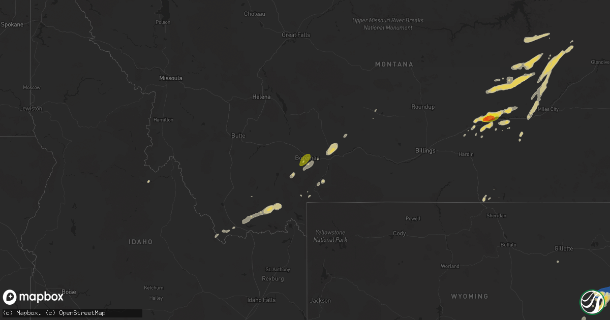
Hail Map on June 30, 2024
Get this storm
June 30 map
$229
one time, instant access
Download today. No call, no setup
Keep the $229
Bought the map and want the full workflow? Apply the entire $229 to a subscription within 7 days. None of it is wasted.
Every map, not just this one
This buys you this map. Subscription and you get every map we run, in the markets you choose from a few cities to whole states to nationwide. Plus real-time alerts the moment a storm fires.
Contact data
Name, contact info, occupancy, even credit band for addresses in the footprint. You go from where it hit to who to call.
Become the source they trust
Unlimited branding weather history reports on demand. You already have the documented answer ready for the property owner, and you are the one who showed up with it.
Property data and RoofTrace estimates
Pull up any address you have got, its value and the exact code rules for that jurisdiction, straight from One Click Code. Then RoofTrace estimates the squares, pitch, and roof value, priced the way you price.
States Impacted by Hail Map on June 30, 2024
Storm reports
Pennsylvania
| Date | Description |
|---|---|
| 06/30/20244:31 PM CDT | Trees downed via social media. |
| 06/30/20244:31 PM CDT | Large tree down picture from social media. |
| 06/30/20244:21 PM CDT | Fallen power cables in upper oxford on rt-896 ] nb/sb near homeville rd. Time estimated from radar. |
| 06/30/20243:48 PM CDT | Trees down on wires along safe harbor road. |
| 06/30/20243:38 PM CDT | Fallen tree. Right lane blocked in lower merion on i-76 eb approaching city ave/exit 339. Time estimated from radar. |
| 06/30/20243:32 PM CDT | Trees down on wires o |
| 06/30/20243:32 PM CDT | Trees down on wires off of penn street. |
| 06/30/20243:20 PM CDT | Tree down on state rd. Time est. By radar. |
| 06/30/20242:43 PM CDT | Large tree limb down on marsh rd. Time estimated from radar. |
| 06/30/20242:40 PM CDT | Report of tree damage on hartz store road resulting in power outages. Time estimated from radar. |
| 06/30/20242:30 PM CDT | Large branches snapped and winds estimated around 60 mph. |
| 06/30/20242:27 PM CDT | Quarter size hail in brickerville. |
| 06/30/20242:26 PM CDT | Large tree down across hopeland road. |
| 06/30/20242:22 PM CDT | Report of tree damage causing power outages. Time estimated from radar. |
| 06/30/20242:06 PM CDT | Tree in the roadway of the 300 block of golf road. Time estimated from radar. |
| 06/30/20241:52 PM CDT | Tree down in east penn township. Time estimated from radar. |
| 06/30/20241:50 PM CDT | Corrects previous tstm wnd dmg report from jim thorpe. A few trees down in jim thorpe. Time estimated from radar. |
| 06/30/20241:34 PM CDT | A few trees down in jim thorpe. Time estimated from radar. |
| 06/30/20241:19 PM CDT | Trees down on wires off of upper road. |
| 06/30/20241:18 PM CDT | Trees down on wires resulting in a fire along stroud court in stroud township. Time estimated from radar. |
| 06/30/202412:57 PM CDT | Wires down across south market street. |
| 06/30/202412:57 PM CDT | Wires down across south |
| 06/30/202412:56 PM CDT | Large tree down on a car on n. Water street. Angry tenant. |
| 06/30/202412:47 PM CDT | Trees and wires down on jennifer ln. Time estimated from radar. |
| 06/30/202412:47 PM CDT | Tree down on cottonwood lane. Tree hit a vehicle and is blocking road. Time estimated from radar. |
| 06/30/202412:42 PM CDT | Trees down on wires along keister road. |
| 06/30/202412:37 PM CDT | Trees down on wires along kaiser run road. |
| 06/30/202412:35 PM CDT | Trees and wires down in lake ariel. Time estimated from radar. |
| 06/30/202412:30 PM CDT | Trees and wires down on old river road. Time estimated from radar. |
| 06/30/202412:30 PM CDT | Multiple trees and wires down near intersection of bear lake road and pine grove road. Time estimated from radar. |
| 06/30/202412:10 PM CDT | Trees down on wires off of axemann road. |
| 06/30/202412:10 PM CDT | Several trees down. |
| 06/30/202412:10 PM CDT | 2 trees down. |
| 06/30/202412:10 PM CDT | Multiple reports of trees and wires down just south of wilkes-barre. Time estimated from radar. |
| 06/30/202411:58 AM CDT | Multiple reports of trees and wires down in jackson township. Time estimated from radar. |
| 06/30/202411:57 AM CDT | Trees down on wires off of laurel run road. |
| 06/30/202411:57 AM CDT | Tree down on a house near the intersection of deitrich rd and nittany valley dr. |
| 06/30/202410:05 AM CDT | Trees and wires down on hancock highway. Time estimated from radar. |
| 06/30/20248:24 AM CDT | Trees down... A pavilion blown over... And a storage unit blown over next to the silver lake fire department. Debris spread throughout property. Time estimated from rad |
West Virginia
| Date | Description |
|---|---|
| 06/30/20244:38 PM CDT | Thunderstorm winds blew down one tree along harmon school road. |
| 06/30/20244:35 PM CDT | A large limb was blown down by thunderstorm winds across littlesburg road. |
| 06/30/20244:29 PM CDT | Thunderstorm winds blew down one tree along the 300 block of courthouse road. |
| 06/30/20244:07 PM CDT | Tree down on silktree drive... Blocking one lane about two tenths of a mile up the mountain... Going towards welch. Time estimated from radar. |
| 06/30/20244:03 PM CDT | Right outside keystone... Tree branch fell in front car. It did not hit it... But was blocking one lane of the road. No lines seen down. Time estimated from radar but c |
| 06/30/20243:49 PM CDT | Tree fell in yard and broke the swing set. Wire of unknown type hanging in the yard. Time estimated from radar but call time close at 501 pm. |
| 06/30/20243:43 PM CDT | Tree down at mohegan left fork rd. Time estimated from radar. |
Wyoming
| Date | Description |
|---|---|
| 06/30/20246:32 PM CDT | A local report indicates 60 MPH wind near 9 SSW Clareton |
| 06/30/20246:09 PM CDT | A local report indicates 60 MPH wind near 7 NNE Rochelle |
| 06/30/20244:25 PM CDT | Largest stones up to ping pong ball sized. |
| 06/30/20244:21 PM CDT | Quarter sized hail at the gurnsey state park dam. |
| 06/30/20243:44 PM CDT | Mesonet station wy40 7.5 s chu |
| 06/30/20243:44 PM CDT | Mesonet station wy40 7.5 s chugwater |
| 06/30/20243:36 PM CDT | Mesonet station wy40 7.5 s chugwater |
| 06/30/20243:16 PM CDT | A local report indicates 58 MPH wind near 17 WSW Wright |
| 06/30/20242:12 PM CDT | Mesonet station wy62 i25 us87 - smokey gap. |
| 06/30/20244:52 AM CDT | Mesonet station wy19 2.9 nw elk mountain |
| 06/29/20249:25 PM CDT | Measured wind from handheld kestrel. |
| 06/29/20249:20 PM CDT | Reports of numerous pole barns being destroyed northeast of intersection of iron mountain road and powderhouse road. |
| 06/29/20249:19 PM CDT | Half an inch of rain in 30 minutes as well. |
| 06/29/20249:18 PM CDT | Strong winds estimated on the north side of cheyenne. |
| 06/29/20248:08 PM CDT | Raws mesonet station gnrw4 located 6 nw hartville. |
| 06/29/20247:52 PM CDT | A local report indicates 60 MPH wind near 2 SW Newcastle |
| 06/29/20247:21 PM CDT | A local report indicates 73 MPH wind near 5 S Newcastle |
| 06/29/20247:11 PM CDT | A local report indicates 60 MPH wind near 7 NNW Morrisey |
Virginia
| Date | Description |
|---|---|
| 06/30/20246:20 PM CDT | Trees down in various places throughout the southern portion of caroline county. |
| 06/30/20246:20 PM CDT | Trees down on route 1 near the border with hanover county. |
| 06/30/20246:20 PM CDT | Trees down on route 1 near |
| 06/30/20246:17 PM CDT | Debris on i-95 near kings dominion due to tstm winds. Report via waze app. |
| 06/30/20245:55 PM CDT | A tree was blown down by thunderstorm winds along west lake road. |
| 06/30/20245:42 PM CDT | Trees down on golansville road in caroline county. Time estimated. |
| 06/30/20245:40 PM CDT | Multiple trees down in ladysmith. Time estimated from radar data. |
| 06/30/20245:27 PM CDT | A tree was down along ham ford road and marye road. The tree fell onto a powerline. |
| 06/30/20245:19 PM CDT | Thunderstorm winds blew down one tree on to an outbuilding along the 100 block of ruskin street. |
| 06/30/20245:15 PM CDT | Several trees down around partlow road. |
| 06/30/20245:11 PM CDT | A tree was down along courthouse road at cloverhill road. |
| 06/30/20244:57 PM CDT | Tree down across portion of milton highway. Time based on radar. |
| 06/30/20244:55 PM CDT | Tree down in runnett bag just north of the franklin/patrick county line. Time estimated from radar. |
| 06/30/20244:30 PM CDT | Corrects time and description of previous tstm wnd dmg report from 1 sse victoria. Multiple trees down near the intersection of route 663 and tomlinson road near victor |
| 06/30/20244:23 PM CDT | A tree was blown down near the intersection of greensboro road and morehead avenue. |
| 06/30/20244:23 PM CDT | A least two trees were blown down by thunderstorms winds near the intersection of water oak road with mapleton road. |
| 06/30/20244:10 PM CDT | A tree was blown down near the intersection of horsepasture price road and far point lane. |
| 06/30/20243:45 PM CDT | A tree was blown down by thunderstorm winds near the intersection of toshes road and darby road. |
| 06/30/20243:45 PM CDT | Thunderstorm winds blew down several trees along hardy road. |
| 06/30/20243:30 PM CDT | Multiple trees down near the intersection of route 663 and tomlinson road near victoria. Time estimated. |
| 06/30/20243:13 PM CDT | Power line downed on chesapeake blvd in norfolk. Time estimated. |
| 06/30/20243:10 PM CDT | Tree down on lovely valley road near smith mountain lake. Time estimated from radar. |
| 06/30/20242:40 PM CDT | Numerous trees down throughout northampton county. |
| 06/30/20242:30 PM CDT | A large tree was blown down by thunderstorm winds onto carlock creek road... Blocking one lane of traffic. |
| 06/30/20242:28 PM CDT | A large tree was blown down onto a power line along cliff view road. |
| 06/30/20242:20 PM CDT | Tree down on power line along lions club road near highway 107. Time estimated from radar. |
| 06/30/20242:10 PM CDT | Tree down on evans creek road in brunswick county. Time estimated. |
| 06/30/20242:05 PM CDT | Tree down on powerline along harmon street in north tazewell. Time estimated from radar. |
| 06/30/20242:00 PM CDT | A few trees down throughout the county. |
| 06/30/20242:00 PM CDT | Lane closures on us-60 likely due to debris on roadway reported by dept of highways. Time estimated from radar data. |
| 06/30/20241:50 PM CDT | A few trees down throughout the county. |
| 06/29/20247:11 PM CDT | Public report of quarter size hail relayed by broadcast media. |
| 06/29/20247:10 PM CDT | Tree partially blocking the roadway on i-64 at gaskins rd. Time estimated from radar data. |
New Jersey
| Date | Description |
|---|---|
| 06/30/20246:15 PM CDT | Twin lakes mesonet gusted to 50 kt. Time given in report. |
| 06/30/20246:05 PM CDT | Nj turnpike auth.: downed tree on garden state parkway northbound south of exit 58 - cr 539 |
| 06/30/20246:00 PM CDT | Wires down on chatsworth road in washington township. Time estimated from radar. |
| 06/30/20245:52 PM CDT | Wires down on route 563 near washington township. Time estimated from radar. |
| 06/30/20245:15 PM CDT | Report from mping: trees uprooted. |
| 06/30/20245:08 PM CDT | Pictures shared on social media showed trees down in the vicinity of commissioners road and bridgeton pike in mullica hill. One tree took down wires and a pole. Some ro |
| 06/30/20244:55 PM CDT | Wires down along route 70 near woodland township. Time estimated from radar. |
| 06/30/20244:30 PM CDT | A few trees down. Time estimated from radar. |
| 06/30/20244:25 PM CDT | A local report indicates 61 MPH wind near 2 SW Marlton |
| 06/30/20243:29 PM CDT | Few trees down. Time estimated from radar. |
| 06/30/20243:26 PM CDT | Trees down on wires. Time estimated from radar. |
| 06/30/20243:15 PM CDT | Many large limbs snapped at the intersection of tree top road and cedar road. Time estimated from radar. |
| 06/30/20242:39 PM CDT | Nj dot - stmc: downed tree on us 46 westbound west of cr 519/bridgeville rd |
| 06/30/20242:31 PM CDT | Coop observer reports tree down at rt 208 south on virginia dr. Time estimated from radar. |
| 06/30/20242:30 PM CDT | Coop observer reports large tree down on wires on cedar st in garfield. |
| 06/30/20242:22 PM CDT | Downed wires on us-46 east in mine hill... Nj. Time estimated from radar. |
| 06/30/20242:20 PM CDT | Nj dot - stmc: downed tree on us 46 eastbound west of cr 669/canfield av |
| 06/30/20242:11 PM CDT | Spotter network: tree uprooted on a house as well as a significant amount of branches ranging between 4-8 inches in diameter. Time estimated from radar. |
| 06/30/20242:10 PM CDT | A few trees and wires blown down. Time estimated from radar. |
| 06/30/20242:00 PM CDT | Tree down on interstate 80 near wharton. Time estimated from radar. |
| 06/30/20241:53 PM CDT | Nj dot - stmc: downed wires on us 206 both directions at cr 604/waterloo rd |
| 06/30/20241:32 PM CDT | Large tree limb at least 6 inches in diameter lying across road. Time estimated from radar. |
| 06/30/20241:30 PM CDT | Tree down crossing roadway. Time estimated from radar. |
| 06/30/20241:30 PM CDT | A few trees and wires down. Time estimated from radar. |
| 06/29/20247:27 PM CDT | Tree down blocking the roadway 8th street behind the pantry one store. Collings lakes fd is responding. Time estimated via radar. |
Maine
| Date | Description |
|---|---|
| 06/30/20243:35 PM CDT | Tree down on wires on route 202. |
| 06/30/20243:32 PM CDT | Delayed report: tree down on powerlines. Time estimated by radar. |
| 06/30/20243:32 PM CDT | Trees downed. |
| 06/30/20243:25 PM CDT | Multiple trees down at madawaska lake with damage to a camp. |
| 06/30/20243:21 PM CDT | Tree down on wires... On fire. |
| 06/30/20243:21 PM CDT | Large tree in road along foch st. |
| 06/30/20243:14 PM CDT | Trees and wires down along torrey rd. |
| 06/30/20243:14 PM CDT | Large branch down on road. Only 1 lane open. Time estimated by radar. |
| 06/30/20243:13 PM CDT | An estimate of 15 to 20 trees down or damaged on golf course. |
| 06/30/20243:13 PM CDT | Trees in road with wires along empire rd. |
| 06/30/20243:10 PM CDT | Numerous trees downed across plains road. |
| 06/30/20243:07 PM CDT | Trees and wire damage along jackson rd... Road closed. |
| 06/30/20243:06 PM CDT | Several trees downed at summit spring golf course. |
| 06/30/20243:05 PM CDT | Powerlines down blocking 2 driveways on main road in milford. |
| 06/30/20242:59 PM CDT | Tree down with powerlines on lakeview road. |
| 06/30/20242:56 PM CDT | Tree down on wires. This has resulted in a small grass fire on the cyr road in madawaska. |
| 06/30/20242:42 PM CDT | Large tree down at the boat ramp. |
| 06/30/20242:38 PM CDT | Spotter reported a large tree down near pleasant mountain on rt 302. Time estimated by radar. |
| 06/30/20242:38 PM CDT | Multiple trees down... No wires involved. |
| 06/30/20242:26 PM CDT | Many large trees down blocking the road and trapping motorists. |
| 06/30/20242:25 PM CDT | Large tree down across lane of 113... One vehicle struck the tree. |
| 06/30/20242:22 PM CDT | Small trees and branches down. |
| 06/30/20242:22 PM CDT | Via social media photo. Large tree branch down on a car. |
| 06/30/20241:59 PM CDT | Numerous trees and wires down in carroll plantation. |
| 06/30/20241:57 PM CDT | Numerous trees and wires down in springfield. |
| 06/30/20241:57 PM CDT | Photos via social media show multiple trees down partially blocking route 1 in weston. |
| 06/30/20241:55 PM CDT | Numerous trees and wires down in howland. |
| 06/30/20241:50 PM CDT | Trees and wires down in webster plantation. |
| 06/30/20241:39 PM CDT | Numerous trees and wires down in winn. |
| 06/30/20241:37 PM CDT | A couple large trees down. |
| 06/30/20241:35 PM CDT | A couple trees snapped along with a partially filled inflatable pool flipped over. |
| 06/30/20241:35 PM CDT | Numerous trees and wires down in chester. |
| 06/30/20241:20 PM CDT | Tree down blocking lakeview road. |
| 06/30/20241:14 PM CDT | Multiple trees down on davis street in brownville. |
| 06/30/20241:13 PM CDT | Trees and wires down blocking the west seboeis road. |
| 06/30/20241:12 PM CDT | Piscataquis county dispatch advising route 11 is shut down between brownville to millinocket. Widespread tree damage with powerlines involved. Emergency crews cannot ac |
| 06/30/20241:04 PM CDT | Numerous trees down cutting access off to residence on the seboeis lake road. |
| 06/30/202412:55 PM CDT | Tree uprooted facing east near the intersection of us route 1 and 1a. |
| 06/30/202412:39 PM CDT | Tree down facing east on the university of maine at presque isle campus. |
Idaho
| Date | Description |
|---|---|
| 06/30/20241:30 AM CDT | Mesonet station ebr inl materials fuels complex. |
| 06/30/202412:40 AM CDT | Mesonet station sum big southern butte. |
| 06/30/202412:35 AM CDT | Mesonet station pbf inl critical infrastructure. |
| 06/30/202412:10 AM CDT | Mesonet station rov 9 ssw mud lake. |
Rhode Island
| Date | Description |
|---|---|
| 06/30/20242:30 PM CDT | Tree own on craig rd. |
| 06/30/20242:17 PM CDT | Tree down on knotty oak rd. |
South Carolina
| Date | Description |
|---|---|
| 06/30/20242:25 PM CDT | Trees down on utility equipment. |
| 06/30/20242:17 PM CDT | Several trees and power lines down on the south side of boiling springs near i-85. |
| 06/30/20242:07 PM CDT | Trees down on utility equipment. |
| 06/30/20241:50 PM CDT | Social media report of trees down just northeast of pickens. |
| 06/29/20247:23 PM CDT | Sc dps reported tree in roadway along louise st near hillview dr. |
Washington
| Date | Description |
|---|---|
| 06/30/20245:40 PM CDT | Tree down on powerline. Handful of power outages in region. |
| 06/29/202410:30 PM CDT | Tree branch down on powerlines. Over 700 people without power. |
Kentucky
| Date | Description |
|---|---|
| 06/30/20241:00 PM CDT | Multiple trees and powerlines down through the county... Including along raywick road. Time estimated by radar. |
| 06/30/202412:40 PM CDT | Multiple trees and powerlines down in marion county... Including within the town of raywick. Time estimated by radar. |
| 06/30/202412:30 PM CDT | Firefighter reports trees and powerlines down near howardstown road and walter hall road. Time of damage estimated by radar. |
Kansas
| Date | Description |
|---|---|
| 06/30/20242:50 AM CDT | Kansas mesonet site reported a wind gust of 58 mph at 10 meter height and 50 mph and 2 meter height. |
| 06/30/20242:47 AM CDT | Weatherlink site tcem colby... Ks. |
North Carolina
| Date | Description |
|---|---|
| 06/30/20245:47 PM CDT | Tree down on skinners road south of hertford. Time estimated from radar data. |
| 06/30/20245:45 PM CDT | Power lines downed on pine lake drive in elizabeth city. |
| 06/30/20245:00 PM CDT | Public report of debris on caratoke highway due to thunderstorm winds. Time estimated. |
| 06/30/20244:49 PM CDT | Report of trees down along culbreth road from culbreth to near berea. |
| 06/30/20244:42 PM CDT | Several trees and power lines down in the wesley chapel area. |
| 06/30/20244:24 PM CDT | Picture of a tree down across shoal rd. |
| 06/30/20243:30 PM CDT | Lots of trees downed from morganton to chesterfield and worry crossroads. |
New Mexico
| Date | Description |
|---|---|
| 06/30/20246:14 PM CDT | Asos station ktcs t-or-c asos. |
| 06/30/20244:35 PM CDT | Mesonet station fw6984 las cruces. |
| 06/30/20244:30 PM CDT | Mesonet station ew8377 las cruces. |
| 06/30/20244:26 PM CDT | Wind gust occurred at the dripping springs visitor center for organ mountains national monument. |
Montana
| Date | Description |
|---|---|
| 06/30/20245:00 PM CDT | Quarter sized hail and heavy rain reported in central bozeman via social media. |
| 06/30/20244:49 PM CDT | Heavy rain with visibility estimated as low as half a mile. Dime to quarter sized hail is starting to accumulate on the ground. |
| 06/29/20249:54 PM CDT | Asos station kmls miles city. |
| 06/29/20249:45 PM CDT | Mesonet station mtm88 jordan e. |
| 06/29/20249:37 PM CDT | Hail up to golf balls with 60 mph winds estimated. |
| 06/29/20249:30 PM CDT | Dime to quarter size hail. Very heavy rainfall. |
| 06/29/20248:56 PM CDT | Mesonet station wrsm8 wise river. |
New Hampshire
| Date | Description |
|---|---|
| 06/30/20246:10 PM CDT | Multiple healthy 8 inch diameter trees uprooted and down. Time estimated by radar. |
| 06/30/20246:02 PM CDT | Tree down on wires. Time estimated by radar. |
| 06/30/20246:00 PM CDT | Two trees down on nh-155 in lee. One fell on wires... The other blocked nh-155. Time estimated by radar. |
| 06/30/20246:00 PM CDT | Reported by weather spotter. Large branches scattered across nh route 27 in raymond. Tree leaning on power lines near sun hill rd. Time estimated by radar. |
| 06/30/20246:00 PM CDT | Tree down on a house. Tree branches went through a window... Tree trunk blocking the driveway. |
| 06/30/20245:54 PM CDT | Large tree down at the east candia depot; diameter approximately 12 inches. Time estimated by radar. |
| 06/30/20245:54 PM CDT | Reported by amateur radio. Social media photo of 1 inch hail on flint rd near the candia town forest. Time estimated by radar. |
| 06/30/20245:52 PM CDT | Observed trees down on shoulder of main street in candia. Trees blocking the rockingham rail trail in numerous places. Time estimated by radar. |
| 06/30/20245:48 PM CDT | Observed 8 inch diameter tree partially blocking farmer rd in hooksett. Time estimated by radar. |
| 06/30/20245:20 PM CDT | Reported by amateur radio. Social media photos posted of trees down at the dmitris pizza and the dollar general parking lots as well as colby rd in weare. Time estimate |
| 06/30/20244:30 PM CDT | Tree down on nh-10 near old marlow rd. Time estimated by radar. |
| 06/30/20242:33 PM CDT | Reported by amateur radio. Measured quarter-sized hail fell on pine hill rd near the town transfer station. Hail shredded leaves. Time estimated by radar. |
| 06/30/20242:12 PM CDT | Tree down on wires... Smoking. |
| 06/30/20242:03 PM CDT | Reported by amateur radio. Numerous trees and branches down in the fourth iron campground parking lot just off of crawford notch rd |
| 06/30/20241:35 PM CDT | Reported by weather spotter. Trees and large branches down near the scarface trailhead and golf course on south end of franconia. Time estimated by radar. |
| 06/30/20241:33 PM CDT | Reported by amateur radio. Time estimated by radar. |
| 06/30/20241:20 PM CDT | A local report indicates 1.25 inch wind near 1 SSW Bath |
| 06/30/20241:19 PM CDT | Delayed report. Concentrated tree damage of approximately 15 downed and snapped trees in bath... Nh. |
| 06/30/20241:19 PM CDT | Trees with wires down. |
| 06/30/20241:17 PM CDT | Trees and wires down. |
| 06/30/20241:17 PM CDT | Tree on wires. |
| 06/30/20241:16 PM CDT | Multiple trees down on railroad street in bath. Time estimated by radar. |
| 06/30/20241:10 PM CDT | Storm winds toppled a few trees on rum hill rd on the east side of woodsville; estimated time by radar. |
Connecticut
| Date | Description |
|---|---|
| 06/30/20241:40 PM CDT | In canterbury... Tree reported down on wires. Relayed via amateur radio. |
| 06/30/20241:36 PM CDT | In hebron... Tree down on wires. Relayed via amateur radio. |
| 06/30/20241:34 PM CDT | In hebron... Many trees were snapped and one was uprooted on east st. Further west at least 8 more trees were snapped in the woods. |
| 06/30/20241:30 PM CDT | In willimantic... Tree reported down across the road. Relayed by amateur radio. |
| 06/30/20241:30 PM CDT | Corrects previous tstm wnd dmg report from 3 ene danbury. Danbury emergency management reports tree and wires down on eagle rd. |
| 06/30/20241:18 PM CDT | In mansfield center... Trees and wires reported down. Relayed by amateur radio. Time estimated by radar. |
| 06/30/20241:11 PM CDT | In columbia... Trees and wires reported down. Time estimated via radar. |
| 06/30/20241:11 PM CDT | Spotter reports large tree down on rt 67 in oxford. All lanes blocked. Time estimated from radar. |
| 06/30/20241:10 PM CDT | In columbia... Trees and wires reported down. Relayed by amateur radio. |
| 06/30/202412:47 PM CDT | Utility reports tree down on wires on terry dr in danbury. |
| 06/30/202412:45 PM CDT | In newington... Spotter measured 60 mph wind gust. |
| 06/30/202412:40 PM CDT | In wethersfield... Reported trees and wires down. |
| 06/30/202412:40 PM CDT | In hartford... 10 inch diameter branch on top of car was reported... Blocking the road. |
| 06/30/202412:35 PM CDT | In west hartford tree reported down on house... People trapped inside. Relayed by amateur radio. |
| 06/30/202412:35 PM CDT | In west hartford... Trees and wires reported down. Relayed by amateur radio. |
| 06/30/202412:35 PM CDT | In west hartford tree reported down into window of third floor apartment. Relayed by amateur radio. |
| 06/30/202412:30 PM CDT | In windsor... Tree reported down blocking right lane and breakdown lane on i-91 northbound. |
| 06/30/202412:25 PM CDT | In canton... Multiple trees and wires reported down. Relayed via amateur radio. |
| 06/30/202412:25 PM CDT | In simsbury... Ct... Reported tree down on wires. Relayed via amateur radio. |
| 06/30/202412:25 PM CDT | In simsbury... Reported wires down. Relayed via amateur radio. |
| 06/30/202412:23 PM CDT | In simsbury a tree was down on a house which caused damage to the house. Relayed by amateur radio. |
| 06/30/202412:15 PM CDT | Report from mping: 3-inch tree limbs broken; power poles broken; time estimated by radar. |
| 06/30/202411:55 AM CDT | Tree down on wires on sawmill hill rd. Time estimated from radar. |
| 06/30/202411:35 AM CDT | Tree down on under mountain rd. Time estimated from radar. |
| 06/30/202411:33 AM CDT | Tree down on route 7 near beebe hill rd partially blocking the road. Time estimated from radar. |
Arizona
| Date | Description |
|---|---|
| 06/30/20246:15 PM CDT | A local report indicates 58 MPH wind near 6 E Saint David |
| 06/30/20245:30 PM CDT | Cwop personal weather station cw4232. |
| 06/30/20242:53 PM CDT | 64 mph thunderstorm wind gust at two guns. |
New York
| Date | Description |
|---|---|
| 06/30/20244:38 PM CDT | Fdny reports wires down and tree on home on elmwood ave. Time estimate from radar. |
| 06/30/20244:00 PM CDT | Utility reports downed wires. Time estimated from radar. |
| 06/30/202412:30 PM CDT | Tree down on route 55 at route 22 ramp. Time estimated from radar. |
| 06/30/202412:13 PM CDT | Route 82 at lomala road is closed due to tree down on wires. |
| 06/30/202412:10 PM CDT | Tree uprooted and down on a house. Report from social media. Time estimated from radar. |
| 06/30/202412:09 PM CDT | Social media post of snapped tree near fishkill. |
| 06/30/202411:00 AM CDT | Tree & wires down across turkey hill rd. |
| 06/30/202410:54 AM CDT | Deck swing destroyed and deck railing damaged and blown away. |
| 06/30/202410:54 AM CDT | Deck swing destroyed and dec |
| 06/30/202410:49 AM CDT | Route 32 closed due to tree down at ulster landing rd. Time estimated from radar. |
| 06/30/202410:47 AM CDT | Trees and wires downed on a vehicle with entrapment on route 32. |
| 06/30/202410:47 AM CDT | Tree down on sawdust ave. Time estimated from radar. |
| 06/30/202410:47 AM CDT | Tree downed on wires on old stage road. |
| 06/30/202410:46 AM CDT | Tree down on lucas ave ext and hinel rd. Time estimated from radar. |
| 06/30/202410:45 AM CDT | Trees and wires downed on route 28. |
| 06/30/202410:45 AM CDT | Tree down on apartment building along route 209. Time estimated from radar. |
| 06/30/202410:43 AM CDT | Tree down on wires on osterhoudt ln. Time estimated by radar. |
| 06/30/202410:40 AM CDT | Trees and wires downed on chestnut hill road. |
| 06/30/202410:40 AM CDT | Trees and wires downed on ryan drive. |
| 06/30/202410:40 AM CDT | Wires down on upper frog hollow road. |
| 06/30/202410:33 AM CDT | Tree and wires down on crispell rd. Time estimated from radar. |
| 06/30/202410:20 AM CDT | Tree downed in mt temper. |
| 06/30/202410:19 AM CDT | Tree down on wires. Time estimated from radar. |
| 06/30/202410:14 AM CDT | Trees and wires downed on route 214. |
| 06/30/202410:14 AM CDT | Route 214 closed due to tree down at willa ln. Time estimated from radar. |
| 06/30/202410:05 AM CDT | Trees and wires down as per county dispatch feed. Radar estimated time. |
| 06/30/20249:52 AM CDT | Trees down on knickerbocker road as per county dispatch feed. Radar-estimated time. |
| 06/30/20249:43 AM CDT | Power poles downed. |
| 06/30/20249:41 AM CDT | Multiple trees down at russel brook campsites with multiple people trapped. Unknown how many injuries at this time. Time estimated from radar. |
| 06/30/20249:40 AM CDT | Multiple trees down at butternut grove campground as per county dispatch feed. Radar-estimated time. |
| 06/30/20249:39 AM CDT | Multiple trees down right off of old route 17 near baxter mountain road. Time estimated from radar. |
| 06/30/20249:39 AM CDT | Multiple trees down on cooks falls road. Time estimated from radar. |
| 06/30/20249:35 AM CDT | *** 1 fatal... 1 inj *** corrects previous tstm wnd dmg report from 1 nw cooks falls. Nws storm survey confirms microburst of 90 mph. Many rvs... Camper units... A few |
| 06/30/20249:31 AM CDT | Multiple trees down on charles medlar road. Time estimated from radar. |
| 06/30/20249:27 AM CDT | Multiple trees down just west of fishs eddy. Time estimated from radar. |
| 06/30/20249:16 AM CDT | Tree down on wires on pennsylvania avenue. Time estimated from radar. |
| 06/30/20249:16 AM CDT | Multiple trees down in the village of hancock. Time estimated from radar. |
Colorado
| Date | Description |
|---|---|
| 06/30/202412:38 AM CDT | The asos in burlington |
| 06/29/20248:07 PM CDT | A local report indicates 1.00 inch wind near 8 S Limon |
| 06/29/20247:41 PM CDT | Asos station klic limon. |
| 06/29/20247:33 PM CDT | Asos station kdro durango la plata cnty airport. |
| 06/29/20247:33 PM CDT | Asos |
| 06/29/20247:16 PM CDT | Mesonet station co066 cedar point. |
Georgia
| Date | Description |
|---|---|
| 06/29/20248:45 PM CDT | There were a couple reports of trees down in cook county. |
| 06/29/20248:30 PM CDT | There were a few reports of trees down in berrien county. |
| 06/29/20248:30 PM CDT | There were a few reports of trees down in berrien county. |
Maryland
| Date | Description |
|---|---|
| 06/30/20246:59 PM CDT | A couple trees down with several branches also down in and around st. Charles and white plains. |
| 06/30/20246:55 PM CDT | Reports of trees and wires down in the elkton area. Power outages as well. |
| 06/30/20246:53 PM CDT | Reports of power outages due to trees and wires down in and around north east. |
| 06/30/20246:44 PM CDT | A tree was down along aldino stepney road. |
| 06/30/20246:37 PM CDT | A local report indicates 1.00 inch wind near Deale |
| 06/30/20246:37 PM CDT | Multiple trees down in and around deale. |
| 06/30/20245:11 PM CDT | Trained spotter reported numerous trees down on middleneck road toward the delaware state line. |
| 06/30/20245:07 PM CDT | Several trees and wires down in and around annapolis. |
| 06/30/20244:59 PM CDT | Trees down in and around cayots corner. |
| 06/30/20244:59 PM CDT | Several trees down on wardour drive... Including one on a house. |
| 06/30/20244:58 PM CDT | A local report indicates 1.00 inch wind near 3 NE Annapolis |
| 06/30/20244:43 PM CDT | Multiple trees down in the herald harbor area. |
| 06/30/20244:32 PM CDT | Tree on house on granby court. Other trees down nearby. |
| 06/30/20244:31 PM CDT | Numerous trees and branches down in and around glen burnie. |
| 06/30/20244:30 PM CDT | Multiple trees down in the pioneer city area. |
| 06/30/20244:28 PM CDT | Large tree down on a house in the 1400 block of disney avenue. |
| 06/30/20244:28 PM CDT | *** 1 inj *** large tree and wires down in 1400 block of maryland avenue... Leading to an injury. |
| 06/30/20243:27 PM CDT | Trees were down along gunpowder road. |
| 06/30/20243:10 PM CDT | Multiple trees down on araby church road near intersection with md route 355. |
| 06/30/20243:07 PM CDT | A tree fell down onto wires on the northern side of urbana. |
| 06/29/20248:05 PM CDT | Multiple reports of trees down on the south side of mechanicsville toward the patuxent river. |
| 06/29/20247:42 PM CDT | Over 40 calls for trees... Wires... And other storm related incidents in the northern portion of st mary's county. The charlotte hall and mechanicsville area over to go |
| 06/29/20247:33 PM CDT | A local report indicates 1.25 inch wind near 2 NW Bryantown |
| 06/29/20247:31 PM CDT | Multiple reports of trees down in hughesville. |
| 06/29/20247:05 PM CDT | Multiple reports of trees down in waldorf. |
Tennessee
| Date | Description |
|---|---|
| 06/30/20245:30 PM CDT | Tree down in bridgeport community. Time estimated by radar. |
| 06/30/20245:13 PM CDT | One tree down. Reported by dispatch. Time and location estimated from radar. |
Vermont
| Date | Description |
|---|---|
| 06/30/20241:12 PM CDT | Power lines down in the moore hill area of newbury. |
| 06/30/202412:54 PM CDT | Tree down into shed at intersection of rt 302 and rt 25. |
Cities Impacted by Hail Map on June 30, 2024
- Seney, MI
- McMillan, MI
- Newberry, MI
- Engadine, MI
- Scottsville, KY
- Holland, KY
- Hancock, NY
- East Branch, NY
- Fishs Eddy, NY
- Long Eddy, NY
- Roscoe, NY
- Parksville, NY
- Willow, NY
- Bearsville, NY
- Woodstock, NY
- Mount Tremper, NY
- Saugerties, NY
- Red Hook, NY
- McDaniels, KY
- Clinton Corners, NY
- Stanfordville, NY
- Salt Point, NY
- Hyde Park, NY
- Staatsburg, NY
- Millbrook, NY
- Leitchfield, KY
- New Milford, CT
- Washington Depot, CT
- Bellefonte, PA
- Howard, PA
- Washington, CT
- Roxbury, CT
- Sarasota, FL
- Rebersburg, PA
- Osprey, FL
- Carmel, NY
- Holmes, NY
- Stormville, NY
- West Point, VA
- Barhamsville, VA
- Patterson, NY
- Clinton, AR
- Center Ridge, AR
- Bridgewater, CT
- Brookfield, CT
- Pawling, NY
- Sherman, CT
- New Fairfield, CT
- Springfield, AR
- Selinsgrove, PA
- Woodbury, CT
- Southbury, CT
- Greenbrier, AR
- Bee Branch, AR
- Hattieville, AR
- Newtown, CT
- Sandy Hook, CT
- Hebron, CT
- Marlborough, CT
- Glastonbury, CT
- Arkadelphia, AR
- Jerusalem, AR
- Damascus, AR
- Amston, CT
- Sunbury, PA
- Middlebury, CT
- Oakville, CT
- Watertown, CT
- Waterbury, CT
- Bethlehem, CT
- Lebanon, CT
- Columbia, CT
- Naugatuck, CT
- Oxford, CT
- Aberdeen, NC
- West End, NC
- Wolcott, CT
- Willimantic, CT
- Andover, CT
- Coventry, CT
- Bethany, CT
- Beacon Falls, CT
- Prospect, CT
- Mansfield Center, CT
- Windham, CT
- Millinocket, ME
- Colchester, CT
- Cheshire, CT
- South Windham, CT
- North Windham, CT
- Hampton, CT
- Pickens, SC
- Pinehurst, NC
- Canterbury, CT
- Newton, NJ
- Castlewood, VA
- Saint Paul, VA
- Coeburn, VA
- Hamden, CT
- Wallingford, CT
- Baltic, CT
- Jewett City, CT
- Scotland, CT
- North Haven, CT
- Benton, AR
- Traskwood, AR
- Plainfield, CT
- Sparta, NJ
- Andover, NJ
- Moosup, CT
- Lafayette, NJ
- Manheim, PA
- Palmyra, PA
- Northford, CT
- Durham, CT
- Guilford, CT
- Easley, SC
- Lititz, PA
- Newfoundland, NJ
- Rockaway, NJ
- Palmerton, PA
- Walnutport, PA
- Lehighton, PA
- Lake Hopatcong, NJ
- Dungannon, VA
- Fort Blackmore, VA
- Mount Gretna, PA
- Lebanon, PA
- Bath, NH
- Wells River, VT
- Woodsville, NH
- Lisbon, NH
- Franconia, NH
- Lincoln, NH
- Stevens, PA
- Ephrata, PA
- Bangor, PA
- Pen Argyl, PA
- Nazareth, PA
- North Haverhill, NH
- Danielsville, PA
- Kunkletown, PA
- Newbury, VT
- Greer, SC
- Denver, PA
- Cordell, OK
- Woodruff, SC
- Simpsonville, SC
- Easton, PA
- Fountain Run, KY
- Carbondale, PA
- Booneville, AR
- Cape Charles, VA
- Lima, MT
- Colony, OK
- Warren, NH
- Oxford, ME
- Casco, ME
- Harrison, ME
- Poland, ME
- Cheyenne, WY
- Burnham, ME
- Unity, ME
- Parks, AR
- Harvey, AR
- Clinton, ME
- York, PA
- Lewisville, AR
- Hope, AR
- San Simon, AZ
- Troy, ME
- Wrightsville, PA
- Oden, AR
- Pencil Bluff, AR
- Chugwater, WY
- Laramie, WY
- Morganton, NC
- Clark, NJ
- Colonia, NJ
- Newmanstown, PA
- Chaparral, NM
- Gillette, WY
- Bird In Hand, PA
- Leola, PA
- Strasburg, PA
- Meriden, WY
- Lagrange, WY
- White Sands Missile Range, NM
- Sierra Blanca, TX
- Elfrida, AZ
- Robesonia, PA
- Coatesville, PA
- Cloudcroft, NM
- Staten Island, NY
- Perth Amboy, NJ
- Fords, NJ
- Keasbey, NJ
- Virginia City, MT
- West Chester, PA
- Kennett Square, PA
- Las Cruces, NM
- Guernsey, WY
- Hanover, MD
- Annapolis Junction, MD
- Jessup, MD
- Severn, MD
- Fort George G Meade, MD
- Wheatland, WY
- Hartville, WY
- Gambrills, MD
- Odenton, MD
- Millersville, MD
- Cameron, MT
- Folsom, PA
- Woodlyn, PA
- Wallingford, PA
- Swarthmore, PA
- Ronks, PA
- Thornton, PA
- Glen Mills, PA
- Oxford, NC
- North East, MD
- Annapolis, MD
- Severna Park, MD
- Crownsville, MD
- Arnold, MD
- Bozeman, MT
- Garnet Valley, PA
- Aston, PA
- Marcus Hook, PA
- Stem, NC
- Princeton, NJ
- Swedesboro, NJ
- Bridgeport, NJ
- Edgewater, MD
- Hillsborough, NJ
- Somerset, NJ
- Sewell, NJ
- Mantua, NJ
- Warwick, MD
- Earleville, MD
- Elgin, SC
- Clarksboro, NJ
- Mickleton, NJ
- Spotsylvania, VA
- Whitehouse Station, NJ
- Willcox, AZ
- Kendall Park, NJ
- Monroe Township, NJ
- Monmouth Junction, NJ
- Dayton, NJ
- Aiken, SC
- Woodford, VA
- Mathiston, MS
- Middletown, DE
- Livingston Manor, NY
- Old Bridge, NJ
- Livingston, MT
- Ruther Glen, VA
- Townsend, DE
- Castle Rock, CO
- Cranbury, NJ
- Forest City, PA
- Oak Ridge, NJ
- Bowie, MD
- Upper Marlboro, MD
- Lanham, MD
- Hyattsville, MD
- Dermott, AR
- Mount Laurel, NJ
- Maple Shade, NJ
- Cherry Hill, NJ
- Marlton, NJ
- Voorhees, NJ
- Medford, NJ
- Vincentown, NJ
- Franktown, CO
- Wilsall, MT
- Batesburg, SC
- Emigrant, MT
- Pray, MT
- Smyrna, DE
- Milford, VA
- Gallatin Gateway, MT
- Saint David, AZ
- Douglas, WY
- Barnegat, NJ
- Chatsworth, NJ
- Delhi, LA
- Media, PA
- Elbert, CO
- Rhinebeck, NY
- Nogales, AZ
- Patagonia, AZ
- West Creek, NJ
- Tuckerton, NJ
- Beach Haven, NJ
- Egg Harbor City, NJ
- Sicklerville, NJ
- Williamstown, NJ
- Clementon, NJ
- West Berlin, NJ
- Berlin, NJ
- Gibbsboro, NJ
- Atco, NJ
- Waterford Works, NJ
- Hammonton, NJ
- Stratford, NJ
- Mays Landing, NJ
- New Gretna, NJ
- Absecon, NJ
- Port Republic, NJ
- Brigantine, NJ
- Somerdale, NJ
- Manahawkin, NJ
- Newcastle, WY
- Larkspur, CO
- Rising Sun, MD
- Nottingham, PA
- Amenia, NY
- Davidsonville, MD
- Lothian, MD
- Springfield, PA
- Broomall, PA
- Baskin, LA
- Lance Creek, WY
- Wenonah, NJ
- Rayville, LA
- Mangham, LA
- Columbia, LA
- Ward, AL
- Buckhorn, NM
- Montpelier, VA
- Richland, GA
- Cusseta, GA
- Elkton, MD
- Colorado Springs, CO
- Chester, PA
- Brookhaven, PA
- Tracys Landing, MD
- Dunkirk, MD
- Deale, MD
- Glen Allen, VA
- Ashland, VA
- Lorton, VA
- Fort Belvoir, VA
- Butler, AL
- Pennington, AL
- Newport, NJ
- Rockville, VA
- North Beach, MD
- Lincoln University, PA
- West Grove, PA
- Landenberg, PA
- Jachin, AL
- Newark, DE
- Port Deposit, MD
- Elk Mills, MD
- Shawmut, MT
- Summerville, GA
- Doswell, VA
- Beaverdam, VA
- Winnsboro, LA
- Hockessin, DE
- Avondale, PA
- Waldorf, MD
- Bryans Road, MD
- Indian Head, MD
- Matheson, CO
- White Plains, MD
- La Plata, MD
- Pomfret, MD
- Chesapeake City, MD
- Edgemont, SD
- Custer, SD
- Limon, CO
- Brandywine, MD
- Hughesville, MD
- Bryantown, MD
- Harwood, MD
- Bonifay, FL
- Shoup, ID
- Greenwich, NJ
- Hanover, VA
- Denmark, SC
- Mechanicsville, VA
- Graceville, FL
- Chipley, FL
- Fredericksburg, VA
- Paonia, CO
- Charlotte Hall, MD
- Mechanicsville, MD
- Henrico, VA
- Hugo, CO
- Ramah, CO
- Glen Burnie, MD
- Pasadena, MD
- Gibson Island, MD
- Pagosa Springs, CO
- Boone, CO
- Alexandria, VA
- Hysham, MT
- Barnwell, SC
- Forsyth, MT
- Fe Warren Afb, WY
- Villa Grove, CO
- Custer, MT
- Rosebud, MT
- Allendale, SC
- Chestertown, MD
- Bighorn, MT
- Sanders, MT
- Lebanon, NJ
- Millen, GA
- Somerville, NJ
- Hathaway, MT
- Riva, MD
- Chadds Ford, PA
- Cedarville, NJ
- Centreville, MD
- Hillsdale, WY
- Carpenter, WY
- Burns, WY
- Kinsey, MT
- Sanford, NC
- Moncure, NC
- Pittsboro, NC
- Garfield, GA
- Kit Carson, CO
- Portal, GA
- Cohagen, MT
- Terry, MT
- Jordan, MT
- Karval, CO
- Circle, MT
- Brockway, MT
- Haswell, CO
- Lindsay, MT
- Chauncey, GA
- Eastman, GA
- Calhan, CO
- Simla, CO
- Agate, CO
- Cheyenne Wells, CO
- Genoa, CO
- Hill City, KS
- Rocky Ford, GA
- Rush, CO
- Zap, ND
- Beulah, ND
- Bogue, KS
- Hazen, ND
- Stanton, ND
- Lenora, KS
- Logan, KS
- Underwood, ND
- Coleharbor, ND
- Riverdale, ND