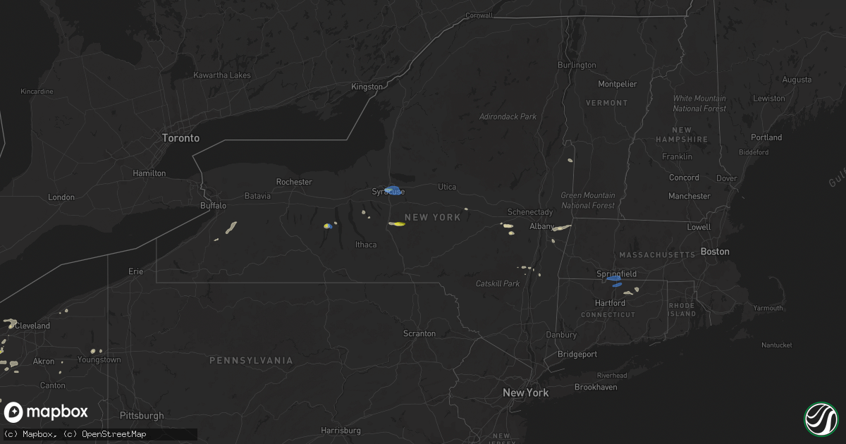
Hail Map in New York on June 29, 2021
Get this storm
June 29 map
$229
one time, instant access
Download today. No call, no setup
Keep the $229
Bought the map and want the full workflow? Apply the entire $229 to a subscription within 7 days. None of it is wasted.
Every map, not just this one
This buys you this map. Subscription and you get every map we run, in the markets you choose from a few cities to whole states to nationwide. Plus real-time alerts the moment a storm fires.
Contact data
Name, contact info, occupancy, even credit band for addresses in the footprint. You go from where it hit to who to call.
Become the source they trust
Unlimited branding weather history reports on demand. You already have the documented answer ready for the property owner, and you are the one who showed up with it.
Property data and RoofTrace estimates
Pull up any address you have got, its value and the exact code rules for that jurisdiction, straight from One Click Code. Then RoofTrace estimates the squares, pitch, and roof value, priced the way you price.
Storm reports in New York
New York
| Date | Description |
|---|---|
| 06/29/20216:06 PM CDT | Report of tree damage. Radar indicates damage was associated with thunderstorm outflow boundary. |
| 06/29/20215:58 PM CDT | Rockefeller rd. |
| 06/29/20215:54 PM CDT | Small tree across roadway near intersection of truxton tully road and foster road. |
| 06/29/20215:53 PM CDT | Report of trees down |
| 06/29/20215:50 PM CDT | Large limbs down on knower ave. |
| 06/29/20215:50 PM CDT | Large limbs down at main st and bridge st |
| 06/29/20215:45 PM CDT | Trees and wires down on ayers road off cold brook road. Time estimated. |
| 06/29/20215:40 PM CDT | Tree down on glen haven road near ny-41... Blocking road. |
| 06/29/20215:36 PM CDT | Dispatch reports tree down across cold brook road. Time estimated. |
| 06/29/20215:35 PM CDT | Tree down on houghton hill road near intersection with ny-41. Time estimated. |
| 06/29/20215:35 PM CDT | Broken poles... On fire... Down across ny-41 just south of west scott road... Shutting down highway. |
| 06/29/20215:25 PM CDT | Tree down on powerlines on banks road near brooktondale road. Apparently due to outflow boundary winds. |
| 06/29/20215:22 PM CDT | Trees and powerlines down yellow barn rd at ny-13. |
| 06/29/20215:20 PM CDT | Trees down onto power lines |
| 06/29/20215:15 PM CDT | Trees down on power lines |
| 06/29/20214:55 PM CDT | Tree down across ledyard road at black rock road. Reported at 1835 edt... Time of event estimated. |
| 06/29/20214:48 PM CDT | Large branch down on wires and poles on east main street in penn yann. |
| 06/29/20214:45 PM CDT | Dispatch reports tree down blocking one lane of west lake road near wycoff road in town of fleming. |
| 06/29/20214:45 PM CDT | Trees down on arnold road. |
| 06/29/20214:40 PM CDT | Trees and wires down on ashley hill road and riders mills road in chatham. |
| 06/29/20214:35 PM CDT | 2 trees and some branches down. |
| 06/29/20214:35 PM CDT | Power lines down across old 14a near east main street. |
| 06/29/20214:33 PM CDT | Dispatch reports trees and wires down on old route 14a. |
| 06/29/20214:25 PM CDT | Dispatch reports tree branch down into house on court street. |
| 06/29/20214:25 PM CDT | Wires down on travis road near ny-14. |
| 06/29/20214:25 PM CDT | Several calls for trees down around chatham. |
| 06/29/20214:23 PM CDT | Trees and wires down along the albany turnpike and decker street in chatham. |
| 06/29/20214:15 PM CDT | Dispatch reports trees and utility lines down on two separate vehicles with no apparent injuries. Maple avenue near hospital. |
| 06/29/20213:55 PM CDT | Several large limbs down. |
| 06/29/20212:43 PM CDT | 2 trees and some branches down. |
| 06/29/20212:41 PM CDT | Tree and wires down along state route 149 in granville. Time estimated by radar. |
| 06/29/20212:40 PM CDT | Five trees were reported down onto route 20a between route 19 and route 238. |
| 06/29/20212:36 PM CDT | Trees down near beecher and lee roads. Time estimated by radar. |
| 06/29/20212:35 PM CDT | Department of highways cleaning up a tree down on boston state road. Delayed report from june 29. |
| 06/29/20212:34 PM CDT | Report from mping: 3-inch tree limbs broken; power poles broken. |
| 06/29/20212:30 PM CDT | Tree down on wires. Time estimated by radar. |
| 06/29/20212:29 PM CDT | Trees down on wire. Time estimated by radar. |
| 06/29/20212:28 PM CDT | Trees down on wire. Time estimated by radar. |
| 06/29/20212:24 PM CDT | Trees down on wire. Time estimated by radar. |
| 06/29/20212:24 PM CDT | Trees and wires down. Time estimated by radar. |
| 06/29/20212:22 PM CDT | Trees down on wire. Time estimated by radar. |
| 06/29/20212:20 PM CDT | Trees and wires down. Time estimated by radar. |
| 06/29/20212:20 PM CDT | Corrects previous flash flood report from 2 w east syracuse. Should have been sent as thunderstorm wind damage. Tree and wires down. Times estimated by radar. |
| 06/29/20211:54 AM CDT | At 653 PM EDT, a severe thunderstorm was located over East Homer, or 7 miles northeast of Cortland, moving east at 35 mph. HAZARD...60 mph wind gusts and penny size hail. SOURCE... Law enforcement has received several reports of downed trees and wires with this storm. IMPACT...Expect damage to roofs, siding, and trees. Locations impacted include... Cortland, Norwich, Guilford, Plymouth, North Norwich, Oxford, Preble, Sherburne, Truxton and Solon. |
| 06/29/20211:53 AM CDT | At 653 PM EDT, a severe thunderstorm was located over Schoharie, or 11 miles east of Cobleskill, moving east at 35 mph. HAZARD...60 mph wind gusts and quarter size hail. SOURCE...Radar indicated. IMPACT...Hail damage to vehicles is expected. Expect wind damage to roofs, siding, and trees. Locations impacted include... Albany, Cohoes, Watervliet, Colonie, Latham, Delmar, Guilderland, Menands, Westerlo, Berne, Voorheesville, Green Island, Altamont, Middleburgh, Schoharie, Delanson, Loudonville, Feura Bush, Central Bridge and Selkirk. |
| 06/29/20211:16 AM CDT | At 615 PM EDT, severe thunderstorms were located along a line extending from near Scott to Perry City, moving east at 30 mph. An outflow boundary with winds of 40 mph will preceed the thunderstorms well before they arrive. HAZARD...60 mph wind gusts and penny size hail. SOURCE...Radar indicated. IMPACT...Expect damage to roofs, siding, and trees. Locations impacted include... Ithaca, Cortland, Cayuga Heights, Lansing, Enfield, Homer, Groton, Locke, Dryden and Trumansburg. |
| 06/29/20211:01 AM CDT | At 601 PM EDT, a severe thunderstorm was located near Wales Center and moving northeast at 15 mph. HAZARD...60 mph wind gusts and quarter size hail. SOURCE...Radar indicated. IMPACT...Minor damage to vehicles is possible. Expect wind damage to roofs, siding, and trees. Locations impacted include... Darien Lakes State Park, Bennington, Alden, Attica, Wales Center, Varysburg, Holland, Sheldon, Corfu and Alexander. |
| 06/29/20211:00 AM CDT | At 600 PM EDT, a severe thunderstorm was located over Cherry Valley, or 9 miles northeast of Cooperstown, moving southeast at 20 mph. HAZARD...60 mph wind gusts and penny size hail. SOURCE...Radar indicated. IMPACT...Expect damage to roofs, siding, and trees. Locations impacted include... Worcester, Middlefield, Cooperstown, Westford, Cherry Valley, Bowerstown, Betty And Wilbur Davis State Park, Glimmerglass State Park and East Springfield. |
| 06/29/202112:57 AM CDT | At 557 PM EDT, a severe thunderstorm was located near Cherry Valley, or 9 miles east of Cooperstown, moving east at 30 mph. HAZARD...60 mph wind gusts and penny size hail. SOURCE...Radar indicated. IMPACT...Expect damage to roofs, siding, and trees. Locations impacted include... Cobleskill, Middleburgh, Schoharie, Richmondville, Sharon Springs, Ames, Central Bridge, Carlisle, Sharon, Seward, Charleston, Esperance, Zeh Corners, Beekman Corners, West Richmondville, Rockwell Corners, Warnerville, Flat Creek, Engleville and Gardnersville. |
| 06/29/202112:28 AM CDT | At 527 PM EDT, a line of severe thunderstorms were located along a line extending from near Owasco to near Prattsburg, moving east at 25 mph. HAZARD...60 mph wind gusts and quarter size hail. SOURCE...Trained weather spotters reported downed trees and wires in Penn Yan. IMPACT...Hail damage to vehicles is expected. Expect wind damage to roofs, siding, and trees. Locations impacted include... Penn Yan, Hector, Romulus, Owasco, Starkey, Fleming, Skaneateles, Urbana, Covert and Locke. |
| 06/29/202112:26 AM CDT | At 525 PM EDT, a severe thunderstorm was located over Springfield, or 10 miles north of Cooperstown, moving southeast at 20 mph. HAZARD...60 mph wind gusts and penny size hail. SOURCE...Radar indicated. IMPACT...Expect damage to roofs, siding, and trees. Locations impacted include... Springfield, Cherry Valley, Salt Springville, Glimmerglass State Park and East Springfield. |
| 06/29/202112:09 AM CDT | At 509 PM EDT, a severe thunderstorm was located over Yatesville, or over Penn Yan, moving east at 30 mph. HAZARD...60 mph wind gusts and quarter size hail. SOURCE...Radar indicated. IMPACT...Hail damage to vehicles is expected. Expect wind damage to roofs, siding, and trees. Locations impacted include... Penn Yan, Benton, Covert, Ovid, Interlaken, Dresden, Lodi, Guyanoga, Himrod and Mays Mills. |
| 06/28/202111:40 PM CDT | At 440 PM EDT, a severe thunderstorm was located over Solsville, or near Hamilton, moving east at 25 mph. HAZARD...60 mph wind gusts and penny size hail. SOURCE...Radar indicated. IMPACT...Expect damage to roofs, siding, and trees. Locations impacted include... Eaton, Hamilton, Brookfield, Augusta, Waterville, Oriskany Falls, Munnsville, Bridgewater, Madison and Solsville. |
| 06/28/202111:04 PM CDT | At 404 PM EDT, a severe thunderstorm was located over Peterboro, or near Oneida, moving east at 35 mph. HAZARD...60 mph wind gusts and penny size hail. SOURCE...Radar indicated. IMPACT...Expect damage to roofs, siding, and trees. Locations impacted include... Oneida, Paris, Sherrill, Morrisville, Stockbridge, Augusta, Nelson, Clinton, New Hartford and Waterville. |
| 06/28/202110:50 PM CDT | Received multiple reports of trees down near rt 32 and rt 9w. Time estimated from radar. |
| 06/28/202110:41 PM CDT | At 341 PM EDT, severe thunderstorms were located along a line extending from Bridgeport to Kirkville to near Syracuse, moving east at 30 mph. HAZARD...60 mph wind gusts and nickel size hail. SOURCE...Radar indicated. IMPACT...Expect damage to roofs, siding, and trees. Locations impacted include... Syracuse, De Witt, Sullivan, Oneida, Lenox, Verona, Chittenango, Canastota, Manlius and Fayetteville. |
| 06/28/202110:18 PM CDT | At 318 PM EDT, a severe thunderstorm was located over Warsaw, or 9 miles northwest of Letchworth State Park, moving east at 25 mph. HAZARD...60 mph wind gusts and quarter size hail. SOURCE...Radar indicated. IMPACT...Minor damage to vehicles is possible. Expect wind damage to roofs, siding, and trees. Locations impacted include... Geneseo, Dansville, Letchworth State Park, Perry, Warsaw, Avon, Mount Morris, Conesus, Portageville and Varysburg. This includes Interstate 390 between exits 5 and 8. |
| 06/28/202110:10 PM CDT | At 310 PM EDT, a severe thunderstorm was located over Syracuse, moving east at 30 mph. HAZARD...60 mph wind gusts and quarter size hail. SOURCE...Radar indicated. IMPACT...Hail damage to vehicles is expected. Expect wind damage to roofs, siding, and trees. Locations impacted include... Syracuse, De Witt, North Syracuse, Solvay, Manlius, Fayetteville, Minoa, East Syracuse, Liverpool and Lyndon. |
| 06/28/20219:55 PM CDT | At 254 PM EDT, a severe thunderstorm was located 7 miles south of Greeley, or 8 miles west of Montague, moving east at 20 mph. HAZARD...60 mph wind gusts and quarter size hail. SOURCE...Radar indicated. IMPACT...Hail damage to vehicles is expected. Expect wind damage to roofs, siding, and trees. Locations impacted include... Matamoras, Milford, Millrift, Twin Lakes and Dingmans Ferry. |
| 06/28/20219:49 PM CDT | At 249 PM EDT, a severe thunderstorm was located near Springville, or 15 miles south of Hamburg, moving east at 15 mph. HAZARD...60 mph wind gusts and quarter size hail. SOURCE...Radar indicated. IMPACT...Minor damage to vehicles is possible. Expect wind damage to roofs, siding, and trees. Locations impacted include... Springville, Arcade, East Concord, Chaffee, Concord, Yorkshire, Holland, Sardinia, Delevan and Sandusky. |
| 06/28/20219:29 PM CDT | At 228 PM EDT, a severe thunderstorm was located near Jordan, or near Baldwinsville, moving east at 20 mph. HAZARD...60 mph wind gusts and quarter size hail. SOURCE...Radar indicated. IMPACT...Hail damage to vehicles is expected. Expect wind damage to roofs, siding, and trees. Locations impacted include... Syracuse, Clay, Cicero, De Witt, Lysander, Van Buren, Baldwinsville, North Syracuse, Solvay and East Syracuse. |
| 06/28/20219:24 PM CDT | At 224 PM EDT, a severe thunderstorm was located near Pecks Pond, or 12 miles west of Montague, moving east at 20 mph. HAZARD...60 mph wind gusts and quarter size hail. SOURCE...Radar indicated. IMPACT...Hail damage to vehicles is expected. Expect wind damage to roofs, siding, and trees. Locations impacted include... Matamoras, Milford, Millrift, Pecks Pond and Twin Lakes. |
| 06/28/20219:12 PM CDT | At 212 PM EDT, a severe thunderstorm was located near Clermont, or 9 miles east of Saugerties, moving east at 5 mph. HAZARD...60 mph wind gusts and penny size hail. SOURCE...Radar indicated. IMPACT...Expect damage to roofs, siding, and trees. Locations impacted include... Livingston, Copake, Clermont, Ancram, Hillsdale, Taghkanic, Ancramdale, Weed Mines, Silvernails, Spaulding Furnace, Copake Falls, Glenco Mills, Barton Corners, Gallatinville, Copake Lake, Manorton, West Taghkanic, West Copake, Bingham Mills and Snyderville. |
All States Impacted by Hail Map on June 29, 2021
Cities Impacted by Hail Map on June 29, 2021
- Perrysville, OH
- Loudonville, OH
- Horseshoe Bend, ID
- Coldwater, MI
- Bronson, MI
- Overton, NV
- Logandale, NV
- Granville, NY
- Colorado City, AZ
- Auburn, KY
- Sycamore, OH
- Williamston, MI
- Webberville, MI
- Collins, NY
- Springville, NY
- Vanlue, OH
- Findlay, OH
- Etna, NH
- Hanover, NH
- Evanston, IN
- Grandview, IN
- Troy, IN
- Lewisport, KY
- Hawesville, KY
- Tell City, IN
- Scipio Center, NY
- Auburn, NY
- Moravia, NY
- New Carlisle, IN
- South Bend, IN
- Adairville, KY
- Coudersport, PA
- Port Allegany, PA
- Roulette, PA
- Austin, PA
- Fair Oaks, IN
- Morocco, IN
- Rensselaer, IN
- Lake Village, IN
- Livermore, KY
- Dayton, OH
- Versailles, IN
- Holton, IN
- Osgood, IN
- Syracuse, NY
- Connersville, IN
- Potomac, IL
- Watson, IL
- Germantown, NY
- Xenia, IL
- Fayetteville, TN
- Allons, TN
- Monroe, TN
- Livingston, TN
- Celina, TN
- Burkesville, KY
- Palm Harbor, FL
- Tarpon Springs, FL
- Greensburg, IN
- Manchester, MI
- Sparta, TN
- Upper Sandusky, OH
- Louisville, IL
- Edgewood, IL
- Mason, IL
- Farina, IL
- Truxton, NY
- Cincinnatus, NY
- Saugerties, NY
- Seymour, IN
- Saint Elmo, IL
- Schoharie, NY
- Berne, NY
- Wharton, OH
- Forest, OH
- Nevada, OH
- Bucyrus, OH
- Bethpage, TN
- Portland, TN
- Centerville, TN
- Duck River, TN
- Hampshire, TN
- Ann Arbor, MI
- Saline, MI
- Leavenworth, IN
- Wilmington, OH
- Washington Court House, OH
- Sabina, OH
- Sells, AZ
- Painesville, OH
- Mayo, FL
- Penn Yan, NY
- Rockville, IN
- Bristow, IN
- Birdseye, IN
- Urbana, OH
- Hopkinsville, KY
- Richfield Springs, NY
- Hubbard, OH
- Vienna, OH
- Girard, OH
- West Salem, OH
- Niles, OH
- Mount Blanchard, OH
- Ferdinand, IN
- Saint Meinrad, IN
- Middleburgh, NY
- Elyria, OH
- Oberlin, OH
- Lagrange, OH
- Jacksonville, IL
- Cromwell, KY
- Beaver Dam, KY
- Ashland City, TN
- Cunningham, KY
- Bardwell, KY
- Avon Lake, OH
- Avon, OH
- Gaston, IN
- Muncie, IN
- Laurel, IN
- Homerville, OH
- Sullivan, OH
- Spencer, OH
- Old Town, FL
- Watertown, TN
- Lebanon, TN
- Panama City, FL
- Freeport, FL
- Ebro, FL
- Ponce De Leon, FL
- Effingham, IL
- Dieterich, IL
- French Lick, IN
- Malden Bridge, NY
- Brainard, NY
- Nassau, NY
- Old Chatham, NY
- Kane, PA
- Sheffield, PA
- Huntington, IN
- Urbana, IN
- North Manchester, IN
- Fancy Farm, KY
- Keuka Park, NY
- Freetown, IN
- Huntingdon, TN
- Greenville, PA
- Dexter, MI
- Oakland City, IN
- Russellville, KY
- Creston, OH
- Burbank, OH
- Roachdale, IN
- Russellville, IN
- Charlotte, TN
- Dickson, TN
- Monroe, OH
- Lebanon, OH
- De Ruyter, NY
- Cortland, NY
- Homer, NY
- McGraw, NY
- Lagrange, IN
- Angola, IN
- Hudson, IN
- Celestine, IN
- Eckerty, IN
- Bradley, IL
- Bourbonnais, IL
- Kankakee, IL
- Big Sandy, TN
- Clinton, MI
- Tecumseh, MI
- Delaware, OH
- Etowah, TN
- Paoli, IN
- Hardinsburg, IN
- Iona, ID
- Wickliffe, KY
- Kevil, KY
- Elkton, KY
- Rootstown, OH
- Grass Lake, MI
- Munith, MI
- Jackson, MI
- Wawaka, IN
- Kimmell, IN
- Rome City, IN
- Kendallville, IN
- Albion, IN
- Ligonier, IN
- Englewood, TN
- Athens, TN
- Martinton, IL
- Clifton, IL
- Howe, IN
- Lobelville, TN
- Linden, TN
- Swartz Creek, MI
- Gaines, MI
- Fenton, MI
- Grand Blanc, MI
- Fort Wayne, IN
- Columbus, IN
- Utica, KY
- Cincinnati, OH
- Loveland, OH
- Iuka, IL
- Dillsboro, IN
- Waverly, TN
- Lutts, TN
- Collinwood, TN
- Warren, OH
- Taswell, IN
- Herndon, KY
- Oak Grove, KY
- Troy, PA
- Mainesburg, PA
- Delphi, IN
- Liberty, IN
- Cobleskill, NY
- Howes Cave, NY
- Mason, WI
- Caneyville, KY
- Hartford, KY
- Palenville, NY
- Hartville, OH
- Alliance, OH
- Louisville, OH
- Rumsey, KY
- Calhoun, KY
- Arlington, OH
- Lodi, OH
- Medina, OH
- Seville, OH
- Maineville, OH
- Mason, OH
- Laotto, IN
- Cadiz, KY
- Hermitage, PA
- Sharpsville, PA
- Erin, TN
- Tennessee Ridge, TN
- Beaverville, IL
- Flora, IL
- English, IN
- Akron, IN
- Danville, OH
- Springville, TN
- Heyworth, IL
- Bloomington, IL
- Sand Lake, NY
- Averill Park, NY
- Holland, NY
- Bowling Green, KY
- Moores Hill, IN
- Aurora, IN
- Greenville, IN
- Lamar, IN
- Philpot, KY
- Whitesville, KY
- Centertown, KY
- Branchville, IN
- Saint Croix, IN
- Perry, MI
- Elka Park, NY
- Cable, OH
- Woodstock, OH
- Stewart, TN
- Owensboro, KY
- Wheatfield, IN
- Paris, IL
- Mattoon, IL
- Griggsville, IL
- Sugar Tree, TN
- Stafford Springs, CT
- Willington, CT
- Plymouth, IN
- Bremen, IN
- McEwen, TN
- Norwich, VT
- Tippecanoe, IN
- Argos, IN
- New Berlin, IL
- Ramsey, IN
- Depauw, IN
- South Lyon, MI
- West Pawlet, VT
- Dresden, NY
- Springfield, OH
- Ten Mile, TN
- Elizaville, NY
- Leopold, IN
- Cannelton, IN
- Columbia City, IN
- Niota, TN
- North Ridgeville, OH
- Syracuse, IN
- Leesburg, IN
- Warsaw, IN
- Catskill, NY
- Taylor, MI
- Chenoa, IL
- Mitchell, IN
- Deputy, IN
- Commiskey, IN
- Miamisburg, OH
- Fairbanks, IN
- Oldsmar, FL
- Safety Harbor, FL
- Elizabethtown, IN
- Scipio, IN
- Medora, IN
- Brownstown, IN
- Belfast, TN
- Petersburg, TN
- Ellington, CT
- Tolland, CT
- Vernon Rockville, CT
- Louisville, KY
- Pembroke, KY
- Orleans, IN
- Santa Claus, IN
- Greenville, FL
- Westport, IN
- Earl Park, IN
- Fowler, IN
- South Wales, NY
- Boston, NY
- East Concord, NY
- Glenwood, NY
- Sweetwater, TN
- Churubusco, IN
- Huntertown, IN
- Auburn, IN
- Garrett, IN
- Browder, KY
- Greenville, KY
- Drakesboro, KY
- Beechmont, KY
- Beech Creek, KY
- Belton, KY
- Demotte, IN
- Island, KY
- Paducah, KY
- Scottsburg, IN
- North Vernon, IN
- Whitmore Lake, MI
- Rockfield, KY
- Garden Valley, ID
- Bowling Green, OH
- Kouts, IN
- Crestview, FL
- Wabash, IN
- Saint Clair Shores, MI
- Madisonville, TN
- Fairborn, OH
- Medway, OH
- Rossville, IL
- Marengo, IN
- Vanleer, TN
- Adams, TN
- Cedar Hill, TN
- Wellington, OH
- South Whitley, IN
- Rushville, IN
- Salem, IL
- Johnsonville, IL
- Roseville, MI
- Galeton, PA
- Berlin, NY
- Petersburg, NY
- Bloomville, OH
- Clifton, TN
- Downs, IL
- Shirley, IL
- Smithville, TN
- Manlius, NY
- Jamesville, NY
- East Syracuse, NY
- Minoa, NY
- Kirkville, NY
- Fayetteville, NY
- Liverpool, NY
- Caliente, NV
- Brook, IN
- Kentland, IN
- Corunna, IN
- Waterloo, IN
- Ashley, IN
- New Carlisle, OH
- Enon, OH
- Xenia, OH
- Donnelsville, OH
- Yellow Springs, OH
- Alpha, OH
- Suffield, CT
- Enfield, CT
- Springfield, MA
- Southwick, MA
- West Suffield, CT
- Longmeadow, MA
- East Longmeadow, MA
- Feeding Hills, MA
- Agawam, MA
- Goodrich, MI
- Atlas, MI
- Flint, MI
- Burton, MI
- Davison, MI
- Canaan, NH


