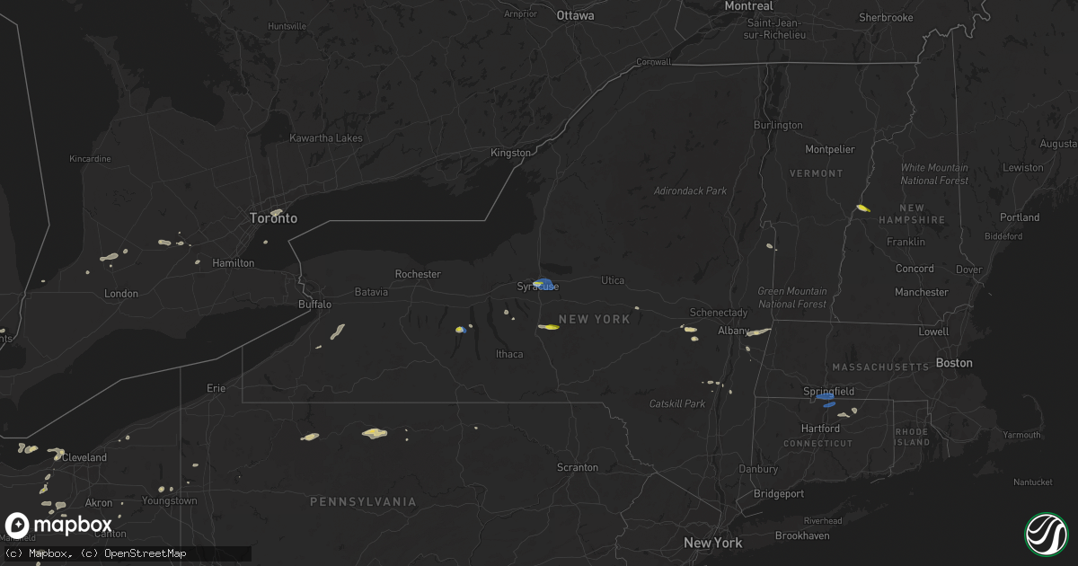
Hail Map on June 29, 2021
Get this storm
June 29 map
$229
one time, instant access
Download today. No call, no setup
Keep the $229
Bought the map and want the full workflow? Apply the entire $229 to a subscription within 7 days. None of it is wasted.
Every map, not just this one
This buys you this map. Subscription and you get every map we run, in the markets you choose from a few cities to whole states to nationwide. Plus real-time alerts the moment a storm fires.
Contact data
Name, contact info, occupancy, even credit band for addresses in the footprint. You go from where it hit to who to call.
Become the source they trust
Unlimited branding weather history reports on demand. You already have the documented answer ready for the property owner, and you are the one who showed up with it.
Property data and RoofTrace estimates
Pull up any address you have got, its value and the exact code rules for that jurisdiction, straight from One Click Code. Then RoofTrace estimates the squares, pitch, and roof value, priced the way you price.
States Impacted by Hail Map on June 29, 2021
Storm reports
Florida
| Date | Description |
|---|---|
| 06/29/20213:50 PM CDT | Fallen trees or limbs resulted in a power outage near highway 90 and old lloyd road as reported on the duke energy outage website. |
| 06/29/20213:45 PM CDT | Fallen trees and limbs resulted in a power outage near ashville highway and clark road as reported on the duke energy outage website. |
| 06/29/20213:39 PM CDT | Fallen trees or limbs resulted in a power outage near highway 19 and waukeenah highway as reported on the duke energy outage website. |
| 06/29/20213:35 PM CDT | Tree reported down near s. Salt rd and railroad. |
| 06/29/20213:35 PM CDT | 911 dispatch reported a tree down along i-10. |
| 06/29/20213:23 PM CDT | Ham radio operator reported a tree was knocked down and blocking a portion of sw overstreet. |
| 06/29/20213:15 PM CDT | Photos were shared on social media that showed a large tree that had fallen as well as some minor structural damage to a house and fence in mt. Carmel... Fl. |
| 06/29/20212:50 PM CDT | Trained spotter reported large tree limbs down along puckett road. |
| 06/29/20212:15 PM CDT | 911 call center reported a tree down along south state road 51. |
| 06/29/202112:26 AM CDT | At 526 PM EDT, a severe thunderstorm was located over Downtown Miami, or over Virginia Key, moving northwest at 15 mph. HAZARD...60 mph wind gusts. SOURCE...Radar indicated. IMPACT...Expect damage to roofs, siding, and trees. Locations impacted include... Miami, Hialeah, Miami Beach, Coral Gables and Key Biscayne. |
| 06/28/202111:18 PM CDT | At 418 PM EDT, a severe thunderstorm was located 15 miles southeast of Monticello, moving west at 20 mph. HAZARD...60 mph wind gusts. SOURCE...Radar indicated. IMPACT...Expect damage to roofs, siding, and trees. Locations impacted include... Monticello, Cody, Ebb, Lamont, Aucilla, Capps, Lois, Eridu, Nash, Thomas City, Drifton, Casa Blanco, Waukeenah, Montivilla, Wacissa, Lloyd, Wacissa Springs, Sirmans and Lake Miccosukee. |
| 06/28/202110:47 PM CDT | At 347 PM EDT, severe thunderstorms were located along a line extending from 12 miles south of Madison to 16 miles south of Perry, moving northwest at 20 mph. HAZARD...60 mph wind gusts. SOURCE...Radar indicated. IMPACT...Expect damage to roofs, siding, and trees. Locations impacted include... Perry, Cody, Goose Pasture, Hells Half Acre, Iddo, Secotan, Boyd, Cabbage Grove, Scanlon, Econfina, Lake Bird, Fanlew, Wacissa Springs, Perry-Foley Airport, Hampton Springs and Shady Grove. |
| 06/28/202110:11 PM CDT | At 311 PM EDT, severe thunderstorms were located along a line extending from near Mayo to 8 miles northwest of Horseshoe Point, moving northwest at 30 mph. HAZARD...60 mph wind gusts. SOURCE...Radar indicated. IMPACT...Expect damage to roofs, siding, and trees. Locations impacted include... Mayo, Perry, Steinhatchee, Pinland, Tennille, Jug Island, Clara, Buckville, Dekle Beach, Jonesboro, Jack Lee Island, Foley, Salem, Perry-Foley Airport, San Pedro Junction, Hampton Springs, Cedar Island, Fish Creek, Cooks Hammock and Howell Place. |
| 06/28/20219:28 PM CDT | At 228 PM EDT, a severe thunderstorm was located near Fowlers Bluff, or 11 miles south of Cross City, moving northwest at 20 mph. HAZARD...60 mph wind gusts. SOURCE...Radar indicated. IMPACT...Expect damage to roofs, siding, and trees. Locations impacted include... Cross City, Horseshoe Point, Horseshoe Beach, Shamrock, Jonesboro, Cross City Airport, Shired Island, Eugene and Yellow Jacket. |
| 06/28/20218:19 PM CDT | At 119 PM CDT, a severe thunderstorm was located 10 miles south of De Funiak Springs, moving northwest at 25 mph. HAZARD...60 mph wind gusts. SOURCE...Radar indicated. IMPACT...Expect damage to roofs, siding, and trees. Locations impacted include... De Funiak Springs, Eglin Air Force Base, Freeport, Red Bay, Portland, Alpine Heights, De Funiak Spring Airport, Rock Hill, Bruce, Eucheeanna, Pleasant Ridge, Center Ridge, New Home, Knox Hill and Argyle. |
Colorado
| Date | Description |
|---|---|
| 06/29/202112:14 PM CDT | Landspout tornado. Lasted from 1114 am to 1118 am. |
Indiana
| Date | Description |
|---|---|
| 06/29/20216:40 PM CDT | Several reports of downed trees in southeastern bartholomew county. One was noted as being near the intersection of county road 950s and state road 11. Time estimated f |
| 06/29/20216:24 PM CDT | Trained spotter relayed a report of an uprooted tree near buffalo trace park just east of palmyra. |
| 06/29/20216:20 PM CDT | Damage reported along totten ford road. Trees and power lines down. |
| 06/29/20216:20 PM CDT | Several downed trees causing power outages. Delayed report from tuesday evening. |
| 06/29/20216:18 PM CDT | Trained spotter received reports of trees and powerlines down in depauw. |
| 06/29/20216:15 PM CDT | Harrison county dispatch reported 5 or 6 power poles down on highway 64 in ramsey. |
| 06/29/20216:10 PM CDT | Delayed report from last evening. Relayed via broadcast media. |
| 06/29/20215:05 PM CDT | Broacast media tweeted a picture of a large limb and power pole down in clarksville. Time estimated from radar. |
| 06/29/20213:55 PM CDT | Measured via weather station. |
| 06/29/20213:38 PM CDT | Measured gust to 62 mph at kentland airport. |
| 06/29/20213:12 PM CDT | Report of trees down on 500n east of the intersection with 300e. |
| 06/29/20214:59 AM CDT | At 958 PM EDT/858 PM CDT/, a severe thunderstorm was located 10 miles northeast of Santa Claus, moving north at 10 mph. HAZARD...60 mph wind gusts and penny size hail. SOURCE...Radar indicated. IMPACT...Expect damage to roofs, siding, and trees. This severe thunderstorm will remain over mainly rural areas of southeastern Dubois and northwestern Perry Counties, including the following locations... Saint Marks, Adyeville, Ferdinand, Bretzville, Siberia, Mentor, Birdseye, Kyana and Saint Anthony. |
| 06/29/20214:53 AM CDT | At 953 PM EDT, a severe thunderstorm was located 13 miles east of Jasper, moving northwest at 15 mph. HAZARD...60 mph wind gusts and penny size hail. SOURCE...Radar indicated. IMPACT...Expect damage to roofs, siding, and trees. This severe thunderstorm will remain over mainly rural areas of northeastern Dubois and southwestern Orange Counties, including the following locations... Ellsworth, Dubois, Hillham, Cuzco, Dubois Crossroads, Norton and Crystal. |
| 06/29/20212:28 AM CDT | At 728 PM EDT, a severe thunderstorm was located 7 miles north of Seymour, moving north at 20 mph. HAZARD...60 mph wind gusts and penny size hail. SOURCE...Radar indicated. IMPACT...Expect damage to roofs, siding, and trees. This severe thunderstorm will be near... Azalia around 735 PM EDT. Elizabethtown around 745 PM EDT.Other locations in the path of this severe thunderstorm includeColumbus and Newbern.This includes Interstate 65 between mile markers 50 and 71. |
| 06/29/20212:04 AM CDT | At 703 PM EDT, a severe thunderstorm was located 8 miles north of Corydon, and is nearly stationary. HAZARD...60 mph wind gusts and penny size hail. SOURCE...Radar indicated. IMPACT...Expect damage to roofs, siding, and trees. This severe thunderstorm will remain over mainly rural areas of northwestern Harrison County, including the following locations... New Salisbury, Moberly, Depauw, Fairdale, Palmyra, Ramsey, Hancock Chapel, Frenchtown and Central Barren. |
| 06/29/20212:01 AM CDT | At 701 PM EDT, a severe thunderstorm was located near Seymour, moving north at 30 mph. HAZARD...60 mph wind gusts. SOURCE...Radar indicated. IMPACT...Expect damage to roofs, siding, and trees. This severe thunderstorm will be near... Jonesville around 705 PM EDT. Azalia around 710 PM EDT. Country Squire Lakes around 715 PM EDT. Elizabethtown around 720 PM EDT.Other locations in the path of this severe thunderstorm includeGrammer and Columbus.This includes Interstate 65 between mile markers 41 and 66. |
| 06/28/202111:10 PM CDT | At 409 PM EDT, a severe thunderstorm was located over Rome City, or near Kendallville, moving northeast at 30 mph. HAZARD...60 mph wind gusts. SOURCE...Radar indicated. IMPACT...Expect damage to roofs, siding, and trees. This severe thunderstorm will be near... Kendallville around 415 PM EDT.Other locations impacted by this severe thunderstorm includeWolcottville, Brimfield, Stroh, Indianola, Lisbon, Fairfield Center,Hudson, Crooked Lake, Golden Lake and Elmira.This includes Interstate 69 in Indiana between mile markers 334 and350. |
| 06/28/202110:26 PM CDT | At 326 PM CDT/426 PM EDT/, a severe thunderstorm was located near Earl Park, or near Kentland, moving north at 30 mph. HAZARD...60 mph wind gusts and penny size hail. SOURCE...Radar indicated. IMPACT...Expect damage to roofs, siding, and trees. Locations impacted include... Fowler, Kentland, Morocco, Sheldon, Goodland, Brook, Earl Park, Stockland, Beaverville, Donovan, Iroquois, Mount Ayr, Dunnington, Foresman and Raub. |
| 06/28/20219:41 PM CDT | At 240 PM CDT, a severe thunderstorm was located near Potomac, or 13 miles northwest of Danville, moving east at 20 mph. HAZARD...60 mph wind gusts. SOURCE...Radar indicated. IMPACT...Expect damage to roofs, siding, and trees. This severe thunderstorm will be near... Rossville around 255 PM CDT. |
| 06/28/20219:03 PM CDT | A tree down at the intersection of state road 264 and 850 south. |
| 06/28/20218:17 PM CDT | Trees down around the tell city area. One tree on a car in tell city. No injuries. Time estimated from radar. |
| 06/28/20217:28 PM CDT | Tree and power lines down in osgood. |
| 06/28/20217:05 PM CDT | County em reported trees and powerlines down. Time estimated off radar. |
California
| Date | Description |
|---|---|
| 06/29/20216:30 PM CDT | Recorded at upper providence remote weather station. |
| 06/29/20216:44 AM CDT | At 1142 AM PDT, a severe thunderstorm was located near Nipton And Ivanpah Roads, or 11 miles south of Primm, moving northeast at 10 mph. The thunderstorm is also just to the east of Mountain Pass on Interstate 15. The storm is moving slowly to the east. HAZARD...60 mph wind gusts. SOURCE...Radar indicated. IMPACT...Expect damage to roofs and trees. Locations impacted include... Nipton, Mountain Pass and Nipton And Ivanpah Roads. This includes Interstate 15 in California between mile markers 169and 186. |
Ohio
| Date | Description |
|---|---|
| 06/29/20216:59 PM CDT | Large tree down on e birch rd. Time est from radar. |
| 06/29/20216:35 PM CDT | One tree downed on old 3c hwy. Time of event estimated from radar. |
| 06/29/20216:33 PM CDT | Large tree uprooted and fell on home along youngstown-kingsville road near cadwallader-sonk road. |
| 06/29/20216:33 PM CDT | Several trees and powerlines down around king graves rd. |
| 06/29/20216:19 PM CDT | Time est by radar. |
| 06/29/20215:55 PM CDT | Large tree branches down in yard. |
| 06/29/20215:43 PM CDT | Tree down on a camper at west branch state park campground. |
| 06/29/20215:34 PM CDT | Tree down on julmar dr. Time est from radar. |
| 06/29/20215:20 PM CDT | Small to medium tree down on house. Time estimated based on radar. |
| 06/29/20214:44 PM CDT | Tree down across cr 75. |
| 06/29/20214:44 PM CDT | Several large tree limbs down across rt 604. Water also ponding on road 1 inch deep. |
| 06/29/20214:35 PM CDT | Tree down across tr 451. |
| 06/29/20214:30 PM CDT | Pine tree down on guilford rd. |
| 06/29/20214:24 PM CDT | Tree fell bringing down power lines and poles. |
| 06/29/20214:15 PM CDT | Several tress and tree limbs down at chippewa lake. |
| 06/29/20214:15 PM CDT | Tree limbs down along with an apple tree split at the base. Half inch size hail also reported. |
| 06/29/20214:08 PM CDT | Tree down on main st between oak st and cherry st. |
| 06/29/20213:32 PM CDT | Tree down on road. |
| 06/29/20213:30 PM CDT | A local report indicates 59 MPH wind near KFFO WRIGHT-PATT AFB |
| 06/29/20212:48 PM CDT | Tree uprooted along marion melmore rd near lemert. |
| 06/29/20211:17 PM CDT | Tree uprooted in concord township... Painesville... Oh. |
| 06/29/20211:11 PM CDT | Tree uprooted along leroy center rd in leroy township... Painesville... Oh. |
| 06/29/20212:45 AM CDT | At 745 PM EDT, a severe thunderstorm was located near Versailles, moving northeast at 10 mph. HAZARD...60 mph wind gusts and quarter size hail. SOURCE...Radar indicated. IMPACT...Minor hail damage to vehicles is possible. Expect wind damage to trees and power lines. Locations impacted include... Lawrenceburg, Greendale, Aurora, Bright, Hidden Valley, Versailles, Milan, Osgood, Dillsboro, Moores Hill, Guilford, Wilmington, Manchester, Sunman, Rexville, Cold Springs, Farmers Retreat, Friendship, Versailles Lake and Mount Sinai. |
| 06/29/20212:08 AM CDT | At 708 PM EDT, a severe thunderstorm was located over Sixteen Mile Stand, moving northeast at 25 mph. HAZARD...60 mph wind gusts and penny size hail. SOURCE...Radar indicated. IMPACT...Expect damage to trees and power lines. Locations impacted include... Mason, Lebanon, Sharonville, Monroe, Blue Ash, Loveland, Springdale, Reading, Montgomery, Madeira, Deer Park, West Chester, Morrow, Highpoint, Remington, Concorde Hills, Kings Island, Sixteen Mile Stand, Olde West Chester and Four Bridges.This includes the following Interstates... I-71 in Ohio between mile markers 13 and 41. I-75 in Ohio between mile markers 15 and 25. |
| 06/29/20212:05 AM CDT | At 705 PM EDT, a severe thunderstorm was located near Sycamore, or 10 miles northwest of Bucyrus, moving east at 35 mph. HAZARD...60 mph wind gusts and quarter size hail. SOURCE...Radar indicated. IMPACT...Minor damage to vehicles is possible. Expect damage to trees and power lines. Locations impacted include... Bucyrus, Upper Sandusky, Shelby, Willard, Plymouth, New Washington, Bloomville, Sycamore, Chatfield, Attica, Benton, Nevada, North Fairfield, Republic, Tiro, Oceola, Sulpher Springs and Shenandoah. |
| 06/29/20211:36 AM CDT | At 635 PM EDT, a severe thunderstorm was located near Forest, or 7 miles west of Upper Sandusky, moving east at 10 mph. HAZARD...60 mph wind gusts and penny size hail. SOURCE...Radar indicated. IMPACT...Expect damage to trees and power lines. Locations impacted include... Upper Sandusky, Forest, Sycamore, Carey, Nevada, Wharton, Harpster and Kirby. |
| 06/29/202112:42 AM CDT | At 542 PM EDT, a severe thunderstorm was located over Wadsworth, or 9 miles southeast of Medina, moving east at 15 mph. HAZARD...60 mph wind gusts. SOURCE...Radar indicated. IMPACT...Expect damage to trees and power lines. Locations impacted include... Akron, Wooster, Cuyahoga Falls, Barberton, Green, Hudson, Wadsworth, Tallmadge, Orrville, Rittman, Mogadore, Doylestown, Creston, Stow, New Franklin, Norton, Fairlawn, Munroe Falls, Lakemore and Silver Lake. |
| 06/29/202112:24 AM CDT | At 524 PM EDT, a severe thunderstorm was located over Loudonville, or 15 miles west of Millersburg, moving east at 15 mph. HAZARD...60 mph wind gusts and quarter size hail. SOURCE...Radar indicated. IMPACT...Minor damage to vehicles is possible. Expect damage to trees and power lines. Locations impacted include... Wooster, Millersburg, Loudonville, Shreve, Holmesville, Glenmont, Nashville, Perrysville, Fredericksburg and Mohicanville. |
| 06/29/202112:12 AM CDT | At 511 PM EDT, a severe thunderstorm was located over North Lewisburg, moving northeast at 30 mph. Another severe thunderstorm was located over Powhattan. HAZARD...60 mph wind gusts and quarter size hail. SOURCE...Radar indicated. IMPACT...Minor hail damage to vehicles is possible. Expect wind damage to trees and power lines. Locations impacted include... Springfield, Marysville, Urbana, Mechanicsburg, North Lewisburg, Milford Center, Tremont City, Woodstock, Catawba, Mutual, Cable, Raymond, Broadway, Middleburg, Powhattan, Mingo, Pottersburg, Catawba Station and Kennard. |
| 06/29/202112:06 AM CDT | At 506 PM EDT, a severe thunderstorm was located near Lodi, or 9 miles west of Medina, moving northeast at 20 mph. HAZARD...60 mph wind gusts. SOURCE...Radar indicated. IMPACT...Expect damage to trees and power lines. Locations impacted include... Medina, Strongsville, Brunswick, North Royalton, Grafton, Lodi, Chippewa Lake, Hinckley, Penfield, Westfield Center, Spencer, Gloria Glens Park, Burbank, Chippewa-On-The-Lake, Valley City, Briarwood Beach and Eaton Estates. |
| 06/28/202111:30 PM CDT | At 430 PM EDT, a severe thunderstorm was located near Fairborn, moving northeast at 10 mph. HAZARD...60 mph wind gusts and quarter size hail. SOURCE...Radar indicated. IMPACT...Minor hail damage to vehicles is possible. Expect wind damage to trees and power lines. Locations impacted include... Fairborn, New Carlisle, Wright-Patterson Afb, Enon, North Hampton, Donnelsville, Green Meadows, Medway, Springfield Municipal Airport, Hustead, Holiday Valley, Snyderville, Crystal Lakes and Park Layne.This includes I-70 in Ohio between mile markers 42 and 52. |
| 06/28/202111:06 PM CDT | At 406 PM EDT, a severe thunderstorm was located near Delaware, moving northeast at 10 mph. HAZARD...60 mph wind gusts and penny size hail. SOURCE...Radar indicated. IMPACT...Expect damage to trees and power lines. Locations impacted include... Delaware, Ashley, Interstate 71 at US Route 36/State Route 37, Kilbourne, Leonardsburg and Olive Green.This includes I-71 in Ohio between mile markers 130 and 138. |
| 06/28/202110:58 PM CDT | At 358 PM EDT, a severe thunderstorm was located near Sycamore, or 8 miles northeast of Upper Sandusky, moving northeast at 10 mph. HAZARD...60 mph wind gusts and quarter size hail. SOURCE...Radar indicated. IMPACT...Minor damage to vehicles is possible. Expect damage to trees and power lines. Locations impacted include... New Washington, Bloomville, Sycamore, Chatfield, Attica, Benton, Nevada, Republic and Oceola. |
| 06/28/202110:55 PM CDT | At 355 PM EDT, a severe thunderstorm was located over Wellington, or 14 miles south of Elyria, moving northeast at 15 mph. HAZARD...60 mph wind gusts and quarter size hail. SOURCE...Radar indicated. IMPACT...Minor damage to vehicles is possible. Expect damage to trees and power lines. Locations impacted include... Elyria, Strongsville, North Ridgeville, Grafton, Wellington, Avon, Eaton, Oberlin, Lagrange, Penfield, Pittsfield, Valley City and Eaton Estates. |
| 06/28/202110:29 PM CDT | At 329 PM EDT, a severe thunderstorm was located near Bucyrus, moving northeast at 35 mph. HAZARD...60 mph wind gusts and quarter size hail. SOURCE...Radar indicated. IMPACT...Minor damage to vehicles is possible. Expect damage to trees and power lines. Locations impacted include... Bucyrus, Willard, Plymouth, New Washington, Bloomville, Chatfield, Attica, Benton, Nevada, Tiro, Oceola and Sulpher Springs. |
| 06/28/20218:46 PM CDT | At 146 PM EDT, a severe thunderstorm was located near Perry, or 7 miles east of Painesville, moving northeast at 15 mph. HAZARD...60 mph wind gusts and nickel size hail. SOURCE...Radar indicated. IMPACT...Expect damage to trees and power lines. Locations impacted include... Chardon, Geneva, Madison, Perry, Montville, Roaming Shores, Thompson and Rock Creek. |
Arizona
| Date | Description |
|---|---|
| 06/29/20216:00 PM CDT | Public reports brief weak spin up landspout tornado in doney park. Result of strong gust front that moved through the area around 4 pm. |
| 06/29/20216:34 AM CDT | At 1133 AM MST, a severe thunderstorm was located 10 miles southwest of Jacob Lake, or 32 miles south of Kanab, moving southeast at 10 mph. HAZARD...60 mph wind gusts and quarter size hail. SOURCE...Radar indicated. IMPACT...Hail damage to vehicles is expected. Expect wind damage to roofs, siding, and trees. This severe thunderstorm will remain over mainly rural areas of Coconino County. |
| 06/28/202110:39 PM CDT | At 338 PM MST/438 PM MDT/, severe thunderstorms were located along a line near Lake Powell and Wahweap Boat Ramp, moving south at 15 mph. HAZARD...60 mph wind gusts. SOURCE...Radar indicated. IMPACT...Expect damage to roofs, siding, and trees. Locations impacted include... Page, Big Five, LeChee, Marble Canyon, Lees Ferry, Antelope Canyon Near Sr 98, Wahweap, Antelope Creek Basin, Lake Powell and Waterholes Canyon. |
| 06/28/202110:20 PM CDT | At 320 PM MST, a severe thunderstorm was located 7 miles northwest of Sells along Highway 86, moving south at 10 mph. HAZARD...60 mph wind gusts and quarter size hail. SOURCE...Radar indicated. IMPACT...Hail damage to vehicles is expected. Expect wind damage to roofs, siding, and trees. Locations impacted include... Gu Oidak, No:ligk, Cababi, San Luis - Sells District and Rincon. This includes Route 86 between mile markers 99 and 111. |
| 06/28/20218:58 PM CDT | At 158 PM MST, a severe thunderstorm was located near Crown King, or 18 miles northwest of New River, moving southeast at 10 mph. HAZARD...60 mph wind gusts and quarter size hail. SOURCE...Radar indicated. IMPACT...Hail damage to vehicles is expected. Expect wind damage to roofs, siding, and trees. Locations impacted include... Crown King, Turney Gulch Group Campground and Hazlett Hollow Campground. |
New Hampshire
| Date | Description |
|---|---|
| 06/29/20215:30 PM CDT | North of canaan near mascoma state park. Time estimated based on radar. |
| 06/29/20215:19 PM CDT | Hail fell for about 5 minutes on east side of goose pond with the largest stones up to 1.25 inches. Time estimated based on radar. |
| 06/29/20215:15 PM CDT | Multiple trees down on talbert hill road. Time estimated based on radar. |
| 06/29/20215:00 PM CDT | A tree and branches down on ferson road. Time estimated by radar. |
Alabama
| Date | Description |
|---|---|
| 06/29/202111:53 AM CDT | A tree was knocked down at 1931 mulberry lane. Time estimated by radar. |
| 06/29/202111:10 AM CDT | A tree was knocked down at 3rd street and montgomery in sheffield. Time estimated by radar. |
Illinois
| Date | Description |
|---|---|
| 06/29/20216:50 PM CDT | Multiple bradford pear trees blown down. Report relayed via wsil tv. |
| 06/29/20217:18 AM CDT | At 1217 PM CDT, a severe thunderstorm was located near Morocco, moving east northeast at 30 mph. HAZARD...60 mph wind gusts and quarter size hail. SOURCE...Radar indicated. IMPACT...Hail damage to vehicles is expected. Expect wind damage to roofs, siding, and trees. Locations impacted include... Wheatfield, Lake Village, Roselawn, Fair Oaks, Parr, Baileys Corner and Stoutsburg.Including the following interstate... Indiana I-65 between mile markers 218 and 230. This includes... US 41 Dragway. |
| 06/28/202111:58 PM CDT | At 457 PM CDT, a severe thunderstorm was located near Bradley, moving east at 25 mph. HAZARD...60 mph wind gusts and quarter size hail. SOURCE...Radar indicated. IMPACT...Hail damage to vehicles is expected. Expect wind damage to roofs, siding, and trees. Locations impacted include... Bradley, Momence, Grant Park and Sun River Terrace. Including the following interstate... I-57 near mile marker 314. |
| 06/28/20218:58 PM CDT | At 158 PM CDT, a severe thunderstorm was located near Allerton, or 18 miles southwest of Danville, moving northeast at 20 mph. HAZARD...60 mph wind gusts. SOURCE...Radar indicated. IMPACT...Expect damage to roofs, siding, and trees. This severe thunderstorm will be near... Fairmount around 215 PM CDT.Other locations in the path of this severe thunderstorm includeMuncie, Georgetown, Catlin, Oakwood, Danville, Westville, Tilton andBelgium.This includes Interstate 74 between mile markers 198 and 219. |
Kentucky
| Date | Description |
|---|---|
| 06/29/20215:49 PM CDT | Reports of a tree down as well as power lines down in bowling green. |
| 06/29/20215:00 PM CDT | Tree limbs and branches down on several trees. |
| 06/29/20212:55 PM CDT | Trees down on a vehicle and on power lines in gracey. |
| 06/29/20213:12 AM CDT | At 812 PM CDT, a severe thunderstorm was located over Tell City, moving north at 15 mph. HAZARD...60 mph wind gusts and penny size hail. SOURCE...Radar indicated. IMPACT...Expect damage to roofs, siding, and trees. This severe thunderstorm will remain over mainly rural areas of southwestern Perry and north central Hancock Counties, including the following locations... Petri, Cannelton, Ranger, Adair, Fenn Haven and Troy. |
| 06/29/20212:13 AM CDT | At 712 PM CDT, a severe thunderstorm was located 2 miles southwest of Whitesville, or 12 miles southeast of Owensboro, moving northeast at 25 mph. HAZARD...60 mph wind gusts and quarter size hail. SOURCE...Radar indicated. IMPACT...Hail damage to vehicles is expected. Expect wind damage to roofs, siding, and trees. This severe thunderstorm will be near... Whitesville around 720 PM CDT.Other locations in the path of this severe thunderstorm includeKnottsville. |
| 06/29/20212:09 AM CDT | At 708 PM CDT, a severe thunderstorm was located near Whitesville, moving northeast at 10 mph. HAZARD...60 mph wind gusts and penny size hail. SOURCE...Radar indicated. IMPACT...Expect damage to roofs, siding, and trees. This severe thunderstorm will remain over mainly rural areas of north central Ohio County, including the following locations... Adaburg, Taffy, Deanefield, Herbert, Ralph and Bells Run. |
| 06/29/20211:53 AM CDT | At 652 PM CDT, a severe thunderstorm was located 3 miles east of Livermore, moving northwest at 15 mph. HAZARD...60 mph wind gusts and penny size hail. SOURCE...Radar indicated. IMPACT...Expect damage to roofs, siding, and trees. This severe thunderstorm will remain over mainly rural areas of southeastern Daviess and east central McLean Counties, including the following locations... Pleasant Ridge. |
| 06/29/20211:40 AM CDT | At 640 PM CDT, a severe thunderstorm was located near Livermore, moving northwest at 10 mph. HAZARD...60 mph wind gusts and penny size hail. SOURCE...Radar indicated. IMPACT...Expect damage to roofs, siding, and trees. This severe thunderstorm will remain over mainly rural areas of west central Ohio County, including the following locations... No Creek, Heflin, Centertown, Coffman, Equality, Matanzas, Buford and Pleasant Ridge. |
| 06/29/20211:31 AM CDT | At 630 PM EDT, a severe thunderstorm was located over Delhi Township, moving northeast at 15 mph. HAZARD...60 mph wind gusts and penny size hail. SOURCE...Radar indicated. IMPACT...Expect damage to trees and power lines. Locations impacted include... Cincinnati, Covington, Florence, Norwood, Forest Park, Erlanger, Fort Thomas, Newport, Sharonville, Blue Ash, Loveland, Springdale, Reading, Montgomery, North College Hill, Madeira, Edgewood, Elsmere, Wyoming and Cheviot.This includes the following Interstates... I-71 in Ohio between mile markers 0 and 19. I-74 in Ohio between mile markers 7 and 19. I-75 in Kentucky between mile markers 182 and 191. I-75 in Ohio between mile markers 0 and 17. |
| 06/29/20211:11 AM CDT | At 611 PM CDT, a severe thunderstorm was located near Plum Springs, moving north at 10 mph. HAZARD...60 mph wind gusts and penny size hail. SOURCE...Radar indicated. IMPACT...Expect damage to roofs, siding, and trees. This severe thunderstorm will remain over mainly rural areas of east central Butler, northwestern Warren and southwestern Edmonson Counties, including the following locations... Segal, Barren River, Asphalt, Girkin, Nick, Greencastle, Benleo, Richardsville, Glenmore and Reedyville. |
| 06/28/20219:49 PM CDT | At 246 PM CDT, a severe thunderstorm was located 8 miles west of Hopkinsville, moving northwest at 20 mph. HAZARD...60 mph wind gusts and quarter size hail. SOURCE...Radar indicated. IMPACT...Hail damage to vehicles is possible. Expect wind damage to roofs, siding, and trees. Locations impacted include... Gracey, Cerulean and possibly Cadiz. |
| 06/28/20217:25 PM CDT | Roof and 1 side of barn blown off and a line of trees blown down. |
New York
| Date | Description |
|---|---|
| 06/29/20216:06 PM CDT | Report of tree damage. Radar indicates damage was associated with thunderstorm outflow boundary. |
| 06/29/20215:58 PM CDT | Rockefeller rd. |
| 06/29/20215:54 PM CDT | Small tree across roadway near intersection of truxton tully road and foster road. |
| 06/29/20215:53 PM CDT | Report of trees down |
| 06/29/20215:50 PM CDT | Large limbs down at main st and bridge st |
| 06/29/20215:50 PM CDT | Large limbs down on knower ave. |
| 06/29/20215:45 PM CDT | Trees and wires down on ayers road off cold brook road. Time estimated. |
| 06/29/20215:40 PM CDT | Tree down on glen haven road near ny-41... Blocking road. |
| 06/29/20215:36 PM CDT | Dispatch reports tree down across cold brook road. Time estimated. |
| 06/29/20215:35 PM CDT | Tree down on houghton hill road near intersection with ny-41. Time estimated. |
| 06/29/20215:35 PM CDT | Broken poles... On fire... Down across ny-41 just south of west scott road... Shutting down highway. |
| 06/29/20215:25 PM CDT | Tree down on powerlines on banks road near brooktondale road. Apparently due to outflow boundary winds. |
| 06/29/20215:22 PM CDT | Trees and powerlines down yellow barn rd at ny-13. |
| 06/29/20215:20 PM CDT | Trees down onto power lines |
| 06/29/20215:15 PM CDT | Trees down on power lines |
| 06/29/20214:55 PM CDT | Tree down across ledyard road at black rock road. Reported at 1835 edt... Time of event estimated. |
| 06/29/20214:48 PM CDT | Large branch down on wires and poles on east main street in penn yann. |
| 06/29/20214:45 PM CDT | Trees down on arnold road. |
| 06/29/20214:45 PM CDT | Dispatch reports tree down blocking one lane of west lake road near wycoff road in town of fleming. |
| 06/29/20214:40 PM CDT | Trees and wires down on ashley hill road and riders mills road in chatham. |
| 06/29/20214:35 PM CDT | Power lines down across old 14a near east main street. |
| 06/29/20214:35 PM CDT | 2 trees and some branches down. |
| 06/29/20214:33 PM CDT | Dispatch reports trees and wires down on old route 14a. |
| 06/29/20214:25 PM CDT | Dispatch reports tree branch down into house on court street. |
| 06/29/20214:25 PM CDT | Wires down on travis road near ny-14. |
| 06/29/20214:25 PM CDT | Several calls for trees down around chatham. |
| 06/29/20214:23 PM CDT | Trees and wires down along the albany turnpike and decker street in chatham. |
| 06/29/20214:15 PM CDT | Dispatch reports trees and utility lines down on two separate vehicles with no apparent injuries. Maple avenue near hospital. |
| 06/29/20213:55 PM CDT | Several large limbs down. |
| 06/29/20212:43 PM CDT | 2 trees and some branches down. |
| 06/29/20212:41 PM CDT | Tree and wires down along state route 149 in granville. Time estimated by radar. |
| 06/29/20212:40 PM CDT | Five trees were reported down onto route 20a between route 19 and route 238. |
| 06/29/20212:36 PM CDT | Trees down near beecher and lee roads. Time estimated by radar. |
| 06/29/20212:35 PM CDT | Department of highways cleaning up a tree down on boston state road. Delayed report from june 29. |
| 06/29/20212:34 PM CDT | Report from mping: 3-inch tree limbs broken; power poles broken. |
| 06/29/20212:30 PM CDT | Tree down on wires. Time estimated by radar. |
| 06/29/20212:29 PM CDT | Trees down on wire. Time estimated by radar. |
| 06/29/20212:28 PM CDT | Trees down on wire. Time estimated by radar. |
| 06/29/20212:24 PM CDT | Trees down on wire. Time estimated by radar. |
| 06/29/20212:24 PM CDT | Trees and wires down. Time estimated by radar. |
| 06/29/20212:22 PM CDT | Trees down on wire. Time estimated by radar. |
| 06/29/20212:20 PM CDT | Trees and wires down. Time estimated by radar. |
| 06/29/20212:20 PM CDT | Corrects previous flash flood report from 2 w east syracuse. Should have been sent as thunderstorm wind damage. Tree and wires down. Times estimated by radar. |
| 06/29/20211:54 AM CDT | At 653 PM EDT, a severe thunderstorm was located over East Homer, or 7 miles northeast of Cortland, moving east at 35 mph. HAZARD...60 mph wind gusts and penny size hail. SOURCE... Law enforcement has received several reports of downed trees and wires with this storm. IMPACT...Expect damage to roofs, siding, and trees. Locations impacted include... Cortland, Norwich, Guilford, Plymouth, North Norwich, Oxford, Preble, Sherburne, Truxton and Solon. |
| 06/29/20211:53 AM CDT | At 653 PM EDT, a severe thunderstorm was located over Schoharie, or 11 miles east of Cobleskill, moving east at 35 mph. HAZARD...60 mph wind gusts and quarter size hail. SOURCE...Radar indicated. IMPACT...Hail damage to vehicles is expected. Expect wind damage to roofs, siding, and trees. Locations impacted include... Albany, Cohoes, Watervliet, Colonie, Latham, Delmar, Guilderland, Menands, Westerlo, Berne, Voorheesville, Green Island, Altamont, Middleburgh, Schoharie, Delanson, Loudonville, Feura Bush, Central Bridge and Selkirk. |
| 06/29/20211:16 AM CDT | At 615 PM EDT, severe thunderstorms were located along a line extending from near Scott to Perry City, moving east at 30 mph. An outflow boundary with winds of 40 mph will preceed the thunderstorms well before they arrive. HAZARD...60 mph wind gusts and penny size hail. SOURCE...Radar indicated. IMPACT...Expect damage to roofs, siding, and trees. Locations impacted include... Ithaca, Cortland, Cayuga Heights, Lansing, Enfield, Homer, Groton, Locke, Dryden and Trumansburg. |
| 06/29/20211:01 AM CDT | At 601 PM EDT, a severe thunderstorm was located near Wales Center and moving northeast at 15 mph. HAZARD...60 mph wind gusts and quarter size hail. SOURCE...Radar indicated. IMPACT...Minor damage to vehicles is possible. Expect wind damage to roofs, siding, and trees. Locations impacted include... Darien Lakes State Park, Bennington, Alden, Attica, Wales Center, Varysburg, Holland, Sheldon, Corfu and Alexander. |
| 06/29/20211:00 AM CDT | At 600 PM EDT, a severe thunderstorm was located over Cherry Valley, or 9 miles northeast of Cooperstown, moving southeast at 20 mph. HAZARD...60 mph wind gusts and penny size hail. SOURCE...Radar indicated. IMPACT...Expect damage to roofs, siding, and trees. Locations impacted include... Worcester, Middlefield, Cooperstown, Westford, Cherry Valley, Bowerstown, Betty And Wilbur Davis State Park, Glimmerglass State Park and East Springfield. |
| 06/29/202112:57 AM CDT | At 557 PM EDT, a severe thunderstorm was located near Cherry Valley, or 9 miles east of Cooperstown, moving east at 30 mph. HAZARD...60 mph wind gusts and penny size hail. SOURCE...Radar indicated. IMPACT...Expect damage to roofs, siding, and trees. Locations impacted include... Cobleskill, Middleburgh, Schoharie, Richmondville, Sharon Springs, Ames, Central Bridge, Carlisle, Sharon, Seward, Charleston, Esperance, Zeh Corners, Beekman Corners, West Richmondville, Rockwell Corners, Warnerville, Flat Creek, Engleville and Gardnersville. |
| 06/29/202112:28 AM CDT | At 527 PM EDT, a line of severe thunderstorms were located along a line extending from near Owasco to near Prattsburg, moving east at 25 mph. HAZARD...60 mph wind gusts and quarter size hail. SOURCE...Trained weather spotters reported downed trees and wires in Penn Yan. IMPACT...Hail damage to vehicles is expected. Expect wind damage to roofs, siding, and trees. Locations impacted include... Penn Yan, Hector, Romulus, Owasco, Starkey, Fleming, Skaneateles, Urbana, Covert and Locke. |
| 06/29/202112:26 AM CDT | At 525 PM EDT, a severe thunderstorm was located over Springfield, or 10 miles north of Cooperstown, moving southeast at 20 mph. HAZARD...60 mph wind gusts and penny size hail. SOURCE...Radar indicated. IMPACT...Expect damage to roofs, siding, and trees. Locations impacted include... Springfield, Cherry Valley, Salt Springville, Glimmerglass State Park and East Springfield. |
| 06/29/202112:09 AM CDT | At 509 PM EDT, a severe thunderstorm was located over Yatesville, or over Penn Yan, moving east at 30 mph. HAZARD...60 mph wind gusts and quarter size hail. SOURCE...Radar indicated. IMPACT...Hail damage to vehicles is expected. Expect wind damage to roofs, siding, and trees. Locations impacted include... Penn Yan, Benton, Covert, Ovid, Interlaken, Dresden, Lodi, Guyanoga, Himrod and Mays Mills. |
| 06/28/202111:40 PM CDT | At 440 PM EDT, a severe thunderstorm was located over Solsville, or near Hamilton, moving east at 25 mph. HAZARD...60 mph wind gusts and penny size hail. SOURCE...Radar indicated. IMPACT...Expect damage to roofs, siding, and trees. Locations impacted include... Eaton, Hamilton, Brookfield, Augusta, Waterville, Oriskany Falls, Munnsville, Bridgewater, Madison and Solsville. |
| 06/28/202111:04 PM CDT | At 404 PM EDT, a severe thunderstorm was located over Peterboro, or near Oneida, moving east at 35 mph. HAZARD...60 mph wind gusts and penny size hail. SOURCE...Radar indicated. IMPACT...Expect damage to roofs, siding, and trees. Locations impacted include... Oneida, Paris, Sherrill, Morrisville, Stockbridge, Augusta, Nelson, Clinton, New Hartford and Waterville. |
| 06/28/202110:50 PM CDT | Received multiple reports of trees down near rt 32 and rt 9w. Time estimated from radar. |
| 06/28/202110:41 PM CDT | At 341 PM EDT, severe thunderstorms were located along a line extending from Bridgeport to Kirkville to near Syracuse, moving east at 30 mph. HAZARD...60 mph wind gusts and nickel size hail. SOURCE...Radar indicated. IMPACT...Expect damage to roofs, siding, and trees. Locations impacted include... Syracuse, De Witt, Sullivan, Oneida, Lenox, Verona, Chittenango, Canastota, Manlius and Fayetteville. |
| 06/28/202110:18 PM CDT | At 318 PM EDT, a severe thunderstorm was located over Warsaw, or 9 miles northwest of Letchworth State Park, moving east at 25 mph. HAZARD...60 mph wind gusts and quarter size hail. SOURCE...Radar indicated. IMPACT...Minor damage to vehicles is possible. Expect wind damage to roofs, siding, and trees. Locations impacted include... Geneseo, Dansville, Letchworth State Park, Perry, Warsaw, Avon, Mount Morris, Conesus, Portageville and Varysburg. This includes Interstate 390 between exits 5 and 8. |
| 06/28/202110:10 PM CDT | At 310 PM EDT, a severe thunderstorm was located over Syracuse, moving east at 30 mph. HAZARD...60 mph wind gusts and quarter size hail. SOURCE...Radar indicated. IMPACT...Hail damage to vehicles is expected. Expect wind damage to roofs, siding, and trees. Locations impacted include... Syracuse, De Witt, North Syracuse, Solvay, Manlius, Fayetteville, Minoa, East Syracuse, Liverpool and Lyndon. |
| 06/28/20219:55 PM CDT | At 254 PM EDT, a severe thunderstorm was located 7 miles south of Greeley, or 8 miles west of Montague, moving east at 20 mph. HAZARD...60 mph wind gusts and quarter size hail. SOURCE...Radar indicated. IMPACT...Hail damage to vehicles is expected. Expect wind damage to roofs, siding, and trees. Locations impacted include... Matamoras, Milford, Millrift, Twin Lakes and Dingmans Ferry. |
| 06/28/20219:49 PM CDT | At 249 PM EDT, a severe thunderstorm was located near Springville, or 15 miles south of Hamburg, moving east at 15 mph. HAZARD...60 mph wind gusts and quarter size hail. SOURCE...Radar indicated. IMPACT...Minor damage to vehicles is possible. Expect wind damage to roofs, siding, and trees. Locations impacted include... Springville, Arcade, East Concord, Chaffee, Concord, Yorkshire, Holland, Sardinia, Delevan and Sandusky. |
| 06/28/20219:29 PM CDT | At 228 PM EDT, a severe thunderstorm was located near Jordan, or near Baldwinsville, moving east at 20 mph. HAZARD...60 mph wind gusts and quarter size hail. SOURCE...Radar indicated. IMPACT...Hail damage to vehicles is expected. Expect wind damage to roofs, siding, and trees. Locations impacted include... Syracuse, Clay, Cicero, De Witt, Lysander, Van Buren, Baldwinsville, North Syracuse, Solvay and East Syracuse. |
| 06/28/20219:24 PM CDT | At 224 PM EDT, a severe thunderstorm was located near Pecks Pond, or 12 miles west of Montague, moving east at 20 mph. HAZARD...60 mph wind gusts and quarter size hail. SOURCE...Radar indicated. IMPACT...Hail damage to vehicles is expected. Expect wind damage to roofs, siding, and trees. Locations impacted include... Matamoras, Milford, Millrift, Pecks Pond and Twin Lakes. |
| 06/28/20219:12 PM CDT | At 212 PM EDT, a severe thunderstorm was located near Clermont, or 9 miles east of Saugerties, moving east at 5 mph. HAZARD...60 mph wind gusts and penny size hail. SOURCE...Radar indicated. IMPACT...Expect damage to roofs, siding, and trees. Locations impacted include... Livingston, Copake, Clermont, Ancram, Hillsdale, Taghkanic, Ancramdale, Weed Mines, Silvernails, Spaulding Furnace, Copake Falls, Glenco Mills, Barton Corners, Gallatinville, Copake Lake, Manorton, West Taghkanic, West Copake, Bingham Mills and Snyderville. |
Massachusetts
| Date | Description |
|---|---|
| 06/29/20216:55 PM CDT | Tree fallen on west road near reservoir road |
| 06/29/20216:32 PM CDT | Several large trees down maple street |
| 06/29/20216:23 PM CDT | Tree and wires down on river road and tree down on main street |
| 06/29/20216:18 PM CDT | Trees and wires down on main street |
| 06/29/20216:08 PM CDT | One foot diameter tree down across rising corner road at the agawam town line |
| 06/29/20215:49 PM CDT | Tree down on berkshire ave |
| 06/29/20215:44 PM CDT | Tree down on sheep pasture road |
| 06/29/20215:42 PM CDT | Tree down on sheep pasture road |
| 06/29/20215:40 PM CDT | Large tree and wires down on long yard road |
| 06/29/20215:26 PM CDT | Tree and wires down on house basket street |
| 06/29/20215:25 PM CDT | Wires down making lake parkway impassable |
| 06/29/20215:05 PM CDT | Trees down. |
| 06/29/20214:45 PM CDT | Trees down. |
| 06/29/20214:40 PM CDT | Trees down. |
| 06/29/20214:20 PM CDT | Tree down on prince street at pond street |
| 06/29/20214:20 PM CDT | Wires down on wolcott road |
| 06/29/20216:05 AM CDT | At 1104 PM EDT, a severe thunderstorm was located near Catskill, moving east at 15 mph. HAZARD...60 mph wind gusts. SOURCE...Radar indicated. IMPACT...Expect damage to roofs, siding, and trees. Locations impacted include... Hudson, Catskill, Saugerties, Claverack, Livingston, Copake, Clermont, Athens, Austerlitz, Philmont, Lorenz Park, Claverack-Red Mills, Saugerties South, Ghent, Veteran, Germantown, Hillsdale, Taghkanic, Centerville and Quarryville. |
| 06/29/20212:45 AM CDT | At 745 PM EDT, severe thunderstorms were located along a line extending from East Greenbush to near New Baltimore to 7 miles east of Preston Hollow, moving east at 15 mph. HAZARD...60 mph wind gusts and penny size hail. SOURCE...Radar indicated. IMPACT...Expect damage to roofs, siding, and trees. Locations impacted include... East Greenbush, Rensselaer, Chatham, Nassau, Delmar, New Baltimore, Ravena, Stephentown, Coxsackie, New Lebanon, Valatie, Castleton-On-Hudson, Kinderhook, Selkirk, Feura Bush, Coeymans, Cairo, Ghent, Stockport and Stuyvesant. |
| 06/29/20212:34 AM CDT | At 734 PM EDT, severe thunderstorms were located along a line extending from near Longmeadow to near Rocky Hill, moving southeast at 20 mph. HAZARD...60 mph wind gusts. SOURCE...Radar indicated. IMPACT...Expect damage to trees and power lines. Locations impacted include... Springfield, Hartford, Manchester, East Hartford, Enfield, Glastonbury, Vernon, Windsor, Agawam, West Springfield, Wethersfield, Mansfield, South Windsor, Windham, Rocky Hill, Willimantic, Southbridge, Longmeadow, Suffield and East Longmeadow. |
| 06/29/20211:59 AM CDT | At 658 PM EDT, severe thunderstorms were clustered over Southwick, or near Westfield, moving east at 15 mph. HAZARD...60 mph wind gusts and penny size hail. SOURCE...Radar indicated. IMPACT...Expect damage to trees and power lines. Locations impacted include... Springfield, Chicopee, Enfield, Westfield, Holyoke, Agawam, West Springfield, Ludlow, Longmeadow, Suffield, East Longmeadow, Ellington, Tolland, Belchertown, Wilbraham, Windsor Locks, Palmer, Stafford, Somers and Granby. |
| 06/29/202112:15 AM CDT | At 515 PM EDT, severe thunderstorms were located along a line extending from Williamstown to near Pittsfield to Chatham, moving east at 25 mph. HAZARD...60 mph wind gusts and penny size hail. SOURCE...Radar indicated. IMPACT...Expect damage to roofs, siding, and trees. Locations impacted include... Pittsfield, North Adams, Chatham, Adams, Williamstown, Lee, Lenox, Cheshire, New Lebanon, Becket, Austerlitz, Florida, Hancock, Savoy, New Ashford, Berkshire, Dalton, Ghent, Lanesborough and Hinsdale. |
| 06/28/202111:42 PM CDT | At 442 PM EDT, a severe thunderstorm was located near Stephentown, or near Nassau, moving southeast at 15 mph. HAZARD...60 mph wind gusts and penny size hail. SOURCE...Radar indicated. IMPACT...Expect damage to roofs, siding, and trees. Locations impacted include... Pittsfield, Nassau, Lenox, Cheshire, Stephentown, New Lebanon, Hancock, West Sand Lake, Averill Park, Berkshire, Sand Lake, Lanesborough, Canaan, Richmond, West Stockbridge, East Nassau, Barkerville, Van Hoesen Station, West Stephentown and Jacks Corners. |
Georgia
| Date | Description |
|---|---|
| 06/29/20215:39 PM CDT | Tree down near bellview. |
| 06/29/20215:15 PM CDT | Reports of a few trees down in mitchell county. |
| 06/29/20215:10 PM CDT | Report of a tree down on powerlines along hwy 133. |
| 06/29/20215:05 PM CDT | Social media picture of a tree down on highway 112 between cairo and camilla. |
| 06/29/20215:00 PM CDT | Report of several trees down in decatur county. |
| 06/29/20214:55 PM CDT | Trees down across thomas county. |
| 06/29/20214:55 PM CDT | Reports of several trees down in grady county. |
| 06/29/20214:40 PM CDT | Tree down resulting in a power outage as reported on the georgia power outage website. |
| 06/29/20214:30 PM CDT | Trees down in thomasville. |
| 06/29/20211:19 AM CDT | At 619 PM EDT, severe thunderstorms were located along a line extending from 6 miles southeast of Putney to 6 miles west of West Bainbridge, moving northwest at 30 mph. These storms have a history of blowing down several trees in Decatur and Grady counties. HAZARD...60 mph wind gusts. SOURCE...Radar indicated. IMPACT...Expect damage to roofs, siding, and trees. Locations impacted include... Colquitt, Newton, Albany, Putney, East Albany, Marine Corps Logistics Base, Turner City, Walker, Babcock, Iveys Mill, Radium Springs, Lockett Crossing, South Albany, Southwest Ga Regional A/P, Mayhaw, Boykin, Acree, Mimsville, Williamsburg and Bellview. |
| 06/29/202112:54 AM CDT | At 554 PM EDT, severe thunderstorms were located along a line extending from 9 miles north of Fitzgerald to 8 miles northwest of Norman Park, moving north at 45 mph. HAZARD...60 mph wind gusts. SOURCE...Radar indicated. IMPACT...Expect damage to roofs, siding, and trees. Locations impacted include... Sylvester, Ashburn, Poulan, Ty Ty, Worth, Terrell, Sycamore, Sumner, Warwick, Rebecca, Amboy, Sylvester Airport, Tempy, Waterloo, Inaha, Red Rock, Hobby, Turner Co Airport, Irwinville Airport and Shingler. |
| 06/29/202112:44 AM CDT | At 544 PM EDT, severe thunderstorms were located along a line extending from 6 miles northwest of Norman Park to near Whigham, moving northwest at 35 mph. HAZARD...60 mph wind gusts. SOURCE...Radar indicated. IMPACT...Expect damage to roofs, siding, and trees. Locations impacted include... Newton, Moultrie, Cairo, Pelham, Camilla, Sylvester, Norman Park, Baconton, Doerun, Ochlocknee, Coolidge, Whigham, Riverside, Schley, Funston, Sale City, Minton, Capel, Sylvester Airport and Anderson City. |
| 06/29/202112:37 AM CDT | At 537 PM EDT, a severe thunderstorm was located 9 miles southeast of Bainbridge, moving northwest at 15 mph. HAZARD...60 mph wind gusts. SOURCE...Radar indicated. IMPACT...Expect damage to roofs, siding, and trees. Locations impacted include... Bainbridge, West Bainbridge, Attapulgus, Climax, Brinson, Vada, Hanover, Ausmac, Eldorendo, Decatur Co A/P, Steinham Store, Laingkat, Fowlstown, Cyrene, Amsterdam and Faceville. |
Pennsylvania
| Date | Description |
|---|---|
| 06/29/20215:42 AM CDT | At 1041 PM EDT, a severe thunderstorm was located near Keating Summit, moving east at 25 mph. HAZARD...60 mph wind gusts and quarter size hail. SOURCE...Radar indicated. IMPACT...Hail damage to vehicles is expected. Expect wind damage to roofs, siding, and trees. Locations impacted include... Coudersport, Roulette, Galeton, Westfield, Keating Summit, Denton Hill State Park, Cherry Springs State Park, Lyman Run State Park, Austin, Sweden Valley and Ski Denton Ski Area. |
| 06/29/20214:30 AM CDT | At 930 PM EDT, a severe thunderstorm was located over Bellefonte, moving northeast at 30 mph. HAZARD...60 mph wind gusts. SOURCE...Radar indicated. IMPACT...Expect damage to roofs, siding, and trees. Locations impacted include... State College, Bellefonte, Pleasant Gap, Lamar, Lemont, Zion, Houserville, Centre Hall, Milesburg, Blanchard, Rebersburg, Madisonburg, Bald Eagle State Park, Howard, Beech Creek, Unionville, McCall Dam State Park, Pennsylvania State University and University Park Airport.For those driving on Interstate 80, this includes areas between theSnow Shoe and Lamar exits, specifically from mile markers 154 to 170.This includes Interstate 99 from mile markers 73 to 85. |
| 06/29/20214:16 AM CDT | At 916 PM EDT, a severe thunderstorm was located over Wetmore, moving east at 25 mph. HAZARD...60 mph wind gusts and quarter size hail. SOURCE...Radar indicated. IMPACT...Hail damage to vehicles is expected. Expect wind damage to roofs, siding, and trees. Locations impacted include... Kane, Port Allegany, Sheffield, Smethport, Wetmore, Betula, James City, Coryville, Crosby, Cyclone, Ludlow, Westline, Kinzua Bridge State Park, Mount Jewett and Bradford Airport. |
| 06/29/20211:42 AM CDT | At 641 PM EDT, a severe thunderstorm was located 7 miles east of Ravenna, moving east at 25 mph. HAZARD...60 mph wind gusts. SOURCE...Radar indicated. IMPACT...Expect damage to trees and power lines. Locations impacted include... Youngstown, Warren, Sharon, Ravenna, Niles, Campbell, Hubbard, Cortland, Newton Falls, Lordstown, Garrettsville, Vienna Center, Hilltop, Maplewood Park, Leavittsburg, Austintown, Girard, Vienna, McDonald and Edinburg. |
| 06/28/20219:48 PM CDT | Multiple trees down on route 872 south of coudersport. |
| 06/28/20218:15 PM CDT | Trees and powerlines down. Structure damaged from fallen tree. |
Idaho
| Date | Description |
|---|---|
| 06/29/20212:43 AM CDT | At 742 PM MDT, a severe thunderstorm was located 7 miles southwest of Ririe Reservoir, moving west at 20 mph. HAZARD...60 mph wind gusts and quarter size hail. SOURCE...Radar indicated. IMPACT...Hail damage to vehicles is possible. Expect wind damage to roofs, siding, and trees. Locations impacted include... Idaho Falls, Goshen, Ririe Reservoir, Ammon, Shelley, Iona, Firth and Basalt. |
Utah
| Date | Description |
|---|---|
| 06/28/202111:03 PM CDT | At 403 PM MDT, a severe thunderstorm was located near Lake Powell, or 14 miles northeast of Page, moving south at 10 mph. HAZARD...60 mph wind gusts. SOURCE...Radar indicated. IMPACT...Expect damage to roofs, siding, and trees. Locations impacted include... Big Water and Lake Powell. This includes US Route 89 between mile markers 0 and 5. |
| 06/28/202110:24 PM CDT | At 323 PM PDT, a severe thunderstorm was located 14 miles southwest of Beaver Dam State Park, or 14 miles southwest of Beaver Dam, moving south at 25 mph. HAZARD...60 mph wind gusts and quarter size hail. SOURCE...Radar indicated. IMPACT...Hail damage to vehicles is expected. Expect wind damage to roofs and trees. Locations impacted include... Carp. |
| 06/28/202110:03 PM CDT | At 302 PM MST/402 PM MDT/, severe thunderstorms were located along a line extending across the Utah/Arizona border near Lake Powell, moving south at 15 mph. This will effect Lake Powell and Wahweap Boat Ramp. HAZARD...60 mph wind gusts and quarter size hail. SOURCE...Radar indicated. IMPACT...Hail damage to vehicles is expected. Expect wind damage to roofs, siding, and trees. Locations impacted include... Page, Big Five, LeChee, Marble Canyon, Lees Ferry, Antelope Canyon Near Sr 98, Wahweap, Antelope Creek Basin, Lake Powell and Waterholes Canyon. |
Michigan
| Date | Description |
|---|---|
| 06/29/20212:13 PM CDT | Large tree uprooted.. Via photo on social media. |
| 06/29/20211:29 PM CDT | A spotter reported a large tree blown down. |
| 06/29/20211:20 PM CDT | Central dispatch reported numerous trees and power lines down across the imlay city area and much of southeastern and southern lapeer county. |
| 06/29/20211:11 PM CDT | Power lines were reported blown down. |
| 06/29/202112:50 PM CDT | A spotter reported a large tree and several large tree limbs blown down. A shed was also damaged and had its roof blown off. |
| 06/29/202112:48 PM CDT | Media received multiple reports of trees down in grand blanc area |
| 06/29/202112:36 PM CDT | Reports of numerous trees down across grand blanc. |
| 06/29/202112:19 PM CDT | Spotters and county officials reported numerous trees down across far southern shiawasee county. |
| 06/29/20213:52 AM CDT | At 851 PM EDT, a severe thunderstorm was located 8 miles northwest of Sleeping Bear Point, moving east at 40 mph. HAZARD...60 mph wind gusts. SOURCE...Radar indicated. IMPACT...Expect damage to roofs, siding, and trees. This severe thunderstorm will be near... Sleeping Bear Point, Glen Arbor and Glen Haven around 900 PM EDT. Leland around 920 PM EDT. Lake Leelanau around 925 PM EDT. Suttons Bay and Peshawbestown around 930 PM EDT.Other locations impacted by this severe thunderstorm include GoodHarbor. |
| 06/29/20211:27 AM CDT | At 627 PM EDT, a severe thunderstorm was located near South Bend, moving east at 25 mph. HAZARD...60 mph wind gusts and quarter size hail. SOURCE...Radar indicated. IMPACT...Hail damage to vehicles is expected. Expect wind damage to roofs, siding, and trees. This severe thunderstorm will be near... South Bend around 635 PM EDT. Georgetown and Roseland around 645 PM EDT. Mishawaka and Granger around 655 PM EDT.Other locations impacted by this severe thunderstorm includeChain-o-lakes, Indian Village and Lydick.This includes Interstate 80 in Indiana between mile markers 68 and81. |
| 06/28/202110:09 PM CDT | At 308 PM EDT, a severe thunderstorm was located near Dearborn, or near Taylor, moving northeast at 20 mph. HAZARD...60 mph wind gusts and penny size hail. SOURCE...Radar indicated. IMPACT...Expect damage to roofs, siding, and trees. This severe thunderstorm will be near... Detroit around 325 PM EDT.Other locations in the path of this severe thunderstorm includeDowntown Detroit, Belle Isle, Grosse Pointe and St. Clair Shores.People attending Detroit Golf Club should seek safe shelterimmediately! |
| 06/28/20219:02 PM CDT | At 201 PM EDT, a severe thunderstorm was located near Dexter, moving east at 20 mph. HAZARD...60 mph wind gusts and penny size hail. SOURCE...Radar indicated. IMPACT...Expect damage to roofs, siding, and trees. This severe thunderstorm will be near... Dexter around 210 PM EDT. Ann Arbor and Saline around 220 PM EDT.Other locations in the path of this severe thunderstorm includeDixboro, Ypsilanti, Salem and Canton. |
| 06/28/20218:55 PM CDT | At 151 PM EDT, a severe thunderstorm was located over Goodrich, or near Grand Blanc, moving east at 35 mph. HAZARD...60 mph wind gusts and quarter size hail. SOURCE...Radar indicated. IMPACT...Hail damage to vehicles is expected. Expect wind damage to roofs, siding, and trees. This severe thunderstorm will be near... Goodrich around 155 PM EDT. Ortonville around 200 PM EDT. Hadley around 205 PM EDT. Lapeer and Metamora around 215 PM EDT. Dryden around 225 PM EDT. Imlay City around 230 PM EDT. Almont around 235 PM EDT.Other locations impacted by this severe thunderstorm include Atlas,Goodland Township, Lakeville, Burnside, Attica, Elba, Holly StateRecreation Area, Leonard, Kings Mill and Thornville. |
| 06/28/20218:19 PM CDT | At 118 PM EDT, severe thunderstorms were located along a line extending from 7 miles northwest of Grass Lake to 6 miles west of Cement City, moving east at 40 mph. HAZARD...Golf ball size hail and 60 mph wind gusts. SOURCE...Radar indicated. IMPACT...Hail could cause damage to roofs, siding, windows, and vehicles. Expect wind damage to roofs, siding, and trees. Locations impacted include... Jackson... Brooklyn... Grass Lake... Vandercook Lake... Leoni... Napoleon... Norvell... Oak Point... Sunset Beach... Michigan Center... Munith... |
| 06/28/20218:06 PM CDT | At 104 PM EDT, a severe thunderstorm was located near Perry, moving east at 40 mph. HAZARD...60 mph wind gusts and quarter size hail. SOURCE...Radar indicated. IMPACT...Hail damage to vehicles is expected. Expect wind damage to roofs, siding, and trees. This severe thunderstorm will be near... Fowlerville around 110 PM EDT. Bancroft around 115 PM EDT. Cohoctah and Oak Grove around 120 PM EDT.Other locations in the path of this severe thunderstorm includeByron, Gaines, Linden, Fenton, Lake Fenton and Holly. |
Tennessee
| Date | Description |
|---|---|
| 06/29/20213:50 PM CDT | Multiple trees down along i75 northbound at mm57. |
| 06/29/20213:10 PM CDT | Downed tree blocking both lanes of bobbitt road. |
| 06/29/20213:00 PM CDT | Numerous trees down and over roads across southern benton couny especially around the community of holladay. |
| 06/29/20212:30 PM CDT | A couple trees down in the dickson and burns area |
| 06/29/202112:20 PM CDT | Tree down on swann creek road |
| 06/29/20217:47 AM CDT | At 1247 PM CDT, a severe thunderstorm was located 8 miles southeast of Olive Hill, or 13 miles southwest of Waynesboro, moving west at 15 mph. HAZARD...Quarter size hail. SOURCE...Radar indicated. IMPACT...Damage to vehicles is expected. Locations impacted include... Lutts. |
| 06/28/202111:20 PM CDT | At 420 PM EDT, a severe thunderstorm was located over Etowah, or near Athens, moving northwest at 15 mph. HAZARD...60 mph wind gusts and penny size hail. SOURCE...Radar indicated. IMPACT...Expect damage to roofs, siding, and trees. Locations impacted include... Athens, Etowah, Englewood, Niota, Riceville, Clear Water, Hillsview and Dentville.This includes Interstate 75 in Tennessee between mile markers 39 and60. |
| 06/28/20219:58 PM CDT | At 258 PM CDT, a severe thunderstorm was located over Watertown, or 12 miles southwest of Carthage, moving west at 20 mph. HAZARD...60 mph wind gusts and quarter size hail. SOURCE...Radar indicated. IMPACT...Hail damage to vehicles is expected. Expect wind damage to roofs, siding, and trees. Locations impacted include... Lebanon, Watertown, Alexandria and Tuckers Crossroads. This includes Interstate 40 between mile markers 236 and 254. |
| 06/28/20219:50 PM CDT | At 250 PM CDT, a severe thunderstorm was located near Natchez Trace State Park, moving west at 10 mph. HAZARD...60 mph wind gusts. SOURCE...Radar indicated. IMPACT...Expect damage to roofs, siding, and trees. Locations impacted include... Lexington, Huntingdon, Natchez Trace State Park, Natchez Trace State Forest, Parsons, Bruceton, Parkers Crossroads, Bargerton, Wildersville, Hollow Rock, Clarksburg, Hillard, Dollar, Jeannette, Union Cross, Holladay, Leach, Timberlake, Tate and Palmer Shelter. |
| 06/28/20218:12 PM CDT | At 112 PM CDT, a severe thunderstorm was located 9 miles south of Centerville, moving west at 15 mph. HAZARD...60 mph wind gusts and quarter size hail. SOURCE...Radar indicated. IMPACT...Hail damage to vehicles is expected. Expect wind damage to roofs, siding, and trees. Locations impacted include... Centerville, Gordonsburg and Kimmins. |
Nevada
| Date | Description |
|---|---|
| 06/29/202112:14 AM CDT | At 513 PM PDT, a severe thunderstorm was located near Moapa Town, moving southeast at 15 mph. HAZARD...60 mph wind gusts and quarter size hail. SOURCE...Radar indicated. IMPACT...Hail damage to vehicles is possible. Expect wind damage to roofs and trees. Locations impacted include... Overton, Moapa Town, Moapa Valley, Valley Of Fire, Overton Beach and Logandale.This includes Interstate 15 in Nevada between mile markers 79 and 97. |
| 06/28/202111:17 PM CDT | At 415 PM PDT, a severe thunderstorm was located 19 miles southeast of Cabin Pines Campground, or 20 miles southwest of Beaver Dam, moving south at 25 mph. HAZARD...Golf ball size hail and 60 mph wind gusts. SOURCE...Radar indicated. IMPACT...People and animals outdoors will be injured. Expect hail damage to roofs, windows, and vehicles. Expect wind damage to roofs and trees. Locations impacted include... Carp. |
| 06/28/20218:41 PM CDT | 64 mph wind gust at knsn2 |
| 06/28/20217:40 PM CDT | 61 mph wind gust along with pea sized hail reported by trained weather spotter. |
| 06/28/20217:16 PM CDT | 72mph wind gusts reported by nvdot mpvnv mesonet site. |
Connecticut
| Date | Description |
|---|---|
| 06/29/20216:55 PM CDT | Trees and wires down on rhodes road |
| 06/29/20216:40 PM CDT | Trees and wires down on maple street near the enfield town line |
| 06/29/20216:20 PM CDT | *** 2 inj *** large tree down on a house on nevins avenue. 2 people had to be freed from the house and were transported to the hospital. |
| 06/29/20215:55 PM CDT | Large tree down on sturbridge court. |
| 06/29/20215:20 PM CDT | *** 2 inj *** large tree down on a house. 2 people had to be freed from the house and were transported to the hospital. |
| 06/29/20215:20 PM CDT | Multiple trees down of rte169 at dodge road |
| 06/29/20211:48 AM CDT | At 647 PM EDT, a severe thunderstorm was located over Terryville, or near Bristol, moving east at 15 mph. HAZARD...60 mph wind gusts and penny size hail. SOURCE...Radar indicated. IMPACT...Expect damage to trees and power lines. Locations impacted include... Hartford, New Britain, West Hartford, Bristol, East Hartford, Southington, Glastonbury, Newington, Windsor, Wethersfield, South Windsor, Farmington, Simsbury, Bloomfield, Berlin, Rocky Hill, Avon, Plainville, Canton and Burlington. |
| 06/29/20211:11 AM CDT | At 610 PM EDT, a severe thunderstorm was located over Webster, or 16 miles south of Worcester, moving east at 30 mph. HAZARD...60 mph wind gusts and penny size hail. SOURCE...Radar indicated. IMPACT...Expect damage to trees and power lines. Locations impacted include... Providence, Pawtucket, East Providence, Woonsocket, Cumberland, North Providence, Franklin, Johnston, North Attleborough, Milford, Attleboro, Walpole, Mansfield, Smithfield, Lincoln, Central Falls, Grafton, Killingly, Foxborough and Webster. |
| 06/28/20217:22 PM CDT | Wires down on rte 44 |
Vermont
| Date | Description |
|---|---|
| 06/29/20213:30 PM CDT | Trees down on main st and north rd... Main st and beech st... And at main st and barnumville rd. |
| 06/29/20211:12 AM CDT | At 611 PM EDT, a severe thunderstorm was located near Enfield, or 8 miles northeast of Lebanon, moving southeast at 30 mph. HAZARD...60 mph wind gusts and quarter size hail. SOURCE...Radar indicated. IMPACT...Hail damage to vehicles is expected. Expect wind damage to roofs, siding, and trees. Locations impacted include... Lebanon, Plymouth, Grafton, Hanover, Enfield, Canaan, Holderness, Ashland, Danbury, Groton, Bristol, Lyme, Hill, Hebron, Dorchester, Orange, Rumney and Campton.This includes Interstate 93 between mile markers 77 and 81. |
| 06/28/202110:41 PM CDT | At 341 PM EDT, a severe thunderstorm was located over Granville, or 13 miles southeast of Whitehall, moving east at 15 mph. HAZARD...60 mph wind gusts and penny size hail. SOURCE...Radar indicated. IMPACT...Expect damage to roofs, siding, and trees. Locations impacted include... Granville, Raceville, Middle Granville, Slateville, West Pawlet and South Granville. |
| 06/28/202110:32 PM CDT | At 331 PM EDT, a severe thunderstorm was located near West Pawlet, moving east at 25 mph. HAZARD...60 mph wind gusts and quarter size hail. SOURCE...Radar indicated. IMPACT...Minor hail damage to vehicles is possible. Expect wind damage to trees and powerlines. Locations impacted include... Chester, Danby, Pawlet, Andover, Mount Tabor, Weston, Mt. Tabor, Wells, Tinmouth, Wallingford, Ludlow, Middletown Springs, Mount Holly, Poultney, North Pawlet, East Wells, Russellville, Danby Four Corners, South Wallingford and Simonsville. |
Cities Impacted by Hail Map on June 29, 2021
- Perrysville, OH
- Loudonville, OH
- Horseshoe Bend, ID
- Coldwater, MI
- Bronson, MI
- Overton, NV
- Logandale, NV
- Granville, NY
- Colorado City, AZ
- Auburn, KY
- Sycamore, OH
- Williamston, MI
- Webberville, MI
- Collins, NY
- Springville, NY
- Vanlue, OH
- Findlay, OH
- Etna, NH
- Hanover, NH
- Evanston, IN
- Grandview, IN
- Troy, IN
- Lewisport, KY
- Hawesville, KY
- Tell City, IN
- Scipio Center, NY
- Auburn, NY
- Moravia, NY
- New Carlisle, IN
- South Bend, IN
- Adairville, KY
- Coudersport, PA
- Port Allegany, PA
- Roulette, PA
- Austin, PA
- Fair Oaks, IN
- Morocco, IN
- Rensselaer, IN
- Lake Village, IN
- Livermore, KY
- Dayton, OH
- Versailles, IN
- Holton, IN
- Osgood, IN
- Syracuse, NY
- Connersville, IN
- Potomac, IL
- Watson, IL
- Germantown, NY
- Xenia, IL
- Fayetteville, TN
- Allons, TN
- Monroe, TN
- Livingston, TN
- Celina, TN
- Burkesville, KY
- Palm Harbor, FL
- Tarpon Springs, FL
- Greensburg, IN
- Manchester, MI
- Sparta, TN
- Upper Sandusky, OH
- Louisville, IL
- Edgewood, IL
- Mason, IL
- Farina, IL
- Truxton, NY
- Cincinnatus, NY
- Saugerties, NY
- Seymour, IN
- Saint Elmo, IL
- Schoharie, NY
- Berne, NY
- Wharton, OH
- Forest, OH
- Nevada, OH
- Bucyrus, OH
- Bethpage, TN
- Portland, TN
- Centerville, TN
- Duck River, TN
- Hampshire, TN
- Ann Arbor, MI
- Saline, MI
- Leavenworth, IN
- Wilmington, OH
- Washington Court House, OH
- Sabina, OH
- Sells, AZ
- Painesville, OH
- Mayo, FL
- Penn Yan, NY
- Rockville, IN
- Bristow, IN
- Birdseye, IN
- Urbana, OH
- Hopkinsville, KY
- Richfield Springs, NY
- Hubbard, OH
- Vienna, OH
- Girard, OH
- West Salem, OH
- Niles, OH
- Mount Blanchard, OH
- Ferdinand, IN
- Saint Meinrad, IN
- Middleburgh, NY
- Elyria, OH
- Oberlin, OH
- Lagrange, OH
- Jacksonville, IL
- Cromwell, KY
- Beaver Dam, KY
- Ashland City, TN
- Cunningham, KY
- Bardwell, KY
- Avon Lake, OH
- Avon, OH
- Gaston, IN
- Muncie, IN
- Laurel, IN
- Homerville, OH
- Sullivan, OH
- Spencer, OH
- Old Town, FL
- Watertown, TN
- Lebanon, TN
- Panama City, FL
- Freeport, FL
- Ebro, FL
- Ponce De Leon, FL
- Effingham, IL
- Dieterich, IL
- French Lick, IN
- Malden Bridge, NY
- Brainard, NY
- Nassau, NY
- Old Chatham, NY
- Kane, PA
- Sheffield, PA
- Huntington, IN
- Urbana, IN
- North Manchester, IN
- Fancy Farm, KY
- Keuka Park, NY
- Freetown, IN
- Huntingdon, TN
- Greenville, PA
- Dexter, MI
- Oakland City, IN
- Russellville, KY
- Creston, OH
- Burbank, OH
- Roachdale, IN
- Russellville, IN
- Charlotte, TN
- Dickson, TN
- Monroe, OH
- Lebanon, OH
- De Ruyter, NY
- Cortland, NY
- Homer, NY
- McGraw, NY
- Lagrange, IN
- Angola, IN
- Hudson, IN
- Celestine, IN
- Eckerty, IN
- Bradley, IL
- Bourbonnais, IL
- Kankakee, IL
- Big Sandy, TN
- Clinton, MI
- Tecumseh, MI
- Delaware, OH
- Etowah, TN
- Paoli, IN
- Hardinsburg, IN
- Iona, ID
- Wickliffe, KY
- Kevil, KY
- Elkton, KY
- Rootstown, OH
- Grass Lake, MI
- Munith, MI
- Jackson, MI
- Wawaka, IN
- Kimmell, IN
- Rome City, IN
- Kendallville, IN
- Albion, IN
- Ligonier, IN
- Englewood, TN
- Athens, TN
- Martinton, IL
- Clifton, IL
- Howe, IN
- Lobelville, TN
- Linden, TN
- Swartz Creek, MI
- Gaines, MI
- Fenton, MI
- Grand Blanc, MI
- Fort Wayne, IN
- Columbus, IN
- Utica, KY
- Cincinnati, OH
- Loveland, OH
- Iuka, IL
- Dillsboro, IN
- Waverly, TN
- Lutts, TN
- Collinwood, TN
- Warren, OH
- Taswell, IN
- Herndon, KY
- Oak Grove, KY
- Troy, PA
- Mainesburg, PA
- Delphi, IN
- Liberty, IN
- Cobleskill, NY
- Howes Cave, NY
- Mason, WI
- Caneyville, KY
- Hartford, KY
- Palenville, NY
- Hartville, OH
- Alliance, OH
- Louisville, OH
- Rumsey, KY
- Calhoun, KY
- Arlington, OH
- Lodi, OH
- Medina, OH
- Seville, OH
- Maineville, OH
- Mason, OH
- Laotto, IN
- Cadiz, KY
- Hermitage, PA
- Sharpsville, PA
- Erin, TN
- Tennessee Ridge, TN
- Beaverville, IL
- Flora, IL
- English, IN
- Akron, IN
- Danville, OH
- Springville, TN
- Heyworth, IL
- Bloomington, IL
- Sand Lake, NY
- Averill Park, NY
- Holland, NY
- Bowling Green, KY
- Moores Hill, IN
- Aurora, IN
- Greenville, IN
- Lamar, IN
- Philpot, KY
- Whitesville, KY
- Centertown, KY
- Branchville, IN
- Saint Croix, IN
- Perry, MI
- Elka Park, NY
- Cable, OH
- Woodstock, OH
- Stewart, TN
- Owensboro, KY
- Wheatfield, IN
- Paris, IL
- Mattoon, IL
- Griggsville, IL
- Sugar Tree, TN
- Stafford Springs, CT
- Willington, CT
- Plymouth, IN
- Bremen, IN
- McEwen, TN
- Norwich, VT
- Tippecanoe, IN
- Argos, IN
- New Berlin, IL
- Ramsey, IN
- Depauw, IN
- South Lyon, MI
- West Pawlet, VT
- Dresden, NY
- Springfield, OH
- Ten Mile, TN
- Elizaville, NY
- Leopold, IN
- Cannelton, IN
- Columbia City, IN
- Niota, TN
- North Ridgeville, OH
- Syracuse, IN
- Leesburg, IN
- Warsaw, IN
- Catskill, NY
- Taylor, MI
- Chenoa, IL
- Mitchell, IN
- Deputy, IN
- Commiskey, IN
- Miamisburg, OH
- Fairbanks, IN
- Oldsmar, FL
- Safety Harbor, FL
- Elizabethtown, IN
- Scipio, IN
- Medora, IN
- Brownstown, IN
- Belfast, TN
- Petersburg, TN
- Ellington, CT
- Tolland, CT
- Vernon Rockville, CT
- Louisville, KY
- Pembroke, KY
- Orleans, IN
- Santa Claus, IN
- Greenville, FL
- Westport, IN
- Earl Park, IN
- Fowler, IN
- South Wales, NY
- Boston, NY
- East Concord, NY
- Glenwood, NY
- Sweetwater, TN
- Churubusco, IN
- Huntertown, IN
- Auburn, IN
- Garrett, IN
- Browder, KY
- Greenville, KY
- Drakesboro, KY
- Beechmont, KY
- Beech Creek, KY
- Belton, KY
- Demotte, IN
- Island, KY
- Paducah, KY
- Scottsburg, IN
- North Vernon, IN
- Whitmore Lake, MI
- Rockfield, KY
- Garden Valley, ID
- Bowling Green, OH
- Kouts, IN
- Crestview, FL
- Wabash, IN
- Saint Clair Shores, MI
- Madisonville, TN
- Fairborn, OH
- Medway, OH
- Rossville, IL
- Marengo, IN
- Vanleer, TN
- Adams, TN
- Cedar Hill, TN
- Wellington, OH
- South Whitley, IN
- Rushville, IN
- Salem, IL
- Johnsonville, IL
- Roseville, MI
- Galeton, PA
- Berlin, NY
- Petersburg, NY
- Bloomville, OH
- Clifton, TN
- Downs, IL
- Shirley, IL
- Smithville, TN
- Manlius, NY
- Jamesville, NY
- East Syracuse, NY
- Minoa, NY
- Kirkville, NY
- Fayetteville, NY
- Liverpool, NY
- Caliente, NV
- Brook, IN
- Kentland, IN
- Corunna, IN
- Waterloo, IN
- Ashley, IN
- New Carlisle, OH
- Enon, OH
- Xenia, OH
- Donnelsville, OH
- Yellow Springs, OH
- Alpha, OH
- Suffield, CT
- Enfield, CT
- Springfield, MA
- Southwick, MA
- West Suffield, CT
- Longmeadow, MA
- East Longmeadow, MA
- Feeding Hills, MA
- Agawam, MA
- Goodrich, MI
- Atlas, MI
- Flint, MI
- Burton, MI
- Davison, MI
- Canaan, NH