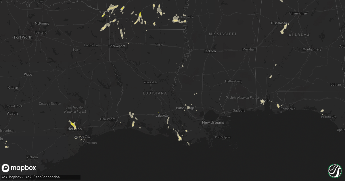
Hail Map in Louisiana on June 28, 2019
Get this storm
June 28 map
$229
one time, instant access
Download today. No call, no setup
Keep the $229
Bought the map and want the full workflow? Apply the entire $229 to a subscription within 7 days. None of it is wasted.
Every map, not just this one
This buys you this map. Subscription and you get every map we run, in the markets you choose from a few cities to whole states to nationwide. Plus real-time alerts the moment a storm fires.
Contact data
Name, contact info, occupancy, even credit band for addresses in the footprint. You go from where it hit to who to call.
Become the source they trust
Unlimited branding weather history reports on demand. You already have the documented answer ready for the property owner, and you are the one who showed up with it.
Property data and RoofTrace estimates
Pull up any address you have got, its value and the exact code rules for that jurisdiction, straight from One Click Code. Then RoofTrace estimates the squares, pitch, and roof value, priced the way you price.
Storm reports in Louisiana
Louisiana
| Date | Description |
|---|---|
| 06/28/20196:30 PM CDT | Large tree down at 106 middle pearl dr. |
| 06/28/20196:13 PM CDT | Nickel and quarter sized hail reported by trained spotter. |
| 06/28/20195:06 PM CDT | Tree and power line down on hwy 146 near woods road. |
| 06/28/20194:15 PM CDT | Tree down on old hammond highway in baton rouge. |
| 06/28/20194:15 PM CDT | Tree down off hwy 1032 near garrison lane. |
| 06/28/20193:40 PM CDT | One inch diamater tree limbs were blown down. |
| 06/28/20193:18 AM CDT | At 817 PM CDT, severe thunderstorms were located along a line extending from Westlake to near Lake Charles Regional Airport, moving southwest at 15 mph. HAZARD...60 mph wind gusts and penny size hail. SOURCE...Radar indicated. IMPACT...Expect damage to roofs, siding, and trees. Locations impacted include... Lake Charles, Westlake, Lake Charles Regional Airport, Carlyss and Holmwood. |
| 06/28/20191:16 AM CDT | At 616 PM CDT, severe thunderstorms were located along a line extending from Eunice to Mire, and are nearly stationary. HAZARD...60 mph wind gusts and quarter size hail. SOURCE...Radar indicated. IMPACT...Hail damage to vehicles is expected. Expect wind damage to roofs, siding, and trees. Locations impacted include... Eunice, Rayne, Church Point, Mowata, Branch, Richard, Mire and Savoy. |
| 06/28/201912:59 AM CDT | At 559 PM CDT, a severe thunderstorm was located near Bayou Chicot, or 7 miles northwest of Ville Platte, moving southeast at 15 mph. HAZARD...Quarter size hail. SOURCE...Radar indicated. IMPACT...Damage to vehicles is expected. Locations impacted include... Ville Platte, Mamou, Pine Prairie, Bayou Chicot and Chicot State Park. |
| 06/27/201911:49 PM CDT | At 448 PM CDT, a severe thunderstorm was located over Farmerville, or 18 miles northwest of Claiborne, moving south at 30 mph. HAZARD...60 mph wind gusts and quarter size hail. SOURCE...Radar indicated. IMPACT...Hail damage to vehicles is expected. Expect wind damage to roofs, siding, and trees. Locations impacted include... Ruston, Claiborne, West Monroe, Brownsville-Bawcom, Brownsville-Bawcomville, Farmerville, Bernice, Dubach, Choudrant, Vienna, Eros, Downsville, Drew, D Arbonne, Calhoun, Folksville, Cheniere, Bayou D Arbonne Lake, Mineral Springs and Caderville. |
| 06/27/201910:52 PM CDT | At 352 PM CDT, severe thunderstorms were located along a line extending from Watson to Shenandoah to Gardere, moving east at 10 mph. HAZARD...60 mph wind gusts and quarter size hail. SOURCE...Radar indicated. IMPACT...Hail damage to vehicles is expected. Expect wind damage to roofs, siding, and trees. Locations impacted include... Baton Rouge, Denham Springs, Oak Hills Place, St. Gabriel, Walker, Addis, Westminster, Old Jefferson, Inniswold, Watson, Village St. George, Shenandoah, Gardere and Greenwell Spring. |
| 06/27/201910:45 PM CDT | At 344 PM CDT, a severe thunderstorm was located near Kentwood, or near Greensburg, moving south at 30 mph. HAZARD...60 mph wind gusts and quarter size hail. SOURCE...Radar indicated. IMPACT...Hail damage to vehicles is expected. Expect wind damage to roofs, siding, and trees. Locations impacted include... Greensburg, Amite, Amite City, Kentwood, Independence, Roseland, Montpelier and Tangipahoa. |
| 06/27/201910:29 PM CDT | At 328 PM CDT, a severe thunderstorm was located over Westminster, or near Baton Rouge, moving east at 10 mph. HAZARD...60 mph wind gusts and quarter size hail. SOURCE...Radar indicated. IMPACT...Hail damage to vehicles is expected. Expect wind damage to roofs, siding, and trees. Locations impacted include... Baton Rouge, Denham Springs, Oak Hills Place, Walker, Westminster, Old Jefferson, Merrydale, Village St. George, Inniswold, Shenandoah and Gardere. |
| 06/27/201910:26 PM CDT | At 325 PM CDT, a severe thunderstorm was located 7 miles southeast of Moro Bay State Park, or 13 miles northwest of Huttig, moving south at 15 mph. HAZARD...60 mph wind gusts and quarter size hail. SOURCE...Radar indicated. IMPACT...Hail damage to vehicles is expected. Expect wind damage to roofs, siding, and trees. Locations impacted include... Huttig, Strong, Lapile, New London, Aurelle and Pigeon Hill. |
| 06/27/201910:23 PM CDT | At 323 PM CDT, a severe thunderstorm was located near Gillsberg, or 7 miles southeast of Liberty, moving southwest at 25 mph. HAZARD...60 mph wind gusts and quarter size hail. SOURCE...Radar indicated. IMPACT...Hail damage to vehicles is expected. Expect wind damage to roofs, siding, and trees. Locations impacted include... Liberty, Greensburg, Felps, Darlington, Gillsberg and Easleyville. |
| 06/27/201910:01 PM CDT | At 300 PM CDT, a severe thunderstorm was located over Felps, or 11 miles northeast of Clinton, moving northeast at 10 mph. HAZARD...60 mph wind gusts and quarter size hail. SOURCE...Radar indicated. IMPACT...Hail damage to vehicles is expected. Expect wind damage to roofs, siding, and trees. Locations impacted include... Felps. |
| 06/27/20199:36 PM CDT | At 236 PM CDT, a severe thunderstorm was located near Pierre Part, or 7 miles northwest of Napoleonville, and is nearly stationary. HAZARD...60 mph wind gusts and quarter size hail. SOURCE...Radar indicated. IMPACT...Hail damage to vehicles is expected. Expect wind damage to roofs, siding, and trees. Locations impacted include... Napoleonville, Paincourtville and Belle Rose. |
| 06/27/20199:18 PM CDT | At 217 PM CDT, a severe thunderstorm was located over Fayette, or 20 miles northeast of Natchez, moving southeast at 20 mph. HAZARD...60 mph wind gusts and penny size hail. SOURCE...Radar indicated. IMPACT...Expect damage to roofs, siding, and trees. Locations impacted include... Fayette, Bude, Hamburg, Lorman, Garden City, Little Springs, Stampley, Red Lick, Church Hill, Kirby, Mcnair, New Hope, Blue Hill, Roxie and Meadville. |
| 06/27/20199:11 PM CDT | At 211 PM CDT, a severe thunderstorm was located over Amelia, or 7 miles east of Morgan City, moving south at 5 mph. HAZARD...60 mph wind gusts and quarter size hail. SOURCE...Radar indicated. IMPACT...Hail damage to vehicles is expected. Expect wind damage to roofs, siding, and trees. This severe thunderstorm will remain over mainly rural areas of northwestern Terrebonne and south central Assumption Parishes. |
| 06/27/20198:52 PM CDT | At 152 PM CDT, a severe thunderstorm was located over Amelia, or near Morgan City, moving south at 10 mph. HAZARD...60 mph wind gusts and quarter size hail. SOURCE...Radar indicated. IMPACT...Hail damage to vehicles is expected. Expect wind damage to roofs, siding, and trees. This severe thunderstorm will remain over mainly rural areas of northwestern Terrebonne and south central Assumption Parishes. |
All States Impacted by Hail Map on June 28, 2019
Cities Impacted by Hail Map on June 28, 2019
- Lebanon, OH
- Morrow, OH
- Hermitage, AR
- Dike, IA
- Cedar Falls, IA
- Ten Mile, TN
- Philadelphia, TN
- Fairview, MT
- Sidney, MT
- Brockton, MT
- Roseville, MI
- Saint Clair Shores, MI
- Stephens, AR
- Rosston, AR
- Walker, LA
- Denham Springs, LA
- Eureka, SD
- Stockdale, TX
- Wolf Point, MT
- Naples, FL
- Estero, FL
- White Hall, IL
- Rockbridge, IL
- Greenfield, IL
- Wrights, IL
- Dittmer, MO
- Timewell, IL
- Lansford, ND
- Washington, AR
- Fulton, AR
- Saratoga, AR
- Ashdown, AR
- Alexander, ND
- Cartwright, ND
- Atlanta, TX
- Blakesburg, IA
- Drakesville, IA
- Unionville, IA
- Bloomfield, IA
- Arnegard, ND
- Lewistown, MT
- Stanley, ND
- Palermo, ND
- Downers Grove, IL
- Louann, AR
- Mount Holly, AR
- Magnolia, AR
- Smackover, AR
- Emerson, AR
- Camden, AR
- El Dorado, AR
- Chicago, IL
- Jesup, IA
- Fairbank, IA
- Dunkerton, IA
- Waterloo, IA
- Whitley City, KY
- Hooks, TX
- Moravia, IA
- Lancaster, MO
- Downing, MO
- Ottumwa, IA
- Albia, IA
- Madison, VA
- Texarkana, AR
- Peebles, OH
- Ross, ND
- Sterling Heights, MI
- Waverly, OH
- Malta, MT
- Zortman, MT
- Deering, ND
- Berthold, ND
- Des Lacs, ND
- Surrey, ND
- Glenburn, ND
- Minot, ND
- Carpio, ND
- Norwich, ND
- Burlington, ND
- Minot Afb, ND
- Donnybrook, ND
- White Earth, ND
- Tolley, ND
- Newport, TN
- Hurley, NM
- Kramer, ND
- Homer Glen, IL
- Huntsville, IL
- Fortuna, ND
- Pleasant Plain, OH
- Thompson, MO
- Detroit, MI
- Scobey, MT
- Englewood, FL
- Hazelton, ND
- Mandan, ND
- Zeeland, ND
- Solen, ND
- Linton, ND
- Hague, ND
- Almont, ND
- New Salem, ND
- Ashley, ND
- Strasburg, ND
- Flasher, ND
- Cannon Ball, ND
- Saint Anthony, ND
- Green Castle, MO
- Green City, MO
- Unionville, MO
- Cincinnati, IA
- Centerville, IA
- Lexington, MI
- Roodhouse, IL
- Winchester, IL
- Mills, NM
- Maxbass, ND
- Herreid, SD
- Lockport, IL
- New Edinburg, AR
- Thornton, AR
- Kingsland, AR
- Fordyce, AR
- Fouke, AR
- Houston, TX
- Two Dot, MT
- Martinsdale, MT
- Eolia, MO
- Souris, ND
- Richey, MT
- Bloomfield, MT
- Glendive, MT
- Savage, MT
- Lambert, MT
- Capitol Heights, MD
- Hyattsville, MD
- Santa Fe, TX
- Elmer, MO
- Chatham, MS
- Greenville, MS
- Hollandale, MS
- Fort Peck, MT
- Strong, AR
- Donnellson, IA
- West Point, IA
- Epping, ND
- Columbus, ND
- Moore, MT
- Hobson, MT
- Buffalo, MT
- Yale, MI
- Floresville, TX
- Willow City, ND
- Winifred, MT
- Union Church, MS
- Reserve, MT
- Redstone, MT
- Plentywood, MT
- Mertztown, PA
- Alburtis, PA
- Hohenwald, TN
- Wewahitchka, FL
- Plaza, ND
- Ashland, IL
- Vance, AL
- Olivehill, TN
- Clintwood, VA
- Clinchco, VA
- New Town, ND
- Warren, MI
- Ashburn, MO
- Louisiana, MO
- New London, MO
- Towner, ND
- New Sharon, IA
- Silex, MO
- Elsberry, MO
- Foley, MO
- Troy, MO
- Roxie, MS
- Alvin, TX
- Poteet, TX
- Bowling Green, MO
- Frankford, MO
- Poplar, MT
- Jacksonville, IL
- Murrayville, IL
- Williston, ND
- Portland, AR
- Lake Village, AR
- Keota, IA
- Sigourney, IA
- Richland, IA
- Lockridge, IA
- Brighton, IA
- Ollie, IA
- Fairfield, IA
- Mount Pleasant, IA
- Rochelle, VA
- Aroda, VA
- Benton City, MO
- Martinsburg, MO
- Boerne, TX
- Franklin, LA
- Keokee, VA
- Saint Charles, VA
- Arenzville, IL
- Concord, IL
- Chapin, IL
- Cranks, KY
- Cawood, KY
- Eubank, KY
- Chillicothe, OH
- Crewe, VA
- Havana, IL
- Topeka, IL
- Wellsville, MO
- Farber, MO
- Laddonia, MO
- Curryville, MO
- Vandalia, MO
- Saint Martinville, LA
- New Iberia, LA
- Hawk Point, MO
- Outlook, MT
- Flaxville, MT
- Oregon, WI
- Brooklyn, WI
- Morgan City, LA
- Griggsville, IL
- Meredosia, IL
- Chambersburg, IL
- Bluffs, IL
- Peerless, MT
- Grundy Center, IA
- Parkersburg, IA
- Holland, IA
- Fleetwood, PA
- Cambridge, WI
- Fort Atkinson, WI
- Grass Range, MT
- Rarden, OH
- Piketon, OH
- Dewar, IA
- Spring, TX
- Tomball, TX
- Wright City, MO
- Warrenton, MO
- Truesdale, MO
- Minor Hill, TN
- Seymour, IA
- Albany, WI
- Plain Dealing, LA
- Hinsdale, MT
- Saco, MT
- Granville, ND
- Bantry, ND
- Powers Lake, ND
- Westhope, ND
- Monroe, IA
- Reasnor, IA
- Fort Madison, IA
- Clarksville, MO
- Okeechobee, FL
- Belleville, WI
- Lenoir City, TN
- Gilman, IA
- Victoria, VA
- Roy, MT
- Hope, AR
- Ray, ND
- Attica, MI
- Capac, MI
- Imlay City, MI
- Knoxville, TN
- Carson, ND
- Terra Ceia, FL
- Faber, VA
- Nellysford, VA
- Tioga, ND
- Tallula, IL
- New Market, TN
- Dandridge, TN
- Inglis, FL
- Frazer, MT
- Larslan, MT
- Queen City, MO
- West Helena, AR
- Raymond, MT
- Steamboat Rock, IA
- Carrollton, IL
- Melbourne, IA
- Lacassine, LA
- Bell City, LA
- Astoria, IL
- Bath, IL
- Burlington, IA
- Wever, IA
- Fort Myers, FL
- North Fort Myers, FL
- Virginia, IL
- Dierks, AR
- Whitewater, WI
- Jefferson, WI
- Palmyra, WI
- New Tripoli, PA
- Manito, IL
- Bainbridge, OH
- Bokeelia, FL
- Grand Chenier, LA
- Petersburg, IL
- La Porte City, IA
- Vermont, IL
- Rushville, IL
- Browning, IL
- Perry, FL
- Warren, AR
- Kinderhook, IL
- Orange, VA
- Radiant, VA
- Beloit, WI
- Rockton, IL
- Church Road, VA
- Cape Coral, FL
- Flat Lick, KY
- Petersburg, VA
- Meherrin, VA
- Meadville, MS
- Watford City, ND
- Table Grove, IL
- Greentop, MO
- Kirksville, MO
- Novinger, MO
- Mount Sterling, IL
- Mountain City, TN
- Powell, TN
- Crab Orchard, KY
- Moberly, MO
- Upham, ND
- Lignite, ND
- Liberty, MS
- Smithdale, MS
- Harper, IA
- Salem, IA
- Packwood, IA
- Knoxville, IA
- Bussey, IA
- Moulton, IA
- Thomasville, AL
- Immokalee, FL
- Whitetail, MT
- Oley, PA
- Reading, PA
- Birdsboro, PA
- Douglassville, PA
- Deep River, IA
- Emmet, AR
- Linden, TX
- Bivins, TX
- Holtwood, PA
- Moss, TN
- Theriot, LA
- Montrose, AR
- Evansville, WI
- Janesville, WI
- Reinbeck, IA
- Harvey, IA
- Loudon, TN
- Sweetwater, TN
- Seminole, AL
- Elberta, AL
- Robertsdale, AL
- Summerdale, AL
- Mohall, ND
- Wentzville, MO
- Prospect, TN
- Lester, AL
- Panama City Beach, FL
- Melrose, FL
- Keystone Heights, FL
- Alexander, IL
- Saint Petersburg, FL
- Denver, IA
- Moundville, AL
- Hazlehurst, MS
- Creole, LA
- Lake Charles, LA
- Cameron, LA
- Westby, MT
- Saint Joseph, LA
- Eudora, AR
- Mobile, AL
- Seymour, TN
- Sevierville, TN
- Seville, OH
- Medina, OH
- Chippewa Lake, OH
- Fayetteville, OH
- Nauvoo, AL
- Carbon Hill, AL
- Bottineau, ND
- Baker, LA
- Baton Rouge, LA
- Pollock, SD
- Williamsburg, MO
- Rhoadesville, VA
- Walker, KY
- Scalf, KY
- Manchester, KY
- Wildrose, ND
- Alamo, ND
- Westlake, OH
- Huntley, IL
- Union, IL
- Toledo, IA
- Garwin, IA
- Lewisville, AR
- Afton, VA
- Roseland, VA
- Auburndale, FL
- Winter Haven, FL
- Ambrose, ND
- Dermott, AR
- Lorman, MS
- Pattison, MS
- Pequea, PA
- Drumore, PA
- Syria, VA
- Etlan, VA
- Nashua, MT
- Gladbrook, IA
- Jonesburg, MO
- Green Bay, VA
- Powersville, MO
- Makoti, ND
- Burkeville, VA
- Valley City, OH
- Grafton, OH
- Columbia Station, OH
- North Port, FL
- Hamburg, AR
- Woodstock, IL
- Marengo, IL
- Hamilton, IA
- Lovilia, IA
- Bradley, AR
- Orfordville, WI
- Winfield, IA
- Grinnell, IA
- Clayton, IL
- Pensacola, FL
- Searsboro, IA
- Delta, PA
- Clearwater, FL
- Largo, FL
- Pinellas Park, FL
- Pleasant Plains, IL
- Pocahontas, AR
- Imboden, AR
- Welch, WV
- Falls City, TX
- Clifton, TN
- Pella, IA
- Trementina, NM
- Osyka, MS
- Aplington, IA
- Clark, MO
- Eddyville, IA
- Melrose, IA
- Tuscumbia, AL
- Avoca, MI
- Emmett, MI
- Greenview, IL
- Utica, MS
- Wilmar, AR
- Patterson, LA
- Crosby, ND
- Jonesville, VA
- Pennington Gap, VA
- Kenvir, KY
- La Vernia, TX
- Front Royal, VA
- Linden, VA
- Markham, VA
- Hume, VA
- Banks, AR
- Marshalltown, IA
- Minden, LA
- Friendswood, TX
- Webster, TX
- League City, TX
- Beaver, OH
- Foristell, MO
- Marthasville, MO
- Hudson, IA
- Wayland, IA
- Livingston, LA
- Waverly, IA
- Pleasanton, TX
- Helena, AR
- Oskaloosa, IA
- Fort Kent, ME
- Newburg, ND
- Bismarck, ND
- Fort Yates, ND
- Clarksville, TN
- Noonan, ND
- Black Rock, AR
- Powhatan, AR
- Monticello, FL
- Ogden, AR
- Mineral Springs, AR
- Richland, MT
- Yankeetown, FL
- New Castle, PA
- Mount Vernon, KY
- Brodhead, KY
- Blackstone, VA
- Daphne, AL
- Loxley, AL
- Port Charlotte, FL
- El Paso, IL
- Hudson, IL
- Hilger, MT
- Kingston, TN
- Eastpointe, MI
- Edgerton, WI
- Bellflower, MO
- New Hartford, IA
- Stanford, MT
- Jackson, AL
- Texas City, TX
- Bowbells, ND
- Madison Heights, MI
- Hazel Park, MI
- Cuba, MO
- Cotton Valley, LA
- Benton, LA
- Fraser, MI
- Cottondale, AL
- West Blocton, AL
- Duncanville, AL
- Texarkana, TX
- Punta Gorda, FL
- Centreville, AL
- Brent, AL
- Woodstock, AL
- Greensboro, AL
- Augusta, ME
- Coahoma, MS
- Friars Point, MS
- East Troy, WI
- Eagle, WI
- Theodore, AL
- Hermanville, MS
- Tama, IA
- Sutherland, VA
- Edwards, MS
- Raymond, MS
- Athens, IL
- Rosharon, TX
- Tallahassee, FL
- Litchfield, OH
- Somerset, VA
- Hood, VA
- Rapidan, VA
- Stanardsville, VA
- Hampton, AR
- Westmont, IL
- Dallas City, IL
- Carthage, IL
- Forrest City, AR
- Jefferson, ME
- Albion, IA
- Batavia, IL
- Warrenville, IL
- Gloster, MS
- Greensburg, LA
- Lewistown, MO
- Vanceburg, KY
- Tollesboro, KY
- Stout, IA
- Spearsville, LA
- Dellroy, OH
- Lynnville, IA
- High Hill, MO
- Sarepta, LA
- Jeanerette, LA
- Conrad, IA
- Madison, MO
- Ebro, FL
- Allison, IA
- Kellogg, IA
- Montour, IA
- Danville, AL
- Flag Pond, TN
- Antler, ND
- Helenville, WI
- Corydon, IA
- Martinsville, OH
- Fayette, MS
- Beaman, IA
- Richmond Dale, OH
- Antelope, MT
- Kenmare, ND
- Bloomburg, TX
- Queen City, TX
- Doddridge, AR
- Greenwell Springs, LA
- Clarksville, IA
- Clutier, IA
- Traer, IA
- Verona, WI
- Arena, WI
- Spring Green, WI
- Glasgow, MT
- Velva, ND
- Lemont, IL
- Lodi, OH
- Rolling Fork, MS
- Mayersville, MS
- Franklin, IL
- New Florence, MO
- Montgomery City, MO
- Strunk, KY
- Brodhead, WI
- Haverhill, IA
- Laurel, IA
- Taylor, AR
- Springhill, LA
- Sibley, LA
- Mount Clemens, MI
- Clinton Township, MI
- Sauk City, WI
- Crane, MT
- Jewell, IA
- Wapello, IA
- La Plata, MO
- Keene, ND
- Mckeesport, PA
- Martinsville, VA
- Liberty, IL
- Coatsville, MO
- Shell Rock, IA
- Morning Sun, IA
- Savannah, TN
- Janesville, IA
- Payson, IL
- Hull, IL
- Denton, MT
- Hazard, KY
- Mexico, MO
- Haughton, LA
- Von Ormy, TX
- Axton, VA
- Callands, VA
- Westlake, LA
- Iowa, LA
- Willowbrook, IL
- Darien, IL
- La Grange, IL
- Bridgeview, IL
- Willow Springs, IL
- Hickory Hills, IL
- Justice, IL
- Glenwood, MO
- Oregonia, OH
- New Glarus, WI
- Monticello, WI
- Keokuk, IA
- Bechtelsville, PA
- Barto, PA
- Philadelphia, PA
- Newton, IA
- Maud, TX
- Boyertown, PA
- Newark, DE
- Scott, LA
- Church Point, LA
- Orland Park, IL
- Collegeville, PA
- Zap, ND
- Richardton, ND
- Hebron, ND
- Halliday, ND
- Dunn Center, ND
- Dodge, ND
- Beulah, ND
- Glen Ullin, ND
- Taylor, ND
- Barberton, OH
- Wadsworth, OH
- Carman, IL
- Lomax, IL
- Saint Marie, MT
- Vandalia, MT
- Rolette, ND


