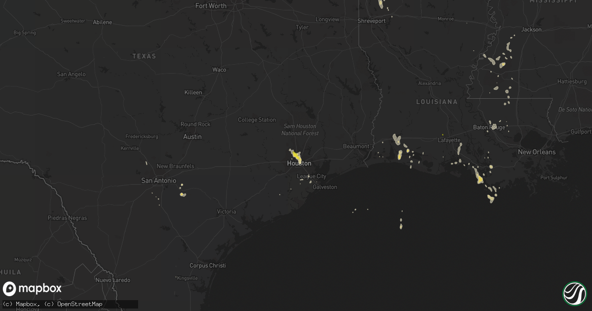
Hail Map on June 28, 2019
Get this storm
June 28 map
$229
one time, instant access
Download today. No call, no setup
Keep the $229
Bought the map and want the full workflow? Apply the entire $229 to a subscription within 7 days. None of it is wasted.
Every map, not just this one
This buys you this map. Subscription and you get every map we run, in the markets you choose from a few cities to whole states to nationwide. Plus real-time alerts the moment a storm fires.
Contact data
Name, contact info, occupancy, even credit band for addresses in the footprint. You go from where it hit to who to call.
Become the source they trust
Unlimited branding weather history reports on demand. You already have the documented answer ready for the property owner, and you are the one who showed up with it.
Property data and RoofTrace estimates
Pull up any address you have got, its value and the exact code rules for that jurisdiction, straight from One Click Code. Then RoofTrace estimates the squares, pitch, and roof value, priced the way you price.
States Impacted by Hail Map on June 28, 2019
Storm reports
Illinois
| Date | Description |
|---|---|
| 06/28/20196:50 PM CDT | Report received via social media. |
| 06/28/20196:50 PM CDT | Report received via social media. |
| 06/28/20196:14 PM CDT | A local report indicates 1.00 inch wind near 3 NE LOCKPORT |
| 06/28/20196:13 PM CDT | A local report indicates 1.75 inch wind near 2 SE LEMONT |
| 06/28/20196:12 PM CDT | Reported at 14600 127th st... Lemont... Il 60439. |
| 06/28/20196:09 PM CDT | A local report indicates 1.75 inch wind near 2 N HOMER GLEN |
| 06/28/20196:04 PM CDT | Report received via social media. |
| 06/28/20193:09 PM CDT | Power lines reported down in town. |
| 06/28/201912:54 PM CDT | Portion of a garage roof blown off and shed window blown out. |
| 06/28/201912:53 PM CDT | Large tree down. Time estimated from radar. |
| 06/28/201912:53 PM CDT | Large tree down. Time estimated by radar. |
| 06/28/20193:59 AM CDT | At 858 AM CDT, a severe thunderstorm was located over Marengo, moving east at 25 mph. HAZARD...60 mph wind gusts and quarter size hail. SOURCE...Radar indicated. IMPACT...Hail damage to vehicles is expected. Expect wind damage to roofs, siding, and trees. Locations impacted include... Carpentersville, Algonquin, McHenry, Woodstock, Marengo, Wonder Lake, Lake In The Hills, Huntley, Hampshire, Lakewood, Prairie Grove, Bull Valley, Trout Valley, Greenwood, Crystal Lake, Cary, Barrington Hills and Union.Including the following interstate... I-90 between mile markers 36 and 45. This includes... Mchenry County College and Mchenry CountyFairgrounds. |
| 06/28/20191:48 AM CDT | At 647 PM CDT, a severe thunderstorm was located over Lakeview, or over Lincoln Park, and is nearly stationary. HAZARD...Quarter size hail. SOURCE...Radar indicated. IMPACT...Damage to vehicles is expected. Locations impacted include... Chicago, Cicero, Berwyn, Oak Park, Harwood Heights, Northerly Island, Lincoln Park, Navy Pier, Lakeview, Humboldt Park, Rogers Park, Logan Square, Douglas Park and Lincolnwood.Including the following interstates... I-55 between mile markers 291 and 294. I-94 between mile markers 41 and 55. I-290 between mile markers 23 and 29. I-294 between mile markers 41 and 55.This includes... Lincoln Park Zoo, Loyola University, NortheasternIllinois University, Soldier Field, University of Illinois Chicago,Wrigley Field, The Loop, Museum Campus, and Northerly Island. |
| 06/28/201912:51 AM CDT | At 550 PM CDT, a severe thunderstorm was located over Lockport, or near Homer Glen, moving east at 10 mph. HAZARD...60 mph wind gusts and quarter size hail. SOURCE...Radar indicated. IMPACT...Hail damage to vehicles is expected. Expect wind damage to roofs, siding, and trees. Locations impacted include... Joliet, Orland Park, Tinley Park, Romeoville, Lockport, New Lenox, Homer Glen, Mokena, Frankfort, Lemont, Worth, Ingalls Park, Palos Hills, Hickory Hills, Goodings Grove, Crest Hill, Bridgeview, Palos Heights, Orland Hills and Palos Park.Including the following interstates... I-80 between mile markers 138 and 149. I-355 between mile markers 1 and 9.This includes... University of St. Francis, Lewis University, andMoraine Valley Community College. |
| 06/27/201910:51 PM CDT | At 349 PM CDT, a severe thunderstorm was located near Greenfield, moving south at 20 mph. HAZARD...60 mph wind gusts and quarter size hail. SOURCE...Radar indicated. IMPACT...Hail damage to vehicles is expected. Expect wind damage to roofs, siding, and trees. Locations impacted include... Carrollton, Greenfield, Athensville, Kane, Wrights and Rockbridge. |
| 06/27/201910:14 PM CDT | At 313 PM CDT, severe thunderstorms were located along a line extending from near Louisiana to near Farber, moving south at 20 mph. HAZARD...60 mph wind gusts and quarter size hail. SOURCE...Radar indicated. IMPACT...Hail damage to vehicles is expected. Expect wind damage to roofs, siding, and trees. Locations impacted include... Bowling Green, Vandalia, Louisiana, Wellsville, Eolia, Clarksville, Farber, Curryville, Tarrants, Buell, New Hartford, Silex, Middletown, Paynesville, Whiteside, Annada, Edgewood, St. Clement, Olney and Cyrene. |
| 06/27/201910:13 PM CDT | At 312 PM CDT, a severe thunderstorm was located near Jacksonville, moving east at 45 mph. HAZARD...60 mph wind gusts and nickel size hail. SOURCE...Radar indicated. IMPACT...Expect damage to roofs, siding, and trees. Locations impacted include... Springfield, Jacksonville, Chatham, Alexander, Auburn, Rochester, Pawnee, New Berlin, Waverly, Divernon, Loami, Franklin, Literberry, South Jacksonville, Jerome, Southern View, Thayer, Berry, Curran and Berlin.This includes the following highways... Interstate 55 between mile markers 77 and 93. Interstate 72 between mile markers 68 and 100. |
| 06/27/20199:44 PM CDT | At 244 PM CDT, a severe thunderstorm was located over Naples, moving southeast at 20 mph. HAZARD...60 mph wind gusts and quarter size hail. SOURCE...Radar indicated. IMPACT...Hail damage to vehicles is expected. Expect wind damage to roofs, siding, and trees. Locations impacted include... Montezuma, Milton, Chambersburg, Detroit, Florence and Valley City. |
| 06/27/20199:39 PM CDT | At 239 PM CDT, a severe thunderstorm was located over Naples, or 10 miles northwest of Winchester, moving southeast at 30 mph. HAZARD...60 mph wind gusts and penny size hail. SOURCE...Radar indicated. IMPACT...Expect damage to roofs, siding, and trees. Locations impacted include... Jacksonville, Winchester, Meredosia, Bluffs, Murrayville, Chapin, Woodson, Manchester, Alsey, Naples, Exeter, South Jacksonville, Glasgow, Lynnville, Valley City, Riggston, Merritt, Oxville, Nortonville and Lake Jacksonville.This includes Interstate 72 between mile markers 43 and 68. |
| 06/27/20199:36 PM CDT | At 235 PM CDT, severe thunderstorms were located along a line extending from 7 miles northwest of Pike to Spencerburg, moving southeast at 10 mph. HAZARD...60 mph wind gusts and quarter size hail. SOURCE...Radar indicated. IMPACT...Hail damage to vehicles is expected. Expect wind damage to roofs, siding, and trees. Locations impacted include... Bowling Green, Louisiana, Clarksville, Curryville, Tarrants, Spencerburg and St. Clement. |
| 06/27/20199:19 PM CDT | At 219 PM CDT, a severe thunderstorm was located near Astoria, or 13 miles northeast of Beardstown, moving east at 35 mph. HAZARD...60 mph wind gusts and penny size hail. SOURCE...Radar indicated. IMPACT...Expect damage to roofs, siding, and trees. Locations impacted include... Astoria, Chandlerville, Bath, Kilbourne, Browning, Marbletown, Bluff City and Snicarte. |
| 06/27/20199:05 PM CDT | At 205 PM CDT, severe thunderstorms were located along a line extending from 9 miles southwest of Rushville to near Mount Sterling to Buckhorn to near Beverly, moving southeast at 15 mph. HAZARD...60 mph wind gusts and penny size hail. SOURCE...Radar indicated. IMPACT...Expect damage to roofs, siding, and trees. Locations impacted include... Mount Sterling, Griggsville, Naples, Buckhorn, La Grange, Versailles, Perry, Chambersburg, Ripley, Fishhook and Coopertown. |
Montana
| Date | Description |
|---|---|
| 06/28/20197:24 AM CDT | At 1224 AM MDT, a severe thunderstorm was located 9 miles west of Lindsay, or 17 miles southeast of Circle, moving east at 30 mph. HAZARD...70 mph wind gusts and quarter size hail. SOURCE...Radar indicated. IMPACT...Hail damage to vehicles is expected. Expect considerable tree damage. Wind damage is also likely to mobile homes, roofs, and outbuildings. Locations impacted include... West Glendive, Lindsay, Marsh and Forest Park. |
| 06/28/20197:09 AM CDT | At 1209 AM MDT, a severe thunderstorm was located near Circle, moving east at 40 mph. HAZARD...70 mph wind gusts and ping pong ball size hail. SOURCE...Radar indicated. IMPACT...People and animals outdoors will be injured. Expect hail damage to roofs, siding, windows, and vehicles. Expect considerable tree damage. Wind damage is also likely to mobile homes, roofs, and outbuildings. Locations impacted include... Circle, Richey, Bloomfield and Enid. |
| 06/28/20196:55 AM CDT | At 1155 PM MDT, a severe thunderstorm was located 10 miles northwest of Brockton, or 13 miles northeast of Poplar, moving northeast at 50 mph. HAZARD...60 mph wind gusts and quarter size hail. SOURCE...Radar indicated. IMPACT...Hail damage to vehicles is expected. Expect wind damage to roofs, siding, and trees. Locations impacted include... Medicine Lake, Froid, Reserve and Homestead. |
| 06/28/20196:06 AM CDT | At 1106 PM MDT, a severe thunderstorm was located 7 miles southwest of Wolf Point, moving east at 45 mph. HAZARD...70 mph wind gusts and ping pong ball size hail. SOURCE...Radar indicated. IMPACT...People and animals outdoors will be injured. Expect hail damage to roofs, siding, windows, and vehicles. Expect considerable tree damage. Wind damage is also likely to mobile homes, roofs, and outbuildings. Locations impacted include... Wolf Point, Poplar, Brockton and Sprole. |
| 06/28/20195:55 AM CDT | At 1054 PM MDT, severe thunderstorms were located along a line extending from 13 miles southwest of Peerless to 9 miles north of Lustre to 12 miles northwest of Wolf Point, moving northeast at 55 mph. HAZARD...70 mph wind gusts and ping pong ball size hail. SOURCE...Radar indicated. IMPACT...People and animals outdoors will be injured. Expect hail damage to roofs, siding, windows, and vehicles. Expect considerable tree damage. Wind damage is also likely to mobile homes, roofs, and outbuildings. Locations impacted include... Scobey, Flaxville, Archer, Port Of Whitetail, Madoc, Bredette, Port Of Scobey, Redstone, Whitetail, Peerless, Outlook, Daleview, Four Buttes, West Fork and Navajo. |
| 06/28/20195:16 AM CDT | At 1016 PM MDT, severe thunderstorms were located along a line extending from 8 miles south of St. Marie to near Rock Creek Rec Area, moving northeast at 45 mph. HAZARD...60 mph wind gusts. SOURCE...Trained weather spotters. IMPACT...Expect damage to roofs, siding, and trees. Locations impacted include... Wolf Point, Lustre, Frazer, West Fork, Volt and Oswego. |
| 06/28/20195:14 AM CDT | At 1013 PM MDT, severe thunderstorms were located along a line extending from 17 miles southwest of Opheim to 20 miles northeast of Tampico to near St. Marie, moving northeast at 40 mph. HAZARD...60 mph wind gusts. SOURCE...Radar indicated. IMPACT...Expect damage to roofs, siding, and trees. Locations impacted include... Opheim, Richland, Port Of Opheim, Baylor, Glentana and Larslan. |
| 06/28/20194:33 AM CDT | At 932 PM MDT, severe thunderstorms were located along a line extending from 16 miles south of Hinsdale to 22 miles northwest of The Pines Rec Area to 8 miles north of Brusett, moving east at 35 mph. HAZARD...70 mph wind gusts and penny size hail. SOURCE...Radar indicated. IMPACT...Expect considerable tree damage. Damage is likely to mobile homes, roofs, and outbuildings. Locations impacted include... Glasgow, Nashua, Fort Peck, The Pines Rec Area, Fort Peck Marina, Hell Creek Rec Area, Duck Creek Rec Area, St. Marie, Rock Creek Rec Area, Haxby, Park Grove and Whatley. |
| 06/28/20194:30 AM CDT | Strong winds dropping limbs and branches approximately 5 inches in diameter. Penny size hail estimated from the storm. |
| 06/28/20194:23 AM CDT | At 922 PM MDT, a severe thunderstorm was located 7 miles north of Hinsdale, or 27 miles northwest of Glasgow, moving northeast at 20 mph. HAZARD...70 mph wind gusts and penny size hail. SOURCE...Radar indicated. IMPACT...Expect considerable tree damage. Damage is likely to mobile homes, roofs, and outbuildings. Locations impacted include... Tampico and Vandalia. |
| 06/28/20194:09 AM CDT | At 908 PM MDT, a severe thunderstorm was located near Saco, or 20 miles southeast of Whitewater, moving northeast at 20 mph. HAZARD...60 mph wind gusts and quarter size hail. SOURCE...Radar indicated. IMPACT...Hail damage to vehicles is expected. Expect wind damage to roofs, siding, and trees. Locations impacted include... Saco and Frenchman Reservoir. |
| 06/28/20193:56 AM CDT | Hail to the size of quarters... With a few larger. 0.8 inches of rain from two storms. 30 to 40 mph wind gusts. Time estimated from radar. |
| 06/28/20193:54 AM CDT | At 853 PM MDT, severe thunderstorms were located along a line extending from 14 miles south of Malta to 25 miles northeast of Fourchette to 14 miles north of Devils Creek Rec Area to near U L Bend Rec Area, moving northeast at 35 mph. HAZARD...70 mph wind gusts and quarter size hail. SOURCE...Radar indicated. IMPACT...Hail damage to vehicles is expected. Expect considerable tree damage. Wind damage is also likely to mobile homes, roofs, and outbuildings. Locations impacted include... Devils Creek Rec Area, U L Bend Rec Area, Hinsdale, The Bentonite Plant and Content. |
| 06/28/20193:13 AM CDT | At 813 PM MDT, a severe thunderstorm was located 8 miles east of Malta, moving northeast at 20 mph. HAZARD...70 mph wind gusts and half dollar size hail. SOURCE...Radar indicated. IMPACT...Hail damage to vehicles is expected. Expect considerable tree damage. Wind damage is also likely to mobile homes, roofs, and outbuildings. Locations impacted include... Malta, Saco, Bowdoin and Sleeping Buffalo. |
| 06/28/20193:05 AM CDT | At 804 PM MDT, a severe thunderstorm was located 9 miles northwest of Fourchette, or 19 miles east of Zortman, moving northeast at 35 mph. HAZARD...Two inch hail and 70 mph wind gusts. SOURCE...Radar indicated. IMPACT...People and animals outdoors will be injured. Expect hail damage to roofs, siding, windows, and vehicles. Expect considerable tree damage. Wind damage is also likely to mobile homes, roofs, and outbuildings. Locations impacted include... Fourchette, Phillips, Content and Sun Prairie. |
| 06/28/20193:01 AM CDT | At 800 PM MDT, a severe thunderstorm was located 21 miles west of Crooked Creek Rec Area, or 22 miles north of Winnett, moving northeast at 55 mph. HAZARD...70 mph wind gusts and half dollar size hail. SOURCE...Radar indicated. IMPACT...Hail damage to vehicles is expected. Expect considerable tree damage. Wind damage is also likely to mobile homes, roofs, and outbuildings. This severe thunderstorm will remain over mainly rural areas of northern Petroleum and northwestern Garfield Counties. |
| 06/28/20192:42 AM CDT | At 741 PM MDT, a severe thunderstorm was located 10 miles south of Roy, or 25 miles east of Lewistown, moving northeast at 45 mph. HAZARD...60 mph wind gusts and half dollar size hail. SOURCE...Trained weather spotters. IMPACT...Hail damage to vehicles is expected. Expect wind damage to roofs, siding, and trees. Locations impacted include... Grass Range, Roy and Fergus. |
| 06/28/20192:30 AM CDT | At 729 PM MDT, severe thunderstorms were located along a line extending from 21 miles northeast of Winifred to 11 miles northeast of Roy, moving northeast at 30 mph. HAZARD...70 mph wind gusts and nickel size hail. SOURCE...Radar indicated. IMPACT...Expect considerable tree damage. Damage is likely to mobile homes, roofs, and outbuildings. These severe thunderstorms will remain over mainly rural areas of northeastern Fergus and south central Blaine Counties. |
| 06/28/20192:18 AM CDT | At 718 PM MDT, a severe thunderstorm was located 15 miles south of Zortman, moving east at 35 mph. HAZARD...Golf ball size hail and 70 mph wind gusts. SOURCE...Radar indicated. IMPACT...People and animals outdoors will be injured. Expect hail damage to roofs, siding, windows, and vehicles. Expect considerable tree damage. Wind damage is also likely to mobile homes, roofs, and outbuildings. Locations impacted include... Fourchette and Fred Robinson Bridge. |
| 06/28/20192:16 AM CDT | At 715 PM MDT, a severe thunderstorm was located over Lewistown, moving northeast at 50 mph. HAZARD...60 mph wind gusts and quarter size hail. SOURCE...Trained weather spotters. IMPACT...Hail damage to vehicles is expected. Expect wind damage to roofs, siding, and trees. Locations impacted include... Lewistown, Grass Range, Roy, Fergus, Forestgrove, Giltedge, Glengarry, Heath and Hilger. |
| 06/28/20192:03 AM CDT | At 703 PM MDT, severe thunderstorms were located along a line extending from Winifred to 13 miles northwest of Roy, moving northeast at 55 mph. HAZARD...70 mph wind gusts and nickel size hail. SOURCE...Observing Equipment. IMPACT...Expect considerable tree damage. Damage is likely to mobile homes, roofs, and outbuildings. Locations impacted include... Winifred and Suffolk. |
| 06/28/20191:52 AM CDT | At 651 PM MDT, a severe thunderstorm was located 19 miles north of Roy, or 28 miles southwest of Zortman, moving northeast at 30 mph. HAZARD...60 mph wind gusts and quarter size hail. SOURCE...Radar indicated. IMPACT...Hail damage to vehicles is expected. Expect wind damage to roofs, siding, and trees. Locations impacted include... Zortman and Landusky. |
| 06/28/20191:43 AM CDT | At 643 PM MDT, a severe thunderstorm was located 8 miles southwest of Moore, or 21 miles southwest of Lewistown, moving northeast at 30 mph. HAZARD...60 mph wind gusts and quarter size hail. SOURCE...Radar indicated. IMPACT...Hail damage to vehicles is expected. Expect wind damage to roofs, siding, and trees. Locations impacted include... Lewistown, Moore, Glengarry and Garneill. |
| 06/28/20191:42 AM CDT | At 642 PM MDT, a severe thunderstorm was located 16 miles north of Roy, or 32 miles southwest of Zortman, moving northeast at 35 mph. HAZARD...60 mph wind gusts and quarter size hail. SOURCE...Radar indicated. IMPACT...Hail damage to vehicles is expected. Expect wind damage to roofs, siding, and trees. This severe thunderstorm will remain over mainly rural areas of north central Fergus and south central Blaine Counties. |
| 06/28/20191:15 AM CDT | At 615 PM MDT, a severe thunderstorm was located 19 miles southwest of Hobson, or 25 miles northwest of Harlowton, moving northeast at 35 mph. HAZARD...60 mph wind gusts and quarter size hail. SOURCE...Radar indicated. IMPACT...Hail damage to vehicles is expected. Expect wind damage to roofs, siding, and trees. Locations impacted include... Hobson, Utica and Ackley Lake State Park. |
| 06/28/20191:11 AM CDT | At 610 PM MDT, a severe thunderstorm was located 11 miles northwest of Hobson, or 11 miles east of Stanford, moving northeast at 35 mph. HAZARD...60 mph wind gusts and quarter size hail. SOURCE...Radar indicated. IMPACT...Hail damage to vehicles is expected. Expect wind damage to roofs, siding, and trees. Locations impacted include... Danvers and Benchland. |
| 06/28/201912:59 AM CDT | Quarter size hail falling in town of plentywood. Still falling. |
| 06/28/201912:49 AM CDT | At 548 PM MDT, a severe thunderstorm was located 24 miles northwest of Harlowton, moving northeast at 35 mph. HAZARD...60 mph wind gusts and quarter size hail. SOURCE...Radar indicated. IMPACT...Hail damage to vehicles is expected. Expect wind damage to roofs, siding, and trees. This severe thunderstorm will remain over mainly rural areas of northwestern Wheatland County. |
| 06/28/201912:45 AM CDT | Reported received through social media. |
| 06/28/201912:37 AM CDT | Time estimated from radar. |
| 06/28/201912:30 AM CDT | One house lose new siding. Estimated wind gust between 60 to 70mph. |
| 06/27/201911:10 PM CDT | Power poles bent but not broken near milk river. |
| 06/27/201911:10 PM CDT | A local report indicates 60 MPH wind near 2 NNW GLASGOW |
| 06/27/201911:09 PM CDT | A local report indicates 62 MPH wind near 2 NW GLASGOW |
| 06/27/201910:40 PM CDT | Healthy tree snapped off at its base by thunderstorm winds near mile marker 521 on highway 2. Time estimated from radar. |
| 06/27/201910:30 PM CDT | A local report indicates 65 MPH wind near 3 NNW VANDALIA |
| 06/27/201910:15 PM CDT | Estimated wind gusts between 55 and 60 mph between 9 and 915. |
| 06/27/201910:10 PM CDT | Multiple 6 inch diameter limbs broken off trees. 3 inches of rain in half an hour |
| 06/27/201910:03 PM CDT | Saco dot |
| 06/27/201910:00 PM CDT | Heavy rain |
| 06/27/20199:30 PM CDT | Also had 45 mph wind and heavy rain |
| 06/27/20199:25 PM CDT | Wind blown hail damaged 4 pickup trucks and several windows on a house. |
| 06/27/20199:15 PM CDT | Metal structure was damaged as strong winds between 60-70 mph affect this area near mile post 135.5 on highway mt-191. |
| 06/27/20198:45 PM CDT | Hail fell between 730 and 755 pm. |
| 06/27/20198:39 PM CDT | At 139 AM MDT, a severe thunderstorm was located 5 miles west of Skaar, or 22 miles south of Sidney, moving east at 45 mph. HAZARD...60 mph wind gusts and quarter size hail. SOURCE...Radar indicated. IMPACT...Hail damage to vehicles is expected. Expect wind damage to roofs, siding, and trees. This severe thunderstorm will be near... Skaar around 145 AM MDT. Trotters around 150 AM MDT. |
| 06/27/20198:25 PM CDT | A local report indicates 1.25 inch wind near 7 NW FORESTGROVE |
| 06/27/20198:05 PM CDT | Also had pea size hail |
| 06/27/20197:59 PM CDT | A local report indicates 1.25 inch wind near 3 SW MOORE |
| 06/27/20197:58 PM CDT | Awos station k1em echo. Time is estimated. |
| 06/27/20197:45 PM CDT | Quarter sized hail reported by storm spotters driving through the storm on us 191. Hail fell from 643 pm to 648 pm. |
Colorado
| Date | Description |
|---|---|
| 06/27/20199:55 PM CDT | Awos station klmo longmont vance brand. |
Maryland
| Date | Description |
|---|---|
| 06/28/20194:40 PM CDT | Numerous trees down blocking roads... On wires... With 3 onto houses. |
| 06/28/20194:38 PM CDT | Three large branches down in 5700 block of falkland place. |
| 06/28/20192:45 PM CDT | Multiple trees down in the rosedale area... Including one onto a house. |
| 06/28/20192:34 PM CDT | Small limbs down at a residence... And a small tree split in half. |
| 06/28/20191:45 PM CDT | Large trees down. Damage to a trailer... Chicken house and trampoline. 7300 block of parsonsburg rd... Grant rd. |
| 06/28/20191:34 AM CDT | At 634 PM EDT, a severe thunderstorm was located near Brooklyn Park, or near Baltimore, moving east at 5 mph. HAZARD...60 mph wind gusts and quarter size hail. SOURCE...Radar indicated. IMPACT...Damaging winds will cause some trees and large branches to fall. This could injure those outdoors, as well as damage homes and vehicles. Roadways may become blocked by downed trees. Localized power outages are possible. Unsecured light objects may become projectiles. Locations impacted include... Baltimore, Fort Smallwood State Park, Millers Island, North Point State Park, Back River, Dundalk, Pasadena, Brooklyn Park, Edgemere, Lansdowne, Fort Howard and Eastpoint. |
| 06/28/20191:25 AM CDT | At 624 PM EDT, severe thunderstorms were located along a line extending from Severn to near Arnold, and are nearly stationary. HAZARD...60 mph wind gusts and quarter size hail. SOURCE...Radar indicated. IMPACT...Damaging winds will cause some trees and large branches to fall. This could injure those outdoors, as well as damage homes and vehicles. Roadways may become blocked by downed trees. Localized power outages are possible. Unsecured light objects may become projectiles. Locations impacted include... Severn, Annapolis, Naval Academy, Severn River, Pinehurst, Gibson Island, Sillery Bay, Glen Burnie, Severna Park, Odenton, Pasadena, Arnold, Lake Shore, Parole, Fort Meade, Millersville, Green Haven, South Gate, Cape St. Claire and Gambrills. |
| 06/28/20191:00 AM CDT | At 600 PM EDT, a severe thunderstorm was located over Stanton, or near Newark, moving east at 40 mph. HAZARD...60 mph wind gusts. SOURCE...Radar indicated. IMPACT...Damage to roofs, siding, trees, and power lines is possible. This severe thunderstorm will be near... Wilmington, New Castle and Delaware City around 605 PM EDT.Other locations impacted by this severe thunderstorm includeBrookside and Edgemoor. |
| 06/28/20191:00 AM CDT | At 600 PM EDT, a severe thunderstorm was located over White Oak, or near Langley Park, moving southeast at 10 mph. HAZARD...70 mph wind gusts and quarter size hail. SOURCE...Radar indicated. IMPACT...Damaging winds will cause some trees and large branches to fall. This could injure those outdoors, as well as damage homes and vehicles. Roadways may become blocked by downed trees. Localized power outages are possible. Unsecured light objects may become projectiles. Locations impacted include... College Park, Greenbelt, Langley Park, Beltsville, Bladensburg, University of Maryland, Fairland, Landover, Hyattsville, White Oak, Takoma Park, East Riverdale, Adelphi, Colesville, Kemp Mill, New Carrollton, North Kensington, South Kensington, Riverdale Park and Forest Glen. |
| 06/28/201912:46 AM CDT | At 546 PM EDT, a severe thunderstorm was located over Lake Shore, or near Sillery Bay, and is nearly stationary. HAZARD...60 mph wind gusts and quarter size hail. SOURCE...Radar indicated. IMPACT...Damaging winds will cause some trees and large branches to fall. This could injure those outdoors, as well as damage homes and vehicles. Roadways may become blocked by downed trees. Localized power outages are possible. Unsecured light objects may become projectiles. Locations impacted include... Riviera Beach, Fort Smallwood State Park, Pinehurst, Gibson Island, Bodkin Point, Sillery Bay, Severna Park, Pasadena, Arnold, Lake Shore, Green Haven, Cape St. Claire, Chelsea Beach and Belvedere Heights. |
| 06/28/201912:40 AM CDT | At 540 PM EDT, a severe thunderstorm was located over Crofton, and is nearly stationary. HAZARD...60 mph wind gusts and quarter size hail. SOURCE...Radar indicated. IMPACT...Damaging winds will cause some trees and large branches to fall. This could injure those outdoors, as well as damage homes and vehicles. Roadways may become blocked by downed trees. Localized power outages are possible. Unsecured light objects may become projectiles. Locations impacted include... Crofton, Parole, Riva, Crownsville and Davidsonville. |
| 06/27/201911:04 PM CDT | At 403 PM EDT, a severe thunderstorm was located near Holtwood, moving southeast at 15 mph. HAZARD...60 mph wind gusts and quarter size hail. SOURCE...Radar indicated. IMPACT...Hail damage to vehicles is expected. Expect wind damage to trees, roofs, and siding. Locations impacted include... Quarryville, Wakefield, Holtwood, Sunnyburn, Smithville, Kirkwood, Little Britain, Buck, Peach Bottom, Airville and Rawlinsville. |
| 06/27/201910:36 PM CDT | At 335 PM EDT, a severe thunderstorm was located over Rosedale, or near Middle River, moving east at 10 mph. HAZARD...60 mph wind gusts. SOURCE...Radar indicated. IMPACT...Damaging winds will cause some trees and large branches to fall. This could injure those outdoors, as well as damage homes and vehicles. Roadways may become blocked by downed trees. Localized power outages are possible. Unsecured light objects may become projectiles. Locations impacted include... Baltimore, Middle River, North Point State Park, Sparrows Point, Back River, Millers Island, Dundalk, Towson, Essex, Parkville, Carney, Perry Hall, Rosedale, Rossville, White Marsh, Bowleys Quarters, Hampton, Joppatowne, Edgemere and Nottingham. |
Wisconsin
| Date | Description |
|---|---|
| 06/28/20197:09 AM CDT | At 1209 AM CDT, a severe thunderstorm was located near North Bend, or 13 miles northwest of Sparta, moving southeast at 35 mph. HAZARD...Quarter size hail. SOURCE...Radar indicated. IMPACT...Damage to vehicles is expected. This severe thunderstorm will be near... Cataract around 1220 AM CDT. Sparta around 1230 AM CDT. Fort Mc Coy around 1240 AM CDT.Other locations impacted by this severe thunderstorm include Melrose,Shamrock, Stevenstown, The North Flowage, Rockland, County Roads D EAnd E and Severson Coulee. |
| 06/28/201912:47 AM CDT | At 547 AM CDT, severe thunderstorms were located along a line extending from 12 miles northwest of Boscobel to near Clermont to near New Hampton, moving south at 20 mph. HAZARD...60 mph wind gusts and quarter size hail. SOURCE...Radar indicated. IMPACT...Hail damage to vehicles is expected. Expect wind damage to roofs, siding, and trees. Severe thunderstorms will be near... Postville and Clermont around 550 AM CDT. Elgin around 555 AM CDT. Fredericksburg around 620 AM CDT. Elkader around 625 AM CDT. Volga around 630 AM CDT. Strawberry Point around 645 AM CDT.Other locations impacted by these severe thunderstorms includeMederville, Randalia, Giard, Highways 3 And 187, Watson, Turkey Riverand Bixby State Park. |
Alabama
| Date | Description |
|---|---|
| 06/28/20196:00 PM CDT | Trees reported down in the town of toney along toney school road. Time estimated by radar. |
| 06/28/20194:50 PM CDT | Metal roof lifted off a building near schillinger & old shell rd. Several reports of trees down. Reports and pictures via social media. |
| 06/28/20194:50 PM CDT | Asos station kmob measured wind gusts of 59mph with sustained wind of 48mph. |
| 06/28/20194:04 PM CDT | 1 report of an oak tree downed... Clipping a house. 1 report of large branches downed. Both in the woodstock area. Time estimated from radar. |
| 06/28/20192:53 PM CDT | Tree reported on house in muscle shoals. Time estimated by radar. |
| 06/28/20192:53 PM CDT | Tree reported blown down on vehicle. Winds estimated at 40 to 50 mph via a user video. Time estimated by radar. |
| 06/28/20192:34 PM CDT | Two single tree down reports... One at gallant rd and dogwood drive and the other at highway 431 and highway 205 near mountainboro. Winds estimated 30-40 mph per radar. |
| 06/27/201911:38 PM CDT | At 438 PM CDT, a severe thunderstorm was located near Midtown Mobile, and is nearly stationary. HAZARD...60 mph wind gusts. SOURCE...Radar indicated. IMPACT...Expect damage to roofs, siding, and trees. Locations impacted include... Midtown Mobile, Downtown Mobile, Prichard, Tillmans Corner, Theodore, Chickasaw, Semmes, I65 And I165, I10 And I65 and Mobile Regional Airport. |
Ohio
| Date | Description |
|---|---|
| 06/28/20196:58 PM CDT | Trees and power line downed. |
| 06/28/20196:37 PM CDT | Several trees down through the city and power outages. |
| 06/28/20196:14 PM CDT | Roof partially torn off old barn. Photo verified. Time estimated from radar. |
| 06/28/20194:30 PM CDT | Trees and power lines down. |
| 06/28/20193:44 PM CDT | Several large branches downed at a property along state route 350. Time estimated from radar. |
| 06/28/20193:08 AM CDT | At 807 PM EDT, a severe thunderstorm was located over Chesterland, or 9 miles southeast of Willowick, moving east at 25 mph. HAZARD...60 mph wind gusts. SOURCE...Radar indicated. IMPACT...Expect damage to trees and power lines. Locations impacted include... Chardon, South Russell, Middlefield, Burton, Chesterland, Willoughby Hills, Kirtland, Chagrin Falls, Huntsburg, Mayfield, Moreland Hills, Claridon, Gates Mills, Montville, Bentleyville, Hunting Valley, Kirtland Hills and Aquilla. |
| 06/28/20192:46 AM CDT | At 746 PM EDT, a severe thunderstorm was located over Wadsworth, or 10 miles southeast of Medina, moving southeast at 30 mph. HAZARD...60 mph wind gusts and quarter size hail. SOURCE...Radar indicated. IMPACT...Minor damage to vehicles is possible. Expect damage to trees and power lines. Locations impacted include... Akron, Canton, Massillon, Barberton, Green, North Canton, Louisville, Orrville, Rittman, Doylestown, Hartville, Creston, Brewster, Navarre, Dalton, New Franklin, Norton, Canal Fulton, Lakemore and Clinton. |
| 06/28/20192:31 AM CDT | At 731 PM EDT, a severe thunderstorm was located near Chippewa Lake, or near Medina, moving southeast at 40 mph. HAZARD...60 mph wind gusts and quarter size hail. SOURCE...Radar indicated. IMPACT...Minor damage to vehicles is possible. Expect damage to trees and power lines. Locations impacted include... Medina, Wadsworth, Rittman, Creston, Chippewa Lake, Seville, Westfield Center, Gloria Glens Park, Burbank, Chippewa-On-The-Lake and Briarwood Beach. |
| 06/28/20191:10 AM CDT | Several trees and branches down in pymatuning state park. |
| 06/28/20191:09 AM CDT | A couple of trees and large branches down. |
| 06/27/201911:43 PM CDT | At 443 PM EDT, a severe thunderstorm was located near Morrow, and is nearly stationary. HAZARD...60 mph wind gusts and quarter size hail. SOURCE...Radar indicated. IMPACT...Minor hail damage to vehicles is possible. Expect wind damage to trees and power lines. Locations impacted include... Lebanon, Waynesville, Morrow, Clarksville, Harveysburg, Corwin, Oregonia, Fort Ancient, Middleboro, Genntown, State Route 350 at US Route 22, Caesar Creek State Park, Ogden and Kingman.This includes I-71 in Ohio between mile markers 31 and 45. |
| 06/27/20197:53 PM CDT | Large tree down via social media. |
| 06/27/20197:03 PM CDT | A local report indicates 1.00 inch wind near 3 NW NORTON |
Delaware
| Date | Description |
|---|---|
| 06/28/20195:05 PM CDT | Time estimated from radar. |
Arizona
| Date | Description |
|---|---|
| 06/28/20197:55 AM CDT | At 1255 PM MST, a severe thunderstorm was located over Sierra Vista, moving north at 5 mph. HAZARD...60 mph wind gusts. SOURCE...Radar indicated. IMPACT...Expect damage to roofs, siding, and trees. Locations impacted include... Sierra Vista, Hereford, Whetstone, Huachuca City, Fort Huachuca, Charleston and Ramsey Canyon Preserve.This includes the following highways... Route 82 between mile markers 47 and 52. Route 90 between mile markers 309 and 326. Route 92 between mile markers 322 and 330. |
New Mexico
| Date | Description |
|---|---|
| 06/28/20192:31 AM CDT | At 731 PM MDT, a severe thunderstorm was located 9 miles northwest of Encino, or 23 miles northwest of Vaughn, moving east at 20 mph. HAZARD...60 mph wind gusts and quarter size hail. SOURCE...Radar indicated. IMPACT...Hail damage to vehicles is expected. Expect wind damage to roofs, siding, and trees. Locations impacted include... Encino.This includes Highway 285 between Mile Markers 224 and 238. |
| 06/28/20191:58 AM CDT | At 658 PM MDT, a severe thunderstorm was located near Mills, or 21 miles southeast of Springer, moving east at 15 mph. HAZARD...60 mph wind gusts and quarter size hail. SOURCE...Radar indicated. IMPACT...Hail damage to vehicles is expected. Expect wind damage to roofs, siding, and trees. Locations impacted include... Mills and Chicosa Lake State Park. |
Tennessee
| Date | Description |
|---|---|
| 06/28/20194:00 PM CDT | Trees down... Bent garage doors... And power outages near lenoir city. |
| 06/28/20193:58 PM CDT | Trees and power lines down across the county. |
| 06/28/20193:47 PM CDT | 20 reports of trees down east of kingston. |
| 06/28/20193:25 PM CDT | Several trees down on white wing rd. |
| 06/28/20193:06 PM CDT | Several trees down along hickory creek road in west knox county. |
| 06/28/20193:00 PM CDT | Trees down on lonas dr. |
| 06/28/20193:00 PM CDT | Tree and power lines down in karns along oak ridge hwy. Time estimated by radar. |
| 06/28/20192:48 PM CDT | Trees down in the hardin valley area. |
| 06/28/20192:30 PM CDT | Several trees down along highway 35/70 near newport. |
| 06/28/20191:50 PM CDT | Trees down along sugar loaf rd. |
| 06/28/20191:50 PM CDT | Trees down along north rogers rd. |
| 06/28/20197:09 AM CDT | At 1208 AM EDT, a severe thunderstorm was located 8 miles southeast of La Follette, moving north at 20 mph. HAZARD...60 mph wind gusts and quarter size hail. SOURCE...Radar indicated. IMPACT...Expect damage to roofs, siding, and trees. Locations impacted include... La Follette, Jacksboro, Jellico, Caryville, Lake City, Norris, Norris Dam State Park, Disney, Fincastle, Norris Lake, Big Ridge State Park and Andersonville. |
| 06/27/201911:43 PM CDT | At 443 PM EDT, a severe thunderstorm was located 7 miles north of Sweetwater, moving northwest at 15 mph. HAZARD...60 mph wind gusts and quarter size hail. SOURCE...Radar indicated. IMPACT...Hail damage to vehicles is expected. Expect wind damage to roofs, siding, and trees. Locations impacted include... Kingston, Rockwood, Loudon, Fairview, Midtown, Harriman, Philadelphia, Paint Rock, Eagle Furnace and Ten Mile. |
| 06/27/201911:25 PM CDT | At 425 PM EDT, a severe thunderstorm was located near Lenoir City, moving northwest at 10 mph. HAZARD...60 mph wind gusts and quarter size hail. SOURCE...Radar indicated. IMPACT...Hail damage to vehicles is expected. Expect wind damage to roofs, siding, and trees. Locations impacted include... Oak Ridge, Lenoir City, Kingston, Farragut, Oliver Springs, Harriman, Bradbury and Dearmond. |
| 06/27/201910:36 PM CDT | At 336 PM EDT, a severe thunderstorm was located near Knoxville, moving northwest at 15 mph. HAZARD...60 mph wind gusts and quarter size hail. SOURCE...Radar indicated. IMPACT...Hail damage to vehicles is expected. Expect wind damage to roofs, siding, and trees. Locations impacted include... Knoxville, Oak Ridge, Clinton, Oliver Springs, Halls, Lake City, Norris, Andersonville, Rosedale, Karns, Bearden, Powell and Norris Dam State Park. |
| 06/27/201910:20 PM CDT | At 320 PM EDT, a severe thunderstorm was located near Newport, moving north at 10 mph. HAZARD...60 mph wind gusts and quarter size hail. SOURCE...Radar indicated. IMPACT...Hail damage to vehicles is expected. Expect wind damage to roofs, siding, and trees. Locations impacted include... Morristown, Newport, White Pine, Baneberry, Parrottsville, Mosheim, Bybee, Del Rio, Lowland and Mohawk. |
| 06/27/20199:42 PM CDT | At 242 PM EDT, a severe thunderstorm was located near Sevierville, moving northwest at 15 mph. HAZARD...60 mph wind gusts and quarter size hail. SOURCE...Radar indicated. IMPACT...Hail damage to vehicles is expected. Expect wind damage to roofs, siding, and trees. Locations impacted include... Knoxville, Sevierville, Pigeon Forge, Strawberry Plains, McMahan, Mascot, Kodak, Kimberlin Heights and Seymour. |
| 06/27/20198:26 PM CDT | At 126 PM EDT, a severe thunderstorm was located near Gatlinburg, and is nearly stationary. HAZARD...60 mph wind gusts and quarter size hail. SOURCE...Radar indicated. IMPACT...Hail damage to vehicles is expected. Expect wind damage to roofs, siding, and trees. Locations impacted include... Gatlinburg, Pittman Center and Great Smoky Mountains National Park. |
Pennsylvania
| Date | Description |
|---|---|
| 06/28/20196:37 PM CDT | Large trees down on brewster rd... Pictures provided. |
| 06/28/20196:36 PM CDT | Trees and power lines down |
| 06/28/20196:25 PM CDT | Single trees down on talley cavey road and wildwood road. Time estimated from radar. |
| 06/28/20196:19 PM CDT | Social media video of two trees blown down during storm on south broad street. Time estimated from radar. |
| 06/28/20196:14 PM CDT | Large hardwood tree uprooted near eagleville... Pa from. Time estimated from radar. |
| 06/28/20195:56 PM CDT | Downed tree blocking germantown pike both directions between grange ave and rdg pike. Time estimated from radar. |
| 06/28/20195:55 PM CDT | Numerous trees down south of evansburg. Time estimated from radar. |
| 06/28/20195:55 PM CDT | Several trees down near 9th avenue and main street. Time estimated from radar. |
| 06/28/20195:55 PM CDT | Gusts estimated 65 to 70mph with pea size hail. |
| 06/28/20195:52 PM CDT | Tree and wires blocking the entire road on west third avenue near chestnut street. Time estimated from radar. |
| 06/28/20195:52 PM CDT | Tree down at the intersection of blacksmith rd and hunter rd. Time estimated from radar. |
| 06/28/20194:52 PM CDT | Corrects time of previous tstm wnd dmg report from 4 sse oley. Tree down at the intersection of blacksmith rd and hunter rd. Time estimated from radar. |
| 06/28/20194:49 PM CDT | Downed tree at intersection of douglass drive and pine forge road. Time estimated from radar. |
| 06/28/20194:45 PM CDT | Few tree limbs down with wind gusts estimated 50 to 60 mph. Time estimated from radar. |
| 06/28/20194:42 PM CDT | At intersection of covered bridge road and memorial highway in oley twp. |
| 06/28/20194:33 PM CDT | Tree down onto wires with a transformer fire. Time estimated from radar. |
| 06/28/20194:33 PM CDT | Report of power lines down near the intersection of old bethlehem pike and saucon drive. Time estimated from radar. |
| 06/28/20194:29 PM CDT | Mping report of tree limbs down and shingles blown off at this location. Time estimated from radar. |
| 06/28/20194:19 PM CDT | Several reports of trees down. Time estimated from radar. |
| 06/28/20194:17 PM CDT | 50 kt gust reported at kabe. |
| 06/28/20193:44 PM CDT | Large tree split in two near the base. Time estimated from radar. |
| 06/28/20193:14 PM CDT | Tree and wires down in martic township. |
| 06/28/20194:01 AM CDT | At 901 PM EDT, a severe thunderstorm was located over Munhall, or near McKeesport, moving southeast at 10 mph. HAZARD...Wind gusts to 60 mph. SOURCE...Radar. IMPACT...Expect damage to trees and power lines, resulting in some power outages. Locations impacted include... Pittsburgh... McKeesport... West Mifflin... Munhall... North Versailles... Swissvale... White Oak... Duquesne... Turtle Creek... North Braddock... Glassport... Trafford... |
| 06/28/20193:19 AM CDT | At 818 PM EDT, a severe thunderstorm was located over North Side Pittsburgh, or over Pittsburgh, moving southeast at 15 mph. HAZARD...Wind gusts to 60 mph. SOURCE...Radar. IMPACT...Expect damage to trees and power lines, resulting in some power outages. Locations impacted include... Pittsburgh... Penn Hills... Mount Lebanon... Ross Township... Shaler Township... West Mifflin... North Side Pittsburgh... Baldwin... Scott Township... Wilkinsburg... Whitehall... Robinson Township... |
| 06/28/20193:10 AM CDT | At 809 PM EDT, a severe thunderstorm was located over Irwin, or near Jeannette, moving east at 5 mph. HAZARD...Wind gusts to 60 mph. SOURCE...Radar. IMPACT...Expect damage to trees and power lines, resulting in some power outages. Locations impacted include... Jeannette... Irwin... Manor... New Stanton... North Irwin... Penn... Madison... Arona... Hunker... Adamsburg... Grapeville... Herminie... |
| 06/28/20192:35 AM CDT | At 734 PM EDT, a severe thunderstorm was located over Camden, moving east at 20 mph. There are strong indications of intense winds with this storm. Take cover now. HAZARD...70 mph wind gusts and penny size hail. SOURCE...Radar indicated. IMPACT...Expect considerable tree damage. Damage is likely to mobile homes, roofs, and outbuildings. Locations impacted include... Camden, Cherry Hill, Evesham, Mount Laurel, Willingboro, Medford, Lumberton, Burlington, Bristol, Mount Holly, Riverside, Palmyra, Magnolia, Beverly, Ramblewood, Barclay-Kingston, Cherry Hill Mall, Golden Triangle, Marlton and Ashland. |
| 06/28/20192:26 AM CDT | At 726 PM EDT, a severe thunderstorm was located over Oakwood, or over New Castle, moving east at 10 mph. HAZARD...Wind gusts to 60 mph and quarter-size hail. SOURCE...Radar. IMPACT...Minor hail damage to vehicles is possible. Expect wind damage to trees and power lines, resulting in some power outages. Locations impacted include... New Castle... Oakwood... New Castle Northwest... Bessemer... South New Castle... Rose Point Park... |
| 06/28/20192:22 AM CDT | At 722 PM EDT, a severe thunderstorm was located over Gibsonia, or near McCandless Township, moving east at 10 mph. HAZARD...Wind gusts to 60 mph and quarter-size hail. SOURCE...Radar. IMPACT...Minor hail damage to vehicles is possible. Expect wind damage to trees and power lines, resulting in some power outages. Locations impacted include... McCandless Township... Hampton Township... Gibsonia... Russellton... Curtisville... Pine Township... |
| 06/28/20191:50 AM CDT | At 650 PM EDT, a severe thunderstorm was located over Collegeville, or 17 miles northeast of West Chester, moving southeast at 30 mph. HAZARD...70 mph wind gusts and quarter size hail. SOURCE...Radar indicated. IMPACT...Minor damage to vehicles is possible. Expect considerable tree damage. Wind damage is also likely to mobile homes, roofs, and outbuildings. Locations impacted include... Philadelphia, Norristown, West Norriton, East Norriton, Yeadon, Conshohocken, Ambler, Collegeville, Royersford, Jenkintown, Narberth, Trappe, Rockledge, Abington, Wissinoming, Morris Park, Germantown, Northeast Philadelphia, Center City and Bryn Mawr. |
| 06/28/20191:48 AM CDT | Tree down on garage on wallace st. |
| 06/28/20191:42 AM CDT | Few trees down on property. |
| 06/28/20191:15 AM CDT | Crawford county dispatch reports tree down at pymatuning state park near oh/pa state line. |
| 06/28/201912:42 AM CDT | At 541 PM EDT, a severe thunderstorm was located near Birdsboro, or 7 miles east of Reading, moving east at 10 mph. This replaces the previous severe thunderstorm warning in effect for the area. HAZARD...60 mph wind gusts and quarter size hail. SOURCE...Radar indicated. IMPACT...Minor damage to vehicles is possible. Wind damage to roofs, siding, trees, and power lines is possible. Locations impacted include... Reading, Pottstown, Birdsboro, Bally, Bechtelsville, Gilbertsville, Cedarville, Stowe, Boyertown, Spring City, Mount Penn, St. Lawrence, Pottsgrove, Lorane, South Pottstown, Reiffton, Amity Gardens, Sanatoga, Kenilworth and Halfway House. |
| 06/28/201912:27 AM CDT | At 526 PM EDT, severe thunderstorms were located along a line extending from Old Orchard to Allentown to near Ancient Oaks, moving southeast at 20 mph. HAZARD...60 mph wind gusts and quarter size hail. SOURCE...Allentown International Airport reported a wind gust to 58 mph at 517 pm. IMPACT...Minor damage to vehicles is possible. Wind damage to roofs, siding, trees, and power lines is possible. Locations impacted include... Allentown, Easton, Bethlehem, Emmaus, Quakertown, Wilson, Hellertown, East Greenville, Alpha, Ferndale, Frenchtown, West Easton, Milford, Bally, Riegelsville, Green Lane, Glendon, Pleasant Valley, Revere and Zionsville. |
| 06/28/201912:06 AM CDT | At 506 PM EDT, severe thunderstorms were located along a line extending from Topton to near Birdsboro, moving east at 15 mph. HAZARD...60 mph wind gusts and quarter size hail. SOURCE...Radar indicated. IMPACT...Minor damage to vehicles is possible. Wind damage to roofs, siding, trees, and power lines is possible. Locations impacted include... Pottstown, Birdsboro, East Greenville, Topton, Bally, Bechtelsville, Lyons, Geryville, Gilbertsville, Stowe, Boyertown, Pennsburg, Red Hill, St. Lawrence, Pottsgrove, Lorane, Reiffton, Amity Gardens, Sanatoga and Halfway House. |
| 06/28/201912:01 AM CDT | At 501 PM EDT, a severe thunderstorm was located over Claussville, or 9 miles west of Allentown, moving southeast at 10 mph. HAZARD...60 mph wind gusts and penny size hail. SOURCE...Radar indicated. IMPACT...Damage to roofs, siding, trees, and power lines is possible. Locations impacted include... Allentown, Easton, Bethlehem, Emmaus, Northampton, Hellertown, Slatington, Walnutport, Steuben, Neffs, Coffeetown, Zionsville, Ancient Oaks, Emerald, Lehigh University, Claussville, Schnecksville, Old Orchard, Catasauqua and Fountain Hill. |
| 06/27/201910:59 PM CDT | Numerous trees down |
| 06/27/20198:15 PM CDT | Trees down. A citizen posted a picture that their tampoline was thrown across the yard. |
| 06/27/20197:35 PM CDT | Power lines down at rt 136 and wooster st |
| 06/27/20197:28 PM CDT | Trees down |
Texas
| Date | Description |
|---|---|
| 06/28/20195:10 PM CDT | Image of approximately one inch size hail reported via social media at veterans and bammel. |
| 06/28/20193:50 AM CDT | A local report indicates 1.00 inch wind near LEARY |
| 06/28/201912:18 AM CDT | At 518 PM CDT, a severe thunderstorm was located over Hooks Airport, or near Tomball, moving northwest at 20 mph. HAZARD...Quarter size hail. SOURCE...Radar indicated. IMPACT...Damage to vehicles is expected. Locations impacted include... Conroe, Tomball, Jersey Village, Pinehurst, The Woodlands, Greater Greenspoint, Spring, Aldine, northwestern Northside / Northline, Oak Ridge North, Panorama Village, Shenandoah, Magnolia, Stagecoach, The Woodlands Pavillion, Hooks Airport, Chateau Woods, Splashtown, Willowbrook and Hidden Valley. |
| 06/27/20198:47 PM CDT | Pictures on twitter of tree branches down in boerne. Time estimated from radar. |
Arkansas
| Date | Description |
|---|---|
| 06/28/20193:42 PM CDT | Trees down on oakland road in strong. |
| 06/28/20197:56 AM CDT | At 1256 PM CDT, a severe thunderstorm was located near Montrose, or 11 miles west of Lake Village, moving south at 15 mph. HAZARD...60 mph wind gusts and quarter size hail. SOURCE...Radar indicated. IMPACT...Hail damage to vehicles is expected. Expect wind damage to roofs, siding, and trees. This severe thunderstorm will be near... Parkdale around 125 PM CDT. |
| 06/28/20195:47 AM CDT | At 1047 PM CDT, a severe thunderstorm was located over El Dorado, moving southeast at 15 mph. HAZARD...60 mph wind gusts and quarter size hail. SOURCE...Radar indicated. IMPACT...Hail damage to vehicles is expected. Expect wind damage to roofs, siding, and trees. Locations impacted include... El Dorado, Junction City, Wesson, Urbana, Newell, Hillsboro and Catesville. |
| 06/28/20195:09 AM CDT | At 1008 PM CDT, a severe thunderstorm was located over Perrytown, or near Hope, moving south at 15 mph. HAZARD...60 mph wind gusts and quarter size hail. SOURCE...Radar indicated. IMPACT...Hail damage to vehicles is expected. Expect wind damage to roofs, siding, and trees. Locations impacted include... Hope, Emmet, Perrytown, Bodcaw, Patmos, Sutton and Falcon. |
| 06/28/20194:56 AM CDT | At 956 PM CDT, a severe thunderstorm was located near Cullendale, or near Camden, moving south at 15 mph. HAZARD...60 mph wind gusts and quarter size hail. SOURCE...Radar indicated. IMPACT...Hail damage to vehicles is expected. Expect wind damage to roofs, siding, and trees. Locations impacted include... Louann... Frenchport... Elliot... Kirkland... Cross Roads in Ouachita County... |
| 06/28/20192:23 AM CDT | At 723 PM CDT, a severe thunderstorm was located near Warren, moving south at 15 mph. HAZARD...60 mph wind gusts and quarter size hail. SOURCE...Radar indicated. IMPACT...Hail damage to vehicles is expected. Expect wind damage to roofs, siding, and trees. Locations impacted include... Mt Olive in Bradley County... Carmel... Johnsonville... Sumpter... Valley... Blanchton... |
| 06/28/20192:04 AM CDT | At 704 AM CDT, a severe thunderstorm was located near Algoa, or 10 miles southeast of Newport, moving south at 20 mph. HAZARD...60 mph wind gusts and nickel size hail. SOURCE...Radar indicated. IMPACT...Expect damage to roofs, siding, and trees. Locations impacted include... Augusta... Patterson... Tupelo... Algoa... McCrory... McFadden... Beedeville... Amagon... Weldon... Balch... Blackville... Shoffner... Stegall... Fitzhugh... Pumpkin Bend... Morton... |
| 06/27/201910:10 PM CDT | A local report indicates 1.00 inch wind near ELLIOTT |
| 06/27/20199:39 PM CDT | At 238 PM CDT, a severe thunderstorm was located over Tipton, or near Fordyce, moving south at 10 mph. HAZARD...60 mph wind gusts and quarter size hail. SOURCE...Radar indicated. IMPACT...Hail damage to vehicles is expected. Expect wind damage to roofs, siding, and trees. Locations impacted include... Fordyce... Kingsland... Marks Mill State Park... Weeks... Ellisville... Tipton... Tinsman... Chambersville... New Edinburg... |
Kentucky
| Date | Description |
|---|---|
| 06/28/20196:15 PM CDT | Tree down in cynthiana... Ky. |
| 06/28/20196:06 PM CDT | Tree down ne of georgetown... Ky. |
| 06/28/20193:55 PM CDT | 5 trees were reported to have been blown down on buckeye branch road. The event time is radar estimated. |
| 06/28/20193:53 PM CDT | A couple of trees were downed near intersection of ky 28 and spencer fork road. Public report via social media. The time of the event is radar estimated. |
| 06/28/20191:23 AM CDT | At 623 PM EDT, a severe thunderstorm was located near Holmes Mill, or 11 miles northeast of Jonesville, moving west at 10 mph. HAZARD...60 mph wind gusts and quarter size hail. SOURCE...Radar indicated. IMPACT...Hail damage to vehicles is expected. Expect wind damage to roofs, siding, and trees. Locations impacted include... Pennington Gap, St. Charles and Dryden. |
| 06/27/201911:36 PM CDT | At 435 PM EDT, a severe thunderstorm was located over Scalf, or 10 miles north of Pineville, moving southwest at 25 mph. HAZARD...60 mph wind gusts and half dollar size hail. SOURCE...Radar indicated. IMPACT...Hail damage to vehicles is expected. Expect wind damage to roofs, siding, and trees. Locations impacted include... Barbourville, Pineville, Artemus, Brightshade, Swan Lake, Clate, Birdseye, Barnyard, Salt Gum, Beverly, Gausdale and King. |
Virginia
| Date | Description |
|---|---|
| 06/28/20195:55 PM CDT | Trees and wires down along garth run road. |
| 06/28/20195:41 PM CDT | Tree down in the 10600 block of hume road. |
| 06/28/20195:40 PM CDT | Trees down in the slate mills area. |
| 06/28/20195:15 PM CDT | Trees down along richmond road. |
| 06/28/20195:10 PM CDT | Trees down along f.t. Valley road. |
| 06/28/20195:05 PM CDT | Dozens of trees down in nelson county. |
| 06/28/20194:45 PM CDT | Tree blocking roadway in scottsville area. |
| 06/28/20194:44 PM CDT | Trees down in the area of remount road near slate hill drive. |
| 06/28/20194:37 PM CDT | Trees down along harmon place. |
| 06/28/20194:32 PM CDT | Pictures received of multiple trees down in the ridgefield community in stephens city. |
| 06/28/20194:30 PM CDT | Stop sign blown over and trees down in the stephens city area. |
| 06/28/20194:30 PM CDT | Multiple large trees down in 100 block of downing circle. |
| 06/28/20194:26 PM CDT | Corrects previous tstm wnd dmg report from 2 w halifax. Approximately a dozen trees down all around the town of halifax. One tree caused cosmetic damage to a truck... A |
| 06/28/20194:10 PM CDT | Numerous limbs... Branches and a tree down along us 11 between va 714 and 717. Tree is blocking va 716. Time based on radar. |
| 06/28/20194:05 PM CDT | Trees down on old robert's road. |
| 06/28/20193:55 PM CDT | Dozens of trees down in nelson county. |
| 06/28/20193:12 PM CDT | Numerous tree limbs downed at the south boston speedway... And several pop-up tents and awnings for an outdoor event were damaged. No injuries. Time estimated from rada |
| 06/28/20192:45 PM CDT | Trees down. |
| 06/28/20192:30 PM CDT | Trees down on burkeville rd. |
| 06/28/20192:22 PM CDT | Three trees blown down. A large kennel was blown 14 feet. Time estimated by radar. |
| 06/28/201912:36 PM CDT | 2 trees downed on grassy hill rd north of rocky mountl... With 1.30 inches of rain in 20 minutes. Time estimated from radar. |
| 06/28/20192:35 AM CDT | At 735 PM EDT, severe thunderstorms were located along a line extending from 13 miles southeast of Culpeper to near Orange, moving southeast at 25 mph. HAZARD...60 mph wind gusts and quarter size hail. SOURCE...Radar indicated. IMPACT...Damaging winds will cause some trees and large branches to fall. This could injure those outdoors, as well as damage homes and vehicles. Roadways may become blocked by downed trees. Localized power outages are possible. Unsecured light objects may become projectiles. Locations impacted include... Fredericksburg, Massaponax, Spotsylvania, Mine Run, Verdiersville, Locust Grove, Snell, Thornhill, Nasons, Partlow, Glenora, Thornburg, Unionville, Cookstown, Rhoadesville, Brokenburg, Parker, Madison Run, Alsop and Gold Dale. |
| 06/28/20192:07 AM CDT | At 706 PM EDT, severe thunderstorms with a history of producing wind damage were located along a line extending from 6 miles west of Culpeper to near Stanardsville, moving southeast at 10 mph. HAZARD...60 mph wind gusts and quarter size hail. SOURCE...Wind damage reported to 911 call centers and doppler radar. IMPACT...Damaging winds will cause some trees and large branches to fall. This could injure those outdoors, as well as damage homes and vehicles. Roadways may become blocked by downed trees. Localized power outages are possible. Unsecured light objects may become projectiles. Locations impacted include... Orange, Madison, Stanardsville, Gordonsville, Ruckersville, Brightwood, Mine Run, Eheart, Oakpark, Barboursville, Verdiersville, Everona, Montpelier Station, Newtown, Thornhill, Nasons, Winston, Madison Mills, Montford and Mitchells. |
| 06/28/20191:32 AM CDT | At 632 PM EDT, severe thunderstorms were located along a line extending from Clover-Darby to Dizney to near Cranks, moving west at 10 mph. HAZARD...60 mph wind gusts and quarter size hail. SOURCE...Radar indicated. IMPACT...Hail damage to vehicles is expected. Expect wind damage to roofs, siding, and trees. Locations impacted include... Harlan, Evarts, Clovertown, Bobs Creek, Black Bottom, Dizney, Chevrolet, Sunshine, Louellen, Clover Fork, Coxton and Short Town. |
| 06/28/20191:22 AM CDT | At 622 PM EDT, a severe thunderstorm was located over Linden, or near Front Royal, moving southeast at 10 mph. HAZARD...70 mph wind gusts and ping pong ball size hail. SOURCE...Radar indicated. IMPACT...Damaging winds will cause some trees and large branches to fall. This could injure those outdoors, as well as damage homes and vehicles. Roadways may become blocked by downed trees. Localized power outages are possible. Unsecured light objects may become projectiles. Locations impacted include... Hume, Linden, Marshall, Chester Gap, Flint Hill, Huntly, Hackleys Crossroads, Amissville, Cresthill, Orlean, Meadowville, Markham, Ashville and Ada. |
| 06/28/201912:50 AM CDT | At 550 PM EDT, severe thunderstorms were located along a line extending from near Luray to Shenandoah, moving southeast at 15 mph. HAZARD...60 mph wind gusts. SOURCE...Radar indicated. IMPACT...Damaging winds will cause some trees and large branches to fall. This could injure those outdoors, as well as damage homes and vehicles. Roadways may become blocked by downed trees. Localized power outages are possible. Unsecured light objects may become projectiles. Locations impacted include... Madison, Stanardsville, Big Meadows, Ruckersville, Brightwood, Quinque, Ida, Lydia, Haywood, Haneytown, Syria, Newtown, Banco, Amicus, Leon, Shady Grove, Hood, Mcmullen, Criglersville and Etlan. |
| 06/28/201912:41 AM CDT | At 540 PM EDT, severe thunderstorms with a history of producing wind damage were located along a line extending from near Front Royal to near Luray, moving east at 15 mph. HAZARD...60 mph wind gusts. SOURCE...Trained weather spotters and doppler radar. IMPACT...Damaging winds will cause some trees and large branches to fall. This could injure those outdoors, as well as damage homes and vehicles. Roadways may become blocked by downed trees. Localized power outages are possible. Unsecured light objects may become projectiles. Locations impacted include... Front Royal, Luray, Sperryville, Hume, Chester Gap, Flint Hill, Washington, Castleton, Huntly, Ida, Hackleys Crossroads, Amissville, Cresthill, Fairview, Karo, Glen Echo, Rock Mills, Boston, Kimball and Arco. |
| 06/28/201912:39 AM CDT | At 539 PM EDT, a severe thunderstorm was located near Shenandoah, or 10 miles northeast of Harrisonburg, moving southeast at 15 mph. HAZARD...60 mph wind gusts and quarter size hail. SOURCE...Radar indicated. IMPACT...Damaging winds will cause some trees and large branches to fall. This could injure those outdoors, as well as damage homes and vehicles. Roadways may become blocked by downed trees. Localized power outages are possible. Unsecured light objects may become projectiles. Locations impacted include... Shenandoah, Massanutten, Elkton, Ingham, Swift Run, Lacey Spring and Jollett. |
| 06/28/201912:25 AM CDT | At 525 PM EDT, a severe thunderstorm was located over Stephens City, or near Winchester, moving southeast at 10 mph. HAZARD...60 mph wind gusts and quarter size hail. SOURCE...Radar indicated. IMPACT...Damaging winds will cause some trees and large branches to fall. This could injure those outdoors, as well as damage homes and vehicles. Roadways may become blocked by downed trees. Localized power outages are possible. Unsecured light objects may become projectiles. Locations impacted include... Winchester, Front Royal, Millwood Pike, Berryville, Stephens City, Middletown, Boyce, White Post, Howellsville, Reliance, Armel, Briggs, Millwood, Nineveh, Bethel, Cedarville and Riverton. |
| 06/28/201912:11 AM CDT | At 511 PM EDT, a severe thunderstorm was located 7 miles northeast of Schuyler, or 14 miles south of Charlottesville, moving east at 10 mph. HAZARD...60 mph wind gusts and quarter size hail. SOURCE...Radar indicated. IMPACT...Damaging winds will cause some trees and large branches to fall. This could injure those outdoors, as well as damage homes and vehicles. Roadways may become blocked by downed trees. Localized power outages are possible. Unsecured light objects may become projectiles. Locations impacted include... Charlottesville, Crozet, Schuyler, Ivy, Scottsville, Esmont, Damon, North Garden, Newcomb Hall, Batesville, Covesville, Monticello, Woodridge, Rockfish, Flordon, Shadwell, Barracks, Keene, Glendower and Overton. |
| 06/27/201911:59 PM CDT | At 459 PM EDT, a severe thunderstorm was located over Halifax, moving east at 10 mph. HAZARD...60 mph wind gusts. SOURCE...Radar indicated. IMPACT...Expect damage to roofs, siding, and trees. Locations impacted include... South Boston... Halifax... Clover... Scottsburg... and Mt Laurel. |
| 06/27/201911:59 PM CDT | At 459 PM EDT, severe thunderstorms were located along a line extending from near Strasburg to near Mount Jackson, moving southeast at 10 mph. HAZARD...60 mph wind gusts. SOURCE...Radar indicated. IMPACT...Damaging winds will cause some trees and large branches to fall. This could injure those outdoors, as well as damage homes and vehicles. Roadways may become blocked by downed trees. Localized power outages are possible. Unsecured light objects may become projectiles. Locations impacted include... Front Royal, Strasburg, Woodstock, Luray, Mount Jackson, Edinburg, Chester Gap, Maurertown, Toms Brook, Kings Crossing, Shenandoah Caverns, Seven Fountains, Riverton, Hamburg, Fairview, Karo, Saint Davids Church, Glen Echo, Bentonville and Rileyville. |
| 06/27/201911:30 PM CDT | At 430 PM EDT, a severe thunderstorm was located near Wintergreen, or 12 miles south of Waynesboro, moving east at 10 mph. HAZARD...60 mph wind gusts and quarter size hail. SOURCE...Radar indicated. IMPACT...Damaging winds will cause some trees and large branches to fall. This could injure those outdoors, as well as damage homes and vehicles. Roadways may become blocked by downed trees. Localized power outages are possible. Unsecured light objects may become projectiles. Locations impacted include... Sherando, Wintergreen, Nellysford, Lovingston, Greenfield, Batesville and Rockfish. |
| 06/27/201910:37 PM CDT | At 337 PM EDT, severe thunderstorms were located along a line extending from near Kenbridge to near Victoria, moving southeast at 10 mph. HAZARD...60 mph wind gusts and penny size hail. SOURCE...Radar indicated. IMPACT...Expect damage to trees and powerlines. Severe thunderstorms will be near, Kenbridge around 345 PM EDT. Dundas around 415 PM EDT.Other locations impacted by these severe thunderstorms include LafoonCorner, Bacons Fork, Danieltown, Irby, Gills Corner, Barrows Store,Murdocks, Oral Oaks, Forkland and The Falls. |
| 06/27/201910:06 PM CDT | At 306 PM EDT, a severe thunderstorm was located 7 miles southwest of Staunton, and is nearly stationary. HAZARD...60 mph wind gusts. SOURCE...Radar indicated. IMPACT...Damaging winds will cause some trees and large branches to fall. This could injure those outdoors, as well as damage homes and vehicles. Roadways may become blocked by downed trees. Localized power outages are possible. Unsecured light objects may become projectiles. Locations impacted include... Staunton, Stuarts Draft, Verona, Greenville, Augusta Springs, Middlebrook, Churchville, Mint Spring, Buffalo Gap, Summerdean, Trimbles Mill, Christian and Swoope. |
Missouri
| Date | Description |
|---|---|
| 06/28/20195:09 PM CDT | Reported at 2545 w randolph st charles: tree branches from large tree down... Also pea sized hail. |
| 06/28/20194:46 PM CDT | Corrects previous tstm wnd dmg report from 2 ne wildwood. Reported at clayton rd and 109: power outages reported due to downed lines. |
| 06/28/20194:41 PM CDT | Corrects previous tstm wnd dmg report from 2 ne saint charles. Reported at 2545 w randolph st charles: tree branches from large tree down... Also pea sized hail. |
| 06/28/20193:30 PM CDT | Relayed report of a 100+ year old tree 2-3 ft in diameter uprooted and blown over. Hail was also reported to be a bit under golf ball size. |
| 06/28/201912:49 PM CDT | Tree branches snapped. |
| 06/28/201912:00 PM CDT | Trees and power lines down in unionville. |
| 06/28/201911:56 AM CDT | Telephone poles down. |
| 06/28/20197:29 AM CDT | At 1229 PM CDT, severe thunderstorms were located along a line extending from near Greensburg to near Greentop to near Green City, moving south at 30 mph. HAZARD...60 mph wind gusts. SOURCE...Law enforcement reported wind damage in Lancaster and Unionville over the past thirty minutes with these storms. IMPACT...Expect damage to roofs, siding, and trees. Locations impacted include... Edina, Greensburg, Plevna, Hurdland, Novelty and Baring. |
| 06/28/20197:28 AM CDT | At 1228 PM CDT, severe thunderstorms were located along a line extending from near Greensburg to near Novinger to 10 miles southwest of Unionville, moving south at 30 mph. HAZARD...60 mph wind gusts and nickel size hail. SOURCE...Radar indicated. IMPACT...Expect damage to roofs, siding, and trees. Locations impacted include... Kirksville, Milan, La Plata, Green City, Novinger, Greentop, Greencastle, Brashear, Browning, Humphreys, Gibbs, Millard, Pollock, South Gifford, Osgood, Kirksville Regional, Winigan, Reger, Lemons and Green Castle. |
| 06/28/20196:29 AM CDT | At 1128 AM CDT, severe thunderstorms were located along a line extending from near Olds to Rome to near Birmingham to near Douds, moving southeast at 20 mph. HAZARD...60 mph wind gusts and quarter size hail. SOURCE...Radar indicated. IMPACT...Hail damage to vehicles is expected. Expect wind damage to roofs, siding, and trees. Locations impacted include... Fairfield, Mount Pleasant, Keosauqua, New London, Wayland, Danville, Birmingham, Milton, Bonaparte, Salem, Libertyville, Stockport, Lockridge, Olds, Cantril, Hillsboro, St. Paul, Rome, Westwood and Mount Union. |
| 06/28/20196:20 AM CDT | At 1118 AM CDT, severe thunderstorms were located along a line extending from near Batavia to Lake Sundown to 9 miles southwest of Chariton, moving south at 25 mph. HAZARD...60 mph wind gusts and quarter size hail. SOURCE...Trained weather spotters and law enforcement have reported wind damage including trees down. IMPACT...Hail damage to vehicles is expected. Expect wind damage to roofs, siding, and trees. Locations impacted include... Centerville, Bloomfield, Corydon, Lake Sundown, Rathbun Lake, Eldon, Seymour, Moravia, Moulton, Allerton, Mystic, Cincinnati, Pulaski, Drakesville, Exline, Floris, Promise City, Unionville, Numa and Rathbun. |
| 06/27/201911:27 PM CDT | At 427 PM CDT, a severe thunderstorm was located over Innsbrook, moving southeast at 15 mph. HAZARD...60 mph wind gusts and quarter size hail. SOURCE...Radar indicated. IMPACT...Hail damage to vehicles is expected. Expect wind damage to roofs, siding, and trees. Locations impacted include... Wentzville, Warrenton, Wright City, Marthasville, Truesdale, Innsbrook, New Melle, Treloar, Flint Hill, Foristell and Holstein.This includes Interstate 70 in Missouri between exits 193 and 210. |
| 06/27/201910:00 PM CDT | At 259 AM CDT, a severe thunderstorm was located 5 miles north of Auburn, or 25 miles west of Tarkio, moving east at 20 mph. HAZARD...Half dollar size hail. SOURCE...Radar indicated. IMPACT...Damage to vehicles is expected. Locations impacted include... Auburn, Peru and Julian. |
| 06/27/20198:09 PM CDT | At 108 PM CDT, a severe thunderstorm was located 10 miles west of Atlanta, or 10 miles southwest of La Plata, moving south at 30 mph. HAZARD...60 mph wind gusts and nickel size hail. SOURCE...Radar indicated. IMPACT...Expect damage to roofs, siding, and trees. Locations impacted include... Macon, Brookfield, Marceline, La Plata, Bevier, Bucklin, Atlanta, Laclede, Callao, Linneus, Browning, New Cambria, Purdin, Jacksonville, Rothville, Elmer, Ethel, South Gifford, New Boston and Excello. |
| 06/27/20198:05 PM CDT | At 104 PM CDT, severe thunderstorms were located along a line extending from near Stronghurst to La Harpe to near Carthage, moving southeast at 35 mph. HAZARD...60 mph wind gusts and quarter size hail. SOURCE...Radar indicated. IMPACT...Hail damage to vehicles is expected. Expect wind damage to roofs, siding, and trees. Locations impacted include... Macomb, Keokuk, Carthage, Bushnell, Hamilton, Warsaw, Colchester, La Harpe, Roseville, Stronghurst, Avon, Blandinsville, Augusta, Bowen, Industry, Good Hope, Prairie City, Terre Haute, Bardolph and West Point.If you are at City of Macomb you should seek safe shelterimmediately! |
Florida
| Date | Description |
|---|---|
| 06/28/20195:54 PM CDT | Trees down on houses in yankeetown... Fl. |
| 06/28/20195:15 PM CDT | L006 reported a wind gust of 55 knots with a severe thunderstorm moving through southern waters of lake okeechbee. |
| 06/28/20194:22 PM CDT | Skywarn spotter reported 1 inch diameter hail. |
| 06/28/20191:35 PM CDT | Cable line down in the laguna beach area. |
| 06/28/201912:17 AM CDT | At 517 PM EDT, a severe thunderstorm was located over West And East Lealman, or over Pinellas Park, moving northwest at 10 mph. HAZARD...60 mph wind gusts and quarter size hail. SOURCE...Radar indicated. IMPACT...Hail damage to vehicles is expected. Expect wind damage to roofs, siding, and trees. Locations impacted include... Clearwater, Largo, Pinellas Park, Seminole, Downtown Saint Petersburg, Saint Petersburg, St. Petersburg, St. Pete Beach, Bay Pines, South Highpoint, Harbor Bluffs, Gandy, Feather Sound, West And East Lealman, Ridgecrest, Safety Harbor, Oldsmar, Gulfport, Treasure Island and Kenneth City. |
| 06/28/201912:01 AM CDT | At 501 PM EDT, severe thunderstorms were located along a line extending from 6 miles northeast of Palm Beach to near Lion Country Safari Park, moving west at 25 mph. HAZARD...60 mph wind gusts and penny size hail. SOURCE...Radar indicated. IMPACT...Expect damage to roofs, siding, and trees. Locations impacted include... West Palm Beach, Boynton Beach, Delray Beach, Wellington and Jupiter. |
| 06/27/201911:07 PM CDT | At 406 PM EDT, a severe thunderstorm was located over Palmona Park, or near Fort Myers, moving northwest at 20 mph. HAZARD...60 mph wind gusts and quarter size hail. SOURCE...Radar indicated. IMPACT...Hail damage to vehicles is expected. Expect wind damage to roofs, siding, and trees. Locations impacted include... Cape Coral, Fort Myers, Punta Gorda, East Dunbar, Palmona Park, Lochmoor Waterway Estates, Charlotte County Airport, Buckingham, Burnt Store Marina, North Fort Myers, Tropical Gulf Acres, Suncoast Estates, Charlotte Park, Cleveland, Pirate Harbor, Tice and Solana. |
| 06/27/20198:34 PM CDT | At 134 PM CDT, severe thunderstorms were located along a line extending from 15 miles northwest of Lynn Haven to near Panama City Beach, moving west at 15 mph. HAZARD...60 mph wind gusts. SOURCE...Radar indicated. IMPACT...Expect damage to roofs, siding, and trees. Locations impacted include... Panama City Beach, Santa Rosa Beach, Eglin Air Force Base, Freeport, Ebro, West Bay, Inlet Beach, Seminole Hills, Port Washington, Gulf Resort Beach, Blue Mountain Beach, Seaside, Bahama Beach, Bruce, Red Head, Pine Log, Sunnyside, Bunker, Laird and Laguna Beach. |
Minnesota
| Date | Description |
|---|---|
| 06/27/20199:56 PM CDT | At 255 AM CDT, a severe thunderstorm was located near Fountain, or 8 miles northwest of Preston, moving east at 20 mph. HAZARD...Half dollar size hail. SOURCE...Radar indicated. IMPACT...Damage to vehicles is expected. This severe thunderstorm will be near... Fountain around 305 AM CDT. Preston around 310 AM CDT. Lanesboro around 330 AM CDT.Other locations impacted by this severe thunderstorm include Choice,Carimona, Old Barn Campground, Isinours, Fillmore, Highway 30 AndCounty 74 and Peterson. |
Maine
| Date | Description |
|---|---|
| 06/28/20193:06 PM CDT | Trees and wires down in south jefferson with nickel sized hail. |
| 06/28/20192:23 AM CDT | At 723 PM EDT, a severe thunderstorm was located 8 miles northwest of Eagle Lake, moving southeast at 25 mph. HAZARD...50 mph wind gusts and quarter size hail. SOURCE...Radar indicated. IMPACT...Minor hail damage to vehicles is possible. Expect wind damage to trees and power lines. Locations impacted include... Fort Kent, Eagle Lake, New Canada, Madawaska Lake, Cross Lake, Wallagrass, Winterville, Westmanland, Soldier Pond, Saint John and Saint Francis. |
| 06/27/201911:03 PM CDT | At 403 PM EDT, a severe thunderstorm was located over Damariscotta, moving southeast at 25 mph. HAZARD...60 mph wind gusts and quarter size hail. SOURCE...Radar indicated. IMPACT...Hail damage to vehicles is expected. Expect wind damage to roofs, siding, and trees. Locations impacted include... Damariscotta, Bristol, Bremen, Jefferson, Cushing, Edgecomb, Friendship, Alna, Nobleboro, Newcastle, Waldoboro, South Bristol, Whitefield and Saint George.This also includes... Pemaquid Beach. Burnt Island, Friendship Long Island, Cranberry Island, OtterIsland, and Thompson Island. |
North Dakota
| Date | Description |
|---|---|
| 06/28/20199:25 AM CDT | Estimated 3 inch tree branches down. Estimated 60 mph winds. 1.5 inches of rain. Pea sized hail. |
| 06/28/20199:20 AM CDT | Trained spotter reported wind gusts estimated up to 65 mph in strasburg... Accompanied by torrential rainfall and small hail from pea to dime size. |
| 06/28/20198:08 AM CDT | Numerous window were broken out of buildings and vehicles. |
| 06/28/20196:20 AM CDT | Arb observer 78...11 miles northwest of kramer. 1 foot diameter crab apple tree blown down. Estimated 65 mph winds. Estimated time from radar. Also 2.10 inches of rain. |
| 06/28/20195:57 AM CDT | Minot air force base asos had a gust to 58 mph at 5:57am. |
| 06/28/20195:01 AM CDT | At 1000 AM CDT, a severe thunderstorm was located over Zeeland, or 16 miles northwest of Eureka, moving east at 25 mph. HAZARD...60 mph wind gusts and quarter size hail. SOURCE...Radar indicated. IMPACT...Hail damage to vehicles is expected. Expect wind damage to roofs, siding, and trees. Locations impacted include... Eureka, Artas and Greenway. |
| 06/28/20192:54 AM CDT | At 753 AM CDT, a severe thunderstorm was located 7 miles west of St. Anthony, or 17 miles southwest of Mandan, moving east at 35 mph. HAZARD...60 mph wind gusts and quarter size hail. SOURCE...Radar indicated. IMPACT...Hail damage to vehicles is expected. Expect wind damage to roofs, siding, and trees. This severe thunderstorm will be near... St. Anthony around 805 AM CDT. Cannon Ball around 835 AM CDT.Other locations impacted by this severe thunderstorm include Breien,Hazelton Recreation Area, Fort Rice, Beaver Bay Recreation Area andHuff. |
| 06/28/20191:59 AM CDT | At 659 AM CDT/559 AM MDT/, a severe thunderstorm was located near New Salem, or 14 miles east of Glen Ullin, moving southeast at 30 mph. HAZARD...60 mph wind gusts and quarter size hail. SOURCE...Radar indicated. IMPACT...Hail damage to vehicles is expected. Expect wind damage to roofs, siding, and trees. This severe thunderstorm will be near... New Salem and Almont around 705 AM CDT. Fish Creek Dam around 730 AM CDT.Other locations impacted by this severe thunderstorm include Lark,Sweet Briar Lake, Judson and Crown Butte Lake. |
| 06/28/201912:56 AM CDT | At 556 AM CDT/456 AM MDT/, a severe thunderstorm was located 10 miles east of Marshall, or 18 miles southwest of Beulah, moving east at 30 mph. HAZARD...60 mph wind gusts and quarter size hail. SOURCE...Radar indicated. IMPACT...Hail damage to vehicles is expected. Expect wind damage to roofs, siding, and trees. This severe thunderstorm will remain over mainly rural areas of southeastern Dunn, northwestern Morton, northeastern Stark, western Oliver and southern Mercer Counties. |
| 06/27/20198:19 PM CDT | At 119 AM MDT, a severe thunderstorm was located near Intake, or 22 miles northeast of Glendive, moving east at 40 mph. HAZARD...60 mph wind gusts. SOURCE...Radar indicated. IMPACT...Expect damage to roofs, siding, and trees. Locations impacted include... Intake, Savage, Midway, Burns and Crane. |
South Dakota
| Date | Description |
|---|---|
| 06/28/201911:18 AM CDT | A local report indicates 1.00 inch wind near 1 SSE EUREKA |
| 06/28/201911:16 AM CDT | A local report indicates 1.00 inch wind near 5 NW EUREKA |
| 06/28/20196:16 AM CDT | At 1116 AM CDT, a severe thunderstorm was located over Eureka, moving east at 30 mph. HAZARD...60 mph wind gusts and quarter size hail. SOURCE...Radar indicated. IMPACT...Hail damage to vehicles is expected. Expect wind damage to roofs, siding, and trees. Locations impacted include... Eureka, Leola, Long Lake, Hillsview and New Town Corner. |
| 06/28/20194:58 AM CDT | At 957 AM CDT, a severe thunderstorm was located 5 miles east of Hague, or 22 miles southeast of Linton, moving east at 30 mph. HAZARD...60 mph wind gusts and quarter size hail. SOURCE...Radar indicated. IMPACT...Hail damage to vehicles is expected. Expect wind damage to roofs, siding, and trees. This severe thunderstorm will be near... Zeeland around 1005 AM CDT. Venturia around 1030 AM CDT. |
| 06/28/20193:53 AM CDT | At 852 AM CDT, a severe thunderstorm was located 7 miles northwest of Linton, moving east at 45 mph. HAZARD...Ping pong ball size hail and 60 mph wind gusts. SOURCE...Radar indicated. IMPACT...People and animals outdoors will be injured. Expect hail damage to roofs, siding, windows, and vehicles. Expect wind damage to roofs, siding, and trees. This severe thunderstorm will be near... Linton around 900 AM CDT.Other locations impacted by this severe thunderstorm includeBurnstad, Beaver Lake State Park, Temvik, Beaver Bay Recreation Areaand Hull. |
New Jersey
| Date | Description |
|---|---|
| 06/28/20196:37 PM CDT | Tree down on 8th st at hunter dr. Time estimated from radar. |
| 06/28/20192:17 AM CDT | At 717 PM EDT, a severe thunderstorm was located over South Philadelphia, or near Gloucester City, moving east at 15 mph. HAZARD...60 mph wind gusts and penny size hail. SOURCE...Radar indicated. IMPACT...Damage to roofs, siding, trees, and power lines is possible. Locations impacted include... Philadelphia, Camden, Gloucester City, Deptford, West Deptford, Lindenwold, Bellmawr, Yeadon, Woodbury, Folcroft, Paulsboro, Magnolia, Westville, Woodbury Heights, National Park, East Lansdowne, Brooklawn, Audubon Park, Darby Township and Barclay-Kingston. |
Iowa
| Date | Description |
|---|---|
| 06/28/201912:57 PM CDT | A local report indicates 70 MPH wind near 1 E BURLINGTON REGIONAL |
| 06/28/201912:52 PM CDT | Estimated winds 55 to 60 mph. Possibly higher. |
| 06/28/201912:03 PM CDT | Spotter reports 6 to 8 inch tree limbs have been snapped. Damage to a residential roof in town. |
| 06/28/201911:55 AM CDT | Sheriffs office received call of trees down in mount pleasant. Time estimated. |
| 06/28/201911:51 AM CDT | Gusty winds were bending small... Weak trees completely over. Bigger trees had 2 to 3 inch diameter branches broken off. Small hail was occurring but appeared to be les |
| 06/28/201911:50 AM CDT | Quarter sized hail and heavy rainfall. |
| 06/28/201911:30 AM CDT | Us army corps of engineers reports large branches down in campground near rathbun lake. |
| 06/28/201911:20 AM CDT | Report of large branches down on the west side of ottumwa. |
| 06/28/201911:13 AM CDT | Social media report of trees down in albia. |
| 06/28/201911:10 AM CDT | Trees and power lines down on railroad street. |
| 06/28/201911:06 AM CDT | Roof damage to buildings. Siding damage to buildings. Multiple maple trees with limbs 10 to 12 inches in diameter down. Winds went through center of town... Tree damage |
| 06/28/201911:05 AM CDT | Appanoose county dispatch is reporting trees down and building damage in moravia. |
| 06/28/201910:52 AM CDT | Report at the otm airport asos. Sustained wind of 41 mph. |
| 06/28/201910:51 AM CDT | Several trees down across the city of eddyville. Utility pole snapped. Two houses had trees that fell on top of them. Unknown damage to houses. Delayed report and time |
| 06/28/201910:50 AM CDT | Corn flattened. Time estimated from radar. |
| 06/28/201910:45 AM CDT | Trees down. Time estimated from radar. |
| 06/28/201910:42 AM CDT | Delayed report. Numerous trees and branches down in city of packwood. Time estimated based on radar. |
| 06/28/201910:40 AM CDT | Report from mping. Large tree 2 to 3 foot diameter snapped in the city central square. |
| 06/28/201910:40 AM CDT | Tree down across 320th street. Time estimated from radar. |
| 06/28/201910:36 AM CDT | Trees down. Time estimated from radar. |
| 06/28/201910:30 AM CDT | Report from kniakrls radio via social media. Large tree snapped in town. Delayed report... Time estimated. |
| 06/28/20199:29 AM CDT | Mping report. |
| 06/28/20199:22 AM CDT | Social media picture. |
| 06/28/20197:58 AM CDT | Mping report. |
| 06/28/20197:29 AM CDT | At 1228 PM CDT, severe thunderstorms were located along a line extending from near West Burlington to near Denmark to New Boston, moving east southeast at 35 mph. HAZARD...60 mph wind gusts and quarter size hail. SOURCE...Radar indicated. IMPACT...Hail damage to vehicles is expected. Expect wind damage to roofs, siding, and trees. Locations impacted include... Burlington, Fort Madison, Carthage, Nauvoo, West Burlington, La Harpe, West Point, Dallas City, Danville, Donnellson, Montrose, Stronghurst, Middletown, Carman, Terre Haute, Ferris, Franklin, Gulf Port, Colusa and Niota. |
| 06/28/20197:25 AM CDT | Barn destroyed at highway 218 and 52nd street. Road had to be closed to clear some debris off of highway. Time estimated. |
| 06/28/20197:25 AM CDT | Barn... Silo... And power lines damaged at 2526 51st street drive about 3 miles south of brandon... Ia. Time estimated. |
| 06/28/20197:07 AM CDT | At 1206 PM CDT, severe thunderstorms were located along a line extending from Milton to near Lancaster, moving south at 35 mph. HAZARD...60 mph wind gusts. SOURCE...Radar indicated. IMPACT...Expect damage to roofs, siding, and trees. Locations impacted include... Memphis, Greensburg, Crawford, Bible Grove, Hitt, Memphis Memorial Airport, Scotland County Fairgrounds, Spillman Mound and Kilwinning. |
| 06/28/20196:24 AM CDT | At 1123 AM CDT, severe thunderstorms were located along a line extending from near Leon to 10 miles southwest of Centerville to 7 miles southwest of Milton, moving south at 30 mph. HAZARD...60 mph wind gusts. SOURCE...Radar indicated. IMPACT...Expect damage to roofs, siding, and trees. Locations impacted include... Kirksville, Milan, Unionville, Lancaster, Princeton, Green City, Queen City, Ridgeway, Novinger, Greentop, Downing, Mercer, Cainsville, Greencastle, Brashear, Spickard, Lineville, Glenwood, Blythedale and Newtown. |
| 06/28/20196:07 AM CDT | At 1107 AM CDT, severe thunderstorms were located along a line extending from 7 miles north of Rathbun Lake to near Chariton, moving south at 30 mph. HAZARD...60 mph wind gusts and quarter size hail. SOURCE...Radar indicated. IMPACT...Hail damage to vehicles is expected. Expect wind damage to roofs, siding, and trees. Locations impacted include... Centerville, Corydon, Rathbun Lake, Seymour, Russell, Allerton, Mystic, Melrose, Promise City, Numa, Rathbun, Plano, Millerton, Red Haw Lake State Park, Honey Creek State Park and Centerville Municipal Airport. |
| 06/28/20195:59 AM CDT | At 1058 AM CDT, severe thunderstorms were located along a line extending from near Hedrick to near Albia, moving south at 30 mph. HAZARD...60 mph wind gusts and quarter size hail. SOURCE...Airport observations from Ottumwa reported 61 mph wind gusts. IMPACT...Hail damage to vehicles is expected. Expect wind damage to roofs, siding, and trees. Locations impacted include... Ottumwa, Centerville, Albia, Eddyville, Ottumwa Industrial Airport, Lake Sundown, Rathbun Lake, Eldon, Fremont, Moravia, Agency, Lovilia, Blakesburg, Drakesville, Kirkville, Floris, Unionville, Chillicothe, Udell and Albia Municipal Airport. |
| 06/28/20195:35 AM CDT | At 1035 AM CDT, severe thunderstorms were located along a line extending from 6 miles east of Harper to near Richland to Abingdon, moving southeast at 25 mph. HAZARD...60 mph wind gusts and quarter size hail. SOURCE...Radar indicated. IMPACT...Hail damage to vehicles is expected. Expect wind damage to roofs, siding, and trees. Locations impacted include... Fairfield, Washington, Wayland, Brighton, Richland, Batavia, Libertyville, Lockridge, Crawfordsville, Maharishi Vedic City, Packwood, Rome, Harper, Pleasant Plain, Kinross, Coppock, Abingdon, Keota, Ollie and West Chester. |
| 06/28/20194:22 AM CDT | At 922 AM CDT, a severe thunderstorm was located near Grinnell, moving southeast at 40 mph. HAZARD...60 mph wind gusts and quarter size hail. SOURCE...Radar indicated. IMPACT...Hail damage to vehicles is expected. Expect wind damage to roofs, siding, and trees. Locations impacted include... Grinnell, Rock Creek Lake, Lynnville, Malcom, Oakland Acres, Grinnell Regional Airport and Rock Creek State Park.This includes Interstate 80 between mile markers 175 and 192. |
| 06/28/20192:50 AM CDT | At 750 PM CDT, a severe thunderstorm was located over Winfield, or 8 miles south of Columbus Junction, moving south at 20 mph. HAZARD...60 mph wind gusts and quarter size hail. SOURCE...Radar indicated. IMPACT...Hail damage to vehicles is expected. Expect wind damage to roofs, siding, and trees. Locations impacted include... Winfield, Mount Union, Wyman, Cairo, Virginia Grove Recreation Area, Marsh and Yarmouth. |
West Virginia
| Date | Description |
|---|---|
| 06/28/201912:42 AM CDT | At 542 PM EDT, severe thunderstorms were located along a line extending from near Berryville to Linden, moving southeast at 15 mph. HAZARD...60 mph wind gusts. SOURCE...Radar indicated. IMPACT...Damaging winds will cause some trees and large branches to fall. This could injure those outdoors, as well as damage homes and vehicles. Roadways may become blocked by downed trees. Localized power outages are possible. Unsecured light objects may become projectiles. Locations impacted include... Charles Town, Purcellville, Ranson, Berryville, Middleburg, Round Hill, Delaplane, Linden, Bluemont, Corporation Of Ranson, Marshall, Hamilton, Hillsboro, Waterford, Gaylord, Blue Mountain, Philomont, Bethel, Lincoln and Rippon. |
District of Columbia
| Date | Description |
|---|---|
| 06/28/201912:07 AM CDT | At 507 PM EDT, a severe thunderstorm was located over Walker Mill, or over Forestville, moving east at 10 mph. HAZARD...60 mph wind gusts and quarter size hail. SOURCE...Radar indicated. IMPACT...Damaging winds will cause some trees and large branches to fall. This could injure those outdoors, as well as damage homes and vehicles. Roadways may become blocked by downed trees. Localized power outages are possible. Unsecured light objects may become projectiles. Locations impacted include... Bowie, Clinton, Forestville, Largo, Coral Hills, Bladensburg, National Harbor, Upper Marlboro, Fedex Field, Andrews Air Force Base, Landover, Camp Springs, Oxon Hill, East Riverdale, Kettering, New Carrollton, Walker Mill, Mitchellville, Rosaryville and Lake Arbor. |
Louisiana
| Date | Description |
|---|---|
| 06/28/20196:30 PM CDT | Large tree down at 106 middle pearl dr. |
| 06/28/20196:13 PM CDT | Nickel and quarter sized hail reported by trained spotter. |
| 06/28/20195:06 PM CDT | Tree and power line down on hwy 146 near woods road. |
| 06/28/20194:15 PM CDT | Tree down on old hammond highway in baton rouge. |
| 06/28/20194:15 PM CDT | Tree down off hwy 1032 near garrison lane. |
| 06/28/20193:40 PM CDT | One inch diamater tree limbs were blown down. |
| 06/28/20193:18 AM CDT | At 817 PM CDT, severe thunderstorms were located along a line extending from Westlake to near Lake Charles Regional Airport, moving southwest at 15 mph. HAZARD...60 mph wind gusts and penny size hail. SOURCE...Radar indicated. IMPACT...Expect damage to roofs, siding, and trees. Locations impacted include... Lake Charles, Westlake, Lake Charles Regional Airport, Carlyss and Holmwood. |
| 06/28/20191:16 AM CDT | At 616 PM CDT, severe thunderstorms were located along a line extending from Eunice to Mire, and are nearly stationary. HAZARD...60 mph wind gusts and quarter size hail. SOURCE...Radar indicated. IMPACT...Hail damage to vehicles is expected. Expect wind damage to roofs, siding, and trees. Locations impacted include... Eunice, Rayne, Church Point, Mowata, Branch, Richard, Mire and Savoy. |
| 06/28/201912:59 AM CDT | At 559 PM CDT, a severe thunderstorm was located near Bayou Chicot, or 7 miles northwest of Ville Platte, moving southeast at 15 mph. HAZARD...Quarter size hail. SOURCE...Radar indicated. IMPACT...Damage to vehicles is expected. Locations impacted include... Ville Platte, Mamou, Pine Prairie, Bayou Chicot and Chicot State Park. |
| 06/27/201911:49 PM CDT | At 448 PM CDT, a severe thunderstorm was located over Farmerville, or 18 miles northwest of Claiborne, moving south at 30 mph. HAZARD...60 mph wind gusts and quarter size hail. SOURCE...Radar indicated. IMPACT...Hail damage to vehicles is expected. Expect wind damage to roofs, siding, and trees. Locations impacted include... Ruston, Claiborne, West Monroe, Brownsville-Bawcom, Brownsville-Bawcomville, Farmerville, Bernice, Dubach, Choudrant, Vienna, Eros, Downsville, Drew, D Arbonne, Calhoun, Folksville, Cheniere, Bayou D Arbonne Lake, Mineral Springs and Caderville. |
| 06/27/201910:52 PM CDT | At 352 PM CDT, severe thunderstorms were located along a line extending from Watson to Shenandoah to Gardere, moving east at 10 mph. HAZARD...60 mph wind gusts and quarter size hail. SOURCE...Radar indicated. IMPACT...Hail damage to vehicles is expected. Expect wind damage to roofs, siding, and trees. Locations impacted include... Baton Rouge, Denham Springs, Oak Hills Place, St. Gabriel, Walker, Addis, Westminster, Old Jefferson, Inniswold, Watson, Village St. George, Shenandoah, Gardere and Greenwell Spring. |
| 06/27/201910:45 PM CDT | At 344 PM CDT, a severe thunderstorm was located near Kentwood, or near Greensburg, moving south at 30 mph. HAZARD...60 mph wind gusts and quarter size hail. SOURCE...Radar indicated. IMPACT...Hail damage to vehicles is expected. Expect wind damage to roofs, siding, and trees. Locations impacted include... Greensburg, Amite, Amite City, Kentwood, Independence, Roseland, Montpelier and Tangipahoa. |
| 06/27/201910:29 PM CDT | At 328 PM CDT, a severe thunderstorm was located over Westminster, or near Baton Rouge, moving east at 10 mph. HAZARD...60 mph wind gusts and quarter size hail. SOURCE...Radar indicated. IMPACT...Hail damage to vehicles is expected. Expect wind damage to roofs, siding, and trees. Locations impacted include... Baton Rouge, Denham Springs, Oak Hills Place, Walker, Westminster, Old Jefferson, Merrydale, Village St. George, Inniswold, Shenandoah and Gardere. |
| 06/27/201910:26 PM CDT | At 325 PM CDT, a severe thunderstorm was located 7 miles southeast of Moro Bay State Park, or 13 miles northwest of Huttig, moving south at 15 mph. HAZARD...60 mph wind gusts and quarter size hail. SOURCE...Radar indicated. IMPACT...Hail damage to vehicles is expected. Expect wind damage to roofs, siding, and trees. Locations impacted include... Huttig, Strong, Lapile, New London, Aurelle and Pigeon Hill. |
| 06/27/201910:23 PM CDT | At 323 PM CDT, a severe thunderstorm was located near Gillsberg, or 7 miles southeast of Liberty, moving southwest at 25 mph. HAZARD...60 mph wind gusts and quarter size hail. SOURCE...Radar indicated. IMPACT...Hail damage to vehicles is expected. Expect wind damage to roofs, siding, and trees. Locations impacted include... Liberty, Greensburg, Felps, Darlington, Gillsberg and Easleyville. |
| 06/27/201910:01 PM CDT | At 300 PM CDT, a severe thunderstorm was located over Felps, or 11 miles northeast of Clinton, moving northeast at 10 mph. HAZARD...60 mph wind gusts and quarter size hail. SOURCE...Radar indicated. IMPACT...Hail damage to vehicles is expected. Expect wind damage to roofs, siding, and trees. Locations impacted include... Felps. |
| 06/27/20199:36 PM CDT | At 236 PM CDT, a severe thunderstorm was located near Pierre Part, or 7 miles northwest of Napoleonville, and is nearly stationary. HAZARD...60 mph wind gusts and quarter size hail. SOURCE...Radar indicated. IMPACT...Hail damage to vehicles is expected. Expect wind damage to roofs, siding, and trees. Locations impacted include... Napoleonville, Paincourtville and Belle Rose. |
| 06/27/20199:18 PM CDT | At 217 PM CDT, a severe thunderstorm was located over Fayette, or 20 miles northeast of Natchez, moving southeast at 20 mph. HAZARD...60 mph wind gusts and penny size hail. SOURCE...Radar indicated. IMPACT...Expect damage to roofs, siding, and trees. Locations impacted include... Fayette, Bude, Hamburg, Lorman, Garden City, Little Springs, Stampley, Red Lick, Church Hill, Kirby, Mcnair, New Hope, Blue Hill, Roxie and Meadville. |
| 06/27/20199:11 PM CDT | At 211 PM CDT, a severe thunderstorm was located over Amelia, or 7 miles east of Morgan City, moving south at 5 mph. HAZARD...60 mph wind gusts and quarter size hail. SOURCE...Radar indicated. IMPACT...Hail damage to vehicles is expected. Expect wind damage to roofs, siding, and trees. This severe thunderstorm will remain over mainly rural areas of northwestern Terrebonne and south central Assumption Parishes. |
| 06/27/20198:52 PM CDT | At 152 PM CDT, a severe thunderstorm was located over Amelia, or near Morgan City, moving south at 10 mph. HAZARD...60 mph wind gusts and quarter size hail. SOURCE...Radar indicated. IMPACT...Hail damage to vehicles is expected. Expect wind damage to roofs, siding, and trees. This severe thunderstorm will remain over mainly rural areas of northwestern Terrebonne and south central Assumption Parishes. |
Michigan
| Date | Description |
|---|---|
| 06/28/20196:34 PM CDT | Power lines down at brown city road and church road. |
| 06/28/20193:40 PM CDT | Social media pictures of quarter-sized hail. |
| 06/28/20193:34 PM CDT | Spotter sent pictures of quarter-sized hail. |
| 06/28/20192:19 AM CDT | At 719 PM EDT, a severe thunderstorm was located over Lum, or near Imlay City, moving east at 30 mph. HAZARD...60 mph wind gusts and half dollar size hail. SOURCE...Radar indicated. IMPACT...Hail damage to vehicles is expected. Expect wind damage to roofs, siding, and trees. This severe thunderstorm will be near... Capac around 740 PM EDT. Melvin around 745 PM EDT. Yale around 750 PM EDT. Emmett around 755 PM EDT. Lakeport around 815 PM EDT.Other locations impacted by this severe thunderstorm include NorthStreet, Goodland Township, Birch Beach, Attica, Lynn Township,Amador, Goodells, Brockway, Valley Center and Wadhams.People attending Blue Water Cruise Weekend should seek safe shelterimmediately! |
| 06/27/201911:31 PM CDT | At 431 PM EDT, a severe thunderstorm was located near Downtown Detroit, moving east at 15 mph. HAZARD...60 mph wind gusts and half dollar size hail. SOURCE...Radar indicated. IMPACT...Hail damage to vehicles is expected. Expect wind damage to roofs, siding, and trees. This severe thunderstorm will be near... Downtown Detroit around 440 PM EDT. Belle Isle around 450 PM EDT. Grosse Pointe around 500 PM EDT.Other locations impacted by this severe thunderstorm include HighlandPark, Melvindale, Northeast Detroit, Ecorse, Southwest Detroit, AllenPark, Hamtramck, River Rouge, Lincoln Park and Grosse Pointe Park.People attending PGA Tournament at the Detroit Golf Club should seeksafe shelter immediately! |
| 06/27/201911:25 PM CDT | At 425 PM EDT, a severe thunderstorm was located over St. Clair Shores, moving east at 10 mph. HAZARD...60 mph wind gusts and half dollar size hail. SOURCE...Radar indicated. IMPACT...Hail damage to vehicles is expected. Expect wind damage to roofs, siding, and trees. This severe thunderstorm will be near... St. Clair Shores around 435 PM EDT.Other locations impacted by this severe thunderstorm include CenterLine, Roseville, Clinton Township, Fraser, Utica, Eastpointe, GrossePointe Shores, Harper Woods and Grosse Pointe Woods.People attending Freedom Hill Amphitheatre should seek safe shelterimmediately! |
Mississippi
| Date | Description |
|---|---|
| 06/28/20191:57 PM CDT | Multiple trees and power lines down on highway 28. There are also reports of trees blocking part of highway 28. |
| 06/28/20191:24 PM CDT | Reports of trees down on highway 18. |
| 06/28/20191:24 PM CDT | Multiple trees and power lines down on daneville road. |
| 06/28/201912:05 AM CDT | At 504 PM CDT, a large severe thunderstorm was located over Mobile and is producing strong wind gusts which will affect the warned area. HAZARD...60 mph wind gusts. SOURCE...Radar indicated. IMPACT...Expect damage to roofs, siding, and trees. Locations impacted include... Tillmans Corner, Theodore, Grand Bay, Bayou La Batre, Dauphin Island, Coden and Alabama Port. |
| 06/27/201911:58 PM CDT | At 457 PM CDT, powerful, damaging winds are spreading quickly westward and northward from a severe thunderstorm located over Mobile Regional Airport, or 7 miles northwest of Tillmans Corner. HAZARD...70 mph wind gusts. SOURCE...Radar indicated. IMPACT...Expect considerable tree damage. Damage is likely to mobile homes, roofs, and outbuildings. Locations impacted include... Midtown Mobile, Prichard, Tillmans Corner, Saraland, Chickasaw, Satsuma, Citronelle, Lucedale, Chunchula, Gulfcrest, Semmes, Tanner Williams, I65 And I165, Mobile Regional Airport, Wilmer, I65 And AL 158 and I10 And I65. |
| 06/27/201910:32 PM CDT | At 332 PM CDT, a severe thunderstorm was located 8 miles southwest of Dolorosa, or 22 miles southeast of Monterey, moving southeast at 5 mph. HAZARD...60 mph wind gusts and quarter size hail. SOURCE...Radar indicated. IMPACT...Hail damage to vehicles is expected. Expect wind damage to roofs, siding, and trees. This severe thunderstorm will remain over mainly rural areas of northwestern Wilkinson County. |
| 06/27/20199:55 PM CDT | At 254 PM CDT, a severe thunderstorm was located 9 miles south of Smithdale, or 9 miles east of Liberty, and is nearly stationary. HAZARD...60 mph wind gusts and quarter size hail. SOURCE...Radar indicated. IMPACT...Hail damage to vehicles is expected. Expect wind damage to roofs, siding, and trees. Locations impacted include... Liberty. |
| 06/27/20199:47 PM CDT | At 246 PM CDT, a severe thunderstorm was located near Gloster, or 10 miles west of Liberty, moving southeast at 10 mph. HAZARD...60 mph wind gusts and quarter size hail. SOURCE...Radar indicated. IMPACT...Hail damage to vehicles is expected. Expect wind damage to roofs, siding, and trees. Locations impacted include... Centreville and Gloster. |
| 06/27/20198:53 PM CDT | At 153 PM CDT, a severe thunderstorm was located over Allen, or 14 miles northwest of Brookhaven, moving southeast at 10 mph. HAZARD...60 mph wind gusts and nickel size hail. SOURCE...Radar indicated. IMPACT...Expect damage to roofs, siding, and trees. This severe thunderstorm will be near... Caseyville around 215 PM CDT. Loyd Star around 245 PM CDT. |
| 06/27/20198:16 PM CDT | At 116 PM CDT, a severe thunderstorm was located near Carpenter, or 18 miles northwest of Hazlehurst, moving southeast at 10 mph. HAZARD...60 mph wind gusts and quarter size hail. SOURCE...Radar indicated. IMPACT...Hail damage to vehicles is expected. Expect wind damage to roofs, siding, and trees. This severe thunderstorm will be near... Dentville around 145 PM CDT. Barlow around 200 PM CDT. |
Cities Impacted by Hail Map on June 28, 2019
- Lebanon, OH
- Morrow, OH
- Hermitage, AR
- Dike, IA
- Cedar Falls, IA
- Ten Mile, TN
- Philadelphia, TN
- Fairview, MT
- Sidney, MT
- Brockton, MT
- Roseville, MI
- Saint Clair Shores, MI
- Stephens, AR
- Rosston, AR
- Walker, LA
- Denham Springs, LA
- Eureka, SD
- Stockdale, TX
- Wolf Point, MT
- Naples, FL
- Estero, FL
- White Hall, IL
- Rockbridge, IL
- Greenfield, IL
- Wrights, IL
- Dittmer, MO
- Timewell, IL
- Lansford, ND
- Washington, AR
- Fulton, AR
- Saratoga, AR
- Ashdown, AR
- Alexander, ND
- Cartwright, ND
- Atlanta, TX
- Blakesburg, IA
- Drakesville, IA
- Unionville, IA
- Bloomfield, IA
- Arnegard, ND
- Lewistown, MT
- Stanley, ND
- Palermo, ND
- Downers Grove, IL
- Louann, AR
- Mount Holly, AR
- Magnolia, AR
- Smackover, AR
- Emerson, AR
- Camden, AR
- El Dorado, AR
- Chicago, IL
- Jesup, IA
- Fairbank, IA
- Dunkerton, IA
- Waterloo, IA
- Whitley City, KY
- Hooks, TX
- Moravia, IA
- Lancaster, MO
- Downing, MO
- Ottumwa, IA
- Albia, IA
- Madison, VA
- Texarkana, AR
- Peebles, OH
- Ross, ND
- Sterling Heights, MI
- Waverly, OH
- Malta, MT
- Zortman, MT
- Deering, ND
- Berthold, ND
- Des Lacs, ND
- Surrey, ND
- Glenburn, ND
- Minot, ND
- Carpio, ND
- Norwich, ND
- Burlington, ND
- Minot Afb, ND
- Donnybrook, ND
- White Earth, ND
- Tolley, ND
- Newport, TN
- Hurley, NM
- Kramer, ND
- Homer Glen, IL
- Huntsville, IL
- Fortuna, ND
- Pleasant Plain, OH
- Thompson, MO
- Detroit, MI
- Scobey, MT
- Englewood, FL
- Hazelton, ND
- Mandan, ND
- Zeeland, ND
- Solen, ND
- Linton, ND
- Hague, ND
- Almont, ND
- New Salem, ND
- Ashley, ND
- Strasburg, ND
- Flasher, ND
- Cannon Ball, ND
- Saint Anthony, ND
- Green Castle, MO
- Green City, MO
- Unionville, MO
- Cincinnati, IA
- Centerville, IA
- Lexington, MI
- Roodhouse, IL
- Winchester, IL
- Mills, NM
- Maxbass, ND
- Herreid, SD
- Lockport, IL
- New Edinburg, AR
- Thornton, AR
- Kingsland, AR
- Fordyce, AR
- Fouke, AR
- Houston, TX
- Two Dot, MT
- Martinsdale, MT
- Eolia, MO
- Souris, ND
- Richey, MT
- Bloomfield, MT
- Glendive, MT
- Savage, MT
- Lambert, MT
- Capitol Heights, MD
- Hyattsville, MD
- Santa Fe, TX
- Elmer, MO
- Chatham, MS
- Greenville, MS
- Hollandale, MS
- Fort Peck, MT
- Strong, AR
- Donnellson, IA
- West Point, IA
- Epping, ND
- Columbus, ND
- Moore, MT
- Hobson, MT
- Buffalo, MT
- Yale, MI
- Floresville, TX
- Willow City, ND
- Winifred, MT
- Union Church, MS
- Reserve, MT
- Redstone, MT
- Plentywood, MT
- Mertztown, PA
- Alburtis, PA
- Hohenwald, TN
- Wewahitchka, FL
- Plaza, ND
- Ashland, IL
- Vance, AL
- Olivehill, TN
- Clintwood, VA
- Clinchco, VA
- New Town, ND
- Warren, MI
- Ashburn, MO
- Louisiana, MO
- New London, MO
- Towner, ND
- New Sharon, IA
- Silex, MO
- Elsberry, MO
- Foley, MO
- Troy, MO
- Roxie, MS
- Alvin, TX
- Poteet, TX
- Bowling Green, MO
- Frankford, MO
- Poplar, MT
- Jacksonville, IL
- Murrayville, IL
- Williston, ND
- Portland, AR
- Lake Village, AR
- Keota, IA
- Sigourney, IA
- Richland, IA
- Lockridge, IA
- Brighton, IA
- Ollie, IA
- Fairfield, IA
- Mount Pleasant, IA
- Rochelle, VA
- Aroda, VA
- Benton City, MO
- Martinsburg, MO
- Boerne, TX
- Franklin, LA
- Keokee, VA
- Saint Charles, VA
- Arenzville, IL
- Concord, IL
- Chapin, IL
- Cranks, KY
- Cawood, KY
- Eubank, KY
- Chillicothe, OH
- Crewe, VA
- Havana, IL
- Topeka, IL
- Wellsville, MO
- Farber, MO
- Laddonia, MO
- Curryville, MO
- Vandalia, MO
- Saint Martinville, LA
- New Iberia, LA
- Hawk Point, MO
- Outlook, MT
- Flaxville, MT
- Oregon, WI
- Brooklyn, WI
- Morgan City, LA
- Griggsville, IL
- Meredosia, IL
- Chambersburg, IL
- Bluffs, IL
- Peerless, MT
- Grundy Center, IA
- Parkersburg, IA
- Holland, IA
- Fleetwood, PA
- Cambridge, WI
- Fort Atkinson, WI
- Grass Range, MT
- Rarden, OH
- Piketon, OH
- Dewar, IA
- Spring, TX
- Tomball, TX
- Wright City, MO
- Warrenton, MO
- Truesdale, MO
- Minor Hill, TN
- Seymour, IA
- Albany, WI
- Plain Dealing, LA
- Hinsdale, MT
- Saco, MT
- Granville, ND
- Bantry, ND
- Powers Lake, ND
- Westhope, ND
- Monroe, IA
- Reasnor, IA
- Fort Madison, IA
- Clarksville, MO
- Okeechobee, FL
- Belleville, WI
- Lenoir City, TN
- Gilman, IA
- Victoria, VA
- Roy, MT
- Hope, AR
- Ray, ND
- Attica, MI
- Capac, MI
- Imlay City, MI
- Knoxville, TN
- Carson, ND
- Terra Ceia, FL
- Faber, VA
- Nellysford, VA
- Tioga, ND
- Tallula, IL
- New Market, TN
- Dandridge, TN
- Inglis, FL
- Frazer, MT
- Larslan, MT
- Queen City, MO
- West Helena, AR
- Raymond, MT
- Steamboat Rock, IA
- Carrollton, IL
- Melbourne, IA
- Lacassine, LA
- Bell City, LA
- Astoria, IL
- Bath, IL
- Burlington, IA
- Wever, IA
- Fort Myers, FL
- North Fort Myers, FL
- Virginia, IL
- Dierks, AR
- Whitewater, WI
- Jefferson, WI
- Palmyra, WI
- New Tripoli, PA
- Manito, IL
- Bainbridge, OH
- Bokeelia, FL
- Grand Chenier, LA
- Petersburg, IL
- La Porte City, IA
- Vermont, IL
- Rushville, IL
- Browning, IL
- Perry, FL
- Warren, AR
- Kinderhook, IL
- Orange, VA
- Radiant, VA
- Beloit, WI
- Rockton, IL
- Church Road, VA
- Cape Coral, FL
- Flat Lick, KY
- Petersburg, VA
- Meherrin, VA
- Meadville, MS
- Watford City, ND
- Table Grove, IL
- Greentop, MO
- Kirksville, MO
- Novinger, MO
- Mount Sterling, IL
- Mountain City, TN
- Powell, TN
- Crab Orchard, KY
- Moberly, MO
- Upham, ND
- Lignite, ND
- Liberty, MS
- Smithdale, MS
- Harper, IA
- Salem, IA
- Packwood, IA
- Knoxville, IA
- Bussey, IA
- Moulton, IA
- Thomasville, AL
- Immokalee, FL
- Whitetail, MT
- Oley, PA
- Reading, PA
- Birdsboro, PA
- Douglassville, PA
- Deep River, IA
- Emmet, AR
- Linden, TX
- Bivins, TX
- Holtwood, PA
- Moss, TN
- Theriot, LA
- Montrose, AR
- Evansville, WI
- Janesville, WI
- Reinbeck, IA
- Harvey, IA
- Loudon, TN
- Sweetwater, TN
- Seminole, AL
- Elberta, AL
- Robertsdale, AL
- Summerdale, AL
- Mohall, ND
- Wentzville, MO
- Prospect, TN
- Lester, AL
- Panama City Beach, FL
- Melrose, FL
- Keystone Heights, FL
- Alexander, IL
- Saint Petersburg, FL
- Denver, IA
- Moundville, AL
- Hazlehurst, MS
- Creole, LA
- Lake Charles, LA
- Cameron, LA
- Westby, MT
- Saint Joseph, LA
- Eudora, AR
- Mobile, AL
- Seymour, TN
- Sevierville, TN
- Seville, OH
- Medina, OH
- Chippewa Lake, OH
- Fayetteville, OH
- Nauvoo, AL
- Carbon Hill, AL
- Bottineau, ND
- Baker, LA
- Baton Rouge, LA
- Pollock, SD
- Williamsburg, MO
- Rhoadesville, VA
- Walker, KY
- Scalf, KY
- Manchester, KY
- Wildrose, ND
- Alamo, ND
- Westlake, OH
- Huntley, IL
- Union, IL
- Toledo, IA
- Garwin, IA
- Lewisville, AR
- Afton, VA
- Roseland, VA
- Auburndale, FL
- Winter Haven, FL
- Ambrose, ND
- Dermott, AR
- Lorman, MS
- Pattison, MS
- Pequea, PA
- Drumore, PA
- Syria, VA
- Etlan, VA
- Nashua, MT
- Gladbrook, IA
- Jonesburg, MO
- Green Bay, VA
- Powersville, MO
- Makoti, ND
- Burkeville, VA
- Valley City, OH
- Grafton, OH
- Columbia Station, OH
- North Port, FL
- Hamburg, AR
- Woodstock, IL
- Marengo, IL
- Hamilton, IA
- Lovilia, IA
- Bradley, AR
- Orfordville, WI
- Winfield, IA
- Grinnell, IA
- Clayton, IL
- Pensacola, FL
- Searsboro, IA
- Delta, PA
- Clearwater, FL
- Largo, FL
- Pinellas Park, FL
- Pleasant Plains, IL
- Pocahontas, AR
- Imboden, AR
- Welch, WV
- Falls City, TX
- Clifton, TN
- Pella, IA
- Trementina, NM
- Osyka, MS
- Aplington, IA
- Clark, MO
- Eddyville, IA
- Melrose, IA
- Tuscumbia, AL
- Avoca, MI
- Emmett, MI
- Greenview, IL
- Utica, MS
- Wilmar, AR
- Patterson, LA
- Crosby, ND
- Jonesville, VA
- Pennington Gap, VA
- Kenvir, KY
- La Vernia, TX
- Front Royal, VA
- Linden, VA
- Markham, VA
- Hume, VA
- Banks, AR
- Marshalltown, IA
- Minden, LA
- Friendswood, TX
- Webster, TX
- League City, TX
- Beaver, OH
- Foristell, MO
- Marthasville, MO
- Hudson, IA
- Wayland, IA
- Livingston, LA
- Waverly, IA
- Pleasanton, TX
- Helena, AR
- Oskaloosa, IA
- Fort Kent, ME
- Newburg, ND
- Bismarck, ND
- Fort Yates, ND
- Clarksville, TN
- Noonan, ND
- Black Rock, AR
- Powhatan, AR
- Monticello, FL
- Ogden, AR
- Mineral Springs, AR
- Richland, MT
- Yankeetown, FL
- New Castle, PA
- Mount Vernon, KY
- Brodhead, KY
- Blackstone, VA
- Daphne, AL
- Loxley, AL
- Port Charlotte, FL
- El Paso, IL
- Hudson, IL
- Hilger, MT
- Kingston, TN
- Eastpointe, MI
- Edgerton, WI
- Bellflower, MO
- New Hartford, IA
- Stanford, MT
- Jackson, AL
- Texas City, TX
- Bowbells, ND
- Madison Heights, MI
- Hazel Park, MI
- Cuba, MO
- Cotton Valley, LA
- Benton, LA
- Fraser, MI
- Cottondale, AL
- West Blocton, AL
- Duncanville, AL
- Texarkana, TX
- Punta Gorda, FL
- Centreville, AL
- Brent, AL
- Woodstock, AL
- Greensboro, AL
- Augusta, ME
- Coahoma, MS
- Friars Point, MS
- East Troy, WI
- Eagle, WI
- Theodore, AL
- Hermanville, MS
- Tama, IA
- Sutherland, VA
- Edwards, MS
- Raymond, MS
- Athens, IL
- Rosharon, TX
- Tallahassee, FL
- Litchfield, OH
- Somerset, VA
- Hood, VA
- Rapidan, VA
- Stanardsville, VA
- Hampton, AR
- Westmont, IL
- Dallas City, IL
- Carthage, IL
- Forrest City, AR
- Jefferson, ME
- Albion, IA
- Batavia, IL
- Warrenville, IL
- Gloster, MS
- Greensburg, LA
- Lewistown, MO
- Vanceburg, KY
- Tollesboro, KY
- Stout, IA
- Spearsville, LA
- Dellroy, OH
- Lynnville, IA
- High Hill, MO
- Sarepta, LA
- Jeanerette, LA
- Conrad, IA
- Madison, MO
- Ebro, FL
- Allison, IA
- Kellogg, IA
- Montour, IA
- Danville, AL
- Flag Pond, TN
- Antler, ND
- Helenville, WI
- Corydon, IA
- Martinsville, OH
- Fayette, MS
- Beaman, IA
- Richmond Dale, OH
- Antelope, MT
- Kenmare, ND
- Bloomburg, TX
- Queen City, TX
- Doddridge, AR
- Greenwell Springs, LA
- Clarksville, IA
- Clutier, IA
- Traer, IA
- Verona, WI
- Arena, WI
- Spring Green, WI
- Glasgow, MT
- Velva, ND
- Lemont, IL
- Lodi, OH
- Rolling Fork, MS
- Mayersville, MS
- Franklin, IL
- New Florence, MO
- Montgomery City, MO
- Strunk, KY
- Brodhead, WI
- Haverhill, IA
- Laurel, IA
- Taylor, AR
- Springhill, LA
- Sibley, LA
- Mount Clemens, MI
- Clinton Township, MI
- Sauk City, WI
- Crane, MT
- Jewell, IA
- Wapello, IA
- La Plata, MO
- Keene, ND
- Mckeesport, PA
- Martinsville, VA
- Liberty, IL
- Coatsville, MO
- Shell Rock, IA
- Morning Sun, IA
- Savannah, TN
- Janesville, IA
- Payson, IL
- Hull, IL
- Denton, MT
- Hazard, KY
- Mexico, MO
- Haughton, LA
- Von Ormy, TX
- Axton, VA
- Callands, VA
- Westlake, LA
- Iowa, LA
- Willowbrook, IL
- Darien, IL
- La Grange, IL
- Bridgeview, IL
- Willow Springs, IL
- Hickory Hills, IL
- Justice, IL
- Glenwood, MO
- Oregonia, OH
- New Glarus, WI
- Monticello, WI
- Keokuk, IA
- Bechtelsville, PA
- Barto, PA
- Philadelphia, PA
- Newton, IA
- Maud, TX
- Boyertown, PA
- Newark, DE
- Scott, LA
- Church Point, LA
- Orland Park, IL
- Collegeville, PA
- Zap, ND
- Richardton, ND
- Hebron, ND
- Halliday, ND
- Dunn Center, ND
- Dodge, ND
- Beulah, ND
- Glen Ullin, ND
- Taylor, ND
- Barberton, OH
- Wadsworth, OH
- Carman, IL
- Lomax, IL
- Saint Marie, MT
- Vandalia, MT
- Rolette, ND