Hail Map in Louisiana on June 26, 2022
Get this storm
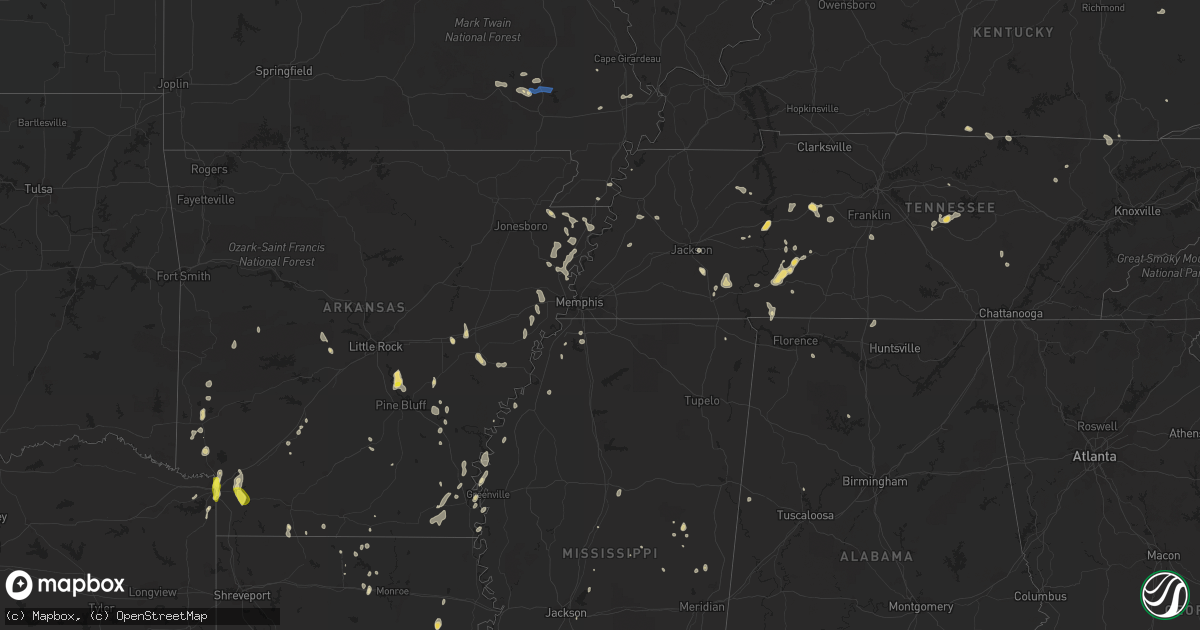
June 26 map
$229
one time, instant access
Download today. No call, no setup
Keep the $229
Bought the map and want the full workflow? Apply the entire $229 to a subscription within 7 days. None of it is wasted.
Every map, not just this one
This buys you this map. Subscription and you get every map we run, in the markets you choose from a few cities to whole states to nationwide. Plus real-time alerts the moment a storm fires.
Contact data
Name, contact info, occupancy, even credit band for addresses in the footprint. You go from where it hit to who to call.
Become the source they trust
Unlimited branding weather history reports on demand. You already have the documented answer ready for the property owner, and you are the one who showed up with it.
Property data and RoofTrace estimates
Pull up any address you have got, its value and the exact code rules for that jurisdiction, straight from One Click Code. Then RoofTrace estimates the squares, pitch, and roof value, priced the way you price.
Storm reports in Louisiana
Louisiana
| Date | Description |
|---|---|
| 06/26/20226:28 PM CDT | A local report indicates 1.00 inch wind near 4 WSW LAKE CHARLES |
| 06/26/20224:02 PM CDT | Multiple trees and power lines down on blade loop road and highway 8 in the whitehall community. Multiple trees and power lines were also down on highway 84... And also |
| 06/26/20222:43 PM CDT | Trees down across antioch church road near the cadeville community. |
| 06/26/20222:28 PM CDT | Trees down across highway 144 southwest of calhoun. |
| 06/26/20222:53 AM CDT | At 753 PM CDT, severe thunderstorms were located along a line extending from Queen City to 6 miles south of Garland, moving south at 15 mph. HAZARD...60 mph wind gusts and penny size hail. SOURCE...Radar indicated. IMPACT...Expect damage to roofs, siding, and trees. Locations impacted include... Atlanta, Queen City, Fouke, Bradley, Bivins, Canfield, Ravanna, Brightstar, Bloomburg, Domino, Pleasant Valley, Gin City, Canale, Fort Lynn and Kiblah. |
| 06/26/20221:48 AM CDT | At 648 PM CDT, a severe thunderstorm was located near Carlyss, or 7 miles southwest of Sulphur, moving southwest at 15 mph. HAZARD...60 mph wind gusts and quarter size hail. SOURCE...Radar indicated. IMPACT...Hail damage to vehicles is expected. Expect wind damage to roofs, siding, and trees. Locations impacted include... Sulphur, Vinton, Carlyss and Edgerly. This includes Interstate 10 in Louisiana between mile markers 6 and20. |
| 06/26/202212:13 AM CDT | A local report indicates 1.25 inch wind near 2 WNW CARLYSS |
| 06/25/202211:02 PM CDT | At 401 PM CDT, a severe thunderstorm was located over Jena, or 23 miles northwest of Larto, moving southwest at 15 mph. HAZARD...60 mph wind gusts. SOURCE...Radar indicated. IMPACT...Expect damage to roofs, siding, and trees. Locations impacted include... Jena, Midway, Nebo and Catahoula Lake. |
| 06/25/20229:25 PM CDT | At 225 PM CDT, a severe thunderstorm was located 8 miles west of Claiborne, moving southeast at 20 mph. HAZARD...60 mph wind gusts. SOURCE...Radar indicated. IMPACT...Expect damage to roofs, siding, and trees. Locations impacted include... Claiborne, West Monroe, Brownsville-Bawcomville, Brownsville-Bawcom, Drew, Cheniere, Calhoun, Mineral Springs, Caderville, Eureka, Folksville and Lapine. |
All States Impacted by Hail Map on June 26, 2022
Cities Impacted by Hail Map on June 26, 2022
- Sherrill, AR
- Louisa, KY
- Dyersburg, TN
- Halls, TN
- Henning, TN
- Ripley, TN
- Camden, TN
- Hestand, KY
- Celina, TN
- Newcomb, TN
- Jellico, TN
- Pine Knot, KY
- Williamsburg, KY
- Smithville, TN
- Woodbury, TN
- Liberty, TN
- Dowelltown, TN
- Dumas, AR
- Nunnelly, TN
- Dickson, TN
- Bon Aqua, TN
- Hernando, MS
- Downsville, LA
- Whitewater, MO
- Manila, AR
- Etowah, AR
- Olivehill, TN
- Savannah, TN
- Lake Village, AR
- Waverly, TN
- McEwen, TN
- Hurricane Mills, TN
- Humphrey, AR
- Widener, AR
- Hughes, AR
- Finger, TN
- Morris Chapel, TN
- Bethel Springs, TN
- Enville, TN
- Adamsville, TN
- Throckmorton, TX
- Burleson, TX
- Clarksdale, MS
- Lockesburg, AR
- Luxora, AR
- Blytheville, AR
- Winnsboro, LA
- Louisville, MS
- Strong, AR
- Mill Spring, MO
- Mineral Wells, TX
- Whitt, TX
- Graford, TX
- Weatherford, TX
- Perrin, TX
- Earle, AR
- Heth, AR
- Allons, TN
- Deer Lodge, TN
- Ridgely, TN
- Arkadelphia, AR
- Lobelville, TN
- Holladay, TN
- Sugar Tree, TN
- Kingsland, AR
- Altheimer, AR
- Stuttgart, AR
- Texarkana, TX
- Texarkana, AR
- Glen, MS
- Graham, TX
- Woodson, TX
- Carthage, MS
- Gilbertown, AL
- Jackson, TN
- Dubach, LA
- Queen City, TX
- Hollow Rock, TN
- Mansfield, TN
- Snow Lake, AR
- Pearl, MS
- Marked Tree, AR
- Lepanto, AR
- Tyronza, AR
- Benton, AR
- Paron, AR
- Gould, AR
- Osceola, AR
- Keiser, AR
- Jeanerette, LA
- Linden, TN
- Jacksboro, TX
- Kimbolton, OH
- Marvell, AR
- Poplar Grove, AR
- Waynesboro, TN
- Piedmont, MO
- Patterson, MO
- Lyles, TN
- Essex, MO
- Ethelsville, AL
- Prescott, AR
- Montrose, AR
- Henderson, TN
- Hohenwald, TN
- Roscoe, TX
- Brush Creek, TN
- Gordonsville, TN
- Flat Lick, KY
- Hayti, MO
- Caruthersville, MO
- Natchez, MS
- Roxie, MS
- Mound Bayou, MS
- Pikeville, TN
- Gurdon, AR
- Logan, AL
- Crane Hill, AL
- Dunlap, TN
- Columbia, TN
- Spring Hill, TN
- Selmer, TN
- Pinson, TN
- Marks, MS
- Clifton, TN
- Mathias, WV
- Lost City, WV
- Readyville, TN
- Tompkinsville, KY
- Gamaliel, KY
- De Queen, AR
- Dermott, AR
- Brickeys, AR
- Forrest City, AR
- Marianna, AR
- Parks, AR
- Abbeville, LA
- Darden, TN
- Lexington, TN
- Marion, LA
- Van Buren, MO
- Ellington, MO
- Rugby, TN
- Robbins, TN
- Greenville, MS
- Northport, AL
- Wellton, AZ
- Warren, AR
- Bassfield, MS
- De Valls Bluff, AR
- Biscoe, AR
- New Iberia, LA
- Broussard, LA
- Youngsville, LA
- Newcastle, TX
- Kaplan, LA
- Lake Charles, LA
- Sumrall, MS
- Albany, LA
- Hammond, LA
- Holden, LA
- Springfield, LA
- Port Allen, LA
- Saint Martinville, LA
- Bluffton, AR
- Monette, AR
- Lake City, AR
- Leighton, AL
- Tucker, AR
- England, AR
- Redfield, AR
- Jefferson, AR
- Emerson, AR
- Albany, TX
- Dell, AR
- Leachville, AR
- Westlake, LA
- Sulphur, LA
- Centerville, TN
- Clarendon, AR
- Cotton Plant, AR
- Brinkley, AR
- Horatio, AR
- De Witt, AR
- Tunica, MS
- Sikeston, MO
- Beattyville, KY
- Rogers, KY
- Campton, KY
- Steele, MO
- Bryson, TX
- Salome, AZ
- Friendship, TN
- Holly Grove, AR
- Umpire, AR
- Mena, AR
- Orange, TX
- Newellton, LA
- Rohwer, AR
- Benoit, MS
- De Kalb, MS
- Garland City, AR
- Fouke, AR
- Colorado City, TX
- Turrell, AR
- Bassett, AR
- Wilson, AR
- Joiner, AR
- Gilmore, AR
- Dyess, AR
- Jonesville, LA
- Iowa, LA
- Parsons, TN
- Branchland, WV
- East Lynn, WV
- Stephenville, TX
- Bluff Dale, TX
- Mendenhall, MS
- Magee, MS
- Kilmichael, MS
- Winona, MS
- Ashdown, AR
- Ovett, MS
- Walker, LA
- El Dorado, AR
- Junction City, AR
- Greenville, MO
- Ogden, AR
- Vidor, TX
- Mize, MS
- Mount Olive, MS
- Bernice, LA
- Farmerville, LA
- Raleigh, MS
- Erath, LA
- Eudora, AR
- Brandon, MS
- McGehee, AR
- Vinegar Bend, AL
- Picayune, MS
- Bay Saint Louis, MS
- Preston, MS
- Tolar, TX
- Lutts, TN
- Hattiesburg, MS
- Portland, AR
- Parkdale, AR
- Hamburg, AR
- Wilton, AR
- Hooks, TX
- Maud, TX
- Athens, AL
- Ardmore, AL
- Elkmont, AL
- Toney, AL
- Gilbert, LA
- Philadelphia, MS
- Waterloo, AL
- Haynesville, LA
- Delcambre, LA
- Calhoun, LA
- Williamsville, MO
- Lewisville, AR
- Fulton, AR
- Jena, LA
- Durant, MS
- Angie, LA
- Paulding, MS
- Canton, MS
- Choudrant, LA
- Delhi, LA
- Pinola, MS
- Spearsville, LA
- Wappapello, MO


