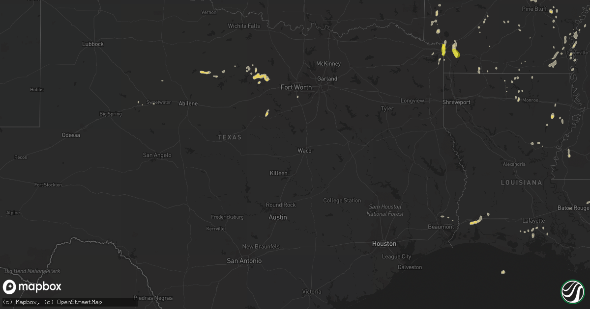
Hail Map on June 26, 2022
Get this storm
June 26 map
$229
one time, instant access
Download today. No call, no setup
Keep the $229
Bought the map and want the full workflow? Apply the entire $229 to a subscription within 7 days. None of it is wasted.
Every map, not just this one
This buys you this map. Subscription and you get every map we run, in the markets you choose from a few cities to whole states to nationwide. Plus real-time alerts the moment a storm fires.
Contact data
Name, contact info, occupancy, even credit band for addresses in the footprint. You go from where it hit to who to call.
Become the source they trust
Unlimited branding weather history reports on demand. You already have the documented answer ready for the property owner, and you are the one who showed up with it.
Property data and RoofTrace estimates
Pull up any address you have got, its value and the exact code rules for that jurisdiction, straight from One Click Code. Then RoofTrace estimates the squares, pitch, and roof value, priced the way you price.
States Impacted by Hail Map on June 26, 2022
Storm reports
West Virginia
| Date | Description |
|---|---|
| 06/26/20223:05 PM CDT | One tree reported down on power lines on iroquois trail in ona. |
| 06/26/20223:00 PM CDT | Trees down along wv 65/ohio river road near west columbia. |
| 06/26/20222:45 PM CDT | One tree reported down in ritter park. |
| 06/26/20221:20 PM CDT | Several trees and wires were blown down bringing down 3 poles in lost river. |
Virginia
| Date | Description |
|---|---|
| 06/26/20221:55 PM CDT | Several trees blew down in northwestern page county... Including along va-654 mims road and va-660 kibler hill road. |
| 06/26/20221:30 PM CDT | Several trees were blown down in shenandoah county... Including along va-698 red banks road and va-726 hepner road. |
| 06/26/202212:55 PM CDT | Tree damage was reported in western augusta county... Including along va-42 scenic highway/little calf pasture highway... And va-254 parkersburg turnpike. |
Tennessee
| Date | Description |
|---|---|
| 06/26/20225:15 PM CDT | County dept of highways reports tree down along highway 90. |
| 06/26/20223:12 AM CDT | At 812 PM EDT, a severe thunderstorm was located near Sweetwater, moving southeast at 20 mph. HAZARD...60 mph wind gusts. SOURCE...Radar indicated. IMPACT...Expect damage to roofs, siding, and trees. Locations impacted include... Sweetwater, Madisonville, Englewood, Vonore, Niota, Philadelphia, Mount Vernon, Murray Store, Fort Loudon State Park and McGee Carson Peninsula.This includes Interstate 75 in Tennessee between mile markers 55 and69. |
| 06/26/202212:28 AM CDT | At 528 PM EDT, a severe thunderstorm was located 14 miles northwest of Wartburg, moving southeast at 10 mph. HAZARD...60 mph wind gusts and quarter size hail. SOURCE...Radar indicated. IMPACT...Hail damage to vehicles is expected. Expect wind damage to roofs, siding, and trees. Locations impacted include... Sunbright, High Point, Deerlodge and Frozen Head State Park. |
| 06/25/202210:13 PM CDT | At 313 PM CDT, a severe thunderstorm was located near Waynesboro, moving southeast at 10 mph. HAZARD...60 mph wind gusts and quarter size hail. SOURCE...Radar indicated. IMPACT...Hail damage to vehicles is expected. Expect wind damage to roofs, siding, and trees. Locations impacted include... Waynesboro. |
| 06/25/202210:05 PM CDT | At 305 PM CDT, a severe thunderstorm was located 7 miles southwest of Dickson, moving southeast at 25 mph. HAZARD...60 mph wind gusts and quarter size hail. SOURCE...Radar indicated. IMPACT...Hail damage to vehicles is expected. Expect wind damage to roofs, siding, and trees. Locations impacted include... Dickson, Centerville, Lyles, Bon Aqua, Nunnelly and Pinewood. This includes Interstate 40 between mile markers 158 and 173. |
| 06/25/20229:31 PM CDT | At 231 PM CDT, a severe thunderstorm was located near Tompkinsville, moving east at 20 mph. HAZARD...60 mph wind gusts and quarter size hail. SOURCE...Radar indicated. IMPACT...Hail damage to vehicles is expected. Expect wind damage to roofs, siding, and trees. This severe thunderstorm will be near... Tompkinsville around 240 PM CDT. |
| 06/25/20227:30 PM CDT | Tree down near county road 325 and hwy 11. Time estimated by radar. |
| 06/25/20227:26 PM CDT | Downed tree blocking the road on county road 326. Time estimated by radar. |
| 06/25/20227:20 PM CDT | Few trees down near murrays chapel. Time estimated by radar. |
Alabama
| Date | Description |
|---|---|
| 06/25/20229:22 PM CDT | At 222 PM CDT, a severe thunderstorm was located 7 miles east of Walnut Grove, or 15 miles northeast of J P Coleman State Park, moving southeast at 10 mph. HAZARD...60 mph wind gusts and quarter size hail. SOURCE...Radar indicated. IMPACT...Hail damage to vehicles is expected. Expect wind damage to roofs, siding, and trees. Locations impacted include... Threet. |
| 06/25/20229:17 PM CDT | At 216 PM CDT, a severe thunderstorm was located near Walnut Grove, or 15 miles northeast of J P Coleman State Park, moving east at 5 mph. HAZARD...60 mph wind gusts and quarter size hail. SOURCE...Radar indicated. IMPACT...Hail damage to vehicles is expected. Expect wind damage to roofs, siding, and trees. Locations impacted include... Cypress Inn and Lutts. |
Arizona
| Date | Description |
|---|---|
| 06/26/20226:44 PM CDT | 3-inch tree limbs broken; power poles broken. |
| 06/26/20223:19 AM CDT | At 819 PM MST, a severe thunderstorm was located near Sentinel, or 36 miles west of Gila Bend, moving southwest at 10 mph. HAZARD...60 mph wind gusts. SOURCE...Radar indicated. IMPACT...Expect damage to roofs, siding, and trees. Locations impacted include... Sentinel and Dateland. This includes AZ Interstate 8 between mile markers 67 and 89. |
| 06/26/20222:14 AM CDT | At 712 PM MST, a severe thunderstorm was located over mainly rural areas near the Maricopa, Yuma County border moving south at 10 mph. HAZARD...60 mph wind gusts. SOURCE...Radar indicated. IMPACT...Expect damage to roofs, siding, and trees. Locations impacted include... Sundad.This includes AZ Interstate 10 between mile markers 65 and 79. |
| 06/26/20221:19 AM CDT | At 618 PM MST, a severe thunderstorm was located 12 miles east of Freeman, or 19 miles west of Casa Grande, and is nearly stationary. HAZARD...60 mph wind gusts. SOURCE...Radar indicated. IMPACT...Expect damage to roofs, siding, and trees. Locations impacted include... Stanfield and Ak-Chin Village. This includes the following highways...AZ Interstate 8 between mile markers 144 and 165.AZ Route 347 between mile markers 161 and 171. |
| 06/25/202211:55 PM CDT | At 455 PM MST, a severe thunderstorm was located over Chandler Heights, or 10 miles southeast of Gilbert, and is nearly stationary. HAZARD...60 mph wind gusts. SOURCE...Radar indicated. IMPACT...Expect damage to roofs, siding, and trees. Locations impacted include... Mesa, Chandler, Gilbert, Sun Lakes, Queen Creek, Chandler Heights, San Tan Village Mall, San Tan Valley, Seville, Bapchule, Phoenix Mesa Gateway Airport, San Tan Mountain Park, Sacaton, Santan and Higley.This includes the following highways...AZ Interstate 10 between mile markers 172 and 178.AZ Route 87 between mile markers 146 and 160.AZ Route 202 between mile markers 32 and 45. |
| 06/25/202211:53 PM CDT | At 453 PM MST, a severe thunderstorm was located over Arizona State Fairgrounds, or near Laveen, and is nearly stationary. HAZARD...60 mph wind gusts. SOURCE...Radar indicated. IMPACT...Expect damage to roofs, siding, and trees. Locations impacted include... Phoenix, Glendale, Scottsdale, Tempe, Avondale, Goodyear, Paradise Valley, Tolleson, Laveen, Cashion, Papago Park, Piestewa Peak Park, South Phoenix, Arizona State Fairgrounds and South Mountain Park.This includes the following highways...AZ Interstate 10 between mile markers 130 and 160.AZ Interstate 17 between mile markers 195 and 207.AZ Route 51 between mile markers 1 and 6. |
| 06/25/202210:59 PM CDT | At 358 PM MST, a severe thunderstorm was located over Apache Junction, and is nearly stationary. HAZARD...60 mph wind gusts and penny size hail. SOURCE...Radar indicated. IMPACT...Expect damage to roofs, siding, and trees. Locations impacted include... Mesa, Apache Junction and Gold Camp. This includes the following highways...US Highway 60 between mile markers 192 and 202.AZ Route 202 near mile marker 28. |
| 06/25/20227:23 PM CDT | 1-inch tree limbs broken; shingles blown off. |
New Mexico
| Date | Description |
|---|---|
| 06/26/20225:14 PM CDT | Multiple tree branches down... Some as large as six inches in diameter. |
New York
| Date | Description |
|---|---|
| 06/26/20226:51 PM CDT | Tree down blocking the road. |
| 06/26/20226:31 PM CDT | Tree down blocking the road at the corner of lyon brook road and wahlberg road. |
| 06/26/20226:20 PM CDT | Trees and wires down on the corner of scott street and chenango street. |
| 06/26/20226:10 PM CDT | Trees and wires down. |
| 06/26/20225:19 PM CDT | Trees and wires down on osceola rd. |
| 06/26/20224:30 PM CDT | Tree down on power line. |
| 06/26/20222:32 AM CDT | At 729 PM EDT, a severe thunderstorm was located over South Oxford, or 11 miles southwest of Norwich, moving northeast at 30 mph. HAZARD...60 mph wind gusts. SOURCE...Radar indicated. IMPACT...Expect damage to roofs, siding, and trees. Locations impacted include... Norwich, Guilford, North Norwich, Oxford, Sherburne, Preston, New Berlin, Morris, Gilbertsville and South Oxford. |
| 06/26/20221:51 AM CDT | At 651 PM EDT, a severe thunderstorm was located over Lowville, or 22 miles southeast of Fort Drum, moving northeast at 30 mph. HAZARD...60 mph wind gusts. SOURCE...Radar indicated. IMPACT...Expect damage to trees and power lines. Locations impacted include... Lowville, Whetstone Gulf State Park, New Bremen, Watson, Martinsburg, Greig, Croghan, Castorland, Turin and Belfort. |
Illinois
| Date | Description |
|---|---|
| 06/26/20226:12 AM CDT | At 1112 AM CDT, severe thunderstorms were located along a line extending from near Chaffee to near Morley to Morehouse, moving east at 40 mph. HAZARD...60 mph wind gusts. SOURCE...Radar indicated. IMPACT...Expect damage to roofs, siding, and trees. Severe thunderstorms will be near... Sikeston around 1120 AM CDT. Miner, Benton and Kelso around 1125 AM CDT.Other locations in the path of these severe thunderstorms includeBertrand, Charleston, Olive Branch and Horseshoe Lake ConservationArea.This includes the following highways... Interstate 57 in Missouri between Mile Markers 1 and 16. Interstate 55 between Mile Markers 66 and 87. |
Kansas
| Date | Description |
|---|---|
| 06/26/20227:55 AM CDT | At 1254 AM CDT, a severe thunderstorm was located 7 miles west of Howard, moving east at 35 mph. HAZARD...Quarter size hail. SOURCE...Radar indicated. IMPACT...Damage to vehicles is expected. Locations impacted include... Fredonia, Howard, Fall River, New Albany and Buxton. |
| 06/26/20227:35 AM CDT | At 1234 AM CDT, a severe thunderstorm was located near Belle Plaine, moving northeast at 15 mph. HAZARD...Quarter size hail. SOURCE...Trained weather spotters. IMPACT...Damage to vehicles is expected. Locations impacted include... Wichita, Derby, Haysville, Mulvane, Rose Hill, Belle Plaine, Mcconnell Air Force Base, South Wichita, Riverdale and Oaklawn.This includes the following highways... Interstate 135 between Mile Markers 0 and 4. Interstate 35 between Mile Markers 22 and 47. |
| 06/25/20229:25 PM CDT | At 225 AM CDT, severe thunderstorms were located along a line extending from near Arcadia to near Liberal to Frontenac, moving east at 35 mph. HAZARD...60 mph wind gusts and nickel size hail. SOURCE...Radar indicated. IMPACT...Expect damage to roofs, siding, and trees. Locations impacted include... Prairie State Park... Lamar... Golden City... Liberal... Sheldon... Nashville... Mindenmines... Bronaugh... Lamar Heights... Irwin... Burgess... Milford... Oakton... Iantha... Oskaloosa... Verdella... Kenoma... Hannon... Boston... This includes Interstate 49 between mile markers 57 and 81. |
| 06/25/20228:47 PM CDT | At 147 AM CDT, severe thunderstorms were located along a line extending from near Uniontown to near Walnut, moving east at 75 mph. HAZARD...60 mph wind gusts and quarter size hail. SOURCE...Radar indicated. IMPACT...Hail damage to vehicles is expected. Expect wind damage to roofs, siding, and trees. Locations impacted include... Erie, St. Paul, Savonburg, Elsmore and Stark. |
| 06/25/20228:45 PM CDT | At 144 AM CDT, severe thunderstorms were located along a line extending from Uniontown to near St. Paul, moving southeast at 35 mph. HAZARD...60 mph wind gusts and quarter size hail. SOURCE...Radar indicated. IMPACT...Hail damage to vehicles is expected. Expect wind damage to roofs, siding, and trees. Locations impacted include... Pittsburg... Fort Scott... Frontenac... Girard... Arma... Marmaton... Mulberry... Chicopee... Franklin... Bronson... Arcadia... Uniontown... Walnut... Redfield... Hepler... Beulah... Croweburg... Yale... Petersburg... Farlington... |
Ohio
| Date | Description |
|---|---|
| 06/25/202210:50 PM CDT | At 350 PM EDT, a severe thunderstorm was located 13 miles south of Gallipolis, moving east at 25 mph. HAZARD...60 mph wind gusts and quarter size hail. SOURCE...Radar indicated. IMPACT...Hail damage to vehicles is expected. Expect wind damage to roofs, siding, and trees. Locations impacted include... Winfield, Eleanor, Buffalo, Teays Valley, Crown City, Grimms Landing, Green Bottom, Fraziers Bottom and Ashton.This includes Interstate 64 in West Virginia between mile markers 37and 39. |
Kentucky
| Date | Description |
|---|---|
| 06/26/20222:45 PM CDT | Downed tree fell onto truck damaging the camper. This occurred on sunset avenue in tompkinsville. |
| 06/26/20221:23 PM CDT | A 3 inch diameter tree limb was blown down along oakwood drive. |
| 06/26/202212:45 PM CDT | Tree down in road on highway 52 west. |
| 06/26/202212:52 AM CDT | At 552 PM EDT, a severe thunderstorm was located over Zion Hill, or 10 miles south of Williamsburg, moving southeast at 10 mph. HAZARD...60 mph wind gusts and quarter size hail. SOURCE...Radar indicated. IMPACT...Hail damage to vehicles is expected. Expect wind damage to roofs, siding, and trees. Locations impacted include... La Follette, Jellico, Elk Valley, Indian Mountain State Park, Clairfield, Fincastle and White Oak.This includes Interstate 75 in Tennessee between mile markers 150 and161. |
| 06/25/20229:23 PM CDT | At 222 PM EDT, severe thunderstorms were located along a line extending from Lee City to Curt to near Cowcreek, moving southeast at 20 mph. HAZARD...60 mph wind gusts. SOURCE...Radar indicated. IMPACT...Expect damage to roofs, siding, and trees. Severe thunderstorms will be near... Haddix around 230 PM EDT. Lost Creek around 235 PM EDT. Watts around 240 PM EDT.Other locations in the path of these severe thunderstorms includeDalesburg, Buckhorn and Rowdy. |
| 06/25/20228:43 PM CDT | At 143 PM EDT, a severe thunderstorm was located over Grannie, or over Campton, moving east at 30 mph. HAZARD...60 mph wind gusts. SOURCE...Radar indicated. IMPACT...Expect damage to roofs, siding, and trees. This severe thunderstorm will be near... Vortex around 150 PM EDT. Lane around 155 PM EDT. Malaga around 200 PM EDT.Other locations in the path of this severe thunderstorm includePaxton and Simpson. |
Missouri
| Date | Description |
|---|---|
| 06/26/202210:55 AM CDT | Significant wind damage across a good part of the county from puxico to bell city. More trees and powerlines found down into the bell city area. |
| 06/26/202210:22 AM CDT | Power poles snapped in puxico. Several large trees broken on highway 51 at the bollinger and stoddard county line. Camper and truck flipped over but no injuries. |
| 06/26/202210:12 AM CDT | Power lines down on a house |
| 06/26/20229:30 AM CDT | 5 to 10 trees down across roads in western wayne county from piedmont to williamsville area |
| 06/26/20224:46 AM CDT | At 945 AM CDT, a severe thunderstorm was located over Williamsville, or 9 miles southwest of Greenville, moving east at 40 mph. HAZARD...60 mph wind gusts and quarter size hail. SOURCE...Radar indicated. IMPACT...Hail damage to vehicles is expected. Expect wind damage to roofs, siding, and trees. This severe thunderstorm will be near... Lake Wappapello State Park and Shook around 1005 AM CDT. |
| 06/25/202211:11 PM CDT | At 411 AM CDT, severe thunderstorms were located along a line extending from 8 miles northeast of El Dorado Springs to 7 miles northwest of Stockton, moving east at 40 mph. HAZARD...60 mph wind gusts. SOURCE...Radar indicated. IMPACT...Expect damage to roofs, siding, and trees. Locations impacted include... Pomme de Terre Lake... Stockton Lake... Pomme De Terre State Park... El Dorado Springs... Stockton... Pittsburg... Humansville... Osceola... Hermitage... Weaubleau... Wheatland... Collins... Flemington... Roscoe... Vista... Gerster... Quincy... Arnica... Nemo... Monegaw Springs... |
Louisiana
| Date | Description |
|---|---|
| 06/26/20226:28 PM CDT | A local report indicates 1.00 inch wind near 4 WSW LAKE CHARLES |
| 06/26/20224:02 PM CDT | Multiple trees and power lines down on blade loop road and highway 8 in the whitehall community. Multiple trees and power lines were also down on highway 84... And also |
| 06/26/20222:43 PM CDT | Trees down across antioch church road near the cadeville community. |
| 06/26/20222:28 PM CDT | Trees down across highway 144 southwest of calhoun. |
| 06/26/20222:53 AM CDT | At 753 PM CDT, severe thunderstorms were located along a line extending from Queen City to 6 miles south of Garland, moving south at 15 mph. HAZARD...60 mph wind gusts and penny size hail. SOURCE...Radar indicated. IMPACT...Expect damage to roofs, siding, and trees. Locations impacted include... Atlanta, Queen City, Fouke, Bradley, Bivins, Canfield, Ravanna, Brightstar, Bloomburg, Domino, Pleasant Valley, Gin City, Canale, Fort Lynn and Kiblah. |
| 06/26/20221:48 AM CDT | At 648 PM CDT, a severe thunderstorm was located near Carlyss, or 7 miles southwest of Sulphur, moving southwest at 15 mph. HAZARD...60 mph wind gusts and quarter size hail. SOURCE...Radar indicated. IMPACT...Hail damage to vehicles is expected. Expect wind damage to roofs, siding, and trees. Locations impacted include... Sulphur, Vinton, Carlyss and Edgerly. This includes Interstate 10 in Louisiana between mile markers 6 and20. |
| 06/26/202212:13 AM CDT | A local report indicates 1.25 inch wind near 2 WNW CARLYSS |
| 06/25/202211:02 PM CDT | At 401 PM CDT, a severe thunderstorm was located over Jena, or 23 miles northwest of Larto, moving southwest at 15 mph. HAZARD...60 mph wind gusts. SOURCE...Radar indicated. IMPACT...Expect damage to roofs, siding, and trees. Locations impacted include... Jena, Midway, Nebo and Catahoula Lake. |
| 06/25/20229:25 PM CDT | At 225 PM CDT, a severe thunderstorm was located 8 miles west of Claiborne, moving southeast at 20 mph. HAZARD...60 mph wind gusts. SOURCE...Radar indicated. IMPACT...Expect damage to roofs, siding, and trees. Locations impacted include... Claiborne, West Monroe, Brownsville-Bawcomville, Brownsville-Bawcom, Drew, Cheniere, Calhoun, Mineral Springs, Caderville, Eureka, Folksville and Lapine. |
Mississippi
| Date | Description |
|---|---|
| 06/25/20227:35 PM CDT | Multiple reports of possible tornado. Tree downed on car. Straight line wind damage to trees. |
| 06/25/20227:29 PM CDT | A tornado developed in central lincoln county near monticello st ne. Initially uprooting several small trees and larger branches... The tornado traveled south down roge |
| 06/25/20227:08 PM CDT | Rotating wall cloud was seen in the vicinity of the greenfield station neighborhood. Several residents and security camera footage from the area confirm a brief tornado |
Texas
| Date | Description |
|---|---|
| 06/26/20222:27 AM CDT | At 727 PM CDT, severe thunderstorms were located along a line extending from 8 miles west of Bodcaw to near Garland to near Genoa to 7 miles southeast of Wake Village, moving south at 20 mph. HAZARD...60 mph wind gusts and penny size hail. SOURCE...Radar indicated. IMPACT...Expect damage to roofs, siding, and trees. Locations impacted include... Texarkana, Stamps, Lewisville, Fouke, Garland, Genoa, Mount Pleasant, Bloomburg, Domino, McKamie, Pleasant Hill, Spirit Lake, Fort Lynn, Piney Grove and Mars Hill. |
| 06/26/20221:58 AM CDT | At 658 PM CDT, a severe thunderstorm was located 8 miles northwest of Fort Griffin, moving west at 15 mph. HAZARD...60 mph wind gusts and quarter size hail. SOURCE...Radar indicated. IMPACT...Hail damage to vehicles is expected. Expect wind damage to roofs, siding, and trees. This severe thunderstorm will be near... Stamford, Lake Stamford Marina and Paint Creek around 800 PM CDT. |
| 06/26/20221:47 AM CDT | At 646 PM CDT, severe thunderstorms were located along a line extending from near Hope to near Fulton to near Ogden to near Red Lick, moving south at 20 mph. HAZARD...60 mph wind gusts. SOURCE...Radar indicated. IMPACT...Expect damage to roofs, siding, and trees. Locations impacted include... Texarkana, Hope, Wake Village, Nash, Red Lick, Perrytown, Garland, Fulton, Ogden, Mandeville, Genoa, Leary, Mount Pleasant, McNab, Patmos, Oakhaven, Pleasant Hill, Hervey, Homan and Piney Grove. |
| 06/25/20228:38 PM CDT | A 64 mph wind gust was measured at the center municipal airport from a shower that moved over the airport. |
| 06/25/20228:28 PM CDT | Kgky asos - arlington municipal airport pk wind 09051kt. |
| 06/25/20227:55 PM CDT | Kfws spinks airport 09028g56kt at 755 pm. |
| 06/25/20227:04 PM CDT | A picture was posted to social media of quarter size hail that fell on the texas side of texarkana. |
Arkansas
| Date | Description |
|---|---|
| 06/26/20222:32 AM CDT | At 732 PM CDT, a severe thunderstorm was located near Lockesburg, or 8 miles southwest of Dierks, moving south at 10 mph. HAZARD...60 mph wind gusts and penny size hail. SOURCE...Radar indicated. IMPACT...Expect damage to roofs, siding, and trees. Locations impacted include... De Queen, Ashdown, Mineral Springs, Dierks, Lockesburg, Wilton, Tollette, Ben Lomond, Saratoga, Oak Grove, Silver Ridge, Geneva, Central, Lebanon, Arden, Provo, Browntown, Bellview and Bright Star. |
| 06/25/202211:52 PM CDT | At 452 PM CDT, a severe thunderstorm was located over Avon, moving southeast at 10 mph. HAZARD...60 mph wind gusts and penny size hail. SOURCE...Radar indicated. IMPACT...Expect damage to roofs, siding, and trees. This severe thunderstorm will be near... Hollandale and Estill around 530 PM CDT. |
| 06/25/202210:27 PM CDT | At 327 PM CDT, a severe thunderstorm was located near Hensley Island, or 19 miles north of Pine Bluff, moving southeast at 5 mph. HAZARD...60 mph wind gusts and quarter size hail. SOURCE...Radar indicated. IMPACT...Hail damage to vehicles is expected. Expect wind damage to roofs, siding, and trees. Locations impacted include... Pine Bluff... White Hall... England... Redfield... Altheimer... Warbritton... Pine Bluff Arsenal... Hensley Island... Wabbaseka... Sherrill... Tucker... Gethsemane... Pastoria... Bredlow Corner... Wright... Lock and Dam 5 Park... Tar Camp Park... Ferda... Dexter... |
| 06/25/20227:35 PM CDT | Trees and power lines were down across central and southern sevier county. |
| 06/25/20227:35 PM CDT | Trees down on redcut road and williams circle in fouke. |
| 06/25/20227:30 PM CDT | Trees down in the 1100 block of county road 26 northwest of fouke. |
| 06/25/20227:28 PM CDT | A tree fell onto a home in the 15000 block of highway 196. |
| 06/25/20227:03 PM CDT | Trees and power lines were downed across both the arkansas and texas sides of texarkana. |
Cities Impacted by Hail Map on June 26, 2022
- Sherrill, AR
- Louisa, KY
- Dyersburg, TN
- Halls, TN
- Henning, TN
- Ripley, TN
- Camden, TN
- Hestand, KY
- Celina, TN
- Newcomb, TN
- Jellico, TN
- Pine Knot, KY
- Williamsburg, KY
- Smithville, TN
- Woodbury, TN
- Liberty, TN
- Dowelltown, TN
- Dumas, AR
- Nunnelly, TN
- Dickson, TN
- Bon Aqua, TN
- Hernando, MS
- Downsville, LA
- Whitewater, MO
- Manila, AR
- Etowah, AR
- Olivehill, TN
- Savannah, TN
- Lake Village, AR
- Waverly, TN
- McEwen, TN
- Hurricane Mills, TN
- Humphrey, AR
- Widener, AR
- Hughes, AR
- Finger, TN
- Morris Chapel, TN
- Bethel Springs, TN
- Enville, TN
- Adamsville, TN
- Throckmorton, TX
- Burleson, TX
- Clarksdale, MS
- Lockesburg, AR
- Luxora, AR
- Blytheville, AR
- Winnsboro, LA
- Louisville, MS
- Strong, AR
- Mill Spring, MO
- Mineral Wells, TX
- Whitt, TX
- Graford, TX
- Weatherford, TX
- Perrin, TX
- Earle, AR
- Heth, AR
- Allons, TN
- Deer Lodge, TN
- Ridgely, TN
- Arkadelphia, AR
- Lobelville, TN
- Holladay, TN
- Sugar Tree, TN
- Kingsland, AR
- Altheimer, AR
- Stuttgart, AR
- Texarkana, TX
- Texarkana, AR
- Glen, MS
- Graham, TX
- Woodson, TX
- Carthage, MS
- Gilbertown, AL
- Jackson, TN
- Dubach, LA
- Queen City, TX
- Hollow Rock, TN
- Mansfield, TN
- Snow Lake, AR
- Pearl, MS
- Marked Tree, AR
- Lepanto, AR
- Tyronza, AR
- Benton, AR
- Paron, AR
- Gould, AR
- Osceola, AR
- Keiser, AR
- Jeanerette, LA
- Linden, TN
- Jacksboro, TX
- Kimbolton, OH
- Marvell, AR
- Poplar Grove, AR
- Waynesboro, TN
- Piedmont, MO
- Patterson, MO
- Lyles, TN
- Essex, MO
- Ethelsville, AL
- Prescott, AR
- Montrose, AR
- Henderson, TN
- Hohenwald, TN
- Roscoe, TX
- Brush Creek, TN
- Gordonsville, TN
- Flat Lick, KY
- Hayti, MO
- Caruthersville, MO
- Natchez, MS
- Roxie, MS
- Mound Bayou, MS
- Pikeville, TN
- Gurdon, AR
- Logan, AL
- Crane Hill, AL
- Dunlap, TN
- Columbia, TN
- Spring Hill, TN
- Selmer, TN
- Pinson, TN
- Marks, MS
- Clifton, TN
- Mathias, WV
- Lost City, WV
- Readyville, TN
- Tompkinsville, KY
- Gamaliel, KY
- De Queen, AR
- Dermott, AR
- Brickeys, AR
- Forrest City, AR
- Marianna, AR
- Parks, AR
- Abbeville, LA
- Darden, TN
- Lexington, TN
- Marion, LA
- Van Buren, MO
- Ellington, MO
- Rugby, TN
- Robbins, TN
- Greenville, MS
- Northport, AL
- Wellton, AZ
- Warren, AR
- Bassfield, MS
- De Valls Bluff, AR
- Biscoe, AR
- New Iberia, LA
- Broussard, LA
- Youngsville, LA
- Newcastle, TX
- Kaplan, LA
- Lake Charles, LA
- Sumrall, MS
- Albany, LA
- Hammond, LA
- Holden, LA
- Springfield, LA
- Port Allen, LA
- Saint Martinville, LA
- Bluffton, AR
- Monette, AR
- Lake City, AR
- Leighton, AL
- Tucker, AR
- England, AR
- Redfield, AR
- Jefferson, AR
- Emerson, AR
- Albany, TX
- Dell, AR
- Leachville, AR
- Westlake, LA
- Sulphur, LA
- Centerville, TN
- Clarendon, AR
- Cotton Plant, AR
- Brinkley, AR
- Horatio, AR
- De Witt, AR
- Tunica, MS
- Sikeston, MO
- Beattyville, KY
- Rogers, KY
- Campton, KY
- Steele, MO
- Bryson, TX
- Salome, AZ
- Friendship, TN
- Holly Grove, AR
- Umpire, AR
- Mena, AR
- Orange, TX
- Newellton, LA
- Rohwer, AR
- Benoit, MS
- De Kalb, MS
- Garland City, AR
- Fouke, AR
- Colorado City, TX
- Turrell, AR
- Bassett, AR
- Wilson, AR
- Joiner, AR
- Gilmore, AR
- Dyess, AR
- Jonesville, LA
- Iowa, LA
- Parsons, TN
- Branchland, WV
- East Lynn, WV
- Stephenville, TX
- Bluff Dale, TX
- Mendenhall, MS
- Magee, MS
- Kilmichael, MS
- Winona, MS
- Ashdown, AR
- Ovett, MS
- Walker, LA
- El Dorado, AR
- Junction City, AR
- Greenville, MO
- Ogden, AR
- Vidor, TX
- Mize, MS
- Mount Olive, MS
- Bernice, LA
- Farmerville, LA
- Raleigh, MS
- Erath, LA
- Eudora, AR
- Brandon, MS
- McGehee, AR
- Vinegar Bend, AL
- Picayune, MS
- Bay Saint Louis, MS
- Preston, MS
- Tolar, TX
- Lutts, TN
- Hattiesburg, MS
- Portland, AR
- Parkdale, AR
- Hamburg, AR
- Wilton, AR
- Hooks, TX
- Maud, TX
- Athens, AL
- Ardmore, AL
- Elkmont, AL
- Toney, AL
- Gilbert, LA
- Philadelphia, MS
- Waterloo, AL
- Haynesville, LA
- Delcambre, LA
- Calhoun, LA
- Williamsville, MO
- Lewisville, AR
- Fulton, AR
- Jena, LA
- Durant, MS
- Angie, LA
- Paulding, MS
- Canton, MS
- Choudrant, LA
- Delhi, LA
- Pinola, MS
- Spearsville, LA
- Wappapello, MO