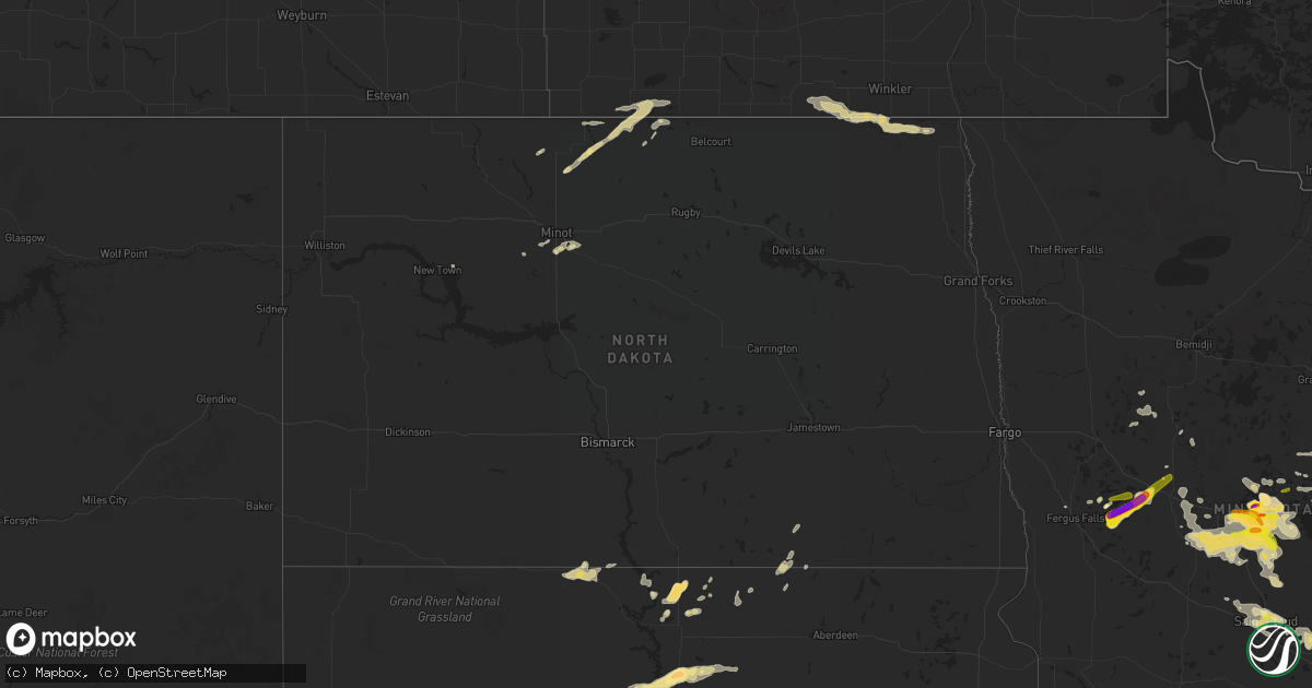
Hail Map in North Dakota on June 23, 2022
Get this storm
June 23 map
$229
one time, instant access
Download today. No call, no setup
Keep the $229
Bought the map and want the full workflow? Apply the entire $229 to a subscription within 7 days. None of it is wasted.
Every map, not just this one
This buys you this map. Subscription and you get every map we run, in the markets you choose from a few cities to whole states to nationwide. Plus real-time alerts the moment a storm fires.
Contact data
Name, contact info, occupancy, even credit band for addresses in the footprint. You go from where it hit to who to call.
Become the source they trust
Unlimited branding weather history reports on demand. You already have the documented answer ready for the property owner, and you are the one who showed up with it.
Property data and RoofTrace estimates
Pull up any address you have got, its value and the exact code rules for that jurisdiction, straight from One Click Code. Then RoofTrace estimates the squares, pitch, and roof value, priced the way you price.
Storm reports in North Dakota
North Dakota
| Date | Description |
|---|---|
| 06/23/20225:45 AM CDT | At 1045 PM CDT, a severe thunderstorm was located near Maida, or 17 miles northeast of Langdon, moving east at 20 mph. HAZARD...60 mph wind gusts and quarter size hail. SOURCE...Radar indicated. IMPACT...Hail damage to vehicles is expected. Expect wind damage to roofs, siding, and trees. This severe thunderstorm will be near... Vang around 1100 PM CDT.Other locations in the path of this severe thunderstorm includeWalhalla and Leroy. |
| 06/22/20229:41 PM CDT | Facebook photo of hail estimated to be 1 inch in diameter. The hail lasted for about a minute according to report. |
| 06/22/20229:18 PM CDT | Mesonet station dw7576 newburg. |
| 06/22/20229:17 PM CDT | Twitter photo of dime to quarter size hail. Time estimated from radar. |
All States Impacted by Hail Map on June 23, 2022
Cities Impacted by Hail Map on June 23, 2022
- Minot, ND
- Kettle River, MN
- Barnum, MN
- Sedona, AZ
- Clarissa, MN
- Browerville, MN
- New Town, ND
- Parshall, ND
- Oak Hill, FL
- Clarkdale, AZ
- Abbeville, LA
- Brainerd, MN
- Cotton, MN
- Makinen, MN
- Shell Knob, MO
- Lampe, MO
- Green Forest, AR
- Berryville, AR
- Sebeka, MN
- Gaylord, KS
- Aitkin, MN
- Bottineau, ND
- Malta, MT
- Ogilvie, MN
- Braham, MN
- Mora, MN
- Fergus Falls, MN
- Maricopa, AZ
- Norwich, ND
- Velva, ND
- Sawyer, ND
- Coushatta, LA
- Osborne, KS
- Duluth, MN
- Des Lacs, ND
- Altoona, FL
- Delphos, KS
- Westhope, ND
- Lansford, ND
- Maxbass, ND
- Souris, ND
- Newburg, ND
- Glasco, KS
- McLaughlin, SD
- Detroit Lakes, MN
- Park Rapids, MN
- Menahga, MN
- Neche, ND
- Maida, ND
- Walhalla, ND
- Langdon, ND
- Cavalier, ND
- Pfeifer, KS
- Houma, LA
- Gray, LA
- Mims, FL
- Titusville, FL
- Mohall, ND
- Riley, KS
- Fort Riley, KS
- Junction City, KS
- Manhattan, KS
- Milford, KS
- Dupree, SD
- Provencal, LA
- Flatwoods, LA
- Brook Park, MN
- Forbes, ND
- Becker, MN
- Saginaw, MN
- Hanksville, UT
- Port Orange, FL
- Mcgregor, MN
- Cottonwood, AZ
- Edgewater, FL
- Eureka, SD
- Isle, MN
- Cawker City, KS
- Downs, KS
- Glen Elder, KS
- Laveen, AZ
- Thomasville, AL
- Wakefield, KS
- Hunter, KS
- Tipton, KS
- Beloit, KS
- San Augustine, TX
- Bronson, TX
- Dunseith, ND
- Uniontown, AL
- Newbern, AL
- Carson, IA
- Bertha, MN
- Ocala, FL
- Seligman, MO
- Daytona Beach, FL
- Waynesboro, MS
- Jasper, AR
- Stanchfield, MN
- Sauk Rapids, MN
- Sartell, MN
- Finland, MN
- Ponsford, MN
- Osage, MN
- Cromwell, MN
- Sawyer, MN
- Wright, MN
- Floodwood, MN
- Jacobson, MN
- Palisade, MN
- Cloquet, MN
- Tamarack, MN
- Eagle Butte, SD
- Haines City, FL
- Motley, MN
- Staples, MN
- Dulac, LA
- Ashley, ND
- Long Lake, SD
- Leola, SD
- Milaca, MN
- Nisswa, MN
- Pequot Lakes, MN
- Albany, MN
- Tescott, KS
- Beverly, KS
- Wadena, MN
- Verndale, MN
- Singer, LA
- Deridder, LA
- Glenham, SD
- Mound City, SD
- Herreid, SD
- Big Lake, MN
- Zimmerman, MN
- Saint Cloud, MN
- Clear Lake, MN
- Elk River, MN
- Walker, SD
- Selfridge, ND
- Phoenix, AZ
- Moose Lake, MN
- Allendale, SC
- Pollock, SD
- Winnsboro, SC
- Courtland, KS
- Underwood, MN
- Battle Lake, MN
- Edgeley, ND
- New York Mills, MN
- Deer Creek, MN
- Vining, MN
- Ottertail, MN
- Henning, MN
- Clitherall, MN
- Luray, KS
- Waldo, KS
- Blackville, SC
- Barnwell, SC
- Pierz, MN
- Cushing, MN
- Randall, MN
- Baxter, MN
- Little Falls, MN
- Hillman, MN
- Long Prairie, MN
- Pillager, MN
- Fort Ripley, MN
- Grand View, ID
- Dorrance, KS
- Bunker Hill, KS
- Russell, KS
- Natoma, KS
- Paradise, KS
- Sweet Water, AL
- Lucas, KS
- Gorham, KS
- Sylvan Grove, KS
- Esbon, KS
- Mankato, KS
- Hoven, SD
- Gettysburg, SD
- Schriever, LA
- Java, SD
- Teasdale, UT
- Crosby, MN
- Saint Joseph, MN
- Waite Park, MN
- Victoria, KS
- Brookville, KS
- Lincoln, KS
- Simpson, KS
- Clay Center, KS
- Miltonvale, KS
- Gilmer, TX
- Longford, KS
- Winslow, AZ
- Blackstock, SC
- Titus, AL
- Wetumpka, AL
- Nodaway, IA
- New Iberia, LA
- Jewell, KS
- Casa Grande, AZ
- Munds Park, AZ
- Merrifield, MN
- Avon, MN
- Grand Marais, MN
- Glasgow, MT
- Saint Marie, MT
- Tolstoy, SD
- Rice, MN
- Royalton, MN
- Onaka, SD
- Grasston, MN
- De Berry, TX
- Minneapolis, KS
- Kulm, ND
- Olar, SC
- Williston, SC
- Theriot, LA
- Clearwater, MN
- Saint Stephen, MN
- Foley, MN
- Alton, KS
- Leupp, AZ
- Fort Peck, MT
- Bluffton, MN
- Aldrich, MN
- Garrison, MN
- Swanville, MN
- Montegut, LA
- Alpena, AR
- Omaha, AR
- Bremen, GA
- Wakpala, SD
- Deerwood, MN
- Lena, LA
- Leesville, LA
- Ocklawaha, FL
- Salt Lake City, UT
- Sandy, UT
- Wilson, KS
- Ellsworth, KS
- Compton, AR
- Ironton, MN
- Sturgeon Lake, MN
- Carlton, MN
- Two Harbors, MN
- Richville, MN


