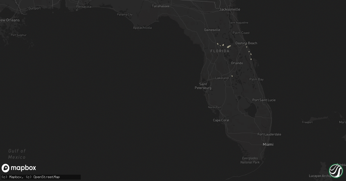
Hail Map in Florida on June 23, 2022
Get this storm
June 23 map
$229
one time, instant access
Download today. No call, no setup
Keep the $229
Bought the map and want the full workflow? Apply the entire $229 to a subscription within 7 days. None of it is wasted.
Every map, not just this one
This buys you this map. Subscription and you get every map we run, in the markets you choose from a few cities to whole states to nationwide. Plus real-time alerts the moment a storm fires.
Contact data
Name, contact info, occupancy, even credit band for addresses in the footprint. You go from where it hit to who to call.
Become the source they trust
Unlimited branding weather history reports on demand. You already have the documented answer ready for the property owner, and you are the one who showed up with it.
Property data and RoofTrace estimates
Pull up any address you have got, its value and the exact code rules for that jurisdiction, straight from One Click Code. Then RoofTrace estimates the squares, pitch, and roof value, priced the way you price.
Storm reports in Florida
Florida
| Date | Description |
|---|---|
| 06/23/20223:45 PM CDT | Corrects previous tstm wnd dmg report from 3 nw silver springs shores. Multiple trees and powerlines down along se 55th pl. Trees and powerlines were reported to be twi |
| 06/23/20223:45 PM CDT | Multiple trees and powerlines down along se 55th pl. Trees and powerlines were reported to be twisted together. Possible tornado damage. Further survey needed to determ |
| 06/23/20223:45 PM CDT | Multiple trees downed or snapped... Power lines downed and people without power near midway rd... Bahia rd and spring rd. Large trees of about 8 to 10 ft in circumferen |
| 06/23/20223:18 PM CDT | Multiple trees and powerlines down along ne jacksonville rd extending from 49th st to 90th st. Time estimated by radar. |
| 06/23/20222:13 AM CDT | At 712 PM EDT, a severe thunderstorm was located near Oak Hill, moving south at 15 mph. HAZARD...60 mph wind gusts and penny size hail. SOURCE...Radar indicated. IMPACT...Expect damage to roofs, siding, and trees. Locations impacted include... Titusville, Oak Hill, Haulover Canal, Mims and Scottsmoor. |
| 06/23/202212:13 AM CDT | At 512 PM EDT, a severe thunderstorm was located near Pittman, or 9 miles south of Juniper Springs, moving southeast at 10 mph. HAZARD...60 mph wind gusts and quarter size hail. SOURCE...Radar indicated. IMPACT...Hail damage to vehicles is expected. Expect wind damage to roofs, siding, and trees. Locations impacted include... Eustis, Pittman, Umatilla, Lake Yale and Lake Dorr. |
| 06/22/202211:58 PM CDT | At 458 PM EDT, a severe thunderstorm was located near Pittman, or 7 miles southeast of Juniper Springs, moving south at 15 mph. HAZARD...60 mph wind gusts and nickel size hail. SOURCE...Radar indicated. IMPACT...Expect damage to roofs, siding, and trees. This severe thunderstorm will remain over mainly rural areas of southeastern Marion County. |
| 06/22/202211:51 PM CDT | At 451 PM EDT, a severe thunderstorm was located near Silver Springs Shores, or near Lynne, moving southeast at 20 mph. HAZARD...60 mph wind gusts and penny size hail. SOURCE...Radar indicated. IMPACT...Expect damage to roofs, siding, and trees. Locations impacted include... Ocklawaha, Moss Bluff, Lake Weir and Silver Springs Shores. |
All States Impacted by Hail Map on June 23, 2022
Cities Impacted by Hail Map on June 23, 2022
- Minot, ND
- Kettle River, MN
- Barnum, MN
- Sedona, AZ
- Clarissa, MN
- Browerville, MN
- New Town, ND
- Parshall, ND
- Oak Hill, FL
- Clarkdale, AZ
- Abbeville, LA
- Brainerd, MN
- Cotton, MN
- Makinen, MN
- Shell Knob, MO
- Lampe, MO
- Green Forest, AR
- Berryville, AR
- Sebeka, MN
- Gaylord, KS
- Aitkin, MN
- Bottineau, ND
- Malta, MT
- Ogilvie, MN
- Braham, MN
- Mora, MN
- Fergus Falls, MN
- Maricopa, AZ
- Norwich, ND
- Velva, ND
- Sawyer, ND
- Coushatta, LA
- Osborne, KS
- Duluth, MN
- Des Lacs, ND
- Altoona, FL
- Delphos, KS
- Westhope, ND
- Lansford, ND
- Maxbass, ND
- Souris, ND
- Newburg, ND
- Glasco, KS
- McLaughlin, SD
- Detroit Lakes, MN
- Park Rapids, MN
- Menahga, MN
- Neche, ND
- Maida, ND
- Walhalla, ND
- Langdon, ND
- Cavalier, ND
- Pfeifer, KS
- Houma, LA
- Gray, LA
- Mims, FL
- Titusville, FL
- Mohall, ND
- Riley, KS
- Fort Riley, KS
- Junction City, KS
- Manhattan, KS
- Milford, KS
- Dupree, SD
- Provencal, LA
- Flatwoods, LA
- Brook Park, MN
- Forbes, ND
- Becker, MN
- Saginaw, MN
- Hanksville, UT
- Port Orange, FL
- Mcgregor, MN
- Cottonwood, AZ
- Edgewater, FL
- Eureka, SD
- Isle, MN
- Cawker City, KS
- Downs, KS
- Glen Elder, KS
- Laveen, AZ
- Thomasville, AL
- Wakefield, KS
- Hunter, KS
- Tipton, KS
- Beloit, KS
- San Augustine, TX
- Bronson, TX
- Dunseith, ND
- Uniontown, AL
- Newbern, AL
- Carson, IA
- Bertha, MN
- Ocala, FL
- Seligman, MO
- Daytona Beach, FL
- Waynesboro, MS
- Jasper, AR
- Stanchfield, MN
- Sauk Rapids, MN
- Sartell, MN
- Finland, MN
- Ponsford, MN
- Osage, MN
- Cromwell, MN
- Sawyer, MN
- Wright, MN
- Floodwood, MN
- Jacobson, MN
- Palisade, MN
- Cloquet, MN
- Tamarack, MN
- Eagle Butte, SD
- Haines City, FL
- Motley, MN
- Staples, MN
- Dulac, LA
- Ashley, ND
- Long Lake, SD
- Leola, SD
- Milaca, MN
- Nisswa, MN
- Pequot Lakes, MN
- Albany, MN
- Tescott, KS
- Beverly, KS
- Wadena, MN
- Verndale, MN
- Singer, LA
- Deridder, LA
- Glenham, SD
- Mound City, SD
- Herreid, SD
- Big Lake, MN
- Zimmerman, MN
- Saint Cloud, MN
- Clear Lake, MN
- Elk River, MN
- Walker, SD
- Selfridge, ND
- Phoenix, AZ
- Moose Lake, MN
- Allendale, SC
- Pollock, SD
- Winnsboro, SC
- Courtland, KS
- Underwood, MN
- Battle Lake, MN
- Edgeley, ND
- New York Mills, MN
- Deer Creek, MN
- Vining, MN
- Ottertail, MN
- Henning, MN
- Clitherall, MN
- Luray, KS
- Waldo, KS
- Blackville, SC
- Barnwell, SC
- Pierz, MN
- Cushing, MN
- Randall, MN
- Baxter, MN
- Little Falls, MN
- Hillman, MN
- Long Prairie, MN
- Pillager, MN
- Fort Ripley, MN
- Grand View, ID
- Dorrance, KS
- Bunker Hill, KS
- Russell, KS
- Natoma, KS
- Paradise, KS
- Sweet Water, AL
- Lucas, KS
- Gorham, KS
- Sylvan Grove, KS
- Esbon, KS
- Mankato, KS
- Hoven, SD
- Gettysburg, SD
- Schriever, LA
- Java, SD
- Teasdale, UT
- Crosby, MN
- Saint Joseph, MN
- Waite Park, MN
- Victoria, KS
- Brookville, KS
- Lincoln, KS
- Simpson, KS
- Clay Center, KS
- Miltonvale, KS
- Gilmer, TX
- Longford, KS
- Winslow, AZ
- Blackstock, SC
- Titus, AL
- Wetumpka, AL
- Nodaway, IA
- New Iberia, LA
- Jewell, KS
- Casa Grande, AZ
- Munds Park, AZ
- Merrifield, MN
- Avon, MN
- Grand Marais, MN
- Glasgow, MT
- Saint Marie, MT
- Tolstoy, SD
- Rice, MN
- Royalton, MN
- Onaka, SD
- Grasston, MN
- De Berry, TX
- Minneapolis, KS
- Kulm, ND
- Olar, SC
- Williston, SC
- Theriot, LA
- Clearwater, MN
- Saint Stephen, MN
- Foley, MN
- Alton, KS
- Leupp, AZ
- Fort Peck, MT
- Bluffton, MN
- Aldrich, MN
- Garrison, MN
- Swanville, MN
- Montegut, LA
- Alpena, AR
- Omaha, AR
- Bremen, GA
- Wakpala, SD
- Deerwood, MN
- Lena, LA
- Leesville, LA
- Ocklawaha, FL
- Salt Lake City, UT
- Sandy, UT
- Wilson, KS
- Ellsworth, KS
- Compton, AR
- Ironton, MN
- Sturgeon Lake, MN
- Carlton, MN
- Two Harbors, MN
- Richville, MN


