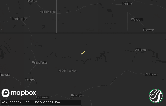
Hail Map in Montana on June 23, 2011
The weather event in Montana on June 23, 2011 includes Hail map. 22 states and 530 cities were impacted and suffered possible damage. The total estimated number of properties impacted is 0.

Hail
0
Estimated number of impacted properties by a 1.00" hail or larger0
Estimated number of impacted properties by a 1.75" hail or larger0
Estimated number of impacted properties by a 2.50" hail or largerStorm reports in Montana
Montana
| Date | Description |
|---|---|
| 06/23/20116:04 PM CDT | Yellow mule raws station elevation 9200 feet |
| 06/23/20115:00 PM CDT | A metal roof was blown off a trailer or shed in the northern portion of great falls. The roof made contact with a power line and witnesses reported that it triggered so |
| 06/23/20114:55 PM CDT | Winds estimated at 60-70 mph at onset of storm with breif heavy rain and pea sized hail |
| 06/23/20114:40 PM CDT | Golf ball sized hail was reported along the us89 near fort shaw |
| 06/23/20114:05 PM CDT | 50-60 mph winds reported with a thunderstorm...along with pea sized hail and 0.30 inches of brief heavy rainfall. |
| 06/23/20112:50 PM CDT | Hail reported at big sky lake. |
| 06/23/20112:50 PM CDT | Public report from salmon lake area |
| 06/23/20112:45 PM CDT | Hail reported at big sky lake. |
| 06/23/20112:00 PM CDT | Spotter reported some shingle damage and dents in copper roofing. |
| 06/22/201111:40 PM CDT | Winds estimated at 60 mph with a 12 ft fence blown down. |
| 06/22/201110:25 PM CDT | Winds sustained 50-60 mph. |
| 06/22/20119:55 PM CDT | 0.50 inches of rain |
| 06/22/20119:35 PM CDT | A local report indicates 65 MPH wind near 7 N SLEEPING BUFFALO |
| 06/22/20119:01 PM CDT | A local report indicates 1.00 inch wind near 9 SSW CHAPMAN |
| 06/22/20117:05 PM CDT | 59 mph wind gust observed at the havre airport asos. |
All States Impacted by Hail Map on June 23, 2011
Cities Impacted by Hail Map on June 23, 2011
- Bonner, MT
- Seeley Lake, MT
- Snowville, UT
- Malad City, ID
- Elkton, FL
- Saint Augustine, FL
- Gate, OK
- Alachua, FL
- Eastover, SC
- Columbia, NJ
- East Stroudsburg, PA
- Olive Hill, KY
- Grayson, KY
- Greenwich, CT
- Stamford, CT
- Arnett, OK
- Sharon, OK
- Vici, OK
- Mutual, OK
- May, OK
- Buffalo, OK
- Woodward, OK
- Laverne, OK
- Seiling, OK
- Fort Supply, OK
- Metter, GA
- Cobbtown, GA
- Lyons, GA
- Lehigh Acres, FL
- Sumter, SC
- Bishopville, SC
- Folkston, GA
- Dumont, NJ
- Cresskill, NJ
- Bergenfield, NJ
- Tenafly, NJ
- Demarest, NJ
- Alpine, NJ
- Yonkers, NY
- Fairfield, MT
- Power, MT
- Sun River, MT
- Cascade, MT
- Fort Shaw, MT
- Vaughn, MT
- Lewistown, MT
- Fargo, OK
- Fort Meade, FL
- Jacksonville, FL
- White Oak, GA
- Woodbine, GA
- Dutton, MT
- Pembroke, GA
- Statesboro, GA
- Brooklet, GA
- Conway, SC
- Oak Ridge, TN
- Clinton, TN
- Oliver Springs, TN
- Hardeeville, SC
- Arcadia, KS
- Liberal, MO
- Springfield, MO
- Bosler, WY
- Valdosta, GA
- Hahira, GA
- Lamar, MO
- Sheldon, MO
- Gainesville, FL
- Micanopy, FL
- Belt, MT
- Edna, KS
- Mound Valley, KS
- Oswego, KS
- Altamont, KS
- Bartlett, KS
- Glenwood, GA
- Stantonsburg, NC
- Walstonburg, NC
- Knoxville, TN
- Charleston, SC
- Howard, KS
- Piedmont, KS
- Orlando, FL
- Geraldine, MT
- Macclenny, FL
- Glen Saint Mary, FL
- Dayton, WY
- Bondurant, WY
- Kalispell, MT
- Independence, KS
- Melrose, FL
- Florahome, FL
- Ridgeland, SC
- Richlands, NC
- Jacksonville, NC
- Climax Springs, MO
- Cross Timbers, MO
- Macks Creek, MO
- Oneida, TN
- Walnut Grove, MO
- Aldrich, MO
- Eldridge, MO
- Lebanon, MO
- Bridger, MT
- Colcord, OK
- Gentry, AR
- Siloam Springs, AR
- Johnston, SC
- Ward, SC
- Tunas, MO
- Lemoyne, NE
- Mount Vernon, GA
- Uvalda, GA
- Elliott, SC
- Groveland, FL
- Seymour, MO
- Farmville, NC
- Savannah, GA
- Allardt, TN
- Jamestown, TN
- Loris, SC
- Montpelier, ID
- Galivants Ferry, SC
- Lakeland, FL
- Welch, OK
- Benson, NC
- Four Oaks, NC
- Maxton, NC
- Moncks Corner, SC
- Summerville, SC
- Mount Vernon, MO
- Miller, MO
- Stotts City, MO
- Wilder, TN
- Dalzell, SC
- Rembert, SC
- Seabrook, SC
- Yemassee, SC
- Eskdale, WV
- Orgas, WV
- Fayetteville, WV
- Gallagher, WV
- Robson, WV
- Kimberly, WV
- Montgomery, WV
- Powellton, WV
- Kincaid, WV
- Wagener, SC
- Whitehall, MT
- Highwood, MT
- Bronaugh, MO
- Tornado, WV
- Hurricane, WV
- Saint Albans, WV
- Montvale, NJ
- West Nyack, NY
- Pearl River, NY
- Westwood, NJ
- Blauvelt, NY
- Saddle River, NJ
- Spring Valley, NY
- Nyack, NY
- Monsey, NY
- Nanuet, NY
- Park Ridge, NJ
- Orangeburg, NY
- Valley Cottage, NY
- Lockwood, MO
- Golden City, MO
- La Russell, MO
- Everton, MO
- Dadeville, MO
- Greenfield, MO
- Bluejacket, OK
- Miami, OK
- Talala, OK
- Oologah, OK
- Claremore, OK
- Chelsea, OK
- Hernando, FL
- Astor, FL
- Sheridan, WY
- Sterling, CO
- Phillipsburg, MO
- Myrtle Beach, SC
- Waycross, GA
- Alamo, GA
- Lumber City, GA
- Jasper, MO
- Sarcoxie, MO
- Bancroft, ID
- Jay, OK
- Millwood, GA
- Manor, GA
- Manhattan, MT
- Saint George, GA
- Thomasville, GA
- Rocky Point, NC
- Albany, GA
- Verona, MO
- McArthur, OH
- Starke, FL
- Lawtey, FL
- Saint Johns, FL
- Lancing, TN
- Deer Lodge, TN
- Wartburg, TN
- Clarkrange, TN
- Sunbright, TN
- Wayne, WV
- Genoa, WV
- Prichard, WV
- Louisa, KY
- Fort Gay, WV
- Ocala, FL
- Augusta, MT
- Register, GA
- West Liberty, KY
- Elkfork, KY
- Wauchula, FL
- Vinita, OK
- Sheldon, SC
- Naples, FL
- Washington, NC
- Green Cove Springs, FL
- Williamston, NC
- Robersonville, NC
- Georgetown, SC
- Hemingway, SC
- Tarawa Terrace, NC
- New Bern, NC
- Green Pond, SC
- Walterboro, SC
- Rincon, GA
- Merritt, NC
- Bayboro, NC
- Fredonia, KS
- Yates Center, KS
- Toronto, KS
- Eatontown, NJ
- Grovespring, MO
- Helmville, MT
- Winter Haven, FL
- Bartow, FL
- Waverly, GA
- Drummond, MT
- Fort Scott, KS
- Powell, TN
- Grass Range, MT
- Roach, MO
- Camdenton, MO
- Boston, GA
- Winter Park, FL
- Maitland, FL
- Monterey, TN
- Cookeville, TN
- Spavinaw, OK
- Eucha, OK
- Milton, WV
- Barboursville, WV
- Salt Rock, WV
- Delaware, OK
- Brunswick, GA
- Hortense, GA
- Huger, SC
- Pantego, NC
- Dillon, MT
- Morriston, FL
- Stoutland, MO
- Gallipolis, OH
- Willow Wood, OH
- Scottown, OH
- Crown City, OH
- Molt, MT
- Broadview, MT
- Jekyll Island, GA
- Newton Grove, NC
- Clinton, NC
- Yulee, FL
- Hilliard, FL
- Kingsland, GA
- Columbia, SC
- Hopkins, SC
- Big Horn, WY
- La Follette, TN
- Hinsdale, MT
- Conrad, MT
- Brady, MT
- Alva, FL
- Punta Gorda, FL
- Estero, FL
- Fort Myers, FL
- Immokalee, FL
- Bern, ID
- Elk City, KS
- Riceboro, GA
- Townsend, GA
- Pollocksville, NC
- Trenton, NC
- Arthur, NE
- Ray City, GA
- Lakeland, GA
- Newton, NJ
- Bartonsville, PA
- Stroudsburg, PA
- Blairstown, NJ
- Lovell, WY
- Shoshoni, WY
- Sylvester, GA
- Wilmington, NC
- Ramsey, NJ
- Tarrytown, NY
- Allendale, NJ
- Scranton, NC
- Fordland, MO
- Richmond Hill, GA
- Apopka, FL
- Sorrento, FL
- Windyville, MO
- Long Lane, MO
- Simms, MT
- Banner, WY
- Windermere, FL
- Winter Garden, FL
- Vidalia, GA
- Bath, NC
- Pinetown, NC
- Belhaven, NC
- Rogersville, MO
- Ravenel, SC
- Riegelwood, NC
- South Charleston, WV
- Arcadia, FL
- Longwood, FL
- Big Timber, MT
- Longs, SC
- Fairland, OK
- West Fork, AR
- Prairie Grove, AR
- Lumber Bridge, NC
- Parkton, NC
- Inverness, FL
- Tabor City, NC
- Pierce City, MO
- Longton, KS
- Hobucken, NC
- Bunnell, FL
- Geyser, MT
- Keystone Heights, FL
- Beaufort, SC
- Coosawhatchie, SC
- Coffeyville, KS
- Caney, KS
- Tallahassee, FL
- Conway, MO
- Gainesboro, TN
- Carter, MT
- Havana, KS
- Murrells Inlet, SC
- Cherryvale, KS
- Bethel, NC
- Edgefield, SC
- Ochopee, FL
- Lava Hot Springs, ID
- Kodak, TN
- Nickerson, KS
- Hutchinson, KS
- Salley, SC
- Bushkill, PA
- Tannersville, PA
- Rowland, NC
- Nashville, GA
- Moody Afb, GA
- Greenup, KY
- Elm City, NC
- Bluffton, SC
- Mooreland, OK
- Coolville, OH
- Grantsboro, NC
- Argillite, KY
- Watts, OK
- Vandemere, NC
- Bronx, NY
- Sloatsburg, NY
- Sterling, NY
- Martville, NY
- Claxton, GA
- Martha, KY
- Malta, MT
- Midway, GA
- Grove, OK
- North Augusta, SC
- Homerville, GA
- Fargo, GA
- Strafford, MO
- Willard, MO
- Havre, MT
- Winifred, MT
- Kila, MT
- Albany, OH
- Lewellen, NE
- Kincaid, KS
- Godwin, NC
- Maple Hill, NC
- Wallace, NC
- Maysville, NC
- Armonk, NY
- Valhalla, NY
- Thornwood, NY
- Pleasantville, NY
- Hawthorne, NY
- Hilger, MT
- Greenville, NC
- Three Forks, MT
- Whitewater, MT
- Callahan, FL
- Big Sandy, MT
- Afton, OK
- Bell, FL
- Branford, FL
- Springfield, GA
- Redfield, KS
- Moundville, MO
- Deerfield, MO
- Huntington, NY
- Cold Spring Harbor, NY
- Hampstead, NC
- Reddick, FL
- Bayville, NY
- Locust Valley, NY
- Dunnellon, FL
- Laurinburg, NC
- Red Springs, NC
- Wagram, NC
- Eustis, FL
- Dunlow, WV
- Cheyenne, WY
- Currie, NC
- Kelly, NC
- Fleming, CO
- Summers, AR
- Stumpy Point, NC
- Buffalo, MO
- Louisburg, MO
- Virgil, KS
- Kitty Hawk, NC
- Turner, MT
- Falcon, MO
- Aynor, SC
- Labelle, FL
- Jamesville, NC
- Ramona, OK
- Shannon, NC
- Patriot, OH
- Oak Hill, OH
- Proctorville, OH
- Busby, MT
- Lamar, SC
- Pinedale, WY
- Monett, MO
- Vass, NC
- Hartville, MO
- High Springs, FL
- Pikeville, NC
- Fremont, NC
- Livingston, TN
- Rickman, TN
- Dixie, GA
- Quitman, GA
- Ona, FL
- Bronson, KS
- Booneville, AR
- Patterson, GA
- North Charleston, SC
- Fort Pierce, FL
- Saco, MT
- Oyster Bay, NY
- Welda, KS
- Arcola, MO
- Floral City, FL
- Chetopa, KS
- Guysville, OH
- Culloden, WV
- West Harrison, NY
- White Plains, NY
- Zolfo Springs, FL
- Moline, KS
- Elk Falls, KS
- Stewart, OH
- Bartlesville, OK
- Tappan, NY
- Piermont, NY
- Franklin Lakes, NJ
- Woodcliff Lake, NJ
- Mahwah, NJ
- Ocoee, FL
- Preston, MO
- Urbana, MO
- McAllister, MT
- Denton, MT
- Shade, OH
- Paisley, FL
- Pinetops, NC
- Macclesfield, NC
- Ashland, KY
- Grovetown, GA
- Barbourville, KY
- Fort Benton, MT
- Pedro, OH
- Clearmont, WY
- Nakina, NC
- Clarendon, NC
- Hanahan, SC
- Paramus, NJ
- Fair Lawn, NJ
- Saint Marys, GA
- Murphy, ID
- Reidsville, GA
- Jerico Springs, MO
- Stokes, NC
- Sandy Hook, KY
- Webbville, KY
- Bearcreek, MT
- Goose Creek, SC
- West Columbia, SC
- Aurora, MO
- Johns Island, SC
- Warthen, GA
- Garnett, KS


