Hail Map in North Carolina on June 23, 2011
Get this storm
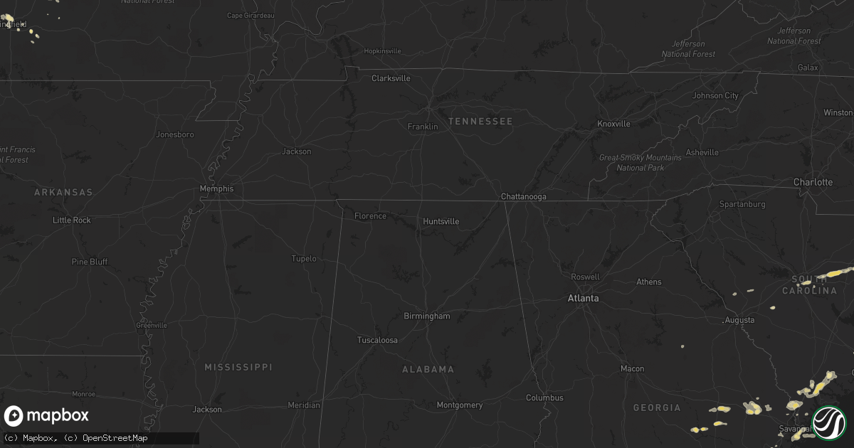
June 23 map
$229
one time, instant access
Download today. No call, no setup
Keep the $229
Bought the map and want the full workflow? Apply the entire $229 to a subscription within 7 days. None of it is wasted.
Every map, not just this one
This buys you this map. Subscription and you get every map we run, in the markets you choose from a few cities to whole states to nationwide. Plus real-time alerts the moment a storm fires.
Contact data
Name, contact info, occupancy, even credit band for addresses in the footprint. You go from where it hit to who to call.
Become the source they trust
Unlimited branding weather history reports on demand. You already have the documented answer ready for the property owner, and you are the one who showed up with it.
Property data and RoofTrace estimates
Pull up any address you have got, its value and the exact code rules for that jurisdiction, straight from One Click Code. Then RoofTrace estimates the squares, pitch, and roof value, priced the way you price.
Storm reports in North Carolina
North Carolina
| Date | Description |
|---|---|
| 06/23/20116:58 PM CDT | Tree down on road. Relayed from media. Time estimated from radar. |
| 06/23/20116:42 PM CDT | Multiple trees down. Relayed from 911 center. |
| 06/23/20116:35 PM CDT | Large tree limb down over hwy 58. Time estimated from radar. |
| 06/23/20116:22 PM CDT | Tree down near the intersection of river neck rd and sound side rd. Relayed from 911 center. |
| 06/23/20116:20 PM CDT | Metal storage shed blown over on rocky run road. Report relayed from media. Time estimated from radar. |
| 06/23/20116:20 PM CDT | Tree down. Time estimated by radar. |
| 06/23/20116:12 PM CDT | Tree down on powerlines. Time estimated from radar |
| 06/23/20115:40 PM CDT | Tree down on shed in brinkley place |
| 06/23/20115:35 PM CDT | Dime to quarter size hail fell. |
| 06/23/20115:26 PM CDT | Several trees were blown down. A metal structure was blown into the woods off of bill long rd. |
| 06/23/20115:20 PM CDT | Multiple trees down. Hail reported... But size unknown. Trees also down in beargrass. |
| 06/23/20115:12 PM CDT | Powerlines down on ridgewood dr. Time estimated from radar |
| 06/23/20115:10 PM CDT | Multiple trees down |
| 06/23/20115:10 PM CDT | Tree limbs down up to 2 inches. Quarter size hail. |
| 06/23/20115:05 PM CDT | Large limbs down. |
| 06/23/20115:01 PM CDT | Multiple trees and limbs down on mills inn fire dept road. Relayed from media. Time estimated from radar. |
| 06/23/20114:55 PM CDT | A local report indicates 60 MPH wind near 2 WSW INSTITUTE |
| 06/23/20114:40 PM CDT | Tree down on vehicle near holiday court. Relayed from 911 center |
| 06/23/20114:28 PM CDT | Multiple trees down near mile marker 64. Relayed from 911 center |
| 06/23/20114:22 PM CDT | Tree down on davistown-mercer road. Power lines down nearby. |
| 06/23/20114:20 PM CDT | Tree down. |
| 06/23/20114:19 PM CDT | Tree down on eagles road. |
| 06/23/20114:18 PM CDT | Tree down on us 258 near nc highway 42. |
| 06/23/20114:17 PM CDT | Intersection of hwy 121 and hwy 264 |
| 06/23/20114:15 PM CDT | Numerous trees down along highway 58 and highway 91 |
| 06/23/20114:12 PM CDT | Trees down near hwy 91. Relayed from 911 |
| 06/23/20114:10 PM CDT | Tree down on west main street in clinton. |
| 06/23/20114:09 PM CDT | Tree down on maple leaf lane in hobbton. |
| 06/23/20114:09 PM CDT | Tree down on wilson road. |
| 06/23/20114:06 PM CDT | Tree down on keener road. |
| 06/23/20114:00 PM CDT | Tree down |
| 06/23/20113:51 PM CDT | Several trees down near antioch road and highway 111 |
| 06/23/20113:43 PM CDT | One tree down at perkins road near albert drive |
| 06/23/20113:42 PM CDT | Structural damage to apartment buiilding across street from unc pembroke campus. |
| 06/23/20113:25 PM CDT | Numerous trees and power lines down across the county |
| 06/23/20113:25 PM CDT | Roof blown off building. Numerous trees and powerlines down across maxton. |
| 06/23/20113:16 PM CDT | One tree down at intersection of brogden road and stevens sausage road |
| 06/23/20113:15 PM CDT | Quarter sized hail reported in murraysville. |
| 06/23/20113:12 PM CDT | Trees down near old wire road and 211 |
| 06/23/20113:08 PM CDT | Gust of 75mph winds measured at kilm. |
| 06/23/20113:06 PM CDT | Tree down on 4th street. |
| 06/23/20113:06 PM CDT | Tree down on mcnair avenue. |
| 06/23/20113:05 PM CDT | Large trees reported down on archie mcgugan rd. |
| 06/23/20113:01 PM CDT | Tree down at leisure and bostic road. |
| 06/23/20112:45 PM CDT | Tree down on airbase road. |
| 06/23/20118:48 AM CDT | Large limbs down. |
| 06/23/20114:55 AM CDT | Relayed report from charlotte fd of lines along 7600 block of park rd |
All States Impacted by Hail Map on June 23, 2011
Cities Impacted by Hail Map on June 23, 2011
- Bonner, MT
- Seeley Lake, MT
- Snowville, UT
- Malad City, ID
- Elkton, FL
- Saint Augustine, FL
- Gate, OK
- Alachua, FL
- Eastover, SC
- Columbia, NJ
- East Stroudsburg, PA
- Olive Hill, KY
- Grayson, KY
- Greenwich, CT
- Stamford, CT
- Arnett, OK
- Sharon, OK
- Vici, OK
- Mutual, OK
- May, OK
- Buffalo, OK
- Woodward, OK
- Laverne, OK
- Seiling, OK
- Fort Supply, OK
- Metter, GA
- Cobbtown, GA
- Lyons, GA
- Lehigh Acres, FL
- Sumter, SC
- Bishopville, SC
- Folkston, GA
- Dumont, NJ
- Cresskill, NJ
- Bergenfield, NJ
- Tenafly, NJ
- Demarest, NJ
- Alpine, NJ
- Yonkers, NY
- Fairfield, MT
- Power, MT
- Sun River, MT
- Cascade, MT
- Fort Shaw, MT
- Vaughn, MT
- Lewistown, MT
- Fargo, OK
- Fort Meade, FL
- Jacksonville, FL
- White Oak, GA
- Woodbine, GA
- Dutton, MT
- Pembroke, GA
- Statesboro, GA
- Brooklet, GA
- Conway, SC
- Oak Ridge, TN
- Clinton, TN
- Oliver Springs, TN
- Hardeeville, SC
- Arcadia, KS
- Liberal, MO
- Springfield, MO
- Bosler, WY
- Valdosta, GA
- Hahira, GA
- Lamar, MO
- Sheldon, MO
- Gainesville, FL
- Micanopy, FL
- Belt, MT
- Edna, KS
- Mound Valley, KS
- Oswego, KS
- Altamont, KS
- Bartlett, KS
- Glenwood, GA
- Stantonsburg, NC
- Walstonburg, NC
- Knoxville, TN
- Charleston, SC
- Howard, KS
- Piedmont, KS
- Orlando, FL
- Geraldine, MT
- Macclenny, FL
- Glen Saint Mary, FL
- Dayton, WY
- Bondurant, WY
- Kalispell, MT
- Independence, KS
- Melrose, FL
- Florahome, FL
- Ridgeland, SC
- Richlands, NC
- Jacksonville, NC
- Climax Springs, MO
- Cross Timbers, MO
- Macks Creek, MO
- Oneida, TN
- Walnut Grove, MO
- Aldrich, MO
- Eldridge, MO
- Lebanon, MO
- Bridger, MT
- Colcord, OK
- Gentry, AR
- Siloam Springs, AR
- Johnston, SC
- Ward, SC
- Tunas, MO
- Lemoyne, NE
- Mount Vernon, GA
- Uvalda, GA
- Elliott, SC
- Groveland, FL
- Seymour, MO
- Farmville, NC
- Savannah, GA
- Allardt, TN
- Jamestown, TN
- Loris, SC
- Montpelier, ID
- Galivants Ferry, SC
- Lakeland, FL
- Welch, OK
- Benson, NC
- Four Oaks, NC
- Maxton, NC
- Moncks Corner, SC
- Summerville, SC
- Mount Vernon, MO
- Miller, MO
- Stotts City, MO
- Wilder, TN
- Dalzell, SC
- Rembert, SC
- Seabrook, SC
- Yemassee, SC
- Eskdale, WV
- Orgas, WV
- Fayetteville, WV
- Gallagher, WV
- Robson, WV
- Kimberly, WV
- Montgomery, WV
- Powellton, WV
- Kincaid, WV
- Wagener, SC
- Whitehall, MT
- Highwood, MT
- Bronaugh, MO
- Tornado, WV
- Hurricane, WV
- Saint Albans, WV
- Montvale, NJ
- West Nyack, NY
- Pearl River, NY
- Westwood, NJ
- Blauvelt, NY
- Saddle River, NJ
- Spring Valley, NY
- Nyack, NY
- Monsey, NY
- Nanuet, NY
- Park Ridge, NJ
- Orangeburg, NY
- Valley Cottage, NY
- Lockwood, MO
- Golden City, MO
- La Russell, MO
- Everton, MO
- Dadeville, MO
- Greenfield, MO
- Bluejacket, OK
- Miami, OK
- Talala, OK
- Oologah, OK
- Claremore, OK
- Chelsea, OK
- Hernando, FL
- Astor, FL
- Sheridan, WY
- Sterling, CO
- Phillipsburg, MO
- Myrtle Beach, SC
- Waycross, GA
- Alamo, GA
- Lumber City, GA
- Jasper, MO
- Sarcoxie, MO
- Bancroft, ID
- Jay, OK
- Millwood, GA
- Manor, GA
- Manhattan, MT
- Saint George, GA
- Thomasville, GA
- Rocky Point, NC
- Albany, GA
- Verona, MO
- McArthur, OH
- Starke, FL
- Lawtey, FL
- Saint Johns, FL
- Lancing, TN
- Deer Lodge, TN
- Wartburg, TN
- Clarkrange, TN
- Sunbright, TN
- Wayne, WV
- Genoa, WV
- Prichard, WV
- Louisa, KY
- Fort Gay, WV
- Ocala, FL
- Augusta, MT
- Register, GA
- West Liberty, KY
- Elkfork, KY
- Wauchula, FL
- Vinita, OK
- Sheldon, SC
- Naples, FL
- Washington, NC
- Green Cove Springs, FL
- Williamston, NC
- Robersonville, NC
- Georgetown, SC
- Hemingway, SC
- Tarawa Terrace, NC
- New Bern, NC
- Green Pond, SC
- Walterboro, SC
- Rincon, GA
- Merritt, NC
- Bayboro, NC
- Fredonia, KS
- Yates Center, KS
- Toronto, KS
- Eatontown, NJ
- Grovespring, MO
- Helmville, MT
- Winter Haven, FL
- Bartow, FL
- Waverly, GA
- Drummond, MT
- Fort Scott, KS
- Powell, TN
- Grass Range, MT
- Roach, MO
- Camdenton, MO
- Boston, GA
- Winter Park, FL
- Maitland, FL
- Monterey, TN
- Cookeville, TN
- Spavinaw, OK
- Eucha, OK
- Milton, WV
- Barboursville, WV
- Salt Rock, WV
- Delaware, OK
- Brunswick, GA
- Hortense, GA
- Huger, SC
- Pantego, NC
- Dillon, MT
- Morriston, FL
- Stoutland, MO
- Gallipolis, OH
- Willow Wood, OH
- Scottown, OH
- Crown City, OH
- Molt, MT
- Broadview, MT
- Jekyll Island, GA
- Newton Grove, NC
- Clinton, NC
- Yulee, FL
- Hilliard, FL
- Kingsland, GA
- Columbia, SC
- Hopkins, SC
- Big Horn, WY
- La Follette, TN
- Hinsdale, MT
- Conrad, MT
- Brady, MT
- Alva, FL
- Punta Gorda, FL
- Estero, FL
- Fort Myers, FL
- Immokalee, FL
- Bern, ID
- Elk City, KS
- Riceboro, GA
- Townsend, GA
- Pollocksville, NC
- Trenton, NC
- Arthur, NE
- Ray City, GA
- Lakeland, GA
- Newton, NJ
- Bartonsville, PA
- Stroudsburg, PA
- Blairstown, NJ
- Lovell, WY
- Shoshoni, WY
- Sylvester, GA
- Wilmington, NC
- Ramsey, NJ
- Tarrytown, NY
- Allendale, NJ
- Scranton, NC
- Fordland, MO
- Richmond Hill, GA
- Apopka, FL
- Sorrento, FL
- Windyville, MO
- Long Lane, MO
- Simms, MT
- Banner, WY
- Windermere, FL
- Winter Garden, FL
- Vidalia, GA
- Bath, NC
- Pinetown, NC
- Belhaven, NC
- Rogersville, MO
- Ravenel, SC
- Riegelwood, NC
- South Charleston, WV
- Arcadia, FL
- Longwood, FL
- Big Timber, MT
- Longs, SC
- Fairland, OK
- West Fork, AR
- Prairie Grove, AR
- Lumber Bridge, NC
- Parkton, NC
- Inverness, FL
- Tabor City, NC
- Pierce City, MO
- Longton, KS
- Hobucken, NC
- Bunnell, FL
- Geyser, MT
- Keystone Heights, FL
- Beaufort, SC
- Coosawhatchie, SC
- Coffeyville, KS
- Caney, KS
- Tallahassee, FL
- Conway, MO
- Gainesboro, TN
- Carter, MT
- Havana, KS
- Murrells Inlet, SC
- Cherryvale, KS
- Bethel, NC
- Edgefield, SC
- Ochopee, FL
- Lava Hot Springs, ID
- Kodak, TN
- Nickerson, KS
- Hutchinson, KS
- Salley, SC
- Bushkill, PA
- Tannersville, PA
- Rowland, NC
- Nashville, GA
- Moody Afb, GA
- Greenup, KY
- Elm City, NC
- Bluffton, SC
- Mooreland, OK
- Coolville, OH
- Grantsboro, NC
- Argillite, KY
- Watts, OK
- Vandemere, NC
- Bronx, NY
- Sloatsburg, NY
- Sterling, NY
- Martville, NY
- Claxton, GA
- Martha, KY
- Malta, MT
- Midway, GA
- Grove, OK
- North Augusta, SC
- Homerville, GA
- Fargo, GA
- Strafford, MO
- Willard, MO
- Havre, MT
- Winifred, MT
- Kila, MT
- Albany, OH
- Lewellen, NE
- Kincaid, KS
- Godwin, NC
- Maple Hill, NC
- Wallace, NC
- Maysville, NC
- Armonk, NY
- Valhalla, NY
- Thornwood, NY
- Pleasantville, NY
- Hawthorne, NY
- Hilger, MT
- Greenville, NC
- Three Forks, MT
- Whitewater, MT
- Callahan, FL
- Big Sandy, MT
- Afton, OK
- Bell, FL
- Branford, FL
- Springfield, GA
- Redfield, KS
- Moundville, MO
- Deerfield, MO
- Huntington, NY
- Cold Spring Harbor, NY
- Hampstead, NC
- Reddick, FL
- Bayville, NY
- Locust Valley, NY
- Dunnellon, FL
- Laurinburg, NC
- Red Springs, NC
- Wagram, NC
- Eustis, FL
- Dunlow, WV
- Cheyenne, WY
- Currie, NC
- Kelly, NC
- Fleming, CO
- Summers, AR
- Stumpy Point, NC
- Buffalo, MO
- Louisburg, MO
- Virgil, KS
- Kitty Hawk, NC
- Turner, MT
- Falcon, MO
- Aynor, SC
- Labelle, FL
- Jamesville, NC
- Ramona, OK
- Shannon, NC
- Patriot, OH
- Oak Hill, OH
- Proctorville, OH
- Busby, MT
- Lamar, SC
- Pinedale, WY
- Monett, MO
- Vass, NC
- Hartville, MO
- High Springs, FL
- Pikeville, NC
- Fremont, NC
- Livingston, TN
- Rickman, TN
- Dixie, GA
- Quitman, GA
- Ona, FL
- Bronson, KS
- Booneville, AR
- Patterson, GA
- North Charleston, SC
- Fort Pierce, FL
- Saco, MT
- Oyster Bay, NY
- Welda, KS
- Arcola, MO
- Floral City, FL
- Chetopa, KS
- Guysville, OH
- Culloden, WV
- West Harrison, NY
- White Plains, NY
- Zolfo Springs, FL
- Moline, KS
- Elk Falls, KS
- Stewart, OH
- Bartlesville, OK
- Tappan, NY
- Piermont, NY
- Franklin Lakes, NJ
- Woodcliff Lake, NJ
- Mahwah, NJ
- Ocoee, FL
- Preston, MO
- Urbana, MO
- McAllister, MT
- Denton, MT
- Shade, OH
- Paisley, FL
- Pinetops, NC
- Macclesfield, NC
- Ashland, KY
- Grovetown, GA
- Barbourville, KY
- Fort Benton, MT
- Pedro, OH
- Clearmont, WY
- Nakina, NC
- Clarendon, NC
- Hanahan, SC
- Paramus, NJ
- Fair Lawn, NJ
- Saint Marys, GA
- Murphy, ID
- Reidsville, GA
- Jerico Springs, MO
- Stokes, NC
- Sandy Hook, KY
- Webbville, KY
- Bearcreek, MT
- Goose Creek, SC
- West Columbia, SC
- Aurora, MO
- Johns Island, SC
- Warthen, GA
- Garnett, KS


