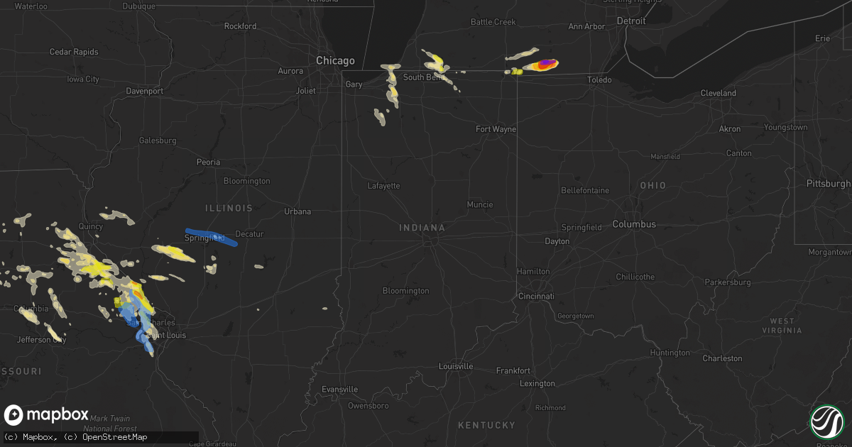
Hail Map in Indiana on June 19, 2021
Get this storm
June 19 map
$229
one time, instant access
Download today. No call, no setup
Keep the $229
Bought the map and want the full workflow? Apply the entire $229 to a subscription within 7 days. None of it is wasted.
Every map, not just this one
This buys you this map. Subscription and you get every map we run, in the markets you choose from a few cities to whole states to nationwide. Plus real-time alerts the moment a storm fires.
Contact data
Name, contact info, occupancy, even credit band for addresses in the footprint. You go from where it hit to who to call.
Become the source they trust
Unlimited branding weather history reports on demand. You already have the documented answer ready for the property owner, and you are the one who showed up with it.
Property data and RoofTrace estimates
Pull up any address you have got, its value and the exact code rules for that jurisdiction, straight from One Click Code. Then RoofTrace estimates the squares, pitch, and roof value, priced the way you price.
Storm reports in Indiana
Indiana
| Date | Description |
|---|---|
| 06/19/20218:50 AM CDT | Multiple trees down and some roads impassable in judah. |
| 06/19/20217:33 AM CDT | At 1233 AM EDT, a severe thunderstorm was located near Spencer, or 21 miles northwest of Bloomington, moving east at 40 mph. HAZARD...60 mph wind gusts and quarter size hail. SOURCE...Radar indicated. IMPACT...Hail damage to vehicles is expected. Expect wind damage to roofs, siding, and trees. This severe thunderstorm will be near... Spencer and McCormicks Creek State Park around 1245 AM EDT. |
| 06/19/20215:30 AM CDT | At 1029 PM EDT/929 PM CDT/, severe thunderstorms were located along a line extending from near Culver to near Dunns Bridge, moving southeast at 25 mph. HAZARD...60 mph wind gusts and quarter size hail. SOURCE...Radar indicated. IMPACT...Hail damage to vehicles is expected. Expect wind damage to roofs, siding, and trees. Locations impacted include... Winamac, North Judson, Medaryville, Ripley, Monterey, Beardstown, Ober, Vanmeter Park, Denham, Lawton, Toto, Clarks, Winona, Bass Lake, San Pierre and Ora. |
| 06/19/20214:43 AM CDT | At 943 PM EDT/843 PM CDT/, a severe thunderstorm was located near Hamlet, or near Knox, moving southeast at 30 mph. HAZARD...60 mph wind gusts and penny size hail. SOURCE...Radar indicated. IMPACT...Expect damage to roofs, siding, and trees. Locations impacted include... Knox, North Judson, Culver, Hamlet, Koontz Lake, Oak Grove, Ober, Twin Lakes, Rutland, Burr Oak, Maxinkuckee, Brems, Toto, Hibbard, Winona, Bass Lake, Donaldson, Grovertown and Ora. |
| 06/19/20213:53 AM CDT | At 852 PM EDT/752 PM CDT/, a severe thunderstorm was located over Kingsford Heights, or near La Porte, moving southeast at 25 mph. HAZARD...60 mph wind gusts and quarter size hail. SOURCE...Radar indicated. IMPACT...Hail damage to vehicles is expected. Expect wind damage to roofs, siding, and trees. Locations impacted include... La Porte, Walkerton, North Liberty, Kingsford Heights, Hamlet, Koontz Lake, Oak Grove, Kingsbury, Teegarden, South Center, Salem Heights, Fish Lake, Tracy, Stillwell, Tyner, Union Mills, Donaldson and Grovertown. |
| 06/19/20213:20 AM CDT | At 820 PM EDT, a severe thunderstorm was located over Simonton Lake, moving southeast at 30 mph. HAZARD...60 mph wind gusts and quarter size hail. SOURCE...Radar indicated. IMPACT...Hail damage to vehicles is expected. Expect wind damage to roofs, siding, and trees. Locations impacted include... Elkhart, Mishawaka, Goshen, Granger, Dunlap, Simonton Lake, Middlebury, Cassopolis, Bristol, White Pigeon, Edwardsburg, Union, Scott, Mottville, Shipshewana, Honeyville, Calvin Center, Adamsville, Juno Lake and Shavehead Lake.This includes Interstate 80 in Indiana between mile markers 81 and121. |
| 06/19/20213:16 AM CDT | At 816 PM EDT/716 PM CDT/, a severe thunderstorm was located over La Porte, moving southeast at 25 mph. HAZARD...60 mph wind gusts and quarter size hail. SOURCE...Radar indicated. IMPACT...Hail damage to vehicles is expected. Expect wind damage to roofs, siding, and trees. Locations impacted include... La Porte, Walkerton, North Liberty, Kingsbury, Byron, Pinola, Springville, Salem Heights, Fish Lake, Stillwell and South Center.This includes Interstate 80 in Indiana between mile markers 42 and53. |
| 06/19/20212:35 AM CDT | At 735 PM EDT/635 PM CDT/, a severe thunderstorm was located over New Buffalo, or 8 miles northeast of Michigan City, moving east at 30 mph. HAZARD...60 mph wind gusts and quarter size hail. SOURCE...Radar indicated. IMPACT...Hail damage to vehicles is expected. Expect wind damage to roofs, siding, and trees. Locations impacted include... South Bend, Michigan City, Buchanan, Trail Creek, New Buffalo, New Carlisle, Three Oaks, Long Beach, Pottawattamie Park, Shorewood-Tower Hills-Harbert, Dayton, Galien, Michiana Shores, Grand Beach, Michiana, Union Pier, Harbert, Chain-o-lakes, Crumstown and Lakeside In Berrien County.This includes the following highways... Interstate 80 in Indiana between mile markers 49 and 73. Interstate 94 in Indiana between mile markers 40 and 45. Interstate 94 in Michigan between mile markers 0 and 11. |
| 06/19/20211:07 AM CDT | At 607 AM EDT, a severe thunderstorm was located 14 miles south of Brazil, or 20 miles southeast of Terre Haute, moving southeast at 45 mph. HAZARD...60 mph wind gusts and quarter size hail. SOURCE...Radar indicated. IMPACT...Hail damage to vehicles is expected. Expect wind damage to roofs, siding, and trees. This severe thunderstorm will be near... Patricksburg and Coal City around 610 AM EDT. Freedom and McCormicks Creek State Park around 625 AM EDT.Other locations in the path of this severe thunderstorm includeSolsberry, Bloomington, Harrodsburg and Smithville. |
| 06/18/202110:45 PM CDT | At 345 AM EDT, a severe thunderstorm was located near Spencer, or 14 miles west of Bloomington, moving east at 30 mph. HAZARD...60 mph wind gusts and quarter size hail. SOURCE...Radar indicated. IMPACT...Hail damage to vehicles is expected. Expect wind damage to roofs, siding, and trees. This severe thunderstorm will be near... Ellettsville around 400 AM EDT.Other locations in the path of this severe thunderstorm includeBloomington, Whitehall and Indiana University. |
| 06/18/20219:37 PM CDT | *** 1 fatal... 1 inj *** corrects previous tstm wnd dmg report from san pierre. A mobile home was rolled and disintegrated. Time estimated from radar. Law enforcement r |
| 06/18/20219:15 PM CDT | Reports of trees and limbs down along sr 8 between n cr 100 w and n range road. |
All States Impacted by Hail Map on June 19, 2021
Cities Impacted by Hail Map on June 19, 2021
- Sherman, ME
- Akron, CO
- Center, MO
- Pueblo, CO
- Harrisburg, NE
- Oakley, KS
- Norton, KS
- Lenora, KS
- Saint David, ME
- Madawaska, ME
- Grand Isle, ME
- Frenchville, ME
- Saint Agatha, ME
- Whitewood, SD
- Pearl, IL
- Pittsfield, IL
- Farmersville, IL
- Calhan, CO
- Peyton, CO
- Kimball, NE
- Frankford, MO
- Canaan, ME
- Pittsfield, ME
- Elkhart, IN
- Goshen, IN
- Chillicothe, MO
- Hale, MO
- Paris, MO
- Madison, MO
- Eads, CO
- Skowhegan, ME
- Caputa, SD
- New Underwood, SD
- Troy, MO
- Las Animas, CO
- Sturgis, SD
- La Plata, MO
- Old Monroe, MO
- Moscow Mills, MO
- Hudson, MI
- Pittsford, MI
- Morenci, MI
- Osseo, MI
- Waldron, MI
- Quinn, SD
- Jerome, MI
- Allen, MI
- Quincy, MI
- Reading, MI
- Jonesville, MI
- Hillsdale, MI
- Coldwater, MI
- North Adams, MI
- Stoutsville, MO
- Perry, MO
- Ethel, MO
- Saint Francis, KS
- Deer Isle, ME
- Knox, IN
- La Porte, IN
- Union Mills, IN
- Kingsford Heights, IN
- Hanna, IN
- Hamlet, IN
- Sterling, CO
- Atwood, CO
- Atlanta, MO
- Gibbs, MO
- Hurdland, MO
- Bethel, MO
- Shelbyville, MO
- Clayton, MI
- Camden, MI
- Saint Louis, MO
- Chesterfield, MO
- Montgomery, MI
- Annada, MO
- Elsberry, MO
- Pleasant Hill, IL
- Nebo, IL
- Logan, IA
- Magnolia, IA
- Bowling Green, MO
- Louisiana, MO
- Fort Morgan, CO
- Ramah, CO
- Caribou, ME
- Mendon, MO
- Sunset, ME
- Searsmont, ME
- Islesboro, ME
- Union, ME
- Liberty, ME
- Lincolnville, ME
- Hope, ME
- Milo, ME
- Sundance, WY
- Wall, SD
- Wasta, SD
- Scenic, SD
- Merino, CO
- Snyder, CO
- Brownstown, IL
- Rapid City, SD
- Piedmont, SD
- Limon, CO
- Almena, KS
- Millersburg, IN
- McClave, CO
- Saint Onge, SD
- Deadwood, SD
- Lead, SD
- Belle Fourche, SD
- Fort Meade, SD
- Box Elder, SD
- Spearfish, SD
- Perham, ME
- New Raymer, CO
- Wright City, MO
- Flagler, CO
- Arriba, CO
- Dodge, NE
- Scribner, NE
- Holly, CO
- Ashley, ND
- Zeeland, ND
- Strasburg, ND
- Eureka, SD
- Hague, ND
- Pawnee, IL
- Saint Francis, WI
- Cudahy, WI
- Elbert, CO
- Kiel, WI
- Newton, WI
- Sheboygan, WI
- Cleveland, WI
- Dawson, IL
- Riverton, IL
- Springfield, IL
- Interior, SD
- Kadoka, SD
- Dix, NE
- Harvel, IL
- Maryville, MO
- Conception Junction, MO
- Barnard, MO
- Payson, IL
- Hamburg, IL
- Batchtown, IL
- Golden Eagle, IL
- O'Fallon, MO
- Saint Charles, MO
- Emden, MO
- Philadelphia, MO
- Monroe City, MO
- Palmyra, MO
- Ashland, MO
- Columbia, MO
- Franklin, IL
- Waverly, IL
- Rocheport, MO
- Jacksonville, IL
- Fremont, IN
- Hannibal, MO
- Cassopolis, MI
- Curryville, MO
- Manitowoc, WI
- Brunswick, MO
- Bridgeport, NE
- Potter, NE
- Fenton, MO
- High Ridge, MO
- Higbee, MO
- Rockbridge, IL
- Carrollton, IL
- Sangerville, ME
- Guilford, ME
- Newark, MO
- Greenfield, IL
- Eldred, IL
- Triplett, MO
- Sumner, MO
- Chamois, MO
- Morrisonville, IL
- Selden, KS
- Breckenridge, MO
- Middletown, MO
- Auxvasse, MO
- Kingdom City, MO
- Levant, KS
- Eolia, MO
- Padroni, CO
- San Pierre, IN
- Franksville, WI
- Muskego, WI
- Waterford, WI
- Big Bend, WI
- Valley Park, MO
- Ballwin, MO
- Eureka, MO
- Imperial, MO
- Arnold, MO
- New Buffalo, MI
- Roodhouse, IL
- New London, MO
- Imogene, IA
- Moberly, MO
- Wanblee, SD
- Phillipsburg, KS
- Anton, CO
- Silex, MO
- Omaha, NE
- Shelbyville, IL
- Findlay, IL
- Bonnots Mill, MO
- Tebbetts, MO
- New Bloomfield, MO
- Jonesburg, MO
- Warrenton, MO
- Truxton, MO
- Hawk Point, MO
- Bellflower, MO
- Columbus, NE
- Humphrey, NE
- Creston, NE
- Lamar, CO
- Sidney, NE
- Long Island, KS
- Baxley, GA
- Broadwater, NE
- Oakland, NE
- West Point, NE
- Hooper, NE
- Uehling, NE
- Prairie View, KS
- La Junta, CO
- Burr Oak, KS
- Guide Rock, NE
- Red Cloud, NE
- New Sweden, ME
- Clarksville, MO
- Dalton, NE
- Gurley, NE
- Braymer, MO
- Foristell, MO
- Hardin, IL
- Foley, MO
- Brussels, IL
- Lake Saint Louis, MO
- Wentzville, MO
- Shelbina, MO
- Saint Peters, MO
- Grafton, IL
- Maywood, MO
- Winfield, MO
- Hunnewell, MO
- Portage Des Sioux, MO
- Bridgeton, MO
- Laddonia, MO
- Maryland Heights, MO
- Farber, MO
- Fieldon, IL
- Ewing, MO
- Vandalia, MO
- Earth City, MO
- Rockport, IL
- Petersburg, OH
- New Springfield, OH
- North Lima, OH
- Youngstown, OH
- Middlebury, IN
- Leola, SD
- Rothville, MO
- Keytesville, MO
- Meadville, MO
- Marceline, MO
- Dawn, MO
- Wheeling, MO
- Agate, CO
- Colorado Springs, CO
- Woodrow, CO
- Bristol, IN
- Sturgeon, MO
- Hallsville, MO
- Thompson, MO
- Centralia, MO
- Fulton, MO
- Mexico, MO
- Winchester, IL
- Virden, IL
- Modesto, IL
- Woodson, IL
- Murrayville, IL
- Tekamah, NE
- Sterling, NE
- Brush, CO
- Hillrose, CO
- Vona, CO
- Reedsville, WI
- Riverton, NE
- Mercer, PA
- Hermitage, PA
- Colby, KS
- Edwardsburg, MI
- Dowagiac, MI
- Niles, MI
- Syracuse, KS
- Coolidge, KS
- Two Rivers, WI
- Brooklin, ME
- Inavale, NE
- Naponee, NE
- Franklin, NE
- Bloomington, NE
- Meadow, SD
- Howells, NE
- Macon, MO
- Adrian, MI
- Cope, CO
- Clark, MO
- Watson, MO
- Peru, NE
- Seibert, CO
- Loraine, IL
- Carpenter, WY
- Burns, WY
- Deer Trail, CO
- Hasty, CO
- Michigan City, IN
- Union Pier, MI
- Three Oaks, MI
- Genoa, CO
- Lindon, CO
- Glasgow, MO
- Burr, NE
- Union Grove, WI
- Caledonia, WI
- Sturtevant, WI
- Mukwonago, WI
- Salisbury, MO
- Graham, MO
- Hettick, IL
- Chesterfield, IL
- Carlinville, IL
- Fort Yates, ND
- New Cambria, MO
- Huntsville, MO
- Mondamin, IA
- Truesdale, MO
- Osceola, IN
- Granger, IN
- Mechanicsburg, IL
- Albion, NE
- Paloma, IL
- Camp Point, IL
- Mendon, IL
- Golden, IL
- Mount Sterling, IL
- Coatsburg, IL
- Clayton, IL
- Timewell, IL
- Rexford, KS
- Jennings, KS
- Brewster, KS
- Gem, KS
- Dresden, KS
- Concordia, MO
- Chula, MO
- Okaton, SD
- Gilliam, MO
- Robinson, IL
- Barnhart, MO
- Wildwood, MO
- Fort Fairfield, ME
- Presque Isle, ME
- Easton, ME
- Alliance, NE
- Angora, NE
- Hugo, CO
- Clifton Hill, MO
- Avon, SD
- Springfield, SD
- Niobrara, NE
- La Crosse, IN
- Brillion, WI
- Creston, IA
- Oakland, ME
- Belgrade, ME
- North Judson, IN
- Kouts, IN
- Medaryville, IN
- Wheatfield, IN
- Brookfield, MO
- Tina, MO
- Ravenwood, MO
- Woodbine, IA
- Mankato, KS
- Bird City, KS
- Washburn, ME
- Wilsonville, NE
- Hendley, NE
- Bayard, NE
- Kampsville, IL
- Ludlow, MO
- Beaver City, NE
- Larkspur, CO
- Stockholm, ME
- Portland, MO
- Linton, ND
- Oberlin, KS
- Belgrade Lakes, ME
- Shipshewana, IN
- Skidmore, MO
- Bolckow, MO
- Armstrong, MO
- Fayette, MO
- Peetz, CO
- Long Lake, SD
- Hoxie, KS
- Chapin, IL
- Montague, MI
- Fort Lupton, CO
- Greenleaf, WI
- Eau Claire, MI
- Berrien Center, MI
- Union, MI
- Murdo, SD
- New Era, MI
- Quaker City, OH
- Palermo, ME
- Volant, PA
- Wooldridge, MO
- Owanka, SD
- Agenda, KS
- Grainfield, KS
- Vernon, CO
- Tobias, NE
- Simpson, KS
- Milligan, NE
- Mahaska, KS
- Downs, KS
- Matheson, CO
- Funk, NE
- Fairbury, NE
- Beloit, KS
- Bertrand, NE
- Wray, CO
- Lawrence, NE
- Republic, KS
- Trenton, NE
- Western, NE
- Stratton, CO
- Kensington, KS
- Quinter, KS
- Wauneta, NE
- Joes, CO
- Wilcox, NE
- Hays, KS
- Damar, KS
- Juniata, NE
- Deshler, NE
- Formoso, KS
- Stockville, NE
- Lebanon, NE
- Exeter, NE
- Scandia, KS
- Ellis, KS
- Cheyenne Wells, CO
- Penokee, KS
- Hunter, KS
- Plainville, KS
- Geneva, NE
- Saronville, NE
- Park, KS
- Delphos, KS
- Bartley, NE
- Dorrance, KS
- Bethune, CO
- Catharine, KS
- Goodland, KS
- Karval, CO
- McDonald, KS
- Idalia, CO
- Morrowville, KS
- Eustis, NE
- Gilead, NE
- Culbertson, NE
- Paoli, CO
- Maywood, NE
- Wakeeney, KS
- Herndon, KS
- Sylvan Grove, KS
- Imperial, NE
- Champion, NE
- De Witt, NE
- Parks, NE
- Ohiowa, NE
- Strang, NE
- Tipton, KS
- Stockton, KS
- Wallace, KS
- Natoma, KS
- Kit Carson, CO
- Courtland, KS
- Lucas, KS
- Belvidere, NE
- Gorham, KS
- Danbury, NE
- Fairmont, NE
- Holbrook, NE
- Ludell, KS
- Heartwell, NE
- Smith Center, KS
- Axtell, NE
- Bladen, NE
- Cuba, KS
- Munden, KS
- Osborne, KS
- Lebanon, KS
- Barnard, KS
- Julesburg, CO
- Holdrege, NE
- Jewell, KS
- Woodston, KS
- Harvard, NE
- Bunker Hill, KS
- Fairfield, NE
- Gove, KS
- Agra, KS
- Cedar, KS
- Oak, NE
- Glasco, KS
- Haigler, NE
- Paradise, KS
- Kirk, CO
- Jamestown, KS
- Blue Hill, NE
- Holyoke, CO
- Waldo, KS
- Collyer, KS
- Daykin, NE
- Moorefield, NE
- Yuma, CO
- Portis, KS
- Walker, KS
- Athol, KS
- Hastings, NE
- Campbell, NE
- Belleville, KS
- Venango, NE
- Davenport, NE
- Palco, KS
- Cambridge, NE
- Clayton, KS
- Edson, KS
- Hill City, KS
- Narka, KS
- Inland, NE
- Kanorado, KS
- Curtis, NE
- Swanton, NE
- Oxford, NE
- Reynolds, NE
- Holstein, NE
- Gaylord, KS
- Roseland, NE
- Plymouth, NE
- Burlington, CO
- Haxtun, CO
- Wild Horse, CO
- Indianola, NE
- Bogue, KS
- Hardy, NE
- Luray, KS
- Republican City, NE
- Clay Center, NE
- Superior, NE
- Bruning, NE
- Deweese, NE
- Esbon, KS
- Grafton, NE
- Arapahoe, NE
- Wilson, KS
- Winona, KS
- Ong, NE
- Shickley, NE
- Norway, KS
- Enders, NE
- Elwood, NE
- Randall, KS
- Wilber, NE
- Ogallah, KS
- Max, NE
- Edgar, NE
- Glade, KS
- Hebron, NE
- Hubbell, NE
- Orleans, NE
- Morland, KS
- Byron, NE
- Stratton, NE
- Hildreth, NE
- Grinnell, KS
- Concordia, KS
- Eckley, CO
- Monument, KS
- Sharon Springs, KS
- Alton, KS
- Minden, NE
- Norcatur, KS
- Ruskin, NE
- Glenvil, NE
- Ayr, NE
- Arapahoe, CO
- Chester, NE
- Lincoln, KS
- Benkelman, NE
- Atwood, KS
- Stamford, NE
- Atlanta, NE
- Nelson, NE
- Amherst, CO
- Glen Elder, KS
- Weskan, KS
- Otis, CO
- Logan, KS
- Carleton, NE
- Alexandria, NE
- Edison, NE
- Jansen, NE
- McCook, NE
- Sutton, NE
- Endicott, NE
- Russell, KS
- Loomis, NE
- Cawker City, KS
- Alma, NE
- Victoria, KS
- Upland, NE
- Kirwin, KS
- Webber, KS
- Granada, CO
- Two Buttes, CO
- Springfield, CO
- Kim, CO
- Walsh, CO
- Pritchett, CO
- Wiley, CO
- Manter, KS
- Mount Auburn, IL
- Buffalo, IL
- Rochester, IL
- Edinburg, IL
- Pleasant Plains, IL
- Tallula, IL
- Cantrall, IL
- Stonington, IL
- Blue Mound, IL
- Pacific, MO
- House Springs, MO
- Camden, ME
- Morrill, ME
- Wayne, ME
- Winthrop, ME
- Readfield, ME
- Grand Bay, AL
- Pensacola, FL
- Lillian, AL
- Elberta, AL
- Orange Beach, AL
- Gulf Breeze, FL
- Milton, FL
- Evergreen, AL
- Castleberry, AL
- Brewton, AL
- Gulf Shores, AL
- Jakin, GA
- Pansey, AL
- Greenwood, FL
- Bascom, FL
- Malone, FL
- Blakely, GA
- Gordon, AL
- Bluffton, GA
- Coleman, GA
- Fort Gaines, GA
- Florala, AL
- Opp, AL
- Andalusia, AL
- Laurel Hill, FL
- Baker, FL
- Defuniak Springs, FL
- Westville, FL
- Samson, AL
- Bonifay, FL
- Caryville, FL
- Graceville, FL
- Vernon, FL
- Ponce De Leon, FL
- Geneva, AL
- Louisville, AL
- Clayton, AL
- Washington, ME


