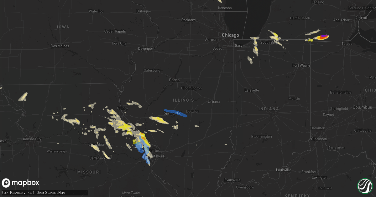
Hail Map in Illinois on June 19, 2021
Get this storm
June 19 map
$229
one time, instant access
Download today. No call, no setup
Keep the $229
Bought the map and want the full workflow? Apply the entire $229 to a subscription within 7 days. None of it is wasted.
Every map, not just this one
This buys you this map. Subscription and you get every map we run, in the markets you choose from a few cities to whole states to nationwide. Plus real-time alerts the moment a storm fires.
Contact data
Name, contact info, occupancy, even credit band for addresses in the footprint. You go from where it hit to who to call.
Become the source they trust
Unlimited branding weather history reports on demand. You already have the documented answer ready for the property owner, and you are the one who showed up with it.
Property data and RoofTrace estimates
Pull up any address you have got, its value and the exact code rules for that jurisdiction, straight from One Click Code. Then RoofTrace estimates the squares, pitch, and roof value, priced the way you price.
Storm reports in Illinois
Illinois
| Date | Description |
|---|---|
| 06/19/20215:17 PM CDT | Four foot diameter tree snapped in half. |
| 06/19/20213:38 PM CDT | Several large trees blown down to the south of batchtown. |
| 06/19/20213:27 PM CDT | Several large trees blown down in the batchtown area. |
| 06/19/20213:00 PM CDT | A local report indicates 1.00 inch wind near HARDIN |
| 06/19/202112:13 PM CDT | Delayed report. Tree trunks snapped. Time estimated from radar. |
| 06/19/202112:03 PM CDT | Delayed report. West wall blown out of farm outbuilding. Time estimated from radar. |
| 06/19/202110:35 AM CDT | Agricultural fields severely damaged by wind and small hail. |
| 06/19/20217:52 AM CDT | At 1252 AM CDT, a severe thunderstorm was located over Green Valley, or 11 miles south of Pekin, moving east at 30 mph. HAZARD...60 mph wind gusts and quarter size hail. SOURCE...Radar indicated. IMPACT...Hail damage to vehicles is expected. Expect wind damage to roofs, siding, and trees. This severe thunderstorm will be near... Delavan and San Jose around 100 AM CDT. Hopedale and Emden around 110 AM CDT.Other locations in the path of this severe thunderstorm includeHartsburg and Armington.This includes Interstate 155 between mile markers 2 and 27. |
| 06/19/20217:13 AM CDT | At 1212 AM CDT, a severe thunderstorm was located over Canton, moving southeast at 45 mph. This is a very dangerous storm. HAZARD...80 mph wind gusts and golf ball size hail. SOURCE...Radar indicated. IMPACT...Flying debris will be dangerous to those caught without shelter. Mobile homes will be heavily damaged. Expect considerable damage to roofs, windows, and vehicles. Extensive tree damage and power outages are likely. This severe thunderstorm will be near... Glasford around 1225 AM CDT.Other locations in the path of this severe thunderstorm includeManito, South Pekin, Green Valley and Delavan.This includes the following highways... Interstate 155 between mile markers 20 and 31. Interstate 474 between mile markers 5 and 14. |
| 06/19/20215:45 AM CDT | At 1045 AM CDT, a severe thunderstorm was located near Waverly, moving southeast at 40 mph. HAZARD...60 mph wind gusts and quarter size hail. SOURCE...Radar indicated. IMPACT...Hail damage to vehicles is expected. Expect wind damage to roofs, siding, and trees. Locations impacted include... Virden, Girard, Raymond, White Oak, Farmersville, Palmyra, Waggoner, Nilwood, Harvel, Modesto, Standard City, Scottville, Atwater and Honey Bend.This includes Interstate 55 in Illinois between exits 60 and 63. This also includes Lake Lou Yaeger. |
| 06/19/20215:19 AM CDT | At 1019 AM CDT, a severe thunderstorm was located near Franklin, or 8 miles southeast of Jacksonville, moving east at 35 mph. HAZARD...60 mph wind gusts and quarter size hail. SOURCE...Radar indicated. IMPACT...Hail damage to vehicles is expected. Expect wind damage to roofs, siding, and trees. This severe thunderstorm will be near... New Berlin and Waverly around 1035 AM CDT.Other locations in the path of this severe thunderstorm includeLoami, Chatham, Auburn, Springfield, Pawnee and Divernon.This includes the following highways... Interstate 55 between mile markers 77 and 91. Interstate 72 between mile markers 64 and 72, and between milemarkers 75 and 76. |
| 06/19/20213:00 AM CDT | At 759 PM CDT, a severe thunderstorm was located over St. Paul, moving southeast at 30 mph. HAZARD...60 mph wind gusts and nickel size hail. SOURCE...Radar indicated. IMPACT...Expect damage to roofs, siding, and trees. This severe thunderstorm will be near... O'Fallon around 810 PM CDT. Cottleville around 815 PM CDT.Other locations in the path of this severe thunderstorm include St.Charles, St. Peters, Weldon Spring, Harvester, Maryland Heights,Orchard Farms, Chesterfield, Town and Country, Champ, Florissant,Hazelwood, Bridgeton, Lambert-St. Louis International Airport,University City, Ferguson, Creve Coeur, Overland, Clayton, Jennings,St. Ann, Bellefontaine Neighbors, Berkeley and Richmond Heights.This includes the following highways... Interstate 44 in Missouri between exits 257 and 269. Interstate 70 in Missouri between exits 216 and 231.This also includes Babler Memorial State Park, Route 66 State Park,Castlewood State Park, and First Missouri State Capitol HistoricSite. |
| 06/19/20212:31 AM CDT | At 731 PM CDT, a severe thunderstorm was located over Fountain N' Lakes, moving southeast at 30 mph. HAZARD...60 mph wind gusts and quarter size hail. SOURCE...Radar indicated. IMPACT...Hail damage to vehicles is expected. Expect wind damage to roofs, siding, and trees. This severe thunderstorm will be near... Winfield and Chain of Rocks around 740 PM CDT. Lake St. Louis, St. Paul and Josephville around 750 PM CDT.Other locations in the path of this severe thunderstorm includeO'Fallon, Dardenne Prairie, Cottleville, St. Charles, St. Peters,Weldon Spring, Harvester and Orchard Farms.This includes Interstate 70 in Missouri between exits 203 and 227. This also includes Cuivre River State Park. |
| 06/19/20212:29 AM CDT | At 729 AM CDT, a severe thunderstorm was located near Mount Auburn, or 14 miles north of Taylorville, moving east at 50 mph. HAZARD...70 mph wind gusts and nickel size hail. SOURCE...Radar indicated. IMPACT...Expect considerable tree damage. Damage is likely to mobile homes, roofs, and outbuildings. This severe thunderstorm will be near... Blue Mound around 735 AM CDT. Moweaqua and Macon around 745 AM CDT.This includes Interstate 72 between mile markers 125 and 134. |
| 06/19/20212:06 AM CDT | At 706 AM CDT, a severe thunderstorm was located near Rochester, or near Springfield, moving east at 55 mph. HAZARD...70 mph wind gusts and nickel size hail. SOURCE...Radar indicated. IMPACT...Expect considerable tree damage. Damage is likely to mobile homes, roofs, and outbuildings. This severe thunderstorm will be near... Mechanicsburg around 710 AM CDT. Edinburg around 715 AM CDT. Illiopolis and Mount Auburn around 720 AM CDT. Stonington around 725 AM CDT.Other locations in the path of this severe thunderstorm include BlueMound.This includes the following highways... Interstate 55 near mile marker 89, and between mile markers 93 and97. Interstate 72 between mile markers 100 and 135. |
| 06/19/20211:46 AM CDT | At 646 PM CDT, a severe thunderstorm was located near Bowling Green, moving southeast at 30 mph. HAZARD...60 mph wind gusts and half dollar size hail. SOURCE...Radar indicated. IMPACT...Hail damage to vehicles is expected. Expect wind damage to roofs, siding, and trees. This severe thunderstorm will be near... Eolia around 700 PM CDT.Other locations in the path of this severe thunderstorm includeElsberry.This also includes Cuivre River State Park. |
| 06/19/202112:46 AM CDT | At 545 PM CDT, a severe thunderstorm was located near Frankford, moving southeast at 30 mph. HAZARD...60 mph wind gusts and quarter size hail. SOURCE...Radar indicated. IMPACT...Hail damage to vehicles is expected. Expect wind damage to roofs, siding, and trees. This severe thunderstorm will be near... Frankford around 600 PM CDT. Spencerburg around 605 PM CDT.Other locations in the path of this severe thunderstorm includeBowling Green, Louisiana and Tarrants. |
| 06/19/202112:44 AM CDT | At 544 AM CDT, a severe thunderstorm was located 7 miles west of Helm, moving east at 40 mph. HAZARD...60 mph wind gusts and quarter size hail. SOURCE...Radar indicated. IMPACT...Hail damage to vehicles is expected. Expect wind damage to roofs, siding, and trees. This severe thunderstorm will be near... Helm around 555 AM CDT.This includes Interstate 57 in Illinois near exit 109. |
| 06/18/202111:43 PM CDT | At 442 PM CDT, a severe thunderstorm was located over St. Paul, moving southeast at 30 mph. HAZARD...60 mph wind gusts and quarter size hail. SOURCE...Radar indicated. IMPACT...Hail damage to vehicles is expected. Expect wind damage to roofs, siding, and trees. This severe thunderstorm will be near... St. Charles, St. Peters, Weldon Spring and Harvester around 455 PM CDT. Maryland Heights around 500 PM CDT.Other locations in the path of this severe thunderstorm includeChesterfield, Town and Country, Champ, Florissant, Hazelwood,Overland, St. Ann, Bridgeton, Berkeley, Lambert-St. LouisInternational Airport, Kirkwood, Ferguson, Creve Coeur, Ladue, DesPeres, Olivette, St. John, Woodson Terrace, Frontenac, Bel-Ridge,University City, Clayton, Jennings, Bellefontaine Neighbors, RichmondHeights, Brentwood, Glendale, Dellwood, Normandy and Northwoods.This includes Interstate 70 in Missouri between exits 214 and 231. This also includes First Missouri State Capitol Historic Site. |
| 06/18/202111:33 PM CDT | At 432 AM CDT, a severe thunderstorm was located 8 miles northeast of Downing, or 8 miles northwest of Memphis, moving east at 55 mph. HAZARD...Ping pong ball size hail. SOURCE...Radar indicated. IMPACT...People and animals outdoors will be injured. Expect damage to roofs, siding, windows, and vehicles. This severe thunderstorm will be near... Granger around 450 AM CDT.Other locations in the path of this severe thunderstorm includeLuray, Kahoka, Croton, Wayland, St. Francisville, New Boston, Keokuk,Nauvoo, Warsaw, Montrose and Hamilton. |
| 06/18/202111:16 PM CDT | At 415 PM CDT, a severe thunderstorm was located near Orchard Farms, moving southeast at 25 mph. HAZARD...60 mph wind gusts and quarter size hail. SOURCE...Law enforcement reported wind damage with this storm in Calhoun County. IMPACT...Hail damage to vehicles is expected. Expect wind damage to roofs, siding, and trees. This severe thunderstorm will be near... Elsah and Portage Des Sioux around 425 PM CDT.Other locations in the path of this severe thunderstorm includeFlorissant, West Alton, Hazelwood, Berkeley, Ferguson, CalvertonPark, St. Louis, Alton, Godfrey, Jennings, Bellefontaine Neighbors,Black Jack, Dellwood, Riverview, Spanish Lake and East Alton.This also includes Confluence State Park and Pere Marquette StatePark. |
| 06/18/202110:31 PM CDT | At 330 PM CDT, a severe thunderstorm was located near Winfield, moving southeast at 20 mph. HAZARD...Ping pong ball size hail and 60 mph wind gusts. SOURCE...Radar indicated. IMPACT...People and animals outdoors will be injured. Expect hail damage to roofs, siding, windows, and vehicles. Expect wind damage to roofs, siding, and trees. Locations impacted include... Grafton, Elsah and Orchard Farms.This also includes Pere Marquette State Park. |
| 06/18/20219:52 PM CDT | At 252 PM CDT, a severe thunderstorm was located near Frankford, moving east at 25 mph. HAZARD...60 mph wind gusts and quarter size hail. SOURCE...Radar indicated. IMPACT...Hail damage to vehicles is expected. Expect wind damage to roofs, siding, and trees. This severe thunderstorm will be near... Bowling Green around 255 PM CDT. Tarrants around 300 PM CDT.Other locations in the path of this severe thunderstorm includeLouisiana and Pike. |
| 06/18/20219:44 PM CDT | At 243 PM CDT, a severe thunderstorm was located near Elsberry, moving east at 30 mph. HAZARD...60 mph wind gusts and quarter size hail. SOURCE...Radar indicated. IMPACT...Hail damage to vehicles is expected. Expect wind damage to roofs, siding, and trees. This severe thunderstorm will be near... Hardin around 300 PM CDT. |
| 06/18/20219:19 PM CDT | At 219 AM CDT, a severe thunderstorm was located over Stanford, or 14 miles west of Bloomington, moving east at 35 mph. HAZARD...60 mph wind gusts and quarter size hail. SOURCE...Radar indicated. IMPACT...Hail damage to vehicles is expected. Expect wind damage to roofs, siding, and trees. This severe thunderstorm will be near... McLean around 225 AM CDT. Bloomington around 235 AM CDT.Other locations in the path of this severe thunderstorm includeHeyworth and Downs.This includes the following highways... Interstate 55 between mile markers 143 and 161. Interstate 74 between mile markers 130 and 144. |
| 06/18/20218:59 PM CDT | At 159 AM CDT, a severe thunderstorm was located near Redmon, or near Paris, moving east at 15 mph. HAZARD...60 mph wind gusts and quarter size hail. SOURCE...Radar indicated. IMPACT...Hail damage to vehicles is expected. Expect wind damage to roofs, siding, and trees. Locations impacted include... Paris and Vermilion. |
| 06/18/20218:23 PM CDT | At 122 AM CDT, a severe thunderstorm was located over Stanford, or 15 miles west of Bloomington, moving east at 30 mph. HAZARD...60 mph wind gusts and quarter size hail. SOURCE...Radar indicated. IMPACT...Hail damage to vehicles is expected. Expect wind damage to roofs, siding, and trees. This severe thunderstorm will be near... McLean around 135 AM CDT.Other locations in the path of this severe thunderstorm includeBloomington, Heyworth and Downs.This includes the following highways... Interstate 55 between mile markers 143 and 162. Interstate 74 between mile markers 128 and 144. |
| 06/18/20218:19 PM CDT | At 118 AM CDT, a severe thunderstorm was located over Stanford, or 15 miles west of Bloomington, moving east at 35 mph. HAZARD...60 mph wind gusts and quarter size hail. SOURCE...Radar indicated. IMPACT...Hail damage to vehicles is expected. Expect wind damage to roofs, siding, and trees. This severe thunderstorm will remain over mainly rural areas of north central Logan, southeastern Tazewell and west central McLean Counties, including the following locations... Dillon.This includes Interstate 155 between mile markers 12 and 27. |
| 06/18/20218:08 PM CDT | At 108 AM CDT, a severe thunderstorm was located near Milton, or 9 miles north of Memphis, moving east at 55 mph. HAZARD...60 mph wind gusts and quarter size hail. SOURCE...Radar indicated. IMPACT...Hail damage to vehicles is expected. Expect wind damage to roofs, siding, and trees. Locations impacted include... Croton, Donnellson, New Boston, St. Francisville, Nauvoo, Montrose and Keokuk. |
| 06/18/20218:02 PM CDT | At 102 AM EDT, a severe thunderstorm was located 8 miles southeast of Terre Haute, moving east at 45 mph. HAZARD...60 mph wind gusts and quarter size hail. SOURCE...Radar indicated. IMPACT...Hail damage to vehicles is expected. Expect wind damage to roofs, siding, and trees. This severe thunderstorm will be near... Saline City around 110 AM EDT. Clay City and Center Point around 115 AM EDT. Bowling Green around 120 AM EDT.This includes Interstate 70 between mile markers 1 and 29. |
All States Impacted by Hail Map on June 19, 2021
Cities Impacted by Hail Map on June 19, 2021
- Sherman, ME
- Akron, CO
- Center, MO
- Pueblo, CO
- Harrisburg, NE
- Oakley, KS
- Norton, KS
- Lenora, KS
- Saint David, ME
- Madawaska, ME
- Grand Isle, ME
- Frenchville, ME
- Saint Agatha, ME
- Whitewood, SD
- Pearl, IL
- Pittsfield, IL
- Farmersville, IL
- Calhan, CO
- Peyton, CO
- Kimball, NE
- Frankford, MO
- Canaan, ME
- Pittsfield, ME
- Elkhart, IN
- Goshen, IN
- Chillicothe, MO
- Hale, MO
- Paris, MO
- Madison, MO
- Eads, CO
- Skowhegan, ME
- Caputa, SD
- New Underwood, SD
- Troy, MO
- Las Animas, CO
- Sturgis, SD
- La Plata, MO
- Old Monroe, MO
- Moscow Mills, MO
- Hudson, MI
- Pittsford, MI
- Morenci, MI
- Osseo, MI
- Waldron, MI
- Quinn, SD
- Jerome, MI
- Allen, MI
- Quincy, MI
- Reading, MI
- Jonesville, MI
- Hillsdale, MI
- Coldwater, MI
- North Adams, MI
- Stoutsville, MO
- Perry, MO
- Ethel, MO
- Saint Francis, KS
- Deer Isle, ME
- Knox, IN
- La Porte, IN
- Union Mills, IN
- Kingsford Heights, IN
- Hanna, IN
- Hamlet, IN
- Sterling, CO
- Atwood, CO
- Atlanta, MO
- Gibbs, MO
- Hurdland, MO
- Bethel, MO
- Shelbyville, MO
- Clayton, MI
- Camden, MI
- Saint Louis, MO
- Chesterfield, MO
- Montgomery, MI
- Annada, MO
- Elsberry, MO
- Pleasant Hill, IL
- Nebo, IL
- Logan, IA
- Magnolia, IA
- Bowling Green, MO
- Louisiana, MO
- Fort Morgan, CO
- Ramah, CO
- Caribou, ME
- Mendon, MO
- Sunset, ME
- Searsmont, ME
- Islesboro, ME
- Union, ME
- Liberty, ME
- Lincolnville, ME
- Hope, ME
- Milo, ME
- Sundance, WY
- Wall, SD
- Wasta, SD
- Scenic, SD
- Merino, CO
- Snyder, CO
- Brownstown, IL
- Rapid City, SD
- Piedmont, SD
- Limon, CO
- Almena, KS
- Millersburg, IN
- McClave, CO
- Saint Onge, SD
- Deadwood, SD
- Lead, SD
- Belle Fourche, SD
- Fort Meade, SD
- Box Elder, SD
- Spearfish, SD
- Perham, ME
- New Raymer, CO
- Wright City, MO
- Flagler, CO
- Arriba, CO
- Dodge, NE
- Scribner, NE
- Holly, CO
- Ashley, ND
- Zeeland, ND
- Strasburg, ND
- Eureka, SD
- Hague, ND
- Pawnee, IL
- Saint Francis, WI
- Cudahy, WI
- Elbert, CO
- Kiel, WI
- Newton, WI
- Sheboygan, WI
- Cleveland, WI
- Dawson, IL
- Riverton, IL
- Springfield, IL
- Interior, SD
- Kadoka, SD
- Dix, NE
- Harvel, IL
- Maryville, MO
- Conception Junction, MO
- Barnard, MO
- Payson, IL
- Hamburg, IL
- Batchtown, IL
- Golden Eagle, IL
- O'Fallon, MO
- Saint Charles, MO
- Emden, MO
- Philadelphia, MO
- Monroe City, MO
- Palmyra, MO
- Ashland, MO
- Columbia, MO
- Franklin, IL
- Waverly, IL
- Rocheport, MO
- Jacksonville, IL
- Fremont, IN
- Hannibal, MO
- Cassopolis, MI
- Curryville, MO
- Manitowoc, WI
- Brunswick, MO
- Bridgeport, NE
- Potter, NE
- Fenton, MO
- High Ridge, MO
- Higbee, MO
- Rockbridge, IL
- Carrollton, IL
- Sangerville, ME
- Guilford, ME
- Newark, MO
- Greenfield, IL
- Eldred, IL
- Triplett, MO
- Sumner, MO
- Chamois, MO
- Morrisonville, IL
- Selden, KS
- Breckenridge, MO
- Middletown, MO
- Auxvasse, MO
- Kingdom City, MO
- Levant, KS
- Eolia, MO
- Padroni, CO
- San Pierre, IN
- Franksville, WI
- Muskego, WI
- Waterford, WI
- Big Bend, WI
- Valley Park, MO
- Ballwin, MO
- Eureka, MO
- Imperial, MO
- Arnold, MO
- New Buffalo, MI
- Roodhouse, IL
- New London, MO
- Imogene, IA
- Moberly, MO
- Wanblee, SD
- Phillipsburg, KS
- Anton, CO
- Silex, MO
- Omaha, NE
- Shelbyville, IL
- Findlay, IL
- Bonnots Mill, MO
- Tebbetts, MO
- New Bloomfield, MO
- Jonesburg, MO
- Warrenton, MO
- Truxton, MO
- Hawk Point, MO
- Bellflower, MO
- Columbus, NE
- Humphrey, NE
- Creston, NE
- Lamar, CO
- Sidney, NE
- Long Island, KS
- Baxley, GA
- Broadwater, NE
- Oakland, NE
- West Point, NE
- Hooper, NE
- Uehling, NE
- Prairie View, KS
- La Junta, CO
- Burr Oak, KS
- Guide Rock, NE
- Red Cloud, NE
- New Sweden, ME
- Clarksville, MO
- Dalton, NE
- Gurley, NE
- Braymer, MO
- Foristell, MO
- Hardin, IL
- Foley, MO
- Brussels, IL
- Lake Saint Louis, MO
- Wentzville, MO
- Shelbina, MO
- Saint Peters, MO
- Grafton, IL
- Maywood, MO
- Winfield, MO
- Hunnewell, MO
- Portage Des Sioux, MO
- Bridgeton, MO
- Laddonia, MO
- Maryland Heights, MO
- Farber, MO
- Fieldon, IL
- Ewing, MO
- Vandalia, MO
- Earth City, MO
- Rockport, IL
- Petersburg, OH
- New Springfield, OH
- North Lima, OH
- Youngstown, OH
- Middlebury, IN
- Leola, SD
- Rothville, MO
- Keytesville, MO
- Meadville, MO
- Marceline, MO
- Dawn, MO
- Wheeling, MO
- Agate, CO
- Colorado Springs, CO
- Woodrow, CO
- Bristol, IN
- Sturgeon, MO
- Hallsville, MO
- Thompson, MO
- Centralia, MO
- Fulton, MO
- Mexico, MO
- Winchester, IL
- Virden, IL
- Modesto, IL
- Woodson, IL
- Murrayville, IL
- Tekamah, NE
- Sterling, NE
- Brush, CO
- Hillrose, CO
- Vona, CO
- Reedsville, WI
- Riverton, NE
- Mercer, PA
- Hermitage, PA
- Colby, KS
- Edwardsburg, MI
- Dowagiac, MI
- Niles, MI
- Syracuse, KS
- Coolidge, KS
- Two Rivers, WI
- Brooklin, ME
- Inavale, NE
- Naponee, NE
- Franklin, NE
- Bloomington, NE
- Meadow, SD
- Howells, NE
- Macon, MO
- Adrian, MI
- Cope, CO
- Clark, MO
- Watson, MO
- Peru, NE
- Seibert, CO
- Loraine, IL
- Carpenter, WY
- Burns, WY
- Deer Trail, CO
- Hasty, CO
- Michigan City, IN
- Union Pier, MI
- Three Oaks, MI
- Genoa, CO
- Lindon, CO
- Glasgow, MO
- Burr, NE
- Union Grove, WI
- Caledonia, WI
- Sturtevant, WI
- Mukwonago, WI
- Salisbury, MO
- Graham, MO
- Hettick, IL
- Chesterfield, IL
- Carlinville, IL
- Fort Yates, ND
- New Cambria, MO
- Huntsville, MO
- Mondamin, IA
- Truesdale, MO
- Osceola, IN
- Granger, IN
- Mechanicsburg, IL
- Albion, NE
- Paloma, IL
- Camp Point, IL
- Mendon, IL
- Golden, IL
- Mount Sterling, IL
- Coatsburg, IL
- Clayton, IL
- Timewell, IL
- Rexford, KS
- Jennings, KS
- Brewster, KS
- Gem, KS
- Dresden, KS
- Concordia, MO
- Chula, MO
- Okaton, SD
- Gilliam, MO
- Robinson, IL
- Barnhart, MO
- Wildwood, MO
- Fort Fairfield, ME
- Presque Isle, ME
- Easton, ME
- Alliance, NE
- Angora, NE
- Hugo, CO
- Clifton Hill, MO
- Avon, SD
- Springfield, SD
- Niobrara, NE
- La Crosse, IN
- Brillion, WI
- Creston, IA
- Oakland, ME
- Belgrade, ME
- North Judson, IN
- Kouts, IN
- Medaryville, IN
- Wheatfield, IN
- Brookfield, MO
- Tina, MO
- Ravenwood, MO
- Woodbine, IA
- Mankato, KS
- Bird City, KS
- Washburn, ME
- Wilsonville, NE
- Hendley, NE
- Bayard, NE
- Kampsville, IL
- Ludlow, MO
- Beaver City, NE
- Larkspur, CO
- Stockholm, ME
- Portland, MO
- Linton, ND
- Oberlin, KS
- Belgrade Lakes, ME
- Shipshewana, IN
- Skidmore, MO
- Bolckow, MO
- Armstrong, MO
- Fayette, MO
- Peetz, CO
- Long Lake, SD
- Hoxie, KS
- Chapin, IL
- Montague, MI
- Fort Lupton, CO
- Greenleaf, WI
- Eau Claire, MI
- Berrien Center, MI
- Union, MI
- Murdo, SD
- New Era, MI
- Quaker City, OH
- Palermo, ME
- Volant, PA
- Wooldridge, MO
- Owanka, SD
- Agenda, KS
- Grainfield, KS
- Vernon, CO
- Tobias, NE
- Simpson, KS
- Milligan, NE
- Mahaska, KS
- Downs, KS
- Matheson, CO
- Funk, NE
- Fairbury, NE
- Beloit, KS
- Bertrand, NE
- Wray, CO
- Lawrence, NE
- Republic, KS
- Trenton, NE
- Western, NE
- Stratton, CO
- Kensington, KS
- Quinter, KS
- Wauneta, NE
- Joes, CO
- Wilcox, NE
- Hays, KS
- Damar, KS
- Juniata, NE
- Deshler, NE
- Formoso, KS
- Stockville, NE
- Lebanon, NE
- Exeter, NE
- Scandia, KS
- Ellis, KS
- Cheyenne Wells, CO
- Penokee, KS
- Hunter, KS
- Plainville, KS
- Geneva, NE
- Saronville, NE
- Park, KS
- Delphos, KS
- Bartley, NE
- Dorrance, KS
- Bethune, CO
- Catharine, KS
- Goodland, KS
- Karval, CO
- McDonald, KS
- Idalia, CO
- Morrowville, KS
- Eustis, NE
- Gilead, NE
- Culbertson, NE
- Paoli, CO
- Maywood, NE
- Wakeeney, KS
- Herndon, KS
- Sylvan Grove, KS
- Imperial, NE
- Champion, NE
- De Witt, NE
- Parks, NE
- Ohiowa, NE
- Strang, NE
- Tipton, KS
- Stockton, KS
- Wallace, KS
- Natoma, KS
- Kit Carson, CO
- Courtland, KS
- Lucas, KS
- Belvidere, NE
- Gorham, KS
- Danbury, NE
- Fairmont, NE
- Holbrook, NE
- Ludell, KS
- Heartwell, NE
- Smith Center, KS
- Axtell, NE
- Bladen, NE
- Cuba, KS
- Munden, KS
- Osborne, KS
- Lebanon, KS
- Barnard, KS
- Julesburg, CO
- Holdrege, NE
- Jewell, KS
- Woodston, KS
- Harvard, NE
- Bunker Hill, KS
- Fairfield, NE
- Gove, KS
- Agra, KS
- Cedar, KS
- Oak, NE
- Glasco, KS
- Haigler, NE
- Paradise, KS
- Kirk, CO
- Jamestown, KS
- Blue Hill, NE
- Holyoke, CO
- Waldo, KS
- Collyer, KS
- Daykin, NE
- Moorefield, NE
- Yuma, CO
- Portis, KS
- Walker, KS
- Athol, KS
- Hastings, NE
- Campbell, NE
- Belleville, KS
- Venango, NE
- Davenport, NE
- Palco, KS
- Cambridge, NE
- Clayton, KS
- Edson, KS
- Hill City, KS
- Narka, KS
- Inland, NE
- Kanorado, KS
- Curtis, NE
- Swanton, NE
- Oxford, NE
- Reynolds, NE
- Holstein, NE
- Gaylord, KS
- Roseland, NE
- Plymouth, NE
- Burlington, CO
- Haxtun, CO
- Wild Horse, CO
- Indianola, NE
- Bogue, KS
- Hardy, NE
- Luray, KS
- Republican City, NE
- Clay Center, NE
- Superior, NE
- Bruning, NE
- Deweese, NE
- Esbon, KS
- Grafton, NE
- Arapahoe, NE
- Wilson, KS
- Winona, KS
- Ong, NE
- Shickley, NE
- Norway, KS
- Enders, NE
- Elwood, NE
- Randall, KS
- Wilber, NE
- Ogallah, KS
- Max, NE
- Edgar, NE
- Glade, KS
- Hebron, NE
- Hubbell, NE
- Orleans, NE
- Morland, KS
- Byron, NE
- Stratton, NE
- Hildreth, NE
- Grinnell, KS
- Concordia, KS
- Eckley, CO
- Monument, KS
- Sharon Springs, KS
- Alton, KS
- Minden, NE
- Norcatur, KS
- Ruskin, NE
- Glenvil, NE
- Ayr, NE
- Arapahoe, CO
- Chester, NE
- Lincoln, KS
- Benkelman, NE
- Atwood, KS
- Stamford, NE
- Atlanta, NE
- Nelson, NE
- Amherst, CO
- Glen Elder, KS
- Weskan, KS
- Otis, CO
- Logan, KS
- Carleton, NE
- Alexandria, NE
- Edison, NE
- Jansen, NE
- McCook, NE
- Sutton, NE
- Endicott, NE
- Russell, KS
- Loomis, NE
- Cawker City, KS
- Alma, NE
- Victoria, KS
- Upland, NE
- Kirwin, KS
- Webber, KS
- Granada, CO
- Two Buttes, CO
- Springfield, CO
- Kim, CO
- Walsh, CO
- Pritchett, CO
- Wiley, CO
- Manter, KS
- Mount Auburn, IL
- Buffalo, IL
- Rochester, IL
- Edinburg, IL
- Pleasant Plains, IL
- Tallula, IL
- Cantrall, IL
- Stonington, IL
- Blue Mound, IL
- Pacific, MO
- House Springs, MO
- Camden, ME
- Morrill, ME
- Wayne, ME
- Winthrop, ME
- Readfield, ME
- Grand Bay, AL
- Pensacola, FL
- Lillian, AL
- Elberta, AL
- Orange Beach, AL
- Gulf Breeze, FL
- Milton, FL
- Evergreen, AL
- Castleberry, AL
- Brewton, AL
- Gulf Shores, AL
- Jakin, GA
- Pansey, AL
- Greenwood, FL
- Bascom, FL
- Malone, FL
- Blakely, GA
- Gordon, AL
- Bluffton, GA
- Coleman, GA
- Fort Gaines, GA
- Florala, AL
- Opp, AL
- Andalusia, AL
- Laurel Hill, FL
- Baker, FL
- Defuniak Springs, FL
- Westville, FL
- Samson, AL
- Bonifay, FL
- Caryville, FL
- Graceville, FL
- Vernon, FL
- Ponce De Leon, FL
- Geneva, AL
- Louisville, AL
- Clayton, AL
- Washington, ME


