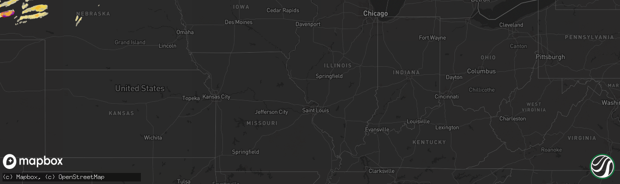
Hail Map in Nebraska on June 19, 2012
The weather event in Nebraska on June 19, 2012 includes Hail map. 11 states and 298 cities were impacted and suffered possible damage. The total estimated number of properties impacted is 0.
Want more than just the map?
Turn this storm into a full workflow.
- Owner + property data so you know who to knock
- OnDemand branded weather history reports to win the "did we even have hail?" argument
- RoofTrace estimate so reps stop guessing numbers at the door
Bought this map? Upgrade within 7 days and we'll credit the $230. (10-15 min setup call)
Hail
0
Estimated number of impacted properties by a 1.00" hail or larger28,745
Estimated number of impacted properties by a 1.75" hail or larger0
Estimated number of impacted properties by a 2.50" hail or largerStorm reports in Nebraska
Nebraska
| Date | Description |
|---|---|
| 06/19/20121:45 AM CDT | A local report indicates 60 MPH wind near 2 N ASHBY |
| 06/19/20121:45 AM CDT | A local report indicates 1.00 inch wind near 7 E CODY |
| 06/19/20121:30 AM CDT | A local report indicates 1.00 inch wind near 6 W CODY |
| 06/19/20121:05 AM CDT | A local report indicates 1.50 inch wind near 4 N BRIDGEPORT |
| 06/19/201212:45 AM CDT | A local report indicates 1.00 inch wind near 16 SW MERRIMAN |
| 06/19/201212:43 AM CDT | A local report indicates 1.00 inch wind near ALLIANCE |
| 06/19/201212:35 AM CDT | Numerous reports of golf ball to hen egg sized hail. Scotts bluff asos reported 62 mph gust at 1135 pm. Widespread reports of windows broken in scottsbluff and gering |
| 06/19/201212:32 AM CDT | Quarters to golf balls. Damage to windows of spotters house. |
| 06/19/201212:31 AM CDT | A local report indicates 1.50 inch wind near SCOTTSBLUFF |
| 06/19/201212:28 AM CDT | A local report indicates 1.50 inch wind near GERING |
| 06/19/201212:27 AM CDT | A local report indicates 1.75 inch wind near GERING |
| 06/19/201212:25 AM CDT | A local report indicates 1.75 inch wind near GERING |
All States Impacted by Hail Map on June 19, 2012
Cities Impacted by Hail Map on June 19, 2012
- Ellsworth, NE
- Emily, MN
- Floodwood, MN
- Suring, WI
- Lena, WI
- Gillett, WI
- Little Falls, MN
- Kimball, SD
- Swanville, MN
- Sauk Centre, MN
- Grey Eagle, MN
- Melrose, MN
- Burtrum, MN
- Brooten, MN
- Freeport, MN
- Glenwood, MN
- Bridgeport, NE
- Hay Springs, NE
- Elk Point, SD
- Bowlus, MN
- Holdingford, MN
- Upsala, MN
- Alliance, NE
- Gregory, SD
- Oacoma, SD
- Kettle River, MN
- Mission, SD
- Detroit Lakes, MN
- Callaway, MN
- Lyman, NE
- Bingham, NE
- Westfield, IA
- Duluth, MN
- Cass Lake, MN
- Garfield, MN
- Miltona, MN
- Alexandria, MN
- Brandon, MN
- Onamia, MN
- Hillman, MN
- Alpena, SD
- Lingle, WY
- Torrington, WY
- Saint Francis, SD
- Corsicana, TX
- Milbank, SD
- Big Stone City, SD
- Stockholm, SD
- Strandburg, SD
- Sturgeon Bay, WI
- Wessington Springs, SD
- White Lake, SD
- Gann Valley, SD
- Pukwana, SD
- Dent, MN
- Vergas, MN
- Benson, MN
- Rushville, NE
- Wagner, SD
- Avon, SD
- Dante, SD
- Audubon, MN
- Winner, SD
- Laporte, MN
- Lake George, MN
- Murdock, MN
- Merriman, NE
- Browerville, MN
- Long Prairie, MN
- Rochert, MN
- Cotton, MN
- Canyon, MN
- Gering, NE
- Minatare, NE
- Scottsbluff, NE
- Mitchell, NE
- Woonsocket, SD
- Watertown, SD
- Hemingford, NE
- Belgrade, MN
- New York Mills, MN
- Menahga, MN
- Kilgore, NE
- Lake Park, MN
- Hawk Springs, WY
- Yoder, WY
- Morrill, NE
- Chamberlain, SD
- Dalton, MN
- Oconto, WI
- Oconto Falls, WI
- Abrams, WI
- Thedford, NE
- Wrenshall, MN
- Carlton, MN
- Bellingham, MN
- Sebeka, MN
- Wadena, MN
- Bluffton, MN
- Makinen, MN
- Aitkin, MN
- Brainerd, MN
- Pound, WI
- Silver Bay, MN
- Bayfield, WI
- Herbster, WI
- Two Harbors, MN
- Ortonville, MN
- Correll, MN
- Madison, MN
- Odessa, MN
- Cody, NE
- Tuthill, SD
- Hamill, SD
- Willow Lake, SD
- Hazel, SD
- Park Rapids, MN
- Hawley, MN
- Ideal, SD
- Fort Ripley, MN
- Keshena, WI
- Frazee, MN
- Perham, MN
- Osage, MN
- Angora, NE
- Oshkosh, NE
- Ashby, NE
- Lakeside, NE
- Barnum, MN
- Dumont, MN
- Beardsley, MN
- Pierz, MN
- Maple City, MI
- Cedar, MI
- Harrison, NE
- Cushing, MN
- Randall, MN
- Deer Creek, MN
- Henning, MN
- Royalton, MN
- Rice, MN
- Avon, MN
- Saint Joseph, MN
- Albany, MN
- Lisco, NE
- Broadwater, NE
- Jay Em, WY
- De Smet, SD
- Erwin, SD
- Bryant, SD
- Vienna, SD
- Ponsford, MN
- Pelican Rapids, MN
- Fergus Falls, MN
- Backus, MN
- Merrifield, MN
- Pequot Lakes, MN
- Mcgregor, MN
- Longville, MN
- Fifty Lakes, MN
- Pine River, MN
- Crosby, MN
- Palisade, MN
- Crosslake, MN
- Jacobson, MN
- Swatara, MN
- Outing, MN
- Hill City, MN
- Montevideo, MN
- Watson, MN
- Garrison, MN
- Iroquois, SD
- Parkers Prairie, MN
- Stapleton, NE
- Porterfield, WI
- Crivitz, WI
- Nunda, SD
- Sinai, SD
- Ramona, SD
- Arlington, SD
- Volga, SD
- Martin, SD
- Veteran, WY
- Hayti, SD
- Carpenter, SD
- Yale, SD
- Morris, MN
- Isle, MN
- Marquez, TX
- Franklin, TX
- Teague, TX
- Mexia, TX
- Groesbeck, TX
- Thornton, TX
- Jewett, TX
- Buckholts, TX
- Mountain, WI
- Coleman, WI
- Osakis, MN
- Nevis, MN
- Elbow Lake, MN
- Wendell, MN
- Wheaton, MN
- Herman, MN
- Marietta, MN
- Reliance, SD
- McGrath, MN
- Tintah, MN
- Clarissa, MN
- Staples, MN
- Platte, SD
- Huron, SD
- Allen, SD
- Barnesville, MN
- Felton, MN
- Borup, MN
- Finland, MN
- Lidgerwood, ND
- Hewitt, MN
- Nisswa, MN
- Chokio, MN
- Ogema, MN
- Brookston, MN
- Eagle Bend, MN
- Motley, MN
- Bertha, MN
- Brimson, MN
- Cavour, SD
- Barrett, MN
- Ellison Bay, WI
- Labolt, SD
- South Shore, SD
- Goodwin, SD
- Twin Brooks, SD
- Tamarack, MN
- Edenton, NC
- Ashby, MN
- Battle Lake, MN
- Deerwood, MN
- Hancock, MN
- Parmelee, SD
- Bayard, NE
- Ironton, MN
- Holloway, MN
- Appleton, MN
- Waubun, MN
- Browns Valley, MN
- Donnelly, MN
- Clitherall, MN
- Vining, MN
- Hoffman, MN
- Evansville, MN
- North Zulch, TX
- Normangee, TX
- Remer, MN
- Corona, SD
- Clinton, MN
- Wahpeton, ND
- Fargo, ND
- White Lake, WI
- Brussels, WI
- Cecil, WI
- Aldrich, MN
- Verndale, MN
- Parkston, SD
- Suttons Bay, MI
- Lake Leelanau, MI
- Rogers, TX
- Coushatta, LA
- Nelson, MN
- Marinette, WI
- Peshtigo, WI
- Moose Lake, MN
- Esko, MN
- Ainsworth, NE
- Wood, SD
- Okreek, SD
- Presque Isle, MI
- Posen, MI
- Sunburg, MN
- Flensburg, MN
- New London, MN
- Starbuck, MN
- Ponca, NE
- Akron, IA
- Lake Norden, SD
- Gordon, NE
- Cromwell, MN
- Wahkon, MN
- Farwell, MN
- Kensington, MN
- Graceville, MN
- Pillager, MN
- Saint Paul, MN
- Hudson, WI
- Stillwater, MN
- Houlton, WI
- Lake Elmo, MN


